
VCFD incidents and information for media and public. All photos uploaded are ok to use by media.
Joined January 2012
- Tweets 8,674
- Following 397
- Followers 62,530
- Likes 3,932
3,378 Photos and videos


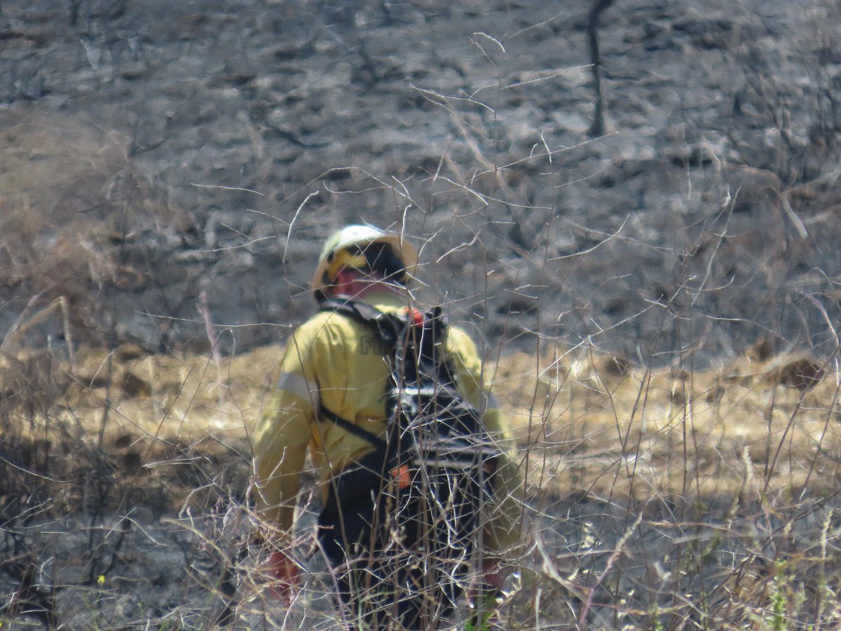


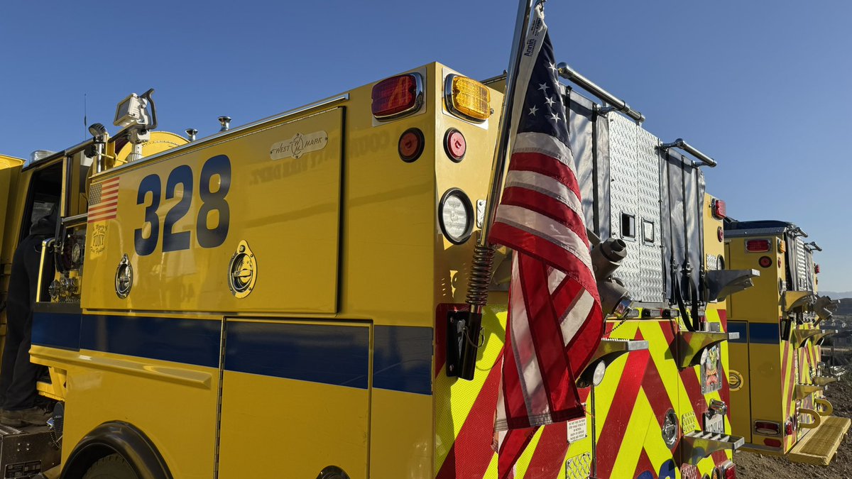
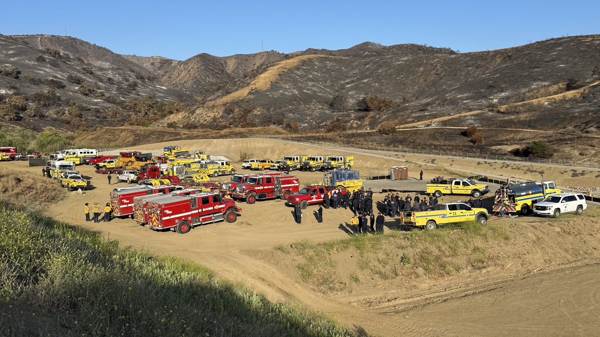
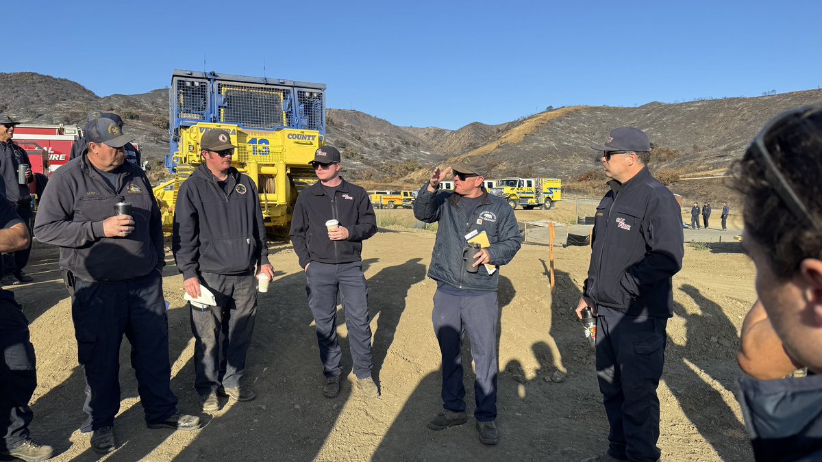
Training Burn Successfully Completed in Fillmore — Today, VCFD firefighters, alongside mutual aid partners from Fillmore Fire, Los Angeles County Fire Department, Los Angeles Fire Department, Carpinteria-Summerland Fire Protection District, Orange County Fire Authority, and Santa Barbara County Fire Department, successfully completed a live-fire training burn on a 9-acre grass field in Fillmore.
The burn provided hands-on training for firefighters participating in a State Ignition Operations course, allowing students to gain practical experience with prescribed fire planning, ignition techniques, drip torch operations, holding operations, and control line construction.
In addition to meeting course objectives, the project reduced dry grass fuels near the community ahead of the Fourth of July season, helping improve community safety and wildfire preparedness.
Training opportunities like this strengthen regional mutual aid partnerships, build firefighter proficiency, and demonstrate how prescribed fire can be safely used as an effective fuel reduction tool.
Thank you to all participating agencies and personnel who helped make today’s training a success.
@CountyVentura @LACOFD
@LAFD @LACoFDPIO
@fillmorefire
@CityofFillmore
@OCFireAuthority @SBCFireInfo
5
59
4,297
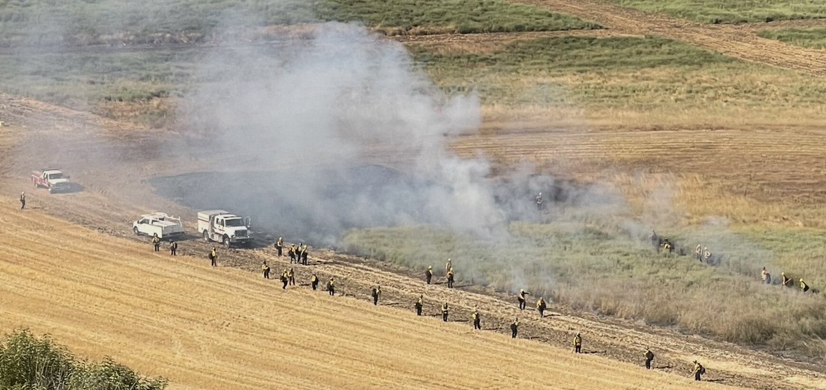
Today, VCFD and our partners are actively reducing wildfire risk across the county through a variety of fuels management projects designed to protect communities in the Wildland Urban Interface (WUI).
In Thousand Oaks, specifically the Rancho area by the 101 and 23 freeways, crews and a tracked masticator is reducing hazardous vegetation and creating strategic fuel breaks to help slow the spread of future wildfires.
Near Long Canyon in Simi Valley, targeted goat grazing is being used to naturally reduce invasive grasses and other flashy fuels while minimizing environmental impacts.
In Upper Ojai, partners are conducting a 65-acre prescribed burn to safely remove excess vegetation under carefully planned conditions, reducing fuel loads.
No single tool solves the wildfire challenge. Mechanical treatment, prescribed grazing, and prescribed fire each play an important role in creating healthier, more fire-resilient landscapes.
These proactive projects represent a balanced approach between wildfire safety, environmental stewardship, and community protection. By reducing hazardous fuels before a fire starts, we can improve firefighter safety, strengthen defensible space, protect critical infrastructure, and reduce the intensity and spread of future wildfires.
The Ventura County Fire Department continues to seek collaborative fuels management and wildfire resilience projects throughout the county to help create safer, more fire-adapted communities.
Together, we're building a more resilient Ventura County.
@CountyVentura
@City_SimiValley
@CityofTO
8
22
113
5,870
Ventura County firefighters and Oxnard firefighters are on scene of a structure fire in the 100 block of Barcelona Street in Camarillo. Firefighters arrived to find heavy fire showing from the structure with a well-established attic fire.
Crews have deployed multiple hose lines and are aggressively attacking the fire while working to protect neighboring homes from extension.
1
6
62
4,761
#BarcelonaFire Update: Firefighters report that the majority of the fire has been knocked down. Crews continue to uncover and extinguish pockets of smoldering fire within the attic to ensure complete extinguishment.
One patient with minor burn injuries was transported to a local hospital. Firefighters are conducting salvage and overhaul operations while fire investigators work to determine the cause of the fire.
@CountyVentura
2
3
25
2,523
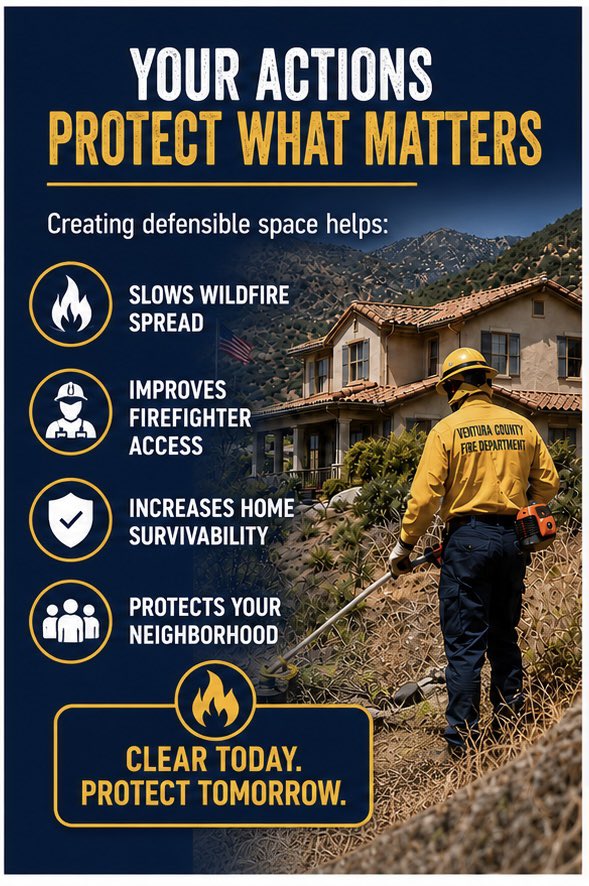
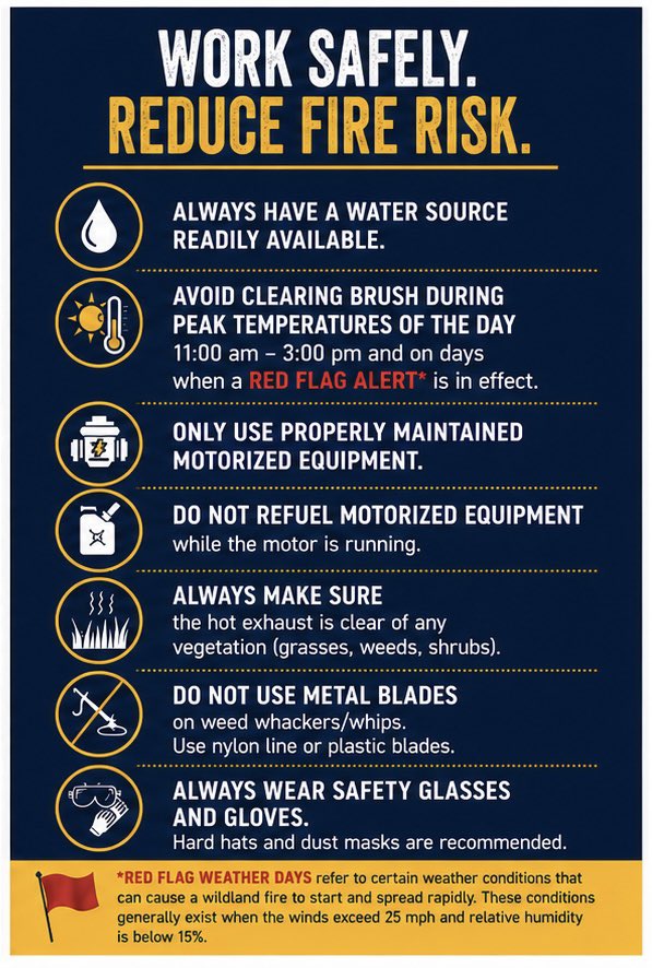
June 1 - Brush Clearance Safety Reminder — As you complete your 100-foot defensible space requirements, Ventura County Fire reminds residents to follow the safety guidelines highlighted in these graphics to help prevent equipment-caused wildfires.
Clear today. Protect tomorrow.
📞 Fire Hazard Reduction Program: (805) 389-9759
#VCFD #DefensibleSpace #WildfirePreparedness #FireHazardReduction
#ZoneZero
@CountyVentura
10
29
2,432
#LesserFire Update
Forward progress of the fire has been stopped. Firefighters have established a wet line around the fire and estimate the fire at approximately 1.5 acres.
Crews are continuing mop-up operations, extinguishing remaining hot spots and strengthening containment lines. Hand crews are constructing a control line down to mineral soil around the fire to help ensure full containment.
Please continue to avoid the area and allow firefighters to work safely.
3
13
88
9,641
Hand crews have arrived on scene and are constructing containment lines around the fire using hand tools. Firefighters remove all vegetation down to mineral soil, creating a barrier that helps prevent the fire from spreading beyond the perimeter. These containment lines, combined with ongoing mop-up efforts, will help secure the fire and support full containment.
1
5
41
2,156
Ventura County Fire is on scene in Newbury Park at the Lesser Fire, making an aggressive attack with support from helicopters.
Please monitor emergency.venturacounty.gov for the latest updates and any evacuation information.
2
12
107
13,606
Ventura County Fire is on scene in Newbury Park at the Lesser Fire, making an aggressive attack with support from helicopters.
Please monitor emergency.venturacounty.gov for the latest updates and any evacuation information.
2
12
107
13,606
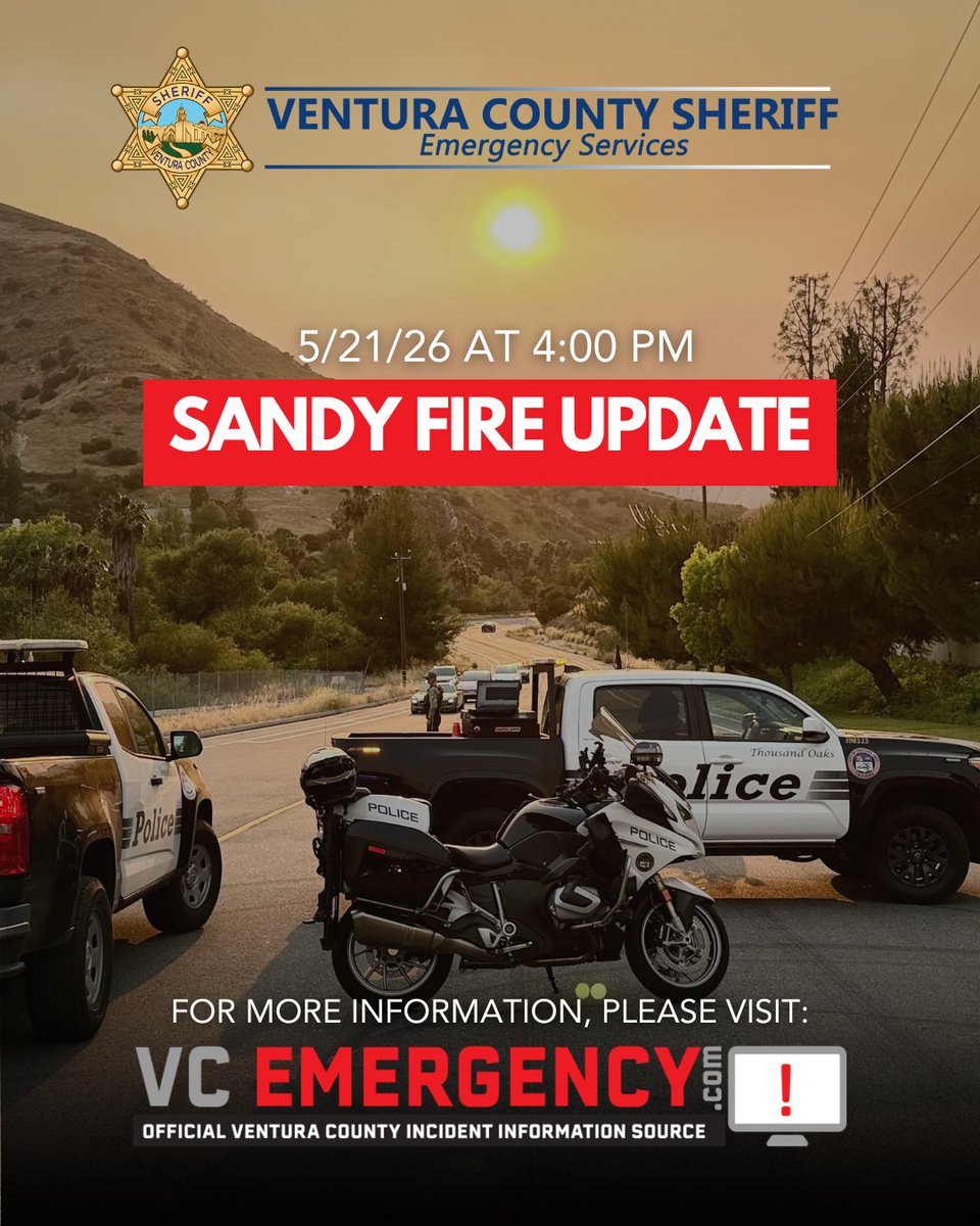
Sandy Fire morning update:
The Sandy Fire remains within its current footprint and has shown minimal activity over the past several days. Firefighters continue making steady progress, and the fire is now 94% contained.
A small portion of uncontained fire line remains on the southern section of the fire, which can be seen on the attached map. Firefighters continue using infrared drones during nighttime operations to identify remaining hotspots. During the day, crews hike into rugged terrain to locate, expose, and fully extinguish those pockets of heat.
As suppression needs decrease, the incident is continuing to scale down operations and reduce assigned resources. Currently, ~50 firefighters remain assigned to the incident and continue working to strengthen containment lines, patrol the fire area, and ensure full extinguishment.
@CountyVentura
@City_SimiValley
2
20
101
5,046
The Sandy Fire is now 90% contained with 107 firefighters remaining assigned to the incident. Please see the attached map.
The suppression cycle continues as firefighters utilize infrared drones during nighttime operations to identify remaining hotspots. During the day, firefighters hike into rugged terrain to locate and fully extinguish those hotspots.
For your safety and firefighter safety, please use caution while recreating in the area, especially on dirt roads where fire personnel and equipment continue to operate.
@CountyVentura
@City_SimiValley
6
29
141
7,527
This Memorial Day weekend, while many gather with family and friends, approximately 150 firefighters remain assigned to the Sandy Fire, which is now 75% contained.
These photos highlight this morning’s operational briefing near the end of Sequoia Ave., in Simi Valley CA, where firefighters continue working diligently to fully extinguish the fire and continue suppression repair efforts to help return the land as closely as possible to pre-fire conditions.
Firefighters are utilizing infrared drone technology to identify underground hotspots hidden beneath the surface. Hand crews then hike into rugged terrain using shovels, picks, and hose lines to dig down to the heat sources, cool them, and ensure they are fully extinguished.
This work is physically demanding and often takes place in steep, remote terrain. We are grateful for the continued dedication and sacrifice of the firefighters, dispatchers, aviation personnel, law enforcement officers, public works crews, and support staff spending their Memorial Day weekend protecting our communities.
As we remember and honor those who gave their lives in service to our country, we also thank the men and women continuing to serve our communities here at home.
@CountyVentura
@SimiValleyPD
@City_SimiValley
@VENTURASHERIFF
@CAL_FIRE
@CALFIRE_SLO
@CALFIRE_PIO
@SBCOUNTYFIRE
@OCFireAuthority
@MrcaFire
@LAFD
@LAFDtalk
8
27
174
6,773
5/23 Sandy Fire Update:
Acres: 2183
Containment: 61%
Personnel: 884
Operations Section Chief Trevor Johnson provides an update on the Sandy Fire.
Firefighters continue to make significant progress on the Sandy Fire in Simi Valley. Weather today will continue to favor mop up operations across the fire perimeter. Morning fog will give way to lower temperatures and higher relative with mild winds throughout the afternoon. These conditions reduce the potential for flare ups, and give firefighters an opportunity to continue identifying and cooling hot spots around the fire.
Smoke from remaining tree stumps and other burned-out areas well within the fire perimeter may continue for the next few days. Firefighters will continue to patrol the fire area and identify, assess and mop up these areas. IR-sensing drone flights will continue as another means of identifying heat sources and directing resource activity.
This will be the last operational briefing on the incident. We will continue to post brief acreage and containment updates through our social media, or follow emergency.venturacounty.gov for the latest updates and information.
#sandyfire #simivalley #firefighter #brushfire
5
17
114
5,465
#SandyFire evening update:
The Sandy Fire is at 2,183 acres and is now 61% contained. Fire crews continue making steady progress, focusing on mop-up operations, extinguishing hotspots, reducing pockets of unburned vegetation near impacted communities, and strengthening containment lines as efforts toward full containment continue.
As of this afternoon, all evacuation warnings have been lifted, with the exception of areas immediately surrounding the fire perimeter, which remain under an evacuation warning.
Residents and visitors are asked to remain mindful of emergency vehicles and fire equipment still operating throughout the area as firefighting operations continue.
Stay informed by monitoring emergency.venturacounty.gov.
@CountyVentura
@City_SimiValley
9
19
147
7,186
Sandy Fire operational update with Chief Anthony Occhipinti:
The Sandy Fire is currently 2,141 acres and 40% contained, with 1,156 personnel assigned to the incident. Fire activity remained minimal overnight.
Weather conditions today are much improved, with a morning marine layer, cooler temperatures, and higher humidity supporting firefighting efforts.
Firefighters continue mop-up operations around homes, reinforcing containment lines and building contingency lines throughout the fire area. Residents may continue to see smoke within the fire perimeter as crews work to fully extinguish hotspots and strengthen containment.
Many evacuation warnings and orders have been lifted. Please continue to monitor emergency.venturacounty.gov for the latest evacuation information and updates.
We want to thank the public for their continued cooperation, patience, and support throughout this incident. Community members quickly heeded evacuation warnings and orders, helping keep roads clear for emergency responders and allowing firefighters to safely and effectively protect lives and property. The support from the community has been greatly appreciated by all personnel assigned to the incident.
To wrap up this update, incident managers are beginning to scale down assigned resources and relocate the operational base camp to the VCFD Training Complex. This transition will allow the community to move forward with this weekend’s youth soccer tournament at Conejo Creek South Park during the Memorial Day holiday weekend.
@SimiValleyPD
@City_SimiValley
@VENTURASHERIFF
@CountyVentura
6
25
156
8,370
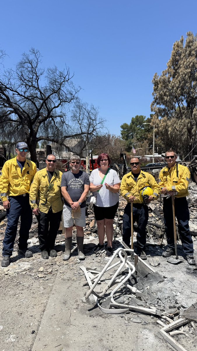
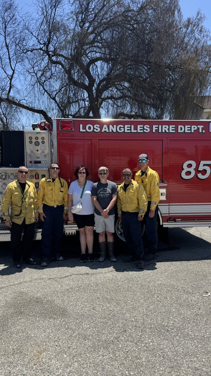
Wedding ring found by LAFD Firefighters in home destroyed byon the Sandy Fire:
Los Angeles Fire Department Engine 85 assigned to the Sandy Fire in Simi Valley came to the aid of the Boyle family whose home was destroyed by the fire.
Firefighters sifted through burned out portions of the home, searching for and ultimately finding a wedding ring and other precious items belonging to the family. The Boyle family has expressed their incredible gratitude to VCFD and all of the firefighters from around California who responded to this incident.
LAFD is one of many agencies from across Southern California that immediately came to support the firefighting efforts as the Sandy Fire quickly spread across Simi Valley on Monday, including CAL FIRE, LAFD, LA County Fire, Santa Barbara County Fire, and many more. These partnerships are a testament to the mutual-aid system in California - and highlight how well our agencies work together when a disaster strikes.
Please join us in thanking the crew from LAFD Engine 85, and all the firefighters and parter agencies who came to support Simi Valley in our time of need.
#simivalley #sandyfire #LAFD #firefighter #brushfire
4
14
153
5,402
Sandy Fire Air Monitoring Update - Due to the Sandy Fire’s proximity to the Santa Susana Field Laboratory (SSFL), hazardous materials and radiological monitoring teams continue proactive air quality and radiation monitoring operations around the fire area.
Currently, seven air sampling radiological monitoring locations have been established surrounding the incident, including the Chatsworth, Lake Manor, Bell Canyon, Oak Park, and Simi Valley areas. These monitoring systems are being used to establish background environmental conditions and to continuously evaluate smoke and air quality conditions as firefighting operations continue.
The Sandy Fire has NOT reached the Santa Susana Field Laboratory property, and there is currently no indication that any radiological material has been released from the site. The attached drone video shows the current fire perimeter in relation to the SSFL area.
Public health and environmental agencies, including Ventura County Public Health, the Los Angeles County Department of Public Health, California Department of Toxic Substances Control (DTSC), Ventura County Air Pollution Control District, and the U.S. Department of Energy, remain actively engaged in monitoring conditions and supporting incident operations.
The U.S. Department of Energy is supporting air monitoring operations around the SSFL out of an abundance of caution. Radiation measurements collected as recently as 2025, along with modeling conducted following the 2018 Woolsey Fire, continue to indicate that the extremely low levels of residual radioactive material at the site pose no risk to public health, even in the event wildfire activity reaches the area.
The SSFL is located in an area historically prone to wildfires, including the 2018 Woolsey Fire. Following that fire, air, soil, and ash sampling conducted by DTSC did not detect the release of chemical or radiological contaminants from the site. Additionally, radiological assessments conducted by the Los Angeles County Department of Public Health found no discernible levels of radiation in tested areas surrounding the site.
Residents can continue monitoring local smoke and air quality conditions using the AirNow Fire and Smoke Map:
fire.airnow.gov/?lang=en#12.…
About the video: The background map shows the drone location as a circle with a blue arrow. The blue line shows the flight path of the drone, while the moving polygon represents the area the drone camera is viewing. The left screen displays the thermal imaging view, and the right screen shows the normal video footage. This video demonstrates that the fire did not reach the Santa Susana Field Laboratory property.
@CountyofLA
@LAFDtalk
@CountyVentura
@SimiValleyPD
@City_SimiValley
@VENTURASHERIFF


10
62
221
20,646
VCFD PIO retweeted

Evacuation Orders and Warnings downgraded and today as fire crews made significant progress toward containment of the #SandyFire. For the latest evacuation status, visit VCEmergency.com. @VCFD_PIO
2
10
45
4,657