I have been chasing storms across Tornado Alley and the Mid-Atlantic since 1997. I also do nature and landscape photography.
Joined October 2011
- Tweets 10,165
- Following 434
- Followers 1,223
- Likes 12,307
1,246 Photos and videos


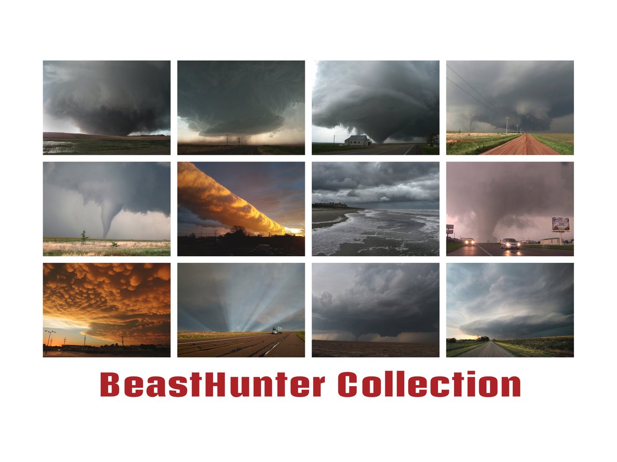
Releasing my first #storm #NFT collection of some of my favorite storm chase images on @opensea Many #Tornado , #supercell and other storm images.
#NFTCommunity #NFTs #nftcollectors opensea.io/collection/beasth…
10
10
58
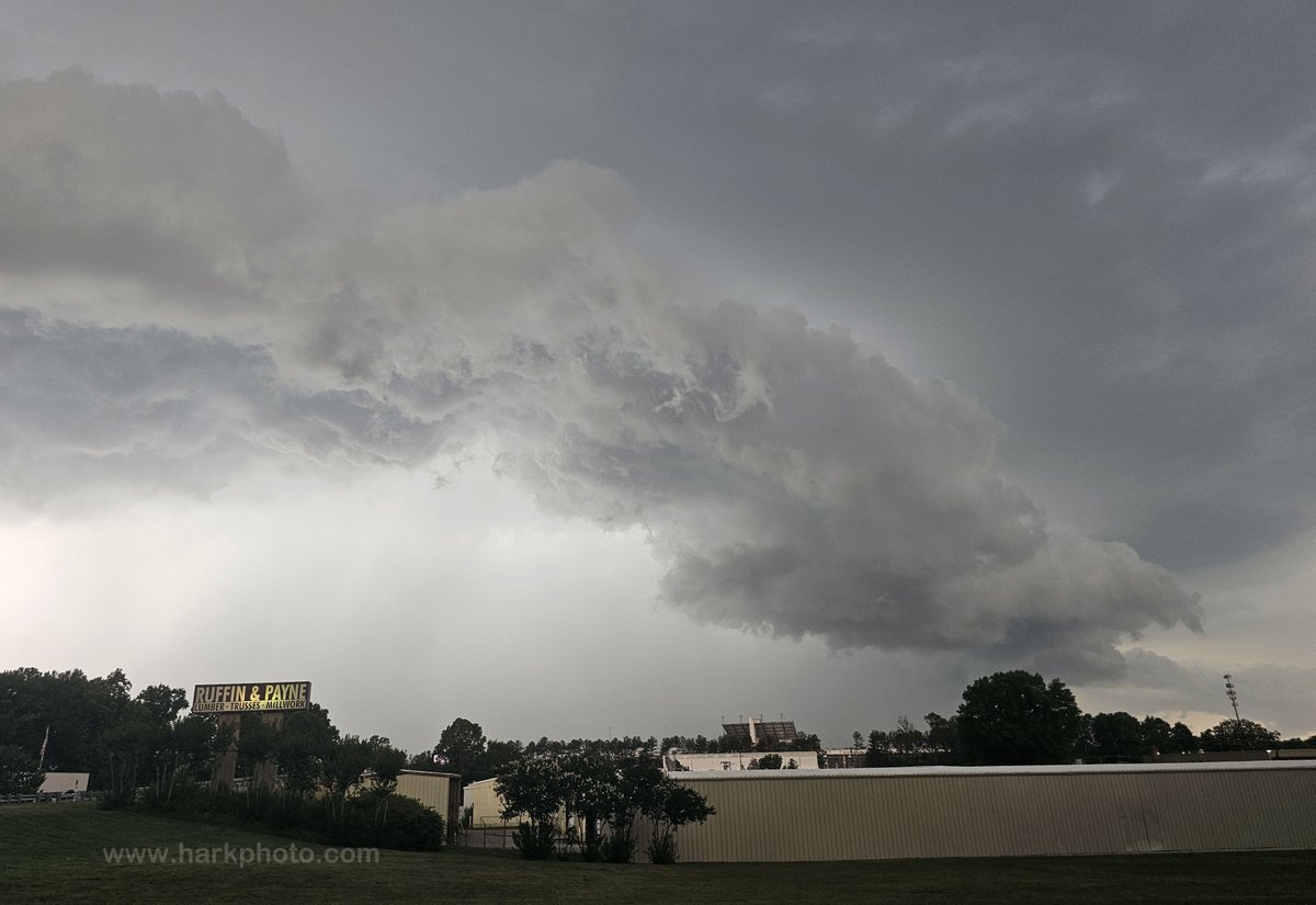
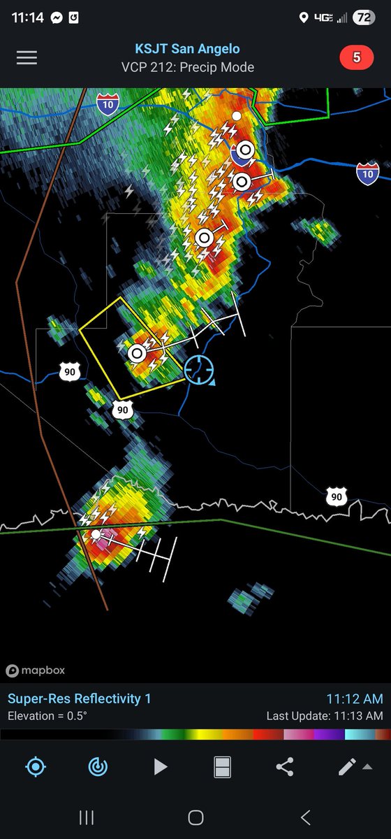
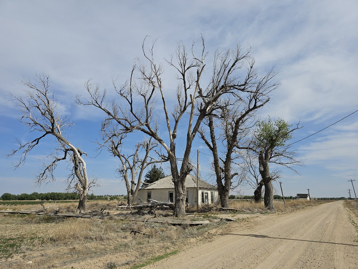
6/15/2026 was a meh chase day! I couldn't resist a 2% tornado risk.High CAPE, decent 500 mb flow, poor shear. I followed a storm that was briefly showing rotation on radar E from near Richmond. State highway 60 is miserable chasing east of Bottom's Bridge. #vawx @NWSWakefieldVA


7
82
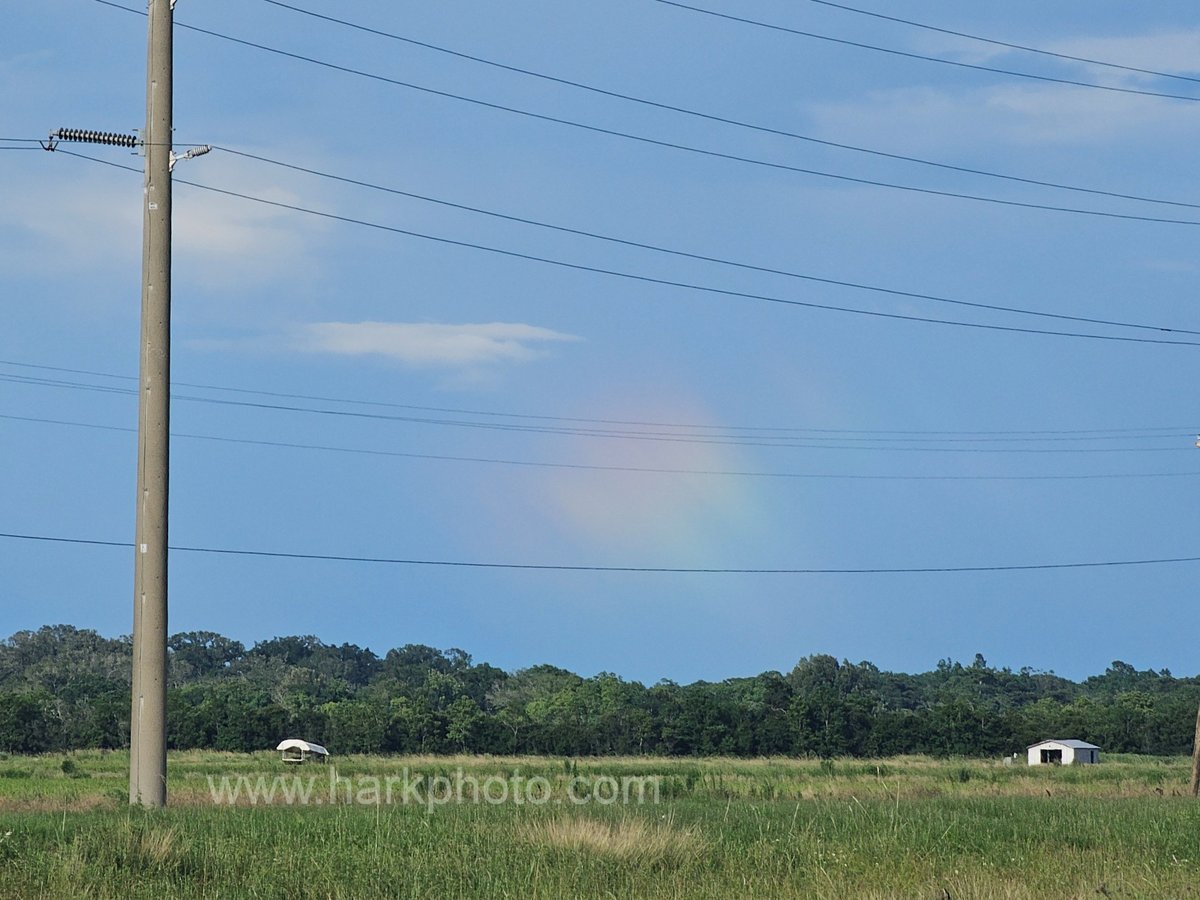
Nice rainbow picture! I love rainbows and have been feeling rainbow-deprived.

I was getting jealous of everyone else's pictures of rainbows this past week. I feel better now. 🌈✨

1
2
105

Bill Hark retweeted

Jun 14
Keep shooting photos even between substorms! Here is a Tall Blue Ray (TBR), possibly a Giant Blue Ray (GBR), captured by Javor Kac from W Slovenia (45°N MLAT) during the 25 September 2023 G2 storm. This blue ray formed *after* a substorm - the substorm lasted about 10 minutes with red pillars / rays reaching about 10° high in the sky. After it faded and only some faint, photographically (barely) detectable red glow remained, this blue ray formed - reaching some 50° high in the sky! Reds 10°, blue 50°! Preliminary triangulation suggests this blue ray reached ~3500 km high!
Jun 13

Various kinds of blue rays all share the same characteristic: they are exceptionally tall. And the blue color, sharing the same emission mechanism - resonant sunlight scattering on ionized molecular nitrogen (N2 ) at very high altitudes, even above the oxygen reds. But being very tall they can be seen very far equatorward, with the lower (red and blue) parts of the auroral oval being below the horizon. I wonder just how often these tall blue rays are seen from lower mid and low latitudes, with nothing else popping above the northern horizon?
This great diagram was made by Geoff Cloake using observations by the GBR group.

1
7
56
2,582
Never stop chasing!
Jun 13

We are so severe weather-aware in Topeka today. Never stop chasing on three.
We will be live by 4 pm
1
161
Bill Hark retweeted

Jun 13
A very interesting ship off the coast of Virginia Beach Virginia this morning.
#dji #ship #topdown #virginiabeach #sunrise
1
1
192
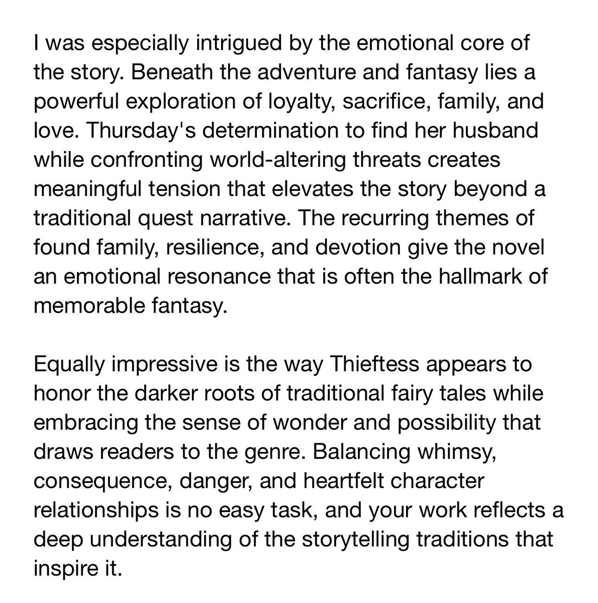
It's summer reading time! Here's a great suggestion or start at the beginning of the series.
Spam Love for THIEFTESS, my fairy pirate novel heavily influenced by "The Story of the Seven Simons,” “The Flying Ship,” and “East of the Sun, West of the Moon." 🖤⚔️🏴☠️
Get your digital copy now!
amzn.to/4uOCfwZ
#writingcommunity

1
1
1
114
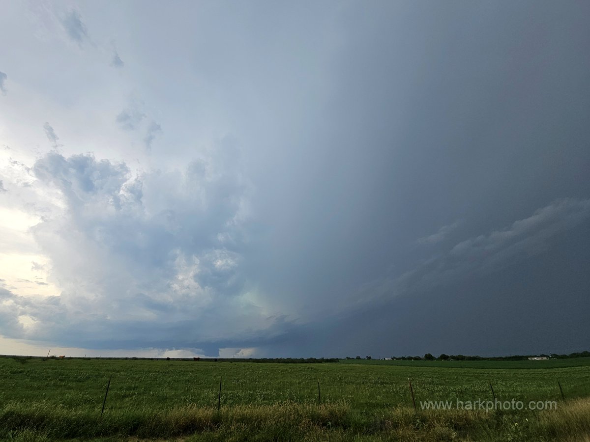
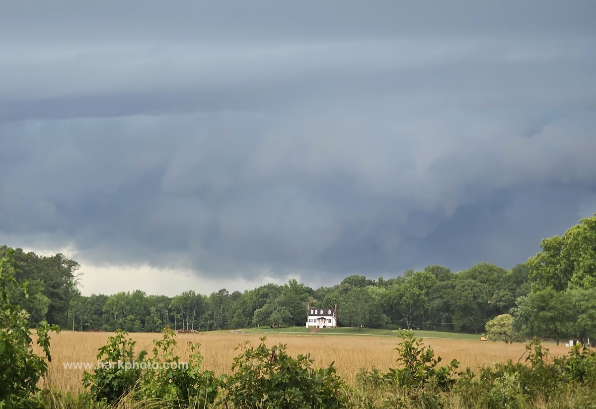
Starting to be interested in MD into northern VA for a possible chase Sun afternoon after reviewing 00Z models Sat night. Very high CAPE, 35-45 forecast SW 500mb winds, south-southeast surfece winds, decent shear across the Mid-Atlantic forecast on Sunday. Too early to target.
1
7
474
Bill Hark retweeted

Jun 12
Super excited to announce that we have received the preliminary results from SPC's Spring Forecasting Experiment!
StormNet scored 1st place overall, plus:
-1st place at each lead-time.
-1st place each week of the experiment.
Even beating CSU-MLP (GEFS-MLP) and WxNext2!

31
59
366
34,100
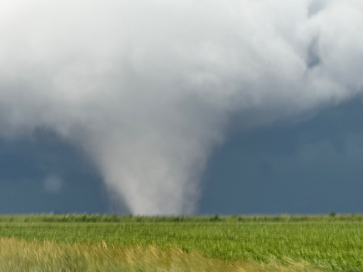
Bill Hark retweeted

Jun 12
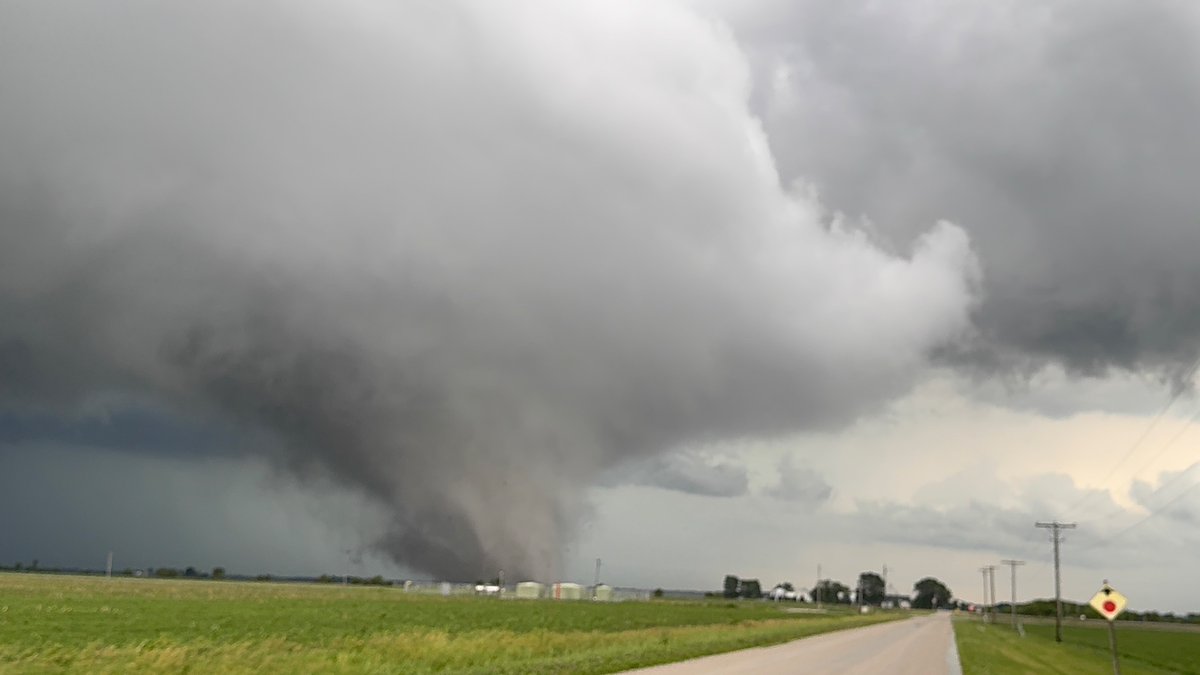
Quick edit showing some of the intense moments today while documenting 8 tornadoes in northern Illinois into Indiana. Massive shoutout to @skydrama for nailing the forecast in the warm sector. Hands down the craziest tornado outbreak I've ever documented.
Full video will be released in the near future on the @thestormreel YouTube page.
#ilwx #inwx #tornado #outbreak
99
998
6,902
595,630
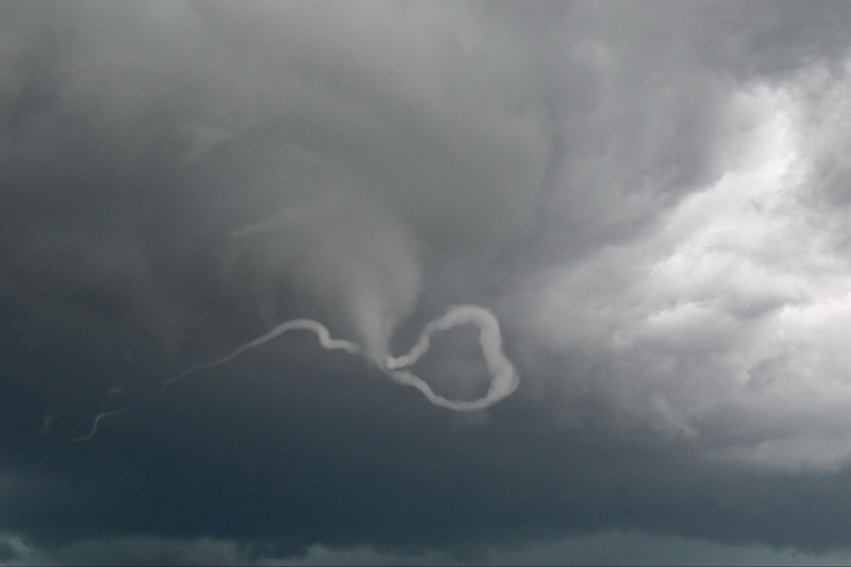
What a beast!

127
Bill Hark retweeted

Jun 12
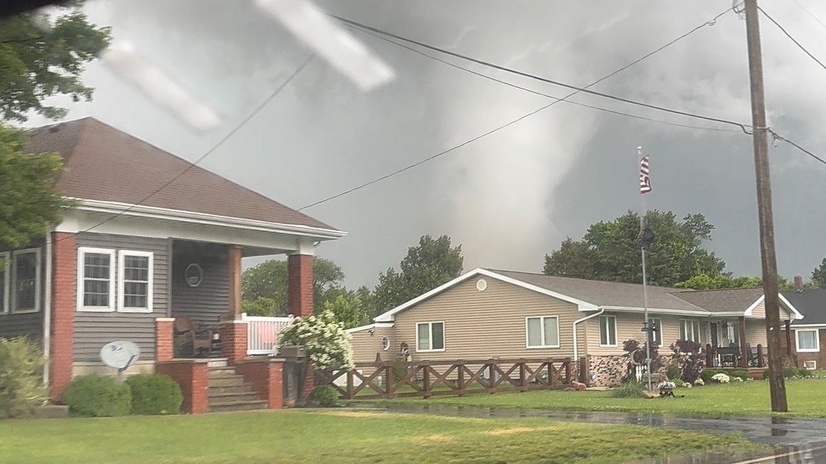
This was one of the most bizarre moments we’ve seen when covering tornadoes.
This sidewinder tornado near Ipava, Illinois fully wrapped around itself, contorting its vortex and writhing like a knotted-up snake, all the while being stretched into eventual oblivion.
8
105
594
16,722
Bill Hark retweeted

Jun 11
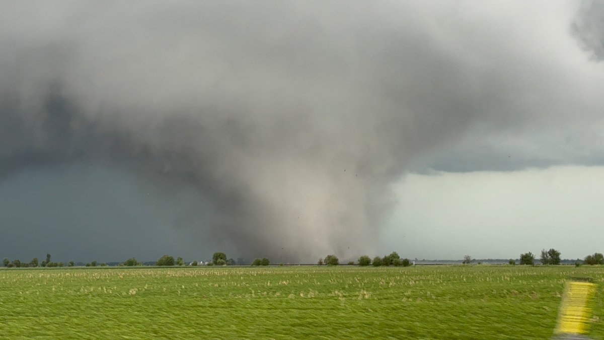
Incredible images of a tornado on the ground in LaSalle County, IL near Streator.
LIVE COVERAGE: wgntv.com/on-air/live-stream… @WGNNews @NWSChicago
14
216
940
80,527
Bill Hark retweeted

Jun 11
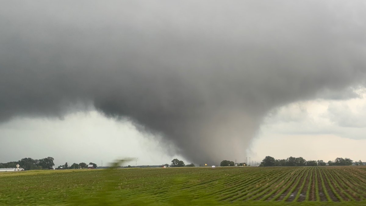
Twin tornadoes near Ransom, IL moments ago
23
428
3,443
103,982
Bill Hark retweeted

Jun 11
Sorry for radio silence, nonstop, filming tornadoes with my jaw on the floor in North Central Illinois.
49
466
3,129
184,804