
#Millwright #Canadian #StormChaser #WX watcher for #EnvironmentCanada, former traveling #BMX Rider. weather, music, cars and handle bars
Joined September 2011
- Tweets 53,845
- Following 1,314
- Followers 2,791
- Likes 61,789
4,773 Photos and videos


Pinned Tweet

3 Jul 2023
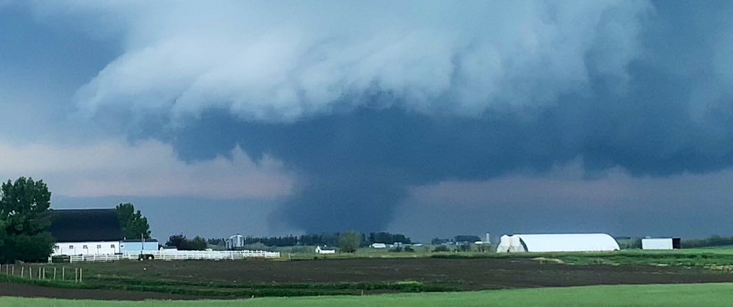
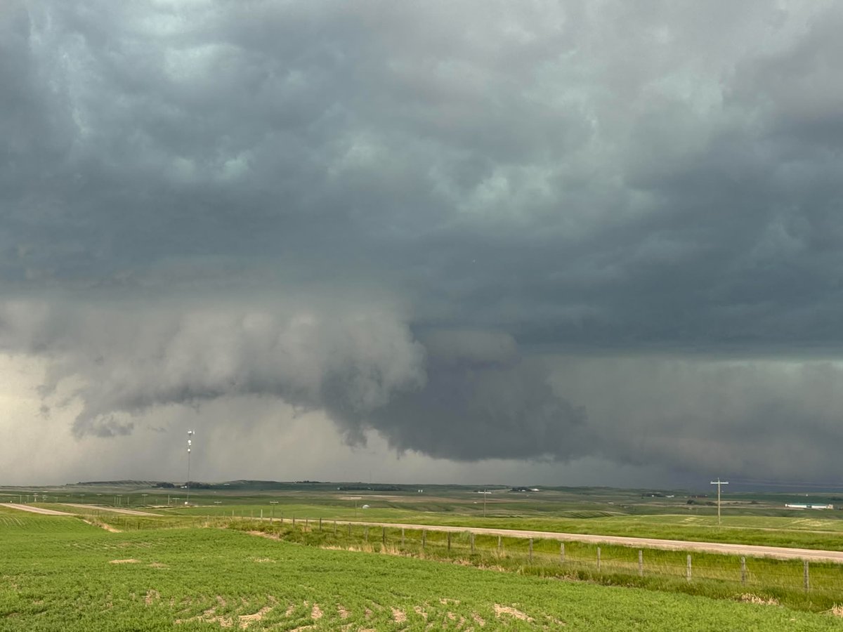
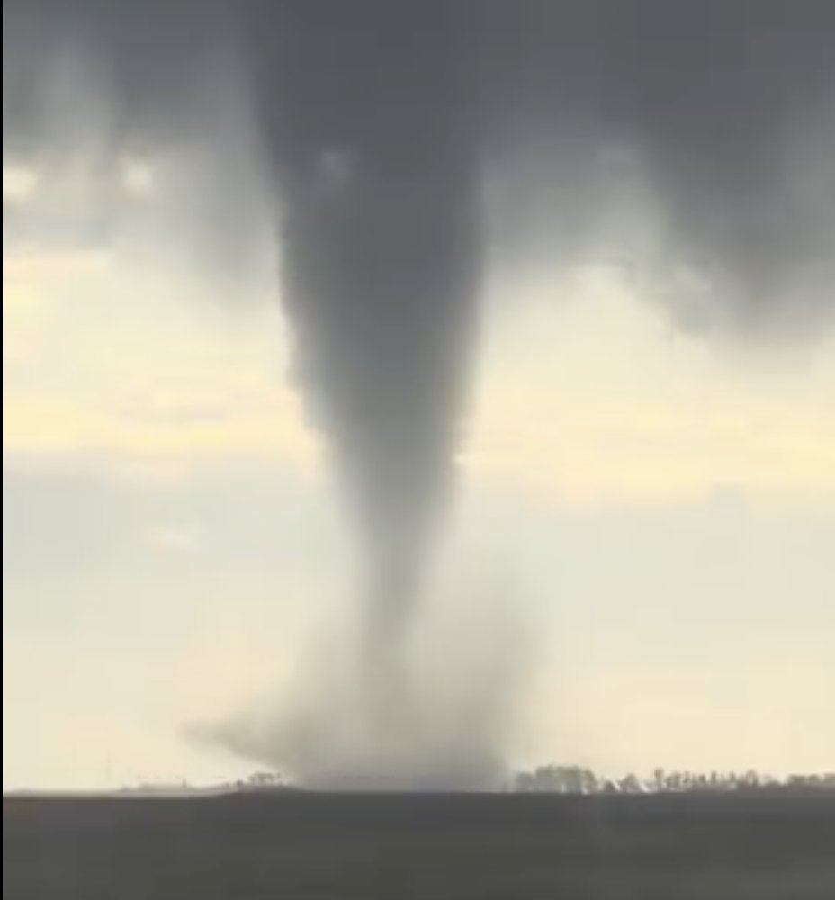
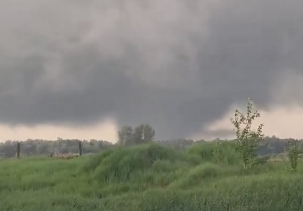
Some more edits from the #tornado by #Didsbury and #Carstairs yesterday #abstorm #ShareYourWeather #July1st2023
1
14
83
8,013
Tom Graham retweeted

Hail building up on Trans-Canada HWY1 northwest of Brooks, Alberta #abstorm
4
15
895

Tom Graham retweeted
Hail impacting vehicles along Trans-Canada HWY1 northwest of Brooks, Alberta #abstorm
6
23
1,418
Tom Graham retweeted

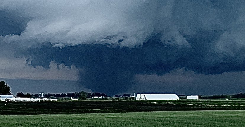
Absolutely REMARKABLE structure on this Supercell just East of Gleichen, AB
1:19pm
#abstorm #stormchase #stormchaser

3
20
754
Tom Graham retweeted

Mark is tracking a supercell east of Strathmore near Gleichen AB. This storm has damaging winds and hail. #abstorm 13:20 @ChasinSpin @ReedTimmerUSA


3
9
698


Tom Graham retweeted

Trees down, major wind south of Strathmore 12:50pm
#abstorm @teamdomcanada
2
20
85
6,964
Tom Graham retweeted
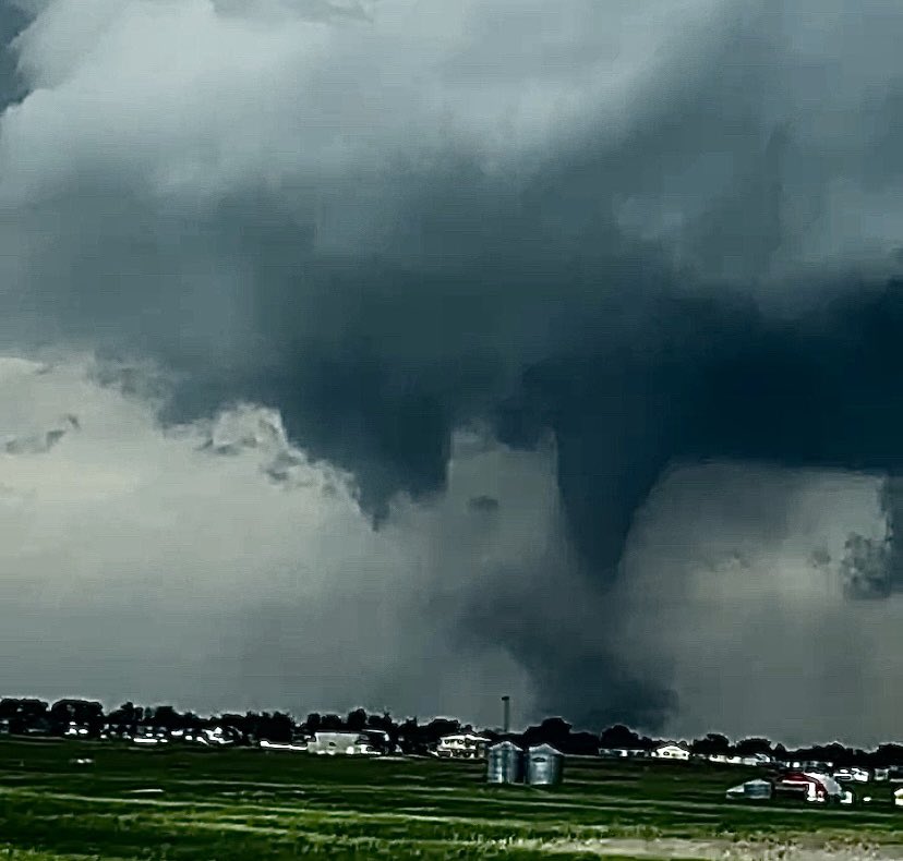
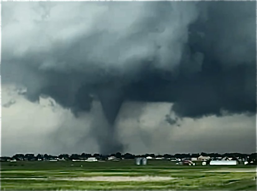
A rare, prolific tornado-producing supercell in northwest Alberta tonight!
Low-topped supercell environment with strong low level shear, and low LCL heights.
In other words, the parent storm was relatively short and small, with low cloud bases.
Screenshots of the tornadoes from the Alberta Storm Reports Facebook page. First tornado was near Girouxville just after 8PM, and the second near High Prairie around 930PM. #abstorm @NTP_Reports

14
48
229
15,952
Tom Graham retweeted

Jun 15
It's not over yet! More rain is on the way for much of the Prairies this week, and timing will be everything. Before you make plans for the week ahead, take a look at the latest Canadian Prairie Weather Outlook at Rural Roots Canada: ruralrootscanada.com/prairie…
3
4
19
1,587
Tom Graham retweeted

Jun 15
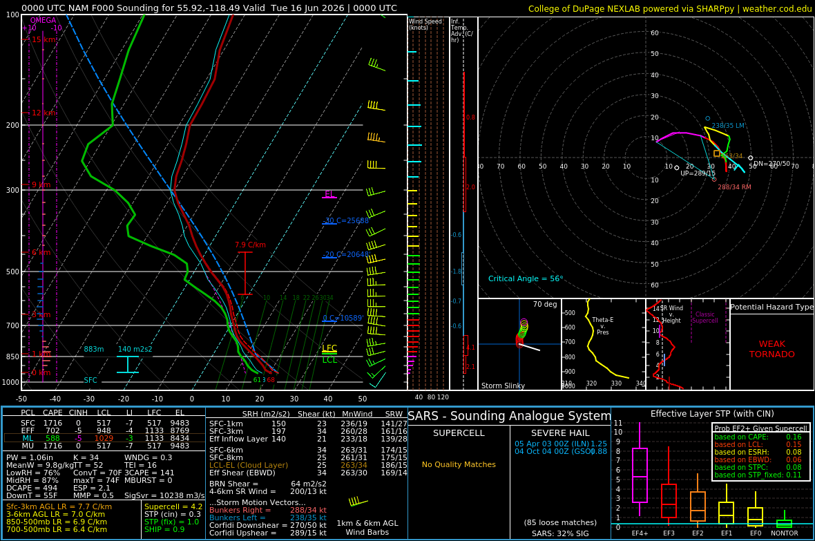
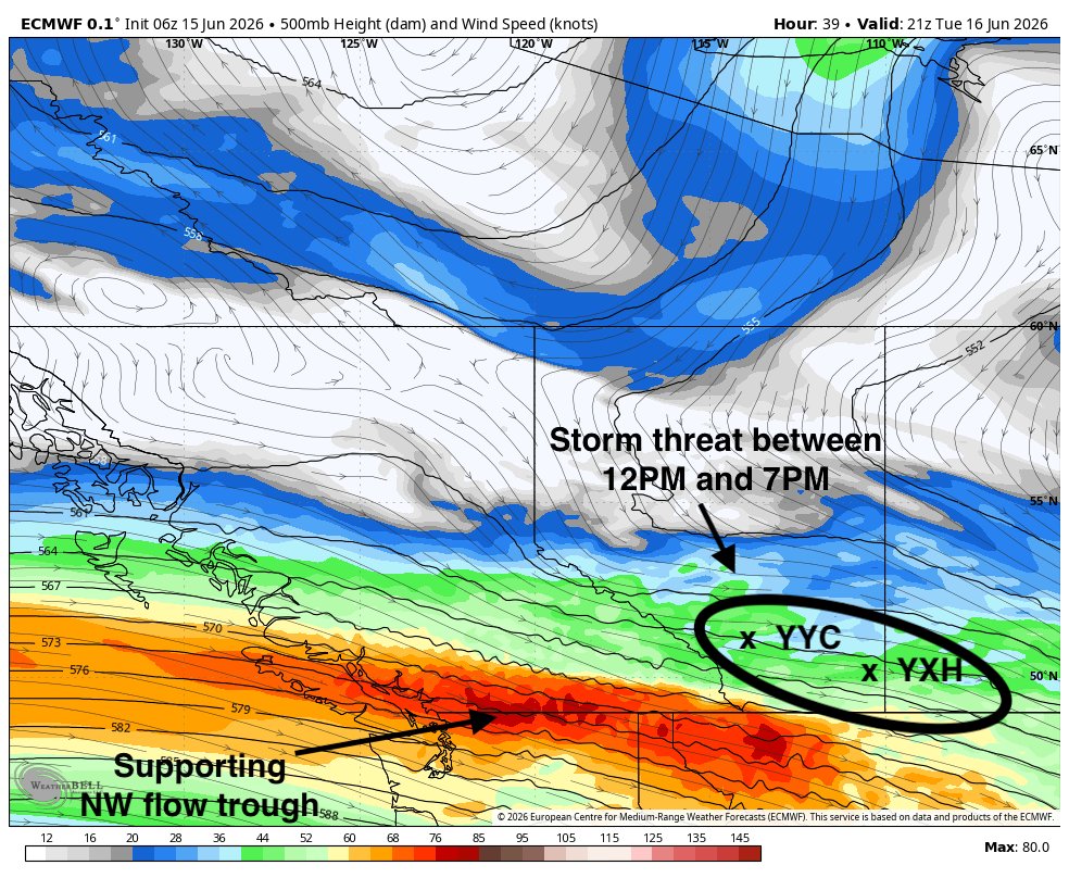
Classic sleeper severe weather setup possible Tuesday in the southwestern Prairies...
Could see fast-moving, long-track thunderstorms with the potential of wind gusts over 100km/h and 3-4 cm hail.
Wind shear and stability profiles have supported similar severe weather in the past.
While certainly not a guarantee, folks across southern Alberta and southwestern Saskatchewan should stay weather aware on Tuesday.
Storm threat in southern Alberta will begin around midday near and north of Calgary, and progress east/southeastward into southwestern Saskatchewan by late afternoon or early evening. #abstorm #skstorm
5
12
83
6,520
Tom Graham retweeted

Jun 14
Weather Channel has maintained its top of the media trustworthiness because they strictly "stick to weather" and sell an amazing product sans politics. Their brand is gold standard, by far.
No one expects the same from CNN, ABC News, or the Washington Post.
7
3
61
8,765
Tom Graham retweeted
Jun 13
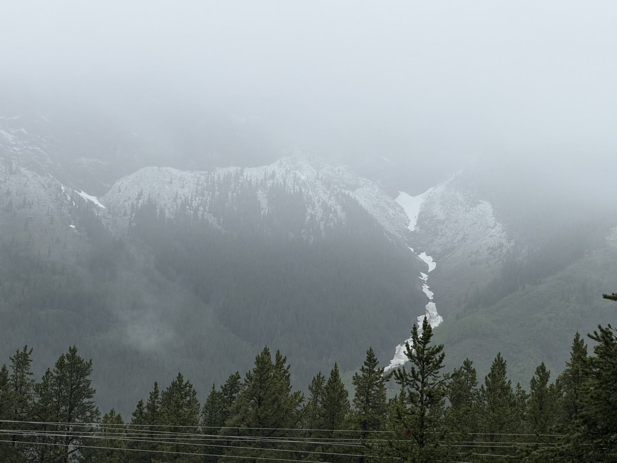
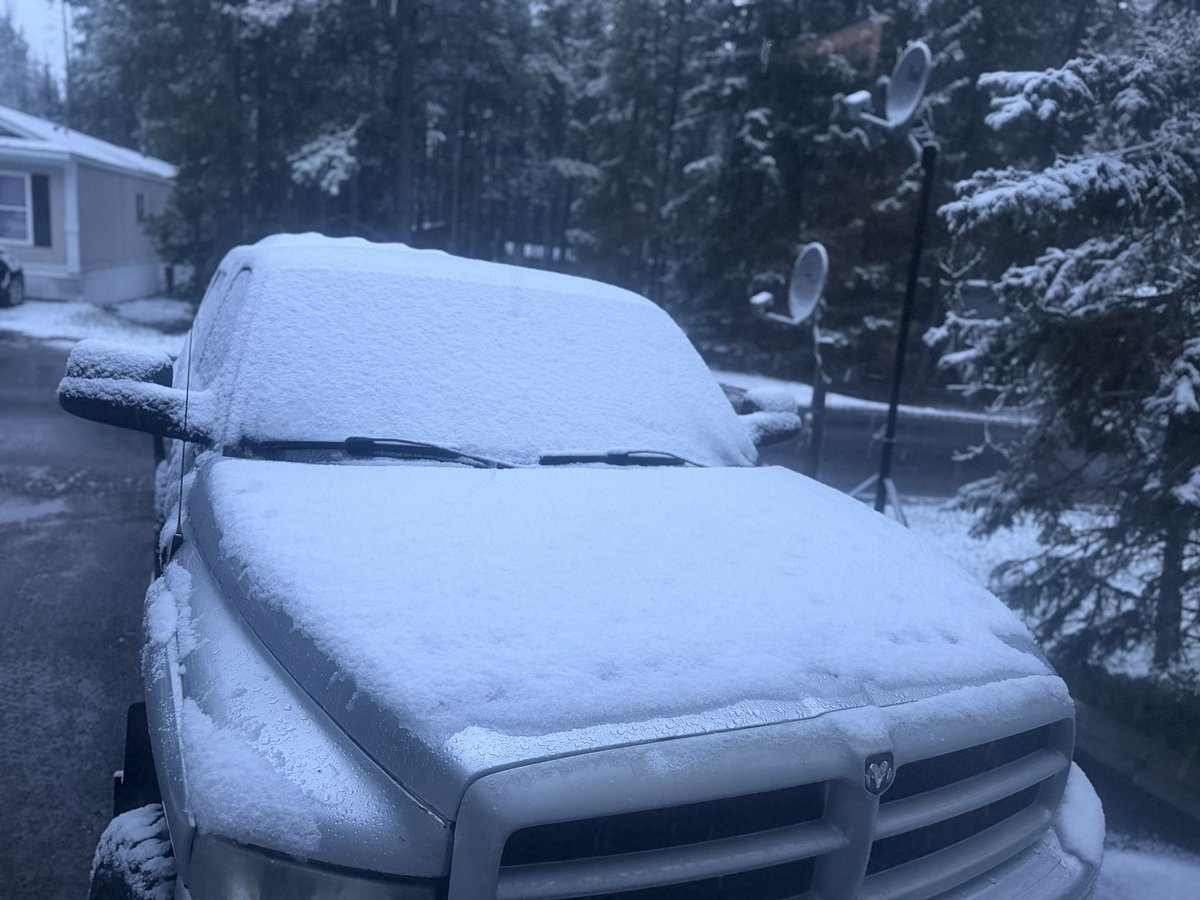
Still tons of snow on the front ranges west of Calgary!
Outlaw Peak at left, Mount Glasgow on the right.

5
13
121
3,118
Tom Graham retweeted

Jun 11
Note preliminary: It appears Manitoba has set a new 24-hr provincial rain record with the storms on Tuesday night. I've confirmed a high-quality gauge measurement of 292 mm (11.48 in) approx. 2 km west of Stonewall. #mbstorm
2
19
131
13,913
Tom Graham retweeted

Jun 11

How Canada’s only F5 tornado has changed alert systems nearly 20 years later. winnipeg.citynews.ca/2026/06…
4
6
2,160
Tom Graham retweeted

How Canada’s only F5 tornado has changed alert systems nearly 20 years later. winnipeg.citynews.ca/2026/06…
2
5
2,605
Tom Graham retweeted

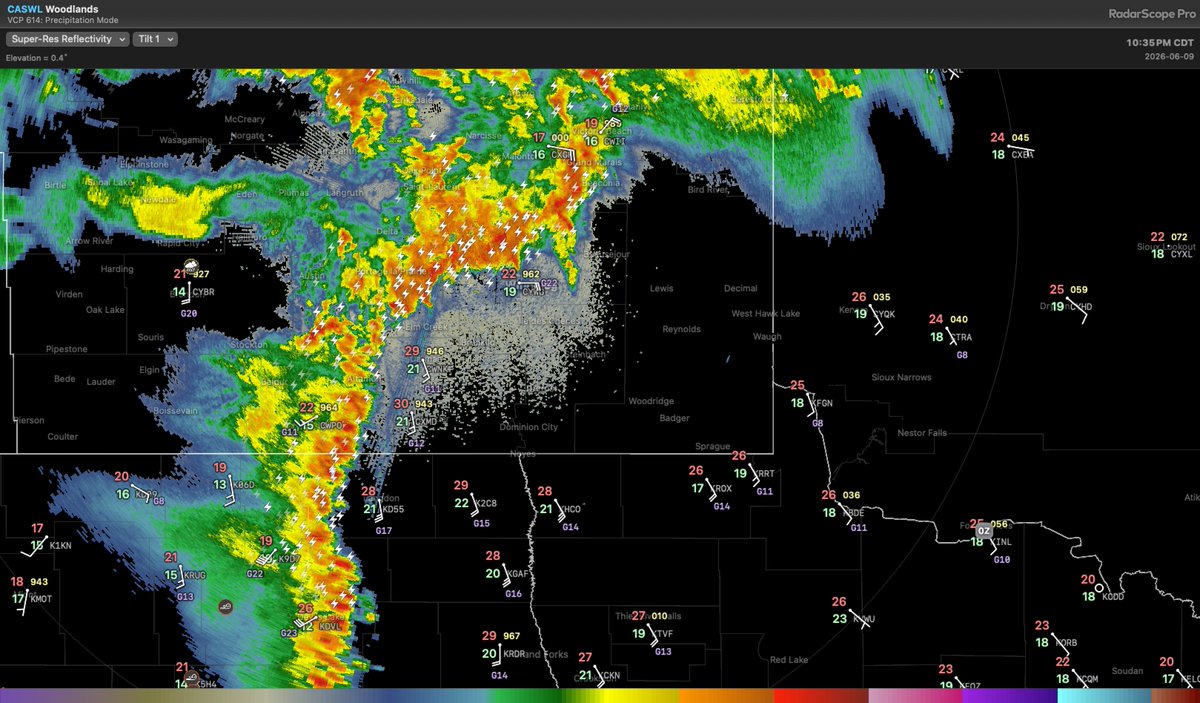
Timelapse sequence of last night's tornado near Oxbow, Saskatchewan #skstorm
63
462
2,493
165,751
Tom Graham retweeted
Jun 10
For all the flack the RRFS has been catching, it was the only model to consistently show supercells affecting the RRV yesterday. Indeed, many runs specifically showed a supercell right over Winnipeg. It has certainly performed no worse than any other CAMs over the past 3-4 days.

4
7
65
5,019
Tom Graham retweeted
Jun 10
Storms have exited Winnipeg for now, but more are on the way. A strong line of storms is presently located from Portage la Prairie southward to just west of Morden. This line will impact the Red River Valley over the next few hours. #mbstorm
4
7
45
5,723