
Love the weather!
Joined April 2021
- Tweets 2,236
- Following 22
- Followers 255
- Likes 2,807
264 Photos and videos


May 15
That was a penalty, but the embellishment is crazy. He got lightly tapped on the top of the head after he skated into Slaf’s stick. Good penalty kill. #habs
125
WeatherMan07 retweeted

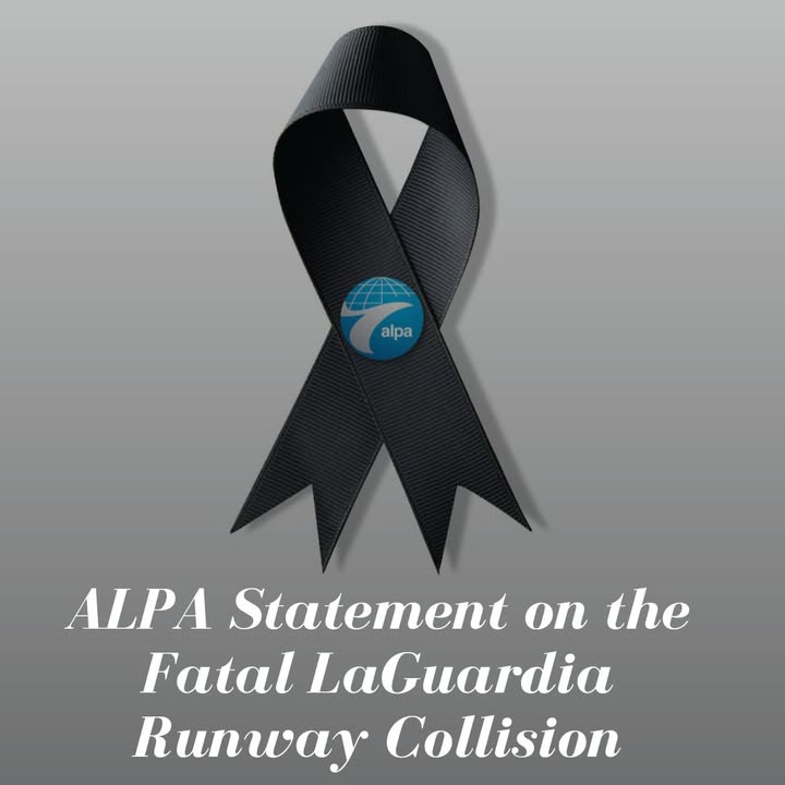
The loss of our two fellow crewmembers onboard Flight 8646 is a profound tragedy. Thinking of their families, loved ones, and colleagues at Jazz Aviation during this devastating time.

18
159
940
24,201
Mar 13
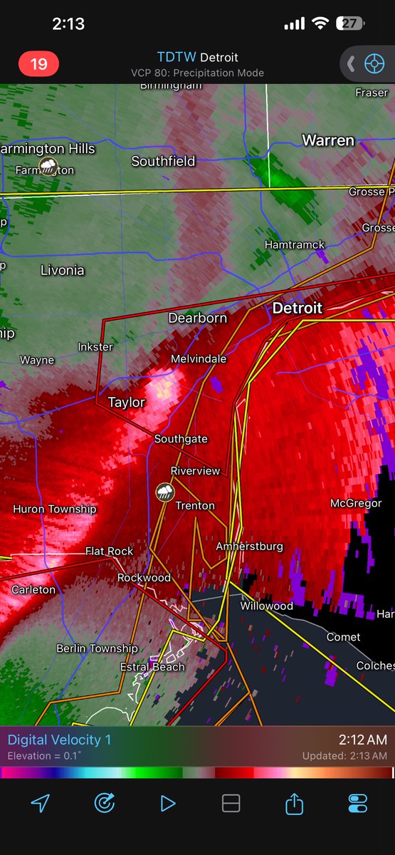
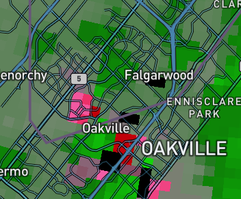
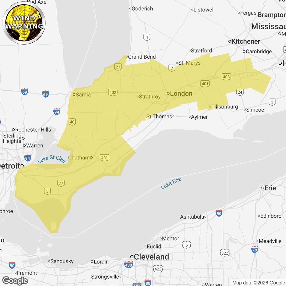
A line of showers with RA/SN mix is making its way across portions of Southern Ontario. Severe gusts are being reported along the cold front with a wind warning out for 110km/h winds. Detroit/Ann Arbour/Toledo all gusted 112-115, Windsor 107km/h, Wallaceburg 102km/h. #Onstorm
2
4
1,295

Jan 26
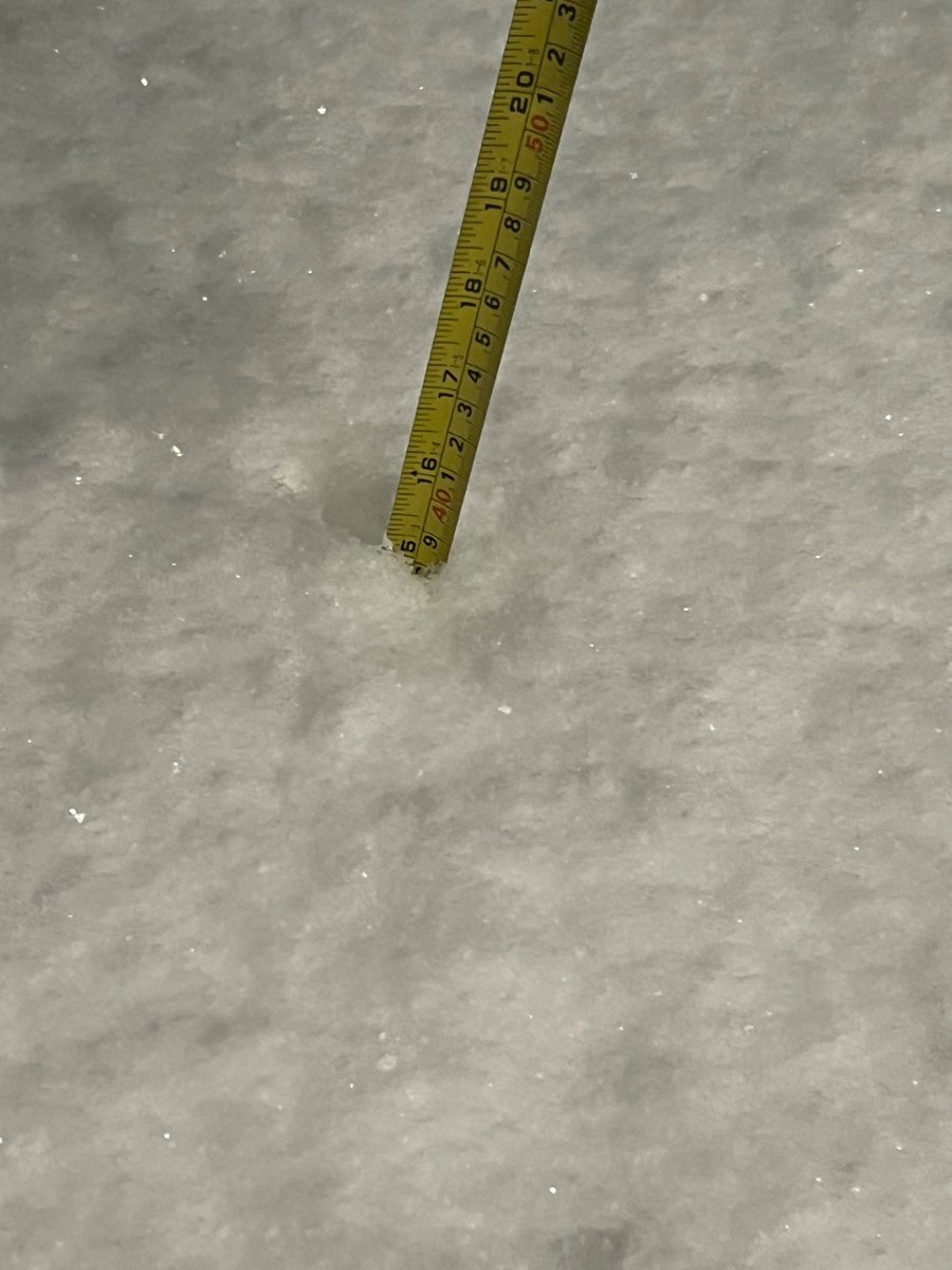
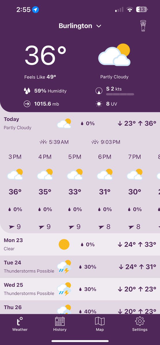
38cm of snow in multiple measurements as of 10pm in south Burlington. Prolific snowfall rates continued w/ likely 6-10cm/h. Estimating ~50cm without drifting as of snow as of 12am. Near zero visibility at times, with gusty winds. Squall is starting to sink south. #Onstorm
1
2
643
Jan 18
It exists! 😮 #onstorm
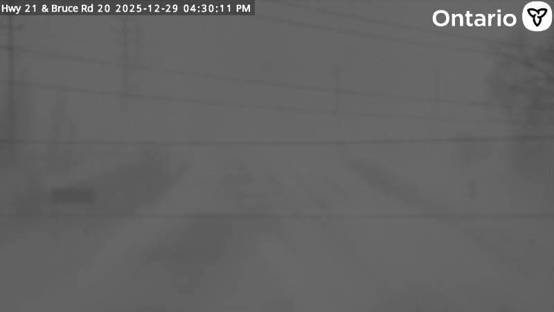
A dangerous period of blizzard conditions with 90km/h winds, 20-40 cm of snow and extremely cold temperatures is expected tomorrow through Tuesday morning. Stay safe, avoid travel and expect lengthy closures and rapidly accumulating snow/snow drifts.

#onstorm 4:38p BLIZZARD WARNING (ORANGE LEVEL) ISSUED by Environment Canada
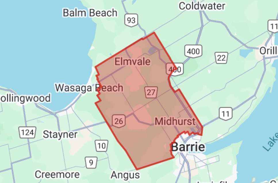
Saugeen Shores - Kincardine - Southern Bruce County
Bruce Peninsula - Sauble Beach - Tobermory
instantweather.ca/2026/01/18…
1
2
582
Jan 18
SW flow will allow PEC/Kingston and Niagara to continue seeing snow squalls today. A clipper moves through the area overnight into tomorrow morning with potent squalls behind the system.
Long range, extremely cold temps over the next two weeks, watching the storm track.
114
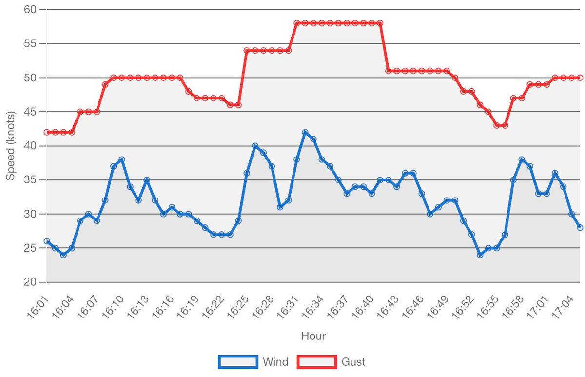
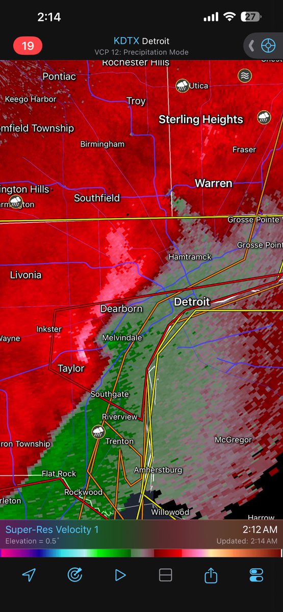
Windsor CYQG is seeing quite the winds today. Sustained 35-42kt gusting up to 58 knots over the past hour. 65-80km/h sustained gusting to 107km/h. #Onstorm
1
174
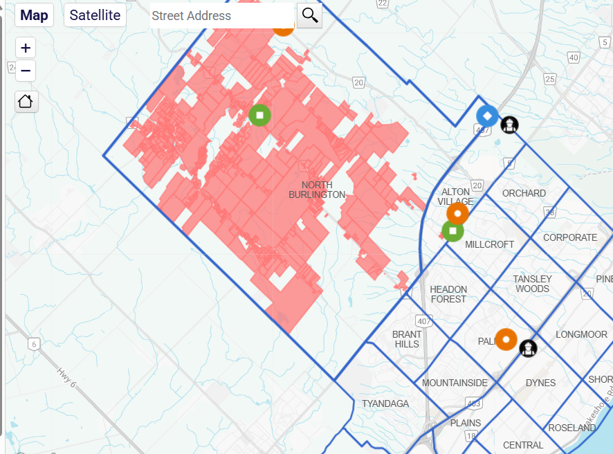
Yellow warning with winds up to 110km/h just issued. #onstorm
Credit to IW for that warning map.
172
WeatherMan07 retweeted

30 Dec 2025
#ONStorm #ONwx Civil Emergency Issued - 10:22 AM
Springwater Township
Non-emergency travel should be avoided.
Civil Emergency in Springwater, Ontario. Emergency services are unable to respond.
Due to a serious threat to safety and security caused by winter weather, emergency services are unable to respond.
- Brennen
7
58
186
35,073
30 Dec 2025
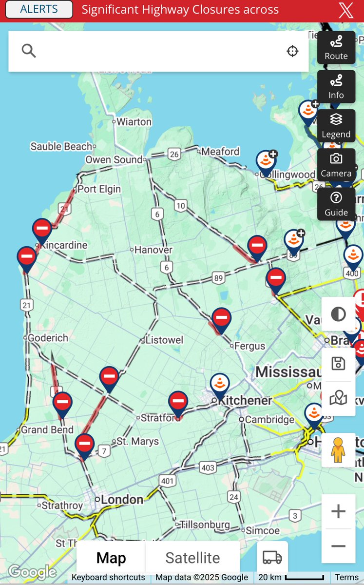
And yet we don’t issue blizzard warnings, even with the ability to set the colour. Travel is impossible, roads are impassable, and it has been like this for many hours. This is insane video footage. Stay home and stay safe everyone! #onstorm
30 Dec 2025

Whiteout conditions east of Wasaga. Heed road closures PLEASE, we’ve seen 5-6 stuck cars every couple hundred yards. #onwx
8
1,021
29 Dec 2025
Dangerous snow squalls are becoming more organized this evening. Strong winds of 60-80km/h are leading to persistent near zero visibility coupled with heavy snowfall rates. Several highways are closed and this will likely increase tonight. Could use a blizzard warning? #Onstorm
2
21
2,789
28 Dec 2025
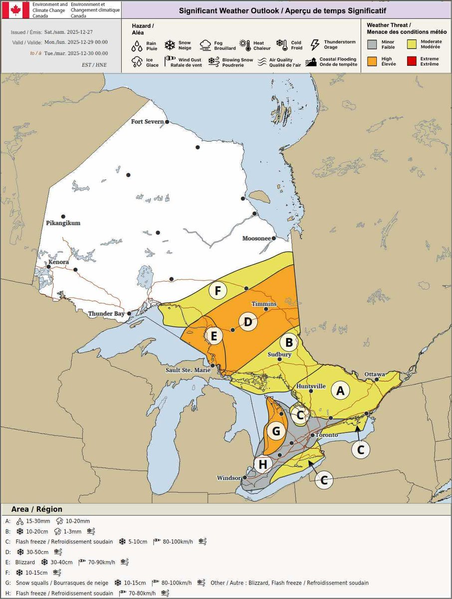
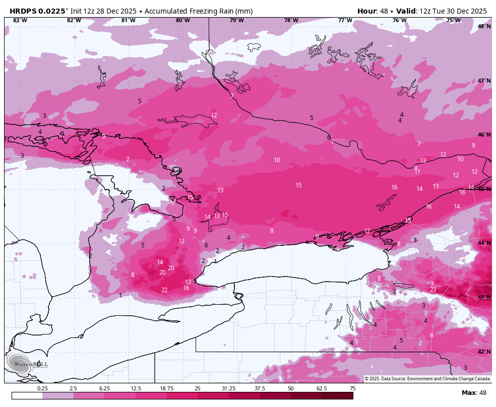
Many areas being upgraded to Orange Freezing Rain Warnings.
“Travel will likely be hazardous and some routes will likely be impassable. Prolonged utility outages are likely. Non-essential travel should be avoided.”
Some bugs with the upgrade aswell.. #Onstorm
5
8
25
5,745
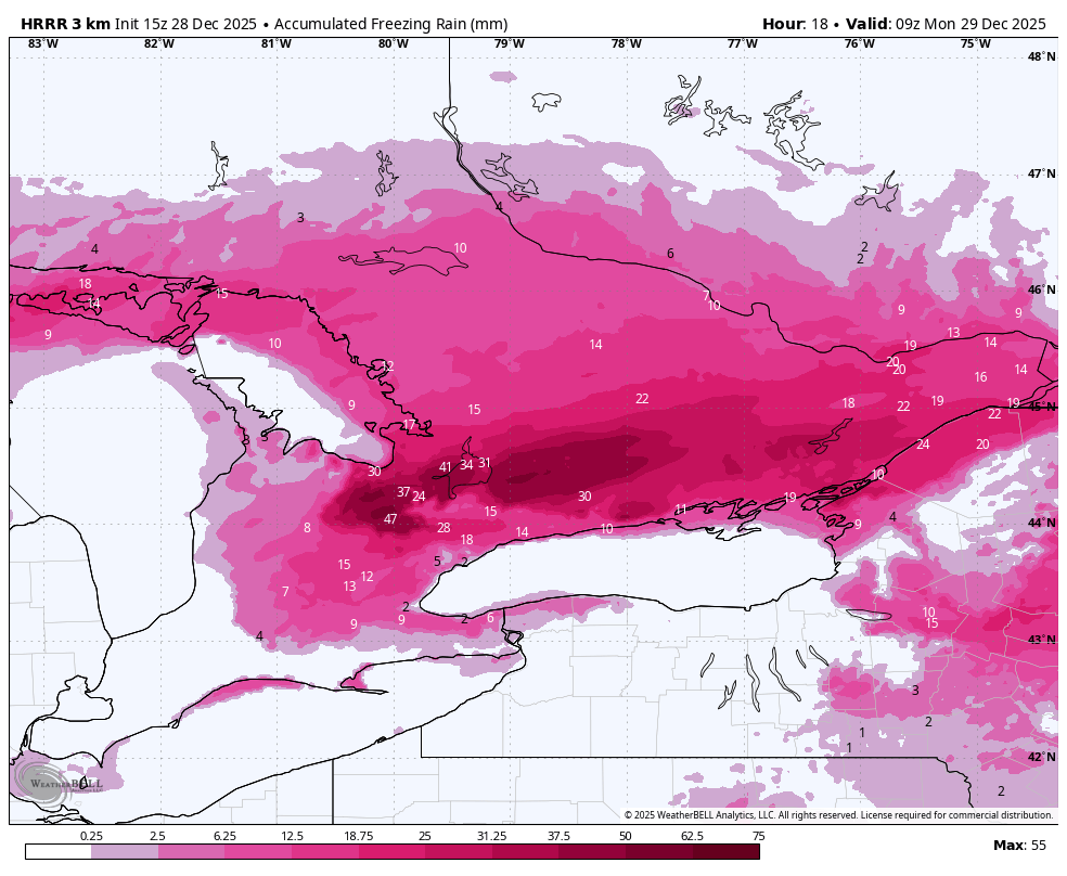
28 Dec 2025
Low level cold airmass seems to be holding on longer than expected. Freezing rain warnings up for the GTA now and expand as far south as London and Woodstock. The latest HRRR is putting out a worse case scenario, and I’m hoping the 12z models are the actual scenario. #Onstorm
5
1
24
7,315
28 Dec 2025
Temperature in Burlington by the lake has actually dropped back down from above zero to -0.1 which is concerning especially for areas away from the lake which are likely still well below the freezing mark. For reference, it was supposed to be 2-3 degrees at this point. #onstorm
2
6
980
28 Dec 2025
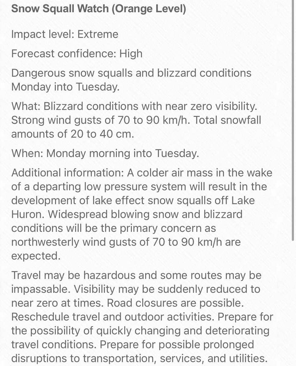
Orange snow squall watches going up for areas SE of GB and Lake Huron. EC is currently forecasting extreme impact and high confidence. If it is upgraded to very high, it would be a red warning. I wouldn’t be surprised if a Red Blizzard Warning was issued. #Onstorm
2
1
763
19 Dec 2025
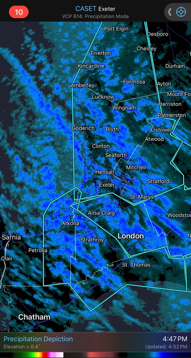
Nice squall moving through North London this hour. Black ice underneath a new layer of snow could make for some dangerous driving conditions. Stay safe. #Onstorm
3
9
1,390