Lifelong passion fascination of weather. Providing insightful forecasts for the Northeast. Trained NWS SKYWARN spotter. facebook.com/WeatherReMarks
- Tweets 10,039
- Following 934
- Followers 1,195
- Likes 18,790


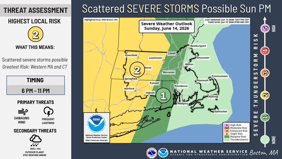
ALT Severe Weather Outlook map image for Sunday, highlighting a Slight (Level 2 of 5) severe weather risk centered in western New England.


ALT Highs today

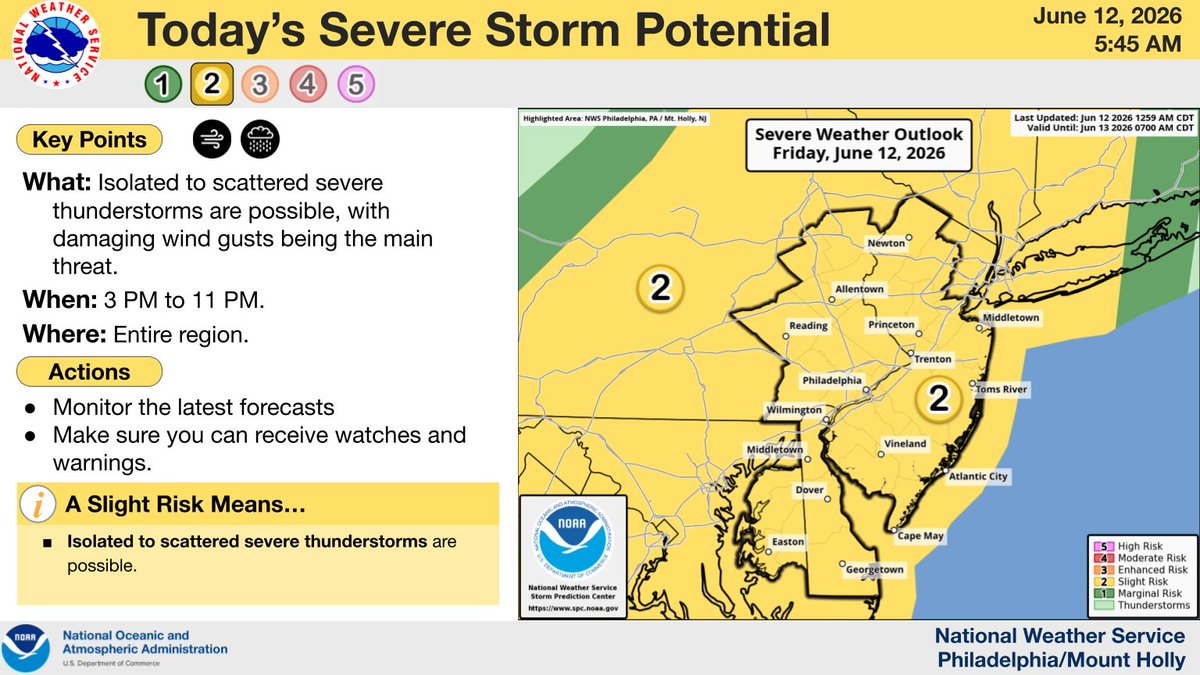
ALT The severe thunderstorm risk for today.

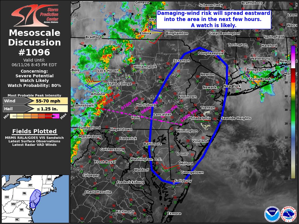
ALT This graphic displays Severe Thunderstorm watch number 317 plotted on a map. The watch is in effect until 12:00 AM EDT. The watch includes parts of Delaware, Maryland, New Jersey, New York, Pennsylvania and Virginia. The threats associated with this watch are no tornadoes expected, isolated hail up to quarter size possible and scattered gusts up to 65 mph possible. There are 27,572,039 people in the watch along with 6473 schools and 372 hospitals.


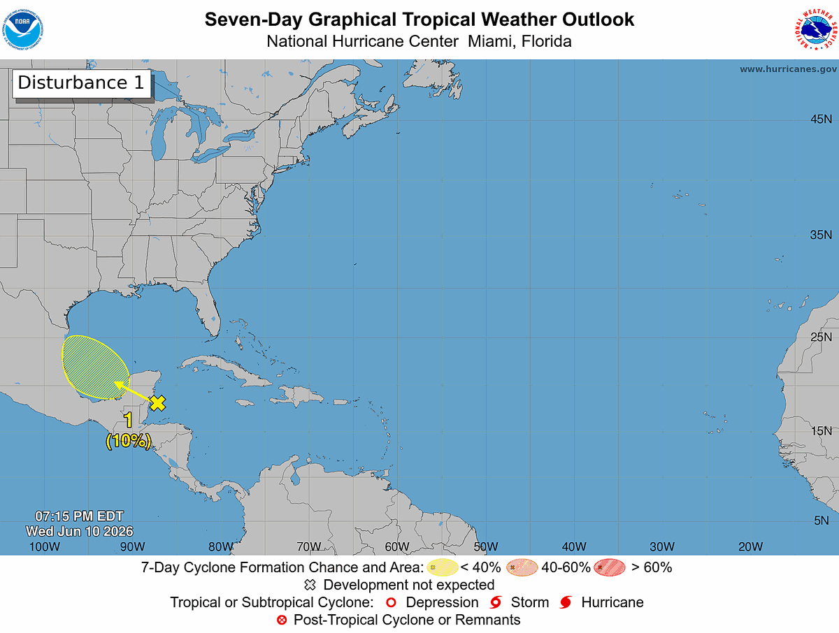
ALT Seven-Day Graphical Tropical Weather Outlook. Disturbance 1: A yellow X is highlighted over the northwestern Caribbean and is forecast to move into the Bay of Campeche by Friday, where there is a 10% chance of formation within the next 48 hours and the next 7 days.


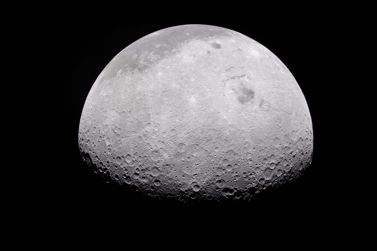
ALT This photo of the Moon was captured by the Artemis II crew aboard the Orion spacecraft a few hours before the lunar flyby on April 6, 2026. During the flyby, the crew captured critical science observations as they traveled around the far side of the Moon, traveling farther than any humans ever before. The Moon resembles a gray cratered orb in the distance, standing out against the blackness of space. Credit: NASA
ALT The Moon appears half-illuminated in this photo captured by the Artemis II crew on April 6, 2026. The terminator — the difference between light and darkness — provides a stark contrast and even greater perspective of the Moon's rocky, uneven, and otherworldly surface features. The near side of the Moon, which is what we can see from Earth, appears in the dark gray regions at the top of this image. The Moon stands out against the blackness of space around it. Credit: NASA

ALT The Artemis II crew was tasked with capturing many key features visible in this image of the Moon, captured on April 6, 2026. The terminator, or the difference in light and darkness, is visible on the top left. The large dark gray area toward center-left is Orientale Basin, while the characteristic dark patches of ancient lava flow we see on the near side are visible on the right half of this image. The Moon stands out against the blackness of space around it. Credit: NASA
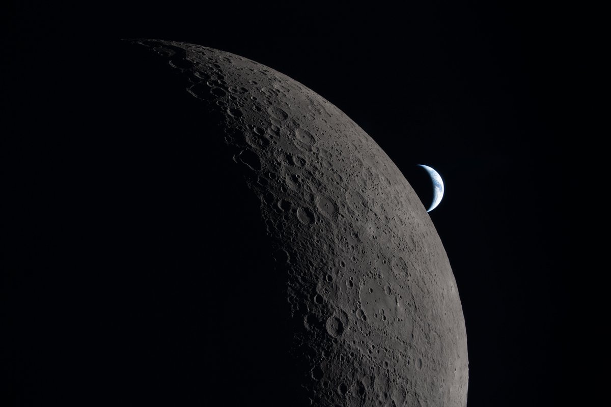
ALT This photo of a crescent Moon and crescent Earth was taken by an Artemis II astronaut during their lunar flyby on April 6, 2026. This image captures one of the final moments before their loss of signal with Earth as the Orion spacecraft flew around the far side of the Moon, reemerging and regaining contact approximately 40 minutes later. Earth can be seen peeking behind the Moon in the distance. The illuminated regions of the Moon and Earth stand out against the blackness of space, while the rest are swallowed in shadow. Credit: NASA


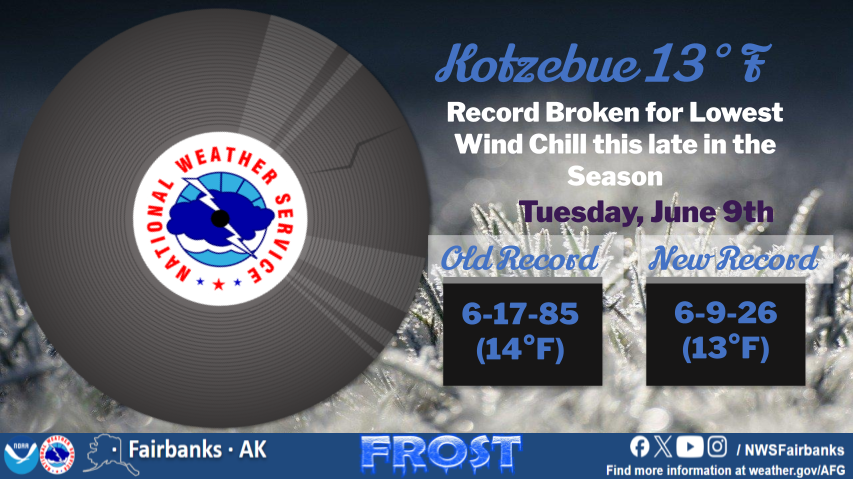
ALT Kotzebue 13°F Record Broken for Lowest Wind Chill this late in the Season Tuesday, June 9th Old Record 6-17-85 (14°F) New Record 6-9-26 (13°F)