
Joined March 2011
- Tweets 9,057
- Following 1,869
- Followers 1,833
- Likes 3,419
1,411 Photos and videos


Brian K. Sullivan retweeted

Jun 11
El Niño has arrived - and it's on track to be a big one. From transatlantic flight times to Panama Canal shipping delays, to the cost of a candy bar or even just a bottle of soap, its effects can pop up all over the economy. (gift link) bloomberg.com/news/articles/…
10
19
21,768
17 gigawatts is enough to send Doc and Marty back to the future 14 times! Great Scott! Nice stories by my @business colleagues.
May 1

great read here, got everything from AI to nuclear power to a fired CEO to Ted Cruz. 17 gigawatts my gosh!! impressive reporting @HiMichelleMa and @naurtorious gift link bloomberg.com/news/articles/…
1
77
exas faces a weekend of flooding, including areas that were devastated in July. This time, some of the heavy rain will be beneficial because of drought, but flooding is always a deadly risk. My @business colleague @laurenthal
has our story here:
bloomberg.com/news/articles/…
1
76
Hawaii is in line for another Kona low through the middle of next week. Flood watches and other hazard markers are up all over the islands. Hawaii got battered last month with two big storms. weather.gov/hfo
1
1
140

Brian K. Sullivan retweeted

Feb 24
Providence just destroyed the record books.
37.9 inches of snow, crushing the Blizzard of 78 by more than 9 inches.
The largest storm in Rhode Island history and the highest snowfall ever recorded at an I-95 Northeast climate site.
And it is still lightly snowing.
23
204
2,275
164,389
Brian K. Sullivan retweeted

Feb 19
A snow-covered I-80 in California turned into a parking lot near Emigrant Gap, where dozens of trucks were stuck and traffic was backed up for more than six miles after heavy snow forced a shutdown of the eastbound lanes.
126
608
3,020
270,297
Brian K. Sullivan retweeted

Feb 13
New: Trump admin moves to pull supercomputing center out of top weather and climate research center (NCAR) in Boulder, Colo. Part of its effort to "break up" the lab. cnn.com/2026/02/13/weather/t…
19
149
250
68,660
Brian K. Sullivan retweeted

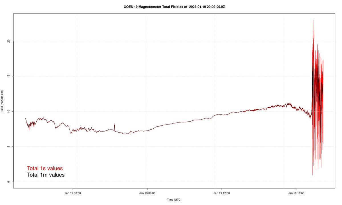
Jan 19
We just got whacked with a CME ...
1
1
2
177

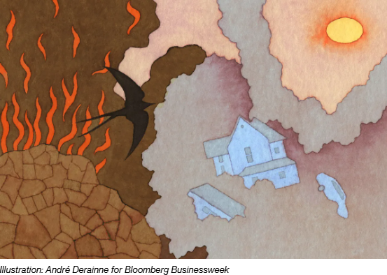
A deep freeze in the Northern Hemisphere would likely mean higher power and natural gas prices, adding to the cost burden for ratepayers as inflation remains stubbornly high, writes @WeatherSullivan @joewertz and @maryhui bloomberg.com/news/newslette…
3
6
11
21,566

6 Nov 2025
4274, remember that number, you may be hearing more about it soon enough. #SpaceWeather
1
104
Brian K. Sullivan retweeted

3 Nov 2025
Unfortunately some of the barrier islands near the Black River have been cut off, with their only road being washed away. Hoping aid is coming their way!
#Melissa #hurricane
31 Oct 2025

NOAA is flying over over the area affected by Hurricane Melissa to support disaster response efforts in Jamaica. Find all the available imagery in our viewer: storms.ngs.noaa.gov/storms/m…

ALT Map of Jamaica indicating the areas where imagery is available
1
66
353
123,462
7 Oct 2025
My mother liked things with lots of fringe on them. I guess I do too.
7 Oct 2025

Lots of words, but not a lot of serious risks although AL95 might brush the #LeewardIslands, fringes of Priscilla impacting #Mexico, fringes of Halong might brush #Japan ... enkiops.org/2025/10/07/al95-…
1
1
113
Brian K. Sullivan retweeted

29 Aug 2025
There's a "tug of war" emerging between Arctic atmosphere (where air near surface is warming faster than high altitudes) and tropics (where high-altitude air is warming faster), and the as-yet TBD outcome will have major implications for global weather patterns. youtu.be/PDV0eCb7UAw
4
31
180
13,665
Brian K. Sullivan retweeted
25 Aug 2025
Typhoon #Kaijiki is making landfall in #Vietnam, more powerful than forecast. Impacts likely to be over $1 Billion; that would be like a $60-70 Billion storm for the US (like a Helene or Sandy). Elsewhere no threats. enkiops.org/2025/08/25/typho…
1
2
280

Brian K. Sullivan retweeted

18 Aug 2025
A large portion of the Atlantic coastline will see the risk for high surf and rip currents increase this week due to #Erin.
🟥Risk of Rip Currents is High🟥
Life-threatening rip currents are likely. Swimming conditions are unsafe for all levels of swimmers. Stay out of the water. Always follow advice from the local beach patrol and flag warning systems.
nhc.noaa.gov/refresh/graphic…
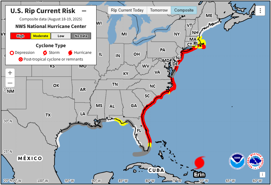
ALT Map of the U.S. rip current risk from Florida to Maine. A majority of the Atlantic coastline is colored red, designating a "high risk" of rip currents this week.
15
524
1,515
192,764
18 Aug 2025
It felt chilly out there today -- 69F at the local airport. Is there snow in the air @judah47 @JoeRyanNews ?
1
1
289
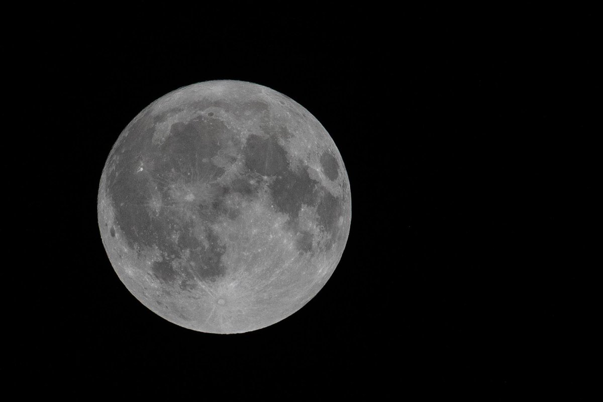
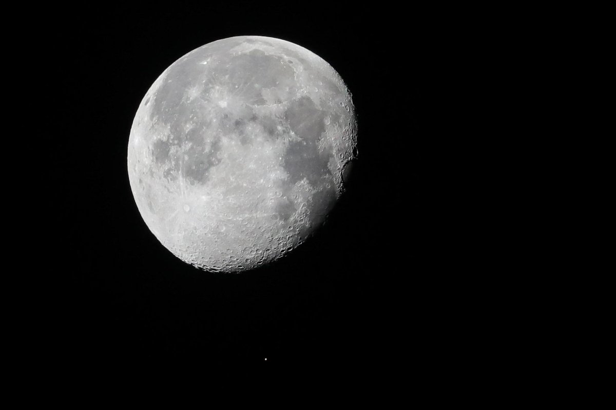
9 Aug 2025
I rarely use X anymore --sorry guys, I noticed today a bunch of you have been poking at me lately. I love that you love me enough to care!!! Ha, anyway I wanted to post a photo of the Moon as it is right now. Good-bye Jim Lovell.
71