
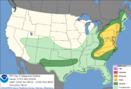
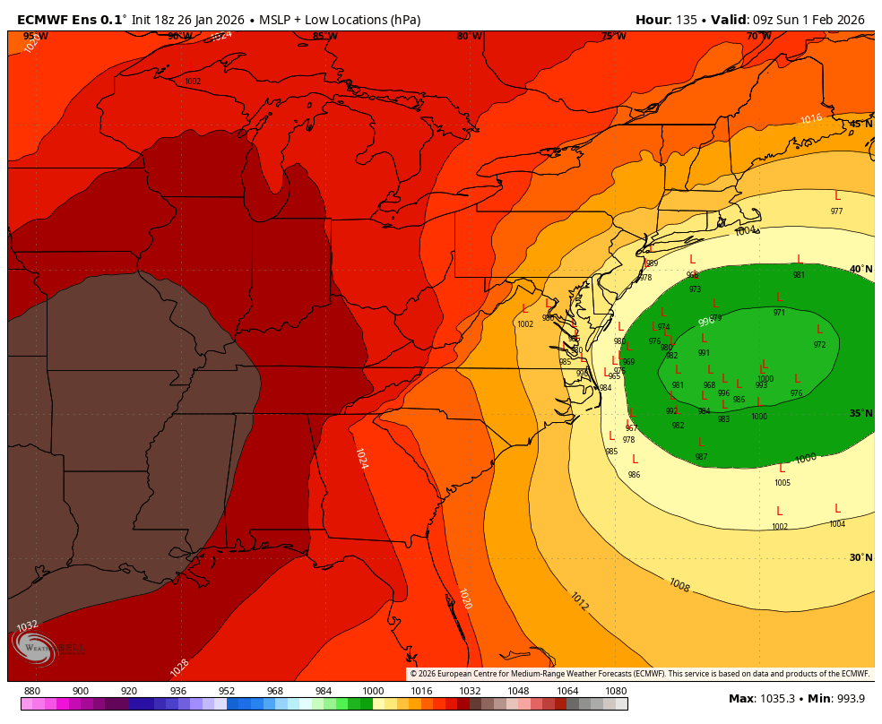
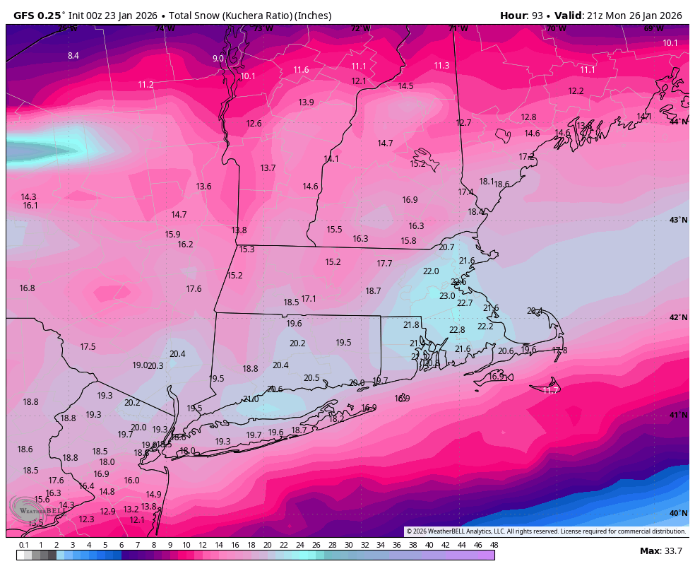
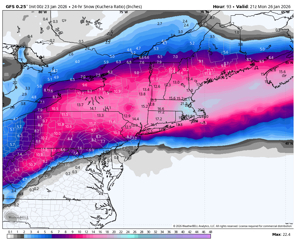
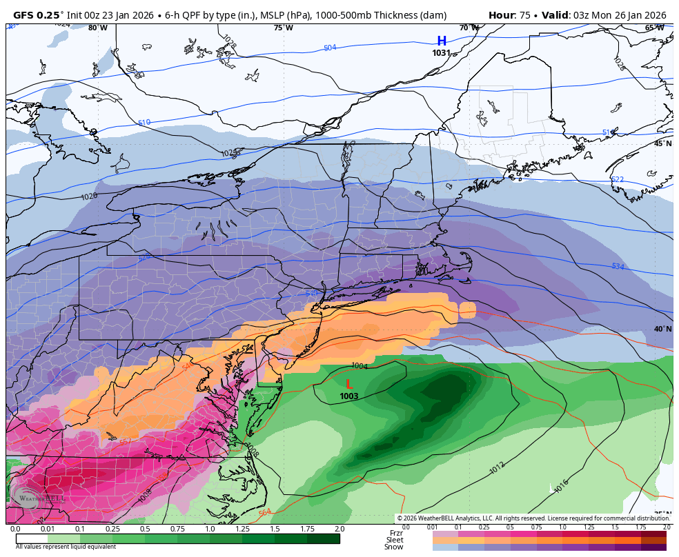
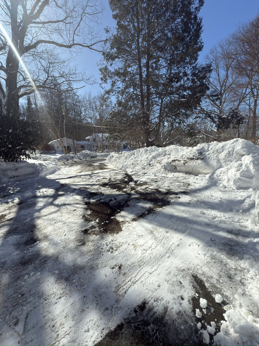
watch late Jan into Feb for many snowstorms and blizzard for sne area big hurricanes over due for sne area .
Joined January 2009
- Tweets 10,499
- Following 199
- Followers 199
- Likes 89
89 Photos and videos


Pinned Tweet
Watch thur for sever thunderstorms for sne area. National weather is slow on it
5


Jun 14
Watch tonight for sever thunderstorms in Connecticut and damage winds near 65.
32
Jun 14
AguaceroWx | Advanced Weather Visualization
AguaceroWx | Advanced Weather Visualization is that good site
27
billy retweeted

Jun 9
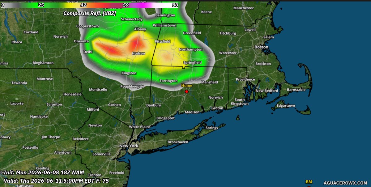
Thursday could be big in New England.
Volatile instability (over 3000 J/Kg), dew points up to 70 in a tropical airmass, and 25-35 kts of mid-level flow should yield in robust thunderstorm development capable of all severe hazards.


4
5
37
4,371
billy retweeted

Apr 30
As much reports as possible would be amazing.
Y’all know I’m genuinely curious but also u got a chance to end up on @JdjWeather ‘s end of season maps and it helps fill in the holes.
I really love what he’s building on his site.

Apr 29

In theory there could be some May magic for accumulation(especially interior elevated New England), but winter is obviously done for the most part for good amount.(Never say never JIC)
But I would love to know what your final tally was on the season.
94.5” on the season for me is my highest since 2015.
Max Snowpack in the 24-30” range and I believe we had at least some snow on the ground for nearly 3 months straight.
One of my favorite winters all time.
Share your seasonal totals!
Would be very helpful and I’m just genuinely curious
1
2
14
5,105
Mar 9
Watch next week very cold weather for connecticut and watch late march for big snowstorms.
1
60
billy retweeted

I would caution against any significant warmup prospects in New England, especially over the next 7-10 days.
We have an above normal snowpack in all of New England and tons of cold in SE Canada. As we all know very well, this cold likes to push back against warmups that try and move in from the SW
12
8
91
17,791
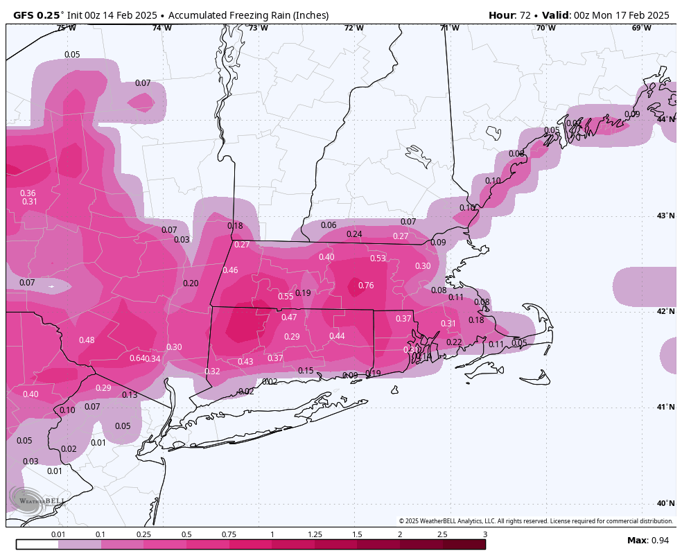
Feb 27
watch next in sne and northeast warm up will not happen next week like what models show . To much snow on the ground and will be colder than forecast. ALSO WATCH AFTER MARCH 10 BIG TIME COLD COMING TOO WITH ANOTHER BLIZZARD .
1
59
billy retweeted

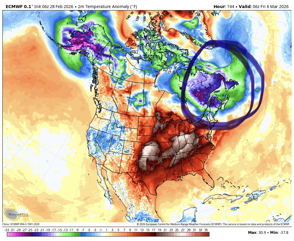
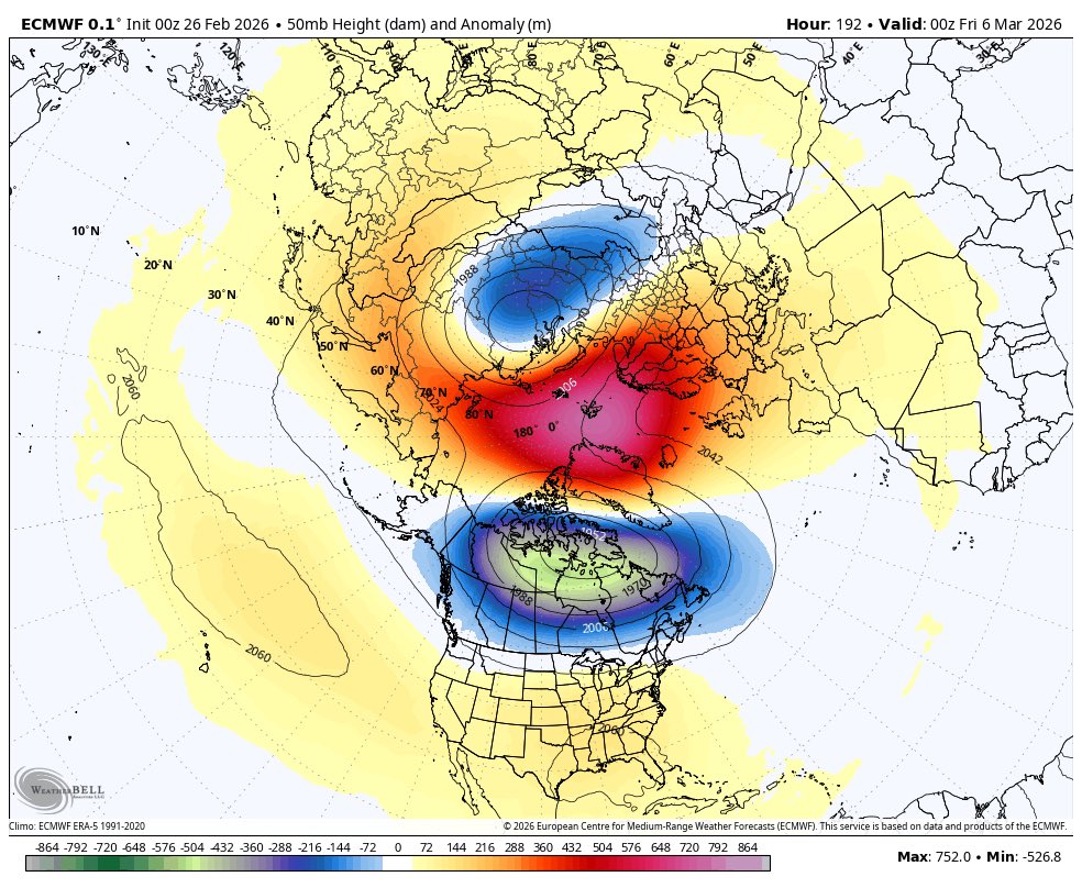
Feb 26
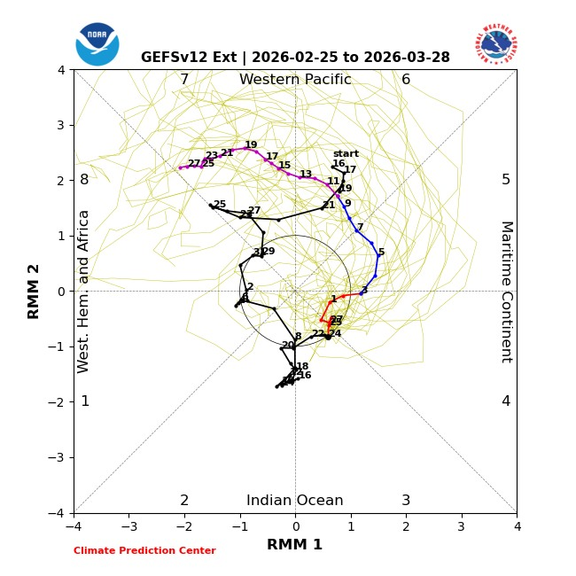
MJO going DEEP into Phase 7 and maybe 8 with a Polar Vortex Spilt
That does not spell spring...makes me think something like March 2017 is an option.
12
12
96
17,952
billy retweeted
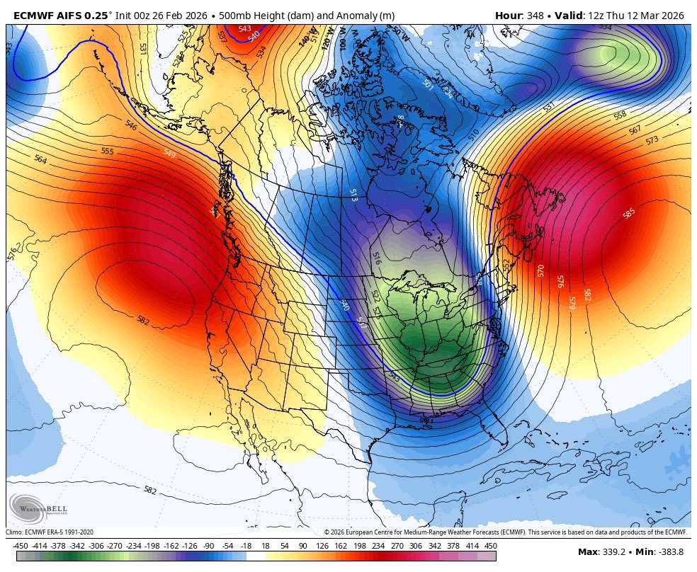
Feb 26
Remember that Polar Vortex Split I told you about?
It’s happening!
And the AI models are starting to sniff out the impacts at the surface.
First image is of the stratospheric polar vortex on March 6th second image is the AIFS seeing a massive Eastern US trough in response around March 12th.
Now I’m not suggesting the March 12th map is exactly correct. But what I am suggesting is that I wouldn’t expect spring warmth to set in while a Polar Vortex Split is happening.
#wxtwitter #wxX
21
23
197
28,155
Feb 25
I say in march will least two big snowstorms. For connecticut area. I would not be surprised if we have over 23 inches in one. If not two.
1
35
billy retweeted

My thoughts…worried about a sharp western cutoff, but nonetheless an all time storm with likely some 24-36” totals over SE New England or Suffolk County NY
1
1
3
937
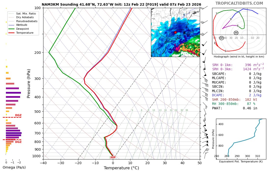
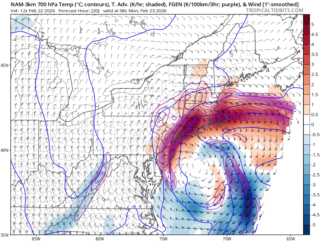
billy retweeted
Feb 22
WOW! Easily 3-5" per hour in that band of what the Nam 3k is showing. Absurd.
5
5
32
4,157
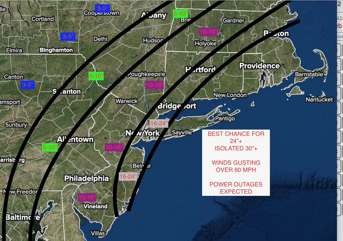
billy retweeted
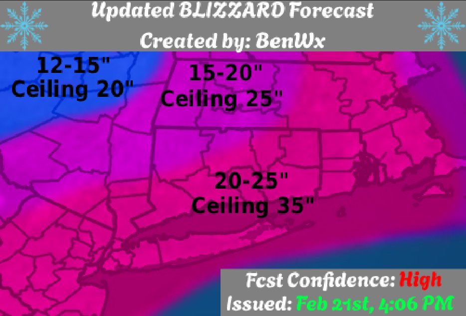
Feb 21
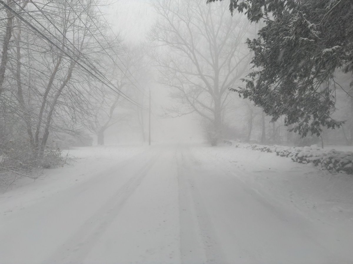
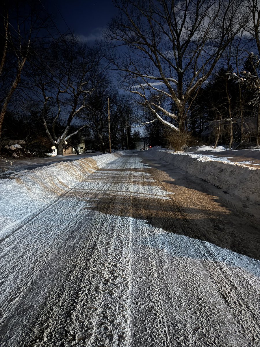
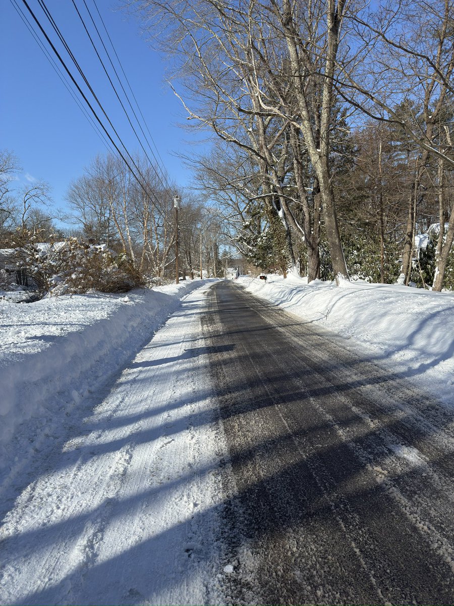
--Updated Blizzard Forecast--
The main change with this update was to change forecast confidence to "High" and expand the highest totals into NE Massachusetts. Ceiling 35", floor 12". Snowfall rates will exceed 2-4" per hour.
16
20
228
29,063
billy retweeted
Feb 18
Something to note upcoming here for Friday-Saturday which does have ties to the next system…
Models often overestimate holding onto the primary too long.
Especially low res physics based models. It’s a unique process that unfolds but even some AI guidance due to the low resolution can struggle in these kind of scenarios as well because even though it has the machine learning aspect and likely will still do better in a sense then some of the physics based guidance.
Within a region and some of the mesoscales details and resolving the secondary low that forms it can struggle a little with that even though it may do a little better with some of the other biases.
So a weaker or delayed transfer has some notable impacts on specifics of mix line, how much precipitation and how long lasting the system is for the northeast.
Talked about this for last couple days.
And this process with the next storm Friday-Saturday has a direct impact on what the UL environment looks like for the storm after.
It’s why many of yall are wasting time with every 6 hours of model runs rn for the Sunday-Monday system.
You’re not gunna get more clarity or the answers ur looking for anytime soon likely as a result with this playing such a direct role in what the stream separation looks like and another vorticity consolidation aspects, and other factors as well.
Can’t skip steps here.
It’s also why i think Friday-Saturday can be a pretty notable snowstorm for New England(yes SNE is apart of New England) and NY with accumulating snow into PA.
Maybe some for N NJ, NYC, LI on the backside for some light accumulations? Possible but rather specific to pin down for the moment.
Just don’t drive yourselves crazy. Many of yall are likely falling into the same trap of model guidance again where you crap all over it, yet you’re letting it dictate your thoughts on what happens with the system(s) again.
If the umpire has a poor strike zone and consistently making the same calls all game long… Are u going to go up for your fourth and fifth at bats and make the same mistake…
And then blame the umpire after?
Or are u going to make adjustments so u can be successful…
Because everyone has the same playing field. No one can make the model show something different ahead of time that will give you an edge over everyone else. It’s the same model run for everyone to look at and they’re just one tool for forecasting as well.
You have so many different tools at your disposal. And then those that just use models won’t even likely often use the the models right away and just get too obsessed with p type maps and snow maps as if they hold any weight…
When in reality if you look under the hood it can tell u 100x more accurately what it’s trying to show
At this point it’s way more at bats than 4 or 5 btw…

5
3
26
4,892
Feb 18
To many weather people say everything has too be good to get a big one in east coast. Disagree totally. Number we. Are many days before mon. I wouldnt be surprised if we get a big without warning. To many weather prof just look one model .
2
1
144
billy retweeted

Feb 17
5 model morning model run (12Z) comparison. Fairly bullish for a Nor’easter… except the Euro which has not come around. What could go wrong? Block is too strong and system is forced south and out to sea. Would not be a complete miss… but it would avoid major/ blockbuster status if so. Stay tuned!!

Feb 17

❄️ The weekend Nor’easter set up, IMO, is pretty darn good! Sure it has lots of model support. But it also has meteorological support. Strong western ridge and block north in Canada, which allows the system to slow, tilt and intensify. Also a pseudo 50/50-ish low, also helping slow, block the storm, giving it time to strengthen. Cold air. The ingredients are there. Let’s see what shakes out. #snow

7
12
92
35,386