
Wx enthusiast from the UK, mainly interested in tropics & severe with a focus (here) on the former.
Joined September 2024
- Tweets 823
- Following 537
- Followers 259
- Likes 2,080
517 Photos and videos
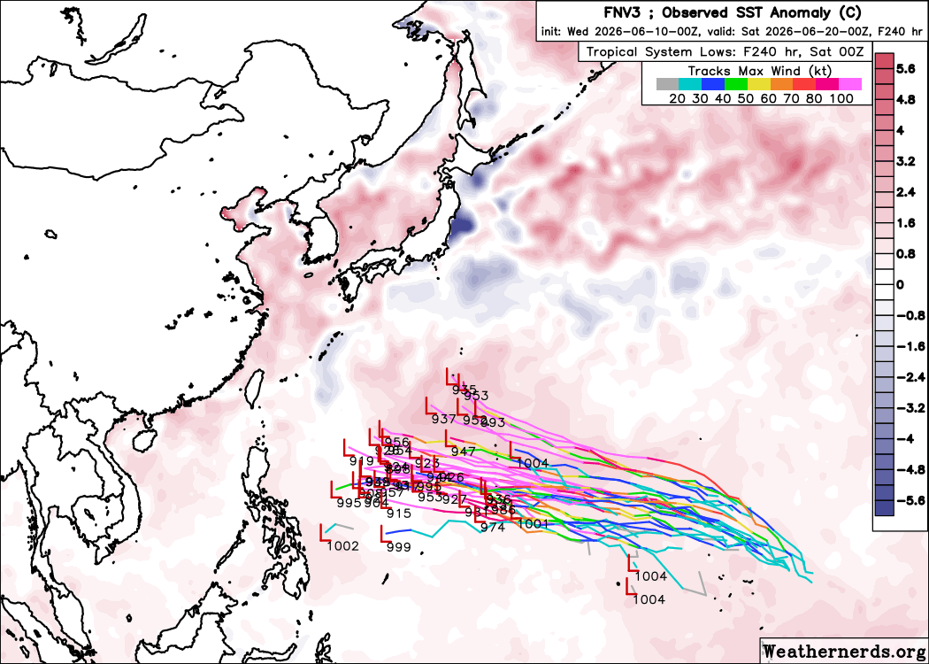


Jun 10
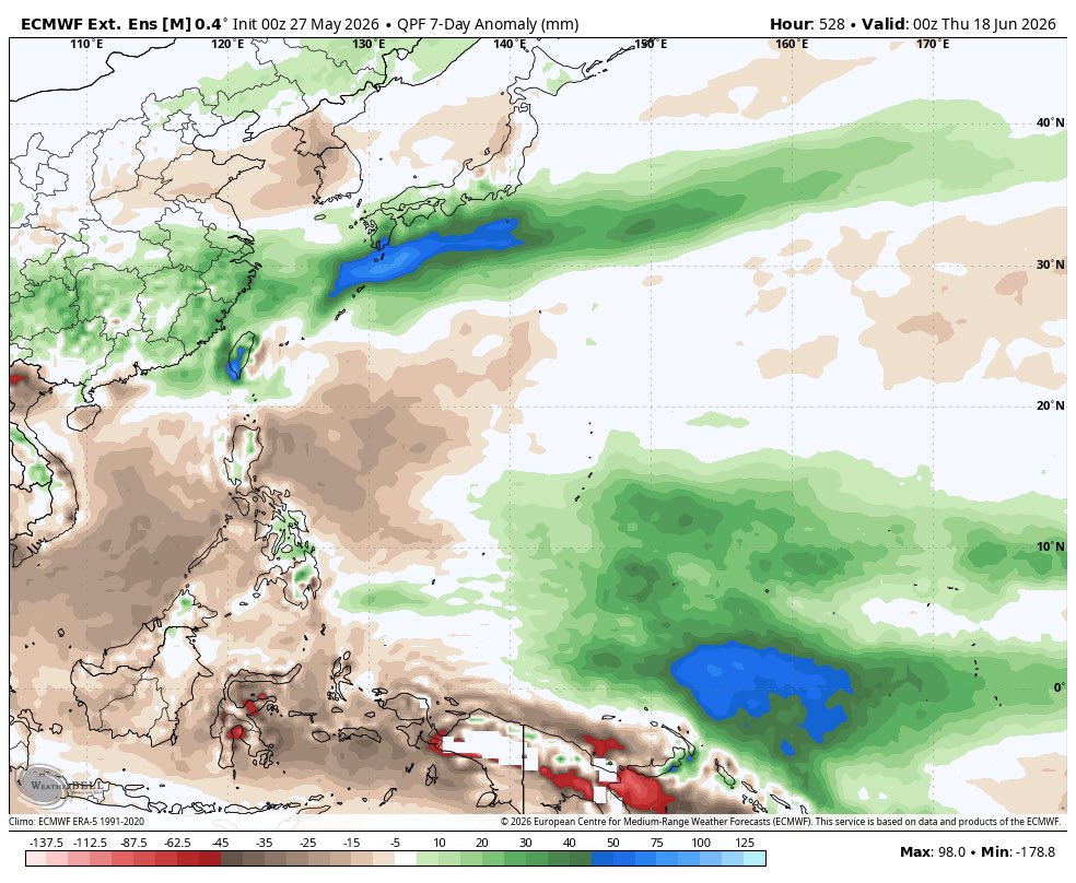
Starting to see more agreement between ML/AI & NWP guidance re: potential development in the far eastern WPAC now. Can see the precursor for this disturbance along the confluence zone/ER near the dateline that'll steadily lift WNWard underneath a zonal subtropical ridge.
Jun 3

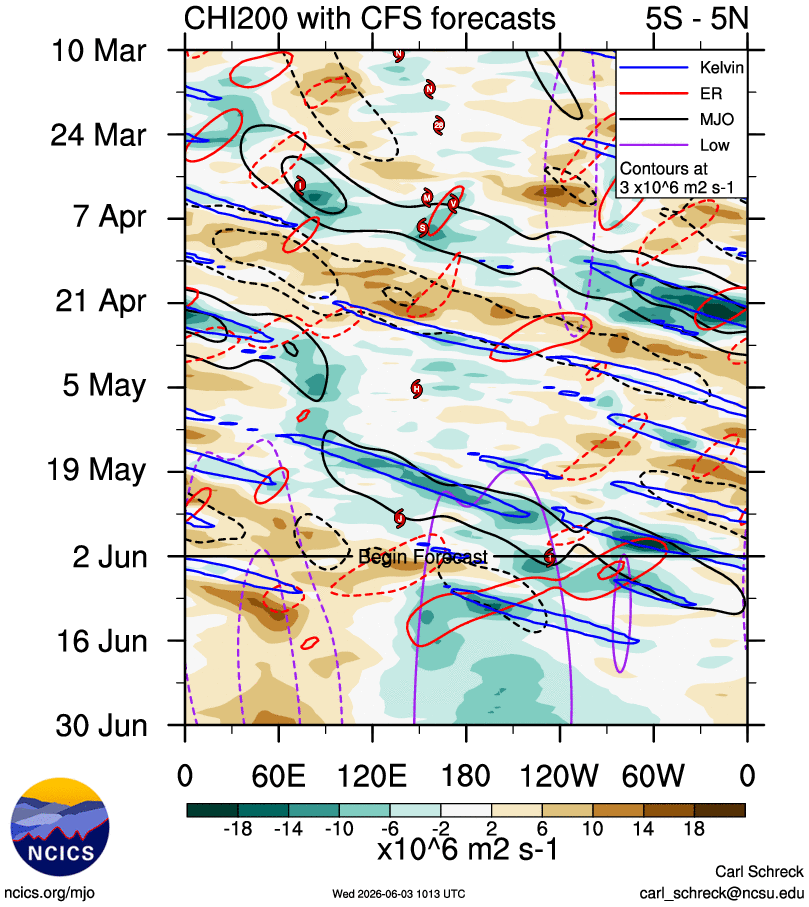
Will be worth watching for low-latitude genesis in the far eastern WPAC around midmonth. A robust equatorial rossby wave - amplified by low-frequency KW forcing near the dateline - will trail westward & provide a boost to low-level westerly anomalies in the deep tropics.
2
3
17
1,168
Jun 10
Interests in the Mariana Islands should closely monitor the progression of this system over the next several days given the modelled synoptic pattern.
4
85
Jun 6
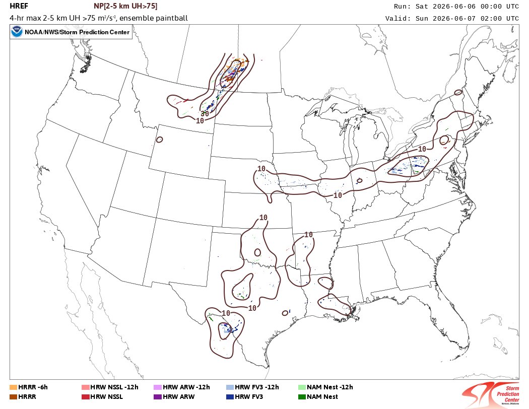
Intrigued by the potential for some well-structured convection in Canada this evening. Low-level wind profiles will rapidly inflate around 00z in tandem with a stabilizing BL - any established (super)cells in this environment would likely attain classic ''mothership'' appearances
2
5
242
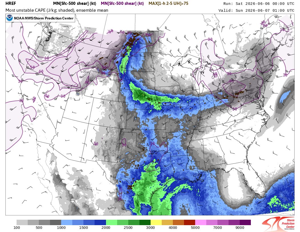
Jun 6
Corresponding HREF signal (00z init) which strongly indicates the maturation of a few supercellular clusters in E Saskatchewan by late afternoon/early evening.

2
88
CG15Wx retweeted

Jun 3
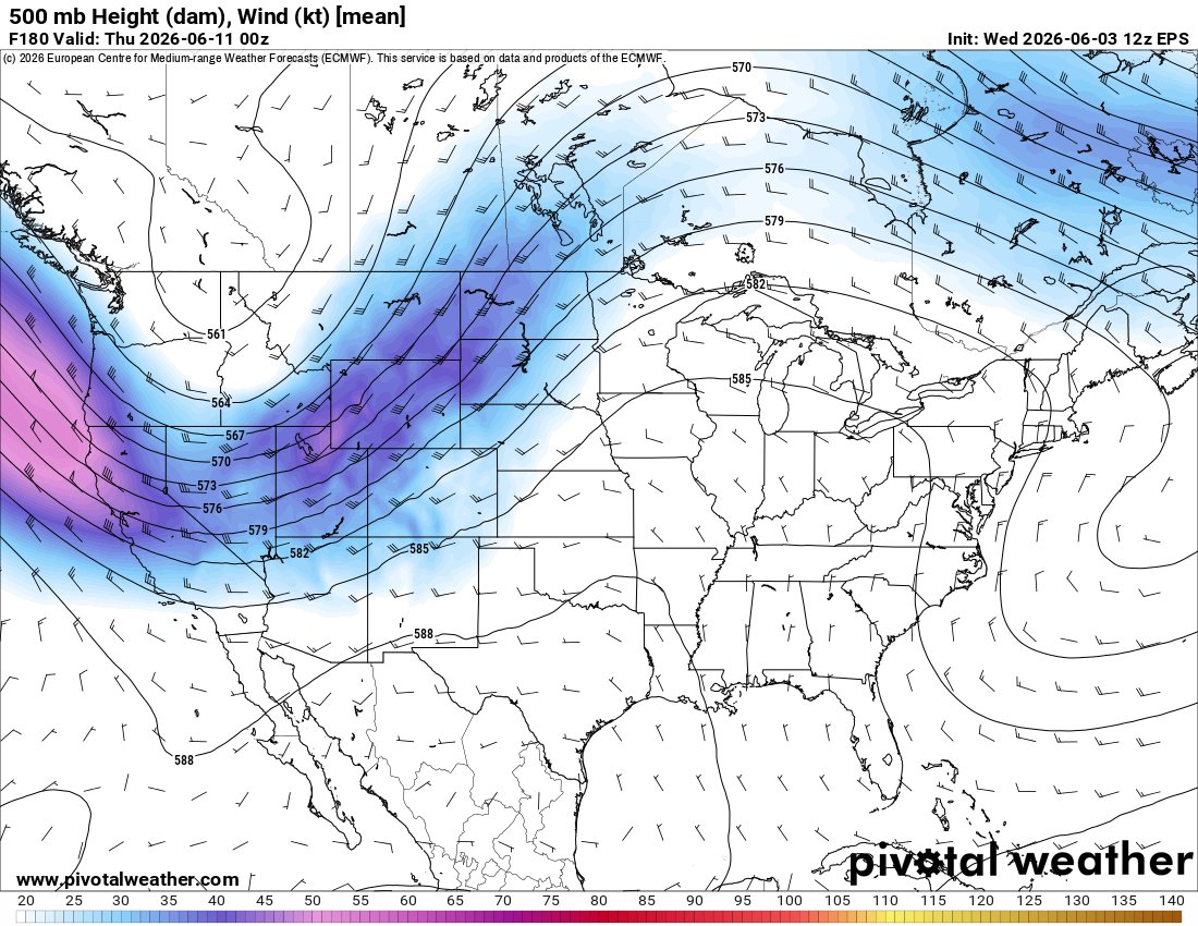
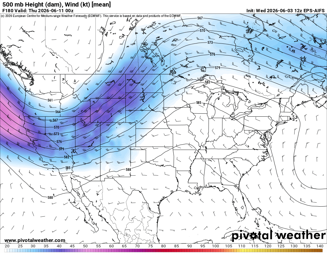
The details and intricacies are impossible to sift through at this range. However, a variety of ensemble guidance is strongly suggesting a major uptick in severe weather potential across the Northern/High Plains starting next week.
3
7
51
11,737
Jun 3
Newly-named #Amanda features a pretty healthy appearance for a compact tropical storm. Persistent, vorticity-rich convection & the associated hot towers will promote strengthening (potentially up to brief HU status?) before entering an increasingly dry environment by the weekend
1
1
15
441
Jun 3
Can easily tell where the deepest updrafts (and their overshooting tops) are pulsating on visible satellite. Pretty common behaviour for newly-developed, small tropical cyclones as concentrated vorticity supports strong centralized convection
5
88
Jun 3
Will be worth watching for low-latitude genesis in the far eastern WPAC around midmonth. A robust equatorial rossby wave - amplified by low-frequency KW forcing near the dateline - will trail westward & provide a boost to low-level westerly anomalies in the deep tropics.
1
6
25
2,502
Jun 3
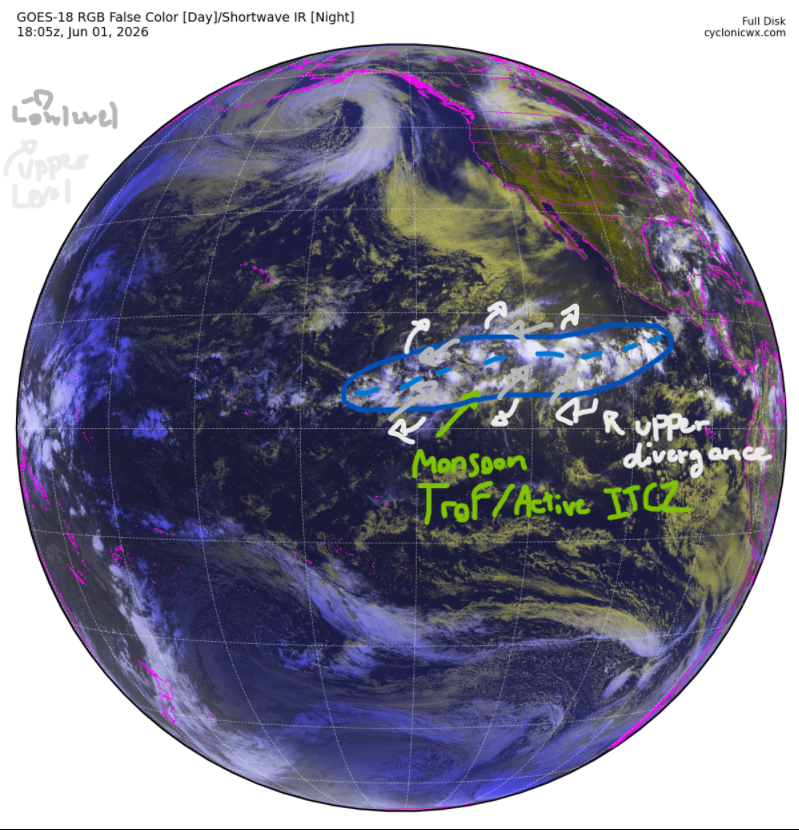
The resultant cyclonic shear vorticity strong upper divergence will yield a conducive environment for increased genesis potential. Pretty classic to see something like this occur in developing strong-super Ninos as enhanced westerly anomalies extend the MT much further eastward
7
193
Jun 2
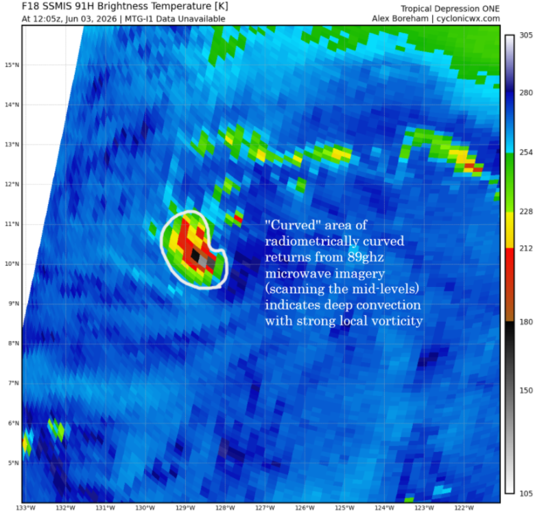
90E is classifiable as a tropical cyclone ATP. Can easily see its vigorous low-level circulation near the convective mass that concentrated vorticity for the cyclone overnight; also note the "curved" band of cool returns on LL microwave imagery in association with these features

1
18
272
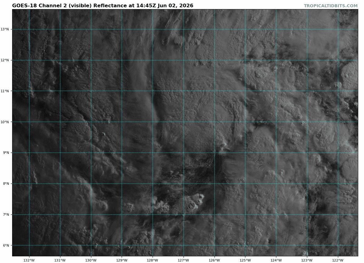
Jun 1
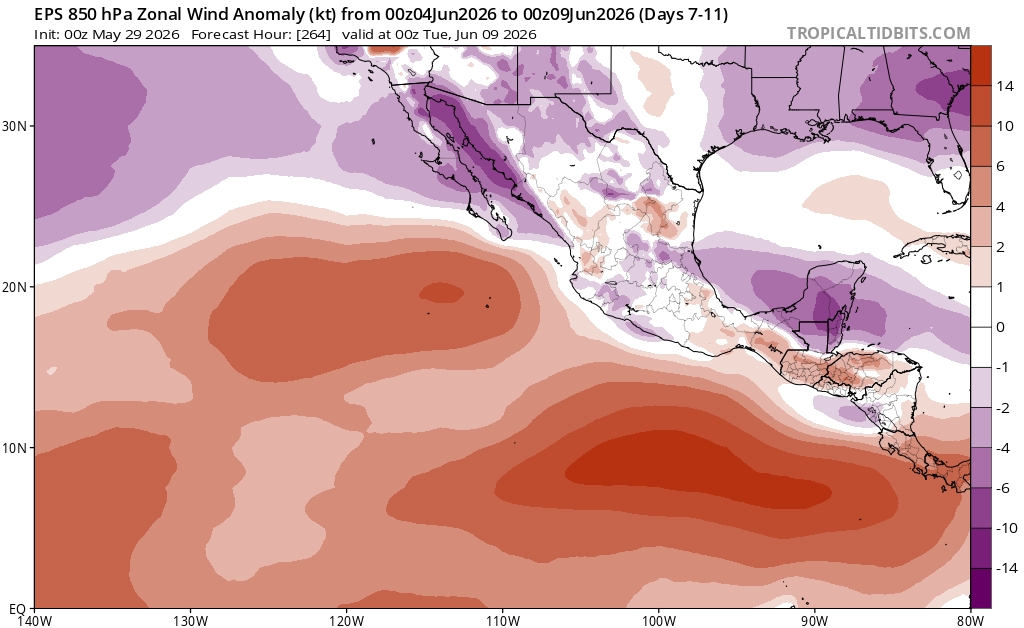
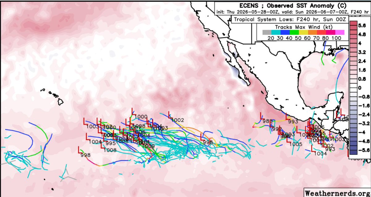
The first case of EPAC TCG occurring this far westward (~130W) is pretty telling of an incoming strong-super niño given the bout(s) of anomalous westerlies that accompany the development of such events - note the strong MJO pulse currently passing through the region
Jun 1
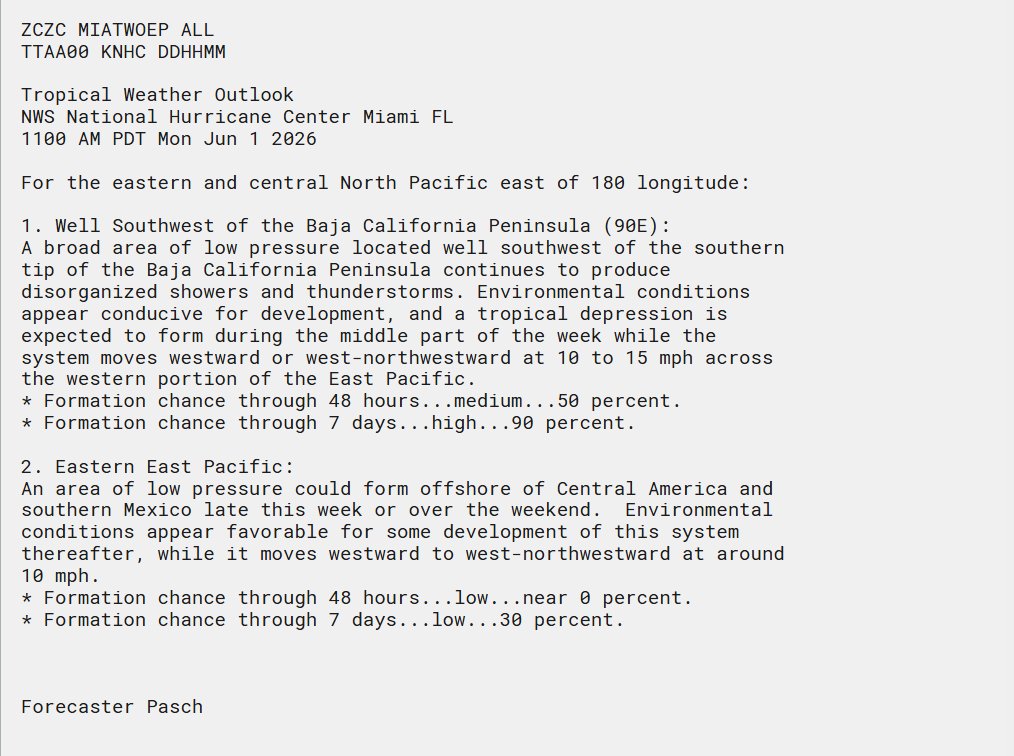
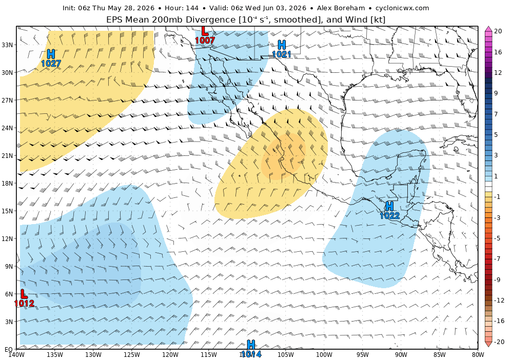
90E has been officially designated as the first invest of the Eastern Pacific hurricane season as of today - June 1st, 2026. Can already see a fairly concentrated vorticity maxima that'll gradually strengthen as it rolls up from the monsoon trough over the next couple days.
2
7
29
2,530
Jun 1
90E has been officially designated as the first invest of the Eastern Pacific hurricane season as of today - June 1st, 2026. Can already see a fairly concentrated vorticity maxima that'll gradually strengthen as it rolls up from the monsoon trough over the next couple days.
2
13
2,976
CG15Wx retweeted

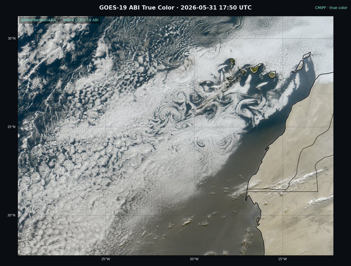
Absolutely gorgeous Karman vortex street occurring over the canary Islands this morning.
1
13
44
1,125
May 29
The next period to monitor for EPAC TC potential will occur further eastward as a few equatorial wavemodes superimpose (constructively interfere) with eachother, briefly yielding a strong intraseasonal pulse. This will bolster LL westerlies/cyclonic vorticity E of 120W.
May 28
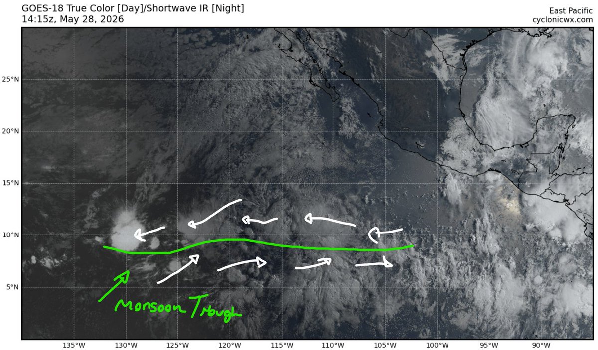
Will be worth watching the monsoon trough currently @ 135-110W for TC potential through next week. Have some scattered ensemble support for some development as a couple of disturbances encounter a marginally favorable environment ahead of the expanding UL anticyclone.

1
4
26
2,086
May 29
These synoptic-scale wave interactions (including the MJO/ENSO - see journals.ametsoc.org/view/jo… for this) result in enhancing convective activity vertical motions (i.e tropical forcing) as they synchronise -> amplify.
2
115
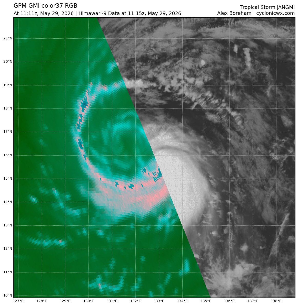
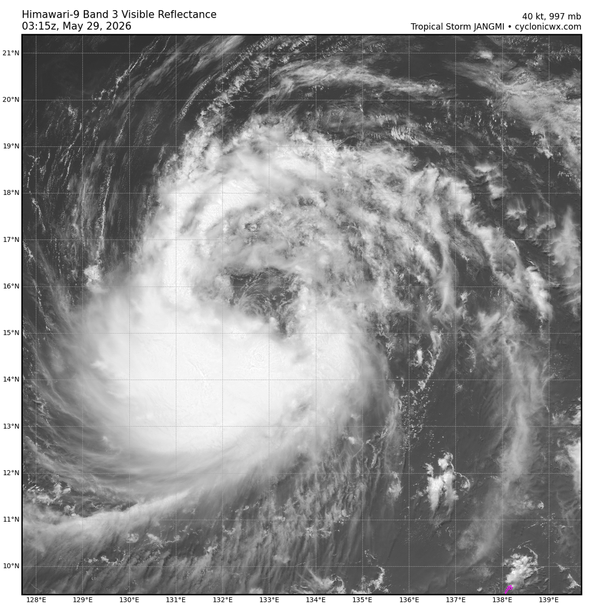
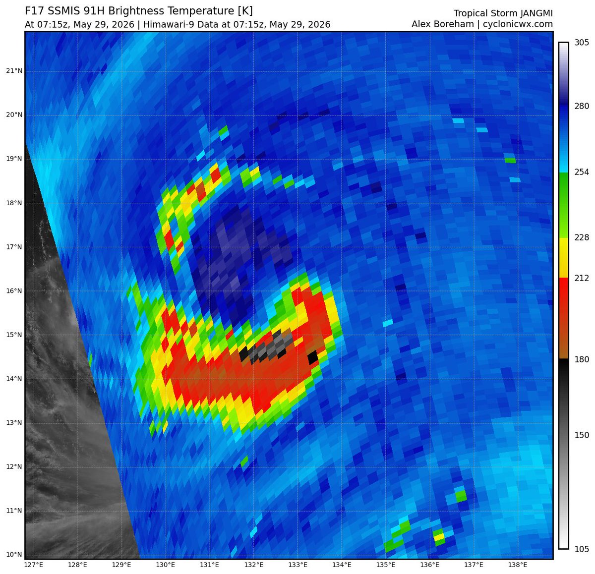
May 29
Pretty impressive structural changes re: Jangmi over the span of just ~12 hours. This change in organization stems back to a mesovortex that rotated downshear -> rolled up vorticity in the SEQ via particularly intense convective bursting (cc/ @WxTca for pointing this out earlier)
1
4
13
410
May 29
A collection of earlier microwave imagery seems to depict this feature's eventual progression quite well — note the locally colder, curved area of returns embedded within the parent circulation indicative of intense, vorticity-rich convection.
3
100
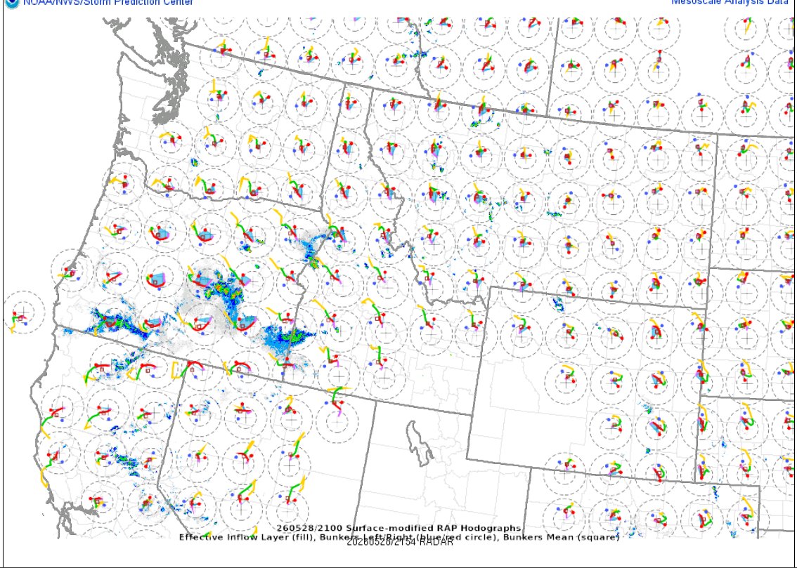
May 28
Always interesting to see wind profile structures from this type of event (oftentimes seen over the PNW!) Can see deep-layer easterlies dominating with enough vertical veering to promote clockwise hodograph curvature, just with reversed orientation compared to usual NHEM setups!
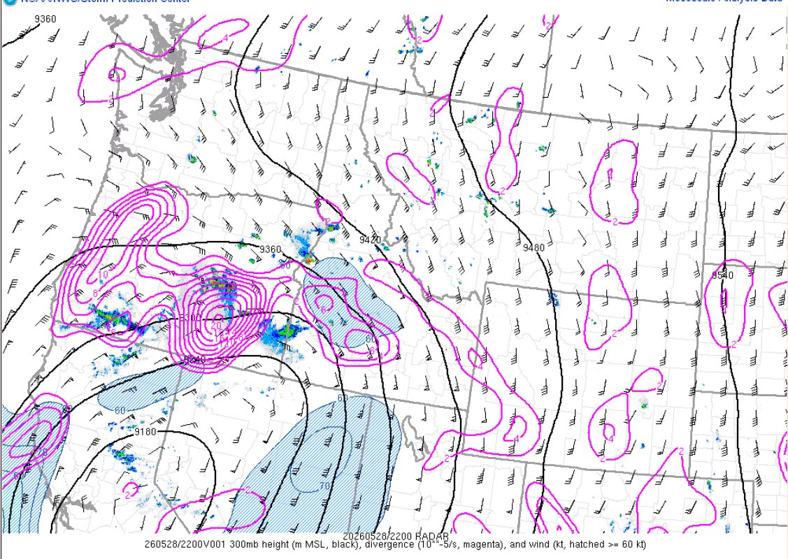
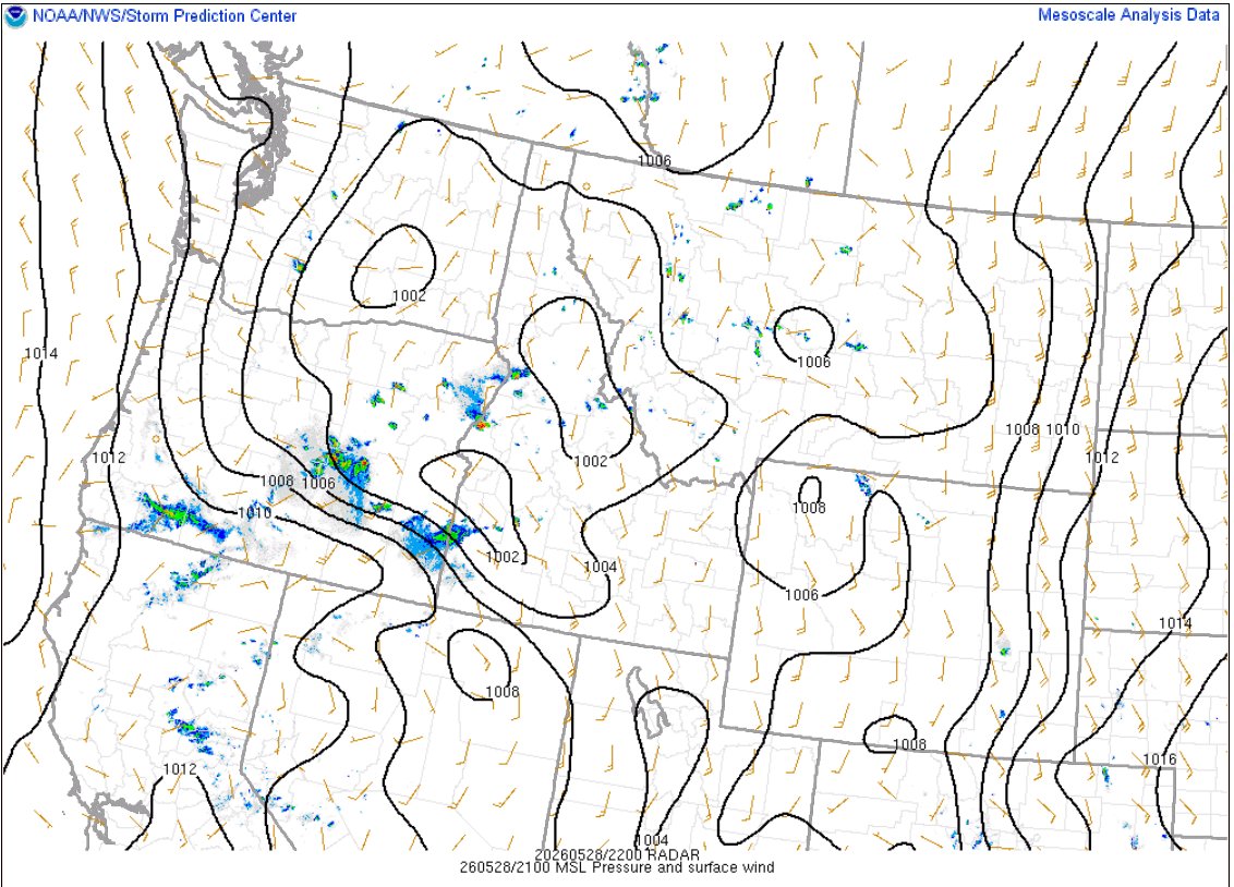
1
99
May 28
Will be worth watching the monsoon trough currently @ 135-110W for TC potential through next week. Have some scattered ensemble support for some development as a couple of disturbances encounter a marginally favorable environment ahead of the expanding UL anticyclone.
1
3
14
2,779
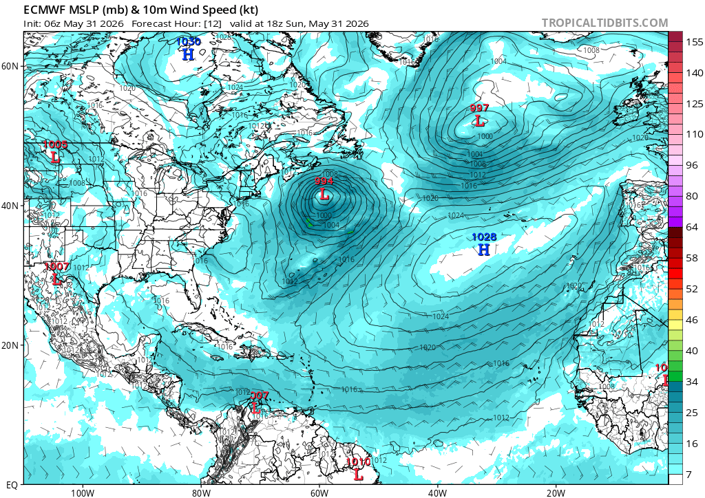
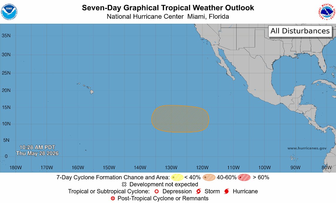
May 28
As such, the NHC has delineated an area of interest - the first within seasonal bounds - with a 40% chance for tropical development over the next 7 days. Will be interesting to see how this evolves over the coming days as details re: the disturbance(s) become clearer.
2
120
CG15Wx retweeted

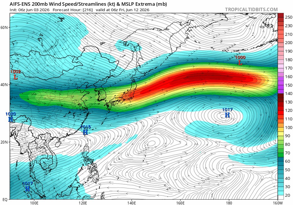
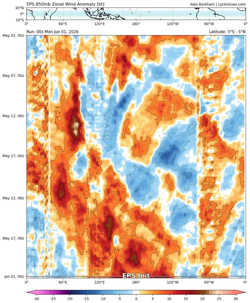
May 28
All the ingredients are there for a gigantic Pacific Jet extension later in week 2 & 3, which should lead to a more favorable pattern for 🌪️ by mid-June:
✅ Kara Sea ridge >> East Asia cold shot
✅ Mei-Yu front south of Japan
✅ Pacific MJO event
✅ Developing Super El Niño

7
33
175
187,532