
Student Meteorologist specializing in Tropical Cyclones and public weather communication.
Joined March 2025
- Tweets 1,776
- Following 206
- Followers 2,446
- Likes 6,953
669 Photos and videos


Pinned Tweet

5 Sep 2025
Big thanks to the @FoxWeather team and @AriWeather for having me on tonight! Always an honor to share in the science with such an incredible group of meteorologists. 🌀✨⚡️
You can find my full interview below!
17
11
115
32,363
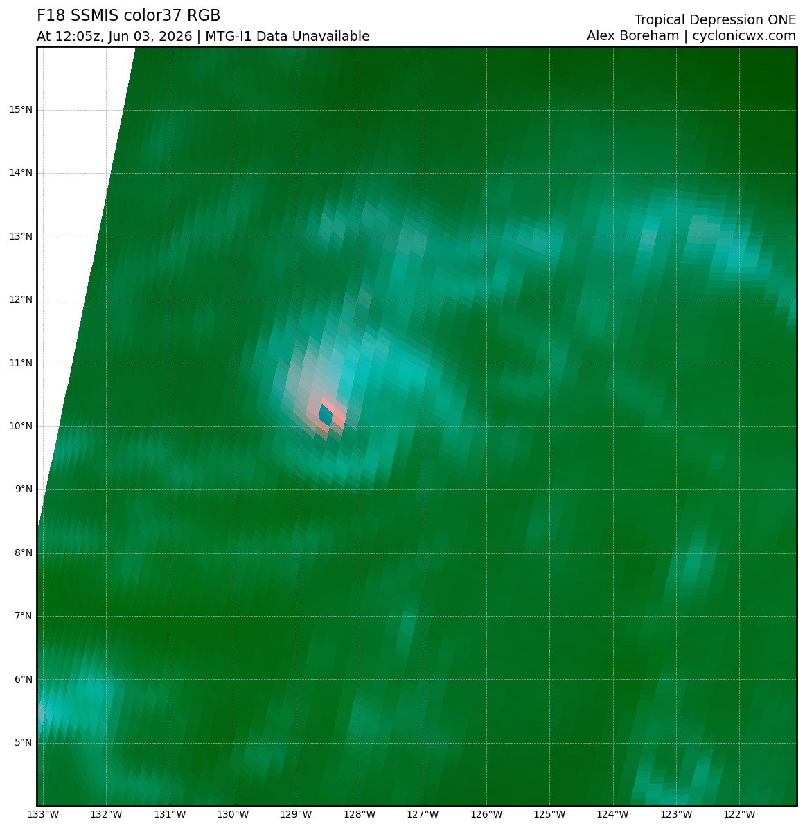
It seems confidence is increasing that a disturbance (#90L) currently over Texas and northeastern Mexico could develop if it moves offshore. While formation is far from guaranteed, marginal conditions may allow a localized circulation to briefly consolidate into a tropical cyclone.
Regardless of classification, tropical-storm-force winds along portions of the coast and heavy rainfall are expected to bring impactful conditions to the Southeast later this week.

1
9
44
2,175
The lack of convection is certainly not going to help generate a circulation here. 🤢
2
5
56
2,648

If the current subsurface ocean conditions in the eastern Pacific hold or even amplify going further into the summer, it should be expected that successive hurricanes may have high intensity potential for longer periods with record TCHP observed near the 26 degree C isotherm.

1
2
18
889
Andrew Austin-Adler retweeted

Jun 11
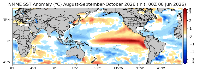
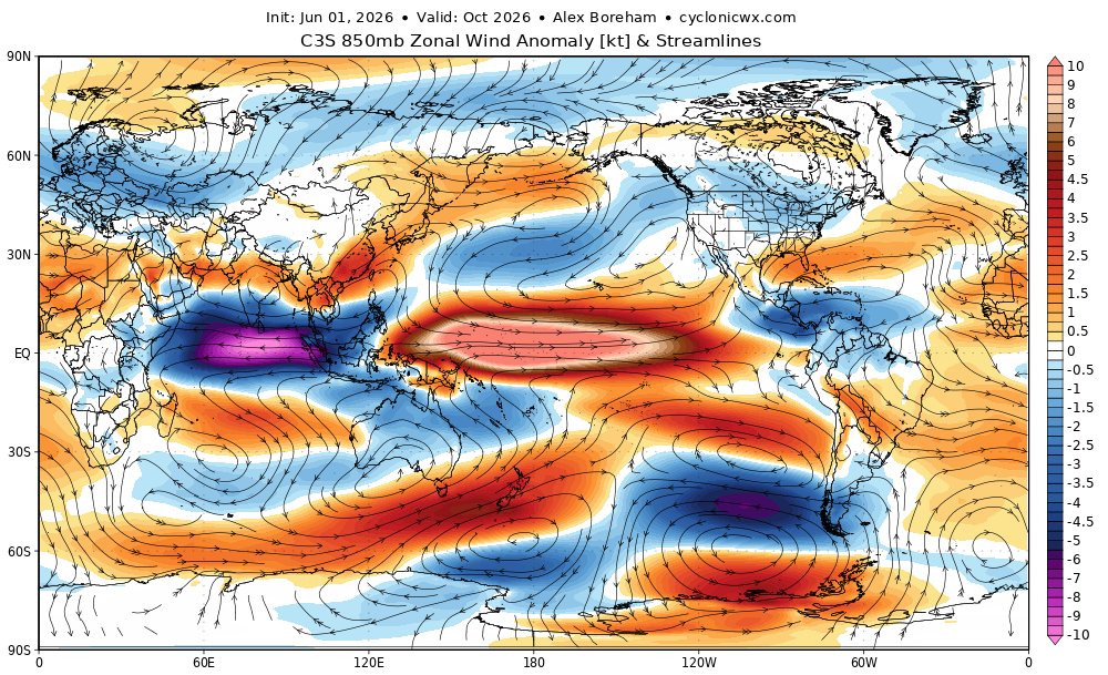
Very impressive El Niño event modeled from the C3S mean. Textbook velocity potential signature, persistent westerlies in the Pacific (& easterlies in the Indian Ocean), and strongly enhanced vorticity near the equator. Looks to be a busy TC season in the Pacific (sorry, Atlantic)


2
27
122
7,155
Andrew Austin-Adler retweeted

Jun 11
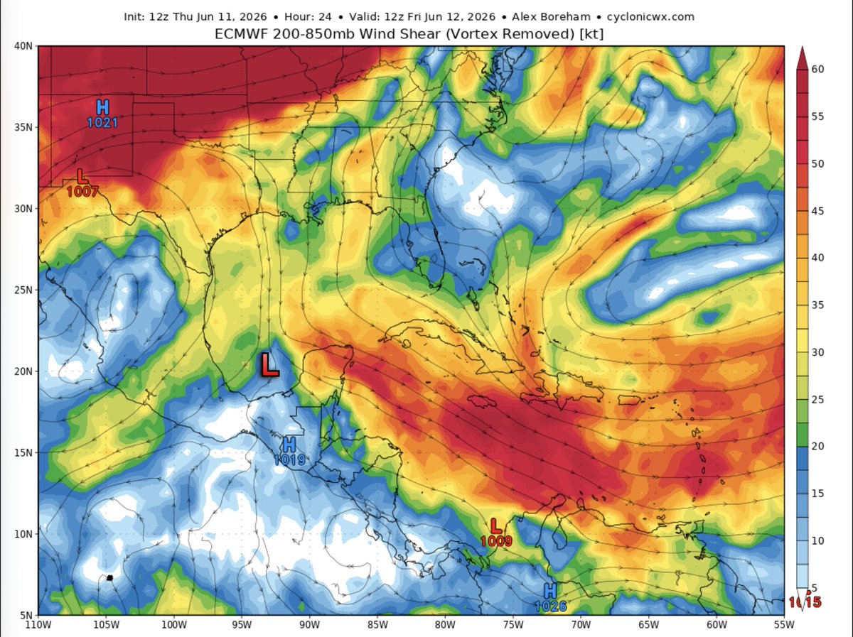
1/🧵 The Bay of Campeche disturbance has a narrow path to development, but the baseline still leans against organization. The main problem is that this is a broad/gyre-like disturbance with limited time over water before moving into eastern Mexico.
That matters because broad lows usually need multiple convective cycles to tighten a defined low-level center, and this window may be too short for that. #wxtwitter #tropics

The environment for the current 10% disturbance in the BOC is highly unfavorable, and development prospects are much the same.
You essentially have 20kts of northerly shear that will advect a dry, subsident airmass into the wave envelope, not to mention the disturbance's limited time over water.
1
5
22
2,033
The environment for the current 10% disturbance in the BOC is highly unfavorable, and development prospects are much the same.
You essentially have 20kts of northerly shear that will advect a dry, subsident airmass into the wave envelope, not to mention the disturbance's limited time over water.
7
40
7,776
El Niño has now been officially declared! Interestingly, the CPC notes here that "There is a 63% chance of a very strong El Niño during November-January that would rank among the largest El Niño events in the historical record going back to 1950".
Intense wording here that also lines up with what we're seeing on climate guidance.

El Niño conditions are present and expected to strengthen into the Northern Hemisphere winter 2026-27. An #ElNino Advisory is now in effect. #ENSO cpc.ncep.noaa.gov/products/a…
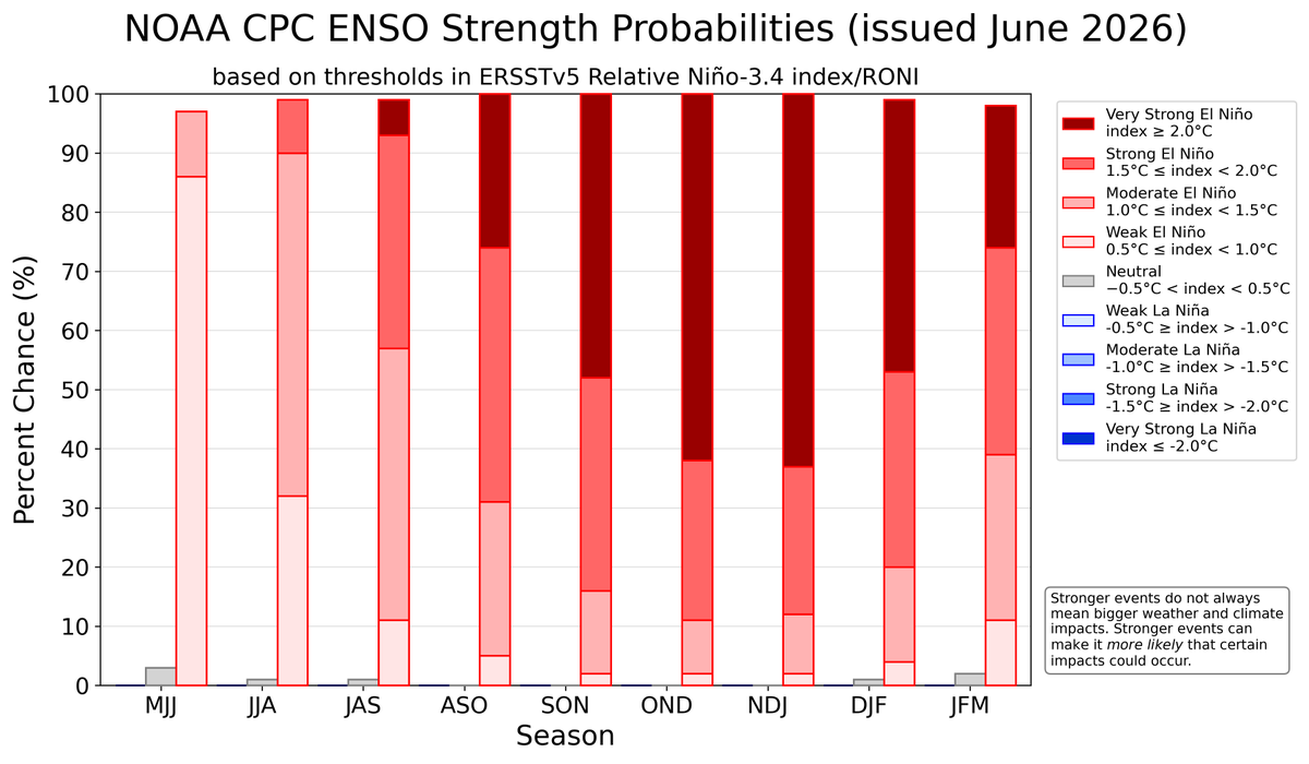
ALT A bar chart showing the chance of El Niño (red bars), ENSO-Neutral (grey bars), and La Niña (blue bars) provided for 9 upcoming, overlapping 3-month seasons (each letter represents a month, for example, F = February). The color shading within the bars indicates the chances of different categories of El Niño or La Niña strength (weak, moderate, strong, and very strong). Alternatively, the table at the internet address below presents the percent chances of each strength category in numerical form. https://cpc.ncep.noaa.gov/products/analysis_monitoring/enso/roni/strengths/
4
26
112
8,249
While it's unlikely that we observe any development here, this would be occurring in a region that's climatologically favored for June TC-formation.
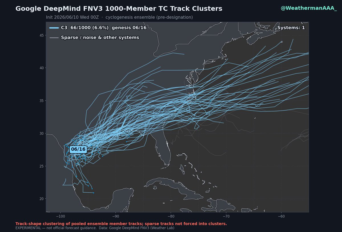
It seems the first shot at TC genesis this season might occur as remnant energy from Tropical Storm Christina crosses over into the Bay of Campeche and interacts with a broad CAG feature.
The signal here is rather weak on most ensemble guidance (with around 6% of the 1000 member FNV3 ensemble supporting development). We'll see if a disturbance can remain off-shore long enough for something to slowly consolidate over the next week.
1
6
33
1,642
It seems the first shot at TC genesis this season might occur as remnant energy from Tropical Storm Christina crosses over into the Bay of Campeche and interacts with a broad CAG feature.
The signal here is rather weak on most ensemble guidance (with around 6% of the 1000 member FNV3 ensemble supporting development). We'll see if a disturbance can remain off-shore long enough for something to slowly consolidate over the next week.
4
12
78
6,407
The eastern pacific is off to a hot start this season with now three TCs developing over the last few days.
#Boris should make landfall near Guerrero, Mexico later today, while #03E will continue to meander just off the coast of Nicaragua over the next couple days, potentially strengthening into a mid-grade Tropical Storm in the process.
1
6
26
1,746
Andrew Austin-Adler retweeted
Jun 6
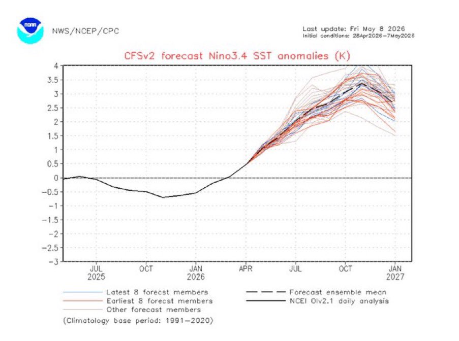
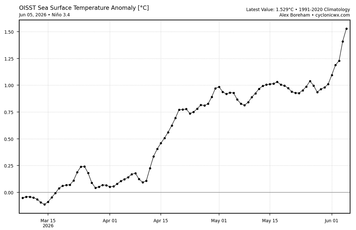
Very rapid strengthening of the El Niño ongoing as the current WWB continues. Passing 1°C anomalies with RONI, which means that soon it will be at moderate Niño strength. Crazy for early June!
4
27
100
4,627
Tropical storm #Amanda has been designated this morning and has decent organization in the low and mid levels according to recent microwave data. The official forecast is for 55kt; however, I wouldn't be surprised if it makes a brief run at hurricane status given this MW progression and its rather small size.
4
13
42
1,975
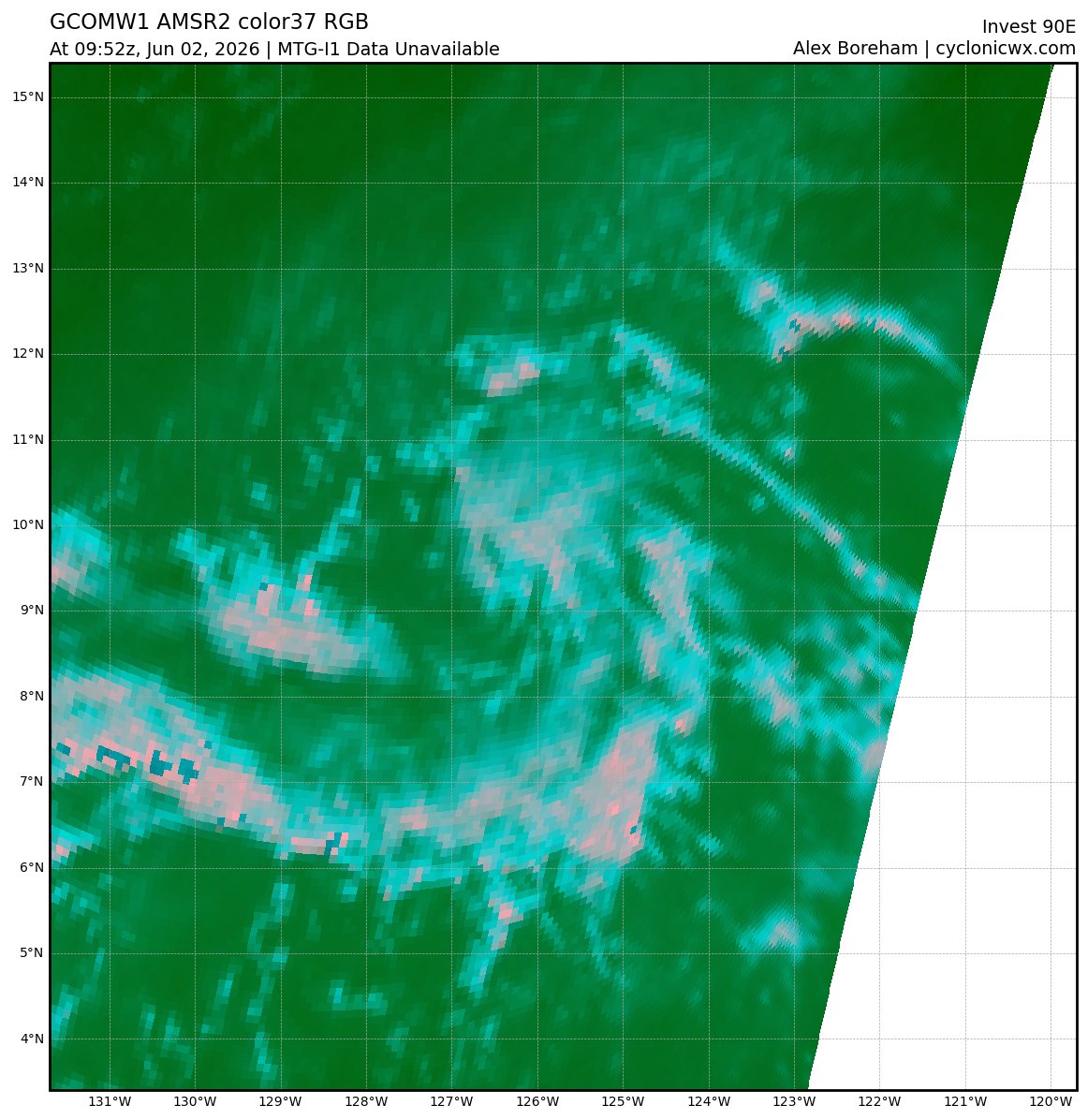
It is quite possible that invest #90E is already a Tropical Cyclone. Note the curved band structure apparent on MW and Satellite data, with an increase in central convection overnight.
1
7
36
1,055
Today is the conventional start of Hurricane Season, and the state of the Atlantic basin continues to be unhealthy. In addition to the classic -amo pattern showing up on -gbl mean plots, the emergence of El Nino this spring will promote increased shear and fewer opportunities for genesis this season.

2
20
75
3,939
Andrew Austin-Adler retweeted

As promised, here's @WeathermanAAA_ and my 2026 hurricane outlook for the Atlantic! Pretty straightforward: a strong-to-super El Niño, combined with a relatively cool Atlantic, should make this season a decently below-average season. As always, be prepared, it only takes one storm!
1
3
11
1,270
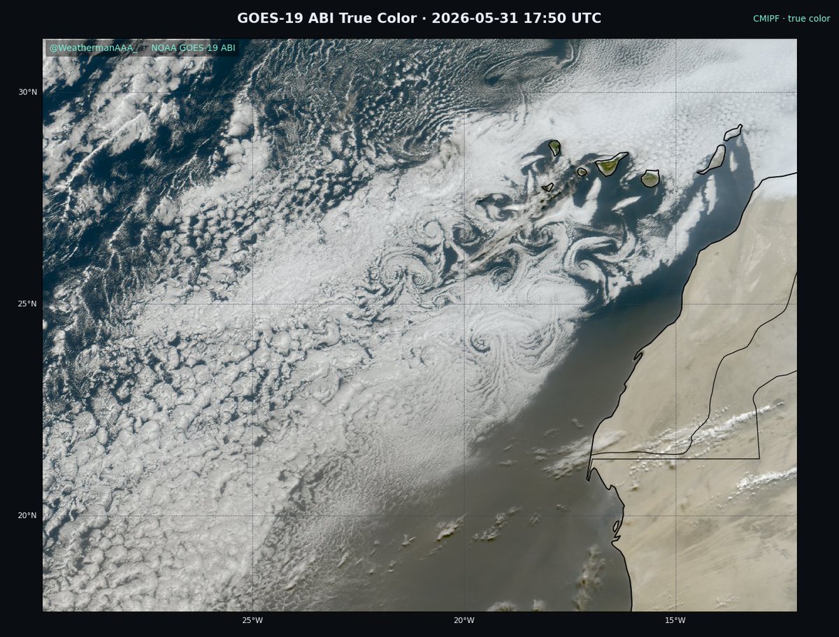
Absolutely gorgeous Karman vortex street occurring over the canary Islands this morning.
1
13
44
1,125
Andrew Austin-Adler retweeted

May 29
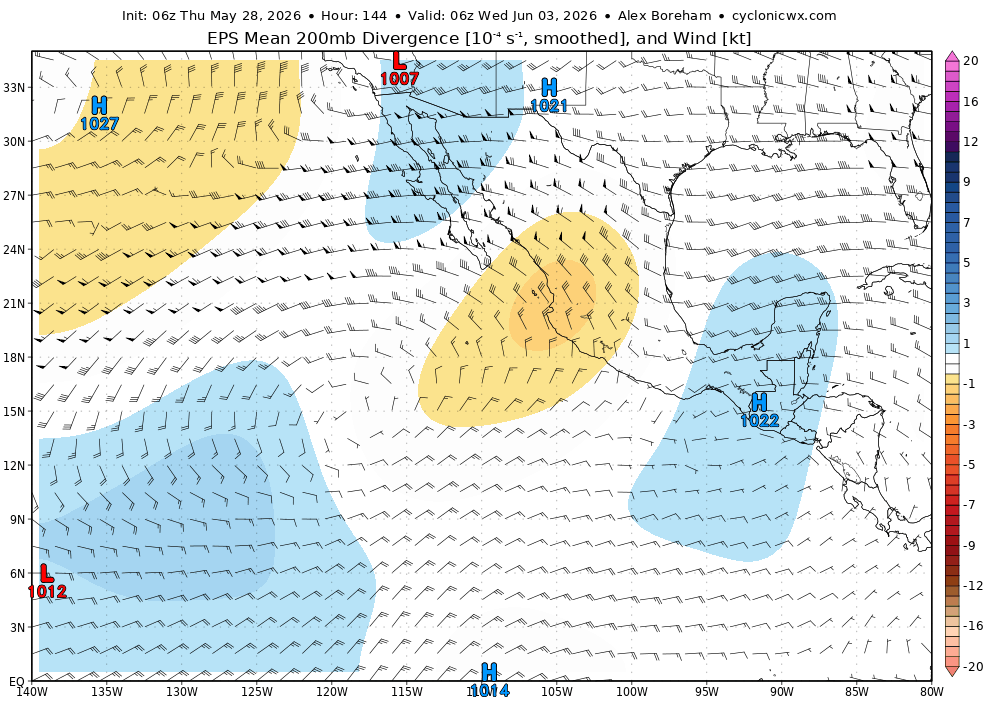
The next period to monitor for EPAC TC potential will occur further eastward as a few equatorial wavemodes superimpose (constructively interfere) with eachother, briefly yielding a strong intraseasonal pulse. This will bolster LL westerlies/cyclonic vorticity E of 120W.

May 28

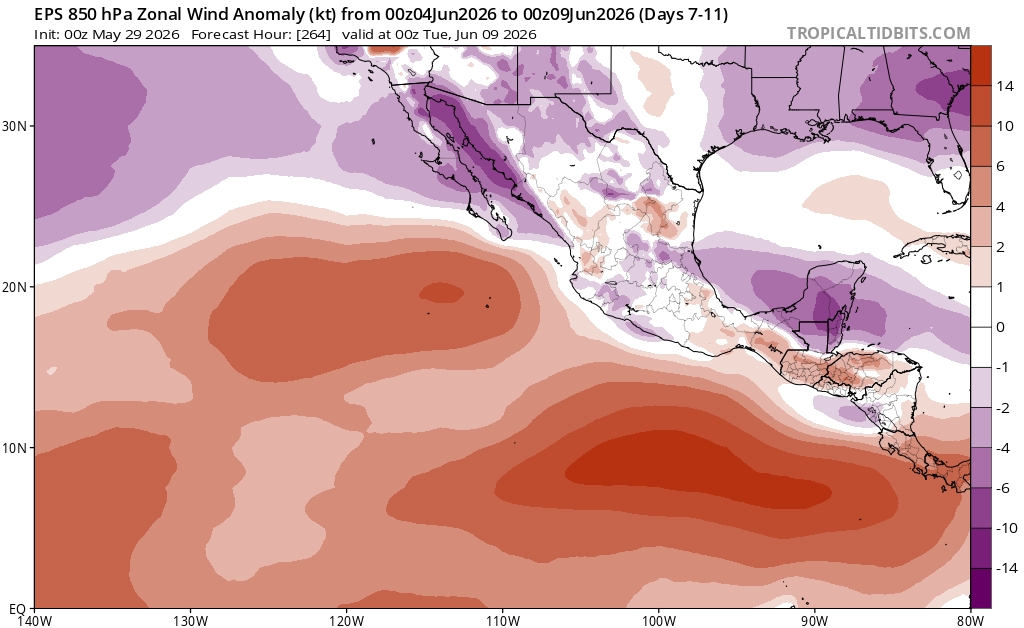
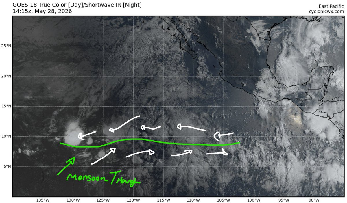
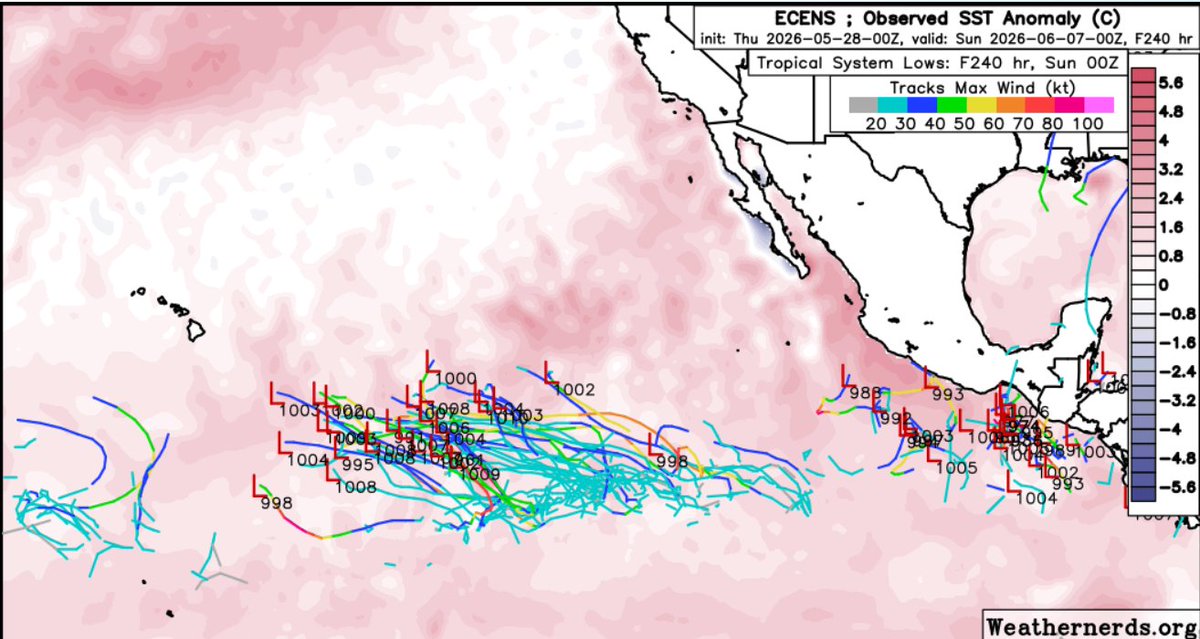
Will be worth watching the monsoon trough currently @ 135-110W for TC potential through next week. Have some scattered ensemble support for some development as a couple of disturbances encounter a marginally favorable environment ahead of the expanding UL anticyclone.

1
4
26
2,086
Tropical storm #Jangmi has slowly started to organize over the last day, now attempting to fire deep central convection to align/deepen its vortex. Initially, moderate shear and a relatively dry environment worked to broaden out its already large/monsoonal structure, so it's taken time and a lot of work to spin-up vorticity.
1
11
38
986
Andrew Austin-Adler retweeted

May 25
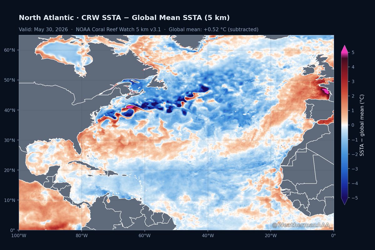
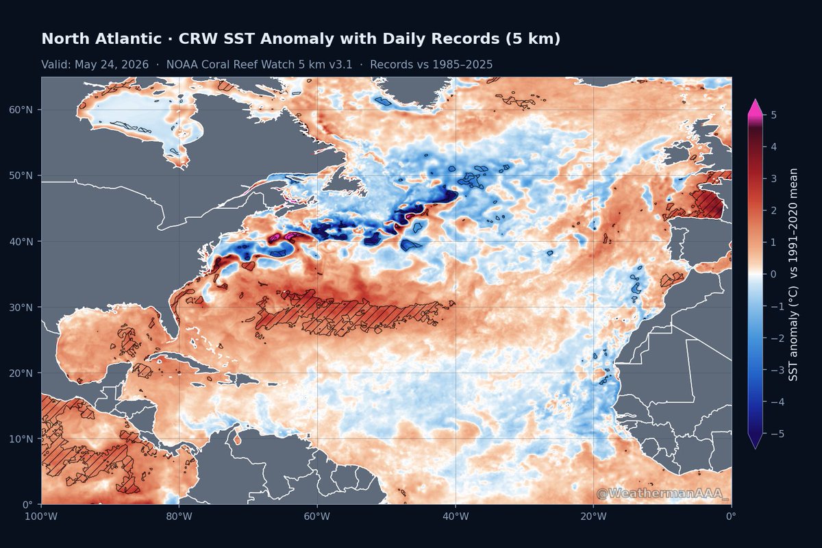
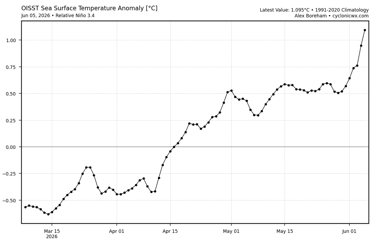
Nice depiction by AAA. This shows the relative sea surface temp anomalies. It subtracts the global mean which allows you to see where the Atlantic is relative warmer and relatively cooler than the other oceans. In this way, you can more easily infer where tropical activity is more likely and less likely. The main development region is not favored. If any place in the Atlantic is favored, it is the subtropics where sea surface temps are record warm.
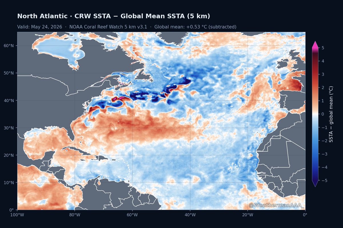
SST anomaly records plot shows that the current warmth in the subtropical atlantic is the highest its been for this date since 1985.
This will work to further stabilize the deep tropics this season, which will already be hindered given the effects of El Nino.

2
9
49
5,378