@PanoramaDTP PhD student @SoGLeeds researching remote sensing of northern peatlands🛰🌎 previously @JNCC_UK 🌱 Geographer. Interested in EO/GI. @AberUni alumni.
- Tweets 5,293
- Following 716
- Followers 515
- Likes 13,538


ALT Screenshot reads: Near-Term Forecasting of Terrestrial Mobile Species Distributions for Adaptive Management Under Extreme Weather Events." Authors: Rachel Dobson, Stephen G. Willis, Stewart Jennings, Robert A. Cheke, Andrew J. Challinor, and Martin Dallimer. Published in Global Change Biology


ALT An illustration of a UK map, with a rich, thriving wetland inside of it. Markers pin-point certain areas of the map and there is text surrounding it, including a title which says 'Putting Wetlands on the Map'. The rest of the graphic explains that restoring 100,000 hectares of wetlands can unlock more than eight billion pounds in benefits.


ALT Launched on 5 September on a Vega rocket from Europe’s Spaceport in French Guiana, the Copernicus Sentinel-2C satellite has delivered its first images. These spectacular views of Earth offer a sneak peek at the data that this new satellite will provide for Copernicus – Europe’s world-leading Earth observation programme. One of these first images features a clear view of Seville and surroundings in southern Spain. Zoom in to explore this image at full 10 m resolution or click on the circles to learn more. Seville, the capital of Andalusia, lies on the Guadalquivir River, one of the longest rivers in Spain. Saville holds the Presidency of the Ariane 2024 Community of Cities, and is home to the headquarters of the Spanish Space Agency.
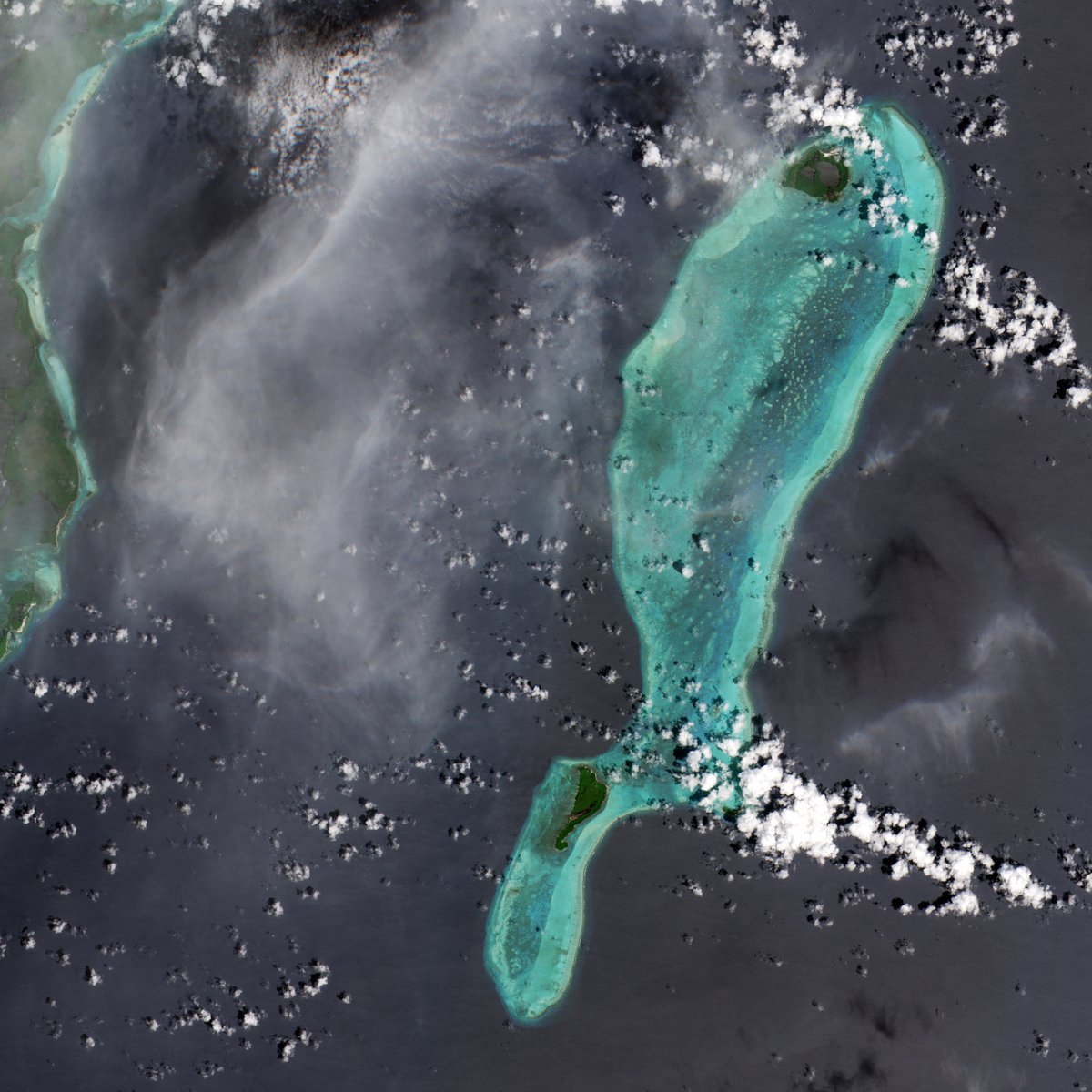
ALT Launched on 5 September on a Vega rocket from Europe’s Spaceport in French Guiana, the Copernicus Sentinel-2C satellite has delivered its first images. These spectacular views of Earth offer a sneak peek at the data that this new satellite will provide for Copernicus – Europe’s world-leading Earth observation programme. One of the images features Lighthouse Reef, part of the large coral reef system off the coast of Belize in Central America. Here the famous Great Blue Hole can be seen – a giant marine sinkhole.
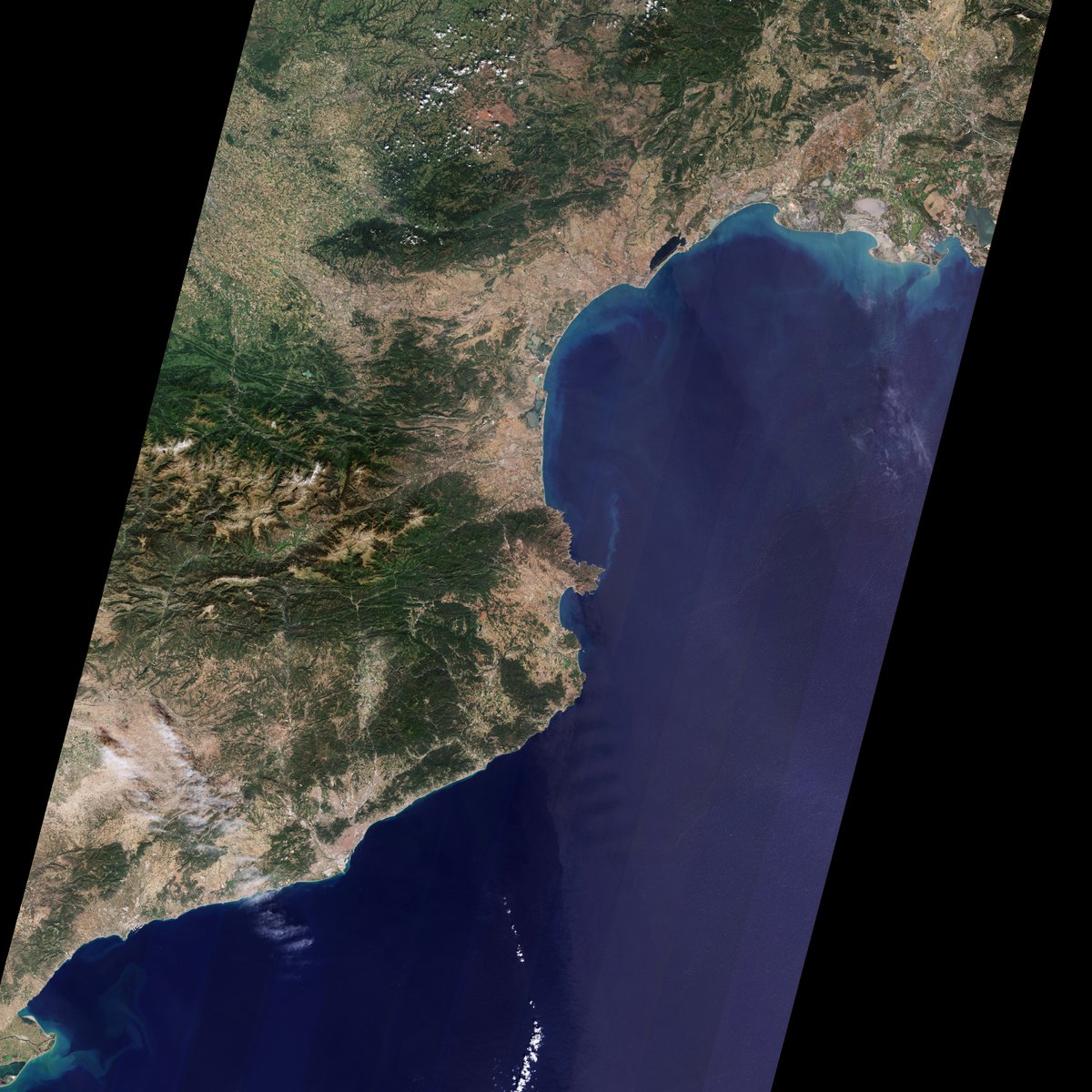
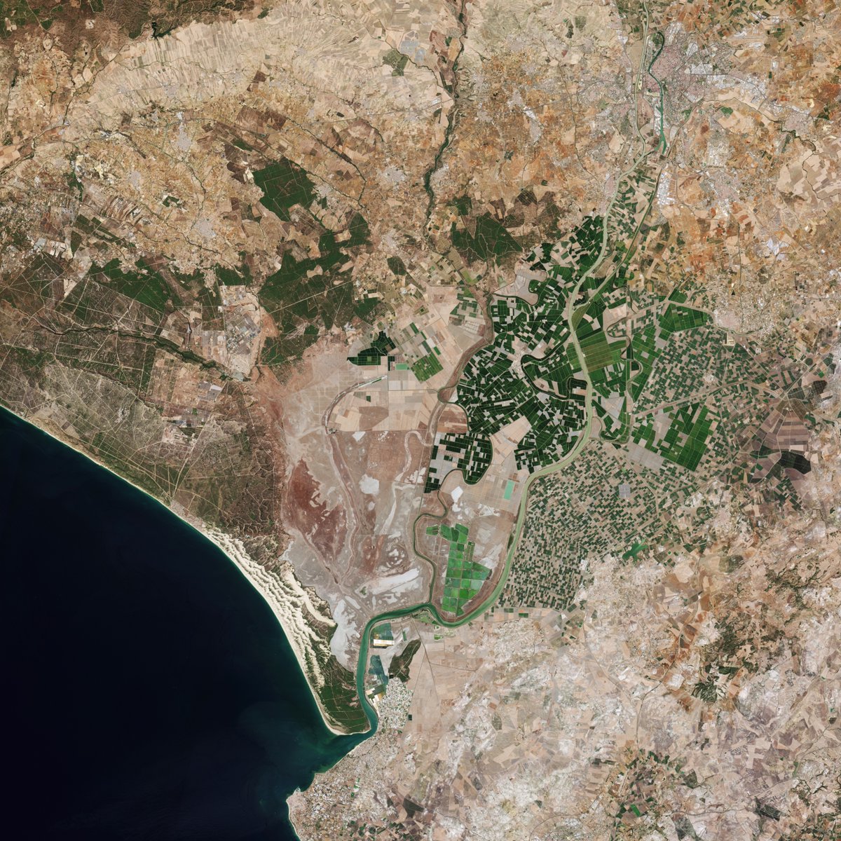
ALT Launched on 5 September on a Vega rocket from Europe’s Spaceport in French Guiana, the Copernicus Sentinel-2C satellite has delivered its first images. These spectacular views of Earth offer a sneak peek at the data that this new satellite will provide for Copernicus – Europe’s world-leading Earth observation programme. Thanks to the satellite’s impressive 290-km-wide swath, one of these first images provides a long strip that stretches from the Camargue and Montpellier in southern France all the way down to south of Barcelona in Spain.
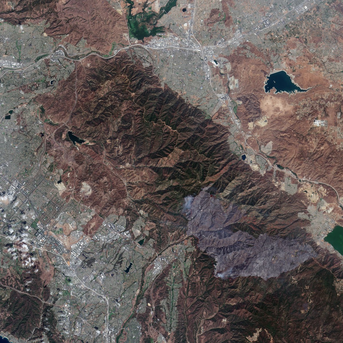
ALT Launched on 5 September on a Vega rocket from Europe’s Spaceport in French Guiana, the Copernicus Sentinel-2C satellite has delivered its first images. These spectacular views of Earth offer a sneak peek at the data that this new satellite will provide for Copernicus – Europe’s world-leading Earth observation programme. The natural colour image of the left captures smoke billowing from the Airport Fire


ALT A small stream in the Faroe Islands
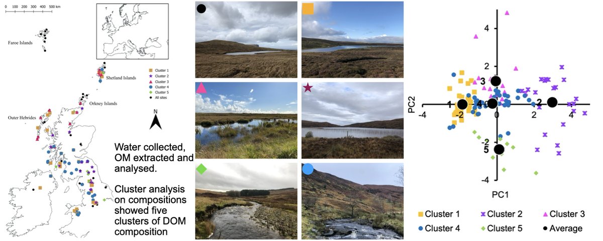
ALT Graphical abstract of the manuscript, showing a map if site locations in the UK and Faroe Islands, thumbnail photos of six sites, and a graph of results showing clusters of DOM compositions


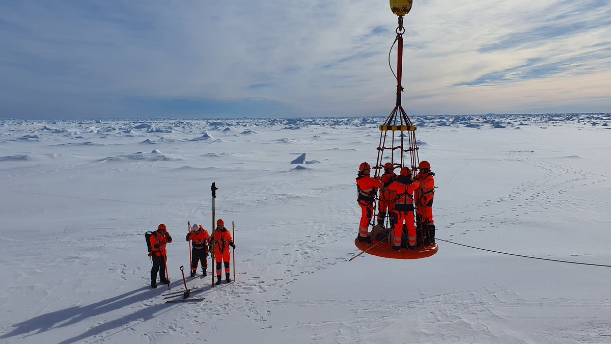
ALT Seven researchers in bright orange overalls in an ice field in Antarctica. Three stand on the ground with spades and poles. Four stand on a platform lifted in the air from the ship (out of view). Find out more about the SEE researcher's Antarctica expedition: https://environment.leeds.ac.uk/faculty/news/article/5753/cold-unbalanced-and-feeling-seasick-all-in-the-name-of-science
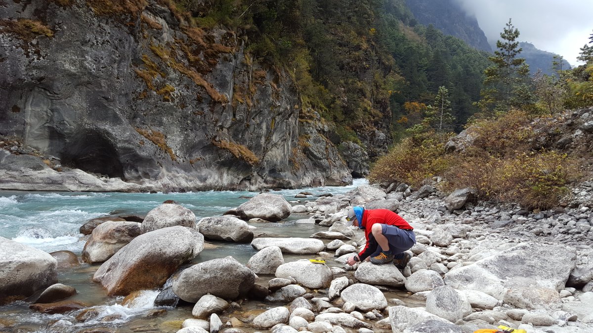
ALT A researcher crouches on the rocky bank of a glacial river, collecting water to study. The water is pale blue. Cliffs and tall trees are across the other side of the river. Read more about our colleagues' glacier research: https://environment.leeds.ac.uk/faculty/news/article/5676/from-running-rivers-to-retreating-glaciers-supporting-world-water-week-at-leeds
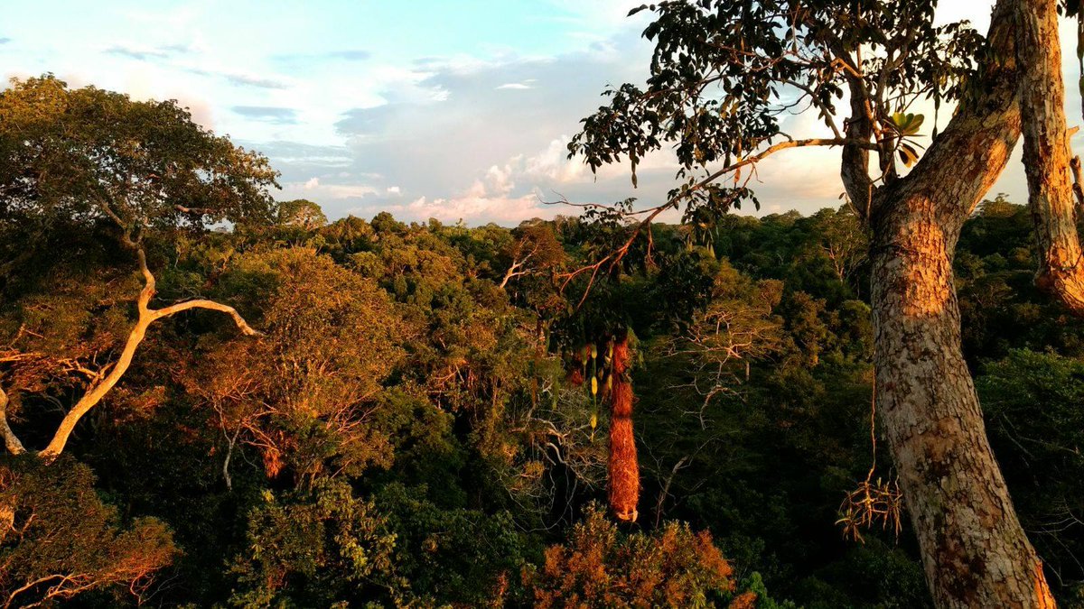
ALT The top of a canopy of the Amazon rainforest in Peru. The sunlight tinges the branches and leaves gold and red. Photo by Francisco Diniz.
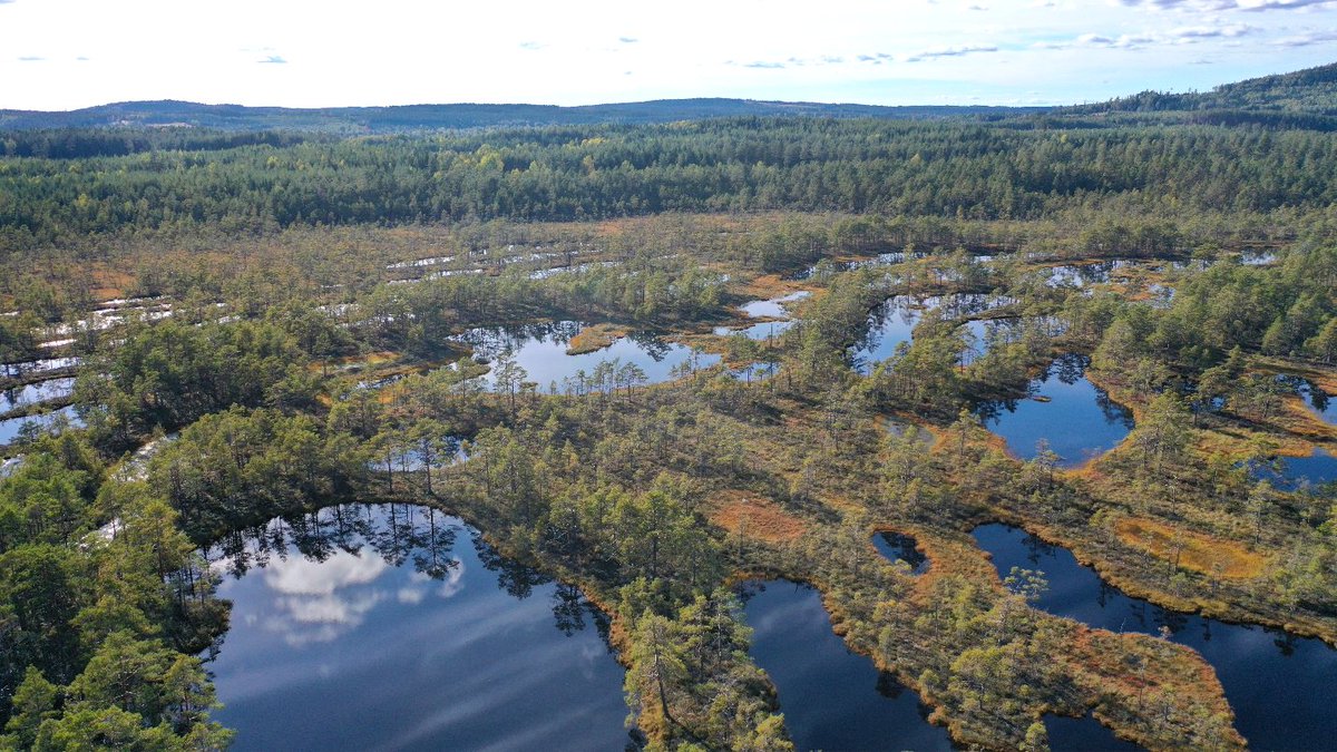
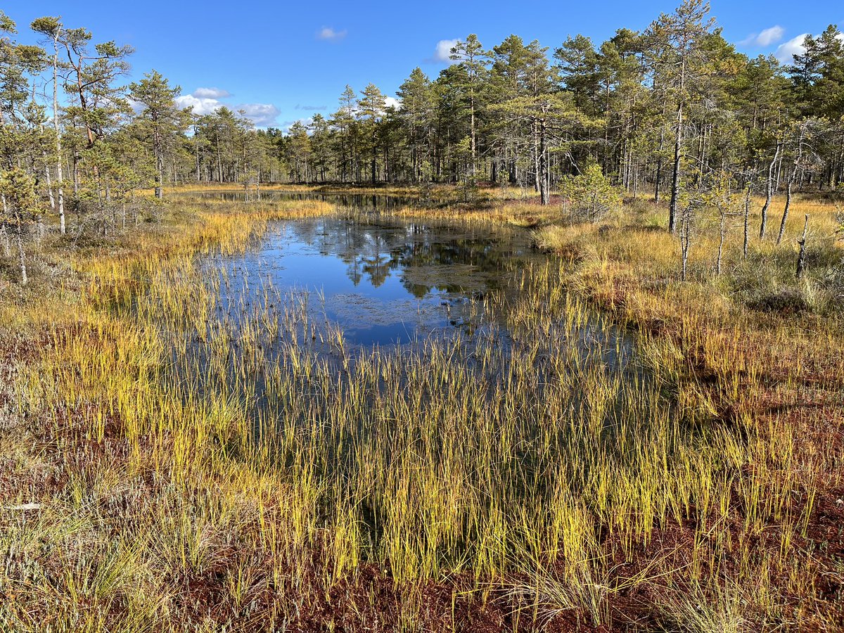
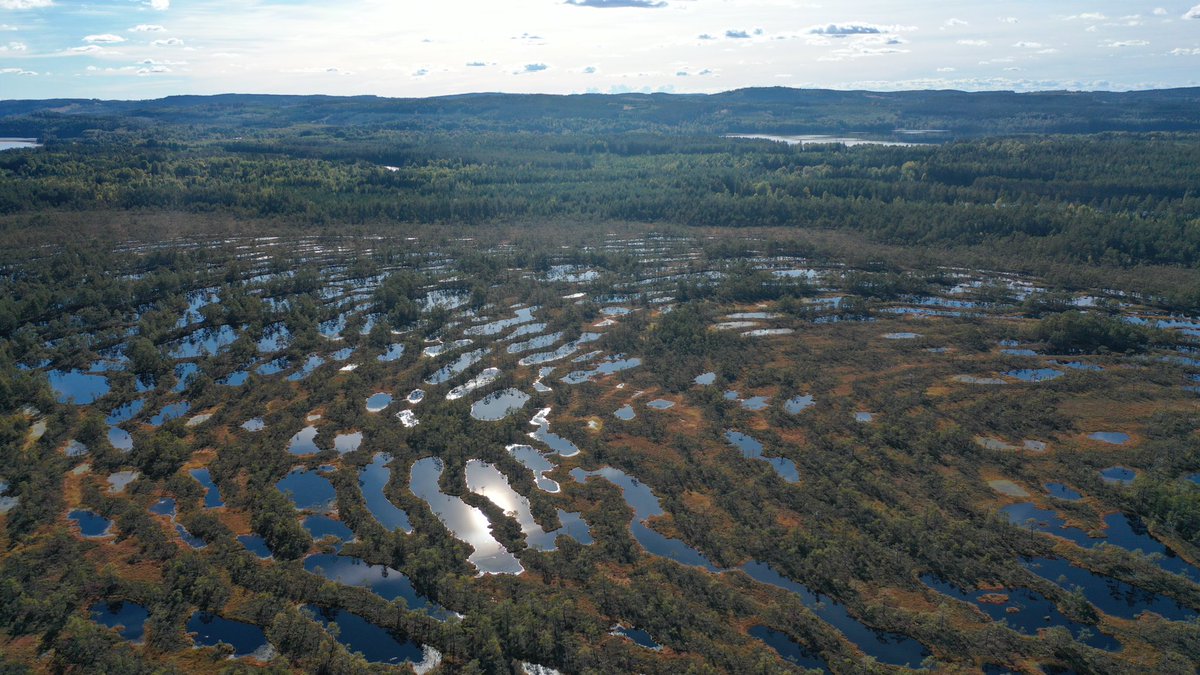
ALT Hammarmossen raised bog, Sweden, from above. Pools of clear water in between land with shrubs and trees. More trees and hills can be seen in the distance. Read more about our colleagues' peatlands research: https://environment.leeds.ac.uk/news/article/5751/shrinking-pools-on-northern-peatlands


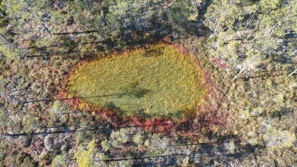


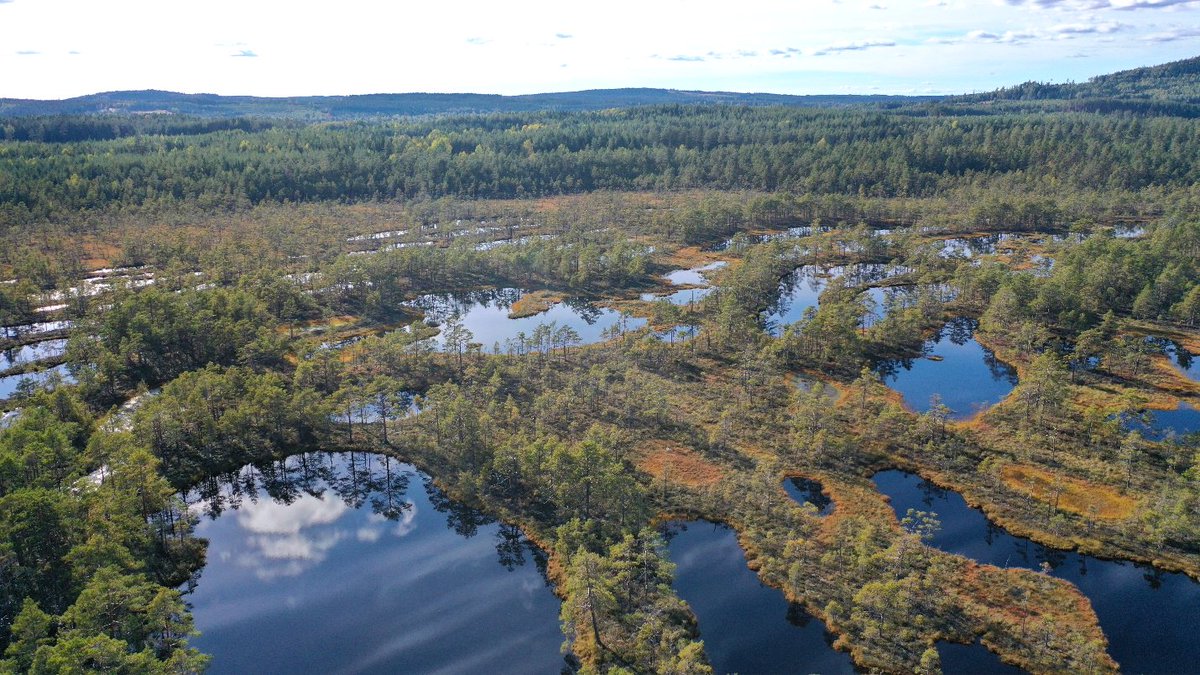
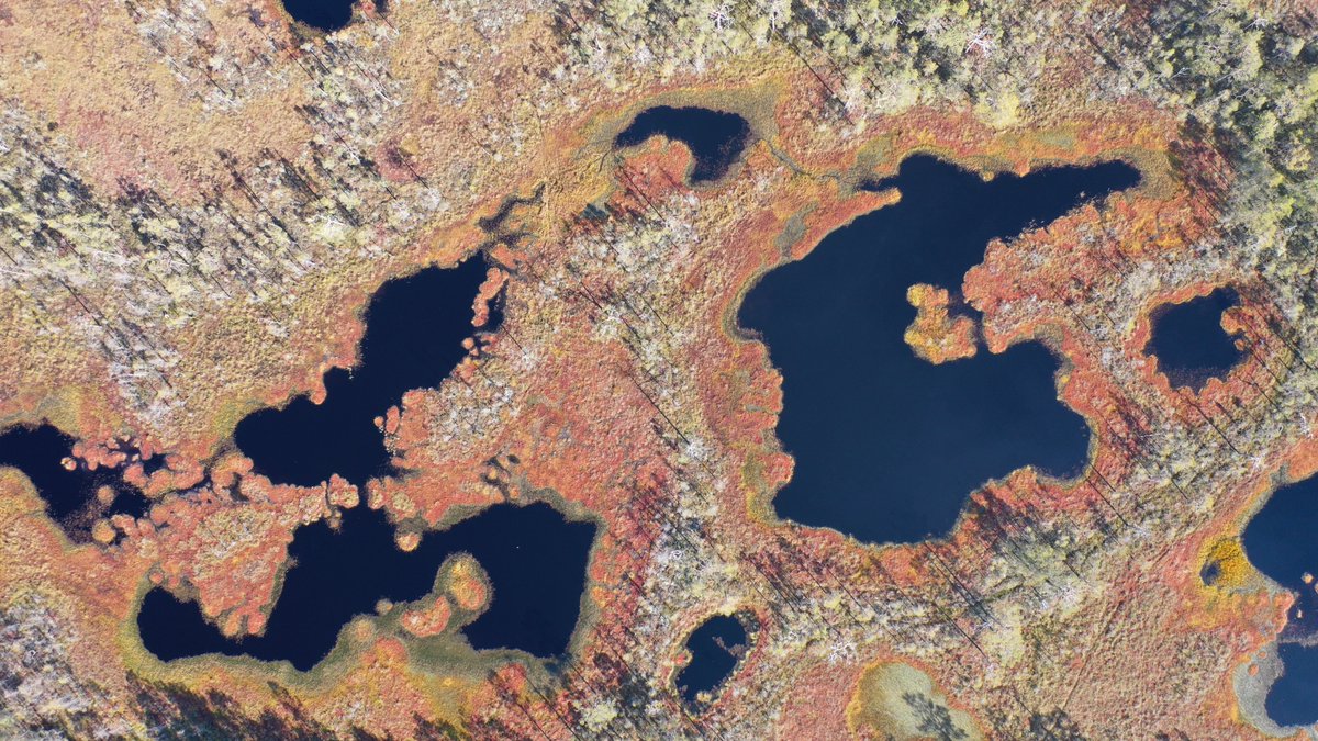
ALT Drone photography of Hammarmossen raised bog, Sweden, where researchers found that open water pools have been rapidly shrinking and disappearing over the last six decades, overgrown by mats of Sphagnum moss and sedges.


