
Jun 12
As the FIFA World Cup kicks off, we're looking back at the "Scoring for Goals" campaign at the United Nations Headquarters.
Quince Imaging was proud to provide the projection mapping technology that transformed the iconic UN façade into a powerful platform for global storytelling and awareness.
We're excited for the incredible moments ahead and look forward to sharing our next media façade project soon! ⚽👀✨
#FIFA #WorldCup #FlashbackFriday #UnitedNations #NYC #ProjectionMapping #MediaFacade #ImmersiveTech #BuildingMapping #CreativeDesign #Fans #Sports #Entertainment #DigitalArt
19

2 Aug 2025
SLAM GNSS: The Mapping Tech Your Multi-Storey Projects Can’t Ignore
Mapping infrastructure in open fields is easy — the real test is inside and between the floors of a multi-storey building.
GNSS? Useless beyond the first wall.
And yet, developers, engineers, and facility managers need accurate spatial data from the basement to the rooftop — for asset management, retrofitting, safety audits, or digital twin creation.
That’s where SLAM (Simultaneous Localization and Mapping), paired with GNSS, becomes a breakthrough combo.
🔍 Picture This: Digitizing a 12-Storey Building
You’ve been tasked with mapping:
1. Electrical, plumbing, and HVAC paths across floors
2. Utility risers and shafts
3. Basement and rooftop systems
4. Stairwells, corridors, and inaccessible nooks
Traditional methods?
- GNSS fails indoors — satellite signals can’t penetrate floors.
- Tape-and-total station? Painfully slow, error-prone, and disruptive.
- 2D plans? Often outdated or missing altogether.
Now imagine:
Walking through the building with a backpack SLAM scanner
Capturing accurate 3D geometry on the move
Every wall, pipe, and conduit scanned — down to the centimeter
Once outside, the SLAM model locks to real-world coordinates via GNSS
The result: a fully georeferenced point cloud or BIM model, ready for design, retrofits, inspections, or digital twin use
📊 Why It Matters
SLAM-GNSS fusion makes data collection exponentially faster. Instead of setting up traditional instruments on every floor, you simply walk through the structure — collecting rich, continuous spatial data in real-time.
The accuracy speaks for itself. With centimeter-level precision, even complex systems like HVAC ducting and electrical runs are captured with confidence, making redesigns, clash detection, and documentation far more reliable.
More importantly, SLAM handles the interior geometry, while GNSS pins the whole model to actual geographic coordinates. This creates a seamless indoor-outdoor model — something neither system could achieve alone.
The cost savings are notable too. With less time needed on-site, fewer personnel, and faster post-processing, SLAM-GNSS pays off across the full project lifecycle.
SLAM without GNSS is trapped indoors.
GNSS without SLAM is blind inside buildings.
Together, they create a full picture — spatially and structurally.
For multi-storey construction, retrofits, facility management, or fire safety mapping, this duo is not just helpful — it's essential.
#SLAM #GNSS #BuildingMapping #3DScanning #ConstructionTech
2
20
79
4,420

6 Jul 2023
@osm_Rwanda is calling all mappers! and we are responding to a calling #OSMRwandaMonthlyMapthon #RoadMapping #BuildingMapping
6 Jul 2023

"Calling all mappers! Join Ecomappers OSM Rwanda this Saturday 1pm for an exciting mapathon! Learn ID Editor for beginners, advanced JOSM for intermediates, and #QGIS with Data quality for advanced mappers. Enhance your mapping skills and contribute to #MapRwanda #OpenStreetMap

2
2
59

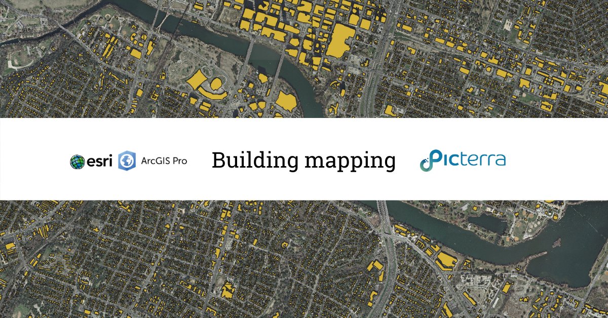
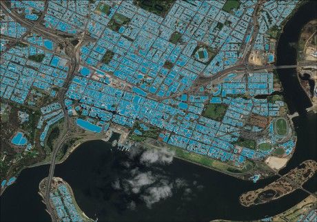
Read our guide to #BuildingMapping 🏘️ and learn how to combine Picterra and #ArcGIS Pro to save a lot of time on manual quality control.
👉 buff.ly/3dF4MhP
#InfrastrutureManagement #UrbanPlanning #ESRI @Esri @ArcGISPro #cadaster #BuildingFootprints #Construction
4

We present to you – PIXERA mini, the next gen media server by AV Stumpfl! The PIXERA mini along with all the other AV Stumpfl media servers are exclusively available in the Middle East from VUEAV.
#AVStumpfl #VUEAV #Pixera #MiddleEast #AV ##BuildingMapping #EdgeBlending

1
2

23 Nov 2018
PSMA Australia completes national 'building census'
Read more: buff.ly/2B57Hyz
@PSMA #geoscape #buildingmapping
1


20 Oct 2016
'#BuildingMapping' 2 prevent fire accidents in Mumbai afternoondc.in/epaper/Epaper… #Fire #Mumbai #Mishaps #FireSafety #BMC #Development @ShivSena
3
2