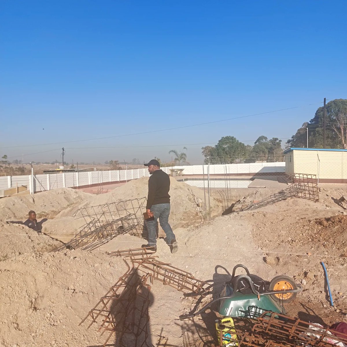
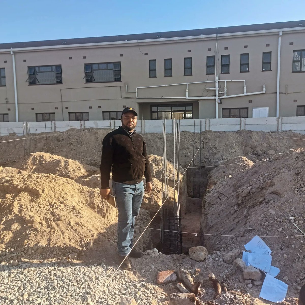
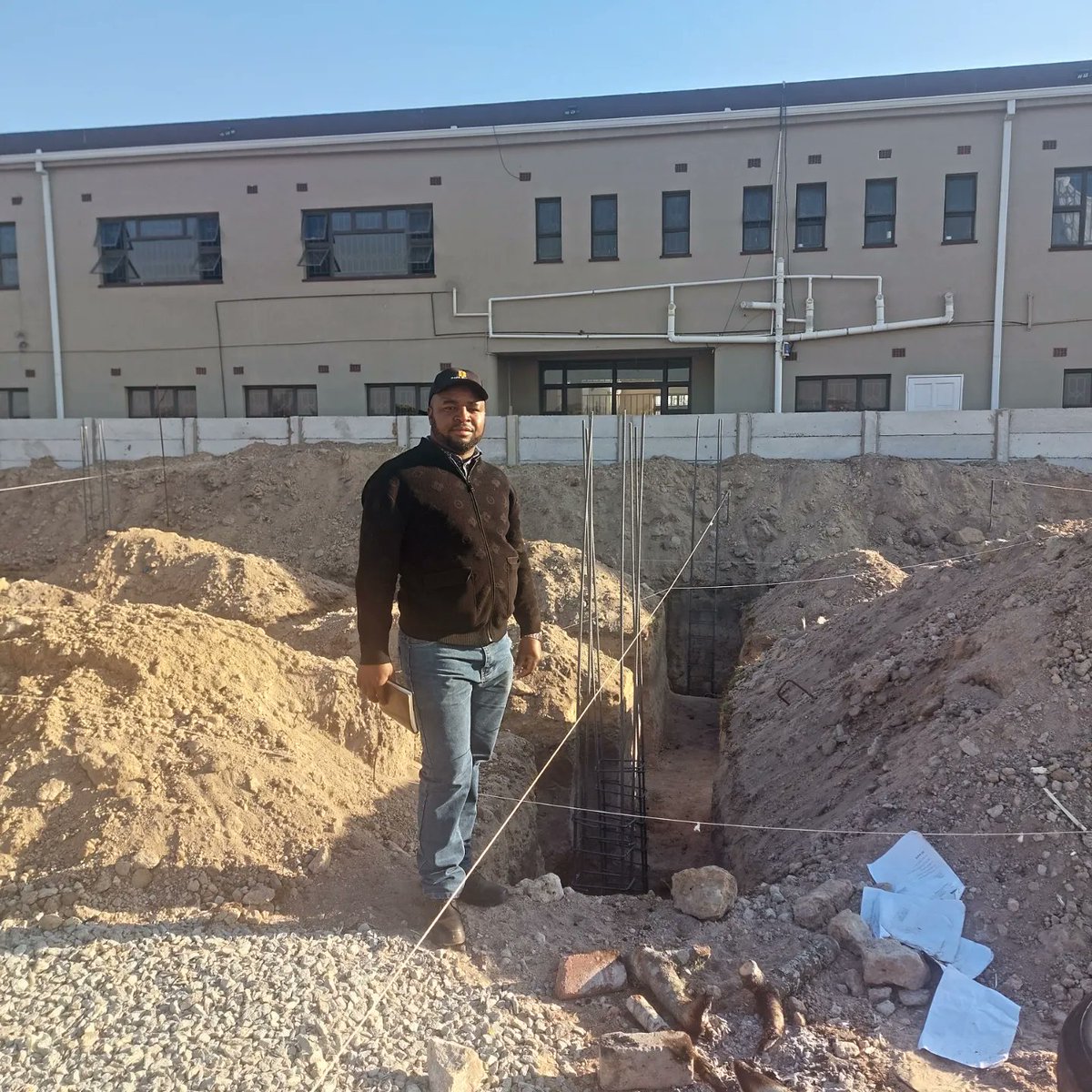
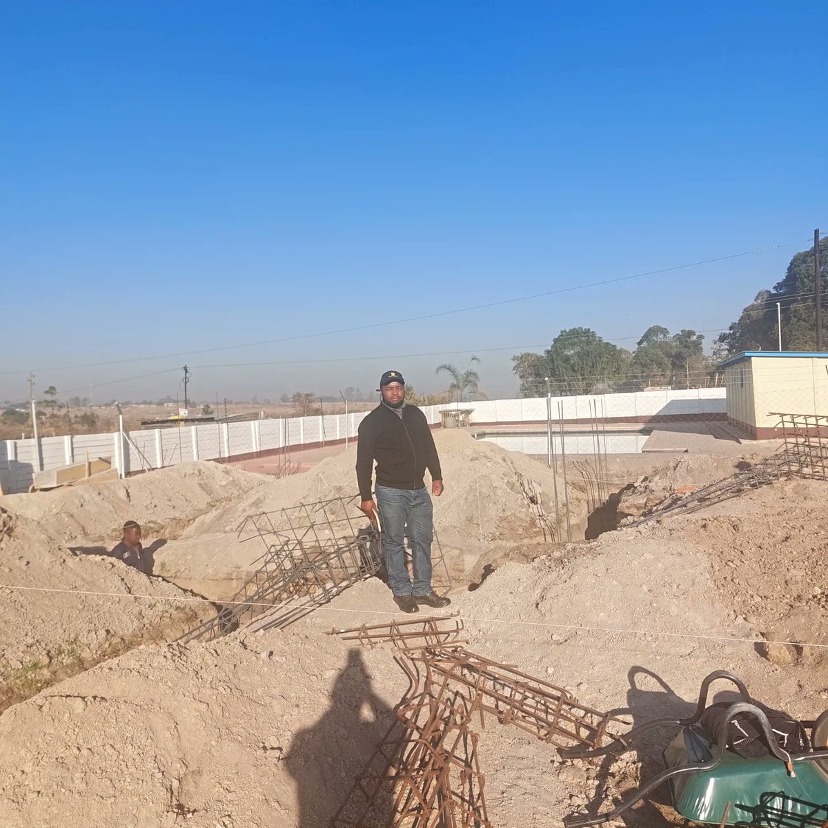
Jun 10
EASY-TANK: Automated FEM & optimization for underground reinforced concrete tanks — simplify complex soil-structure interactions and improve design efficiency. Read more: wix.to/Ovnj08J
#Engineering #FEM #CivilEng #StructuralEng
40

Jun 10
I spent 12years studying Engineering, which also included starting another Engineering degree qualification.
My qualifications are as follow:
1. N.Dip. CivilEng (DUT)
2. BSc AgricEng (UKZN)
3. BSc Civil/StructuralEng (NDP-UKZN)
4. MSc CivilEng (UKZN-Hydropower)
1
1
3
666

Assalamualaikum ✨
Good morning, 𝕩 fam!
It's Another day to grind, Rise up, stay focused, and let’s make today count. #MorningGrind #CivilEng #AI #BuildTheFuture

12
6
22
350

Need gravel in bulk? 🚛 💨
Get a full tipper load of premium gravel stones for your construction site. Perfect for foundations, drainage, and roadwork.
📍 Free delivery in Uyo!
⏱️ 1-3 days mobilization.
Order now: underconstructionmaterials.c…
#Construction #Uyo #Gravel #CivilEng
3
6
34

Jan 23
It would be nice if the construction industry had humanoids (robots like humans) that could handle the whole setting out process of buildings. What do you think? #ideatank #CivilEng #ideatank #innovation2025
1
2
59

מאמרון שכתבתי לאיזה אתר בתחום שאני מתעסק בו
מעבר לתקן: מדוע תוכנות התכנון הסטנדרטיות נכשלות בחישובי פיצוץ? | CivilEng - מובילים שינויי בענף הבנייה
civileng.co.il/מע%…
3
79

3 Dec 2025
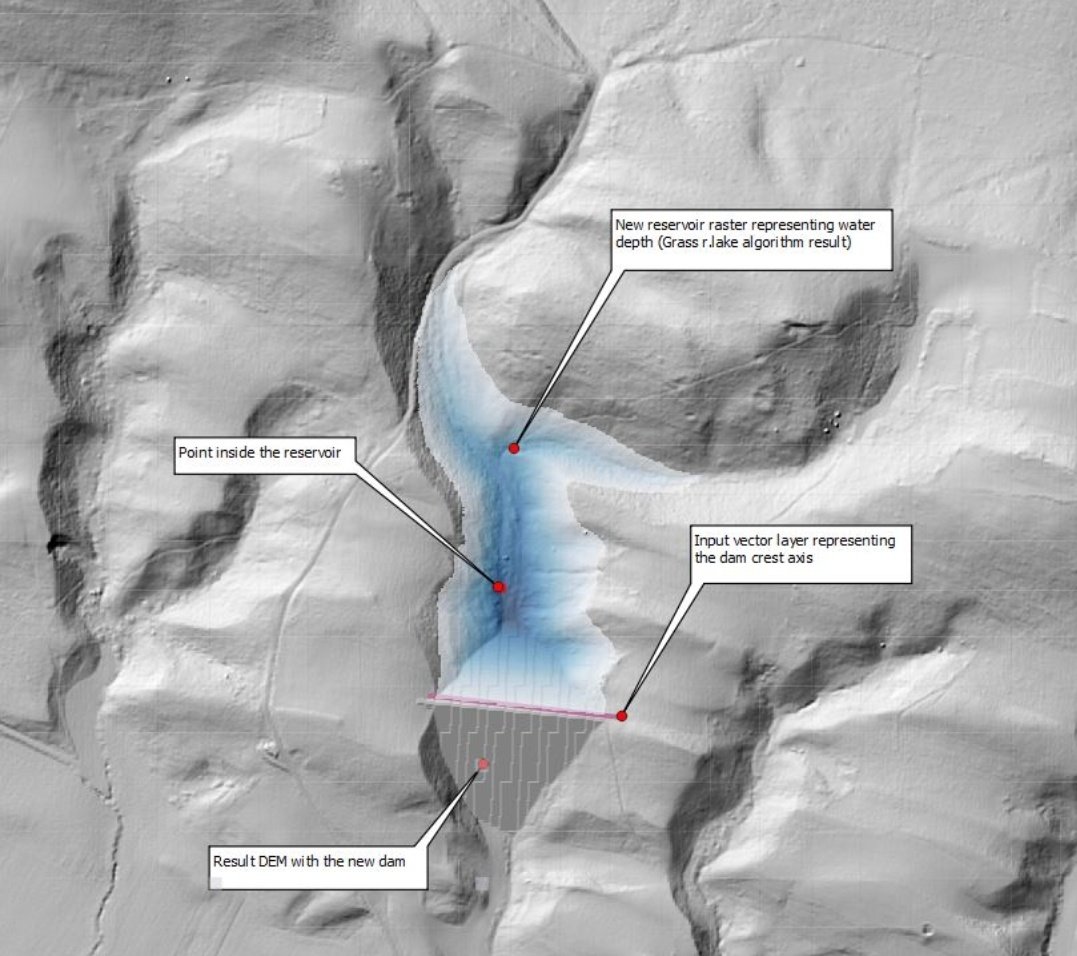
🌍 CivilEng: QGIS Tools for Civil Engineering Automation
CivilEng is a powerful QGIS provider designed to automate early-stage civil engineering workflows. It brings Reservoir modeling, Earthworks simulation, and Linear Referencing (LRS) directly into QGIS — enabling faster, more accurate, and more visual project design.
Built by Iñigo Marin, CivilEng helps engineers, planners, and GIS professionals streamline terrain analysis and conceptual design.
Core Capabilities Include:
🏞️ Reservoir Modeling
Generate a modified terrain DEM and flooded-area depth raster from:
✔️ Existing DEM
✔️ Dam crest axis
✔️ Top-of-dam level
✔️ Water depth
✔️ Slope parameters
✔️ A reference point upstream
Perfect for quickly testing reservoir layout scenarios before detailed hydraulic modeling.
⛰️ Earthworks Simulation
Create a modified DEM showing cut & fill earthworks using:
✔️ Terrain DEM
✔️ Platform layout
✔️ Base elevation
✔️ Cut/fill slopes
Ideal for road design, construction platforms, site preparation, and grading plans.
📏 Linear Referencing (LRS)
Automatically generate linear referencing marks every 25 m and 100 m along a polyline — useful for roads, pipelines, utility lines, and corridor mapping.
Applications:
🔹 Water resources & dam design
🔹 Road & corridor planning
🔹 Construction site grading
🔹 Infrastructure feasibility studies
🔹 Terrain modification simulations
🔗 Resource / Download:
📦 GitHub / QGIS Resource Link: plugins.qgis.org/plugins/Civ…
👤 Follow @GodieMurithi for more QGIS tools, civil engineering plugins, automation workflows, and spatial analysis tips.
🌍 Take it further with @OrionGeospatial — upload your modified DEMs, earthworks outputs, reservoir layers, and engineering models into a centralized platform where teams can:
✔️ Collaborate on terrain changes
✔️ Share engineering layers
✔️ Manage multiple design scenarios
✔️ Visualize & compare cut-fill results
👉 Explore Orion Terrametrics: orionterrametrics.co.ke
18
119
4,196

14 Nov 2025
Doc...I JUST made a new open source engineering software...LMFAO
🧬 I just open-sourced **FluidSlime**
55% cheaper canals, roads, HVAC — in **0.022 seconds**
Uses slime mold 7 AI hybrids
Voice-controlled
Eats LiDAR & drone photos
Spits KML, GeoJSON, PDF
No CAD. No legacy. Just flow.
GitHub: github.com/lyleantoine-colla…
Live: huggingface.co/spaces/lylean…
Civil engineers: your move.
#BioInspired #OpenSource #CivilEng #AI
Mahsi Cho. DYB DYB DYB.
1
95

9 Oct 2025
Engineers study engineering to make things stand — safely.
Ellipse Waterfall is an iconic high-rise apartment development that exemplifies structural integrity and design excellence.
#Safety #StructuralEngineering #CivilEng #ElectricalEng #MechanicalEng #BuiltEnvironment
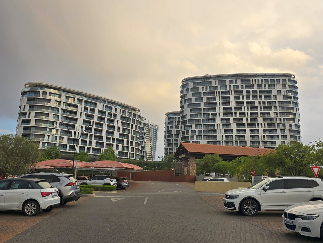
ALT #EngineeringExcellence
2
3
156

19 Aug 2025
📢 #PhDPosition Alert 📢
🎓PhD opportunity in Civil Engineering
🔬Field: Immersed tunnel joints
🌍Country: Netherlands 🇳🇱
🏫University: Delft University of Technology
💰Funding: Salary: €3,059 - €3,881/month benefits
❓How to apply: Apply online via TU Delft portal
⏳Deadline: 15 September 2025
📧Contact: w.broere@tudelft.nl
🔗More info
🎯 Follow @ApplyKite for the latest fully funded PhD opportunities across the Europe and beyond!
——————————————————
⚡️ With a #FREE subscription, you can see numerous fully funded opportunities in your field with just one click. After clicking the link below, select 'Login with Google':
🌐 dashboard.applykite.com
#PhD #FullyFundedPhD #PhDOpportunity #FullyFunded #Scholarship #PhDScholarship #CivilEngineering #CivilEng #StudyInEurope #StudyInNetherlands

1
208

9 Jun 2025
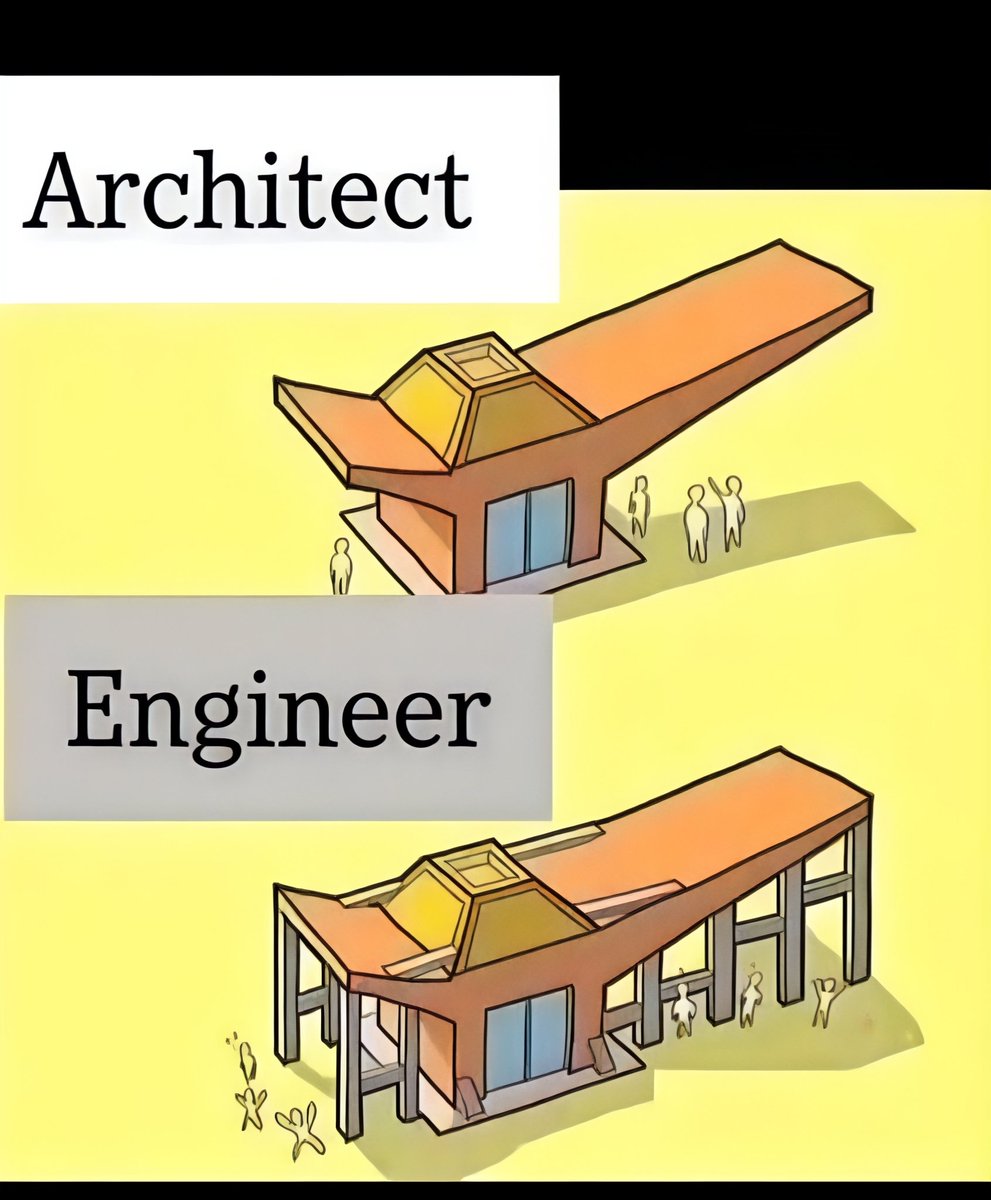
Architect vs Engineer
#CivilEngineering #StructuralDesign #EngineeringTips #CivilEng #ConstructionProjects #BridgeDesign #CivilEngineers07
2
333

6 Jun 2025
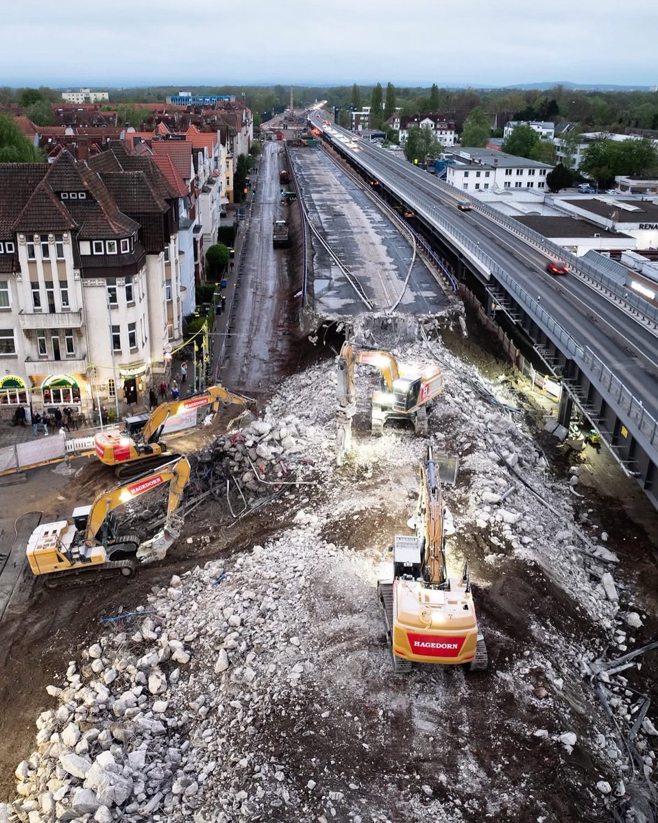
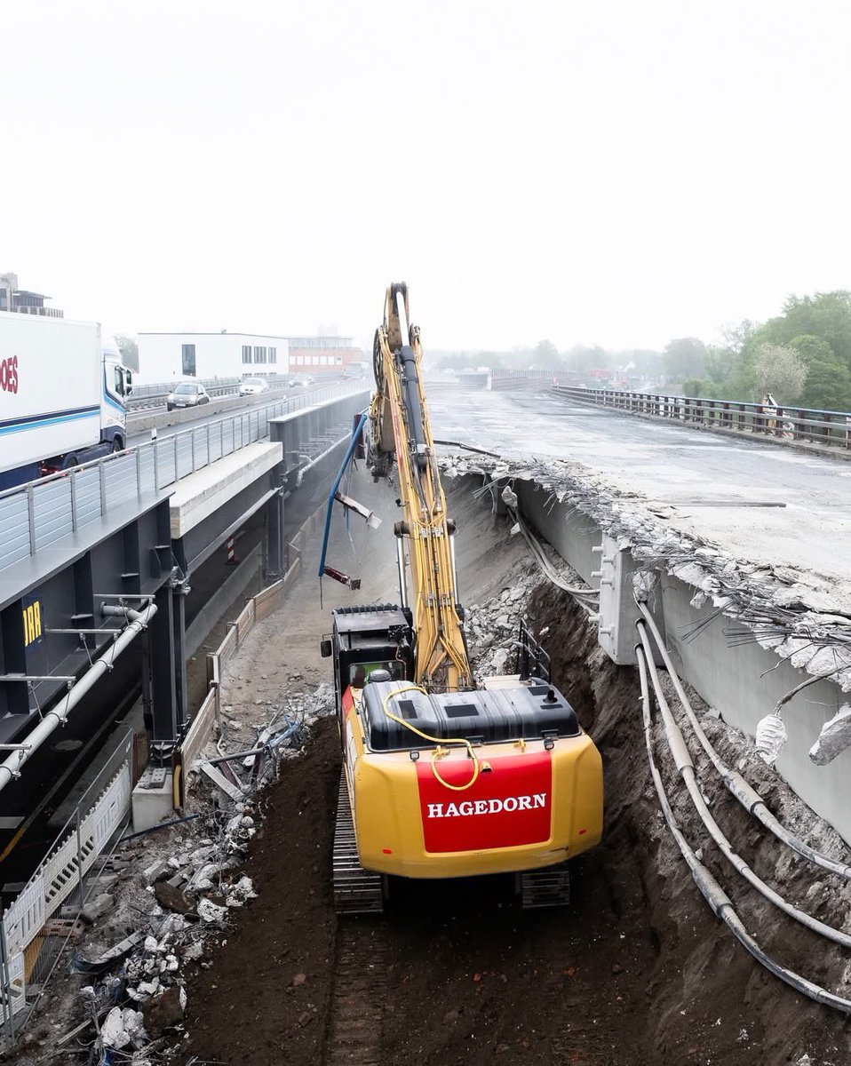
Demolition in action in Germany 🇩🇪! Excavators are tearing down a structure next to a busy highway. What’s your take on urban demolition projects? #CivilEngineering #Construction #Demolition #CivilEng


2
1
9
1,480

1
3
627

15 Apr 2025
NIT Warangal Congratulates Ms. K Madhavi Latha, Research Scholar, Department of Civil Engineering, working under the guidance of Prof. P. Ratish Kumar, on achieving two outstanding milestones! 🌍✈️
#NITWarangal #CivilEng #ResearchExcellence #TrinityCollegeDublin #TUDresden #nitw

8
440

4 Apr 2025
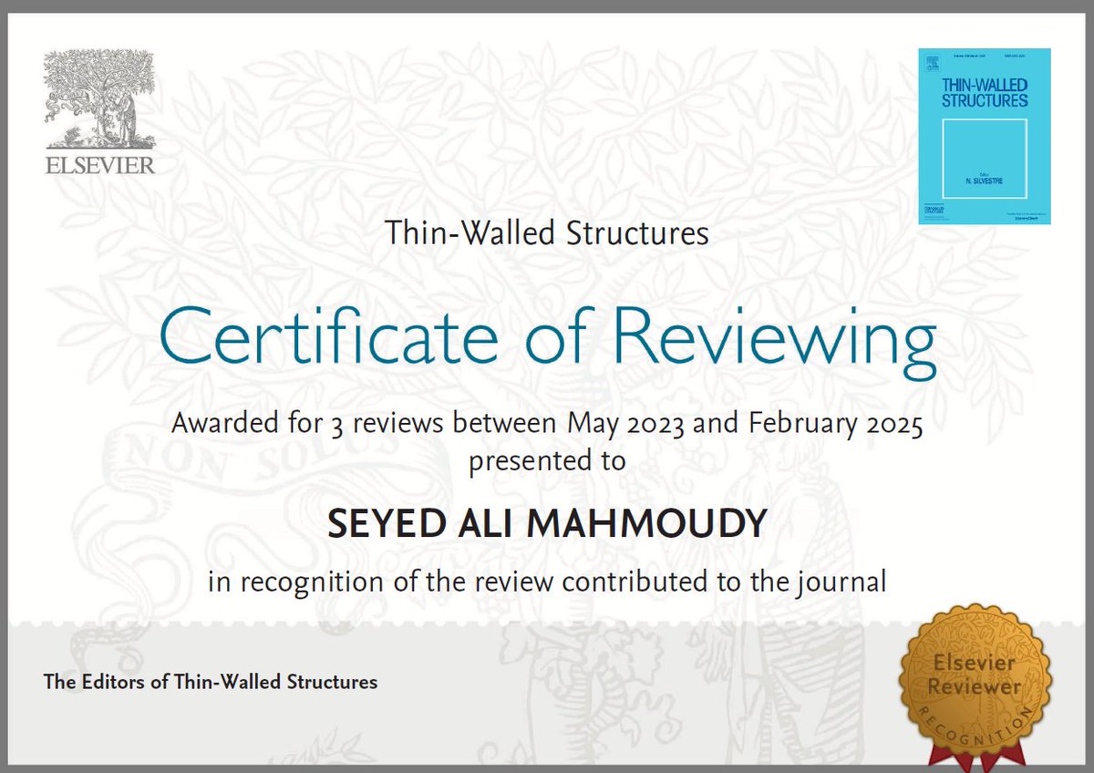
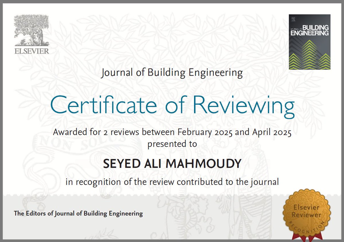
Thrilled to have had the opportunity to review papers five times for prestigious Building Engineering and Thin-Walled Structures journals. Grateful for the chance to contribute to the advancement of our field.
#CivilEng
#StructuralEngineering
#Research
#Elsevier
#PeerReview
2
70

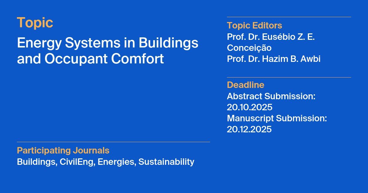
The main #Topic of the day!
Energy Systems in Buildings and Occupant Comfort
Participating journals with #SustainabilityMDPI: @Buildings_MDPI, CivilEng MDPI, @energies_mdpi
More at mdpi.com/topics/UGK38DON18
#mdpi #Sustainability #EnergySecurity #buildings #comfort

1
2
98

28 Feb 2025
The main #Topic of the day!
Energy Systems in Buildings and Occupant Comfort
Participating journals with #SustainabilityMDPI: @Buildings_MDPI, CivilEng MDPI, @energies_mdpi
More at mdpi.com/topics/UGK38DON18
#mdpi #Sustainability #EnergySecurity #buildings #comfort
1
3
2
138
22 Feb 2025
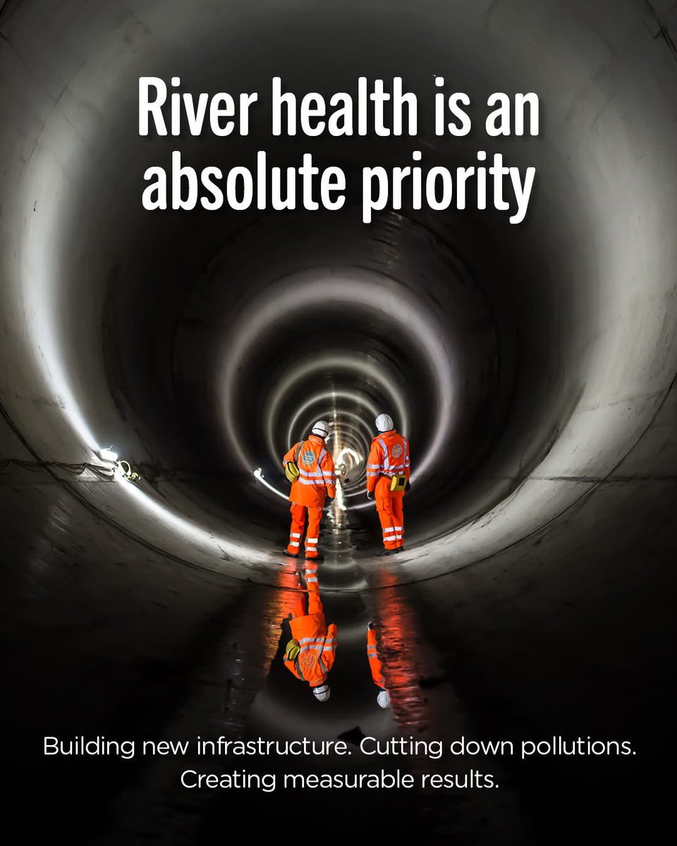
One of our biggest upgrades: the London Tideway scheme. From Sewage Works to the £4.5B Thames Tideway Tunnel, cutting Thames sewage spills by 95%. 25 yrs in the making! Details thameswater.co.uk #CivilEng #Infrastructure #SuperSewer #SustainableBuilding #tunnel #water
1
5
727

11 Aug 2024
Attention civil & structural engineers! 🏗️ Dive into the world of Python programming and unlock new possibilities for your projects. 🐍💡 From data analysis to automation, Python is a game-changer for modern engineering. Start learning today! #PythonForEngineers #CivilEng
2
32