
29 Aug 2018
This image of Mount Kilimanjaro made with @geotrellis #GeoPySpark shows a cost distance friction surface based on @openstreetmap highways & elevation. Looks like a pretty tough climb!
Find us at @foss4g in Tanzania this week to talk about how we made this! #opensource
2
5

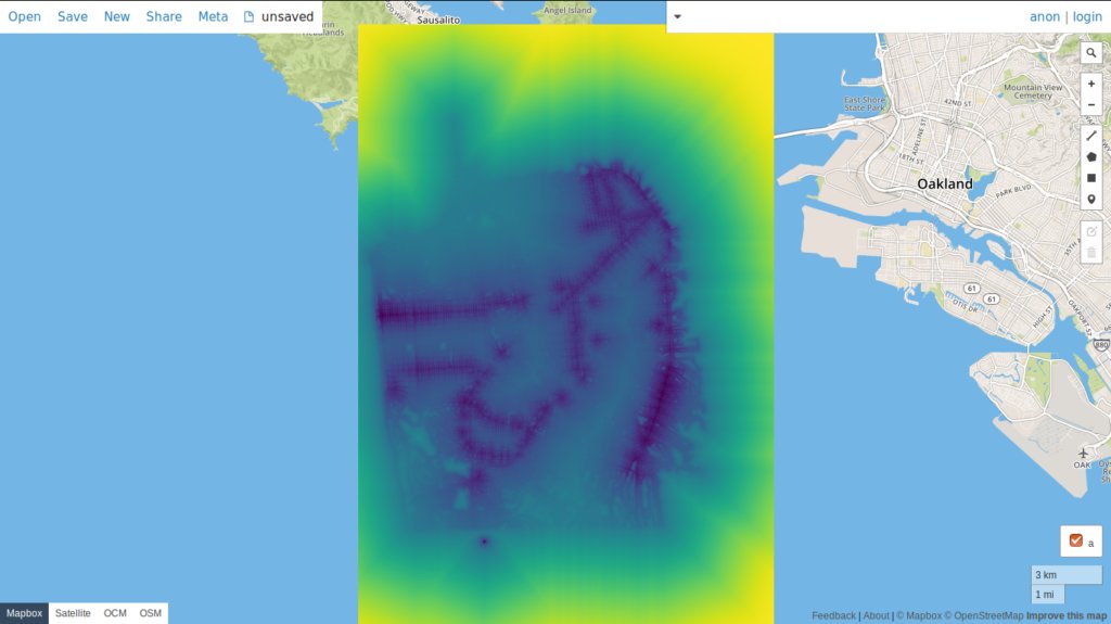
21 Jul 2018
@geotrellis PySpark = GeoPySpark ...which again proves you can put #geo in front of most anything #gischat
github.com/locationtech-labs…
2

22 May 2018
.@azavea's Jacob Bouffard presented GeoPySpark earlier this month @GeoPythonConf.
9 May 2018

Last talk of GeoPython 2018: Jacob Bouffard presents an introduction to GeoPySpark #GeoPython #python #geopyspark #scala

2

9 May 2018
Last talk of GeoPython 2018: Jacob Bouffard presents an introduction to GeoPySpark #GeoPython #python #geopyspark #scala
2
9
8 May 2018
Excited to share about big data geospatial processing with #GeoPySpark tomorrow @GeoPythonConf 2018.geopython.net/#s138 @ApacheSpark #GIS
15
16
1 May 2018
GeoPython 2018 Conference Schedule is now available as pdf 2018.geopython.net/schedule.… #GeoPythonConf #GeoPython #Python #geospatial #machinelearning #gis #bigdata #geovisualization #QGIS #arcgis #fme #geopandas #grassgis #geopyspark (and much more)
26
19
21 Feb 2018
Excited to present on #GeoPySpark at @GeoPythonConf this year in #Switzerland. The talk will be an overview of GeoPySpark features and then an example use case in a #Jupyter notebook that will utilize an #EMR @awscloud cluster
1
2
12
15 Jan 2018
The header image for our #2017recap newsletter was created using using #GeoPySpark, Python binding for @GeoTrellis, in our version of #GeoNotebook to show a color gradient as the speed of travel over the terrain bit.ly/2D2X9BW

1
6
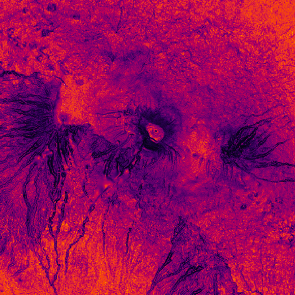
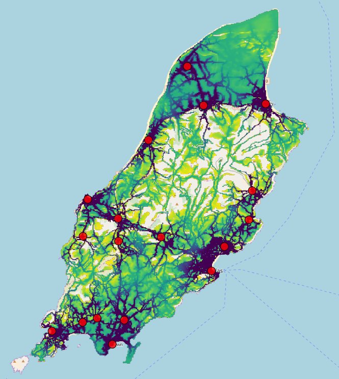
8 Jan 2018
Our @GeoTrellis Team created this image using #GeoPySpark & our version of GeoNotebook to show calculated cost distance of walking between population centers on the Isle of Man when @openstreetmap highways & elevation are taken into account
13
28
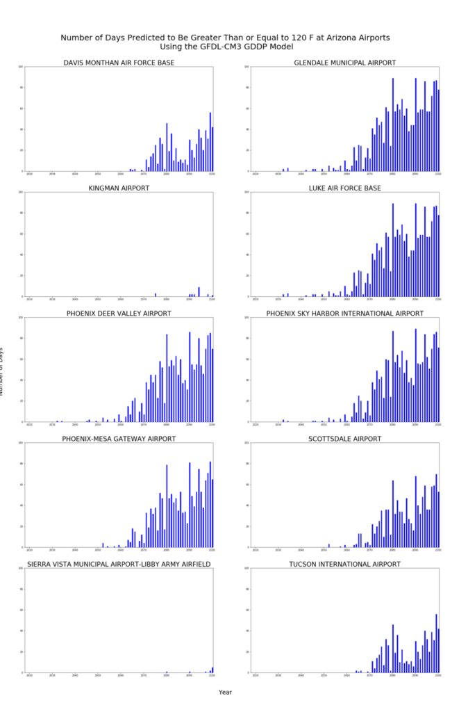
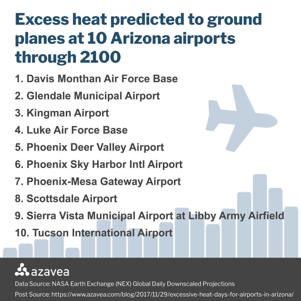
8 Dec 2017
We used #GeoPySpark – Python bindings for @Geotrellis – to analyze a large @nasa dataset relying on @awscloud EMR services & form #ClimateChange Projections for Excessive Heat Days at Arizona Airports bit.ly/2BMQN6i
2
7 Dec 2017
Preliminary results show 10 Arizona airports are at risk of grounding planes due to temperatures that exceed 120°F through 2100 bit.ly/2kwcbJ2 #climatechange #GeoPySpark
1
1
30 Nov 2017
And check out this blog post about a project using GeoPySpark to project excessive heat days for Arizona airports based on climate data azavea.com/blog/2017/11/29/e… @NASA #earthonaws #gddp #climatechange
3
4
30 Nov 2017
GeoPySpark 0.3.0 is released. It's a series of optimizations and fixes to improve ease of use. Take a look at whats new geopyspark.readthedocs.io/en…
4
3

Good to have our alum/@azavea's Jacob Bouffard back at Temple, presenting "Analyzing Climate Data With GeoPySpark" at #TUGISDAY17
1
3
3 Nov 2017
Check out this position @farmers_edge for a software development manager - knowledge of GeoTrellis and GeoPySpark farmersedge.applicantpro.com…
2

2 Oct 2017
Follow-up blog that walks you through using #GeoPySpark in a #geonotebook with @Docker. azavea.com/blog/2017/09/29/h… #python #gis
8
7
29 Sep 2017
Attn #Python users: access the speed and power of the @geotrellis framework with Python binding GeoPySpark bit.ly/2y5DG1t #geochat
1
6

22 Sep 2017
218-.GeoPySpark: Librería de Python que sirve para usar GeoTrellis, Liberia de Scala para trabajar con datos geoes… ift.tt/2xWyDQR
1
1
Introducing GeoPySpark, a Python Binding of GeoTrellis bit.ly/2xRQI2j
1
2