
Pinpoint accuracy, redefined.
@Qualcomm’s new X105 5G Modem-RF brings Quad-Frequency GNSS (L1 L2 L5 L6), delivering free decimeter-to-centimeter location accuracy — anywhere, anytime.
Smarter navigation, safer autonomy, and next-level location experiences are here.
Read the full story: qualcomm.com/news/onq/2026/0…
#GNSS #LocationTech #5G #PrecisionPositioning
1
7
414

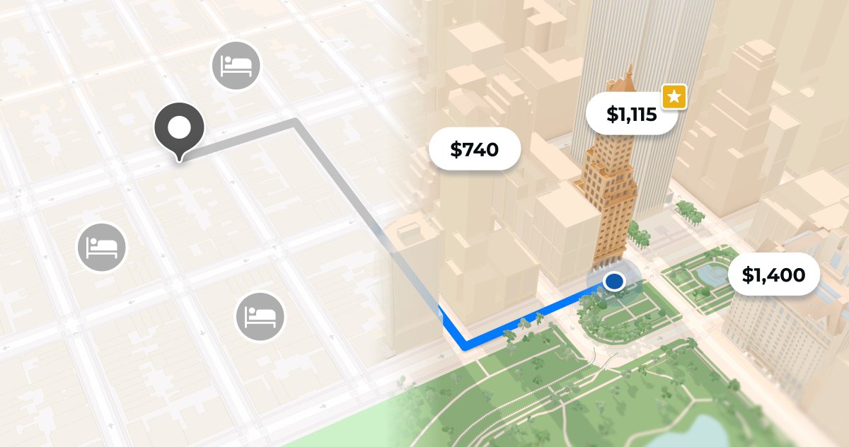
Stop adapting to your map provider.
With Mapbox, your map adapts to your product — your brand, your architecture, your users.
Build your way: mapbox.com/your-map?utm_sour…
#BuiltWithMapbox #LocationTech #Innovation
1
12
1,550

Jan 21
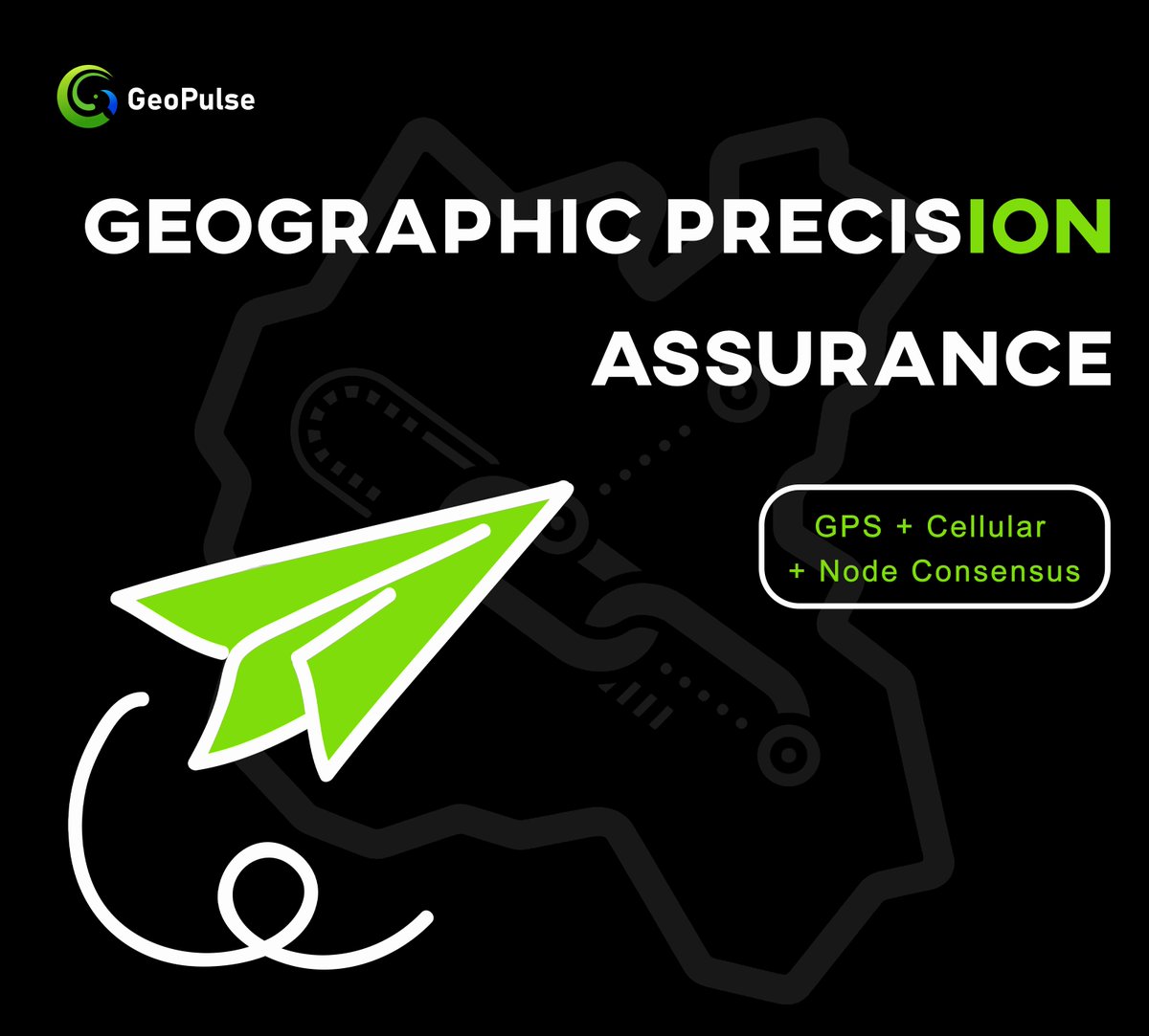
📡 How do we ensure location accuracy?
GeoPulse nodes run on multi-source validation:
📍GPS
📶 Cellular triangulation
🔄 Neighboring node consensus
#GeoAccuracy #LocationTech #DePIN
9
1
16,551

Jan 10
1/ What if your map didn’t just show places — but proved experiences?
That’s what happens when dagama_world meets OfficialXYO.
We’re not just mapping the world.
We’re anchoring it in truth, movement, and value.
Let’s break it down 🧵
—
2/ Discovery with memory.
Most apps show where things are.
DaGama shows where people go, stay, and return to.
Every pin, post, and check-in tells a story.
It’s not static data — it’s living movement.
—
3/ XYO adds the trust layer.
OfficialXYO validates physical presence without compromising privacy.
• Were you really there?
• Was the visit real?
• Can it be verified on-chain?
With XYO, the answer is YES — cryptographically.
—
4/ This changes local business.
Fake reviews? Out.
Anonymous foot traffic? Out.
Now, businesses can:
• See real impressions
• Track verified visits
• Reward loyal customers
• Run trust-based promotions
—
5/ For users, value follows reality.
Your gym session, your brunch spot, your pop-up visit — it all counts.
Post with daGama.
Prove with XYO.
Earn and build rep on-chain.
It’s passive IRL → active value.
—
6/ Real-world activity becomes data with meaning.
DaGama gives it form.
XYO gives it proof.
Together, they turn everyday life into:
• Trustworthy signals
• Sustainable rewards
• Useful recommendations
—
7/ This is where Web3 meets the real world.
No hype.
No guesswork.
No hallucination.
Just proof-based location intelligence that actually works.
#DGMA #XYO #Web3 #LocationTech #IRLData #Maps #DiscoveryFi

Jan 10

1/ What makes real-world discovery trustworthy in Web3?
It’s not just about showing places.
It’s about proving movement, validating experiences, and rewarding participation.
That’s where dagama_world and OfficialXYO align perfectly.
Let’s break it down 🧵
—
2/ Discovery ≠ Search
Search shows what’s out there.
Discovery shows what matters now.
dagama_world flips discovery from passive browsing to active, community-driven curation — powered by real check-ins, impressions, and rewards.
—
3/ Proof of Visit ≠ Check-in
A traditional check-in can be faked.
XYO fixes this.
OfficialXYO anchors location to reality using decentralized location data.
It verifies you were really there, without relying on trust.
—
4/ daGama = Social x Maps x Rewards
Not just where — but why a place matters.
• Follow trusted explorers
• Post impressions
• Earn points
• Let the map evolve with your world
It’s like a living city guide built by real people.
—
5/ XYO = Trust Layer for IRL Data
Behind every move, there’s verified proof.
• Location oracles
• Timestamped data
• Device signatures
• No spoofing
This keeps daGama grounded in *truth*, not just user claims.
—
6/ Together? A New Location Standard
• Discover with daGama
• Verify with XYO
• Reward users for real-world engagement
• Help businesses connect with verified foot traffic
This is location intelligence* done right.
—
7/ Real Adoption Happens IRL
dagama_world x OfficialXYO are building tools that fit into daily life.
No steep learning curves.
No speculation games.
Just value from movement, discovery, and proof.
That’s sustainable.
#DGMA #XYO #Web3 #LocationFi #Maps #IRL
2
19
21
470
Jan 3
𝐃𝐀𝐆𝐀𝐌𝐀 × 𝐗𝐘𝐎 — 𝐓𝐡𝐞 𝐆𝐞𝐨𝐒𝐭𝐚𝐜𝐤 𝐟𝐨𝐫 𝐇𝐮𝐦𝐚𝐧 𝐒𝐢𝐠𝐧𝐚𝐥𝐬
Apps read your clicks.
Maps track your steps.
But what if the physical world could become the interface?
dagama_world and OfficialXYO are building a new GeoStack — where human movement becomes structured, meaningful, and trusted.
A thread 🧵👇
—
1️⃣ The Problem: Disconnected Signals
• Most location data is passive
• Most reviews are fake or biased
• Most maps are outdated or gamed
The result: noisy data, low trust, and weak utility.
—
2️⃣ The XYO Layer: Verifiable Presence
OfficialXYO turns physical movement into proofs:
• Cryptographically signed location data
• Device-to-device signal validation
• Tamper-resistant trail of real-world interaction
XYO = Proof of Where
—
3️⃣ The daGama Layer: Human Context
dagama_world turns those locations into stories:
• People post photos, insights, reactions
• Maps update in real time
• Places become living, social entitiesDGMA = Proof of Meaning
—
4️⃣ The Outcome: A Living, Trustworthy GeoGraph
• Users contribute knowingly and earn value
• Businesses engage directly with verified activity
• The map becomes a shared, trusted reality
—
✅ TL;DR
OfficialXYO proves you were there
dagama_world shows why it mattered
Together, they build a real-time, trusted interface for the physical world.
XYO DGMA power the next generation of human-mapped discovery.
#GeoWeb #CryptoInfra #LocationTech #ProofOfLocation #Web3UX #XYO #DGMA

Jan 2
𝐃𝐀𝐆𝐀𝐌𝐀 × 𝐗𝐘𝐎 — 𝐌𝐨𝐛𝐢𝐥𝐢𝐭𝐲 𝐚𝐬 𝐒𝐢𝐠𝐧𝐚𝐥, 𝐍𝐨𝐭 𝐍𝐨𝐢𝐬𝐞
Most systems treat location data as noise — vague, passive, and disconnected.
dagama_world and OfficialXYO flip that model:
They turn mobility into a verified signal of attention, value, and intent.
A thread 🧵👇
—
1️⃣ Why Movement Matters
Where people go =
• What they care about
• What they trust
• What’s trending — organically
This is real-world intent. It’s stronger than likes.
—
2️⃣ OfficialXYO Captures Movement With Proof
• Location data is signed, timestamped, and tamper-proof
• No spoofing, no assumptions
• This forms a verifiable signal chain of presence
XYO = Proof you were really there
—
3️⃣ @dagama_world Adds Context to That Movement
• It’s not just “where” — it’s *why*
• Reviews, photos, videos, check-ins, reactions
• The map becomes emotionally and socially aliveDGMA = The meaning of movement
—
4️⃣ Together, They Build:
• A trust layer for real-world exploration
• A source of truth for discovery and marketing
• A base layer for geospatial applications
—
✅ TL;DR
• Movement = intent
• OfficialXYO makes it verifiable
• dagama_world makes it meaningful
• XYO DGMA = Mobility as signal, not noise
This is how real-world behavior becomes digital truth.
#XYO #DGMA #GeoWeb #Web3Signals #CryptoInfra #ProofOfLocation

4
25
29
545
30 Dec 2025
𝐃𝐀𝐆𝐀𝐌𝐀 x 𝐗𝐘𝐎 — 𝐏𝐫𝐨𝐨𝐟 𝐁𝐞𝐚𝐭𝐬 𝐏𝐫𝐞𝐬𝐮𝐦𝐩𝐭𝐢𝐨𝐧
In most location-based apps, your data is assumed, estimated, or inferred.
But assumption is fragile. And fragile systems can’t scale trust.
With OfficialXYO and dagama_world, location is verified — not guessed.
A thread 🧵👇
—
1️⃣ Why Presumption Fails
Traditional systems rely on:
• App signals
• Wi-Fi triangulation
• GPS with margin of error
The result?
• False check-ins
• Faked location history
• Broken incentives
—
2️⃣ @OfficialXYO Anchors Reality
Using cryptographic proofs and real-world witness devices, $XYO confirms:
• Who was there
• When it happened
• How long it lasted
Not assumed. Proven.
—
3️⃣ @dagama_world Rewards Real Presence
Places that are verified:
• Earn higher trust
• Attract more foot traffic
• Unlock rewards for users
• Build stronger local communities
Fake reviews and check-ins don’t survive.
—
4️⃣ Verified Presence = Trusted Systems
The future of location-based apps requires:
• Verifiability
• Transparency
• Decentralization
• Incentive alignment
dagama_world Officialxyo are setting that standard.
—
✅ TL;DR
• Most apps guess your location — dagama_world and Officialxyo verify it
• Trust is built on proof, not assumption
• Verified check-ins unlock real value
• It’s not just where you are, it’s what you can prove
#XYO #DGMA #Web3 #LocationTech #ProofOfLocation #TrustLayer #CryptoExplorers #DecentralizedApps #DataWithProof

30 Dec 2025
𝐃𝐀𝐆𝐀𝐌𝐀 𝐱 𝐗𝐘𝐎 — 𝐘𝐨𝐮𝐫 𝐌𝐨𝐯𝐞𝐦𝐞𝐧𝐭 𝐢𝐬 𝐌𝐞𝐚𝐧𝐢𝐧𝐠𝐟𝐮𝐥 𝐃𝐚𝐭𝐚
Everywhere you go tells a story.
Until now, that story stayed offline — untracked, unvalued, and unused.
dagama_world and OfficialXYO are changing that.
Your everyday movement becomes structured, verifiable, and rewarding.
A thread 🧵👇
—
1️⃣ The Physical Layer Is Full of Signals
• Walking into a gym
• Visiting your favorite café
• Attending an event
• Spending time at a coworking space
These are data points — not just habits.
—
2️⃣ OfficialXYO Captures It Accurately
Using:
• Bound Witness technology
• Decentralized devices
• Verified timestamps
• Tamper-proof location signatures
It doesn’t guess where you were. It proves it.
—
3️⃣ dagama_world Turns It Into Value
Your verified location powers:
• Points & rewards
• Community visibility
• City-wide rankings
• Local business discovery
It’s not tracking. It’s empowering.
—
4️⃣ From Data Exhaust to Data Ownership
Most apps extract your location behind the scenes.
dagama_world OfficialXYO flip the model:
• You control the data
• You choose when to share
• You get rewarded for it
—
✅ TL;DR
• Movement becomes meaningful with verification
• @OfficialXYO captures it with proof
• @dagama_world activates it with value
• Web3 meets the real world
This is human activity — mapped, owned, and rewarded.
#XYO #DGMA #Web3Data #LocationProof #MoveToEarn #DecentralizedDiscovery #OwnYourData

5
24
28
598
29 Dec 2025
𝐃𝐀𝐆𝐀𝐌𝐀 𝐱 𝐗𝐘𝐎 — 𝐏𝐫𝐨𝐨𝐟 𝐨𝐟 𝐋𝐨𝐜𝐚𝐭𝐢𝐨𝐧 𝐢𝐬 𝐚 𝐖𝐞𝐛𝟑 𝐏𝐫𝐢𝐦𝐢𝐭𝐢𝐯𝐞
Blockchains gave us proof of ownership.
What comes next is proof of presence —
where you were, when, and why it matters.
OfficialXYO dagama_world are turning location into trust.
A thread 🧵👇
—
1️⃣ Location is the Missing Signal
Most digital apps don’t know where you really are.
They guess — based on IP, check-ins, or manual tags.
@Officialxyo fixes that with:
• Hardware witnesses
• Time-stamped location proofs
• On-chain verification
—
2️⃣ @dagama_world Makes It Actionable
dagama_world takes that verified presence and gives it purpose.
It powers:
• Local discovery
• Community-driven maps
• Real-world rewards
• User-owned city data
—
3️⃣ From Check-ins to Proofs
Old way:
📍“User says they went to a gym.”
New way:
📍“User verified at this gym, this time, for this long.”
This transforms rewards, reviews, and real-world UX.
—
4️⃣ Proof = Incentives
With verified location:
• Rewards can’t be gamed
• Discovery becomes trustworthy
• Campaigns reflect real attendance
• Businesses get real footfall data
—
✅ TL;DR
• Proof of location adds trust to movement
• OfficialXYO = location truth engine
• dagama_world = user-facing layer that activates it
Together, they make the physical world verifiable.
#ProofOfLocation #XYO #DGMA #Web3 #GeoData #LocationTech #TrustedDiscovery

29 Dec 2025
𝐃𝐀𝐆𝐀𝐌𝐀 𝐱 𝐗𝐘𝐎 — 𝐑𝐞𝐚𝐥-𝐖𝐨𝐫𝐥𝐝 𝐃𝐚𝐭𝐚 𝐢𝐬 𝐧𝐨𝐰 𝐈𝐧𝐟𝐫𝐚𝐬𝐭𝐫𝐮𝐜𝐭𝐮𝐫𝐞
The most valuable layer of Web3 might not be on-chain.
It’s off-chain, real-world data — verified, structured, and made actionable.
That’s what dagama and Officialxyo are building together. A thread 🧵👇
—
1️⃣ From Data
Streams to Living Systems
@OfficialXYO captures geospatial data at the edge —
physical movements, coordinates, time-stamps.
@dagama_world transforms that data into living discovery maps, filled with local behavior, preferences, and context.
—
2️⃣ Why Physical Data is Underpriced
Every app depends on real-world behavior.
Yet most Web2 platforms:
• Own the data
• Monetize without users
• Lack transparency
Web3 flips the model:
• Users generate value
• Location = proof
• Activity = ownership
—
3️⃣ Applications Built on Truth
This stack enables:
• Verified reviews
• Geo-reward campaigns
• Crowd-mapped recommendations
• Data-backed discovery
Not just content — evidence.
—
4️⃣ Infrastructure, Not Just Features
daGama and XYO are not building apps.
They’re building infrastructure for location-aware systems:
• Truthful data
• Trusted incentives
• Transparent usage
—
✅ TL;DR
• XYO = verified real-world signals
• daGama = discovery powered by trust
• Together = infrastructure for next-gen location apps
This is the Geo stack Web3 didn’t know it needed.
#GeoWeb #XYO #DGMA #Web3Infra #RealWorldData #ProofOfLocation #DecentralizedDiscovery

3
28
30
578

11 Dec 2025
Introducing daGama 🚀
Redefining Real World Location Intelligence with Web3 AI 🌍
The future of location-based applications isn’t just digital…
it’s verified, transparent, and powered by blockchain.
That’s exactly what daGama is building.
@dagama_world is a next-gen RWL (Real World Locations) platform designed to bring authenticity, trust, and intelligence to real world data. By combining blockchain’s transparency with AI driven insights, daGama transforms how users interact with real-world places from commercial hubs to hidden local gems.
💡 What are RWLs?
RWL (Real World Locations) are all physical places shops, venues, public sites, private spaces, and more unified through a Web3 infrastructure.
This means real world places are no longer just static points on a map… they become verifiable on-chain assets, enriched with community input and AI powered recommendations.
✨ Why it matters
🏷️ Authentic, tamper-proof info
🤝 Community driven trust
🔗 Transparent data ownership
🧠 AI-enhanced discovery
🌐 A path toward true Web3 mass adoption
By merging the real world with decentralized tech, daGama isn’t just mapping locations it’s unlocking a new layer of digital-physical experience where every place gains verifiable value.
🌐 @dagama_world is building the future of location discovery.
If Web2 mapped the world, Web3 will validate it and @dagama_world is leading the way.
#daGama #Web3 #AI #RWL #Blockchain #LocationTech #CryptoInnovation #MassAdoption 🚀
3
468

18 Nov 2025
🔥 Ever forget the places you saved? Cafes, stores, travel spots… happens to all of us.
That’s why I started using SpotSignal — a simple, private app that reminds you only when you’re nearby.
No clutter.
No noise.
Just a clean reminder when you need it.
✨ Features I love:
• Save locations in 1 tap
• Add personal notes
• Push notifications when you’re close
• Lightweight, reliable, private
📍 If you hate forgetting places you care about, try SpotSignal. It’s a small app solving a big everyday problem.
👇 Check it out here:apps.apple.com/in/app/spotsi…
#SpotSignal #AppRecommendation #ProductivityTools #LocationTech #UsefulApps
55
19
59
457

12 Nov 2025
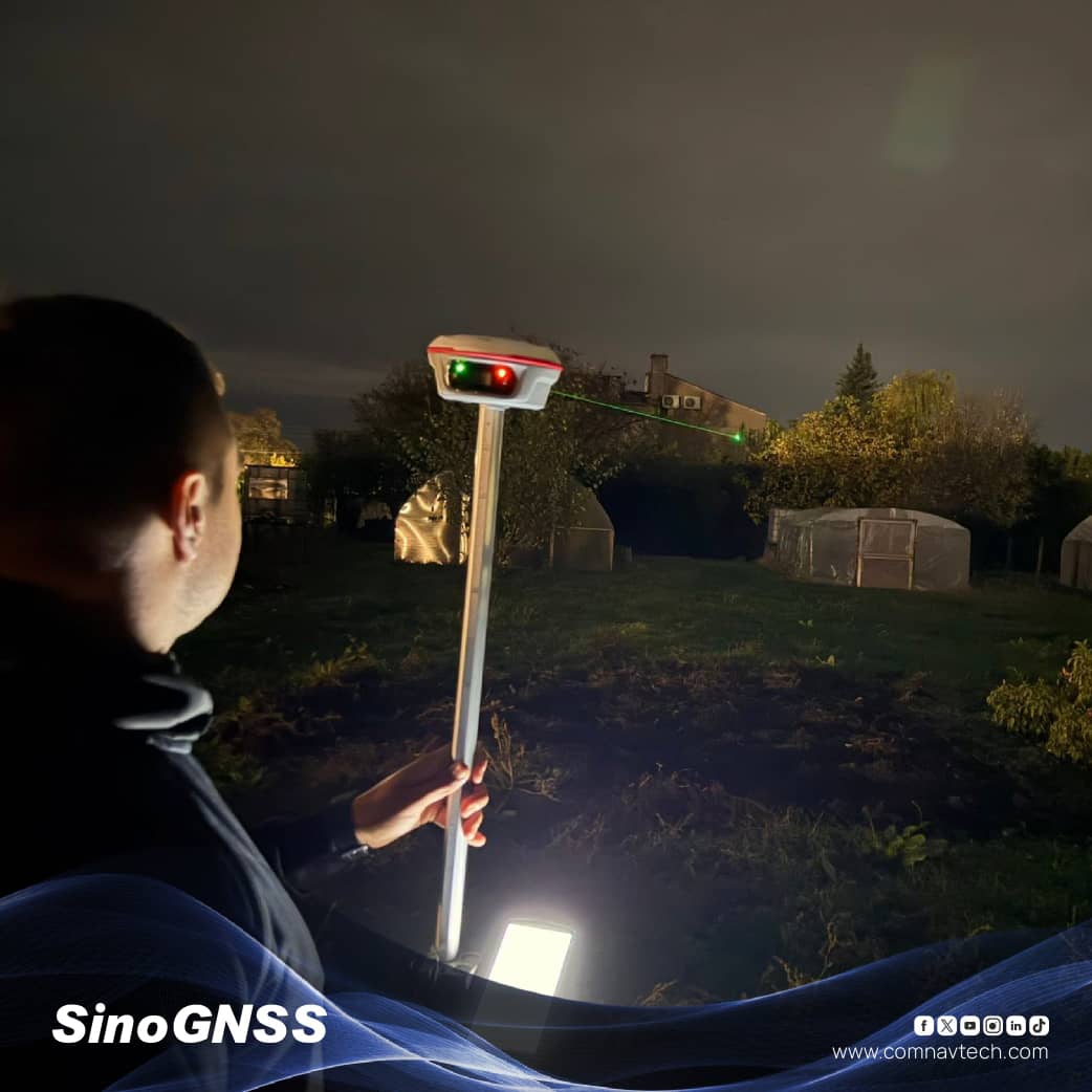
GNSS receiver goals! 🎯 This one's a connectivity superhero 🦸♂️ - Bluetooth, Wi-Fi, NFC, 4G, UHF radio modem... it's like having a magic toolbox for all your location needs 🧰📍 Perfect for geospatial pros and anyone who needs precision and flexibility. 💡 #GNSS #LocationTech
3
6
346

4 Nov 2025
“Where should we meet?” The question that wastes 30 minutes of messages every time. 🗺️
Meeting a friend on the opposite side of the city? We’ve all been there.
That’s why we built SearchSpot—a travel confidence engine that:
✅ Finds the perfect midpoint between you and your friend
✅ Searches cafes & restaurants in that area
✅ Analyzes social media reviews for ambiance, noise levels, and pricing
✅ Recommends the best spot based on YOUR needs
No more endless back-and-forth. No more settling for “somewhere in the middle.”
In this demo, I show how SearchSpot helped me find the ideal meeting spot with my college friend Kunal—considering travel time, cafe atmosphere, and budget.
**Building in public:** We’re laser-focused on clarity over scale. That’s why we’ve added a feedback system with $20 weekly prizes for the most valuable insights. Join our Discord and help shape the future of city exploration.
The world is ours to explore. Let’s make it easier. 🚀
**What’s the most annoying part of planning meetups in your city?** Drop a comment below 👇
#ProductDemo #StartupLife #TravelTech #BuildingInPublic #UserExperience #LocationTech #StartupJourney
1
1
5
115

9 Sep 2025
How’s your location staying real in a world of fakes? 🧠📍
@dagama_world ain’t playing.
They’re using AI blockchain to verify every check in timestamps, metadata, patterns, all cross-checked like a boss.
🔐 No spoofing.
📊 No fluff.
🌍 Just raw, trusted geo data.
Welcome to Smart Validation.
Your map. Your truth. Your tokens.
Web3 #AI #LocationTech #CryptoTravel #DaGama
3
6
7,861

6 Sep 2025
🌟OWNAI isn’t just another platform—it’s a game-changer for how we manage, trade, and grow our assets.
🔹With a focus on keeping things clear, secure, and straightforward, OWNAI builds trust for everyone involved. Its smart, automated systems tackle the heavy lifting, cutting through the clutter so you can focus on what counts: building real, lasting value. Whether you’re an individual or a business, OWNAI makes it easy to take control of your assets with tools that are both user-friendly and cutting-edge, raising the bar for what asset management can be.
🔹This is the start of a future where smart assets flourish in a fair, accessible, and user-focused marketplace. With OWNAI, you’re not just participating—you’re shaping a world where technology and human creativity come together to drive progress. @ownaiNetwork
#OWNAI #LocationTech #SmartAssetManagement #APAC

48
25
1,299

5 Sep 2025
🌍 GeoAI Agents & Platforms: Who They Are & What They Do 🤖🗺️
Geospatial AI is booming. Here’s a curated list of standout platforms—from public APIs to enterprise-grade systems—each transforming how we analyze and act on spatial data.
🔑 Featured GeoAI Platforms
🛰️ Descartes Labs
Handles petabytes of satellite data for climate impact assessment, crop forecasting, and supply chain monitoring. Recently advanced federated learning for edge-based predictions.
👉 descarteslabs.com
📊 Orbital Insight
Fuses satellite, aerial, and geolocation data with computer vision to track infrastructure, population activity, and economic indicators. Includes its self-service tool, Orbital Insight GO.
👉 orbitalinsight.com
🌍 Planet Labs
Operates the largest Earth-observing satellite fleet, delivering AI-driven pixel-level land-use classification, anomaly detection, and change monitoring.
👉 planet.com
🏙️ OneAtlas (Airbus Intelligence)
Uses high-resolution imagery with AI to monitor infrastructure, urban growth, and disaster impacts using deep learning.
👉 oneatlas.airbus.com
📡 GeoWGS84.ai
Offers AI-first geocoding, object detection, and spatial foundation models for real-time mapping and infrastructure analytics.
👉 geowgs84.ai
🛠️ Sparkgeo
Builds custom GeoAI pipelines and microservices for 3D topography, drone imagery, and LiDAR analysis using cloud-native ML.
👉 sparkgeo.com
🗺️ SuperMap
Integrates AI into GIS workflows for image interpretation, object detection, scene classification, and change detection with models like U-Net and DeepLabv3 .
👉 supermap.com/en-us
📈 Galigeo
Delivers predictive geomarketing and embedded location intelligence inside Power BI, Salesforce, and SAP BI.
👉 galigeo.com
🌐 ArcGIS (Esri)
A mature GeoAI platform with embedded ML, deep learning, natural-language assistants, and deployable AI agents across imagery and workflows.
👉 esri.com/en-us/arcgis/about-…
📦 CARTO
Cloud-native spatial analytics and location intelligence, integrated with BigQuery, Snowflake, and enriched by its Data Observatory.
👉 carto.com
🤖 Ageospatial (GeoForge)
Provides GeoAI agents that parse text queries, discover geodata, plan workflows, and generate maps/reports—via API or UI.
👉 ageospatial.com
✨ Why It Matters
These platforms cover the spectrum—from infrastructure and agriculture to climate, marketing, and enterprise intelligence. Whether you’re building custom GeoAI pipelines or embedding spatial AI in business dashboards, there’s a tool for the task—or multiple that can be combined.
#GeoAI #SpatialIntelligence #RemoteSensing #Geospatial #AI #LocationTech

14
59
3,904

5 Sep 2025
我第一次听到 OWNAI @ownaiNetwork ,是在一个 TG 群。
起初没太在意。
这两年打着 AI RWA 旗号的项目太多了,不是卖 PPT,就是做“AI 生成 NFT”“链上 GPT”。
但我点进了官网,然后停下来了。
---
它不是讲“AI 怎么生成内容”,
不是在炒“AI 数据怎么上链”。
它讲的是一件我以前从没认真想过的事:
“普通人,能不能拥有一台正在赚钱的 AI 资产?”
---
这句话听起来很怪。
AI 资产离我们太远——
买自动驾驶车?咖啡机器人?无人机?
第一反应就是:
我没钱,我不会运营。
但 OWNAI 在做的是:
把这些现实中能赚钱的 AI 资产碎片化,
通过协议托管、运营、分红。
---
也就是说:
它把一个“我参与不了”的资产,
拆成了我买得起的**所有权份额**。
资产在现实中跑单、送货、接客,
净收益通过链上合约自动分给我。
---
我突然意识到:
这不是讲未来,
这是直接改写一个我从没考虑过的问题:
我不仅能用 AI,我可以拥有 AI。
---
它目前上线的三类资产:
🚗 Own-V:自动驾驶车辆(网约车/物流)
🤖 Own-R:服务机器人(咖啡/配送)
🚁 Own-M:未来出行资产(无人机、仓储车)
这些资产是真部署、真跑业务、真产出。
---
你不需要操心运营、不用报税、不用维护。
你只要持有代币。
这代表你拥有这台 AI 资产的一部分。
收益自动分发,链上可查、可验证、不可篡改。
---
我看懂之后的第一个反应是:
这不是另一个平台,而是一种结构性变化。
它不像 Airbnb、Uber 那样靠平台协调资源,
而是用智能合约 区块链,作为信任中枢。
---
当“自动化 智能体 去中介化”三浪叠加,
OWNAI 实质上是在把“AI 劳动力资产”,
从中心化科技公司手里剥离出来,交还给社区。
听起来理想,但它设计得极其现实:
---
✅ 每个资产都有注册结构托底
✅ 所有参与者需 KYC,规避灰区
✅ 所有权碎片化,运营由专业团队负责
✅ 收益通过链上合约透明分发,无黑箱操作
---
$OAN 代币设计也非常干净:
0% 团队预留
0% VC 份额
未售代币全部销毁
持币即治理权,绑定 Snapshot
——这在 Web3 已经不多见。
---
但让我最警醒的不是模型设计。
而是它提出了一个很扎实的现实问题:
“AI 红利期已经开始了,普通人还有参与机会吗?”
---
如果没有 OWNAI 这样的结构,答案多半是:
没有。
你只能是 AI 的使用者、内容贡献者、模型微调工人。
但要成为共建者、收益者,那扇门是关着的。
---
OWNAI 打开了一扇侧门:
你不需要技术、不需要背景,
只要愿意掏一点起步资金,
就能成为 AI 资产的一部分拥有者。
---
我不知道 OWNAI 能走多远,
但我知道它这条路,是未来的大趋势。
也许现在它还小众,还不性感,
但等所有人都懂得“AI 资产可碎片化 自动分润”的那天,会不会有点迟了?所以你还在等什么?
#OWNAI #LocationTech
5 Sep 2025

OWNAI is not just a platform, it is a marketplace that enables assets to be managed and exchanged with transparency and precision.
By ensuring trust and efficiency across every interaction, it makes operations both safer and more effective.
Automated systems handle the complexity so people can focus on creating real value.
This is how the future of smart assets is built on marketplaces that can be owned.
With OWNAI, that future is in your hands.
#OWNAI #LocationTech #SmartAssetManagement
46
32
1,602

5 Sep 2025
OWNAI is not just a platform, it is a marketplace that enables assets to be managed and exchanged with transparency and precision.
By ensuring trust and efficiency across every interaction, it makes operations both safer and more effective.
Automated systems handle the complexity so people can focus on creating real value.
This is how the future of smart assets is built on marketplaces that can be owned.
With OWNAI, that future is in your hands.
#OWNAI #LocationTech #SmartAssetManagement
117
3
17
18,416
🚚 Curious how reverse geocoding works in real time? Try the Mapbox Delivery App Demo.
Drag the delivery truck across the U.S., and the app makes a reverse geocoding API call, just like a real vehicle’s location tracker. Then, see how the simulated mobile app shows the package’s current location to the end user.
It’s a simple way to explore Mapbox location intelligence in action. Try it for yourself: labs.mapbox.com/demo-deliver…
#BuiltWithMapbox #Geocoding #LocationTech #DeliveryDemo #GIS

1
1
1,049
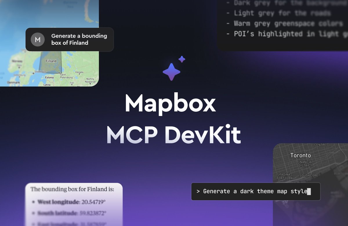
Developers — supercharge your Mapbox development workflows with the new Mapbox MCP DevKit. 🚀
Now, it’s faster and easier to build with Mapbox by equipping AI coding tools with access to the Mapbox platform. From designing maps to managing data, generating API tokens, and formatting GeoJSON, the Mapbox MCP DevKit provides an interface to help AI assistants like Copilot, Cursor, and Claude Code to understand and streamline the Mapbox development environment.
Learn more: mapbox.com/blog/the-mapbox-m…
#BuiltWithMapbox #LocationTech #AIDevelopment
1
1
7
1,620

It’s been a big few weeks at NextNav:
🔹 Tolling coexistence study
🔹 Partnership with Oscilloquartz
🔹 Feature in GPS World: “The Race to GPS Resiliency”
🔹 3D location now live in parts of North Central TX 9-1-1
🔹 First Due partnership: Vertical location & 3D visualization
🔹 Honoring heroes at #APCO2025
📬 Stay in the loop: hubs.la/Q03BQSWk0
#PNT #PublicSafety #GPSresiliency #5G #LocationTech
13
1,193
📍Want to make your maps more interactive and informative?
In this Mapbox GL JS tutorial, you’ll learn how to:
✅ Use any image as a map marker
✅ Show clickable popups with rich details
✅ Build a better user experience with interactive web maps
Perfect for web developers looking to level up their Mapbox skills and bring more context to their location data.
See the tutorial here: docs.mapbox.com/help/tutoria…
#BuiltWithMapbox #MapboxGLJS #WebDev #InteractiveMaps #LocationTech #DeveloperTutorial

2
1,006