
Jun 10
Today | 13:00–14:00 SAST 🌍
GHIAA joins Innovus TTO at @StellenboschUni for a live MAPGuide® walkthrough on keeping equitable access commitments intact across the R&D value chain. Still time to join.
🔗 events.teams.microsoft.com/e…
#EquitableAccess #GlobalHealth #MAPGuide

7

Jun 8
Only 2 days left!
Innovus TTO & GHIAA bring you practical tools to embed access commitments across the R&D value chain.
Register: shorturl.at/l3DDR
Read about the MAPGuide® lnkd.in/eyrm4whS
Submit questions: lnkd.in/di2JFj-R
For enquiries: tto@sun.ac.za

9
Jun 8
Equitable access is usually discussed at the level of objectives. The MAPGuide® Provision Database operates one layer deeper, at the contractual language that turns those objectives into commitments.
🔗 90-second tour: youtu.be/iYm1VNf_IU0
#EquitableAccess #GlobalHealth
6
May 29
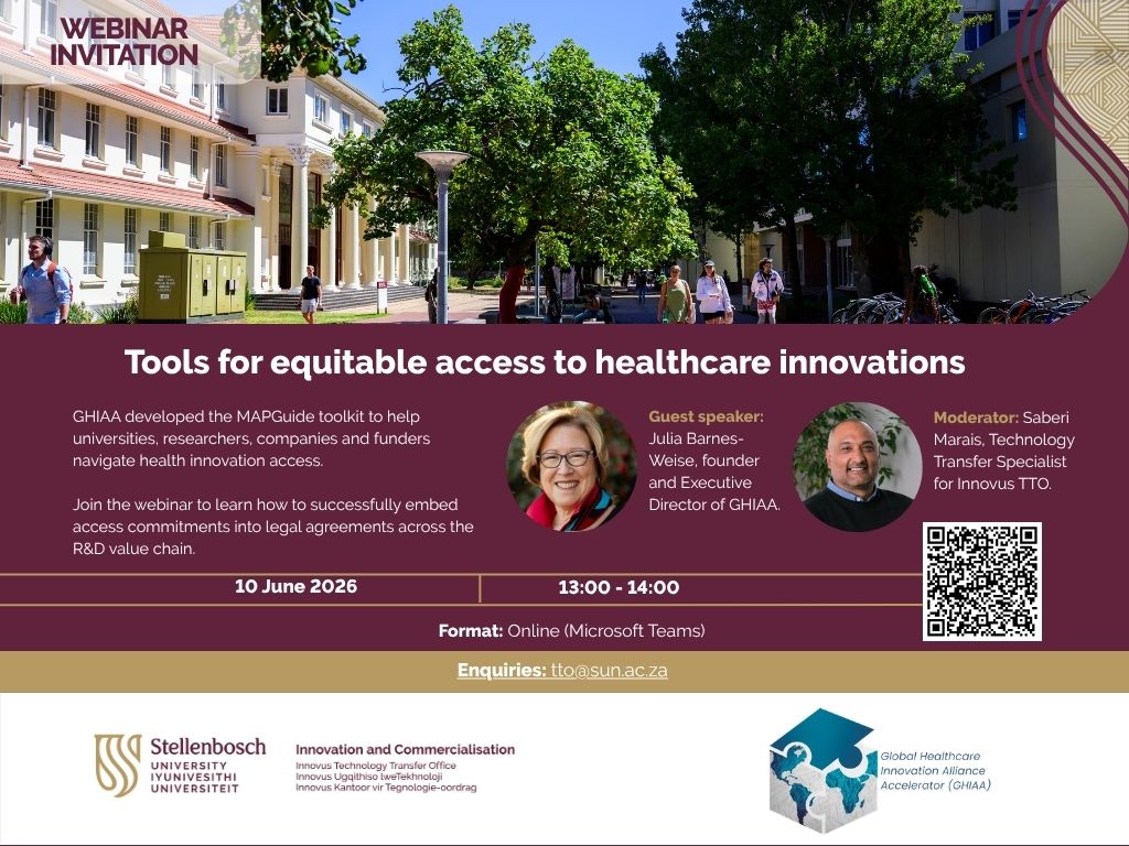
Join us and @GHIAAteam for an online webinar on embedding equitable access commitments into legal agreements across the R&D value chain.
𝐃𝐚𝐭𝐞: 10 June 2026
𝐓𝐢𝐦𝐞: 13:00 – 14:00
𝐅𝐨𝐫𝐦𝐚𝐭: Microsoft Teams shorturl.at/l3DDR
#HealthcareInnovation #MAPGuide
2
28
Mar 12
Our ED Julia Barnes-Weise joins experts from @UKHSA at #WorldVaccineCongress Washington (April 1) to examine real-world PPP models for pandemic readiness & biosecurity.
📍 Walter E. Washington Convention Center
🔗 terrapinn.com/conference/wor…
#GlobalHealth #MAPGuide #Biosecurity

2
2
60
24 Sep 2025
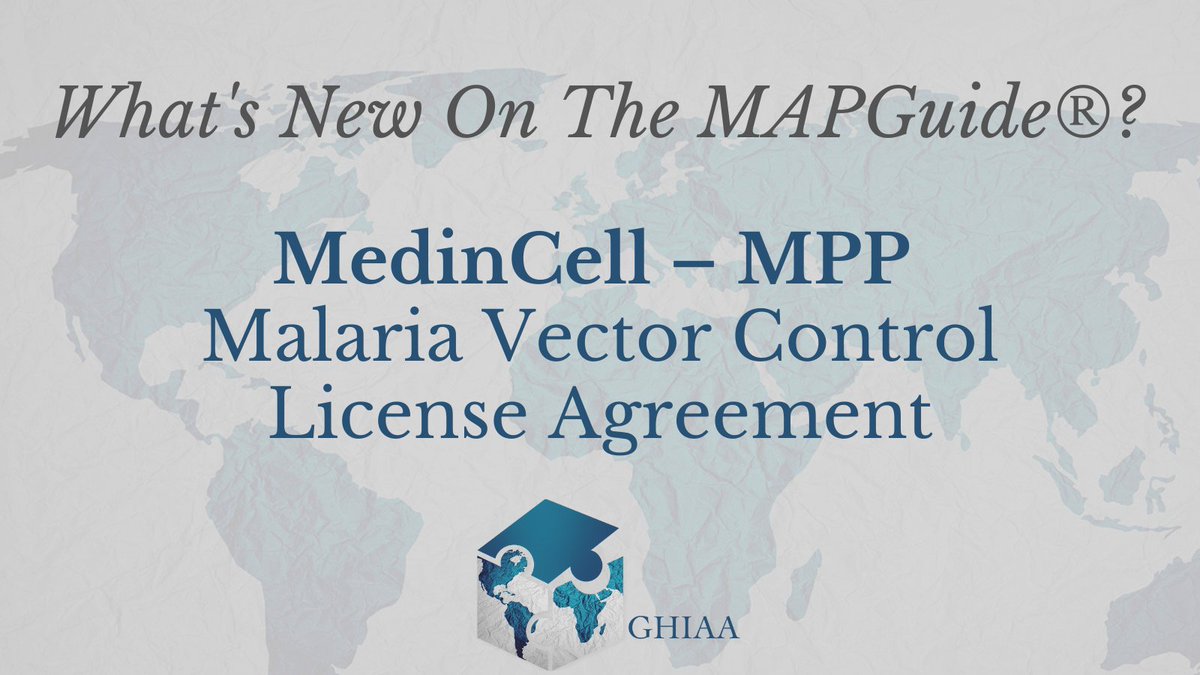
New on the MAPGuide 📖
@MedinCell & MPP sign a license for mdc-STM, a 3-month injectable ivermectin using BEPO® tech.
The deal includes affordable pricing, timely supply, and access commitments for LMICs.
🔗Read more - ghiaa.org/mapguide-home/sear…
#MAPGuide #GlobalHealth #Malaria
1
1
1
222

22 Aug 2025
Did you know?
The open-source geospatial world is booming — and the OSGeo community has built some of the most powerful tools for maps, analysis, databases, and geoportals. 🗺️
Here’s a quick guide to four major categories of OSGeo tools that every geo-professional, student, or tech enthusiast should know 👇
🧭 WEB MAPPING TOOLS
The engines that publish your geospatial data online:
🌐 GeoServer – Publish & style spatial data as OGC services (WMS/WFS/WCS).
⚡ MapServer – High-performance web map rendering engine.
🗺️ OpenLayers – JavaScript library to build interactive maps in the browser.
🗃️ GEOPORTALS
Platforms that let you organize, share, and manage maps & data:
🧩 GeoNode – A full geo-CMS (think “WordPress for maps”) with data, metadata, users & permissions.
🧭 Mapbender – Build web GIS apps with no coding — just configure & go.
🧭 MapGuide Open Source – Powerful web mapping platform for custom geoportals.
💻 DESKTOP GIS
Your all-in-one GIS workbenches:
🧠 QGIS – The most popular open-source desktop GIS: editing, analysis, cartography, plugins galore.
🌿 GRASS GIS – Advanced geospatial modeling, raster processing, terrain & environmental tools.
🏔️ SAGA GIS – Lightweight but strong in terrain & hydrological analysis.
🗄️ SPATIAL DATABASES
The backbone of any enterprise GIS — storing & querying spatial data:
🏛️ PostGIS – Spatial extension of PostgreSQL, enabling advanced spatial SQL queries, analysis & storage.
📦 SpatiaLite – Lightweight SQLite with spatial functions, great for mobile & offline GIS apps.
📚 All of these are part of the OSGeo ecosystem — a global community building free and open-source software for geospatial.
🔖 Save this post.
💬 Share it with a geo-nerd.
💡 Tell me in the comments: Which one do you use the most?
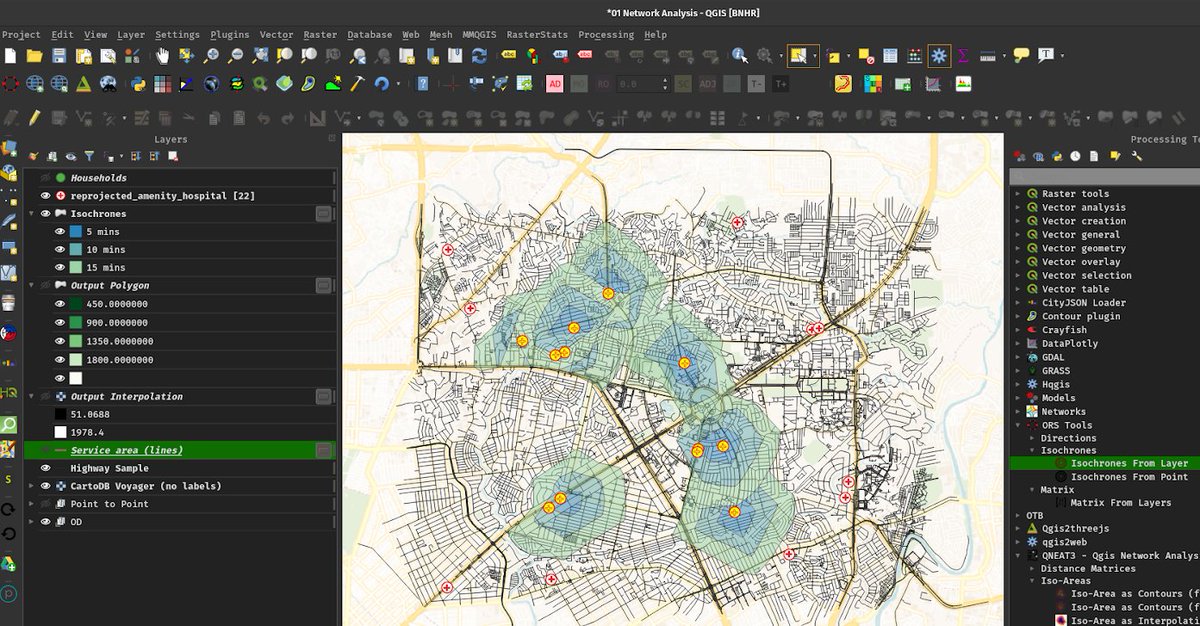
ALT QGIS User Interface
1
91
417
16,256

5 Jun 2025
Great to see a project that's been around a long time, with another release: MapGuide Open 4.0.0-beta3 released trac.osgeo.org/mapguide/wiki… #foss4g

1
5
292

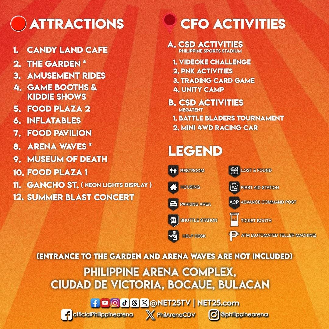
Para mas smooth ang gala mo, check out the SummerBlast 2025 Map Guide!
Alamin kung saan ang entrance, booths, fun activities, redemption areas, at iba pang important spots!
Remember: ✅ Follow the signs ✅ Ask our marshals kung naligaw ✅ Most importantly, enjoy every moment!
Save this guide para ready ka na sa big day!
See you at the Philippine Arena and Sports Stadium!
#SummerBlast2025 #NET25 #MapGuide
13
42
1,715

27 Mar 2025
Remember maps? 🗺️ Snag your FREE National Geographic MapGuide before supplies run out. bit.ly/42aiTW5

1
547

25 Oct 2024
Connectivity Unlocked: Access Silver City from Key Cities Across Pakistan!
📱 UAN: 0304 111 86 86
🌐 silvercity.pk
#SilverCity #Connectivity #RealEstatePakistan #LocationAccess #StrategicLocation #InvestInSilverCity #TravelPakistan #MapGuide #PropertyInvestment
2
22

9 Oct 2024
Geo Tools
geocreepy → geocreepy.com/
Sentinel Hub → sentinel-hub.com/
Geosocial Footprint → geosocialfootprint.com/
Batch Geocoder For Journalists → geocode.localfocus.nl/
Google Workspace Marketplace → workspace.google.com/marketp…
Geoserver.org → geoserver.org/
OpenLayers → openlayers.org/
Google Maps Platform | Google DevelopersGoogleGoogle → developers.google.com/maps
Leaflet → leafletjs.com/
Welcome to the QGIS project! → qgis.org/en/site/
Planet → planet.com/
Welcome to MapServer → mapserver.org/
Mapguide Osgeo → mapguide.osgeo.org/
6
10
1,239

24 Feb 2024
FREE National Geographic Crown of the Continent MapGuide
hunt4freebies.com/free-natio…
2
308
2 Jan 2024
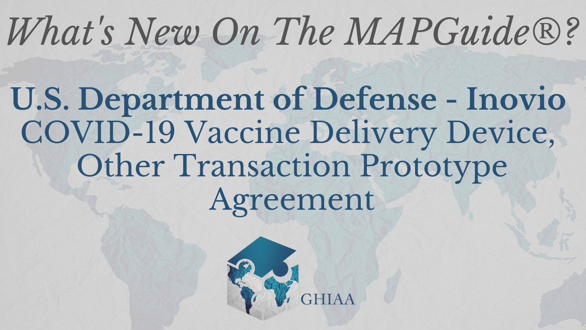
New on the #MAPGuide: This agreement includes a Most Favored Customer provision under which Inovio agrees that it will not sell the production model of the Prototype to any entity at a lower price than that offered to the DoD.
Read the agreement here: ow.ly/LeMn50Q6yBb
3
174
20 Nov 2023
Announcing a tool designed to make equitable access agreements just a little bit clearer. Coming November 27, 2023.
#GlobalHealth #EquitableAccess #MAPGuide
1
4
64
10 Jul 2023
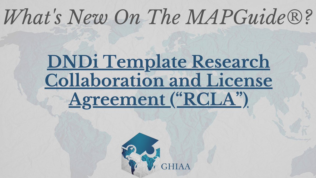
New on the #MAPGuide: @DNDi Template Research Collaboration & License Agreement. The RCLA sets the expectation that any Development Program will prioritize affordable distribution of the product in all countries in which the disease is endemic.
Read it: ow.ly/M1HP50P4lcJ
1
2
134

17 Jun 2023
The Seattle Map is Live! Will be working on updating my other maps soon! heravenue.com/travelmap
#travelmap #seattle #travelcontentcreator #seattletravel #googlemaps #travelblogger #summertravels #mapguide

2
62

26 May 2023
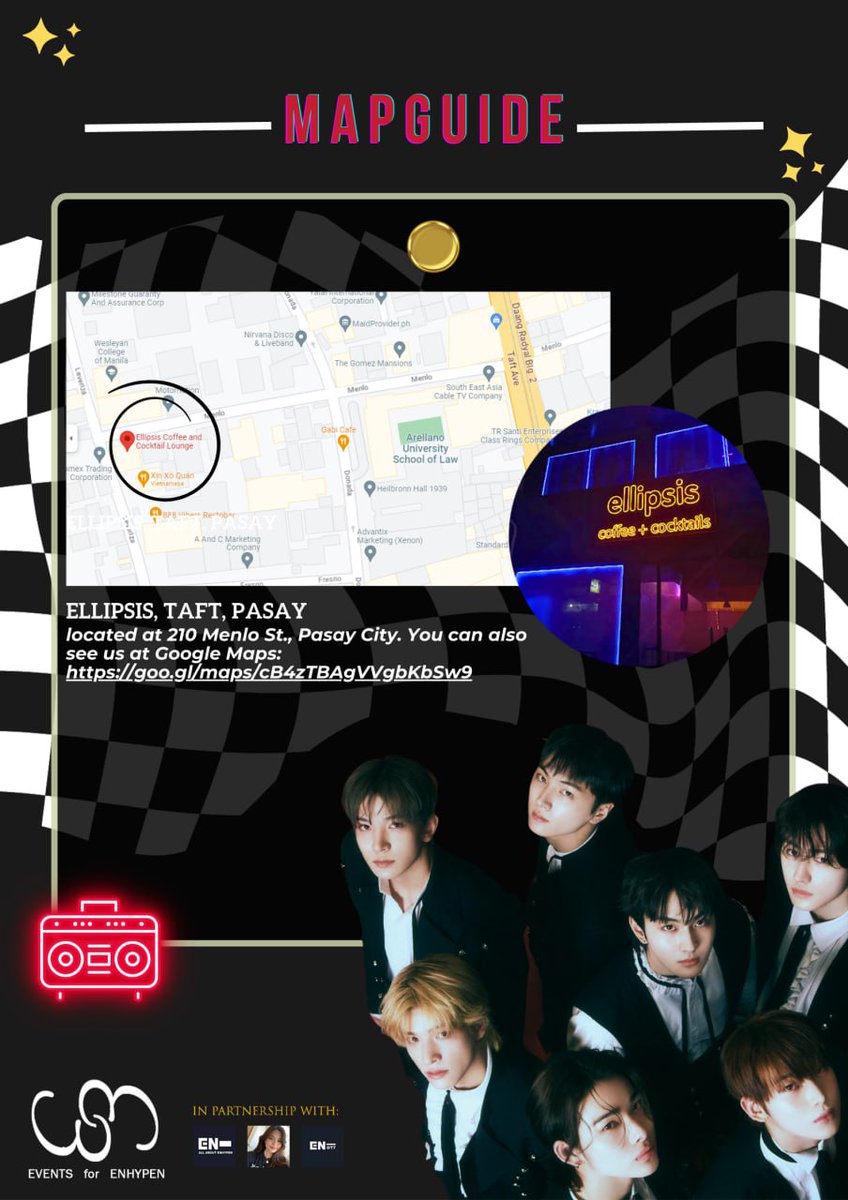
MAPGUIDE for Ellipsis, Taft!
If you have questions/inqueries, do DM us.
Thank you!
1
348
27 Apr 2023
Our monthly newsletter is out now! Read more about our case study of the @Novavax COVID-19 vaccine, @DNDi's exciting recent publications, and some new #MAPGuide updates from @MedsPatentPool and Afrigen Biologics
linkedin.com/pulse/policies-…

1
1
2
183
19 Apr 2023
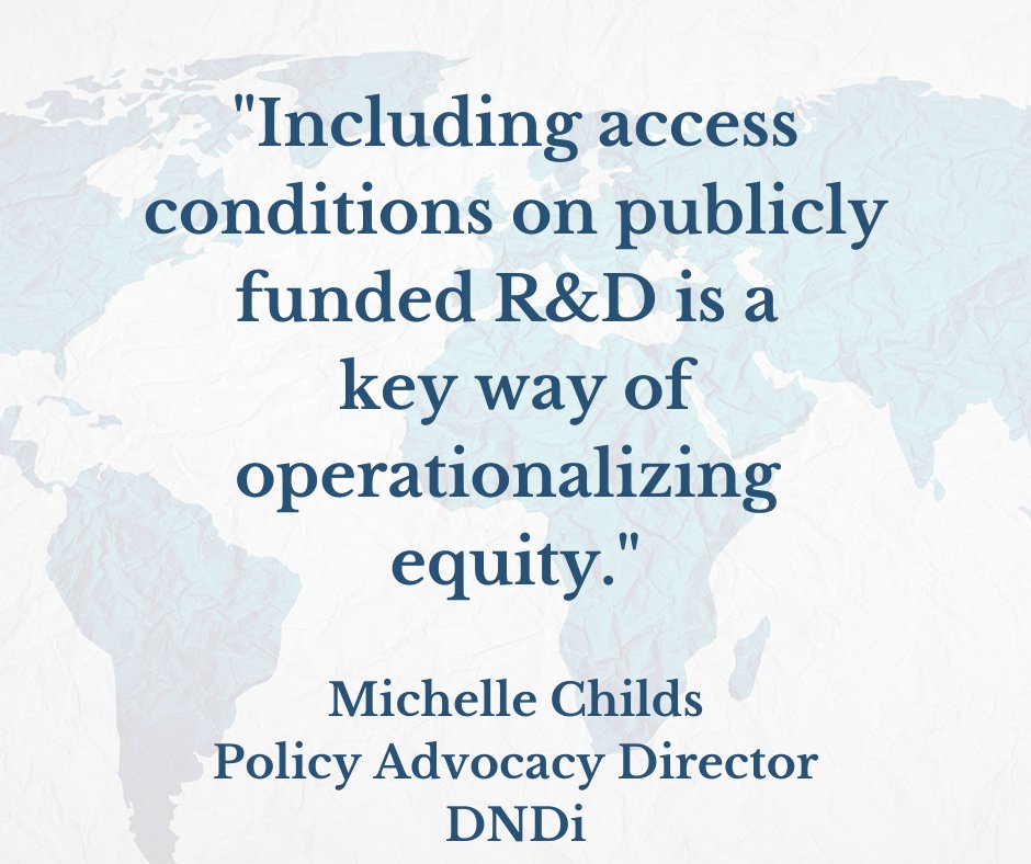
We applaud @DNDi's transparency & acknowledgment of the challenges & rewards encountered by all negotiators of equitable access terms! Look out for our analysis of DNDi's model agreements in @GHIAAteam's ®MAPGuide provision database. Coming soon!
18 Apr 2023

Last week, @DNDi published an important @JIPLP paper in which it shares its experience & agreement templates, providing insight into how the provisions in R&D collaboration agreements can facilitate #EquitableAccess to the resulting products. #globalhealth bit.ly/41DBnMJ
1
2
38