
Apr 30
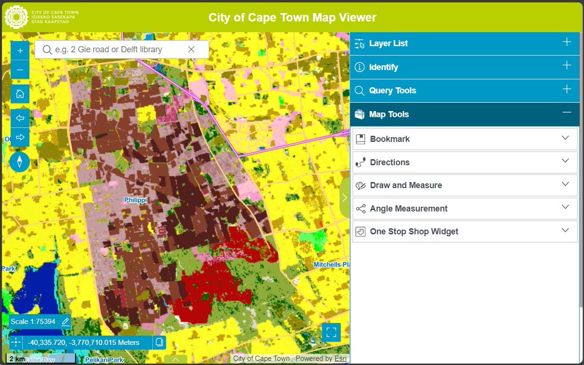
The City is launching a redesigned MapViewer on 30 April 2026, offering a more intuitive way to access maps and city data. Users can view property info, services, planning data and log service issues in one place.
See: brnw.ch/21x2404

9
17
1,447

Apr 6
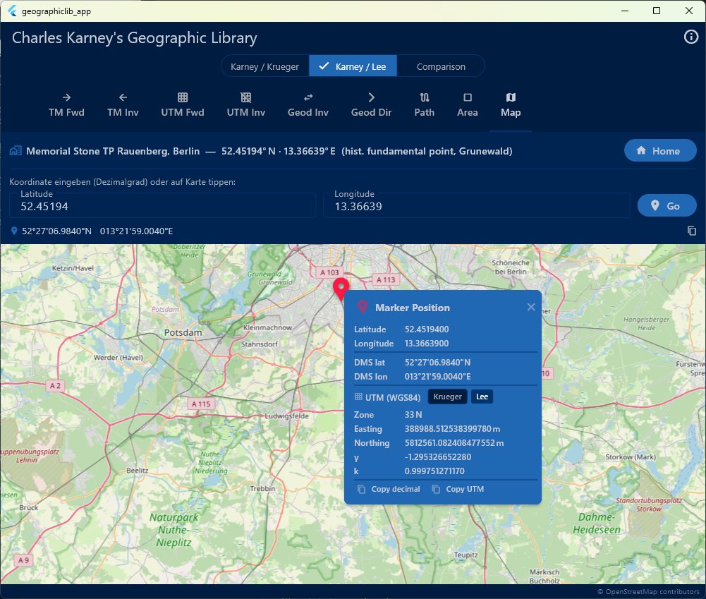
A small extension to my @FlutterDev app for Charles Karney's GeographicLib: coordinate input or point picking on the map, and conversion to UTM based on Krueger and Lee accuracy.
fmatz.com/flutter/geolib/
This completes the component for coordinate transformation, as a component for my @FlutterDev Mapviewer Editor.
2
88

Upgrade your mapping in #MapViewer! With this latest #ArcGISOnline release you can define visible time ranges, animate any vector symbol, draw and edit curved features, and more. Read the blog to learn about these new features. Read here ➡️ ow.ly/4KrJ50YmLkV
2
8
556

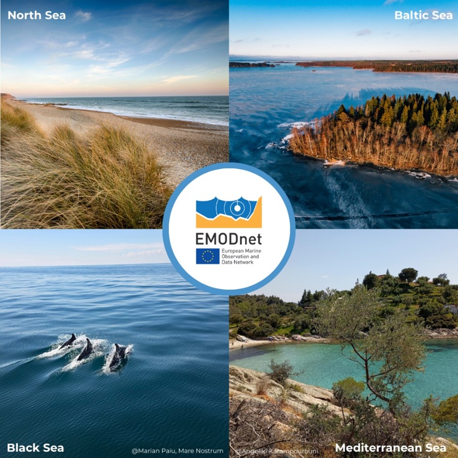
#DYK EMODnet offers #MarineData and #DataProducts for Europe's diverse regional sea-basins? 🌊 With the EMODnet #MapViewer you can browse, visualise and select the area(s) you need, or simply download the fully harmonised European scale maps!
2
4
331

25 Jul 2025
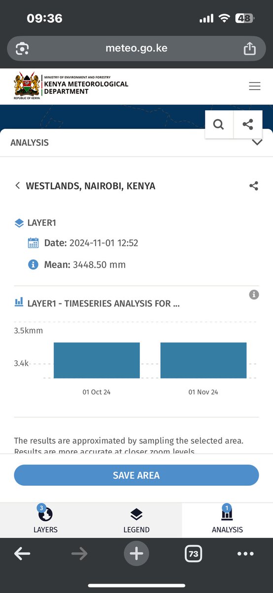
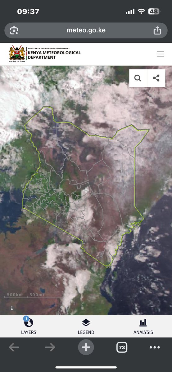
📊 Discover Kenya’s Weather Maps with KMD MapViewer!
Explore Kenya’s climate like never before — free access to weather & environmental data at your fingertips.
🔍 Explore features like:
•Daily & 10‑day maps for rainfall, temperature, wind, humidity, soil moisture, pollution, and more.
•High‑resolution visuals built from merged station and satellite data.
•Tailored insights by county or grid point for agriculture, aviation, health, energy, and planning sectors.
📍 All available online, mobile‑friendly, and continuously updated.
👉 Visit now: meteo.go.ke/mapviewer/
🔗 Learn more about KMD Data Services: meteo.go.ke/Services/climate…
✅ Open access, scientifically reliable, and designed for decision‑making!
Suggested visuals:
•Screenshot of daily rainfall or temperature overlay in county view.
•Overlay text: “KMD MapViewer – Kenya’s Interactive Climate Maps”.
•Hashtags: #KMD #MapViewer #WeatherData #KenyaClimate #OpenData
1
7
1,118

19 May 2025
A tout hasard, qui utilisait Eumetrain MapViewer pour l'observation et le suivi des orages avec différents paramètres ? Chez moi, l'interface est down, je suis dégoûté. Cela marche chez vous ?
5
1
16
3,902


26 Mar 2025
ArcGIS Online'daki son güncellemeyi gördünüz mü? Heyecan verici yeni yeteneklerle birlikte geliyor!
Yenilikleri inceleyin: esritr.link/glpeoh
🌎 Map Viewer'da animasyonlu semboller
🌎 ArcGIS Data Pipelines'da Yeni Öznitelikleri Özetleme aracı
🌎 Birden fazla Bina Sahne Katmanını (BSL) aynı anda görüntüleyin
ve daha fazlası!
#ArcGISOnline #Release #Güncelleme #ArcGIS #EsriTürkiye #Esri #TheScienceOfWhere #CBS #CoğrafiBilgiSistemleri #MapViewer #DataPipelines #BuildingSceneLayers #Update

1
5
229

5 Mar 2025
ArcGIS Onlineがアップデートされました。
主な機能追加・機能改善
〇MapViewer
・シンボルのアニメーション
・フィーチャ テンプレートの作成、管理、更新
〇Scene Viewer
・複数のビルディング シーン レイヤーの表示
他にも追加・改善された機能があります。
詳しくはこちら:
buff.ly/1859DN9
1
6
992

23 Jan 2025
🌐💻➡️ En esta entrada se va a mostrar cómo incluir imágenes en datos de tipo punto en un visor de 𝗔𝗿𝗰𝗚𝗜𝗦 𝗼𝗻𝗹𝗶𝗻𝗲.
Enlace: cursosgis.com/como-incluir-i…
#ArcGISOnline #mapviewer #ArcGIS
5
8
301


14 Nov 2024
Great news! #ModelBuilder (Beta) is now available in #MapViewer! Build #models that connect #analysistools and #data together. Read more about the update in the #ArcGIS blog post. Happy Modelling!
#GIS #ArcGISOnline #STEAM #GISSkills #mapping
esri.com/arcgis-blog/product…
1
2
99


20 Aug 2024
In 3 days, @esriuk & @EsriIreland webinar: #Web #Editing with ease and efficiency in #ArcGIS tinyurl.com/msy84b25
#MapViewer #WebEditor #ArcGISApps #SweetForArcGIS #data #editor #GIS #esri #mapping @Esri @ArcGISOnline @ArcGISApps

5
206

31 Jul 2024
Attraverso il MapViewer è possibile visualizzare immagini in colore naturale (RGB), Infrarosso e NDVI per il 2024(lato destro) e confrontarle con quelle del recente passato (lato sinistro).
Già con la composizione in RGB è possibile vedere significative differenze nel paesaggio
1
4
466


يغطي هذا البرنامج التعليمي @GISinSchools الخطوات الأساسية للبدء في رسم خرائط الويب باستخدام ArcGIS MapViewer. عزز مهاراتك في رسم الخرائط عبر الإنترنت باستخدام خرائط الويب التفاعلية.
#ArcGIS #Basemap #MappingData #MapViewer #Tutorial #ArcGISforSchools
15 May 2024

This @GISinSchools tutorial covers the essential steps to get started with web mapping using ArcGIS MapViewer. Enhance your online mapping skills with interactive web maps.
#ArcGIS #Basemap #MappingData #MapViewer #Tutorial #ArcGISforSchools youtu.be/ThJuR9lXckc
3
5
1,519

15 May 2024
This @GISinSchools tutorial covers the essential steps to get started with web mapping using ArcGIS MapViewer. Enhance your online mapping skills with interactive web maps.
#ArcGIS #Basemap #MappingData #MapViewer #Tutorial #ArcGISforSchools youtu.be/ThJuR9lXckc
2
1
7
2,269
30 Apr 2024
🌐💻➡️ En esta entrada se va a mostrar cómo incluir imágenes en datos de tipo punto en un visor de 𝗔𝗿𝗰𝗚𝗜𝗦 𝗼𝗻𝗹𝗶𝗻𝗲.
Enlace: bit.ly/iconos_ArcGIS-Online
#ArcGISOnline #mapviewer #ArcGIS
2
15
367
