
#Trimble Terra Office v2026.10 is Now Available!
bit.ly/4ogdlUA
#PLI #Geospatial #GeospatialSolutions #GeospatialAnalysis #SurveyLife #Surveying #LandSurveying #SurveyingSoftware #GPS #GIS #GNSS #Mapping #MappingSoftware #ArcGISPro #ArcGIS #NSPS #PLS

42

4 Jun 2024
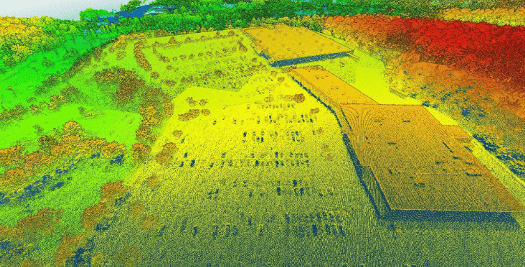
Creating a topographic map from a point cloud
Read more: hubs.la/Q02zqK8L0
#mapping #drone #mappingsoftware #geospatial #tech @BlueMarbleGeo
1
3
196
3 Jun 2024
In Global Mapper Pro, you can create a topographic map from a point cloud. With @BlueMarbleGeo's article, “Creating a Topographic Map from a Point Cloud,” learn how to make your own.
Read more: hubs.la/Q02zcxzZ0
#mapping #drone #mappingsoftware #geospatial #tech
3
313

15 May 2024
Welcome to PixElement: Your Solution for #aerialmapping!
We are thrilled to introduce you to PixElement’s cloud-based software, designed to meet all your #3Dmodeling and #mapping needs. Check out the #tutorial below:
#mappingsoftware #photogrammetry
youtube.com/watch?v=9LN8Hf-x…
1
2
24

13 Mar 2024
Head of Technology, Rob Morrison shares that spatial data is being used to create sophisticated models called ‘digital twins’ which help to plan and manage infrastructure more efficiently. #GIS #MappingSoftware #DataAnalytics @businessposthq
esri.social/1nLv50QSu4Q

138
18 May 2023
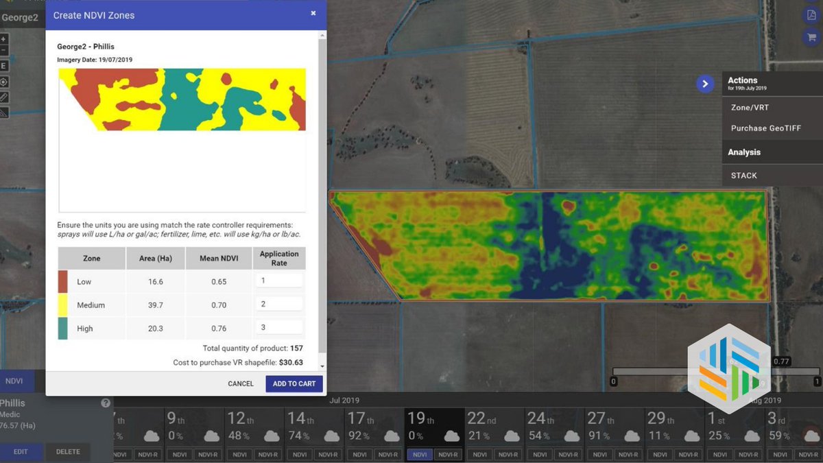
Amanda Lind from @BlueMarbleGeo explains the automated method of extracting curbs as line features from elevation data using Global Mapper. Read more: buff.ly/3OopIOG
#geospatial #mapping #software #mappingsoftware #geospatialtechnology
1
3
534

9 May 2023
🗺️🚀 Maptitude 2023: The ultimate tool for business development is out now! 🎉🎉 The powerful mapping & GIS analysis app is easy-to-use & affordable. Visualize your data & gain valuable insights that drive success. #businessdevelopment #mappingsoftware caliper.com/press/pr20230504…
1
3
67

12 Mar 2023
7
22
2,954
21 Feb 2023
4
2
662
17 Feb 2023
1
2
3
755
20 Jan 2023
1
2
406
13 Jan 2023
6
3
640

26 Sep 2022
Heard of #GIS? Not exactly sure what it is? See why GIS is on the rise, and start creating powerful maps yourself. No special training required.
#ConstructionTechnology #GeographicInformationSystems #MappingSoftware
hubs.li/Q01ncYYG0
2

3 Mar 2022
Interested in using drones for commercial mapping? Here are six of the top drone mapping software options for 2022: commercialuavnews.com/regula… #PADrone #DroneMapping #MappingSoftware #Drone #CommercialDrone11
3
3
3 Mar 2022
Interested in using drones for commercial mapping? Here are six of the top drone mapping software options for 2022: commercialuavnews.com/regula… #PADrone #DroneMapping #MappingSoftware #Drone #CommercialDrone
2
3

7 Dec 2021
Here is a #TuesdayTip: Our #QuickMap 3D® app makes #Crash and #CrimeScene mapping quicker and easier than ever. Pair the smartphone/tablet #MappingSoftware with an LTI #laser to get down to the facts faster with an optimized workflow tinyurl.com/2p9ye3n7
2

19 Nov 2021
Say hello to effortless data collection. Say goodbye to unreliable paper forms. Say hello to KOREC Capture youtu.be/61r2N5PMVj8
#mapping #gis #mappingsoftware #positioning
2
2

27 Sep 2021
Return to School with Just the Right Digital Map Tool! In this free #webinar, #Esri will cover free #mappingsoftware; entry-level, standards-based #GeoInquiry activities for the class; and tips and tricks for flexible instruction with #digitalmaps.
ow.ly/AUTy50Gfih4
#k12

1
4

17 Sep 2021
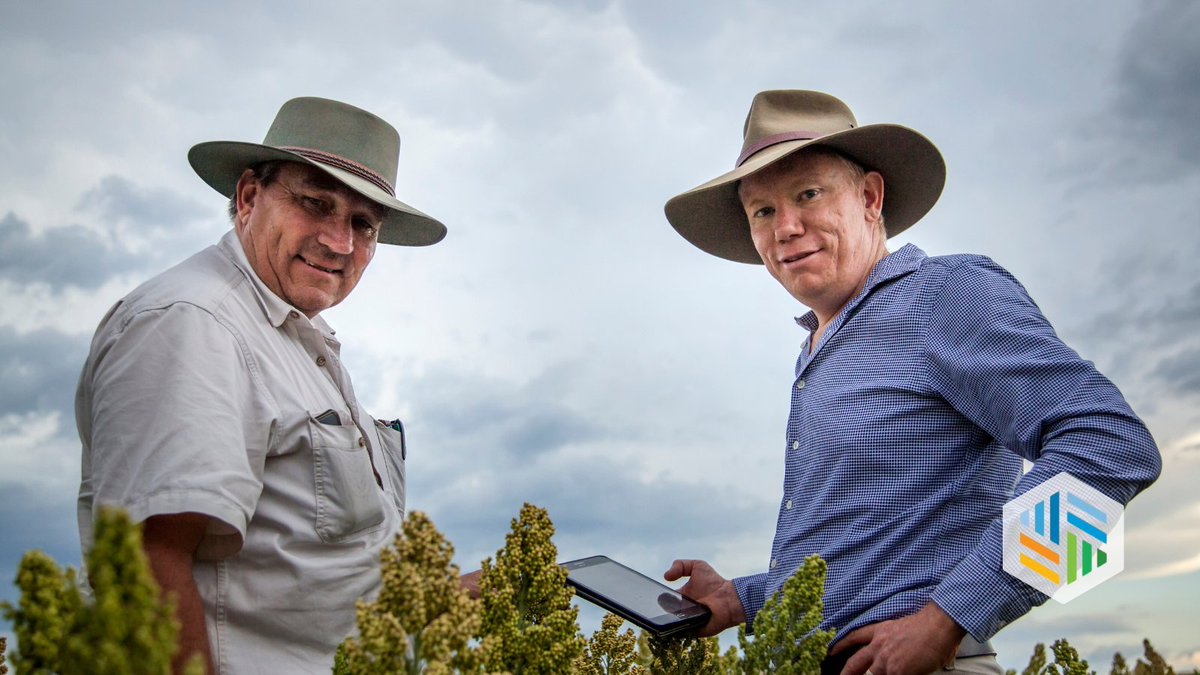
At #DataFarming, we consider ourselves #agtechleaders.
We’re constantly searching the globe 🌏 for the latest and greatest #satellitedata, 🛰 to continually improve our #mappingsoftware for #agriculture 👨🌾
2
15 Sep 2021
DataFarming is all Australian & developed for #aussiefarmers 🚜 by 20 year #precisionag veterans.
We’re proud that our #geospacial #mappingsoftware is now benefiting #agriculture across the globe 🌏 #DataFarming
2
7