
May 11
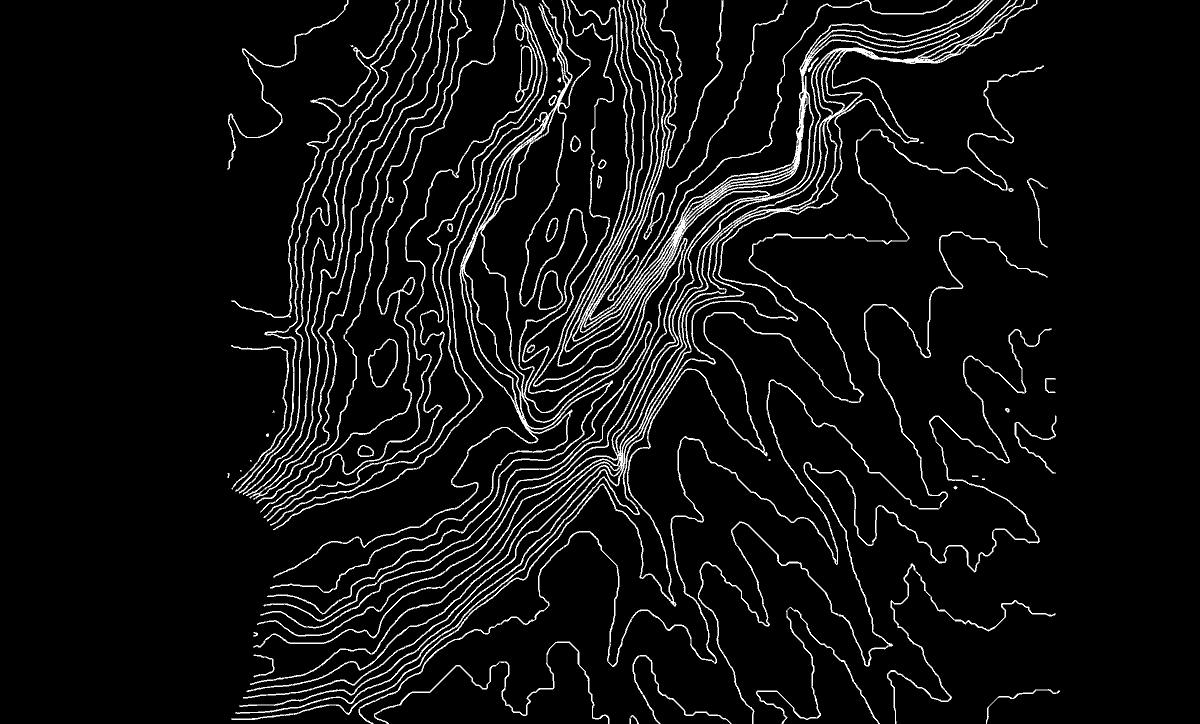
Day 92. Hong Kong Crosshatch 🏙️
Sometimes the right move is not more data, but a different way of seeing it.
This map reads Hong Kong in pen-and-ink style: Tangram JS (WebGL) for rendering, Leaflet for navigation, and shader crosshatching where line density carries structure.
Dense fabric, vertical rhythm, irregular shoreline - great fit for line-based form reading.
maptheclouds.com/playground/…
#100DayMapChallenge Day 92/100
#TangramJS #Leaflet #WebGL #OpenStreetMap #Geospatial #DataVisualization #HongKong #Shaders #CreativeCoding #3DMaps #Cartography
2
13
710

Note, forgot to give a proper mention to inspiration
- @codetaur series of posts like x.com/codetaur/status/196778…
- Olive Groves ( I think @LarsMaxfield) impasto.dev
- @TangramJS height-mapper @mapzen
Might be useful to you @youwillmakemaps, @giswqs etc

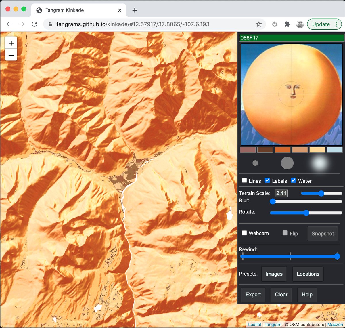
added curvature to my threejs terrain color shader options.
now there's height, slope, hillshade, and curvature
3
134
20 Mar 2023
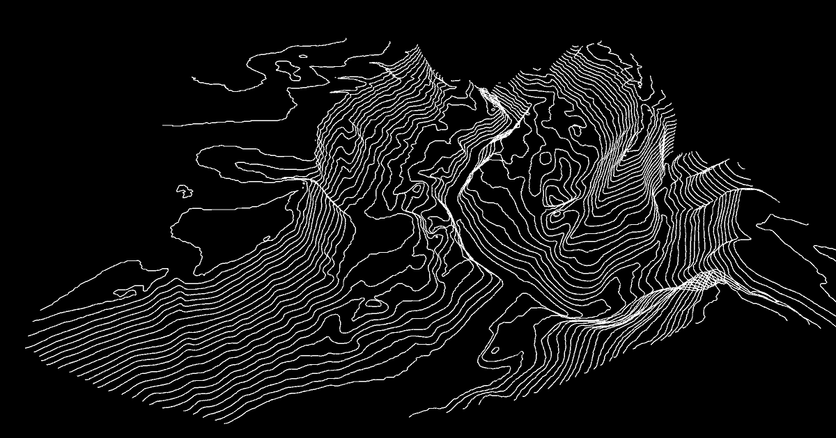
Hong Kong 香港 reloaded.
Live: maptheclouds.com/playground/…
Music by Music_For_Videos from Pixabay.
#TangramJS #webgl #shaders #hongkong
9
704
2 Nov 2022
#30DayMapChallenge Day 2: Lines
Here's a stunning map style from the god of shaders. ✏️🙂
'Hong Kong 香港'
Live: maptheclouds.com/playground/…
@patriciogv #TangramJS #webgl #shaders #crosshatch #map #3D
2
1
11

26 Sep 2022
Search @bruno_simon’s “threes journey” for an introduction to threes and baked lighting. You’ll also need to learn to write shaders (vertex shader, fragment shader), so you can displace the vertices according to a height map.
1
1
2
23 Sep 2022
Hi, thank you! Look into three.js if you want to code something like this for the web browser. You could also try a program called Unity, which is designed for making games but could also do something like this.
1
3

18 Oct 2021
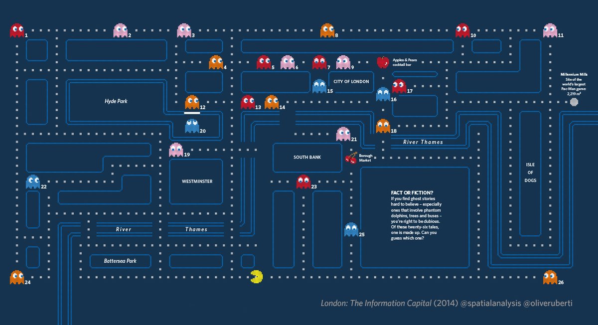
Nice!😆Reminds me of when @BandaiNamcoUS helped us create our 'Ghosts of London Past' in @theinfocapital and told us to correct the color of the stems on the🍒&🍎
2

1 Oct 2021
Ahh thanks for these, it's really nice to see the Mapzen tiles still being used 👍
1
1

1 Oct 2021
oh! another fun project! This is the repository of that one github.com/mapzen/terrarium I'm happy to see this technique resurfacing 6 years later!
1
1 Oct 2021
Oh man! I love encoding data in PNGs. I think the example you are referring is this wind map github.com/tangrams/WeatherO… Each weather station in the US a row and the columns are samples. I like that you can actually see the transition to winter
1
2
5
1 Oct 2021
Getting some @TangramJS vibes here! Seems to be based on regl – I think @patriciogv was the first to use this trick in a Tangram map, looks like this example might be using github.com/sasakiassociates/…
1
3

12 Jul 2021
I still only have the basics of Arabic display; next goals are quality line breaking, justification and bidi for map labels! @TangramJS has open sourced some work related to Arabic on curved paths: github.com/tangrams/tangram/…
2


23 Mar 2021
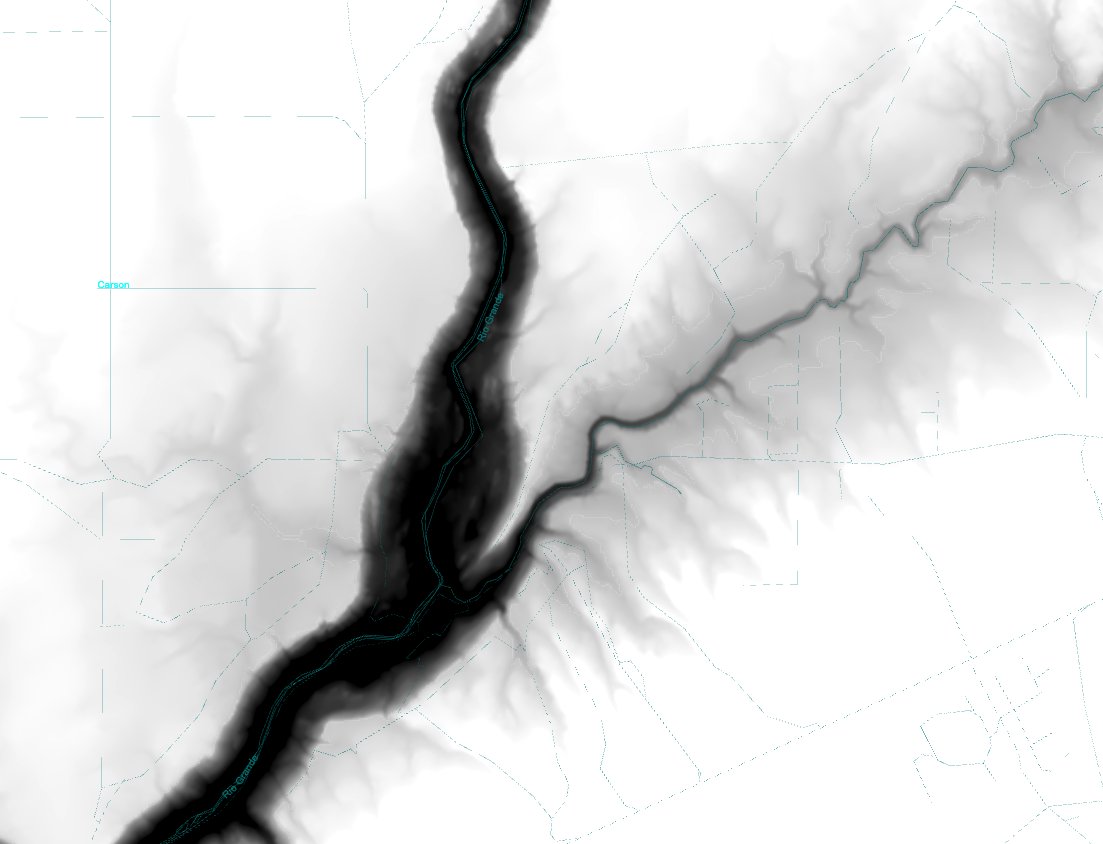
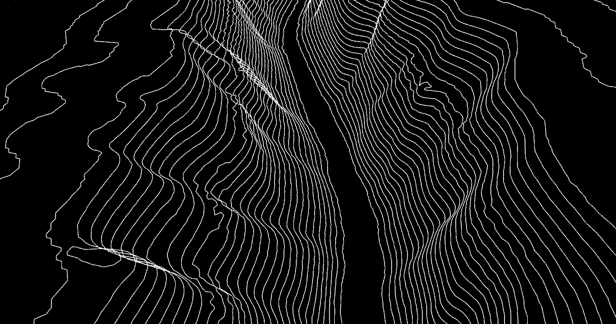
Looking for interesting uneven terrains on @TangramJS Heighmaps to explore topographic-lines 3D visualisations. Bellow Rio Grande Canyon (in New Mexico, near TAOS)
1
8


16 Dec 2020
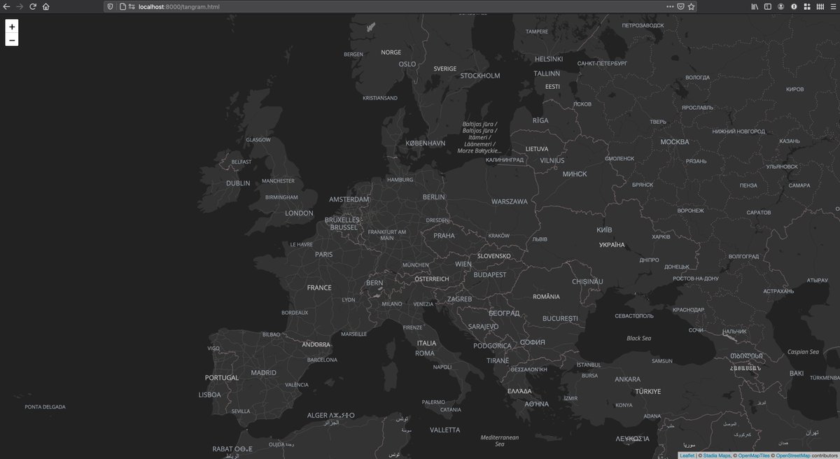
Very cool to see @TangramJS get a shout out in the Amazon Location Service docs. But I guess they didn't hear about Mapbox GL?
docs.aws.amazon.com/location…

1
8

11 Dec 2020
Update: a first pass is now published! @TangramJS vs GL screenshots attached. Text styling is still WIP & lines are a bit off. I'll be populating an issue backlog with the items that are priorities for me, but hope this turns into a collaborative project. github.com/stadiamaps/cartog…

1
1
2