
Project IGI 3D Editor
Create epic IGI maps , edit missions, and build your dream levels ! Open-source & FREE
🔗 github.com/jones-hm/project-…
#ProjectIGI #IGIEditor #LevelDesign #GameDev #OpenSource #3DMaps #Gaming #RetroGaming #PCGaming
6

3d map the best village in the alpine landscape #3DArt #3DArtist #Render #3DRender #Blender3D #b3d #3DMap #3DMaps #3DVisualization #3DVisuals #Mapping #Cartography #Paesaggioalpino #alpinelandscape

2
6
87
3,106

May 20
I just tried Mapterhorn terrain in OpenGlobus - and my first impression is literally: WOW, it looks amazing!
Clean, detailed, visually pleasant relief, and it loads surprisingly fast. Really like the idea behind it: open-data terrain built for modern web mapping. Huge respect to @leichteralsluft for pushing this forward.
Check it out 👉 mapterhorn.com/
#OpenGlobus #Mapterhorn #WebGL #GIS #OpenData #3DMaps
4
10
450

May 19
Day 100. Silent Moon 🌘
When Artemis II carried four humans around the far side of the Moon again, the story was easy to follow, but the trajectory still felt abstract in my head. I started building Silent Moon as a browser scene where the mission path stays readable in motion instead of collapsing into a decorative curve.
The initial version focused on clarity: one continuous trajectory from real orbital vector context, stable phase markers, and labels that hold up while the camera moves.
From there, scroll-driven narrative, camera locking between Moon, Earth, and Orion, and continuous tracking so navigation does not snap you out of the mission thread.
Later iterations added atmosphere: clearer Earth and Moon textures, a subtle glow layer, a denser star field, and tuned trajectory contrast for dark space. ✨
Stack: React, Three.js, React Three Fiber, and Drei, with shader work where lighting stays physically coherent.
Still a work in progress, but the clearest articulation so far of how I want to connect geospatial craft to cinematic mission storytelling without losing engineering honesty. 🚀
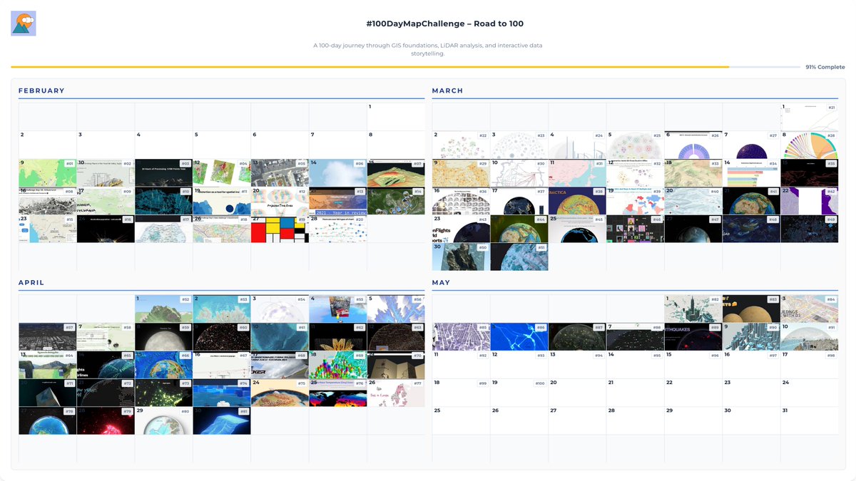
Day 100. Campaign complete. 🌍
100 consecutive days of showing up, shipping work, and building in public. Thank you for following this journey. The work continues. ❤️
#100DayMapChallenge Day 100/100
#3DMaps #Artemis #ThreeJS #WebGL #SpaceExploration #DataStorytelling #DataVisualization #Animation #Geospatial #NASA #ReactThreeFiber #Interactive3D #MapTheClouds #CampaignComplete
2
219
May 18
Seven projects, but one of them ended up defining the week.
The week opened with stylized cartography and local scale: Hong Kong crosshatch linework through Tangram shaders, a Cluj five-minute walking footprint, then Cluj County forests where QGIS prep met Three.js terrain. In The Clouds continued the thread into supertall storytelling on a MapLibre Three.js stage with GSAP carrying the comparisons.
Then came Inner Fire: a realtime seismic monitor where earthquake activity behaves more like a living spatial system than a static dashboard, built on React 19, R3F, GLSL, MapLibre, and the live USGS feed routed through a coherent time engine.
It also became my first proper experiment using AI as a coding collaborator. ChatGPT carried much of the vision work, the creative brief, and the first HUD scaffold. Gemini joined as the 'app architect,' reviewing React 19 purity, hook discipline, and render-loop performance. Claude later helped refine components and 3D scene iteration during the Cursor passes.
The second half became quieter: balloons through a Mapbox Three.js skyline, then The Earth in Blender, a materials and lighting study that also became the offline globe model behind several later web visualizations, Inner Fire included.
The projects kept changing, but the underlying approach stayed remarkably similar: choosing the tool that best serves the question.
Week 15 begins today.
#100DayMapChallenge Day 92-98/100
#InnerFire #DataVisualization #Geospatial #ThreeJS #React #WebGL #AI #AICoding #ChatGPT #Claude #Gemini #Cursor #GIS #3DMaps #MapLibreGL #Animation #GSAP #QGIS #Blender #WeeklyReflection

ALT Week 14 reflection centered on Inner Fire, a realtime 3D seismic monitor and the first proper AI-assisted build of the campaign. Surrounded by Hong Kong crosshatch shaders, Cluj walk and forest studies, In The Clouds supertalls, hot air balloons, and The Earth in Blender. Days 92-98 of the #100DayMapChallenge.
3
240
May 16
Day 97. Hot air balloons everywhere! 🪂
Late-campaign lightweight piece: one clear visual idea, but still built on a proper geospatial stack.
Hot air balloon glTF above dense 3D buildings in Mapbox GL JS, with animation lighting in a custom Three.js layer rendered over the map WebGL canvas.
Click/touch relocates the balloon. Playful interaction, geographically anchored.
maptheclouds.com/playground/…
#100DayMapChallenge Day 97/100
#ThreeJS #WebGL #MapboxGL #MapTiler #Geospatial #CreativeCoding #Animation #3DMaps
2
12
892
May 15
Day 96. Inner Fire 🔥
Global seismic activity has always felt strangely alive to me. Not just as data points on a map, but as a continuous planetary pulse unfolding through time.
Inner Fire is my current attempt at exploring that idea: a realtime seismic monitor where earthquake activity behaves more like a living spatial system than a static dashboard, balancing atmosphere, clarity, and performance while staying operationally readable.
It also became my first proper experiment using AI as a coding collaborator.
The process started with ChatGPT, where the initial vision, creative brief, and first HUD structure took shape around a live USGS-driven globe built with React, Three.js, GLSL, and a temporal simulation engine. Gemini later joined as the “app architect,” reviewing React 19 purity, hook discipline, and render-loop performance, while Claude helped refine components and 3D scene iteration during the Cursor passes.
The system gradually evolved into GPU-instanced eruption lifecycles, synchronized simTime playback, virtualized seismic feeds, atmosphere and cloud layers, and more recently a MapLibre globe overlay for close-range navigation.
The AI did not build the project. It shortened the distance between an idea and a first working scene.
Inner Fire is still evolving, but it has already become the project I point to whenever someone asks what AI-assisted development actually feels like in practice.
maptheclouds.com/inner-fire/
#100DayMapChallenge Day 96/100
#AI #AICoding #ChatGPT #Gemini #Claude #Cursor #ThreeJS #DataVisualization #Seismic #Geospatial #Animation #3DMaps
1
7
310

May 14
Small but important OpenGlobus v1 rendering update:
Text rendering has been migrated to MTSDF: sharper fonts, cleaner outlines, and fixes for several special-character issues.
Live examples:
sandbox.openglobus.org/examp…
sandbox.openglobus.org/examp…
#OpenGlobus #WebGL #Geospatial #3DMaps #Terrain #PlanetaryMapping
1
6
93
May 13
Day 94. Cluj County forests, România 🌳💚
Quieter, more personal chapter after playful map experiments: Cluj County as one continuous story of canopy relief.
Workflow stays grounded in QGIS preprocessing and Three.js/WebGL rendering, while swipe interaction makes mountain growth feel tactile instead of purely visual.
maptheclouds.com/playground/…
#100DayMapChallenge Day 94/100
#ThreeJS #WebGL #QGIS #Geospatial #Animation #CreativeCoding #3DMaps
1
15
879
May 12
Day 93. Cluj-Napoca 5-minute walk 🚶
This one is intentionally small and local: how much of a city becomes reachable within roughly five minutes on foot?
The map stays centred on Cluj-Napoca and keeps the visual language simple (Three.js/WebGL), while Openrouteservice provides walking isochrones over Stamen Design tiles and OpenStreetMap data.
Right click anywhere to generate 5, 10, 15, 20, 25, and 30-minute walking ranges and compare accessibility across the city.
maptheclouds.com/playground/…
#100DayMapChallenge Day 93/100
#ThreeJS #WebGL #Geospatial #Walkability #Urban #ClujNapoca #Romania #Cartography #3DMaps
1
7
696
May 11
Day 92. Hong Kong Crosshatch 🏙️
Sometimes the right move is not more data, but a different way of seeing it.
This map reads Hong Kong in pen-and-ink style: Tangram JS (WebGL) for rendering, Leaflet for navigation, and shader crosshatching where line density carries structure.
Dense fabric, vertical rhythm, irregular shoreline - great fit for line-based form reading.
maptheclouds.com/playground/…
#100DayMapChallenge Day 92/100
#TangramJS #Leaflet #WebGL #OpenStreetMap #Geospatial #DataVisualization #HongKong #Shaders #CreativeCoding #3DMaps #Cartography
2
13
710
May 11
Week 13 Reflection
This week moved between very different map experiments and spatial systems, from audio-reactive city motion and walkability to atmospheric particle studies and a major full-stack environmental platform.
The second half returned to browser 3D and map-native interaction through World Earthquakes, Making Lights, and Snow Dome Anywhere.
Not every day is a traditional map, and that is intentional. This campaign became a way to revisit projects, client systems, and failed ideas that shaped my spatial storytelling practice.
A personal note about AI.
For a while, I was genuinely angry at it. After years of struggling with freelancing, I had finally started to feel that things were stabilizing, then mainstream AI arrived and the industry shifted again. It became difficult not to question whether all those years of self-study, experimentation, uncertainty, and personal brand building had really been worth it.
This campaign became, in part, a way of acknowledging that past while trying to make peace with the future. Somewhere during these 100 days, I stopped seeing AI only as competition and started experimenting with it as a collaborator, amplifier, and extension of curiosity.
Now I sometimes feel like a kid at Hogwarts holding a magic wand for the first time. I have barely scratched the surface of what becomes possible when spatial thinking, rendering, storytelling, and AI start working together.
I still have a million map ideas in my head, except now many of them suddenly feel reachable.
Let’s bring them to life.
I’m available for new projects.
Thank you to everyone who joined me throughout this journey, and for all the support, patience, feedback, and conversations along the way.
Week 14 begins today.
#100DayMapChallenge #DataVisualization #Animation #Geospatial #GIS #OpenSource #3DMaps #FOSS4G #ThreeJS #WebGL #MapLibreGL #MapboxGL #QGIS
ALT Days 85-91 moved across very different spatial directions: audio-reactive city motion, walkability, particle-based atmosphere, a client-scale environmental platform, seismic and lighting studies, and Snow Dome Anywhere as a quiet 3D close. Different subjects, same method: follow the question, then choose the tool.
4
132
May 10
Day 91. Snow Dome Anywhere (3D Particles) ❄️
What happens when a city map shifts from analysis to atmosphere?
This experiment turns a dense 3D city view into a quiet snow-dome version of itself.
Mapbox GL JS holds the base with the MapTiler Winter theme, while a custom Three.js/WebGL layer adds snow particles, soft glow, and a subtle dome-like effect. Navigation remains fully explorable, but every click transforms the map into a small snow globe.
Inspiration: FOSS4G Bucharest 2019 - @RealIvanSanchez and @BNiene.
Even though I followed it only online, the work presented by these two wonderful people stayed with me throughout my growth as a freelancer. I remember seeing what they built and thinking: this is what I want to do with maps too - transform maps from static, boring images into compelling stories and experiences.
Thank you!
BTW: FOSS4G Europe 2026 is coming: 2026.europe.foss4g.org
The conference is planned for 29 June - 3 July 2026 in Timișoara, Romania.
Do not miss it - it might change your life.
#100DayMapChallenge Day 91/100
#ThreeJS #WebGL #MapboxGL #MaplibreGL #MapTiler #Geospatial #Animation #DataVisualization #OpenSource #3DMaps
1
15
909

🏙️🛰️ Mapas urbanos en 3D con R
Combinando osmdata, mapdeck y la potencia de Mapbox, es posible construir visualizaciones urbanas en 3D usando información real de edificios y su altura.
📍 Ideal para:
• Análisis de densidad urbana
• Planeación territorial
• Estudios de sombra, calor y verticalización
#RStats #GIS #Mapbox #UrbanData #Cartagena #DataVisualization #3DMaps
1
7
308
Day 90. Making Lights 🌚🌞
MapLibre GL JS over lower Manhattan keeps the same OSM extrusions, but routes them through custom WebGL where SunCalc positions the light and day or dark MapTiler JSON swaps at dawn and dusk so the basemap tracks the shader, while GSAP, lil-gui, and Turf handle animated time, uniforms, and footprint popups.
Buildings with raw WebGL on MapLibre.
maptheclouds.com/playground/…
#100DayMapChallenge Day 90/100
#MapLibre #WebGL #Geospatial #Animation #NYC #3DMaps
7
61
2,535
Day 93. City Streets 🌆
Simple brief, honest output: show main city streets people instantly recognise.
OSM roads prepared in QGIS, turned into a luminous 3D network in Three.js.
maptheclouds.com/playground/…
#100DayMapChallenge 93/100
#ThreeJS #WebGL #QGIS #OpenStreetMap #Geospatial #3DMaps
1
1
14
657

Apr 27
3D model maps of cities from RenderHub make it easy to create virtual environments. From games and animation walkthroughs to architectural visualization, these models give you the flexibility to bring your ideas to life.
renderhub.com/discover/3d-mo…
#3DMaps #3DCities #3DModels

3
175


Mar 15
Google Maps gets a Gemini AI brain boost. From 'Ask Maps' answering real-world questions to richer 3D maps for navigating roads, exploring and planning trips just got a lot smarter. 🗺️ #Google #GoogleMaps #GeminiAI #3DMaps #AskMaps community.designtaxi.com/top…
368