

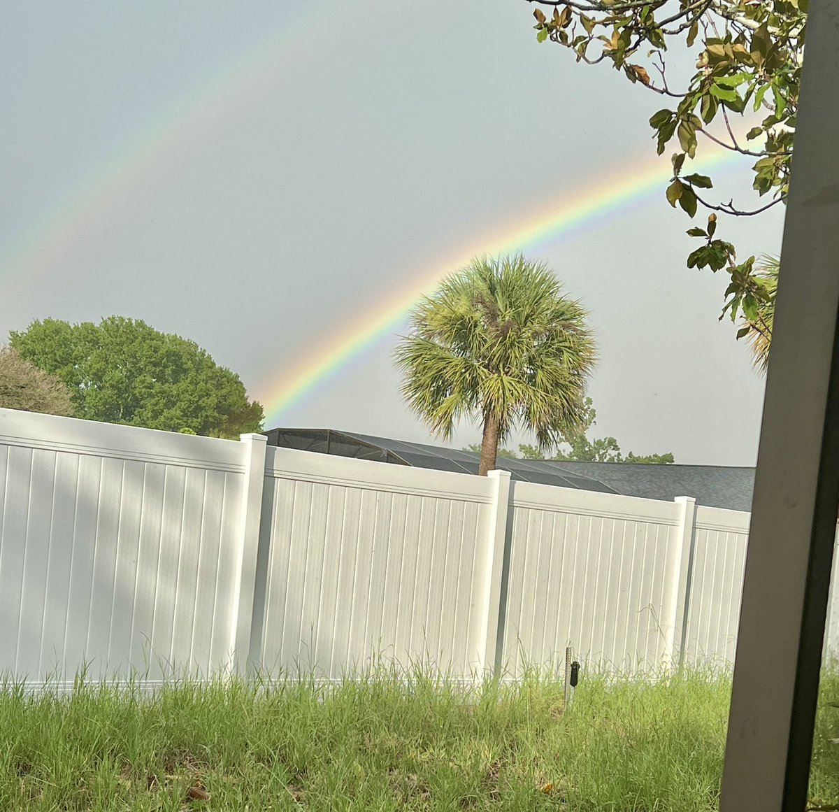
Holy crap that last strike was way too close!!! Double rainbow after the storm passed.
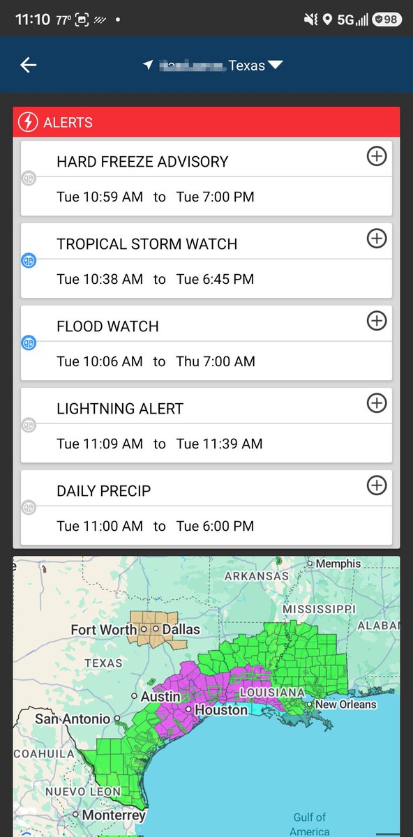
Map courtesy of @WeatherBug

8

Jun 16
WeatherBug app is just throwing all the alerts.
Dont know about a hard freeze in SETX in June but ill take it.
1
18

Jun 16
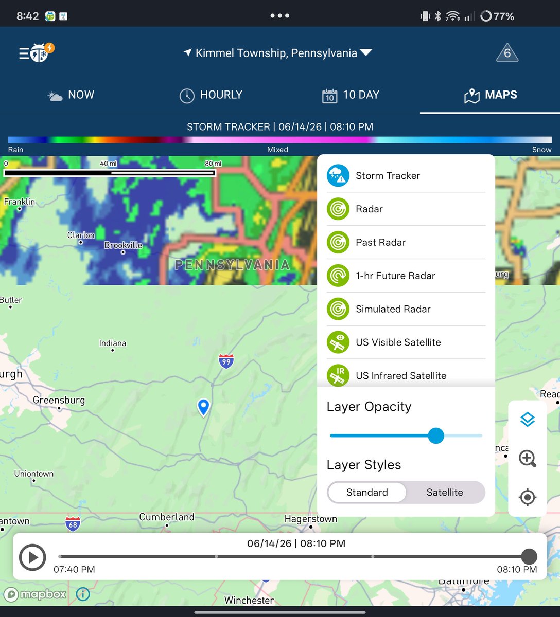
Uhhh....@WeatherBug, I think your app is confused about what season it is....😅😂 @davis_wx, @StormChaserHTX , y'all good out there? Watch out for those wind chills my dudes...


1
20

Jun 16
It’s very revealing. What else are they lying about. I use WeatherBug app. Very local and accurate.
7


Jun 15
There is an active wildfire in Yakima County (the broader Yakima area), though not directly in the city of Yakima itself.
Tule Fire (also called 4170 Tule Road Fire or Tule Fire south of Toppenish)
Location: South of Toppenish (near Tule Road / south of Toppenish Ridge), in rangeland in Yakima County, Washington. This is roughly 20 miles southeast of Yakima city, in the Yakima Valley area.
yakimaherald.com
Size: Approximately 5,000 acres (as of Monday morning reports on June 15, 2026). It grew very rapidly from an initial ~100 acres on June 14.
Containment: 0%.
Start: Reported just before 1 p.m. on Sunday, June 14, 2026.
Status: Still active and burning. Lead agency is Yakama Nation Fire Management, with support from Yakima County Fire District 5, dozers, aircraft, and other resources.
Impacts:
No evacuation orders reported.
US Highway 97 (between Goldendale and Toppenish) was temporarily closed due to the fire but reopened around 11:30 a.m. on Monday, June 15.
Estimated damages around $250,000.
Air quality has been impacted in parts of the valley (unhealthy in areas like Mabton and Prosser; good in Yakima city proper).
Here’s a recent map showing the Tule Fire (5,000 acres) along with other fires burning in southeastern Washington:
wasmoke.blogspot.com
Other notesIn Yakima city proper: No major wildfires reported. The City of Yakima Fire Department is handling routine calls (including at least one recent structure fire response by a county district).
A smaller fire (Pine Tree Fire) sparked by a military aircraft crash near Rimrock Lake (west of Yakima in the mountains) on June 13 appears to be contained or very small.
Fire danger is extreme across the Yakima area today (Monday, June 15) and for the next several days due to hot, dry, and windy conditions.
Recommendation: Conditions can change quickly with wildfires. For the latest updates, check:Local news (Yakima Herald-Republic, NBC Right Now / KNDU)
Yakima County Emergency Management or Fire District pages
Official maps: InciWeb, National Wildfire Coordinating Group (NWCG), WA DNR wildfire dashboard, or WeatherBug fire map
Stay safe, and monitor local alerts if you're in the area.
1
113


Thankfully the weather channel was wrong and a wonderful evening…
Maybe I need to switch to WeatherBug or more @TravisABC13 for accuracy
30


Jun 15
Worried? No.
Prepared? Yes.
The worst part of traveling in tornado season is being on the road, knowing there are violent storms around and needing information to avoid them.
Get a good weather app (like WeatherBug) and plot a few safe stops along your route. You should be fine.
1
76
Cheaptarts retweeted

Jun 15
@WeatherBug storm tracker function is totally down and broken and has been all evening.
1
2
162


WeatherBug is fairly reliable for my area as well as our local weather site. You either don’t understand forecasting or have unrealistic expectations about it because it is better than 10 years ago, idk what you’re talking about there or if there’s an ulterior motive behind that
1
1
77

Jun 14
@WeatherBug how does your lightning map work? Is it where it struck ground? Is it where it originated in air? Is it best guess? Curious
29

