
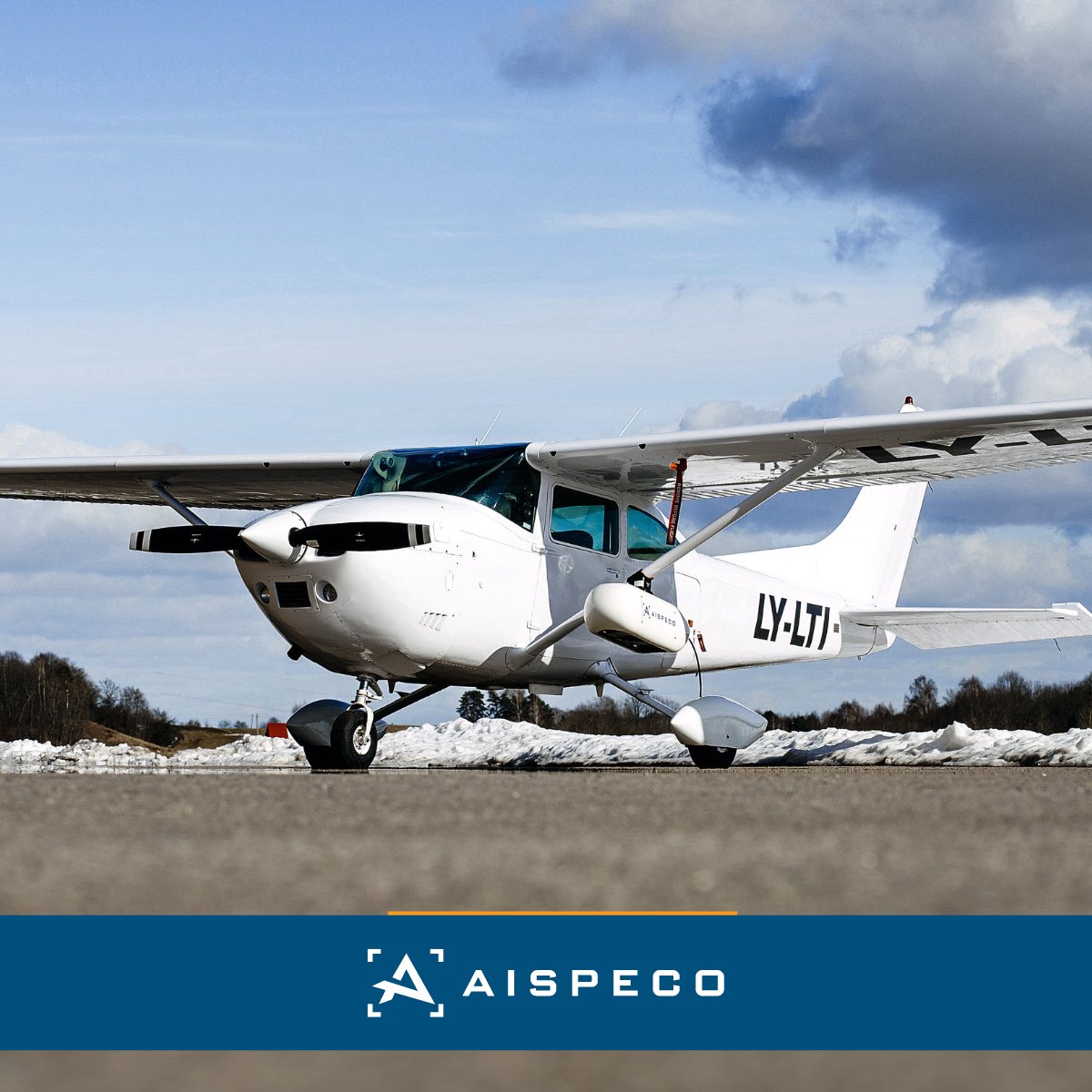
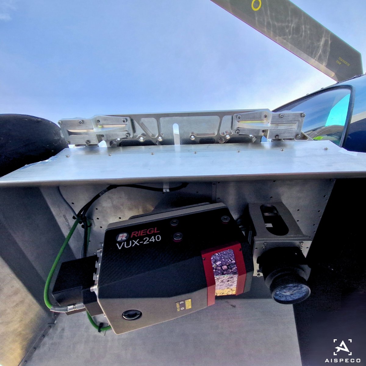
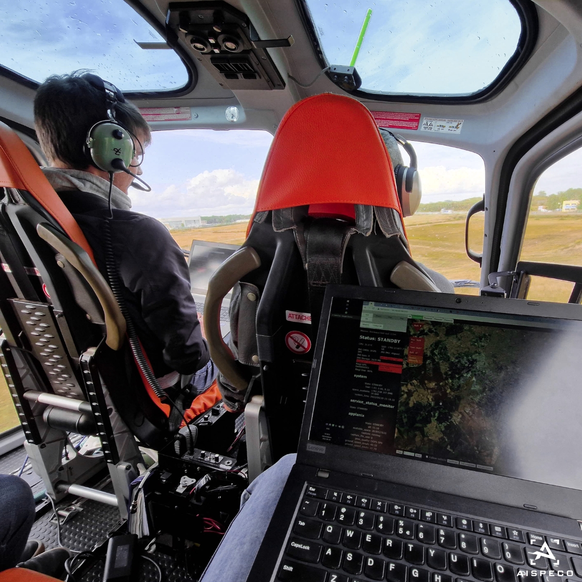
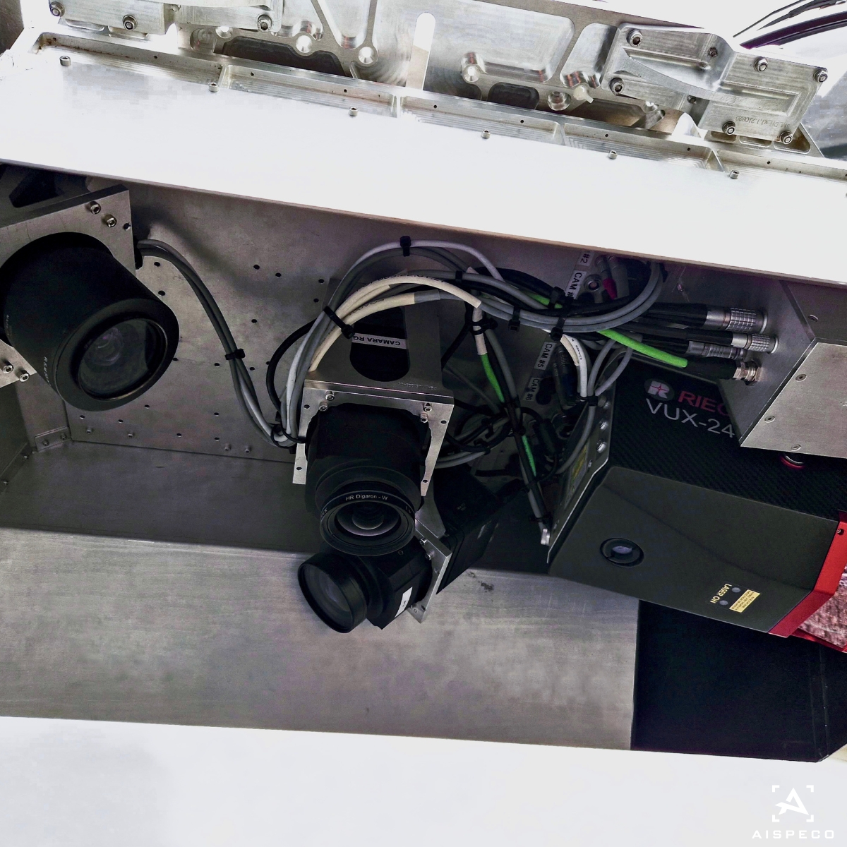
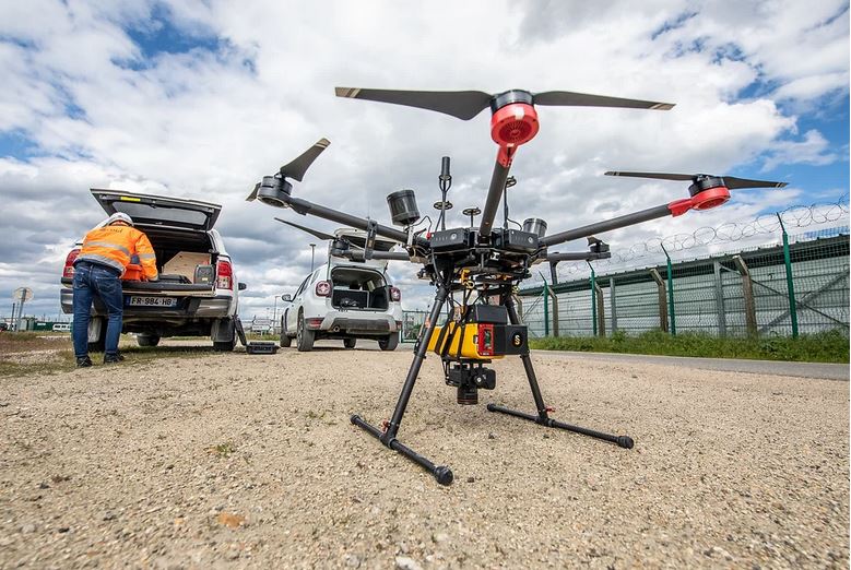
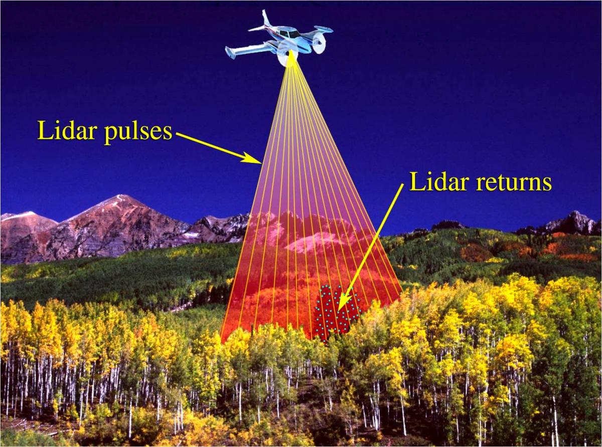
#AISPECO data-collection system mounted on Cessna 182 for #corridormapping application. Equipped with:
•Riegl VUX-240 LiDAR scanner;
•2x PhaseOne iXM-RS150F oblique;
•PhaseOne iXM-RS150F 4-Band;
•Applanix AP 60 GNSS and IMU positioning system.
#geospatial


1
2
42
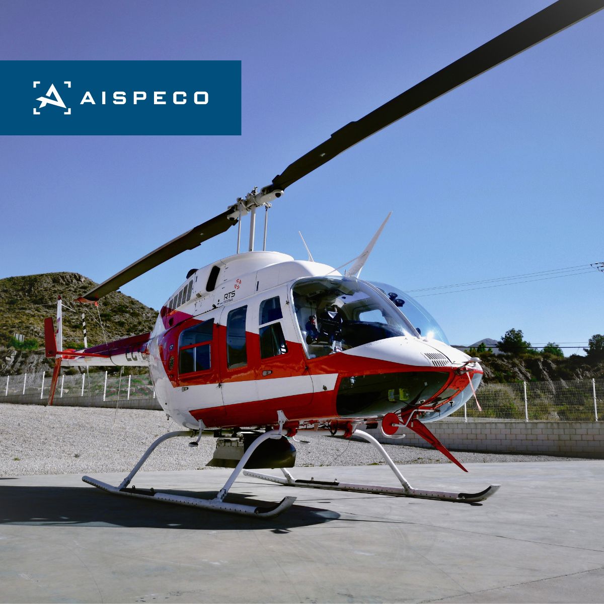
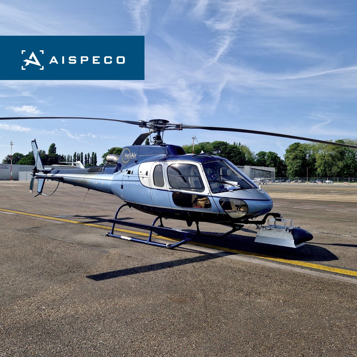
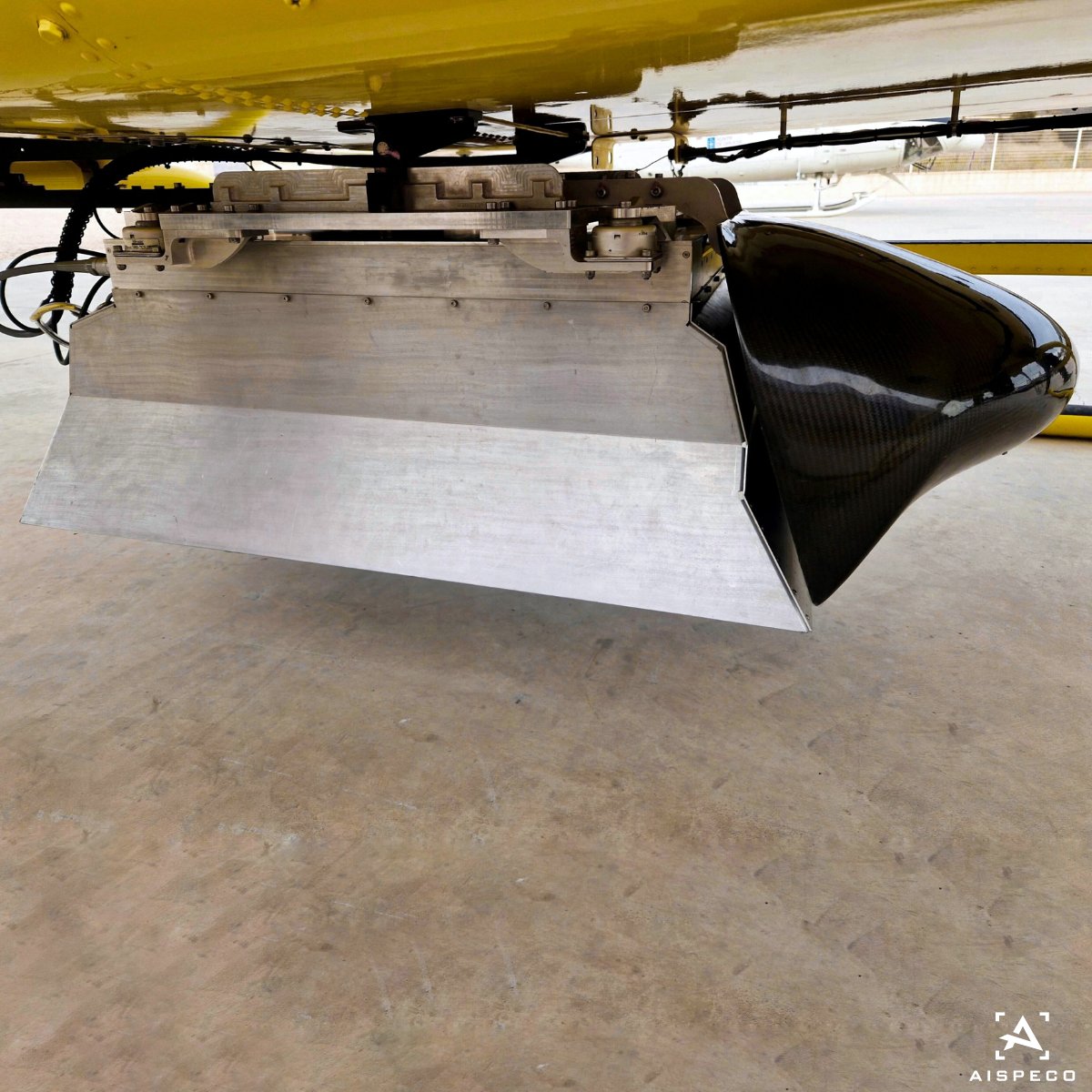
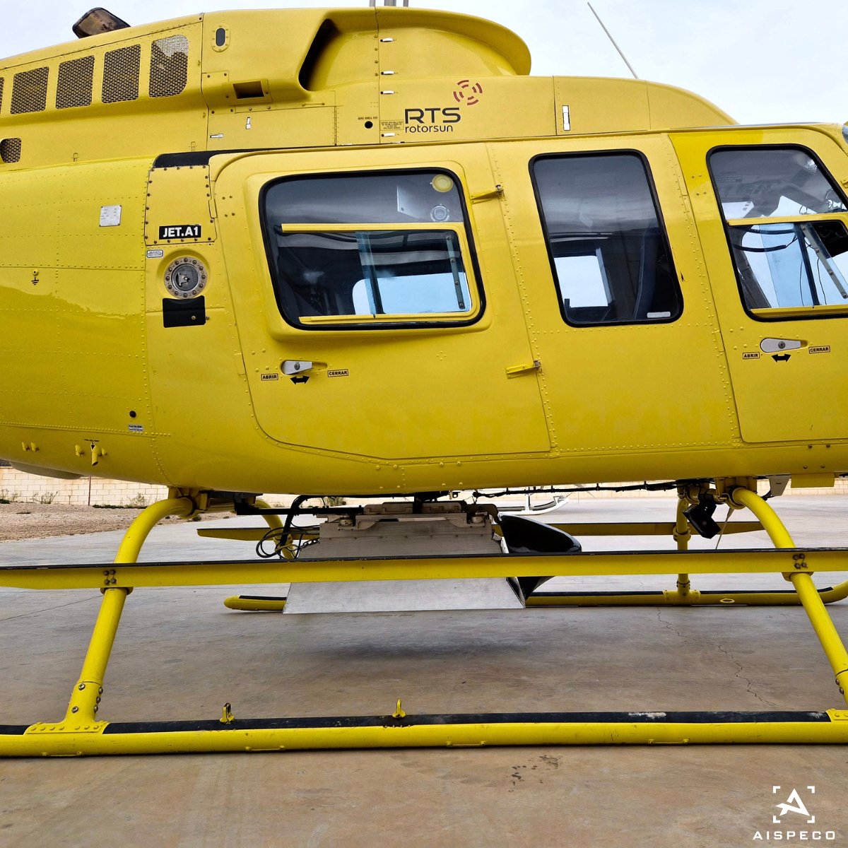
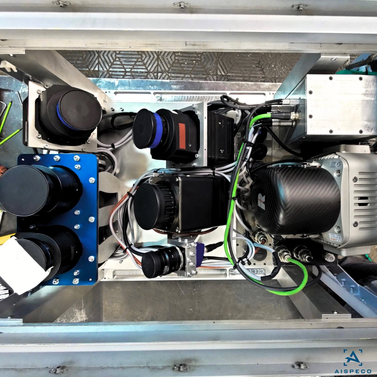
#AISPECO data-collection system mounted on Bell 206 for #corridormapping application. Equipped with:
• Riegl VUX-240 LiDAR scanner;
• Applanix AP 30 GNSS and IMU positioning system;
• 2 x PhaseOne iXM-RS 150F cameras;
• Jenoptik Blackbird XGA thermal camera.
#geospatial
1
2
107
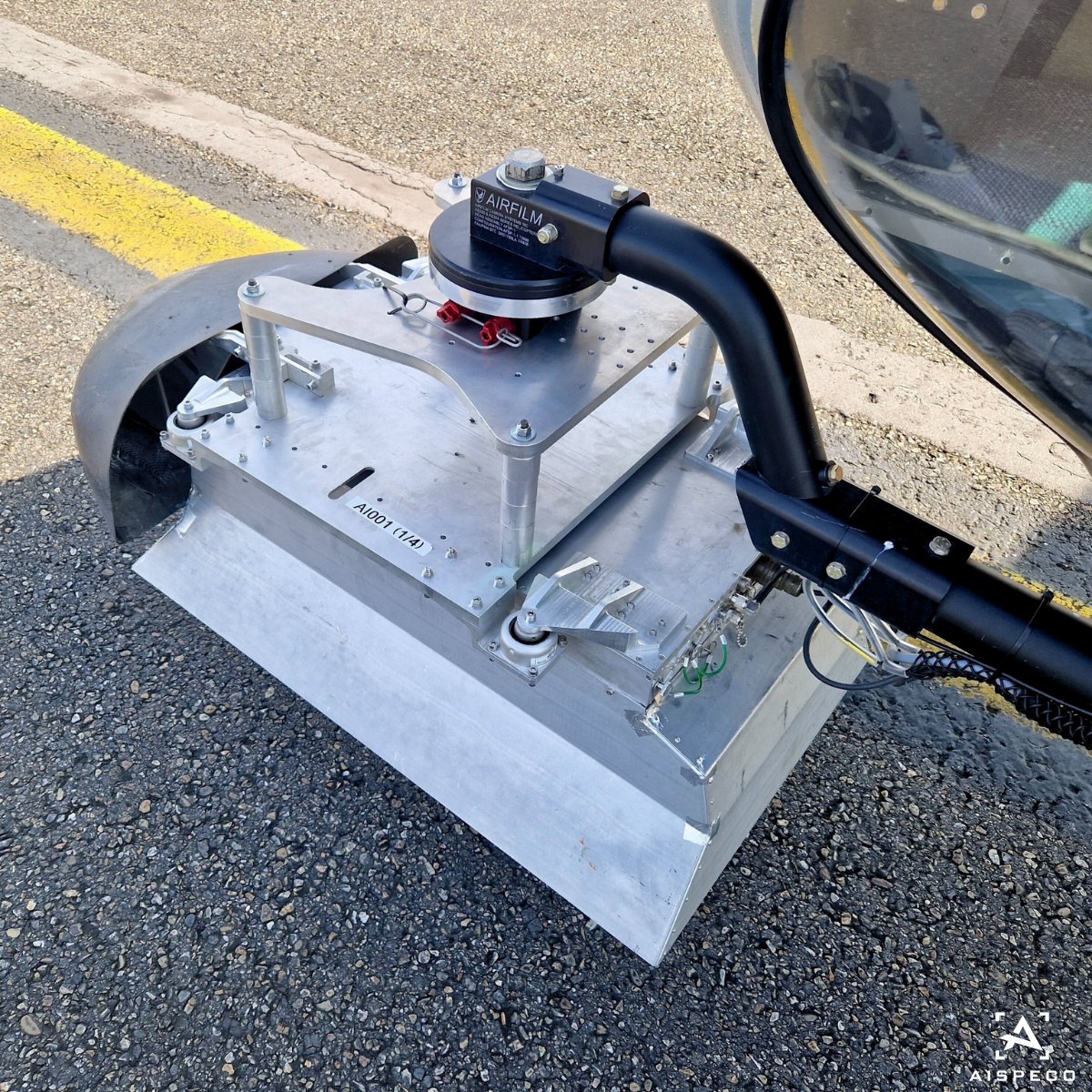
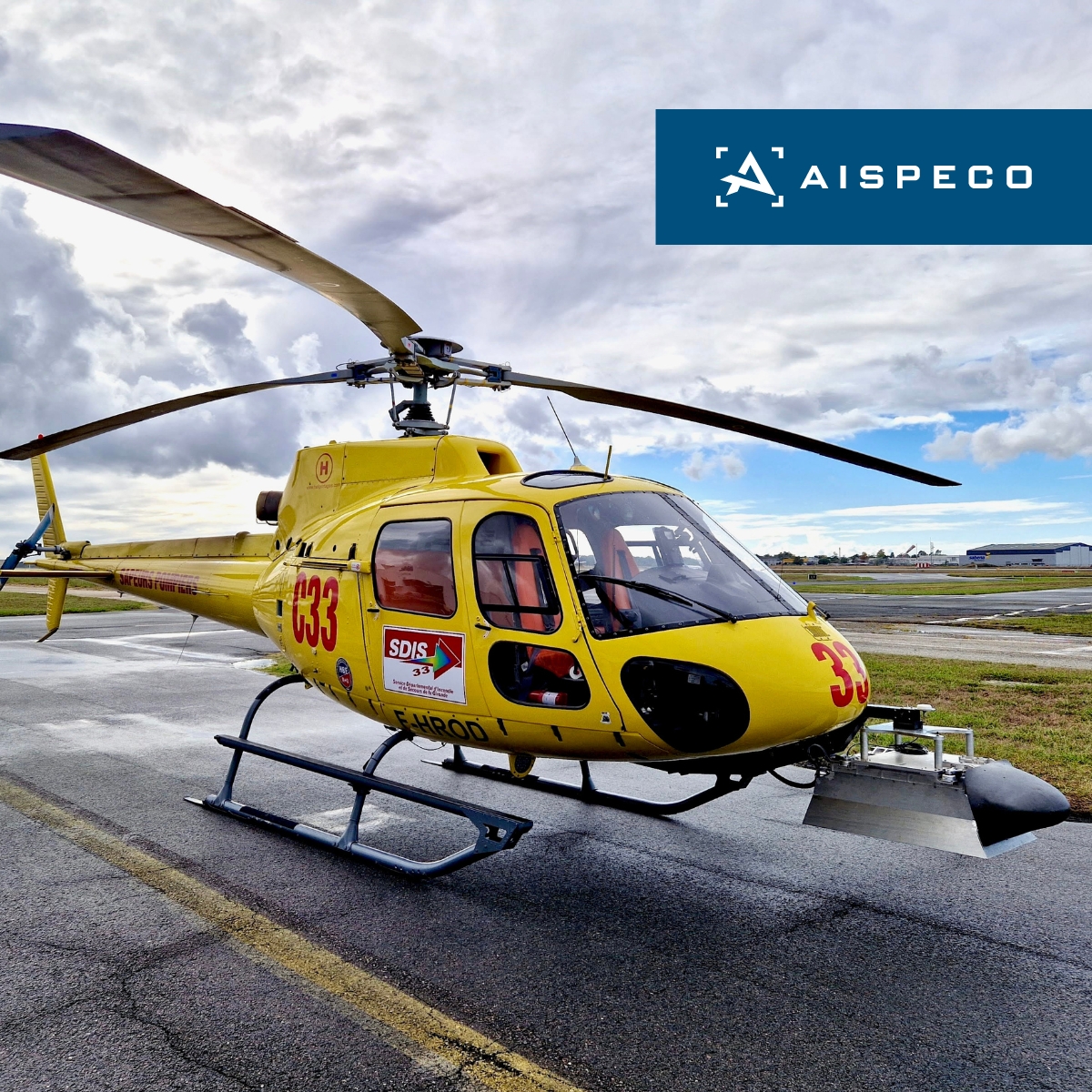
#AISPECO data-collection system mounted on AS355 for #corridormapping application. Equipped with:
• Riegl VUX240 LiDAR scanner;
• Applanix AP 50 GNSS and IMU positioning system;
• 2 x PhaseOne iXU-RS1000 cameras;
• 1 x PhaseOne iXM-RS150 camera. #geospatial
2
4
222
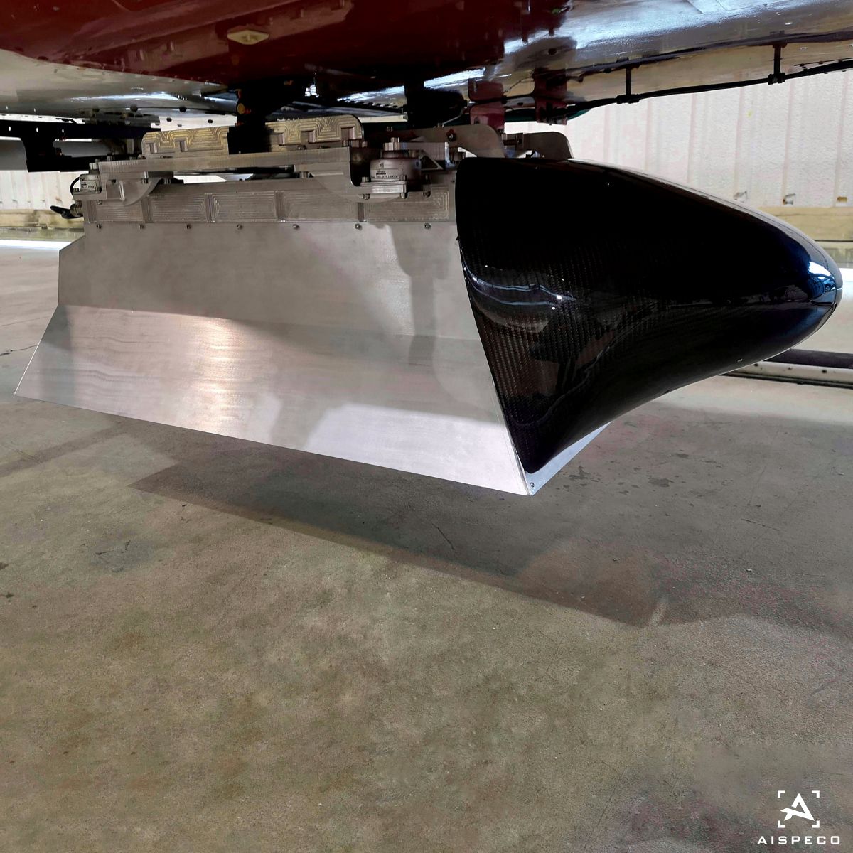
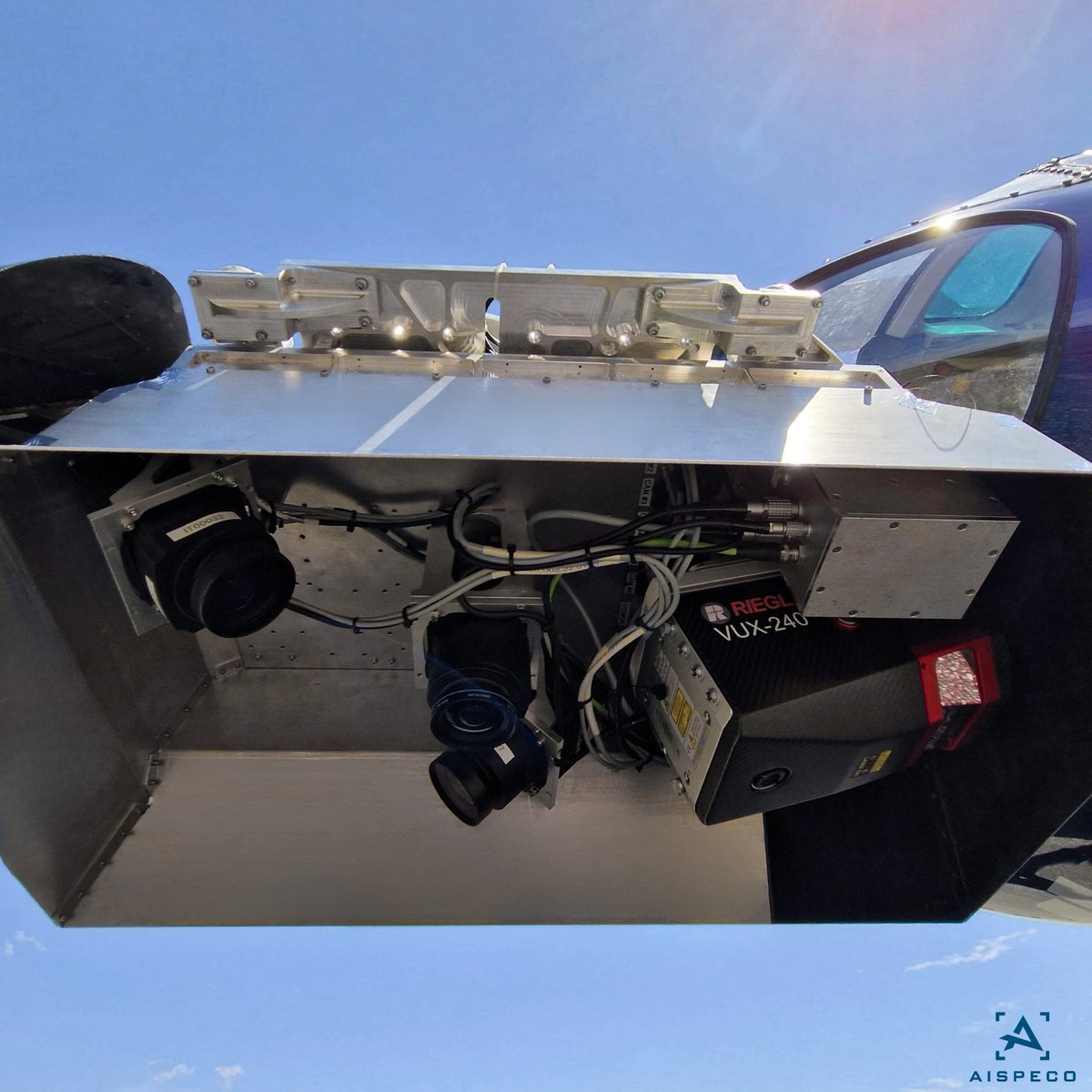
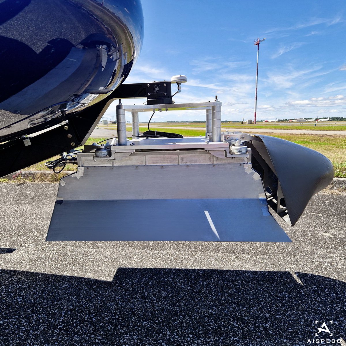
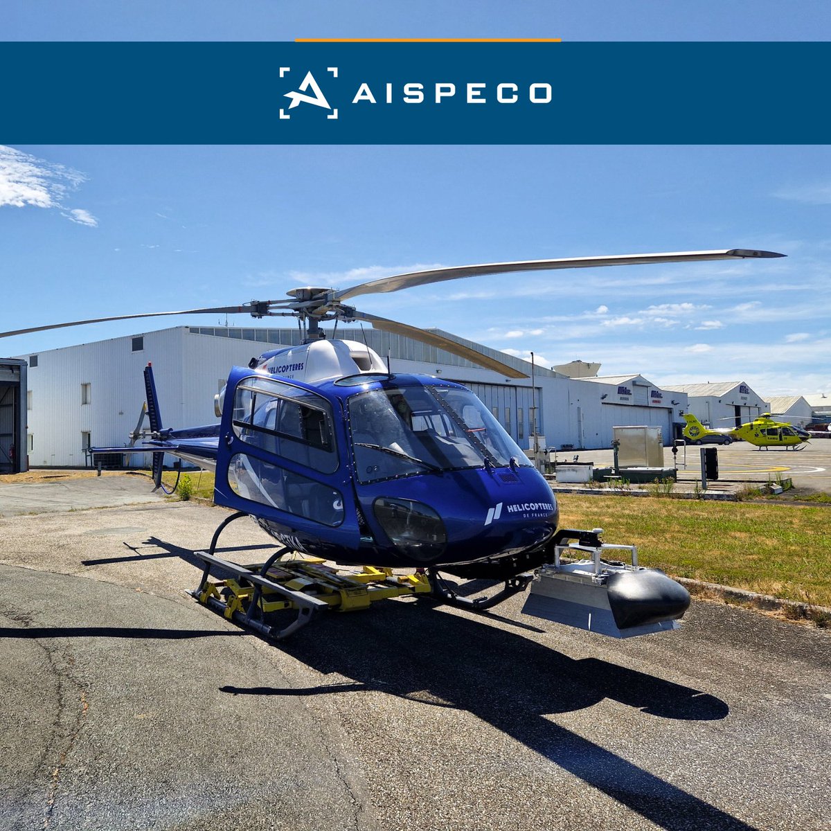
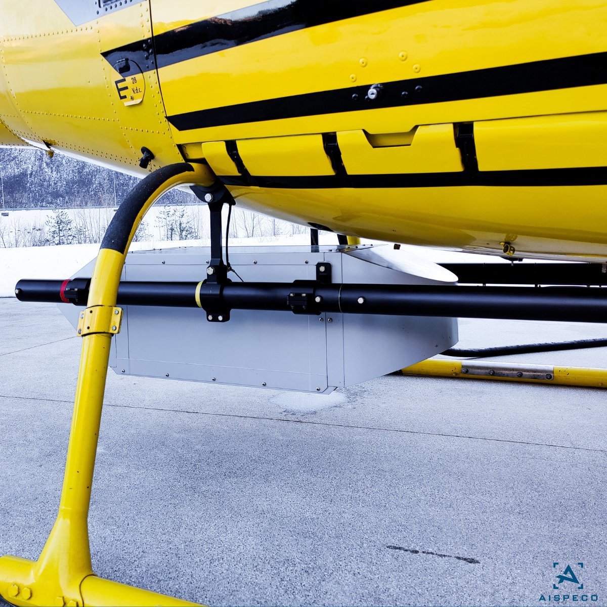
#AISPECO data-collection system mounted on a Eurocopter AS350 B3 for #corridormapping application. Equipped with:
•Applanix AP 30 GNSS and IMU positioning system;
•RIEGL VUX-240 LiDAR scanner;
•PhaseOne iXU-RS1000 orthographic camera. #geospatial #aerialsurvey
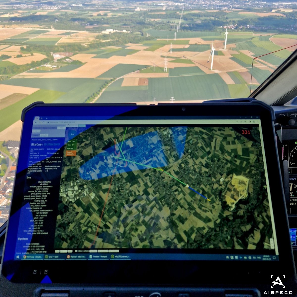
2
6
230
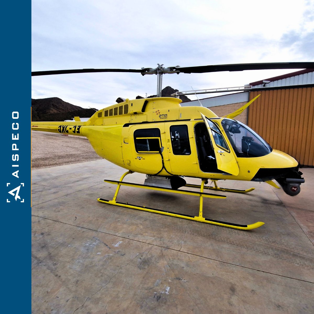
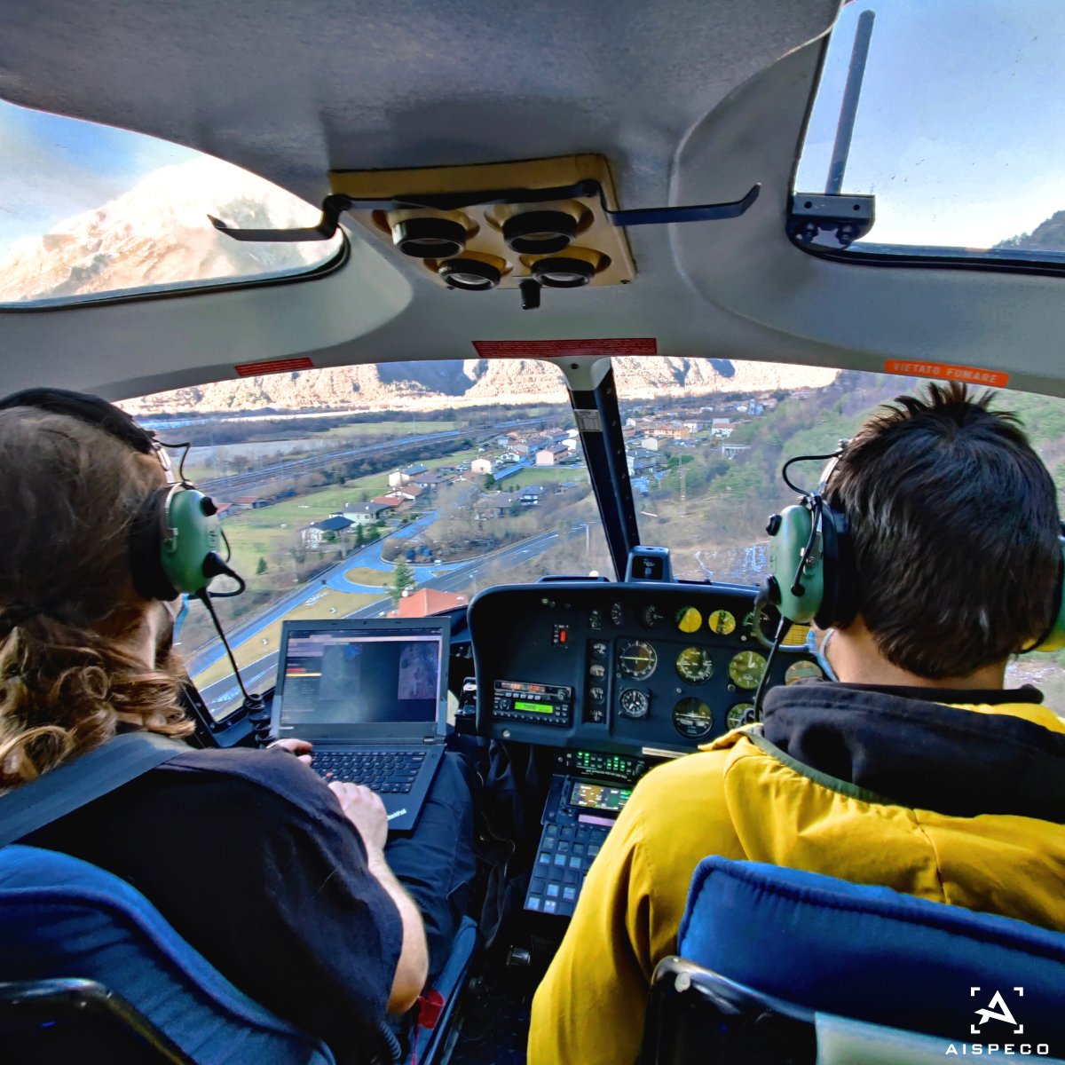
#AISPECO data-collection system mounted on Bell206 for #corridormapping application. Equipped with:
• Riegl VUX-1 LiDAR scanner;
• Applanix AP 30 GNSS and IMU positioning system;
• 2 x PhaseOne iXM-RS 150F cameras;
• Jenoptik Blackbird XGA thermal camera. #geospatial

2
4
330
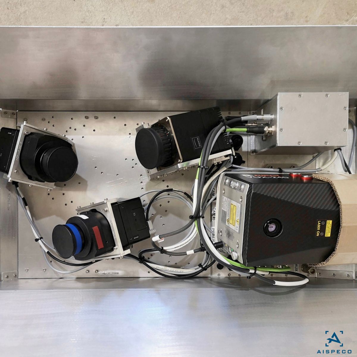
#AISPECO data-collection system mounted on AS350 for #corridormapping application.Equipped with:
•@Riegl VUX1 LiDAR scanner;
•@TrimbleApplanix AP 20;
•@PhaseOnePhoto 2 x iXU-RS1000 and 2 x iXMRS 150F;
•Jenoptik Blackbird;
•@MATRIXVISION mvBlueFOX3-2;
•ProxiVision UV
1
2
267
#AISPECO data-collection system mounted on AS350 for #corridormapping application. Equipped with:
• @Riegl VUX240 LiDAR scanner;
• @TrimbleApplanix AP 50 GNSS and IMU positioning system;
• 2 x @PhaseOnePhoto iXU-RS1000 cameras;
• 1 x @PhaseOnePhoto iXM-50 camera.
#geospatial
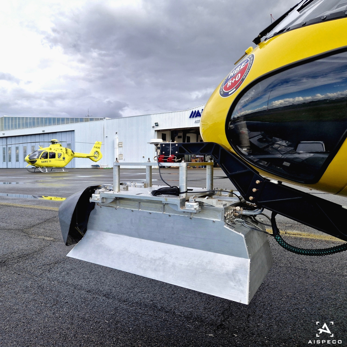
3
6
271

9 Dec 2022
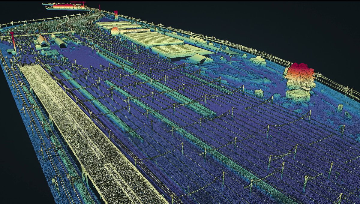
Wanna know how drone LiDAR surveys compare to traditional methods in railway corridor mapping projects? 🚆
Check out our success story 👉 lnkd.in/eX2sg8Dv
#corridormapping #LiDAR #Surveying


2

4 Aug 2022
Achieving good geometric accuracy is always a challenge in UAV Photogrammetry. Check out our publication that discusses the optimal control point distribution for UAV mapping.
#uavphotgrammetry #accuracy #uavmapping #corridormapping #AcademicTwitter link.springer.com/chapter/10…
5
8

12 May 2022
📢Discover our new podcast: PIXELS AND POINTS by SimActive.
EPISODE #1: Corridor Mapping for Infrastructure Using Drones.
Listen the full podcast on your favorite streaming platforms: lnkd.in/eHcGRYig
#photogrammetry #podcast #corridormapping #dronemapping
2
9 Sep 2021
The Explorer in all its glory. ✨
Our objective with this product is to offer the market a solution that strikes the right balance between size, range, accuracy and weight. 👌 swll.to/Explorer-teaser #MAV #UAV #LiDAR #Powerlines #Corridormapping #Forestry
1
2

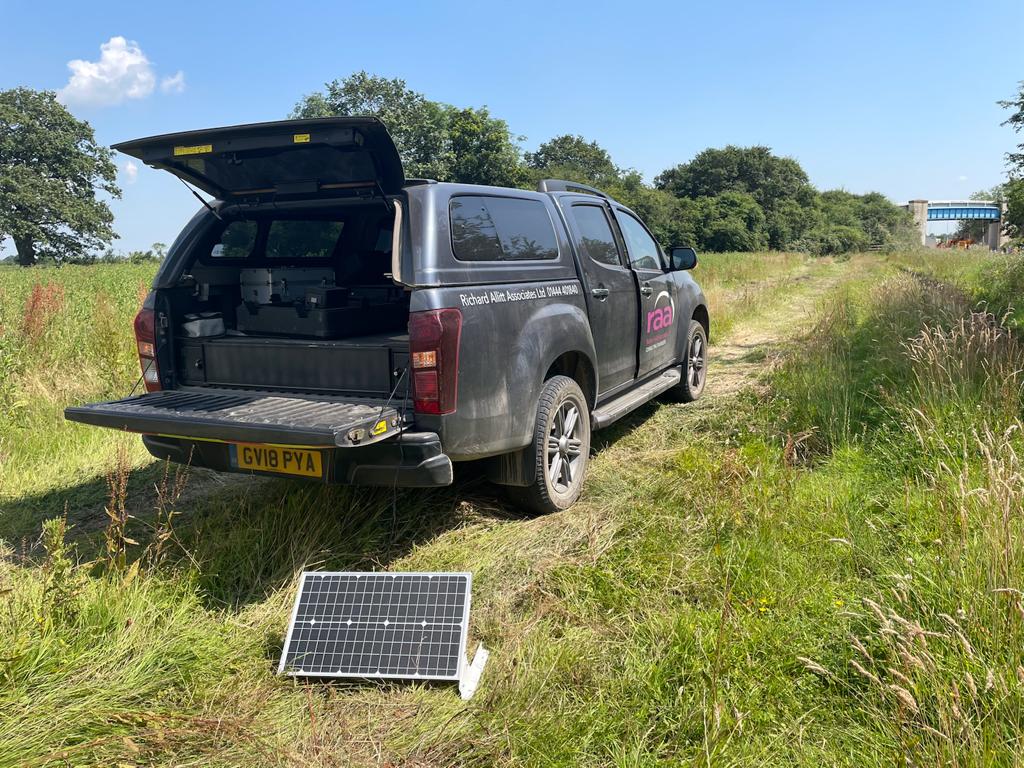
21 Jul 2021
We are taking advantage of the weather to test our new solar panels for charging UAV batteries out on site, working towards net zero operations #netzero #dronesurveys #corridormapping #longsummerdays
2

18 May 2021
The Path of Least Resistance: Thinley Wangden ’23 [@ColbyCollege] uses NASA data to map safe corridors for Bhutan’s elephants #SatelliteData #ElephantConservation #CorridorMapping
colby.edu/magazine/nasa-data…
1
2

10 Aug 2020
Growing Demand for LiDAR Drones for #CorridorMapping and #PrecisionAgriculture Applications
Know More @ bit.ly/2DUByxu
#Drone #Archeology #LiDARSensors #GIS

2
23 Jul 2020
First commercial flight for our #WingtraOne in Scotland today #dronesurvey #fixedwing #rail #corridormapping #3dmodelling
1
3
1 Jun 2020
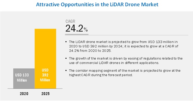
#lidar #Drone Market Worth $392 Million by 2025
Know More @
prnewswire.com/news-releases…
#uavs #drones #CorridorMapping #LiDARDrones #agriculture #scanner #GIS
1
2
17 Apr 2020
Here it is, the RAS team are delighted to unveil our new WingtraOne and look forward to flying some large scale projects as soon as it is safe to get out and do so #drones #UAV #Wingtra #DroneSurveys #aerialsurveys #corridormapping #GIS #VTOL #construction #railway #environmental
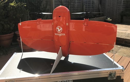
1
3
15 Apr 2020
Scenarios of impact of Coronavirus on LiDAR Market
marketsandmarkets.com/Market…
@OlaRollen @trimblegis @VelodyneLidar
@HxGNLIVE @CARIS_GIS
#LIdar #CorridorMapping #Drone #UAV #3D #Covid19 #Cameras
.
2
14 Jan 2020
LiDAR Market by Service (Aerial Surveying, GIS services) and Trends
Read More @ prnewswire.com/news-releases…
#LiDAR #GIS #Engineering #Driverless #CorridorMapping

1
3
9 Jan 2020
Use of LiDAR in Geographical Information Systems (GIS) Applications
Read More @ prnewswire.com/news-releases…
#LiDAR #CorridorMapping #Engineering #GIS
2