
New #Geosphere: Power of modern 3D visualization of high-res terrain models in geologic mapping: Complex fold geometries shown by 3D mapping, Panamint metamorphic complex, E. California, USA, by Pavlis & Serpa: doi.org/10.1130/GES02742.1 #GSAPubs #3-DMapping @sciencesutep
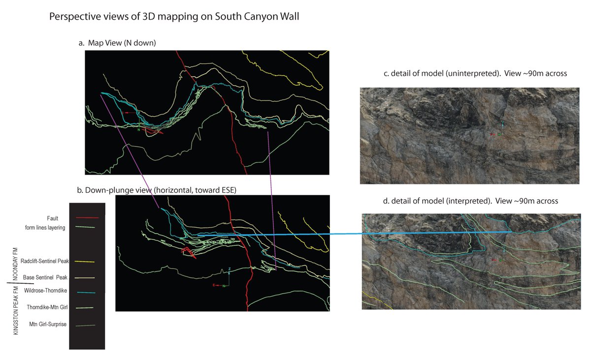
ALT Five parts, including a legend, make up Figure 7. Parts A and B are black rectangles representing the map view and down-plunge view, respectively, with seven colors of lines representing stuctures of the south wall of Pleasant Canyon. Parts C and D are photos detailing the model. Part D has an overlay of colored lines, whereas part C has no overlay. There are two purple lines connecting features in A and B; a blue line connects features in B and D.
4
2
910

18 Dec 2023
43 Crazy Ai Tools Tools you need to know and don't forget to follow for more content
#aitools #ai #artificialintelligence #digitaltwin #indoormapping #newtech #geospatialdata #datamapping #gis #mapping #geospatialtechnology #gismapping #dmapping #geospatial #dmap #digitaltwins

3
57

Best AI Tools 2023
Visit at: wbcomdesigns.com/best-ai-too… #aitools #ai #artificialintelligence #digitaltwin #indoormapping #newtech #geospatialdata #datamapping #gis #mapping #geospatialtechnology #gismapping #dmapping #geospatial

1
3
116
Best AI Tools 2023
Visit at: wbcomdesigns.com/best-ai-too…
#aitools #ai #artificialintelligence #digitaltwin #indoormapping #newtech #geospatialdata #datamapping #gis #mapping #geospatialtechnology #gismapping #dmapping #geospatial

1
3
63
Best AI Tools To Future-Proof Yourself (2023)
Visit at: wbcomdesigns.com/best-ai-too…
#aitools #ai #artificialintelligence #digitaltwin #indoormapping #newtech #geospatialdata #datamapping #gis #mapping #geospatialtechnology #gismapping #dmapping #geospatial #dmap #digitaltwins

2
58

我那天和一个老外聊的时候顺嘴说了一句:
三Dmapping。。。。。。。。
他说:“what?”
我说:“sanD Mapping啊!”
17 Aug 2023

不知道你们,英文中的数字我都按照中文发音来读
1
3
2,002

26 Mar 2023
1000 AI Tools collection youtu.be/twSTt0w0lxI via @YouTube
some of the best AI Tools
#aitools #ai #artificialintelligence #digitaltwin #indoormapping #newtech #geospatialdata #datamapping #gis #mapping #geospatialtechnology #aitechnology #dmapping #geospatial #dmap
3
3
212
22 Mar 2023
Top 10 AI Tools use for 2023 youtu.be/z5JnNMF5tMo via @YouTube
#aitools #ai #artificialintelligence #digitaltwin #indoormapping #newtech #geospatialdata #datamapping #gis #mapping #geospatialtechnology #gismapping #dmapping #geospatial #dmap #digitaltwins #machinelearning
5
2
151

18 Sep 2022
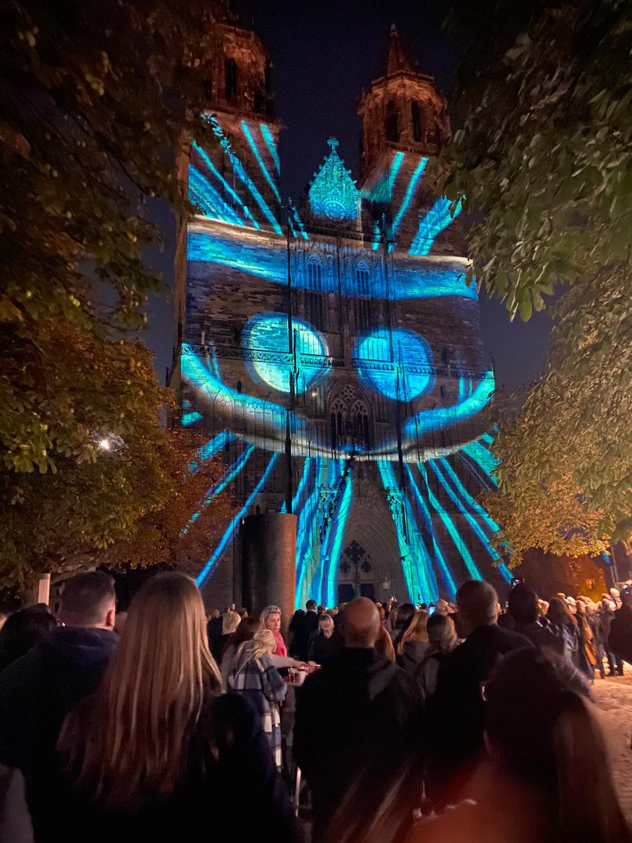
Magdeburg in Light 2023 - Klima neutrales Event Titel: The eye / Das Allsehende Auge
made by VISUALIMPRESSION and Stefan Haberkorn
magdeburg-in-light.de
#projectionmapping #videomapping #mapping #projection #digitalart #dmapping #art #projectionart #interaktiv #visualart

3
21 Aug 2022
Magdeburg in Light 2022 - Otto leuchtet!
Beamer Lichtshow auf dem Westportal
Magdeburger Dom 21.05.2022
um 23 Uhr
magdeburg-in-light.de
#projectionmapping #videomapping #mapping #projection #digitalart #dmapping #art #projectionart #interaktiv #visualart #lightart
2
6
30 Jul 2022
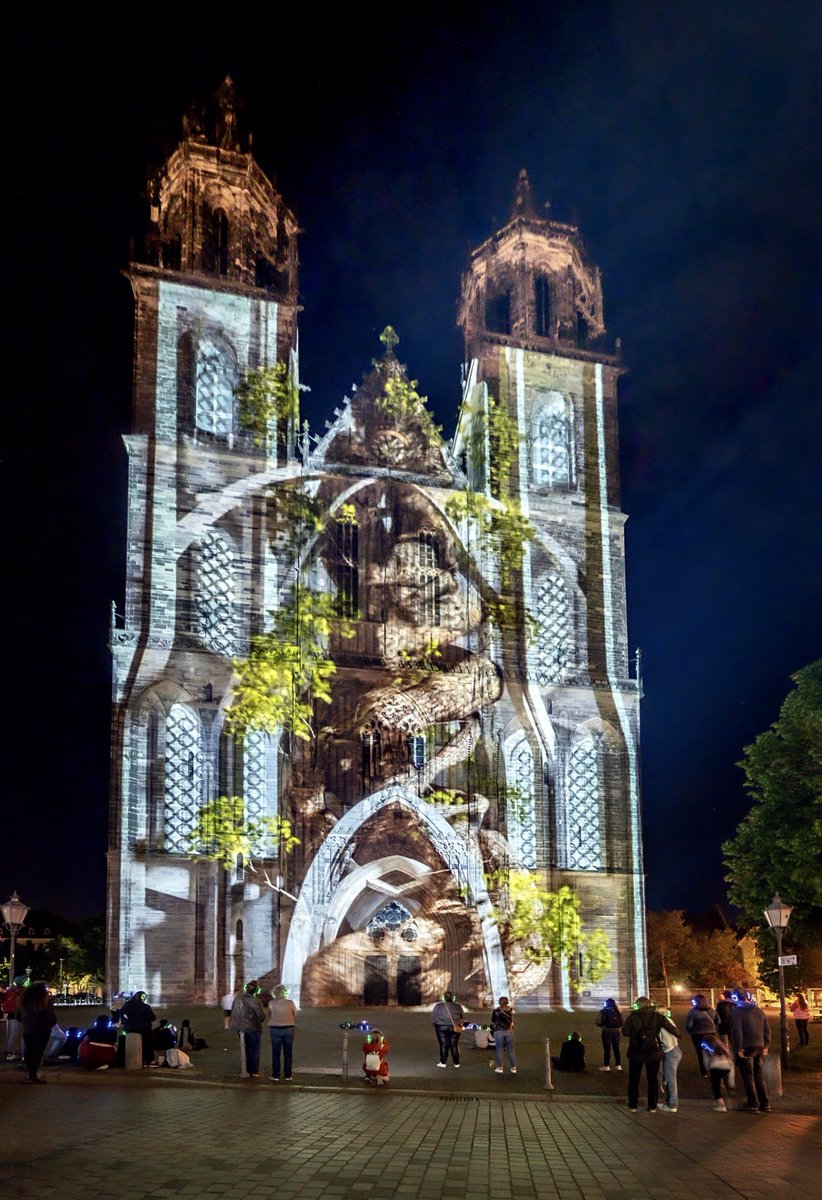
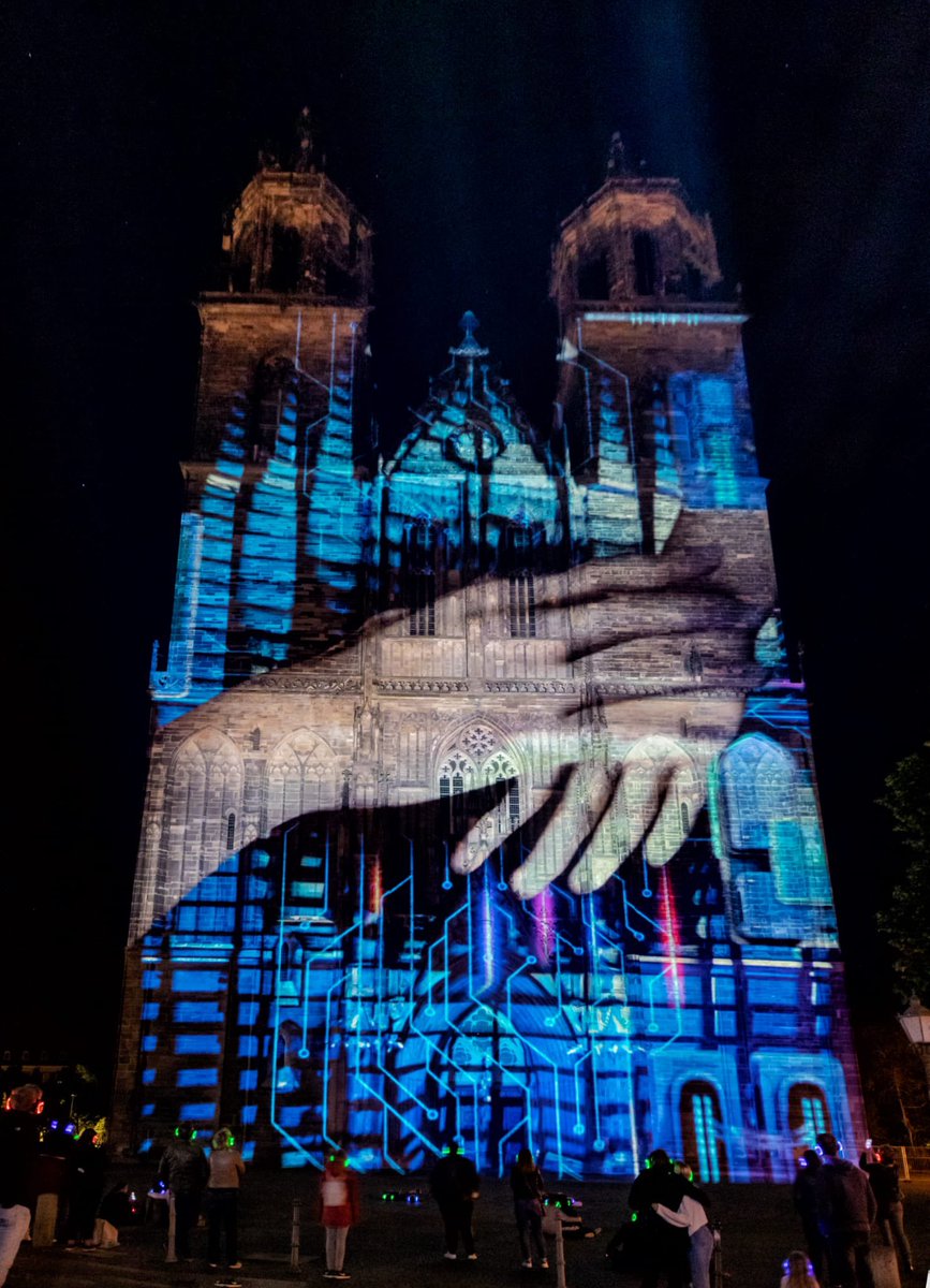
Magdeburg in Light 2022 - Handshake
Beamer Lichtshow auf dem Westportal
Magdeburger Dom 21.05.2022
um 23 Uhr
magdeburg-in-light.de
#projectionmapping #videomapping #mapping #projection #digitalart #dmapping #art #projectionart #interaktiv #visualart #lightart #madmapper #dj
8
14 Jul 2022
Magdeburg in Light 2022
making of - Timetravel Scene
youtu.be/e1TZmHI3X3M
made by Stefan Haberkorn / VISUALIMPRESSION
magdeburg-in-light.de
visualimpression.de
#projectionmapping #videomapping #mapping #projection #digitalart #dmapping #art #projectionart #interaktiv
2
5
20 Jun 2022
Magdeburg in Light 2022
making of - End Scene
made by Stefan Haberkorn / VISUALIMPRESSION
magdeburg-in-light.de
visualimpression.de
#projectionmapping #videomapping #mapping #projection #digitalart #dmapping #art #projectionart #interaktiv #visualart #lightart
2
6 Jun 2022
Königstage Quedlinburg 2022
Beamer Mapping Lichtshow
03.06-05.06.2022
jeweils 23 Uhr
made by VISUALIMPRESSION GmbH
Partner: Studio D4
Foto/Video: Christian Walter
visualimpression.de
#projectionmapping #videomapping #mapping #projection #digitalart #dmapping #quedlinburg
1
4
5 Jun 2022
Königstage Quedlinburg
Beamer Mapping Lichtshow
03.06-06.06.2022
jeweils 23 Uhr
made by VISUALIMPRESSION GmbH and Stefan Haberkorn
Partner: Studio D4
visualimpression.de
#projectionmapping #videomapping #mapping #projection #digitalart #dmapping #art #projectionart

3
31 May 2022
Magdeburg in Light 2022
making of - die Stadt
made by Stefan Haberkorn / VISUALIMPRESSION GmbH
Beamer Lichtshow auf dem Westportal
Magdeburger Dom 21.05.2022
um 23 Uhr
magdeburg-in-light.de
#projectionmapping #videomapping #mapping #projection #digitalart #dmapping #art
2
4
26 May 2022
Magdeburg in Light 2022
making of
Beamer Lichtshow auf dem Westportal
Magdeburger Dom 21.05.2022
um 23 Uhr
magdeburg-in-light.de
#projectionmapping #videomapping #mapping #projection #digitalart #dmapping #art #projectionart #interaktiv #visualart #lightart
1
12
20 May 2022
Magdeburg in Light 2022 - Technikprobe
Beamer Lichtshow auf dem Westportal
Magdeburger Dom 21.05.2022
um 23 Uhr
If you are interested in our festival, feel free to use the link magdeburg-in-light.de
#projectionmapping #videomapping #mapping #projection #digitalart #dmapping
2
2
14

had a great time creating a mapping of a pyramidal origami wall. 🔷🔹💠@_davideb3dart instagram.com/p/CZxq-DpNCn_/… #videomapping #projectionmapping #mapping #projection #art #digitalart #d #vj #dmapping #videoart #visualart #lightart #video #contentvideomapping
ALT Music: Neuges - In dreams. FULL VÍDEO: https://vimeo.com/577170707
2
5 Dec 2021
Magdeburg in Light 2021
Virtual World
Beamer Mapping Projection Festival
on Westportal Magdeburg Cathedral
magdeburg-in-light.de
#projectionmapping #videomapping #mapping #projection #digitalart #dmapping #art #projectionart #interaktiv #visualart #lightart #madmapper #vj
4