

10 Sep 2024
@Okikiri_Favour
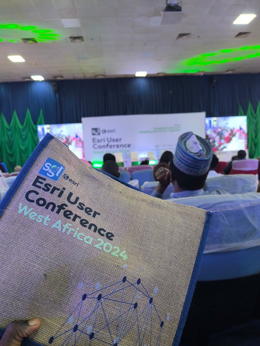
So glad to be finally attending Esri User Conference 😌. I'm seeing alot of professionals here currently working on great projects in the GIS space.
@gischatbot @John_M_Nelson
2
28

13 Jul 2024
Remote sensing combined with data analysis makes visualization easy and data driven decision approach.
@gischatbot @python #remotesensing #DataAnalytics
28 Aug 2023

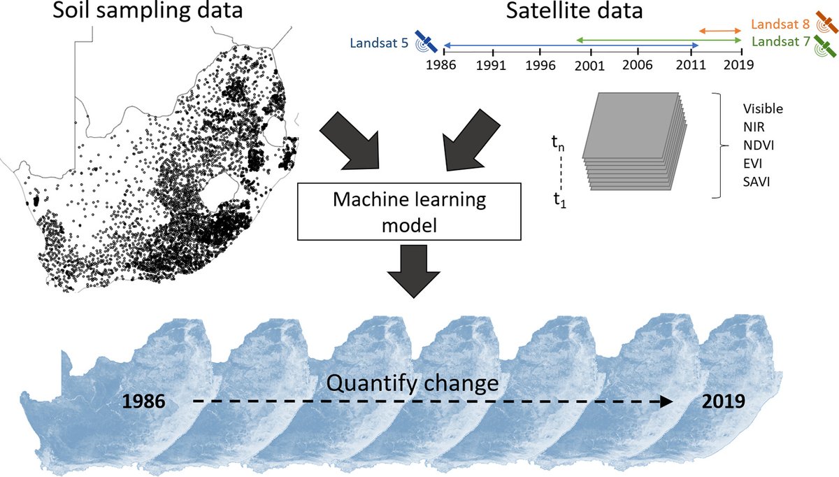
Have you ever thought of how soil analysis using Satellite can be of vital information to the agriculture sector?
Talk of soil moisture estimation, soil composition, Normalized Difference Moisture Index and also historical changes.
@wemappers @RCMRD_ @GeospatialDev_ @googleearth
6
18
412
30 Apr 2024
I'm excited to share my first 3D map created using ArcGIS Pro! 🥹 As a budding GIS professional, I'm eager to receive honest feedback and constructive criticism to improve my skills. Your insights would be invaluable in helping me grow.
T for thanks😊
@John_M_Nelson @gischatbot
2
2
14
565

1 Apr 2024
One week remains to submit a presentation proposal for #GISPro2024 in Portland, Maine. Proposals are due April 8. Don't miss the opportunity! urisa.org/page/GIS-Pro_Propo… @NEURISA @MaineGIS @URISATexas @cal_urisa @GISCI_GISP @gischatbot @URISAVC

1
2
223

26 Mar 2024
Our GIS class is on Monday to Friday, every 7am. To join the class, email me at morrisgambogis@gmail.com so I can add you to the class.
Our topic today is "Preparation for a GIS project."
#GIS #Geospatial #Survey #DataScience #DataAnalytics #GISchatbot
7
70
23 Jan 2024
From print("Hello world") to a backend engineer, spatial Data analysis and software developer.
Am proud to say consistence and discipline it's what it takes to be that person.
#GIS #SoftwareEngineer #DataScience
@gischatbot @SuperMap__GIS @DeKUTkenya @GeospatialDev_
2
6
26
987

11 Jan 2024
Other than water depth, does the use of the phrase "water level" also refer to the water areal extent as used in this case correct?
2
27

13 Dec 2023
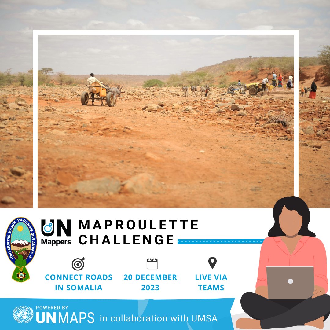
🚀 Connect, map, and make a difference!
🌐Join our mapathon for a #MapRoulette challenge to repair #OSM disconnected roads in Somalia 🛣️
🗓️ Wed, 20 December
➡️Register here: tinyurl.com/MapSom23
🗣️The event will be held in #Spanish
@gischatbot
13
21
1,167

Día 30.- Mi favorito
Day 30.- My favourite
app.bemaps.es/user-map/65684…
#30DayMapChallenge #GIS #mapas #mapa #maps #map @gischatbot @GISchat

2
7
208
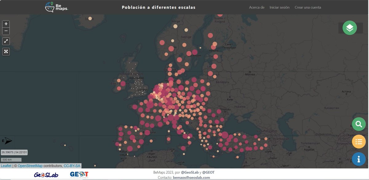
Día 29.- Población. Población a diferentes escalas
Día 29.- Population. Population at different scales
app.bemaps.es/user-map/65672…
#30DayMapChallenge #GIS #maps #Mapas #mapa #map @gischatbot @GISchat
2
3
108
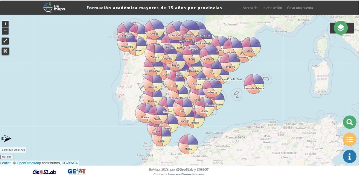
Día 28.- ¿Es esto un gráfico o un mapa?
Day 28.- Is this a chart or a map?
Fuente: Padrón municipal del INE
Source: Municipal census of the National Institute of Statistics (INE)
#30DayMapChallenge #GIS #maps #mapas #map @gischatbot @GISchat
2
4
158
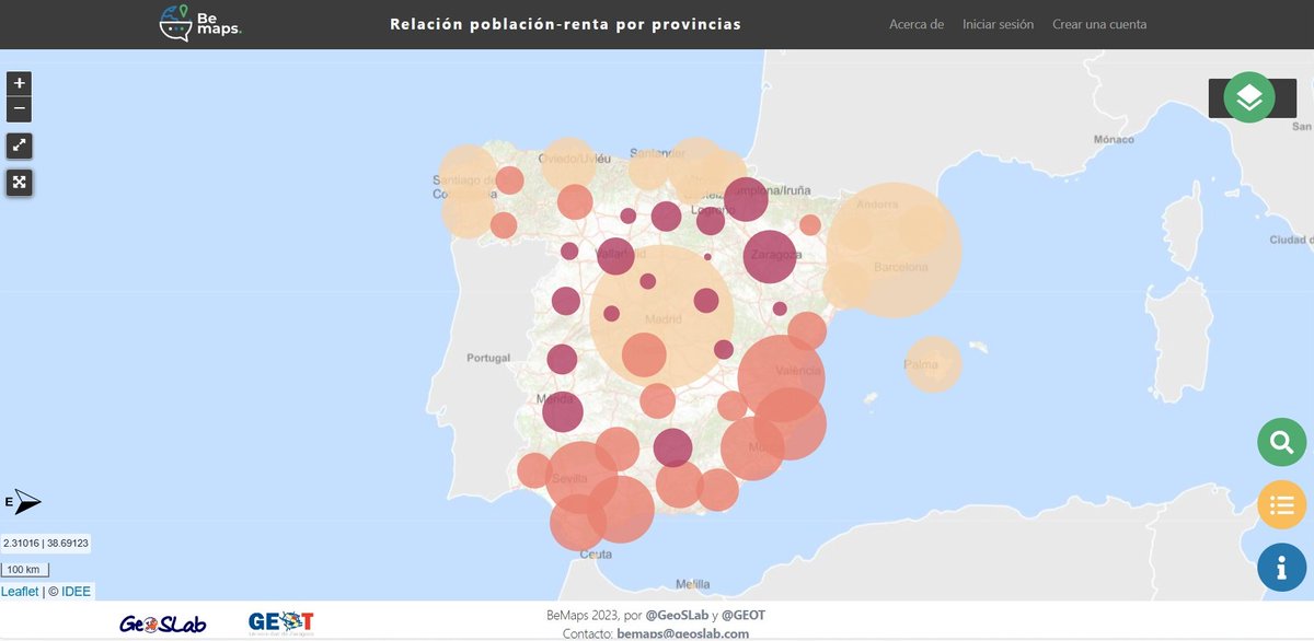
Día 27.-Punto
Day 27.- Dot
Fuente: Panel Municipal del INE
Source: municipal register of the national statistics institute (INE)
app.bemaps.es/user-map/65645…
#30DayMapChallenge #GIS #maps #mapas #Map
@gischatbot @GISchat
2
2
116
Día 24.-Blanco y negro
Day 24.- Black and white
app.bemaps.es/user-map/65605…
#30DayMapChallenge #GIS #maps #mapas #mapa
@gischatbot @GISchat

2
3
126
Día 23.- 3D
Day 23.- 3D
app.bemaps.es/user-map/655f1…
#30DayMapChallenge #GIS #mapa #Map #maps @gischatbot @GISchat

3
3
132
Día 22.- El norte no está siempre arriba
Day 22.- North is not always up
app.bemaps.es/user-map/655de…
#30DayMapChallenge #GIS #maps #mapas #map
@gischatbot @GISchat
2
3
115
Día 21.- raster. Espacios naturales protegidos
Day 21.- raster. Protected natural areas.
app.bemaps.es/user-map/655cb…
#30DayMapChallenge #maps #mapas #Map #GIS @gischatbot @GISchat

3
3
114
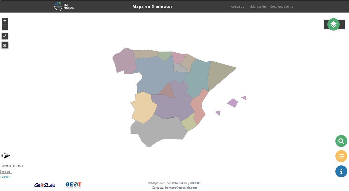
Día 19.- mapa en 5 minutos. Digitalización a gran escala de las Comunidades Autónomas de España.
Day 19.- 5 minute map. Large-scale digitisation of Spain's Autonomous Communities.
app.bemaps.es/user-map/65576…
#30DayMapChallenge #mapas #Map #maps #GIS @gischatbot @GISchat
2
5
131
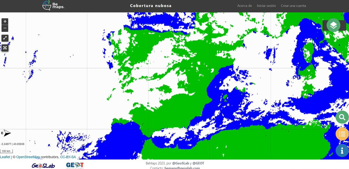
Día 18.- Atmósfera
Day 18.- Atmosphere
Fuente/Source: Eumetsat (eumetsat.int/)
app.bemaps.es/user-map/65573…
#30DayMapChallenge #GIS #maps #mapas #Map @gischatbot @GISchat
2
4
141
17 Nov 2023
Have you joined @URISA with the Geography Week discount? Valid for student, young professional and professional new memberships only through Saturday. Don't miss it! urisa-portal.org/page/Indivi… @EsriYPN @URISAVC @GISCI_GISP @gischatbot @directionsmag @EsriSLGov

1
2
3
652