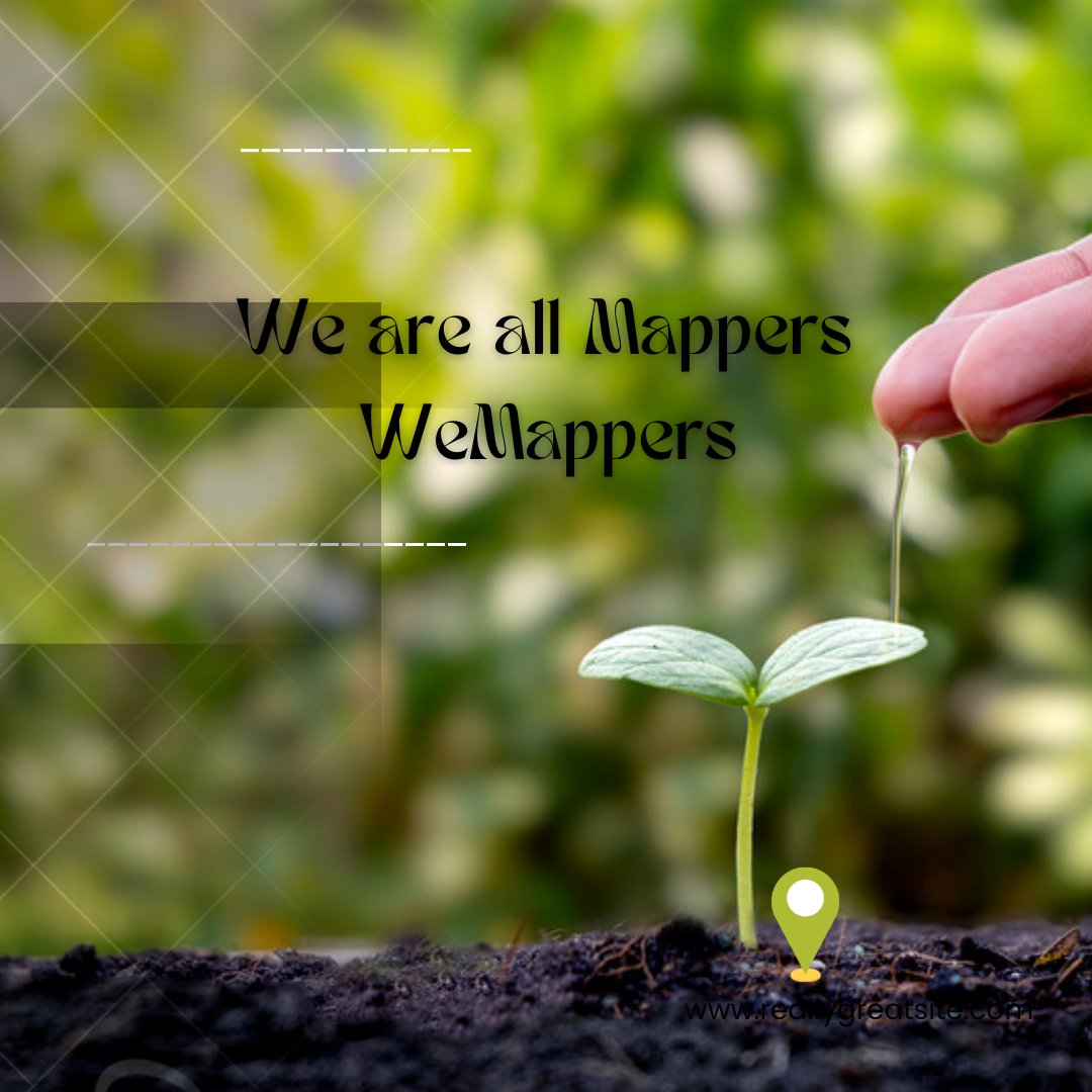
the best table for world geospartial experts
Joined April 2020
- Tweets 331
- Following 298
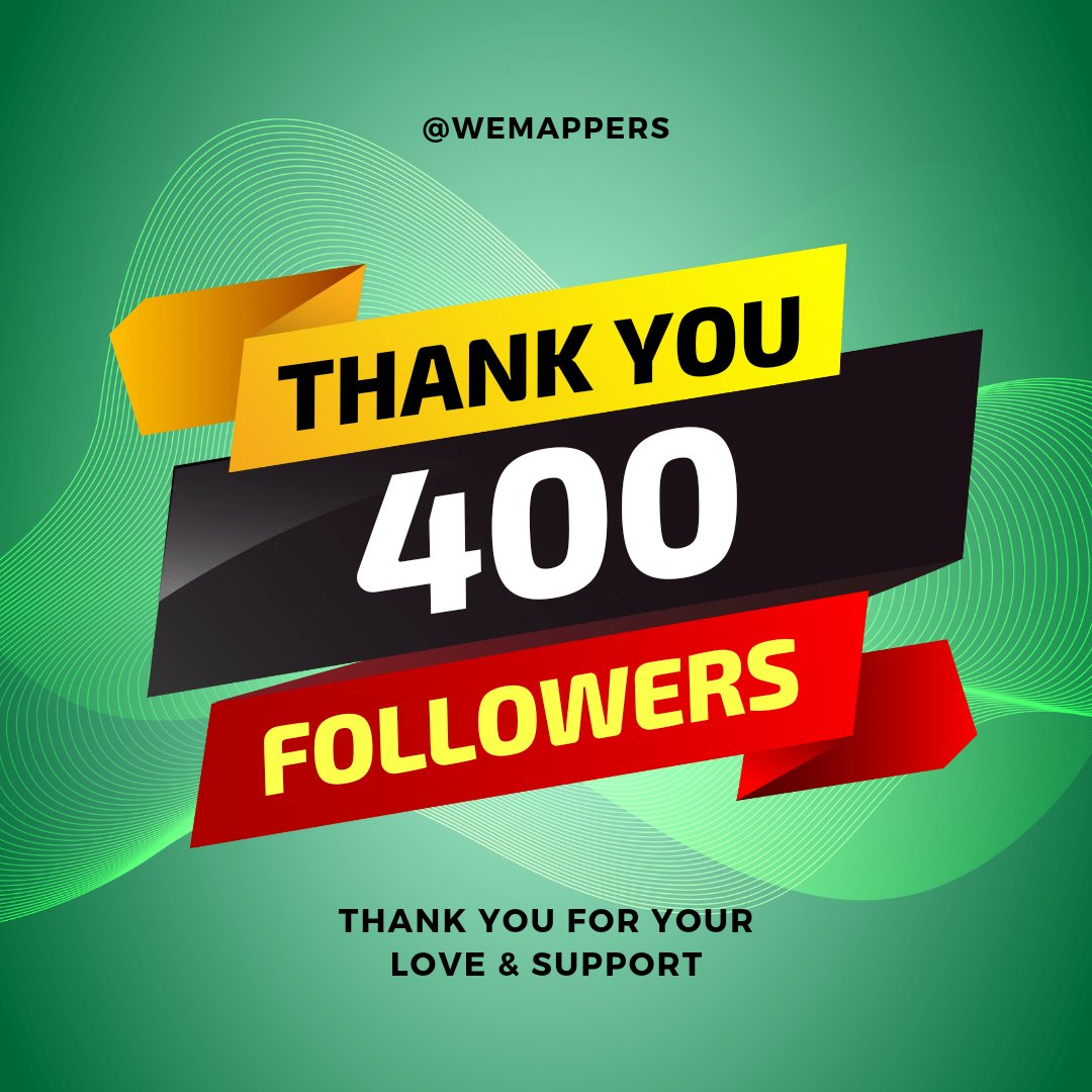
- Followers 423
- Likes 1,546
86 Photos and videos


16 Feb 2025
We are working on this
16 Feb 2025

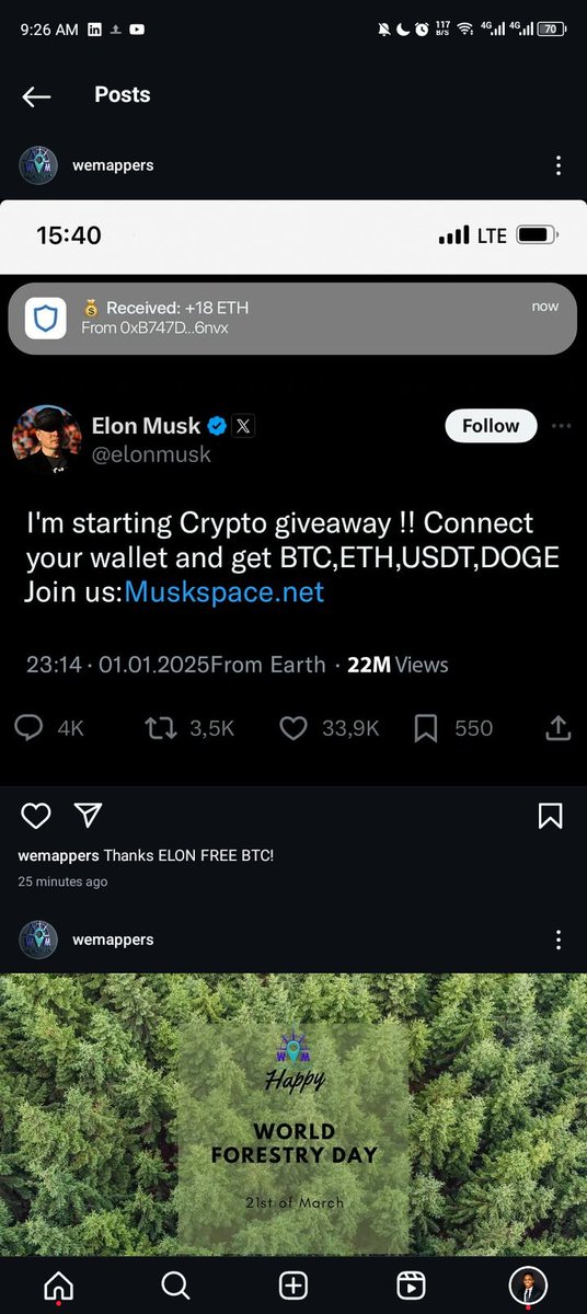
Our WeMappers Instagram account has been harked by unknown,
It should be known that WeMappers is not crypto business organization,
Don't get trapped
1
18
WEMAPPERS retweeted

16 Feb 2025
Our WeMappers Instagram account has been harked by unknown,
It should be known that WeMappers is not crypto business organization,
Don't get trapped
2
2
71
WEMAPPERS retweeted

17 Dec 2024
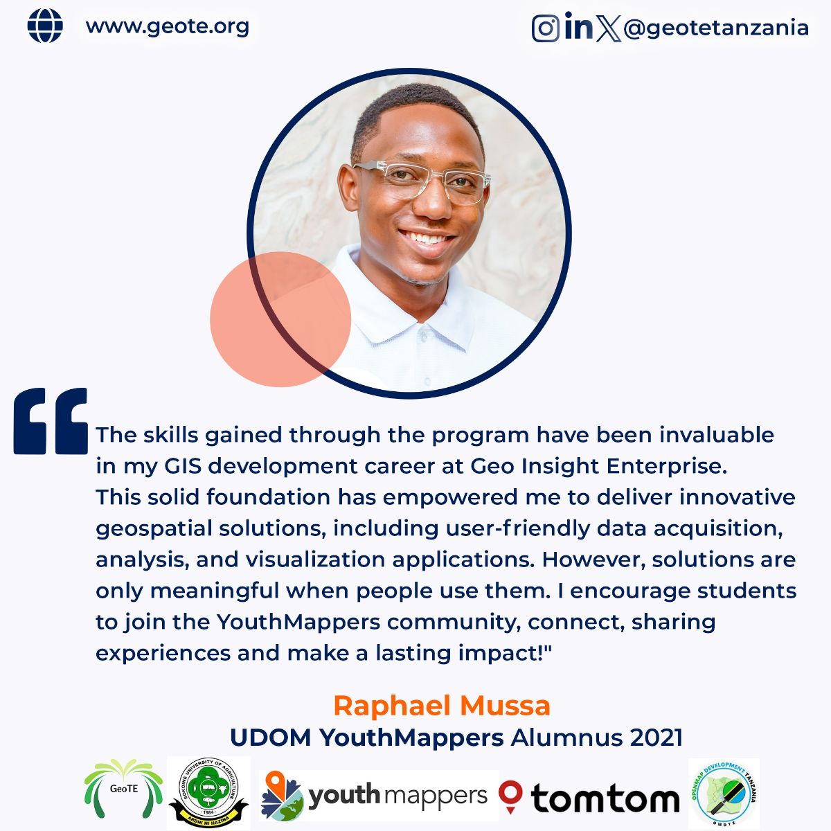
Spotlight on @raphaelmr47 🌍
From @youthmappers at university of Dodoma to GeoInsight Enterprise, Raphael is transforming geospatial data into actionable solutions.
Keep shining 🌟
@youthmappers @OMDTZ @TomTom @SokoineU
6
14
201
WEMAPPERS retweeted
3 Mar 2024
Imagine mtu unatembelea, page ya timu Yako unakutana na hiii pattern.
This is Simba
#NguvuMoja

1
1
108
WEMAPPERS retweeted

10 Mar 2024
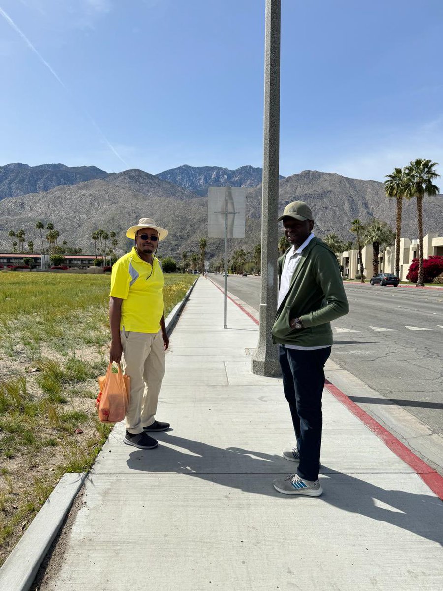
Down at the west coast for the Esri Partner Conference and DevSummit!


1
3
26
846
WEMAPPERS retweeted

16 Mar 2024
16/03/2024.When I made this map,I came to understand why the Deputy President @rigathi is really advocating for the ending of alcohol consumption in Mt #Kenya region..Data clearly shows that there's a high rate of alcohol consumption .Did this under the guidance of @Pete_M_M
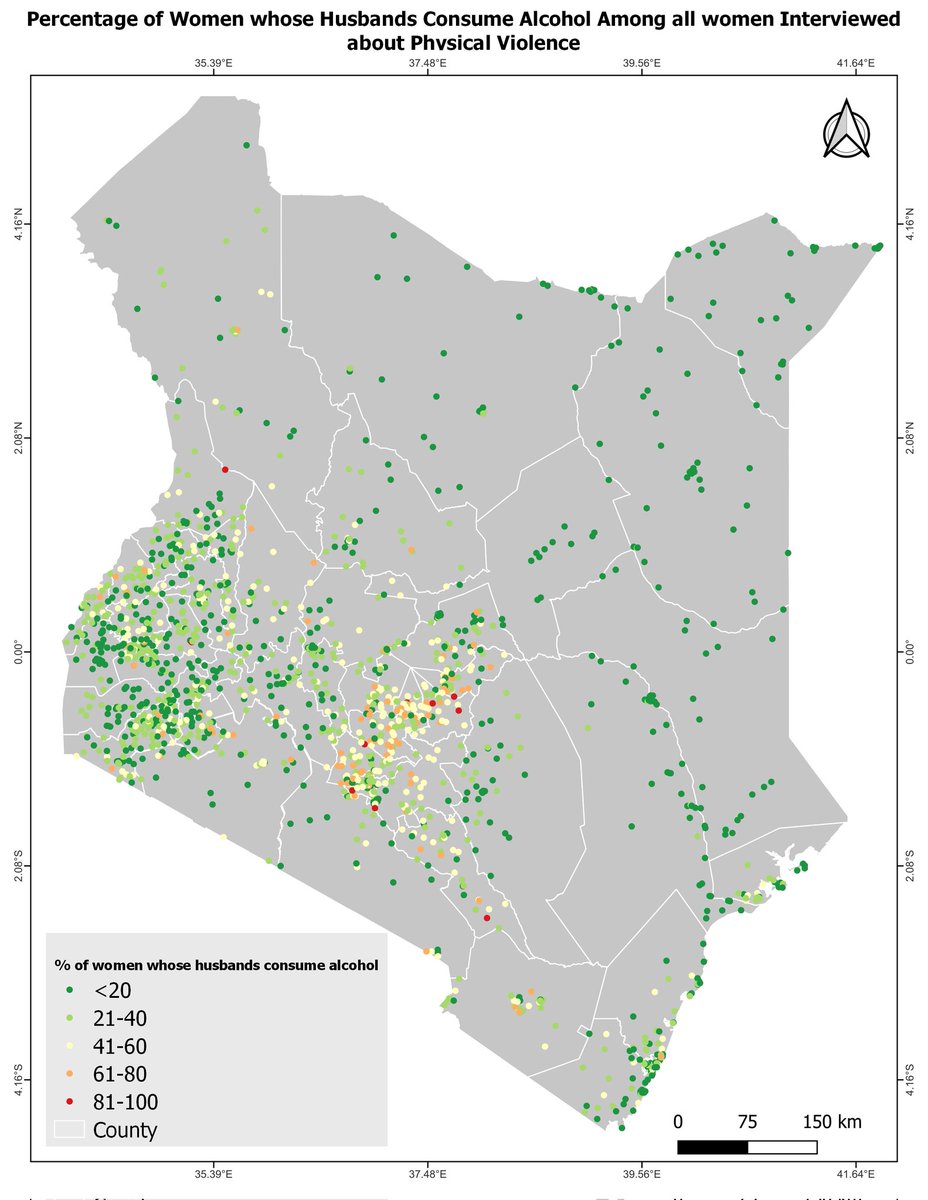
8
17
61
3,069
WEMAPPERS retweeted

9 Feb 2024
TANZANIA'S SCHOLARSHIP OPPORTUNITIES FOR HIGHER EDUCATION IN THE UK AND IRELAND #scholarshipopportunities #scholarships2024 #tanzania #scholarship #scholarships #londonuk #london #tanzaniaunforgettable #highereducation #educationforchange #educationforall

2
5
221
WEMAPPERS retweeted
5 Dec 2023
Big shoutout to WemappersTanzania! 🙌 Their groundbreaking blend of imagery and GIS integration, highlighted in a stunning 3D video, not only paints a vivid picture but immerses us in the challenges ahead at Hanang. Tech meets insight, raising the bar in disaster preparedness! 👏
2
9
434
WEMAPPERS retweeted

1 Dec 2023
Tanzania has secured one of East Africa's largest carbon credit projects.
The deal is between Tanzania's National Park Agency (Tanapa) and Carbon Tanzania.
africa.businessinsider.com/l…
5
15
4,168
WEMAPPERS retweeted

26 Oct 2023
The #ArcGISOnline 2023 October update is here! 🎉
🌎 Enforce multi-factor authentication
🌎 New date and time fields available
🌎 Save group layers as items
🌎 Customize pop-up charts
🌎 Much more!
Learn about all of the new enhancements: esri.social/9G5a50Q0SWC
1
17
39
8,831
WEMAPPERS retweeted

19 Oct 2023
🌍 What is the current state of #OpenStreetMap in your Country? Share your insights for the upcoming #SotMAfrica2023 Complete this 30 min survey👉 ee.kobotoolbox.org/x/o1kYNDk…
Help shape the future of #OpenStreetMap in Africa. Deadline: Oct 31, 2023
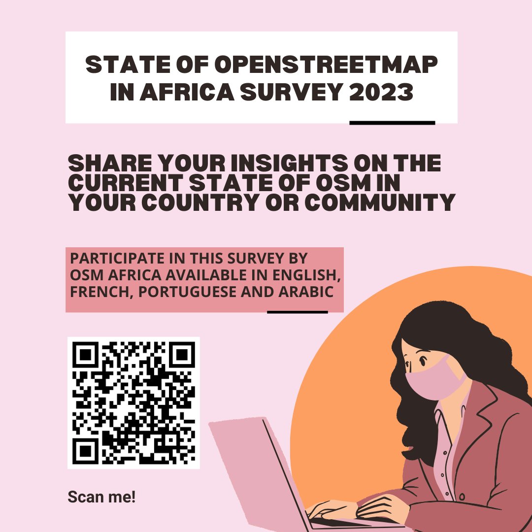
2
23
33
2,204
WEMAPPERS retweeted
13 Oct 2023
Dear cartographers do you see any implications of scale to a digital map shared as image, with unknown paper size... ?
67%
Yes scale has implication
33%
No any implication
3 votes • Final results
2
3
127
WEMAPPERS retweeted

29 Sep 2023
See you tomorrow, drone enthusiasts! 🛩️
The first training under the @youthmappers UpSkilling Series is about to begin!
Get your wings ready because we're all set to take off into the world of drones! 🚀💫 Don't forget to bring your excitement and curiosity! 🤗
1
4
7
864
WEMAPPERS retweeted
28 Sep 2023
🌍🗺️ Thank you all for the amazing response to the first episode of my webmap tutorial series! 🙏 In the next episode, we'll be diving deeper into HTML and CSS to customize the user interface of our webmap.
Don't forget to follow me for more updates! And once this tweet reaches 50 retweets, I'll release the third episode where we'll add a basemap and map title. Let's continue exploring the world together! 🌐✨
@_francisodero_
@wemappers
@GISforAfrica
@underdarkGIS
@MrGis
@QGIS
@geospatialwomen
@GeoWithJustin
#GIS #Maps #QGIS #FYP
5
9
554
WEMAPPERS retweeted
28 Sep 2023
🌍🗺️ Excited to share my new tutorial video on creating webmaps using QGIS, Leaflet, and VsCode! 🎥🎉 In this episode, I’ll guide you through the process of building a webmap from scratch. Let’s explore the world together! 🌐✨
Once this tweet reaches 25 retweets, I’ll release the next episode where we’ll dive into customizing the webmap user interface and adding base maps. Stay tuned! 😊
13
30
2,604
WEMAPPERS retweeted
27 Sep 2023
How You can use ArcGIS pro, to calculate land surface temperature, data used was Landsat 9,
@wemappers @_francisodero_ @GISforAfrica @SuperMap__GIS @gisday @gischatbot
2
11
469
WEMAPPERS retweeted

18 Oct 2022
You are invited to join us today October 18 at 3 pm EAT for this online webinar. Event is free, registration is needed.
#Post2020 #Biodiversity #Protectedareas #COP15 #BIOPAMA #IUCN #CBD
us06web.zoom.us/webinar/regi…
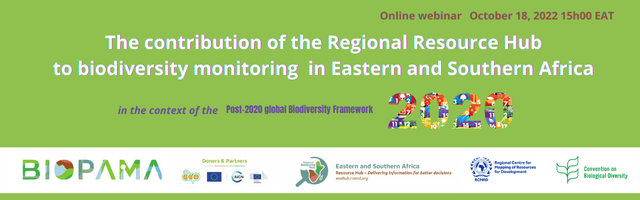
5
11