
Jun 10
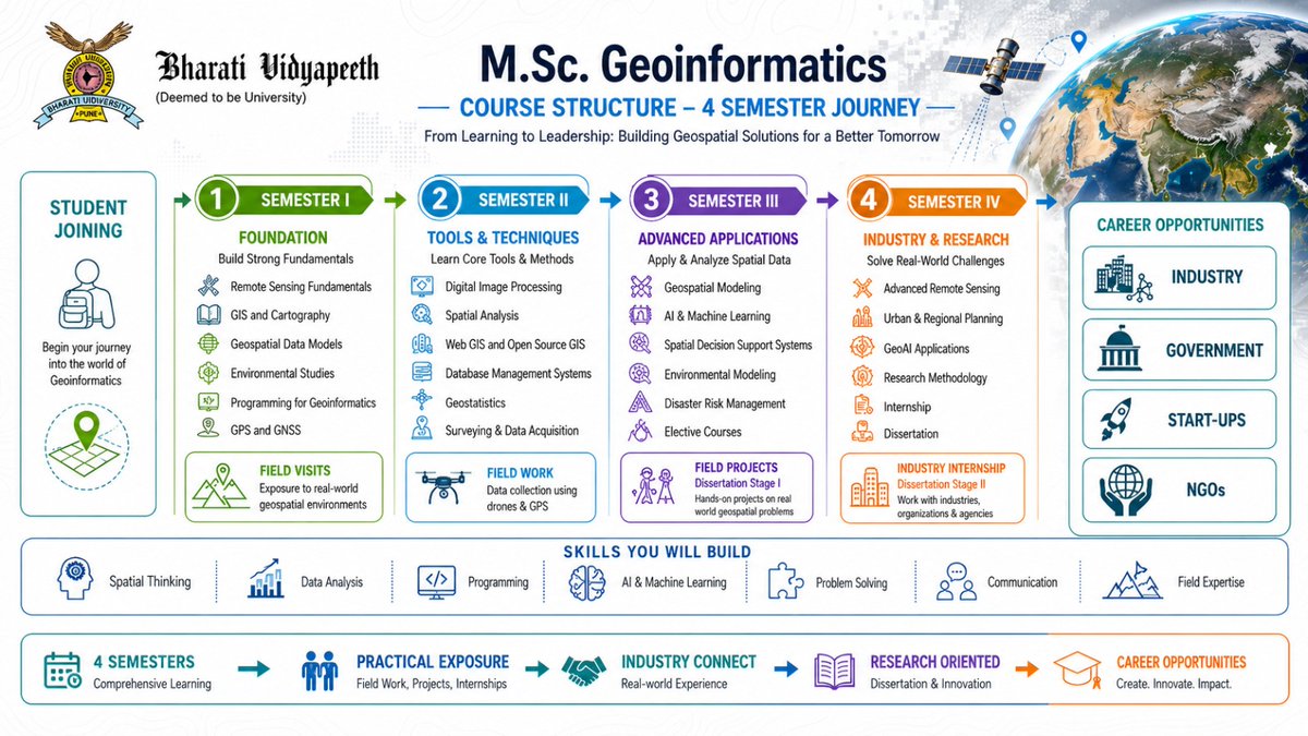
Map the World. Shape the Future.
Turn your passion for technology, data, and innovation into a rewarding career with M.Sc. Geoinformatics at Bharati Vidyapeeth's Institute of Environment Education & Research, Pune
Master GIS, Remote Sensing, GeoAI, and Spatial Analytics through hands-on learning, fieldwork, and industry exposure.
🌍 Learn. Analyze. Innovate. Lead.
📢 Admissions Open Now!
Apply Now - bvducet.bharatividyapeeth.ed…
#MSCGeoinformatics #Geoinformatics #GIS #RemoteSensing #GeoAI #SpatialAnalytics #BVIEER #BharatiVidyapeeth #AdmissionsOpen #GeospatialTechnology #FutureReady
21

May 18
Mapping smarter decisions: How geospatial data is transforming evidence-informed governance in South Africa 🌍
The Geospatial Information Management Strategy (GIMS), developed by @DpmeOfficial, highlights the growing role of geospatial technologies, spatial data, and analytics in strengthening government planning, monitoring, and evaluation: online.fliphtml5.com/xdpr/rr….
Designed to improve evidence-based planning and decision-making, GIMS also aims to strengthen spatial governance, enhance data integration, and support more coordinated and responsive public service delivery.
For the evidence-informed decision-making (EIDM) community, particularly #AENmembers, the strategy demonstrates how innovative data systems can improve policy responsiveness, accountability, and developmental impact.
The initiative is especially relevant for professionals working in monitoring and evaluation, governance, health systems, climate adaptation, urban planning, and public policy, as it reinforces the importance of integrating diverse forms of evidence into decision-making processes across Africa.
#Accountability #AfricaLovesEvidence #AfricanEIDM #DataForDevelopment #DigitalGovernance #EvidenceUse #GeospatialData #InnovationInPolicy #PublicSectorInnovation #SpatialAnalytics
May 18

WHAT IS GIMS?
GIMS is a strategic framework developed by the @DpmeOfficial to strengthen the use of geospatial technologies, spatial data and analytics in government planning, monitoring & evaluation.
#DpmeGIMS @eThekwiniM @GCIS_KZN @kzngov @SeisoMohai

3
3
185

May 6
Precision agriculture starts with intelligent visibility. 🌱
At @gistechke,we deliver Geo-Intelligence solutions for Precision Agriculture by integrating #GIS #RemoteSensing (EO) and #spatialanalytics to drive smarter, data-driven farming decisions.
#GIS #Africa #Zerohunger
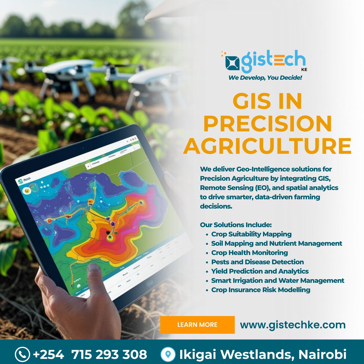
ALT GIS in Precision Agriculture by GISTechKE
2
3
66

May 6
‘Next-Level Spatial Mapping in Tableau’ with legends from the Tableau Community.
Always inspiring to learn from people pushing the boundaries of what’s possible with data maps. 🌎📊
#TC26 #Tableau #DataViz #SpatialAnalytics


1
18
374

Apr 27
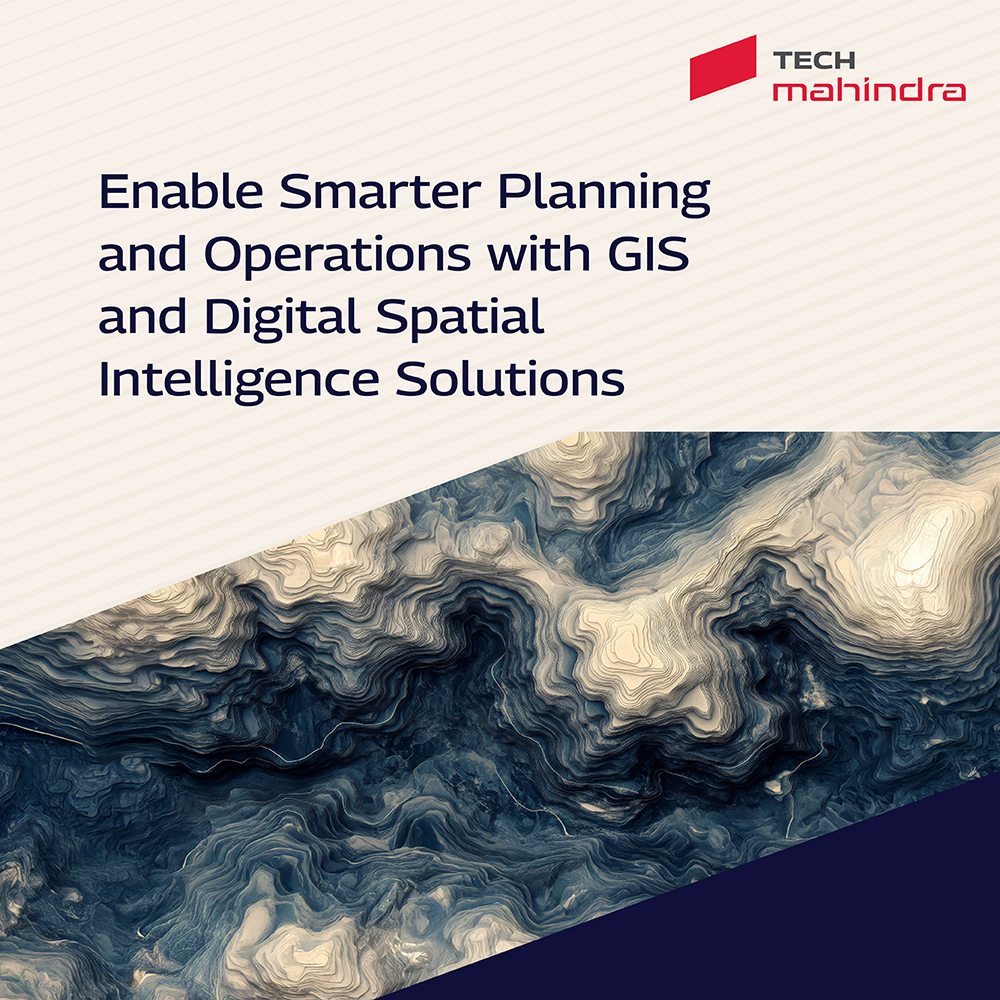
In a data-driven world, location intelligence is key to smarter planning and operational efficiency.
Explore how @tech_mahindra BPS delivers Geographic Information System (GIS) solutions across spatial data capture, street view data collection, LiDAR imaging, data management, analysis, visualization, and AI-powered geospatial platforms like Yantr.ai and Altavec.
These end-to-end #GIS services help enterprises improve asset visibility, optimize field operations, enhance network planning, and drive data-driven decisions across utilities, transport, telecom, and government sectors.
Know more: techmahindra.com/services/bu…
#ScaleAtSpeed #Geospatial #SpatialAnalytics #DigitalTransformation
4
200
Apr 21
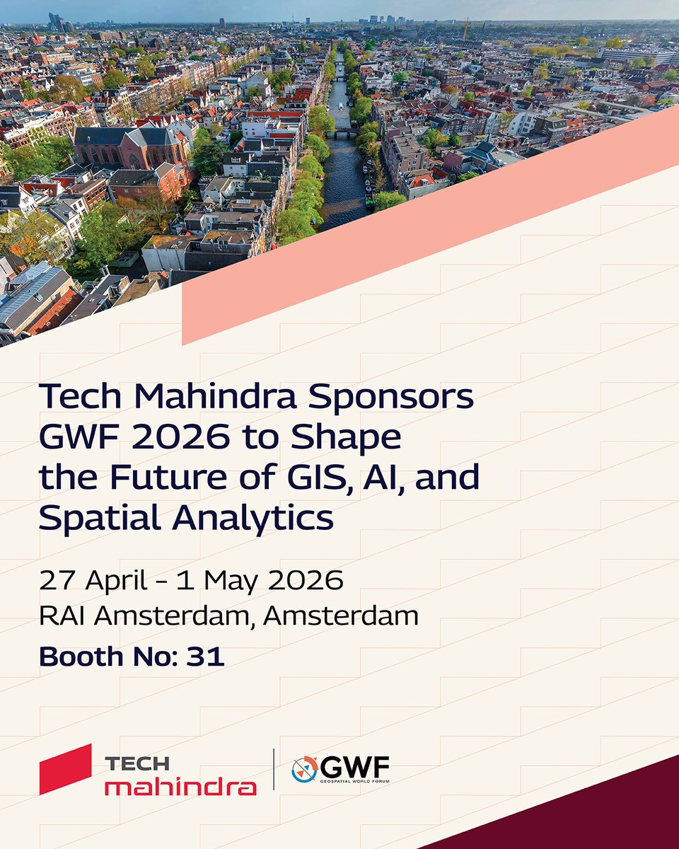
Tech Mahindra is sponsoring #Geospatial World Forum 2026, bringing forward next-generation #GIS and spatial analytics solutions designed to support smarter decisions and resilient enterprise operations.
📅April 27 – May 1, 2026
📍RAI Amsterdam, Amsterdam
🔢Booth No. 31
Connect with Birendra Sen, Dhananjay Deshmukh, Rajanikanth Muppalla, Shashikant Bagul, PMP® ITIL, Eloise Thaisen, Toshi Choudhary, Nitin Pande, and Balvinder Kaur Sethi to explore how GIS, spatial analytics, and AI-driven geospatial solutions are shaping enterprise intelligence and operational resilience.
Register now and meet us at Booth 31.
Know more: techmahindra.com/insights/ev…
#ScaleAtSpeed #GWF2026 #SpatialAnalytics #DigitalTransformation

172
Tech Mahindra joins #GeospatialWorldForum 2026, a global forum driving the next wave of geospatial intelligence and digital transformation.
📅 April 27 – May 1, 2026
📍 RAI Amsterdam, Amsterdam
📌 Booth No: 31
Join us to explore how @tech_mahindra is enabling enterprises with advanced #GIS, spatial analytics, AI‑driven geospatial solutions, and digital #innovation to support smarter decisions and more resilient operations.
Register now and connect with our experts at Booth 31: techmahindra.com/insights/ev…
#ScaleAtSpeed #GWF2026 #Geospatial #DigitalTransformation #SpatialAnalytics

1
2
175

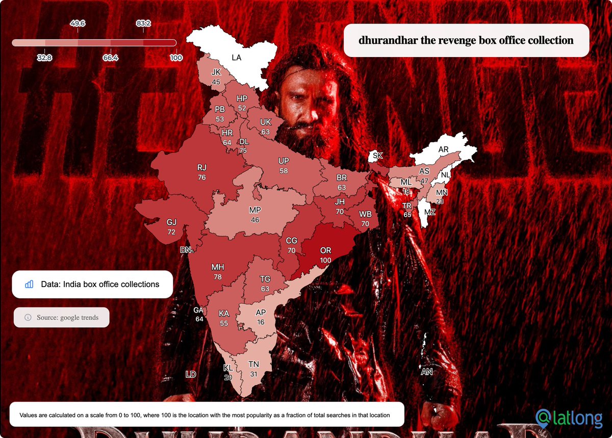
Mar 24
From a 100-point peak in Odisha to high-octane interest in Maharashtra (78) and Rajasthan (76), our mapping shows exactly where the revenge saga is dominating the charts.
This is how location intelligence turns search trends into clear, actionable spatial insights. 📍
How are you tracking your brand's regional reach? let us know below.
#dhurandhar #boxofficeindia #googletrends #datavisualization #mappingindia #spatialanalytics #MarketResearch
3
46

Mar 19
Learn how AI fits into GIS workflows 🗺️🤖
The GeoAI Essentials learning plan by Esri covers ML, deep learning, and spatial analytics in ArcGIS Pro.
Find out more: esri.com/training/catalog/66…
#Geoawesome #GeoAI #ArcGIS #GIS #SpatialAnalytics #MachineLearning #DeepLearning
4
299

The physical world is finally programmable. Motion in. Meaning normalized. Action out. ⚡️
If you're a developer ready to build with motion as a primitive, it's time to dive in.
#Web3 #DePIN #EkstraAI #MotionRuntime #SpatialAnalytics #BuildInWeb3
7
237

Feb 25
Pulse helps teams spot patterns, anomalies & hotspots in massive geospatial datasets, so traffic, security & planning decisions are based on real insights, not guesswork.
📽️ Watch: youtu.be/iWpA8uHxYlA
#AI #Geospatial #SpatialAnalytics
1
4
157

Feb 24
Applied Geospatial #DataScience with Python: amzn.to/3YIgKi4 v/ @PacktDataML
—————
#GIS #LocationIntelligence #DataScientist #SpatialAnalytics
2
3
8
827
Feb 24
Learning #Geospatial Analysis with #Python — Unleash the power of Python with practical techniques for #GIS and #RemoteSensing (4th edition): amzn.to/3HvTigy v/ @PacktDataML
————
#DataScience #Analytics #SpatialAnalytics #DataScientist #LocationIntelligence

4
3
22
1,142
Feb 19
Geospatial data is massive and easy to miss patterns in. Pulse uses AI to turn billions of location points into clear insights, spotting hotspots & anomalies with interactive maps.
📽️ Watch the video: youtu.be/iWpA8uHxYlA
#SpatialAnalytics #AI #Geospatial
1
3
234
Feb 14
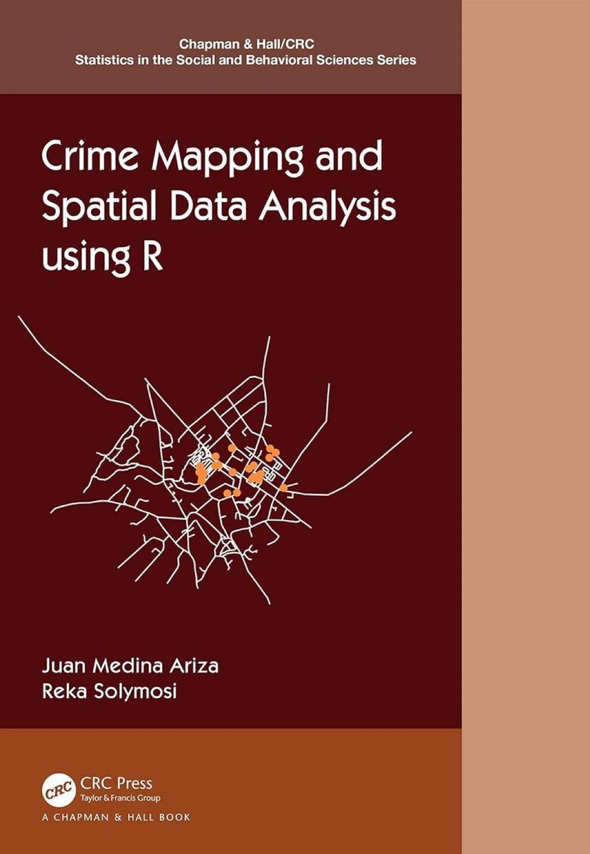
“Crime Mapping and Spatial Data Analysis using R” book by @r_solymosi and @Juan_JoseMedina ➡️ amzn.to/44pYEnR
————
@CRC_MathStats #Rstats #DataScience #DataScientist #SpatialAnalytics #SpatialData #Statistics

1
10
52
1,563
Feb 10
Accelerate business intelligence and operational efficiency with @tech_mahindra's #GIS and Geospatial Services. Our end‑to‑end spatial solutions enable organizations to capture, manage, analyze, and visualize high‑precision geospatial data for actionable, location‑driven insights.
From street‑level mapping and advanced data visualization to AI/ML‑powered platforms like Altavec and Yantr.ai, we help enterprises enhance asset management, improve operational planning, mitigate risk, and boost field workforce productivity.
Leverage spatial intelligence to make smarter decisions, optimize workflows, and unlock growth through location‑led insights.
Know more: techmahindra.com/services/bu…
#ScaleAtSpeed #Geospatial #SpatialAnalytics #DigitalTransformation #OperationalExcellence
1
1
4
233
Jan 25
Learning #Geospatial Analysis with #Python — Unleash the power of Python with practical techniques for #GIS and #RemoteSensing (4th edition): amzn.to/3HvTigy v/ @PacktDataML
————
#DataScience #Analytics #SpatialAnalytics #DataScientist #LocationIntelligence
1
4
691
Jan 22
GeoAI is turning maps into predictive tools. AI EO PNT now help track climate change, floods, and city dynamics.
Follow for more:
geoawesome.com/geospatial-ai…
#GeoAI #GIS #EarthObservation #SmartCities #SpatialAnalytics
1
4
389
Jan 17
“Crime Mapping and Spatial Data Analysis using R” book by @r_solymosi and @Juan_JoseMedina ➡️ amzn.to/44pYEnR
————
@CRC_MathStats #Rstats #DataScience #DataScientist #SpatialAnalytics #SpatialData #Statistics
36
159
4,089
In a world where location matters, GIS-powered spatial intelligence is transforming how organizations plan, operate, and grow.
Our comprehensive GIS solutions cover the entire lifecycle, from high-precision spatial data capture and mapping to data management, analysis, visualization, and #DigitalTwin creation.
Whether it is urban planning, utilities, transportation, telecommunications, or asset-heavy sectors, we deliver real-time spatial insights, optimized field operations, robust network design, and actionable mapping intelligence.
👉 Know more: techmahindra.com/services/bu…
#ScaleAtSpeed #SpatialAnalytics #Geospatial #LocationIntelligence #DataVisualization #DigitalTransformation

1
1
185