
Maps of Toronto @tdubolyou @willy_maps IG: instagram.com/mapTOdotCA
Joined November 2016
- Tweets 456
- Following 520
- Followers 1,354
- Likes 781
132 Photos and videos


Pinned Tweet

30 Dec 2020
Thanks to all of you who followed our 2020 Map of the Week challenge! #TorontoAtlas As you may have noticed, it got the best of us and we were only able to make it to week 33. Now that we're on vacation in St. Barts, we thought we'd highlight our personal faves to end the year:
2
13
29
7 Aug 2025
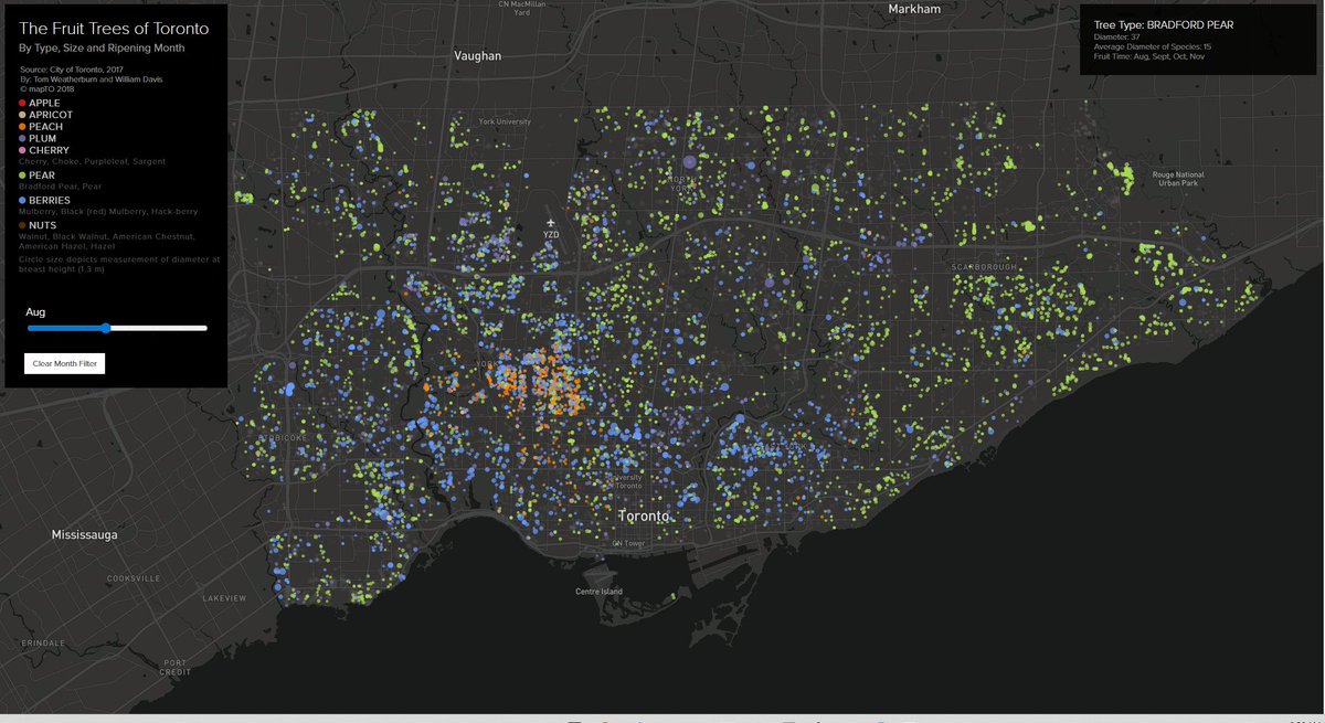
Heading into a glorious time for local fruit. Peaches, pears and plums #toronto #topoli #ediblecity #map
mapto.ca/maps/the-fruit-tree…
1
1
192

14 Oct 2021
14 Oct 2021

#topoli To all of you who live in the venn diagram intersection that includes data nerds and development nerds -- and you know who you are -- the CoT is about to dump 15 yrs of Section 37 records into the City's open-data portal. Deets here: app.toronto.ca/tmmis/viewAge…. Have at it.
2
mapTO retweeted

24 Aug 2021
Great set of images for #OntEd gr 9 math teachers who are going to be teaching some financial math with a hint of data management. #ITeachMath
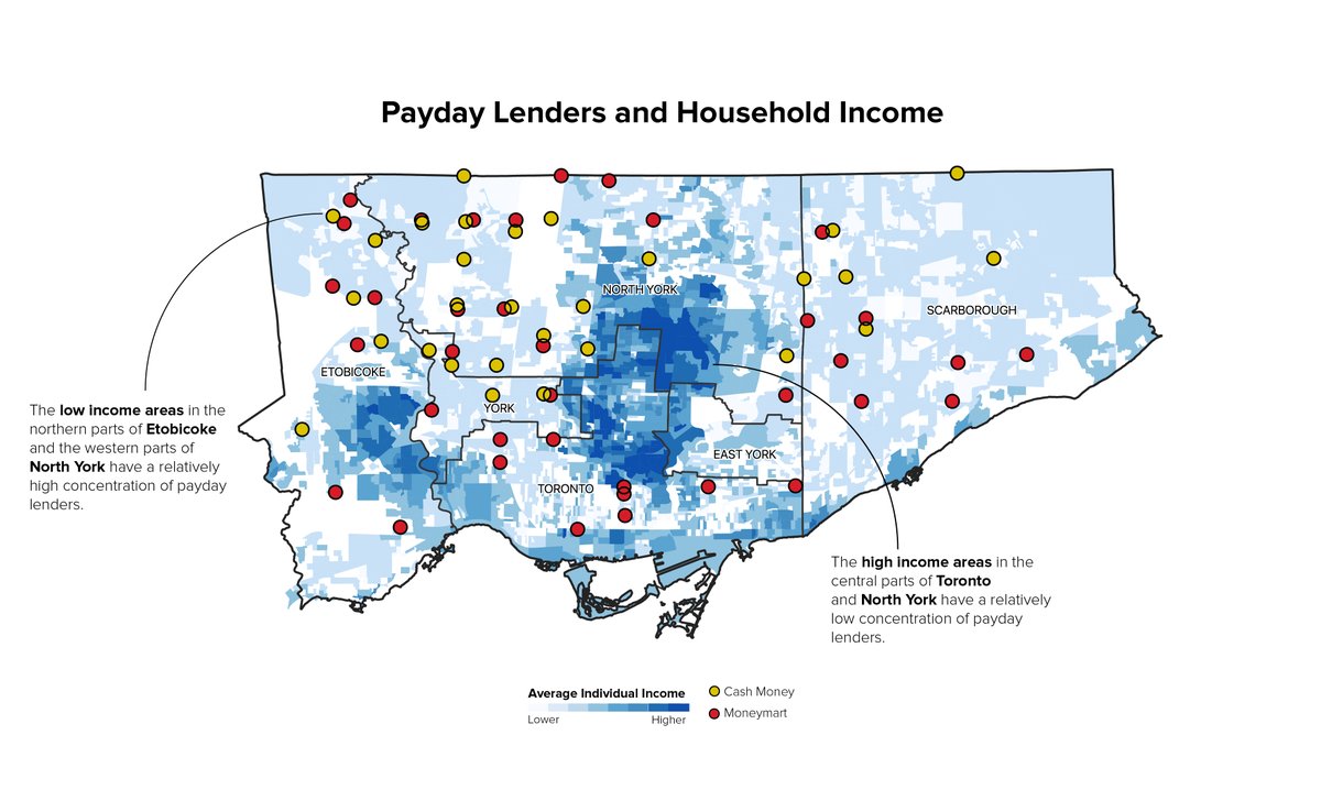
2 Mar 2020

Week 9: The geography of Payday Lending in Toronto
We mapped the locations of two prominent payday lenders over average individual income. Interesting pattern.
#TorontoAtlas #maps #dataviz
2
7
53
17 Jun 2021
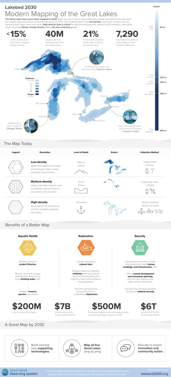
Modern Mapping of the Great Lakes!
This is a fun project we did for @RealGLOS ahead of their #Lakebed2030 Conference.
What % of the Great Lakes have been mapped in high density? See below!
#dataviz #infographics #maps
16 Jun 2021

Today, only 5% of the Great Lakes are mapped at high-density, leaving big areas of unknowns across our lakefloor.
We created this infographic to explore what it will take to complete this map.
glos.us/wp-content/uploads/2…
More at lakebed2030.org
4
8
mapTO retweeted

11 Jun 2021
Holy crap. We won, @thelocalhealth
11 Jun 2021

Way to go! The #DPA21 General Excellence in Digital Publishing: Small award goes to @thelocalhealth! buff.ly/3eowizw
25
15
225
mapTO retweeted

Maps have been core to our work here at The Local, starting with our very first issue, The Geography of Difference. They reveal truths about Toronto that are otherwise invisible to the naked eye. thelocal.to/mapping-our-divi…
1
4
5
mapTO retweeted
In Toronto, the big difference between illness and health is your postal code. Here's the full collection of maps we assembled while putting together our latest story.
1. COVID-19 infections are highest in the northwest and east

1
10
14
mapTO retweeted
In the five Toronto neighbourhoods worst-hit by COVID, all in the northwest, there are no pharmacies offering vaccines. The five neighbourhoods with the fewest infections have 12. @royinori on how COVID hot-spots have become vaccine deserts. thelocal.to/plenty-of-pharma…
29
580
802
mapTO retweeted

20 Mar 2021
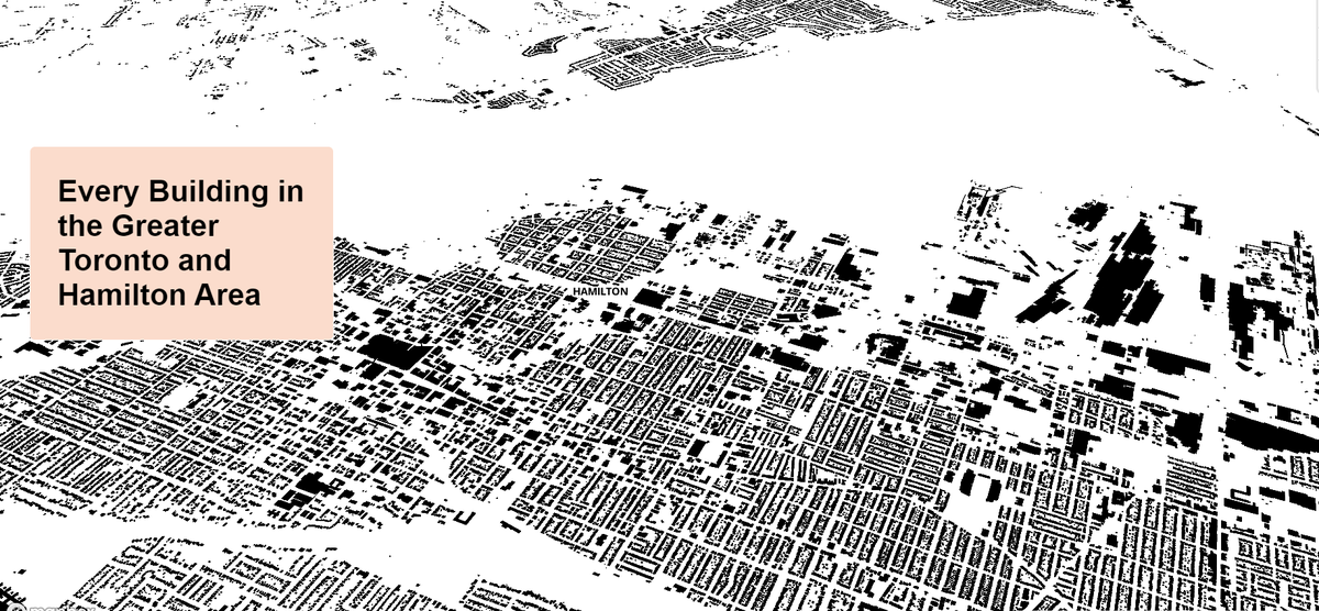
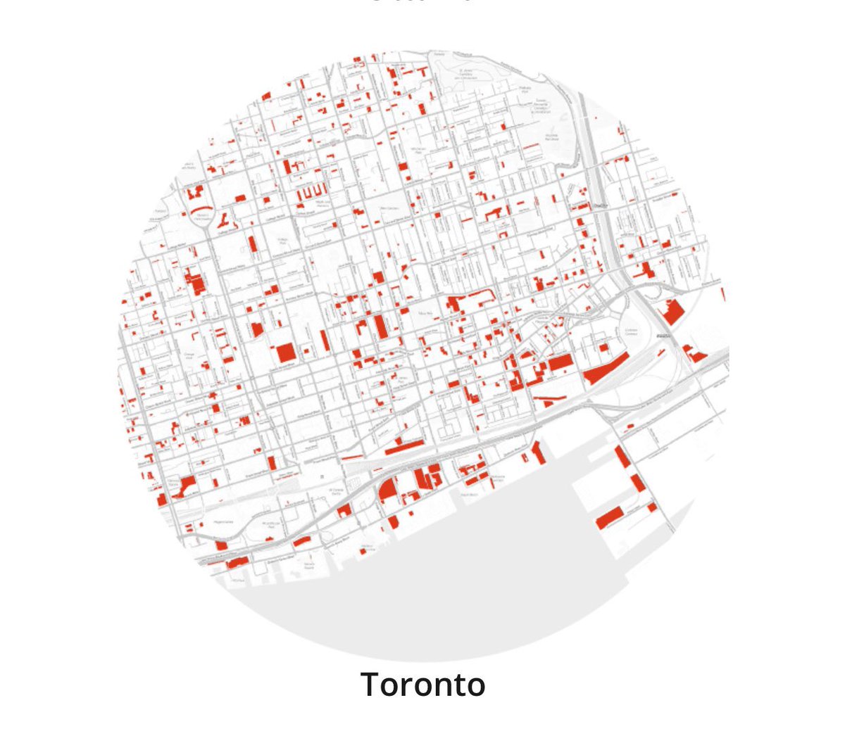
Ever wonder what the footprint of every building in #Hamilton looks like? Well look no further!
Check out cool interactive map of every single building in the Greater #Toronto & Hamilton Area🗺️ #HamOnt #topoli
mapto.ca/maps/every-building…
2
15
46
25 Feb 2021
If you want to see how Toronto’s surface parking changed over time - mapto.ca/maps/parkinglots
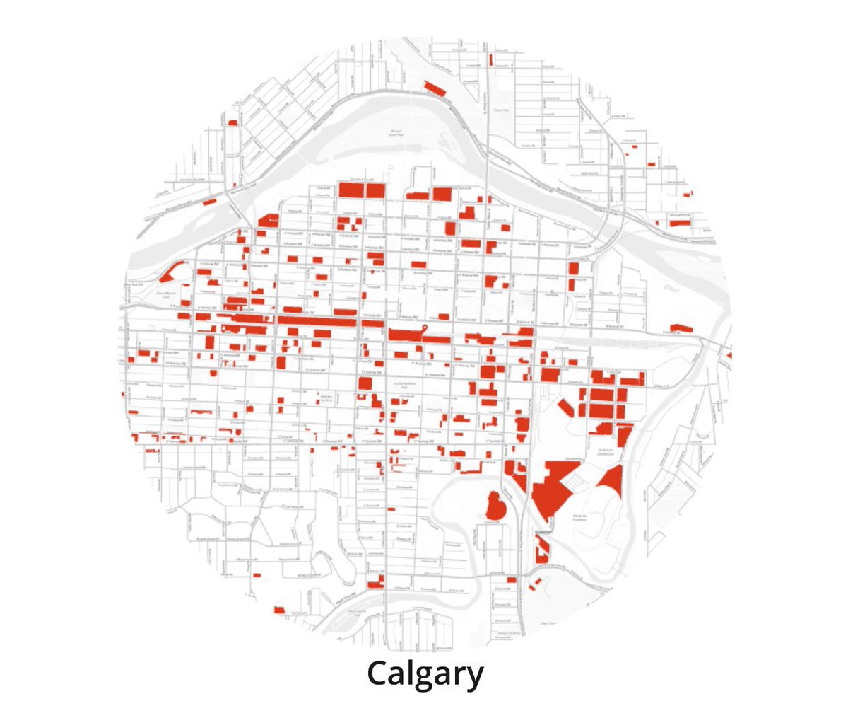
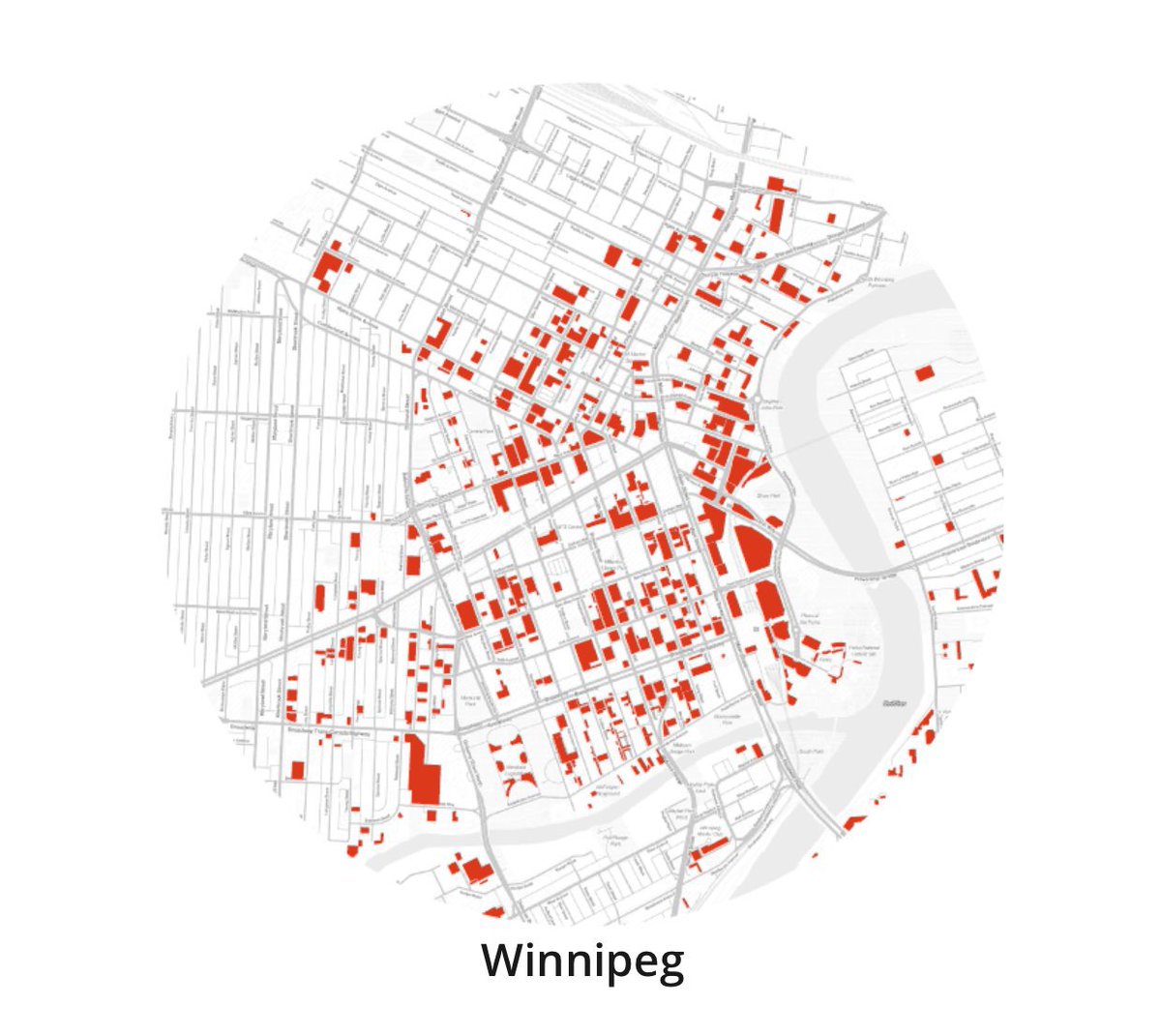
24 Feb 2021

Arguably one of the clearest indicators of the success of a downtown is the amount of surface parking. The more there is, the less successful the downtown likely is. Maps via @WinnipegNews (from 2017). For more on smart parking, read my comments here: winnipegfreepress.com/local/…
1
6
22 Feb 2021
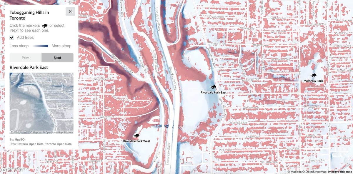
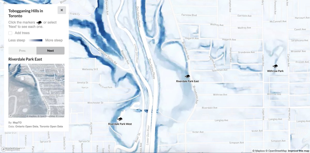
We've included a variety of data layers to make slope surfing that much more exciting. Here is a screenshot with trees turned on 🔴
1
2
6
22 Feb 2021
These locations are based on the official City of Toronto Tobogganing page toronto.ca/explore-enjoy/rec…