
371 Photos and videos


Feb 28
Israel closes airspace, per NOTAM, to all flights except civilian/military flights with prior permission.
266
Feb 28
Iranian state media banner confirms Israel conducted military strikes on Tehran.
153
Feb 28
Iranian state media flashing a banner that confirms smoke is rising in Tehran after explosions were heard.
125
Feb 28
Iran has just closed its airspace according to a NOTAM.
A0715/26 NOTAMN
Q) OIIX/QAFLC/IV/NBO/E/000/999/
A) OIIX B) 2602280630 C) 2602281200
E) TEHRAN FIR CLSD
1
207
Feb 28
Iran just closed part of its airspace above Tehran this morning according to a NOTAM. Planes use the airway in the red box to fly OVER Tehran (they don't land there).
Planes landing in Tehran can still use it.
The NOTAM ends on May 1.
228
Jan 9
Protest in Zahedan, Iran. Some sort of smoke seen rising in one of the videos; both were taken outside of the Grand Makki Mosque during Friday prayers.
There's unconfirmed reports (no video supporting) that claims authorities were firing live rounds at protesters.
1
189
Jan 9
This wouldn't be the first time Zahedan has seen violence.
en.wikipedia.org/wiki/2022_Z…
1
131
Jan 4
Most intriguing US strike in Venezuela is the 2 buildings on remote road above Fuerte Tiuna military complex.
Right in the middle of that road is a large building with partially covered driveway.
Wonder who may have been there?
Imagery from @vantortech
200
23 Jun 2025
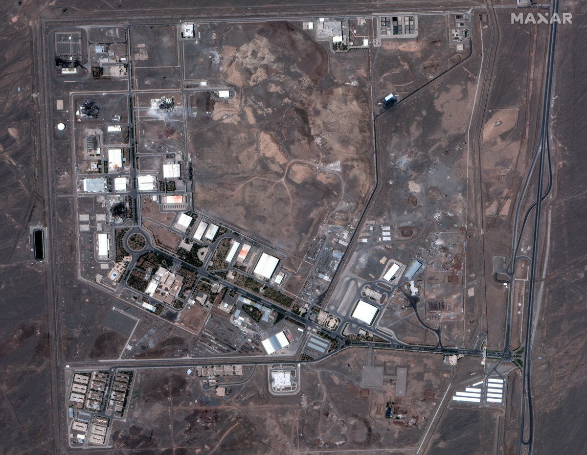
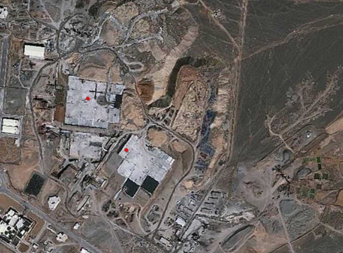
.@BlackSky_Inc IDs additional damage at Isfahan Nuclear Technology Center, likely from US Tomahawks. The images are taken by their new Gen-3 sats (35cm), so can see a lot more detail.
Have to wonder what was so important about the building the US hit at 32.583, 51.824
526
22 Jun 2025
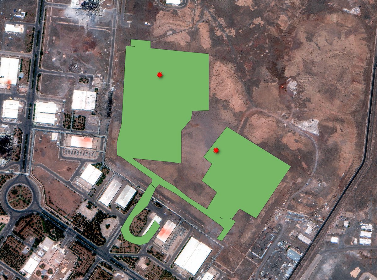
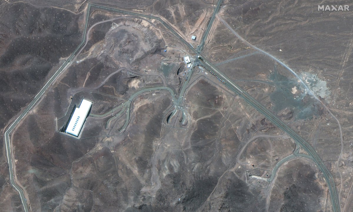
Digging further into the archival Maxar QuickBird imagery, a rough layout of the visible underground infrastructure at Natanz appears (in green). The strike locations are in red.
Notably, the entrance building to these has not yet been targeted by a strike.
22 Jun 2025

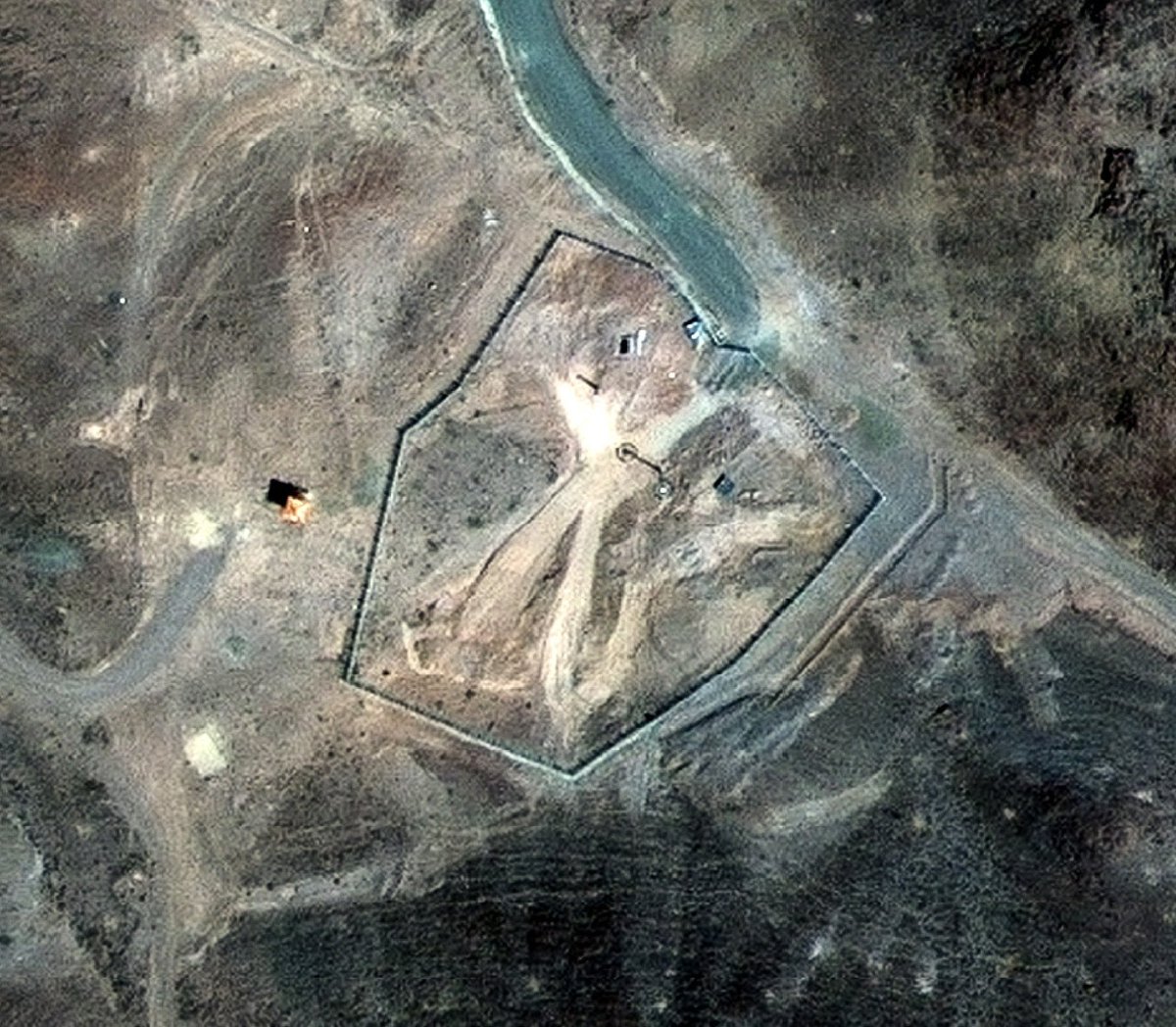
What was hit by the US at Natanz? A 2003 image from when @Maxar was known as DigitalGlobe lets us see.
The second image, shows what the Iranians built underground at Natanz. And it shows the second crater was targeting a second underground section of that facilities there.
3
617
22 Jun 2025
Fordow is dramatically different from Natanz, where the Iranians constructed an underground structure and then buried it.
All of the construction at Fordow, as seen in Landsat 7 images, was underground. And it was very, very deep.
Hence why the US engineer the GBU-57.
22 Jun 2025
How did we get from a bit of remote land in rural Iran to the US bombing what's now the Natanz Nuclear Facility?
Construction began in April 2000.
Imagery from the since decommissioned Landsat 7 shows us the construction of the project over time.
464
22 Jun 2025
How did we get from a bit of remote land in rural Iran to the US bombing what's now the Natanz Nuclear Facility?
Construction began in April 2000.
Imagery from the since decommissioned Landsat 7 shows us the construction of the project over time.
2
4
866
22 Jun 2025
What was hit by the US at Natanz? A 2003 image from when @Maxar was known as DigitalGlobe lets us see.
The second image, shows what the Iranians built underground at Natanz. And it shows the second crater was targeting a second underground section of that facilities there.
1
6
2,038
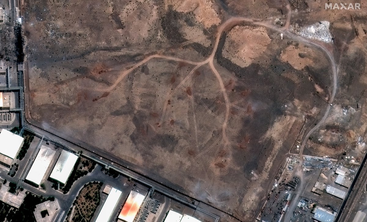
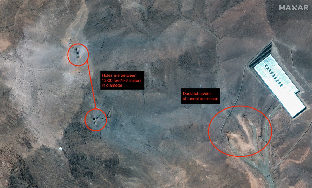
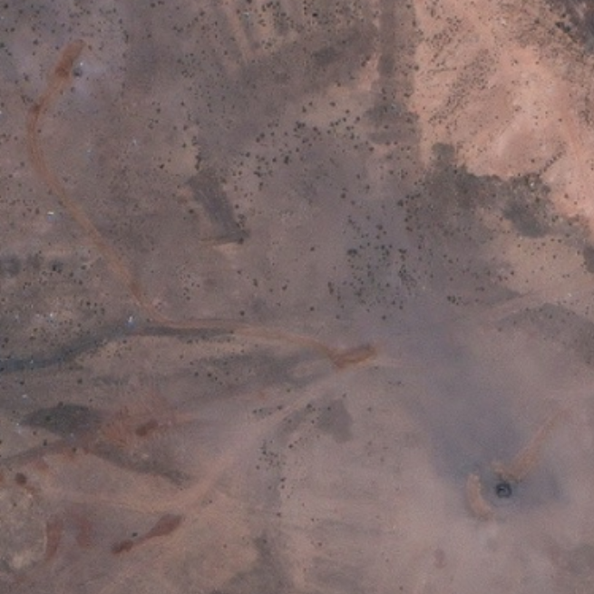
22 Jun 2025
This hole that @MeraMeraska points out is almost 10 feet/a little over three meters. Which makes it the smallest crater generated by US strikes on Iran, so far.
It's definitely a crater from a strike, but not convinced it's a crater from a GBU-57 at the moment.

5
803