
18,646 Photos and videos


p•3•s•t retweeted

🇳🇴 Meanwhile in Norway
Man exposes satanic symbolism in one of Norway’s largest parks.
This is a crazy one - they don’t even try to hide it.
55
484
1,418
30,429
p•3•s•t retweeted

I've always wondered why noone has attempted this technique 🤔

Why aren't Football teams trying this technique to score easier goals.. Are they stupid?
1
1
3
507

p•3•s•t retweeted

Under the protection of the regime, Kasol forest in Indian Himalayas is being used for drug parties for Israeli tourists for several years. Finally, the court has come out directing police and district officials to stop these illegal activities.
46
332
1,001
56,280


p•3•s•t retweeted

Google hid a fully working flight simulator inside Google Earth back in 2007 and never told anyone.
You unlocked it with a secret keystroke: Ctrl Alt A. No menu, no announcement. One user stumbled onto it, the combo spread, and it got popular enough that Google made it official the next year. Two planes, an F-16 and a Cirrus SR22, flying over real satellite imagery of the entire planet.
Then it stayed locked inside the downloadable desktop app for 18 years. The browser version was a stripped-down viewer that couldn't run it. Today that changed.
Here is the part that makes it impressive. A flight simulator is the single hardest thing you can ask a 3D map to do. Panning is easy, the software has all the time it wants to load the terrain ahead of you. Flying low and fast strips that away, forcing it to fetch, decompress, and render the world faster than you are crossing it. The hardest possible job for every part of the system at once.
So "just for fun" is carrying a lot of weight in that sentence. Getting this to run in a browser tab is the cleanest proof that the web version finally matches what used to need a desktop app.
The toy is the benchmark.
Jun 12

Prepare for takeoff. ✈️ Flight simulator is now available globally on web to all users. goo.gle/4fBYnWO
We've recently added many our most powerful professional desktop features to web. Elevation profiles, new import types, but there's always been one other feature you've been asking us to add to the web version of Google Earth, just for fun...
Where will you fly? Share your best maneuvers, views, and flyovers with us!
46
568
5,764
1,150,192
p•3•s•t retweeted

Jun 13
🚨| BREAKING: FIFA President Gianni Infantino just told Speed he can be the FIFA President at the next game he attends 🤯🔥
614
3,071
47,405
3,005,422
p•3•s•t retweeted

Breaking: Palestinian prisoner Imad Sarhan, from Haifa, has died in Gilboa Prison after spending 24 years in Israeli prisons.
15
710
1,411
20,267
p•3•s•t retweeted
For those still asleep at the back.
22
360
1,035
19,240
p•3•s•t retweeted

Jun 12


193
18,256
157,188
1,633,113
p•3•s•t retweeted

Does your dad have an emerald mine?
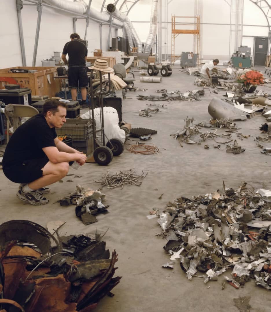
Jun 12

Next time you think of giving up, remember this photo of Elon in 2008.
626
18,760
249,188
3,288,640
p•3•s•t retweeted

20h
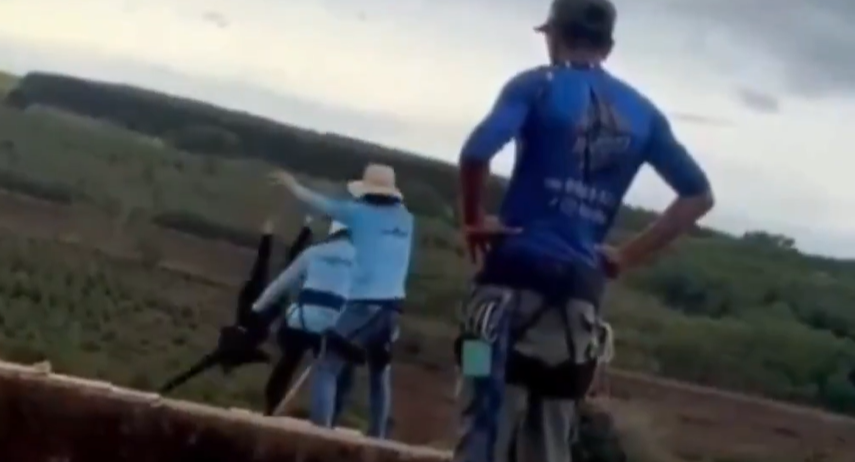
Another fake video intentionally going viral so they can continue to suck you dry of your emotional energy.
Interesting how the arms of the ''woman'' remain outstretched the entire time and barely move at all...almost like they are throwing a silicone dummy off the bridge and not a real person 🙄
Nice try but I'm not buying what they're selling.

Jun 13

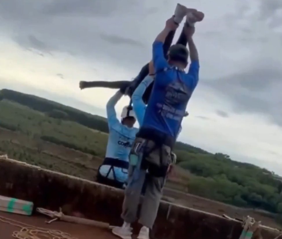
JUST IN: 21-year-old dies after workers forget to attach safety rope and push her off 40-meter bridge in São Paulo’s Limeira, Brazil
17
20
102
11,135

RT @__almaas__: Digital currency aka cbdc is already on the way.
x.com/i/status/2065412909547…


ALT MDP's menifesto in previous gov

1
RT @__almaas__: Many people recently started realising this. We already have this digital id system up & running for sometime now. At first…
6
p•3•s•t retweeted

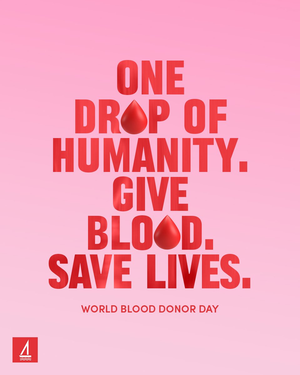
People donate blood for humanity and this bank sucks the life out of people 😅
This #WorldBloodDonorDay, we are reminded that every donor helps form a lifeline that connects and protects us all. ❣️
The gift of blood is precious, so let’s encourage one another to #GiveBlood.
4
11
673
p•3•s•t retweeted

10h
⚽️🇮🇹 "Free drinks during all Italy World Cup games"
*BTW, Italy failed to qualify World Cup
Bastards...

13
22
409
14,523

p•3•s•t retweeted
Pfft!! Whats with all the complains when you commoners got hands they say!!
1
1
184
p•3•s•t retweeted

14h
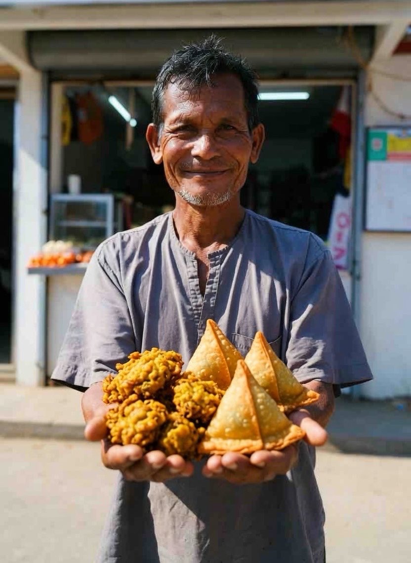
These people don't really care about environment or our health.
There are food that shouldn't be put in bags that are used now. I don't know what's it made of, but they shed tiny hair-thin fibres that get inside or stick to food like sugar, hedhika.
2
2
7
205
p•3•s•t retweeted

Jun 13
Every year he says some shit about Palestine and every year people act like its the first time this Zionist said something racist.
And he was famous for being a “comedian” before my adulthood.
I never found him funny. Just annoying as shit.

- Jerry Seinfeld is currently trending due to his controversial statements regarding Palestine.
- He has been labeled as a "fanatical genocidal Zionist."‼️

3
9
175