
You exist in the context of all in which you live and what came before you.
Joined April 2007
- Tweets 24,443
- Following 1,085
- Followers 2,700
- Likes 31,314
2,144 Photos and videos


Pinned Tweet

18 Nov 2015
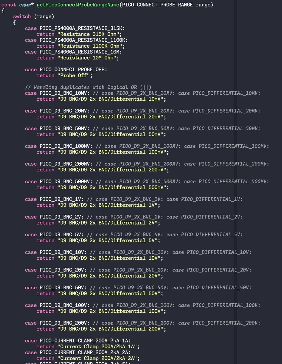
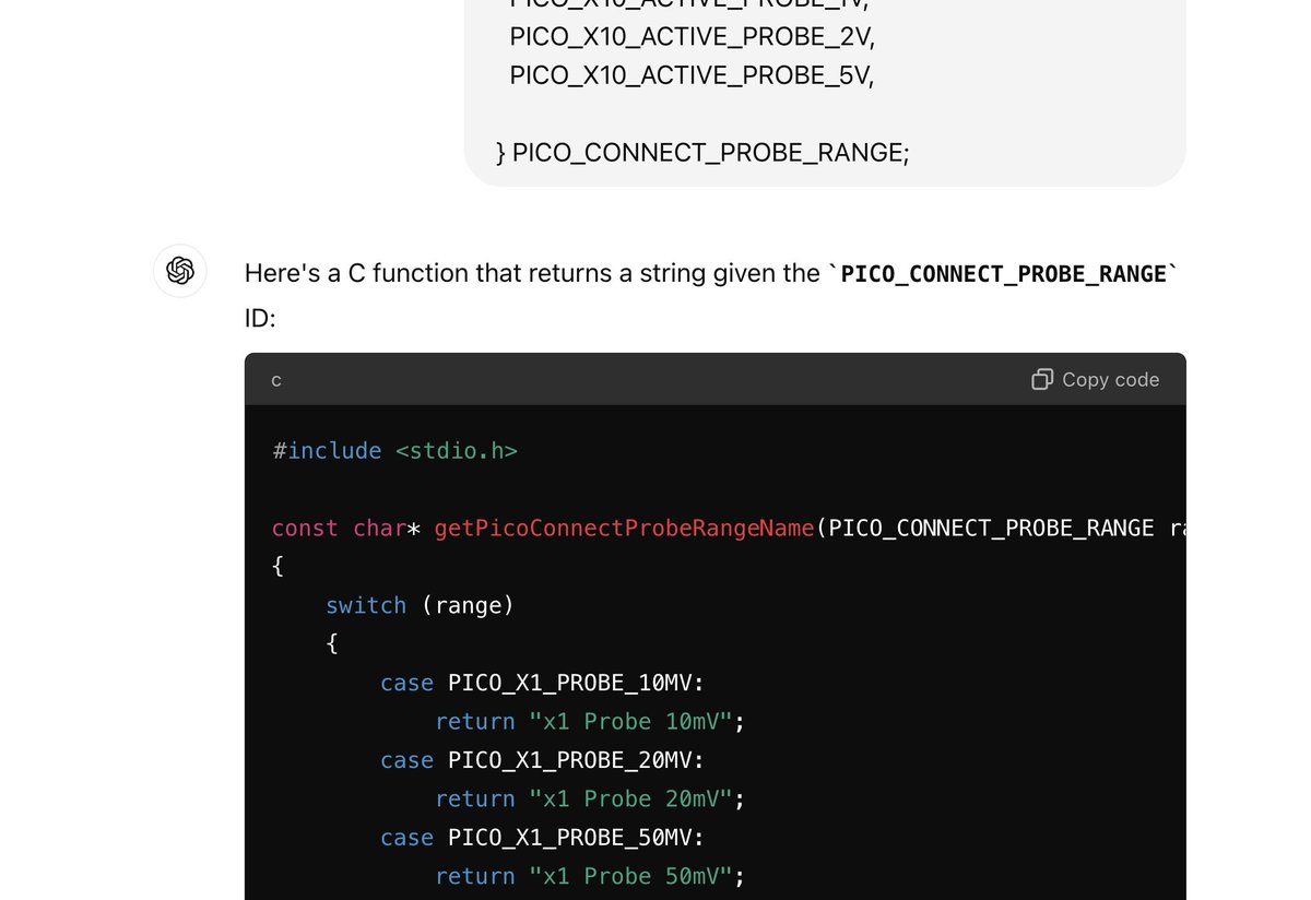
The single best software engineering graphic you need to know.
softwareengineeringdaily.com…

14
1,900
1,758
Again, june 6, 2026. I'm just using Twitter now to report fireworks to myself. Hi future self <waves> I bet it's all worse than we thought.
16 Nov 2023

I've done this before. Right next to your tweet on "berkeley fireworks"
1
224
Scott Stanfield 🇺🇸🧢🌻 retweeted

Jun 6
This is really stupid, and it’s not getting enough attention.
The Trump administration is pulling a working $368 million ocean monitoring system out of the water, equipment taxpayers already bought, built, and sank into the deep ocean.
And they are doing it right when the oceans are behaving in ways that alarm the scientists who study them.
Record-breaking temperatures.
A system of Atlantic currents that may be lurching toward collapse.
The response?
Yank out the instruments and walk away.
That is not budgeting. That is smashing the gauges while the engine is on fire and calling it efficiency.
For what? The Trump administration dressed it up as a “nimbler approach” and “smart lifecycle management,” which is fancy nonsense for “we shut it off and hoped nobody would ask why.” There is no return-on-investment analysis. They cannot show taxpayers save a dime, because the gear is already paid for and the science it produces protects real money and real lives.
The kicker: the same people killing the monitors want to mine the deep sea for minerals. So they are destroying the only tools that could measure what that mining does. That is not an accident.
That is the point. You cannot see the damage if you break the instruments first.
cnn.com/2026/06/03/climate/o…
1,165
15,150
30,237
1,008,430
Scott Stanfield 🇺🇸🧢🌻 retweeted

May 27
This is Ken Paxton's mugshot.
He was indicted on 3 felony counts for investment fraud.
He was reported to the FBI by his own staff for bribery.
He was impeached by his own party for corruption.
Now he’s the Republican nominee for US Senate in Texas.
Together we will stop him.

4,419
20,400
59,760
2,043,799
Scott Stanfield 🇺🇸🧢🌻 retweeted

May 28
Then vs. now
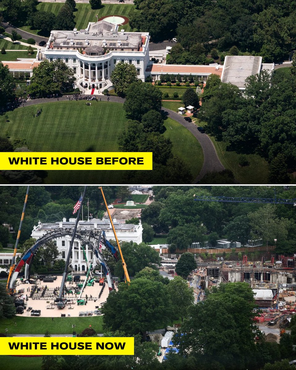
ALT A two panel graphic comparing the White House South Lawn before and during Trump's construction projects. The top panel shows the pristine, green South Lawn with the White House and East Wing fully intact. The bottom panel reveals the lawn heavily disrupted by large cranes, a massive arched UFC stage structure, and an extensive excavation site to the right where the East Wing used to stand.
1,561
937
7,967
982,746
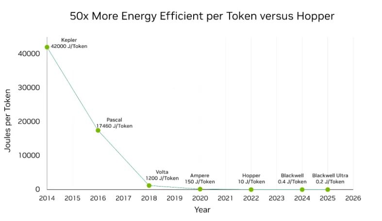
What SI crazy is this: Joules/token.
Part of "we put floating point in your floating point" NVFP4 quantization magic from nvidia (Jun 2025). developer.nvidia.com/blog/in…
1
1
87
My good friend Dave @triprideordie just said, "can confirm: my Kepler was a space heater that did math"
43
(turn your volume down first). This is pretty epic, chasing the weakest tornado in California. Very cool
Apr 22

The zero meter in question. Very weak, but still counts. Made the 10 hour drive well worth it. #cawx
1
134
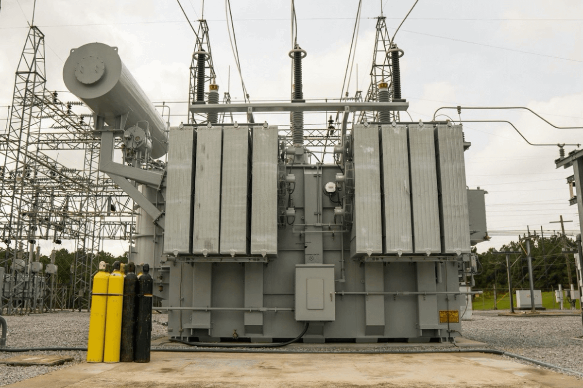
Good read on transformers: more than meets the eye.
Apr 22

Half of America's AI data centers planned for 2026 are delayed or cancelled. They're waiting on transformers. I build chemical plants. Transformer prices have tripled in the last four years. Lead times are 2 to 4 years. Each new plant we build competes with AI data centers for the same grid equipment. Every large power transformer in America runs on grain-oriented electrical steel. It's made by rolling iron and silicon together until their crystals align in one direction. No other alloy works at utility scale and only one US company makes it: Cleveland-Cliffs. The average large power transformer on the grid is 38 years old. Service life is 40. Amazon, Google, Meta, and Microsoft committed $650 billion to AI infrastructure this year. Nvidia's most expensive GPU is useless without a transformer.
166
It's 10:59pm. I'm sliding in with 1 min at nearly my session limit. This is the 2026 equivalent of posting iPhone screenshots with 1% battery left.
46
Scott Stanfield 🇺🇸🧢🌻 retweeted

Mar 13
San Francisco, Oakland and San Jose have NEVER seen a 90° day in the month of March. Next week we could have several days of 90° . This will be an unprecedented March heat wave beginning Monday. For context, temperature records in SF go back to 1874.
109
569
6,345
311,562
Scott Stanfield 🇺🇸🧢🌻 retweeted

Mar 2
This is buried under the noise.
By November, it may be the story that mattered most.
If you read one thing today, make it this.


Mar 2

Several high-ranking federal election officials attended a summit last week at which prominent activists who worked to overturn Trump’s loss in the 2020 election pressed for the president to declare a national emergency to take over the midterms.
propublica.org/article/elect…
139
8,653
15,281
706,170
Scott Stanfield 🇺🇸🧢🌻 retweeted

Feb 27
The cover of the Lancet. It says it all.

605
9,438
29,564
822,661
Scott Stanfield 🇺🇸🧢🌻 retweeted

Feb 27
It Can Now Be Plainly Said: Trump Is Planning a November Coup d’État trib.al/gAbdlNN
228
3,105
7,749
330,030
Scott Stanfield 🇺🇸🧢🌻 retweeted

Feb 27
It's worse than expected, and that's saying a lot.
Feb 27

🚨 EXCLUSIVE: Democracy Docket has obtained a draft of the executive order being circulated with the White House that would allow Trump to take unprecedented control over voting.
Legal experts called the order blatantly unconstitutional. Read the full, 17-page order below👇 bit.ly/4l0gmXp

512
5,305
11,653
608,700
Scott Stanfield 🇺🇸🧢🌻 retweeted

This post is false.
The military operation in Tapalpa, Jalisco, aimed at capturing Rubén “N,” alias “Mencho,” was planned and executed by Mexican Special Forces.
The action was carried out within the framework of bilateral cooperation, with U.S. authorities providing complementary intelligence.
Mexican National Guard and Army troops are currently reinforcing security in Jalisco and neighboring states to maintain order.

1,313
7,438
43,889
4,227,185
Scott Stanfield 🇺🇸🧢🌻 retweeted

Feb 22
This storm is a meteorological masterpiece. I’m just in awe.
As the storm explodes in intensity, it will evolve into something elegantly extreme.
In the “warm sector,” a few tornado-strength waterspouts are likely 250 miles offshore. Those same thunderstorms could produce large hail and destructive winds; mariners should be extremely cautious.
Just west of the rain/snow line, snowfall rates or 3 inches per hour will be likely over the open Atlantic, with thunder and lightning. There could even be some pea-sized hail with the thundersnow.
At the storm’s center, a calm, clear eye-like feature may develop. NOTE: it is NOT an eye; it forms in completely different ways due to “baroclinic” processes. (Sinking air, a warm blob secluded from the rest of the warm sector, etc.) But it will still be mesmerizing on satellites.
And lastly, a 75-90 mph “sting jet” may form east of the Delmarva Peninsula as wraparound moisture (clouds and precipitation) is blown into the storm’s dry slot. That caused the clouds to evaporate, leading air parcels to sink and dragging destructive upper-atmospheric winds to the sea surface.
Simply incredible.

43
459
2,803
199,287
4 Dec 2025
Just launched Twitter first time in maybe 6 months to check on the Nevada 5.9 earthquake, as warned by myShakeApp. Didn't feel it in Bay Area, but I'm sure they did in Carson City!
1
1
3
1,097
Scott Stanfield 🇺🇸🧢🌻 retweeted

4 Dec 2025
President Trump has now pardoned 12 members of Congress convicted of crimes varying from tax evasion, campaign corruption, lying to the FBI, bribery, insider trading, obstruction, etc.
If Jeff Epstein were alive today, he’d be a free man in Trump’s America.
325
4,970
16,026
305,382
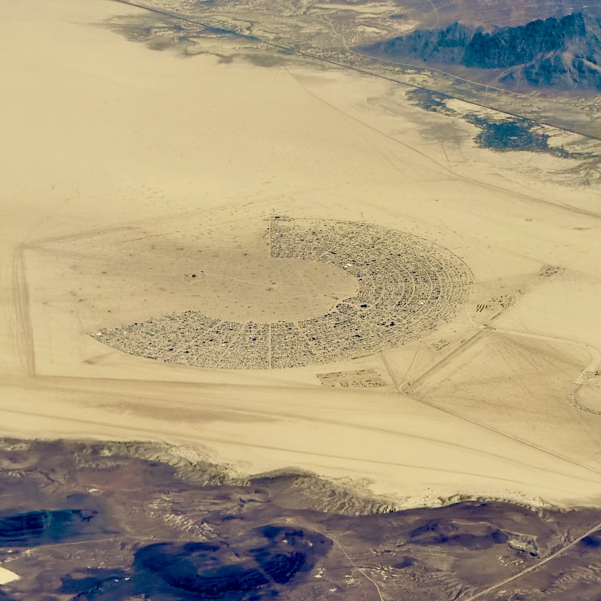
25 Aug 2025
Flying over Burning Man, Mon Aug 25 ~1:45pm PT. Can't tell from 30k feet they've had major windstorms.
10
4,747