
Tinkering (digital)things : Maps, 3D, AI, Data Viz: beatthetraffic.app, maps3d.io , pregonerosdemedellin.com , opendata.cam ... @tdurand@mapstodon.space
Joined April 2009
- Tweets 1,723
- Following 1,338
- Followers 530
- Likes 11
Photos and videos
Thibault Durand retweeted

Apr 26
What if you could draw ANY image using real city streets?
latest experiment: Upload any picture → the app detects its edges → then autonomous agent trace and fill the image using actual roads from OpenStreetMap.
Agents draws the outlines and fills the interior in green.
The city itself becomes your canvas.
Built with React 19 DeckGL MapLibre Overpass API
Like/ RT to show support.
#CreativeCoding #GenerativeArt #OpenStreetMap #DataViz #Maps #React #BuildingInPublic #UrbanArt
10
33
276
16,745

20 Jul 2025
Summing up how the "AI assisted" coding feels those days 🙃
worksonmymachine.substack.co…
1
175
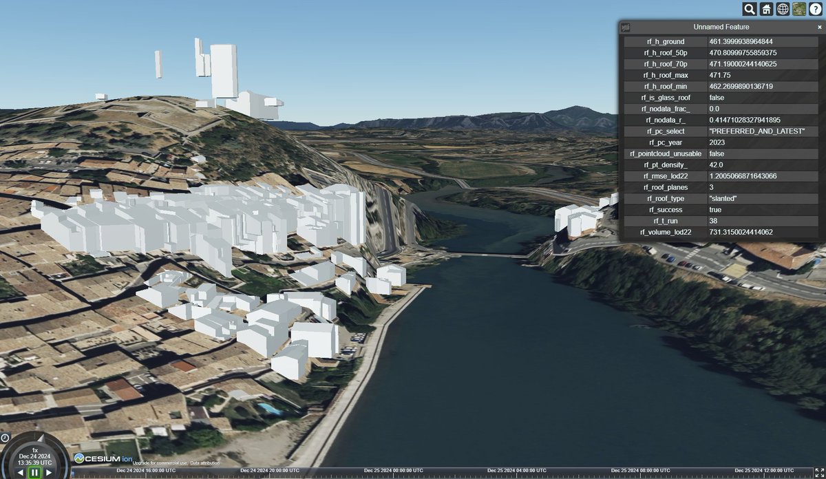
24 Dec 2024
🏢🔥

210
9 Dec 2024
Enjoyed this piece about the upcoming React compiler 👏
9 Dec 2024

#react 19 was just released, maybe React Compiler will be next? 🤞🏼
In the meantime, I measured how the Compiler impacts initial load and interaction #performance, in preparation for the future release.
Actual numbers on a real app 😉
developerway.com/posts/how-r…
189
16 Nov 2024
⛰️🪄
14 Nov 2024

#wip #30dayMapChallenge a new tool
Experimenting with the #DeepPaint addon in #Blender to 'paint' a landscape - coloring a 3D model of landscape generated from USGS lidar point cloud data.
1
183
15 May 2024
Keep the open data coming 🚀🚀
15 May 2024

🚨🚨Announcing the publication of our own global, cloud free Sentinel-2 dataset. 12 bands, all in full resolution, aggregated over all of 2023 — over 33 TB in total!
We've partnered w/ the @source_coop team to make this dataset open & accessible. 👇🏽
medium.com/earthrisemedia/an…
189
Thibault Durand retweeted

1 May 2024
browsing recipes on the Internet in 1999 vs 2024—
13
14
166
23,655
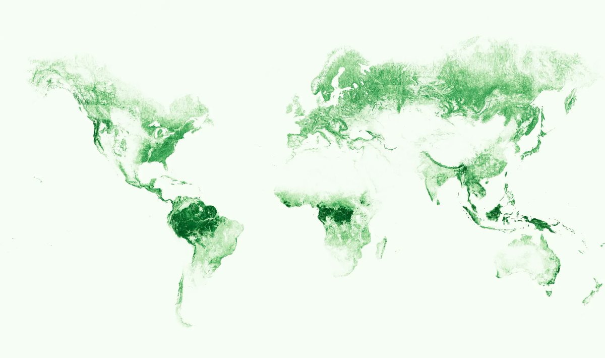
25 Apr 2024
25 Apr 2024

Just realised that it sounds too clickbait 😀
Basically, it's about the latest release of a 1-m res global tree canopy dataset: sustainability.fb.com/blog/2…
1
125
24 Apr 2024
Black magic 🪄🤯
23 Apr 2024

Generating compressed meshes and textures with lazy loading in 2 minutes → Here we go from 70 MB to just 3 MB with automatic LOD switching (1.2 mio vertices)
In the cloud
@NeedleTools #threejs
1
129
21 Apr 2024
🤩🤩, 3D maps, so much to learn, prototype and explore
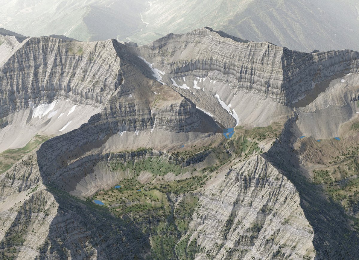
20 Apr 2024

Mt. Timpanogos, Utah, summit detail rendered with Natural Scene Designer Pro. Digital ingredients include 1m NAIP imagery, 1m DEM, texture shading, transparent shadows, haze, and tiny 3D trees.
1
170
1 Oct 2023
Insightful behind the scene post about the making of the '24 hours in an invisible epidemic' interactive piece. 👏👏 @alv9n
bigcharts.substack.com/p/inv…
1
158
27 Sep 2023
Loved that interactive piece, simple and effective 👏👏
26 Sep 2023

This is “Martin.”
At 7:20am he watches TV.
At 10:15am he gets groceries.
At noon he eats lunch.
At 5:10pm he watches more TV.
At 8:30pm he goes to bed.
“Martin” lives a pretty isolated life. Find out why this matters in our newest piece by @alv9n.
pudding.cool/2023/09/invisib…
1
298
5 Jul 2023
Enjoyed this interactive deep dive into SVG paths 😎

My interactive guide to SVG paths is now live!
A comprehensive deep dive into every single path command complete with challenges where you get to trace over icons. Huge thanks to @iconists for allowing me to use their icons in this guide!
nan.fyi/svg-paths
235
21 Mar 2023
✨🗺️New map project out ! gpstovideo.com/ , an easy way to turn your GPX track into videos.
1
261
9 Mar 2023
beatthetraffic.app 🪄 Reviving old projects, Beat the traffic is live again, 🎮📱 a fun game around urban mobility made back in the days with @move__lab @bndktgrs @markus_kre @flooopooo @whatsuprapha
2
1
1,017
26 Jan 2023
Great write up on what's going on in the ever changing web development landscape robinwieruch.de/web-developm… , 👏 @rwieruch
1
1
573
13 Jan 2023
Draw SVG rope using JavaScript🪄 tech blog post muffinman.io/blog/draw-svg-r… , code pen: codepen.io/stanko/pen/vYaEMK…
166
11 Jan 2023
when someone build what you have in your TODO list 🤗👏
1
336
3 Nov 2022
🔥

New PMTiles demo! @maplibre Raster DEM
This page is powered by a single 30 gigabyte PMTiles v3 file on @cloudflare R2, which contains 350,000 Terrarium RGB-encoded terrain bathymetry tiles - 10 zoom levels for the planet.
protomaps.github.io/PMTiles/…
dataset via Mapzen Joerd!
2