
Advanced geospatial analysis for browsers and Node.js. Support the project on opencollective.com/turf 🙏
Joined September 2015
- Tweets 66
- Following 15
- Followers 405
- Likes 83
1 Photos and videos

TurfJS retweeted

22 Apr 2024
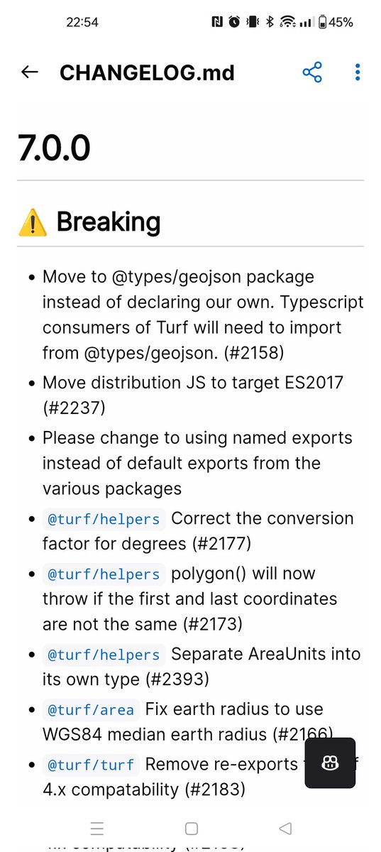
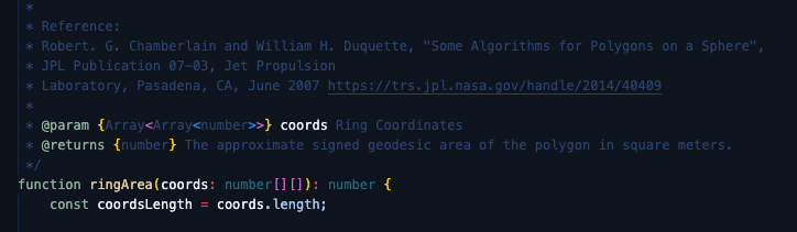
Love that the @turfjs implementation for measuring Polygon area on the Earths surface come from a NASA Jet Propulsion Laboratory publication dataverse.jpl.nasa.gov/datas…
1
1
4
536
TurfJS retweeted

6 Jun 2023
Built with @Mapbox, @vite_js, @reactjs, @fontawesome, @tailwindcss. Data processing with @turfjs, and R (gtfsrouter package). Deployed on @Netlify. Code on @github.
6 Jun 2023

Inspired by the rapid-fire experience of chronotrains.com, I built a similar interactive that shows how far you can get from each NYC subway station in 40 minutes. Have a look at subwaysheds.com/ 👀
2
13
1,053
TurfJS retweeted

9 May 2023
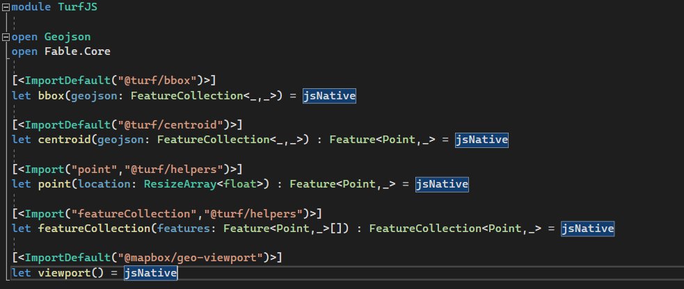
I love how easy it is to use JS libraries with @FableCompiler
To use @turfjs I just need to specify which functions I need and what types I do expect
#fsharp
4
17
1,108
TurfJS retweeted
12 May 2023
10-20-30-40 minute isochrones for subway walking(ish) from Atlantic Ave/Barclays Center. This is a @turfjs -intensive workflow, using buffer, dissolve, truncate, and intersect. Now to make them for the other 471 stations. cc/ @_benjamintd

1
7
687
TurfJS retweeted
8 May 2023
After a bit of work the Turf.js docs should now be responsive and be an all round nicer experience on mobile/tablet than they were before! turfjs.org
1
1
8
604

TurfJS retweeted

2 May 2023
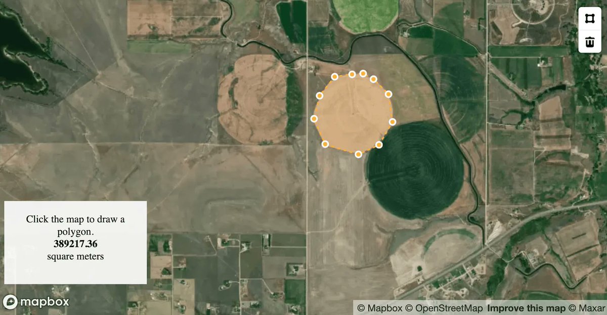
A "new" way to find locations on a map, powered by @Mapbox & @turfjs.
Search for a geolocation, change the center marker & drag to resize the radius zone.
Pairs with @thatsfinsweet Attributes to update a filterable list.
Coming soon!
3
1
19
1,955
TurfJS retweeted

5 Oct 2022
Look what I've done with @turfjs (and taskr)
gist.github.com/mestachs/439…

1
2
TurfJS retweeted

19 Sep 2022
Make your web maps look more like print – by overlapping a hidden symbol layer along a map edge you can avoid labels being clipped with @Mapbox and @turfjs. Play with it here: willymaps.github.io/labelcli…
3
8
76

TurfJS retweeted

16 Jun 2022
Thanks to @willy_maps idea and code, and a bit of help from @en_dash, I have now made a totally essential spidermap of trig pillars across Great Britain - shows the 8 closest trig pillars to the centre of the screen
alasdairrae.github.io/trigpi…
37
125
683
TurfJS retweeted
12 Jun 2022
129
1,107
10,529
TurfJS retweeted

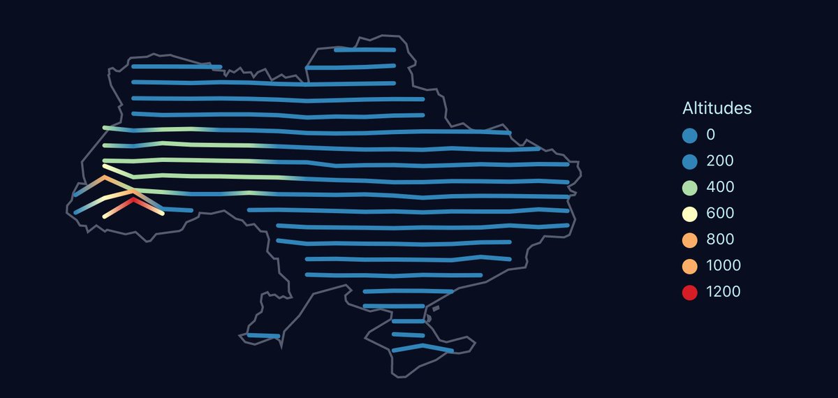
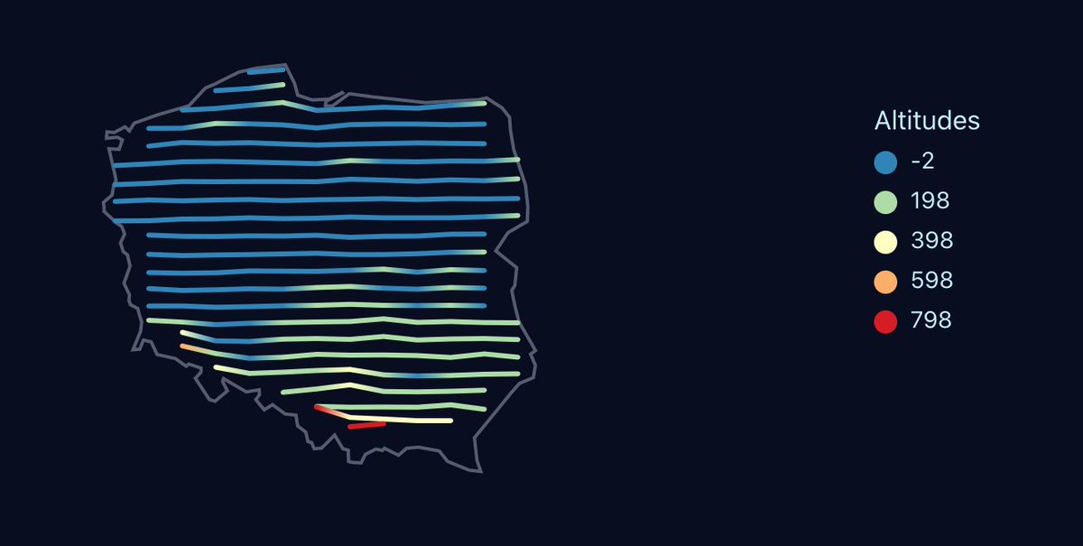
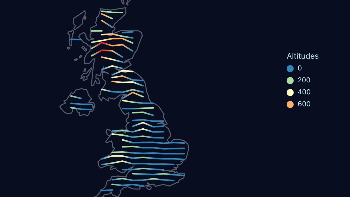
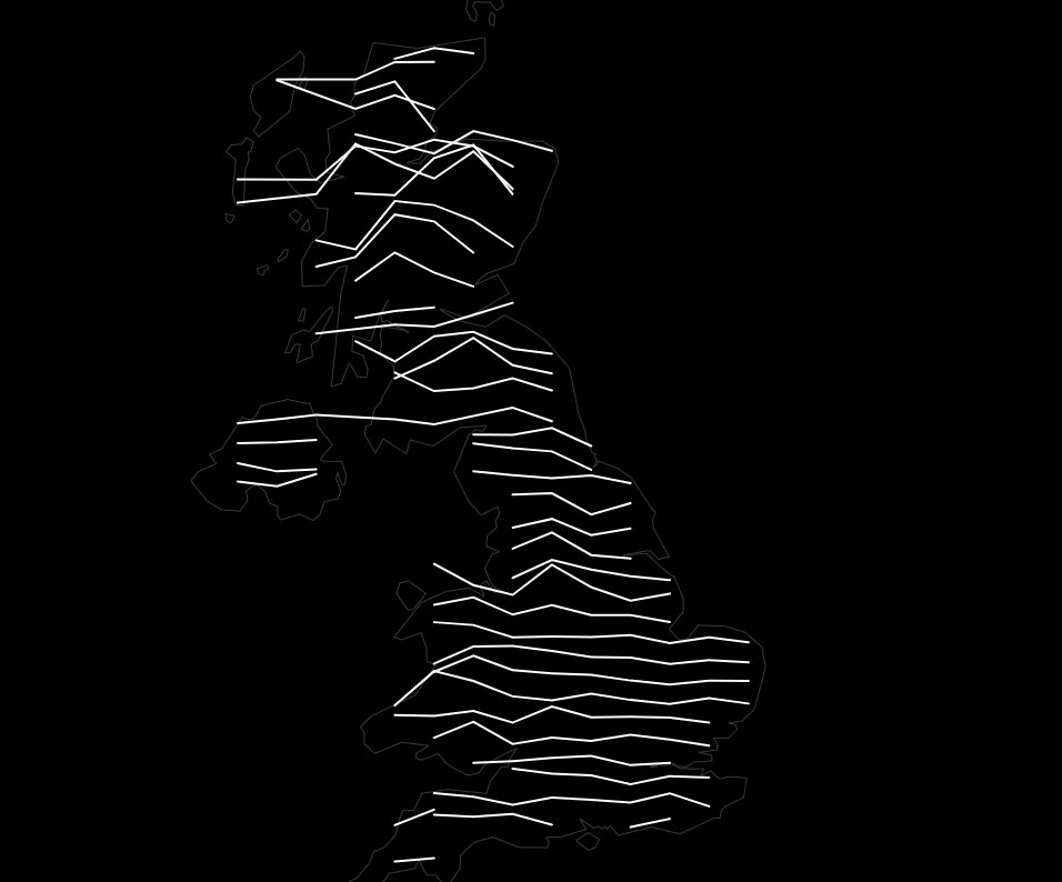
19 Apr 2022
Another day, another #dataviz. This time, Joy Division-style ridgeline map with altitudes on @observablehq with the help of d3 and @turfjs.
#observable #datavisualization
observablehq.com/@dmylian/ma… 🇺🇦
7
26
TurfJS retweeted
6 May 2022
Calculating distance between 2 points in one notebook #fsharp, #javascript (with @turfjs ), #python (with geopy via @pyodide)
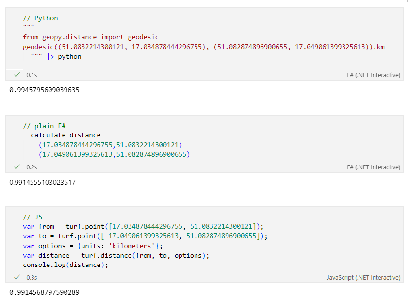
7
18
TurfJS retweeted

10 Nov 2021
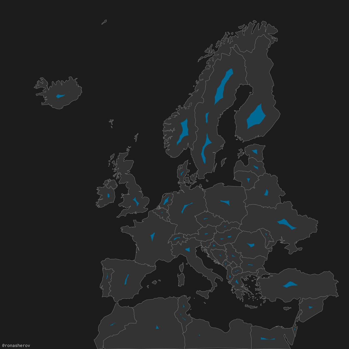
#30DayMapChallenge (late) Day 8 - Blue
This map shows each European country's surface water area. The Netherlands has the highest percentage, with 10.35% of its area covered by water
2
2
29
TurfJS retweeted

19 Oct 2021
I just published in @JS_PlainEnglish A Neat Trick to Merge Adjacent Polygons in Spatial Datasets with Turf.js javascript.plainenglish.io/a…
#geospatial #ools #DataAnalytics
3
2

Video: "@FOSS4G - Browser-side geoprocessing with Turf.js and #Leaflet" youtube.com/watch?v=mS-o7UGS…

1
1
TurfJS retweeted

As with all of our experimental web apps on @glitch, you can remix and try out the code yourself!
This tool uses some simple @turfjs geospatial analysis to figure out what district a point is located within.
Check out the code at:
glitch.com/edit/#!/massachus…
3
8