- Tweets 17,793
- Following 297
- Followers 2,522
- Likes 51,732


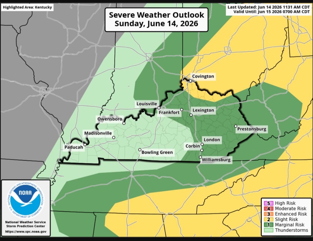


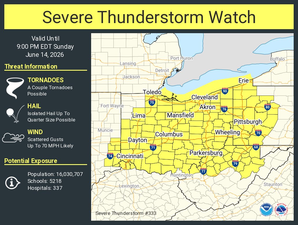
ALT This graphic displays Severe Thunderstorm watch number 333 plotted on a map. The watch is in effect until 9:00 PM EDT. The watch includes parts of Indiana, Kentucky, Ohio, Pennsylvania and West Virginia. The threats associated with this watch are a couple tornadoes possible, isolated hail up to quarter size possible and scattered gusts up to 70 mph likely. There are 16,030,707 people in the watch along with 5218 schools and 337 hospitals.
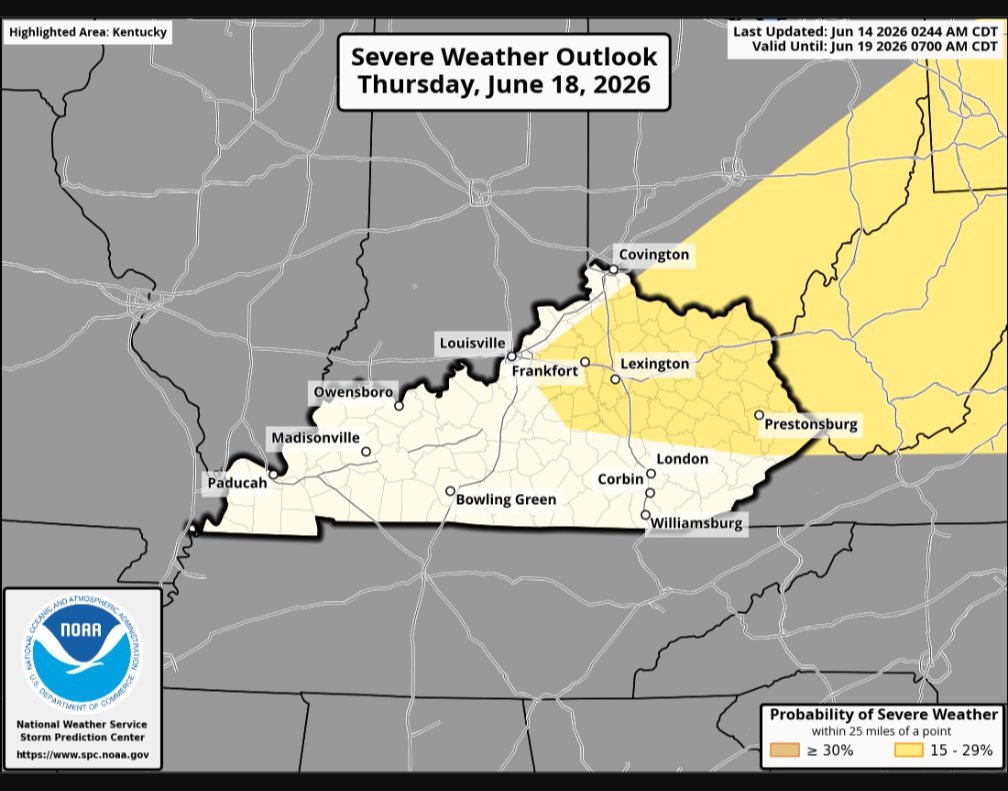

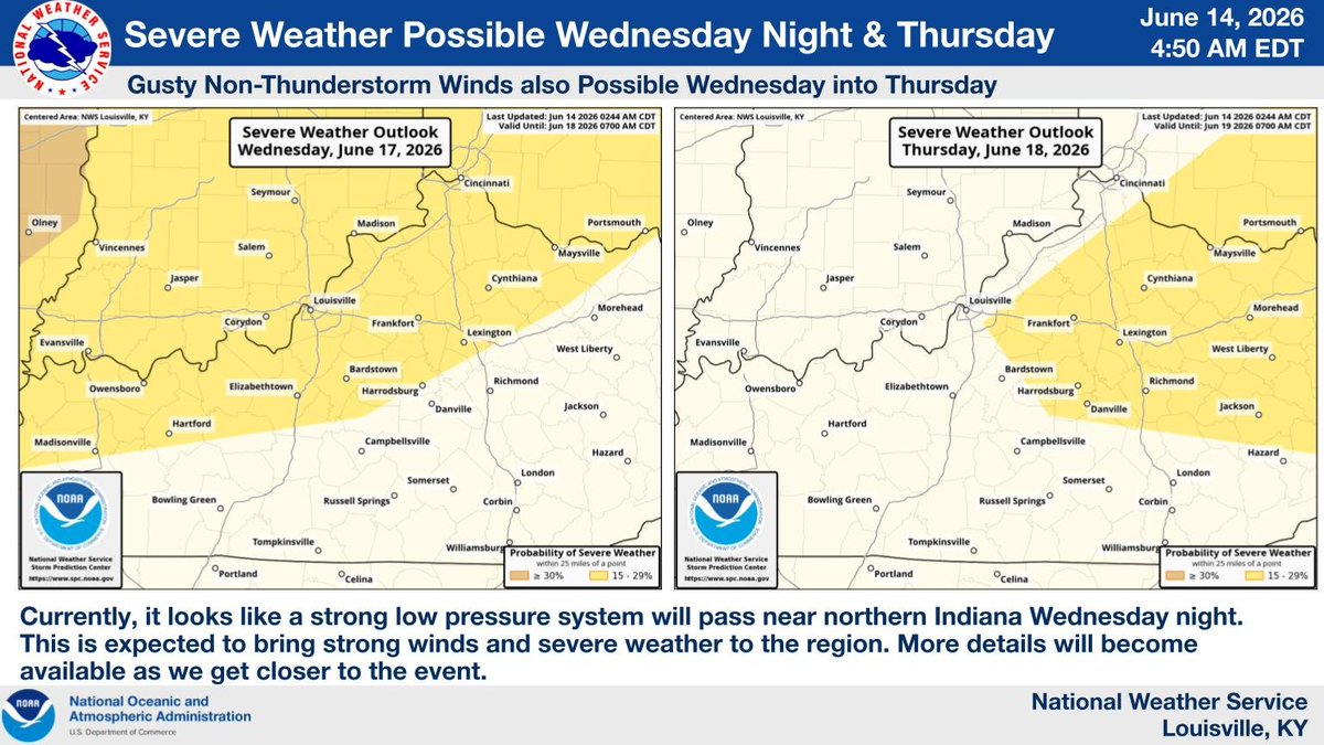
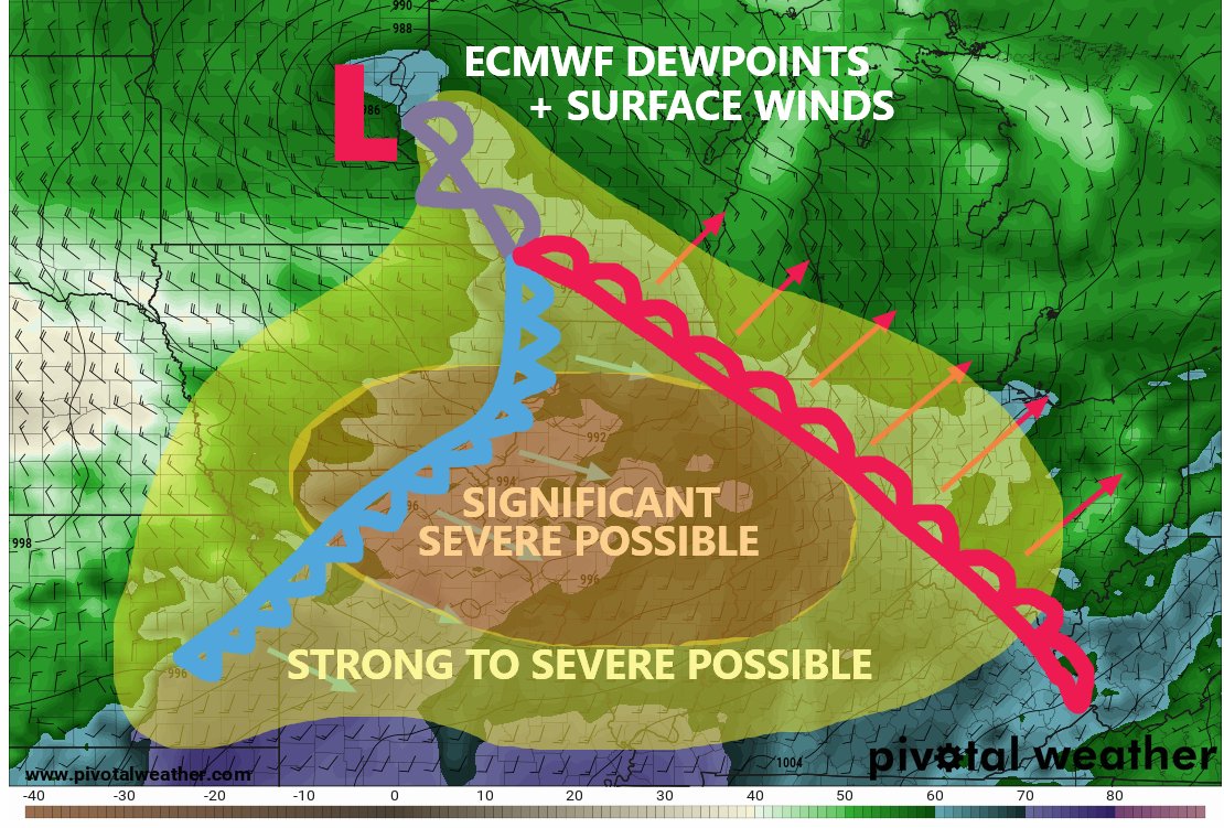
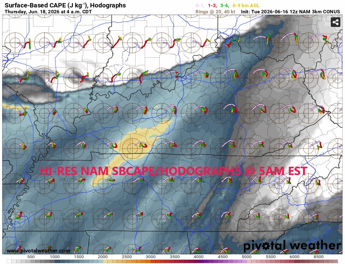
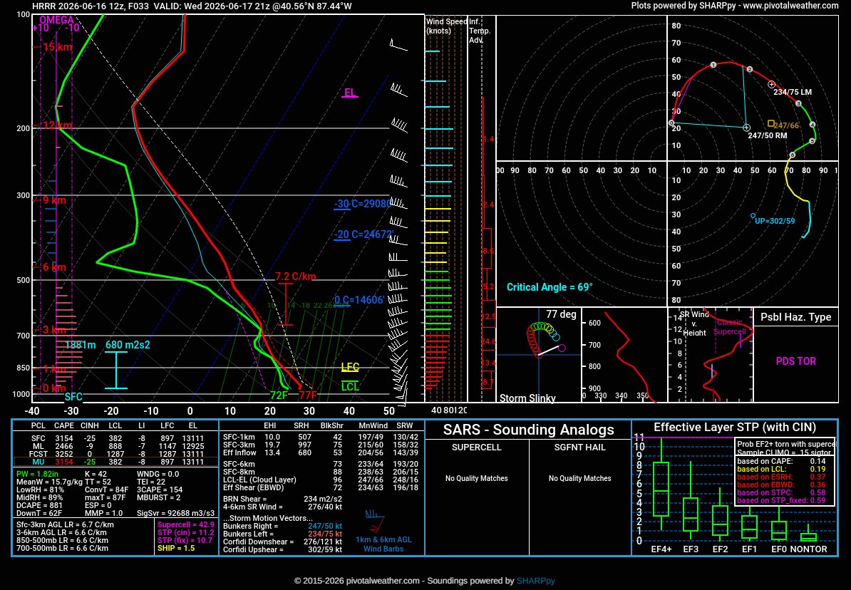
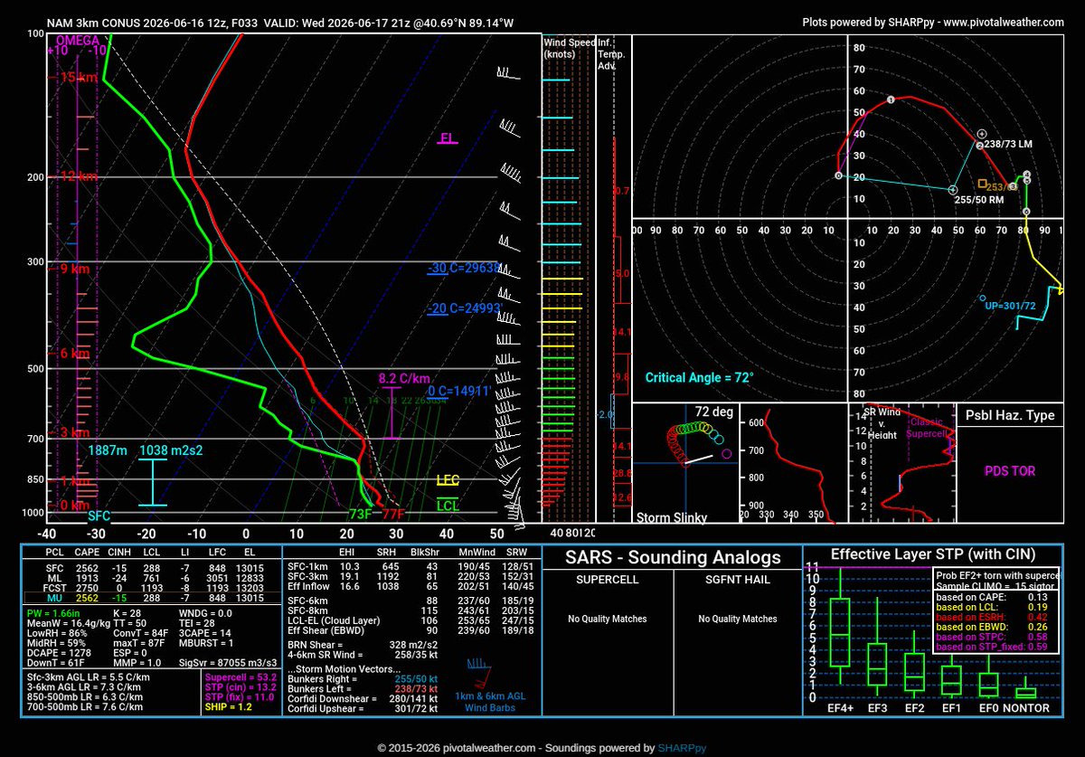
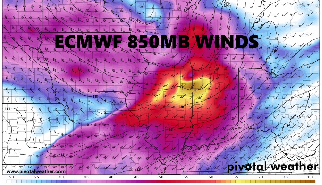
ALT Currently, it looks like a strong low pressure system will pass near northern Indiana Wednesday night. This is expected to bring strong winds and severe weather to the region. More details will become available as we get closer to the event.


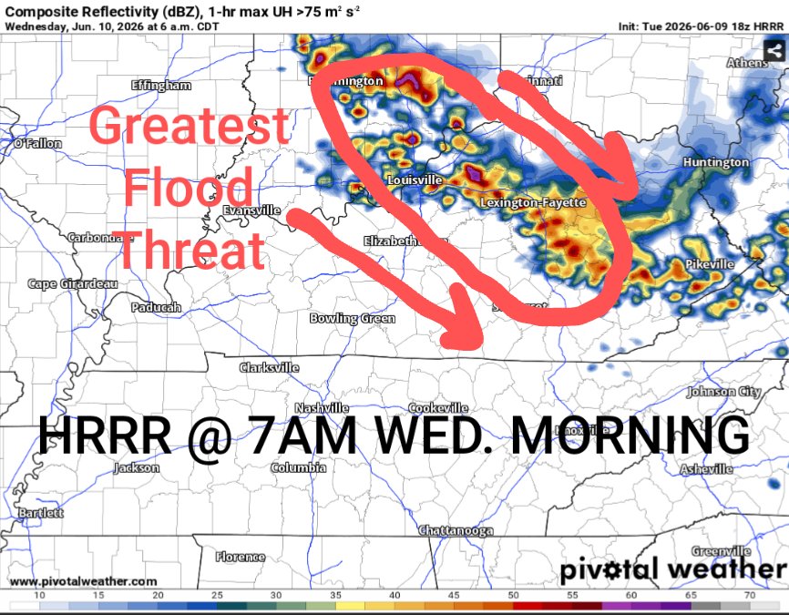
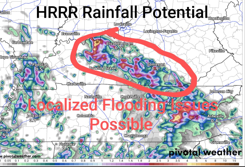
ALT A Flood Watch is in effect for the area today through Wednesday morning. Rounds of slow-moving storms will bring waves of showers and storms with widespread amounts of 1 to-3" of rain are expected. Localized 4-7 " are possible which may result in flash flooding


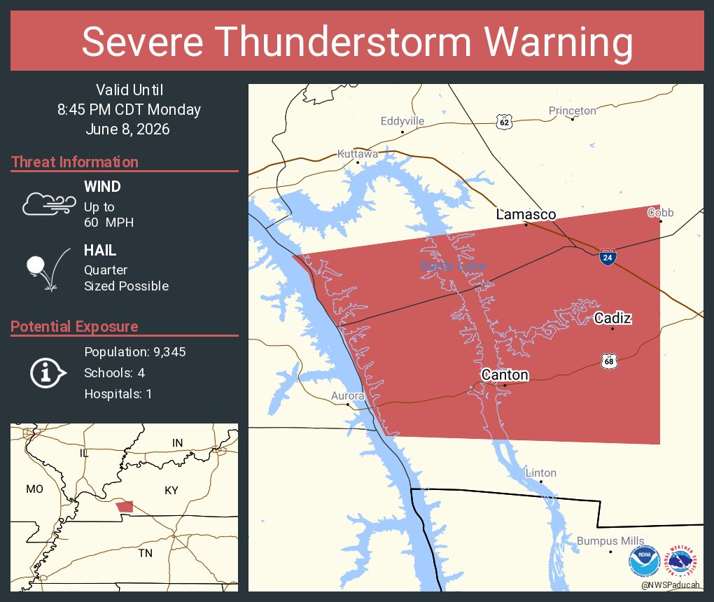
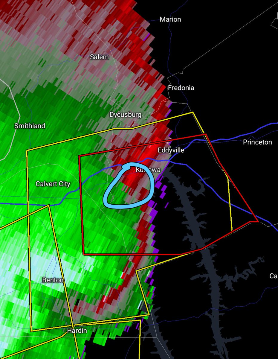
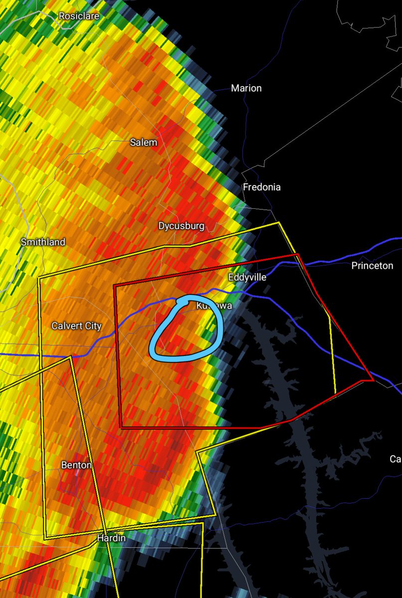
ALT This graphic displays a severe thunderstorm warning plotted on a map. The warning is in effect until 8:45 PM CDT. The warning includes Cadiz KY, Lamasco KY and Canton KY. This warning is for South central Caldwell County in western Kentucky, Central Trigg County in western Kentucky and Southern Lyon County in western Kentucky. The threats associated with this warning are wind gusts up to 60 MPH and quarter sized hail. There are 9,345 people in the warning along with 4 schools and 1 hospital.