
Maps & data visualizations - GIS Analyst based in 🇮🇪
Joined December 2011
- Tweets 205
- Following 193
- Followers 739
- Likes 950
86 Photos and videos


Vanessa Tebbitt retweeted

16 Apr 2024
we mapped tents in Rafah by applying machine learning to high resolution satellite imagery from @planet. we also show damaged buildings from analysis done by @coreymaps and @JamonVDH. 🛰️
read here 🎁: bloomberg.com/graphics/2024-…
a small thread with some model specifics 🧵
8
123
307
82,450
Vanessa Tebbitt retweeted

7 Jan 2024
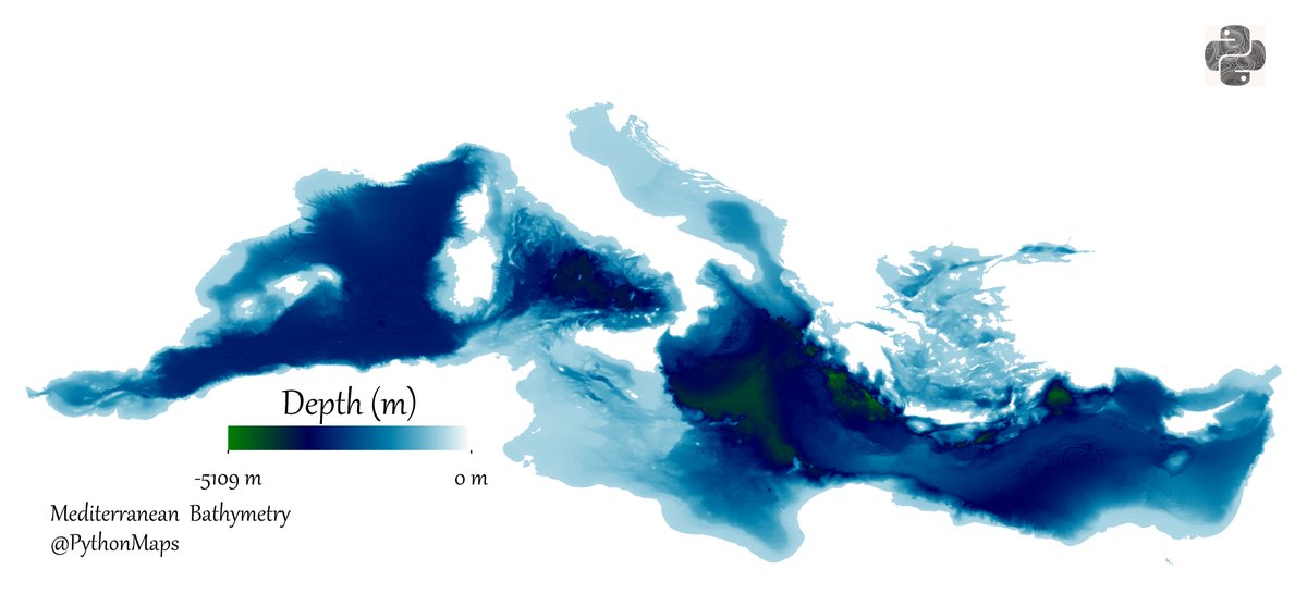
Bathymetry of the Mediterranean. I used the ocean colourmap and I think the colours come together really beautifully.
5
56
373
31,835

30 Nov 2022
Wow #30DayMapChallenge I did it! I made a map for every day of November!! I'M SO PROUD OF MYSELF!
It has been so inspiring to see such incredible talent in the geospatial community. You are all amazing!!
Now I better go focus on my wedding coming up next week!!! 😅🤣
4
3
79
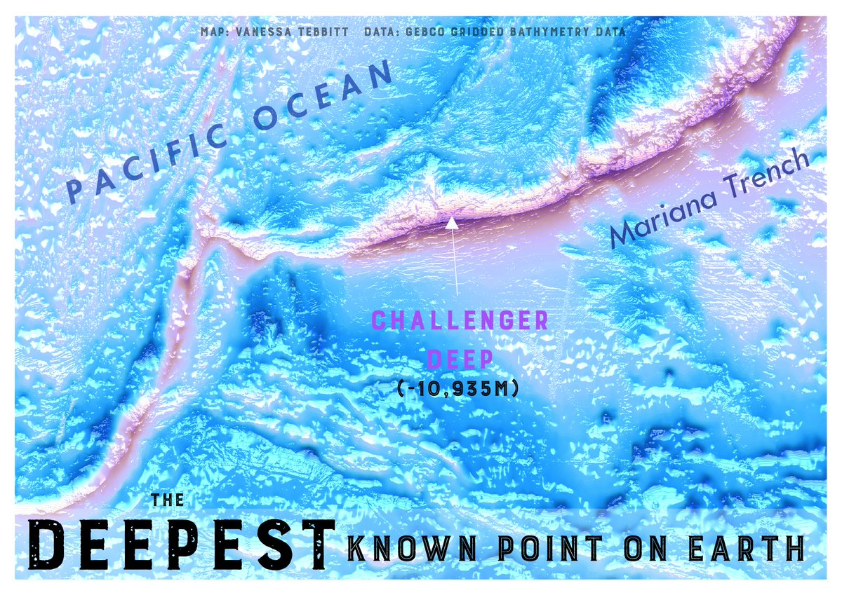
30 Nov 2022
The deepest known point on Earth - Challenger Deep!
Day 30!!!!! #30DayMapChallenge
Made in #QGIS
2
1
45
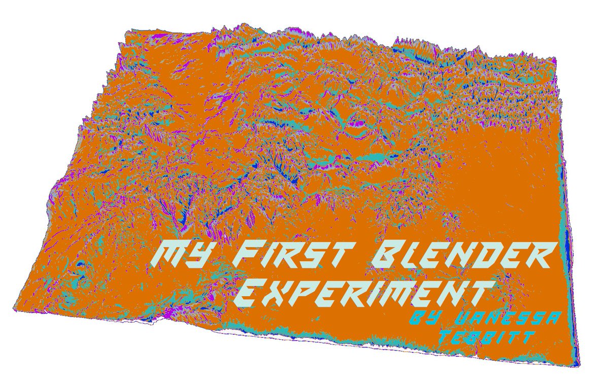
29 Nov 2022
Very much out of my comfort zone with this one! I tried Blender for the first time and it is definitely not the kind of tool you can learn in an hour or two!!
Day 29 - Out of my comfort zone #30DayMapChallenge
I followed @pinakographos exceptional tutorial!! Thank you Daniel!
1
33
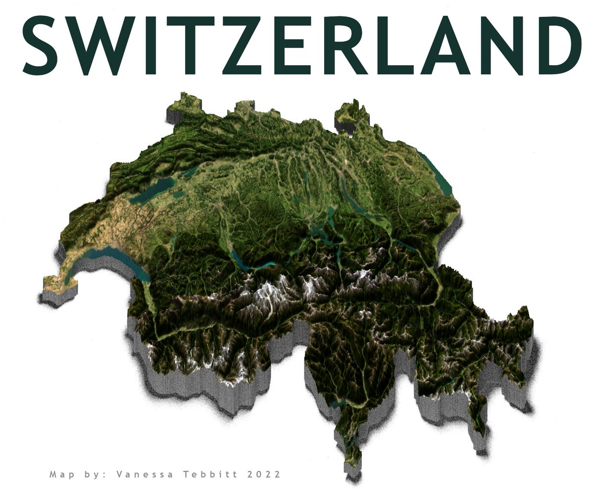
28 Nov 2022
3D topographic map of Switzerland made in R.
Day 28 - 3D #30DayMapChallenge
Code from @milos_agathon
#RStats #rayshader
1
10
84
27 Nov 2022
Longest running Music Festivals in Europe!!!
Day 27 - Music #30DayMapChallenge
Fun little map made in #QGIS
2
2
21
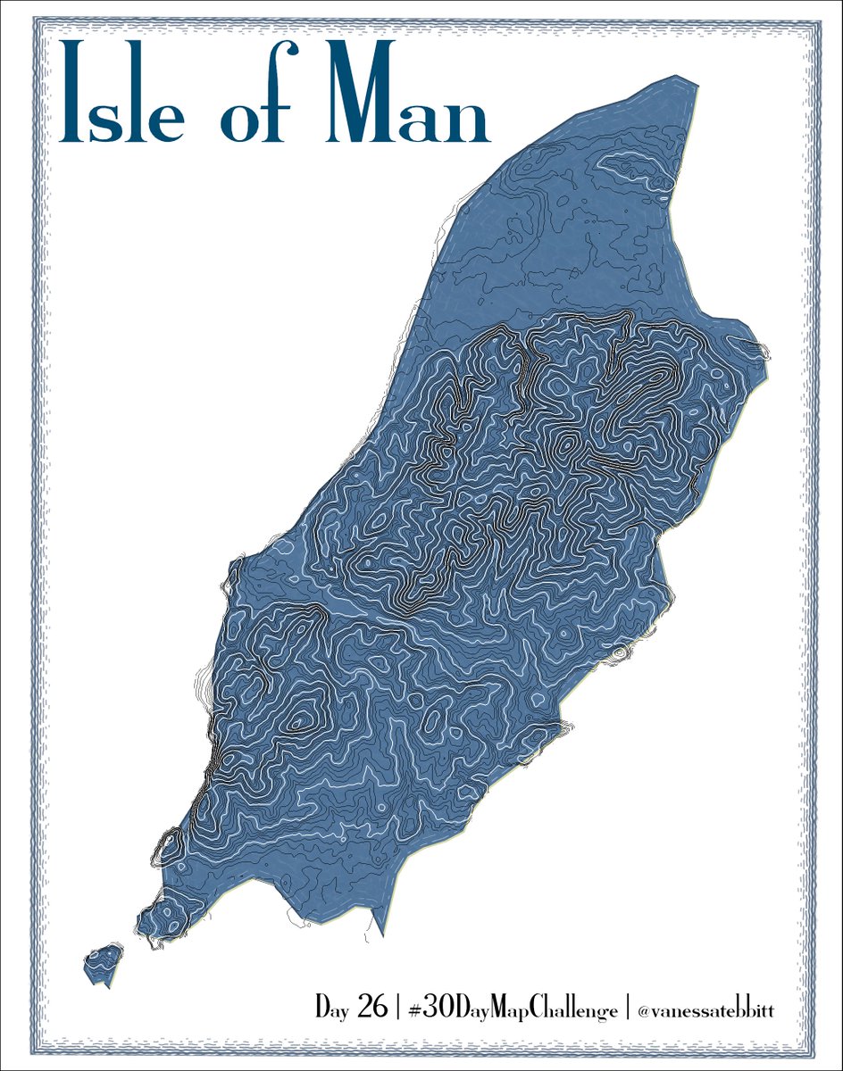
26 Nov 2022
Love these hypnotic contours of the Isle of Man!
Day 26 - Island(s) #30DayMapChallenge
2
1
57
25 Nov 2022
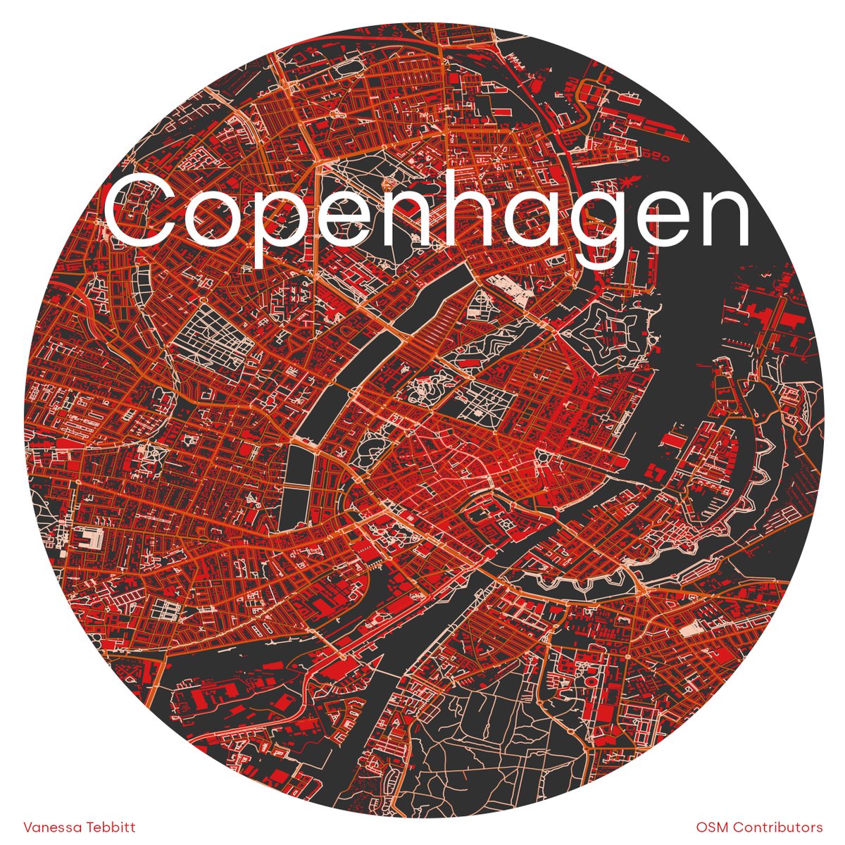
🔴 and ⚫️ Copenhagen for Day 25 - 2 colours
#30DayMapChallenge
Made in #QGIS
Data OSM Contributors
I will be visiting this city for the first time in about a week!! 😀
2
3
66
24 Nov 2022
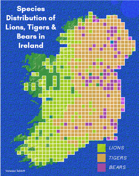
Apex predators are key to the health of an ecosystem...!
Day 24 - Fantasy #30DayMapChallenge
Lions and Tigers and Bears! Oh My!
3
26
24 Nov 2022
Map from @BioDataCentre Data (clearly) not real. Can anyone guess what species this map is ACTUALLY showing?! 🤔
1
1
23 Nov 2022
This animation shows all suspected automatic identification system (AIS) disabling events by commercial fishing vessels between 2017 and 2019.
In other words times big commercial fishing boats turned off their trackers.
More info below 👇
Day 23 - Movement #30DayMapChallenge
3
23
103
23 Nov 2022
Why would big fishing vessels intentionally stop broadcasting their position? This study by Welch et al (2022) researches why: science.org/doi/10.1126/scia…
2
1
5
22 Nov 2022
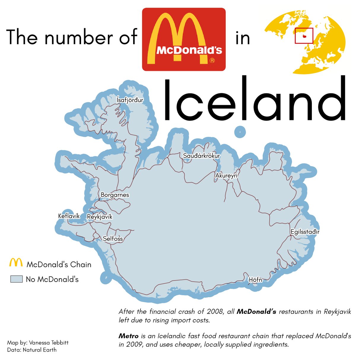
This one was fun!! How many McDonald's are there in Iceland?!
Day 22 NULL #30DayMapChallenge
Made in #QGIS
Data: Natural Earth
6
7
109
20 Nov 2022
This is a lovely 7.9km loop trail near Glendalough in County Wicklow, Ireland. Views are stunning, not to mention its iconic heart-shaped lake!
Day 20 - My favourite (hike) #30DayMapChallenge
Made in #QGIS
Data from @AllTrails
32
19 Nov 2022
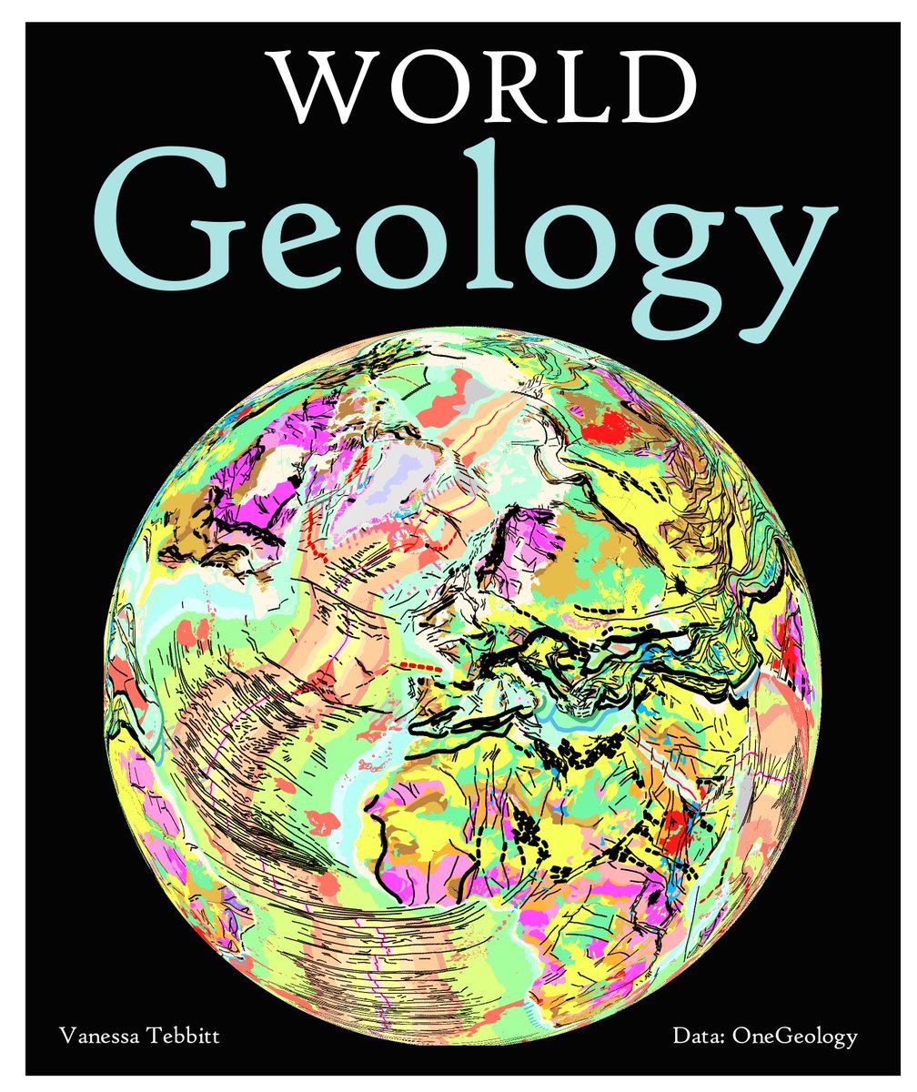
Geology of the globe in 80s style colour palette!
Day 19 - Globe #30DayMapChallenge
Made in #QGIS using the Globe Builder plugin.
Was almost not going to make a map for today but...gotta..keep...going....😅🤣
12
99