
Cornell CALS🐻 Atmospheric Science ‘26 | Meteorologist | News Contributor @MyRadarWx | Former CCAMS President @cornellweather | Intern @NHC_Atlantic | Go Pats
Joined April 2022
- Tweets 1,203
- Following 394
- Followers 468
- Likes 13,323
217 Photos and videos


Pinned Tweet

May 28
I am OFFICIALLY a meteorologist.
(No less likely to be caught without an umbrella)

34
22
1,127
21,973
Weatherman Will retweeted
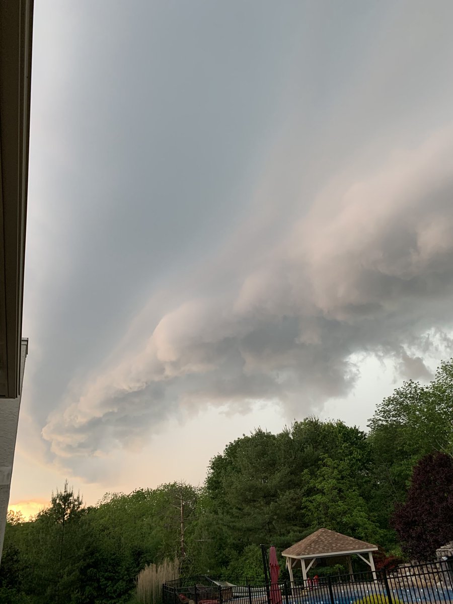
INCREDIBLE shear, or changing winds with height, on Wednesday.
We have "off the charts" helicity, or twist. Look how much the winds change with height! Any storms will feel those changing winds and rotate profusely.
NWS Chicago is calling it "off the charts" spin.

5
33
1,198
Weatherman Will retweeted

Jun 14
BE CAREFUL, PHIL!
A confirmed & damaging tornado is ONGOING 7 miles north of Punxsutawney, Pennsylvania.
If you live in, or know anyone, in Troutville, Sykesville, Dubois, or Clearfield, PA, TAKE COVER NOW!


6
20
2,380
Weatherman Will retweeted
Jun 12
El Niño is officially here — and expected to strengthen.
Many models even point to a rare "Super El Niño" taking place later this year. But what does that mean, and what does it mean for your weather?
@willcanowx breaks it down.
17
45
3,479
Weatherman Will retweeted
Jun 12
Heat is a part of life in Florida, but this weekend may feel different. Temperatures are running above average, humidity is soaring, & heat index values could top 100° to 110°.
Meteorologist @WillCanoWX explains why & what it could mean for World Cup visitors arriving in Miami.
2
8
2,082
Weather on film 📸
Now that I have a true film camera (Canon EOS Rebel 200 SLR), I am going to start posting more weather photos with it.
This shot is from Cornell’s Libe Slope near sunset in late May 2026. Turned out pretty sweet.
We’ll see how the chase photos turned out!
4
112
Such a memorable day. We had a supercell come in that same evening that was tornado warned in downtown Philly!

📅⛈️ On this day 6 years ago, a destructive derecho swept across central & southeast PA, & southern NJ. 60-75 mph wind gusts occurred in a swath upward of 50-60 miles wide. Notable measured gusts include 83 mph at Reading Regional Airport, PA & 93 mph at Beach Haven, NJ. (1/3)
3
499
Weatherman Will retweeted
May 31
TORNADO near Wellfleet, Nebraska at 7:30 p.m. Central time via @MatthewCappucci and his intrepid mother, whom he told he was taking to the Boot Barn but instead dragged tornado-chasing.
7
59
389
26,114
Weatherman Will retweeted
May 30
Rotating thunderstorms are possible Saturday on the Great Plains.
A few tornadoes, damaging gusts, and large, destructive hail are possible.
@MatthewCappucci has an update.
4
24
3,600
Weatherman Will retweeted
May 30
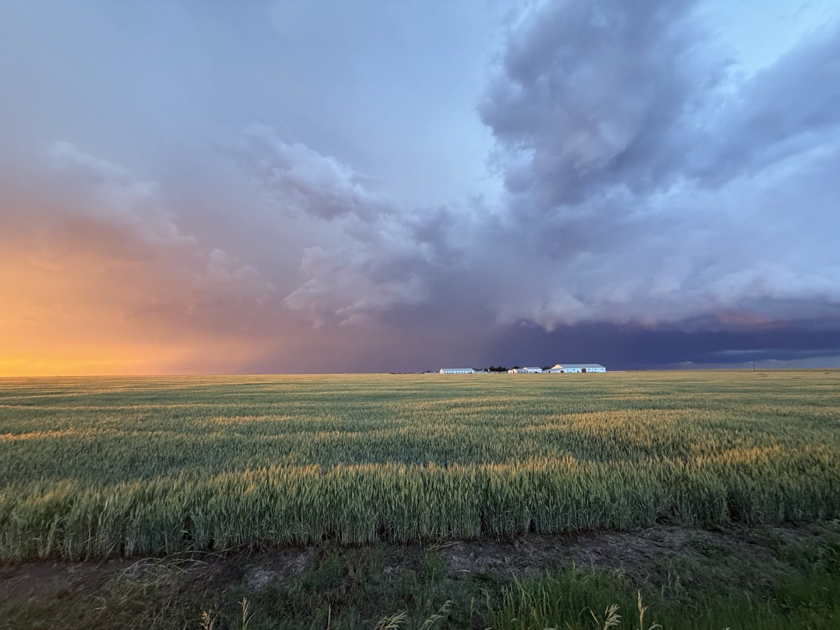
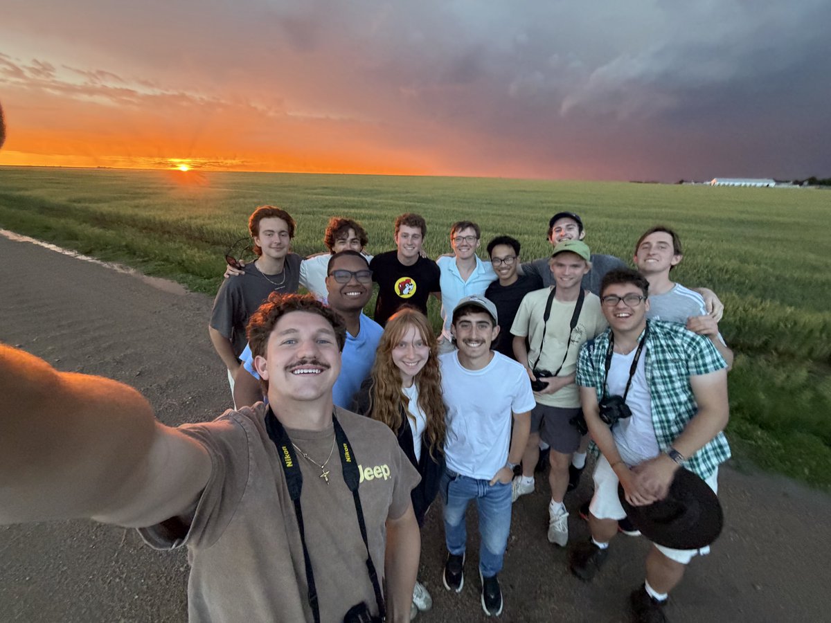
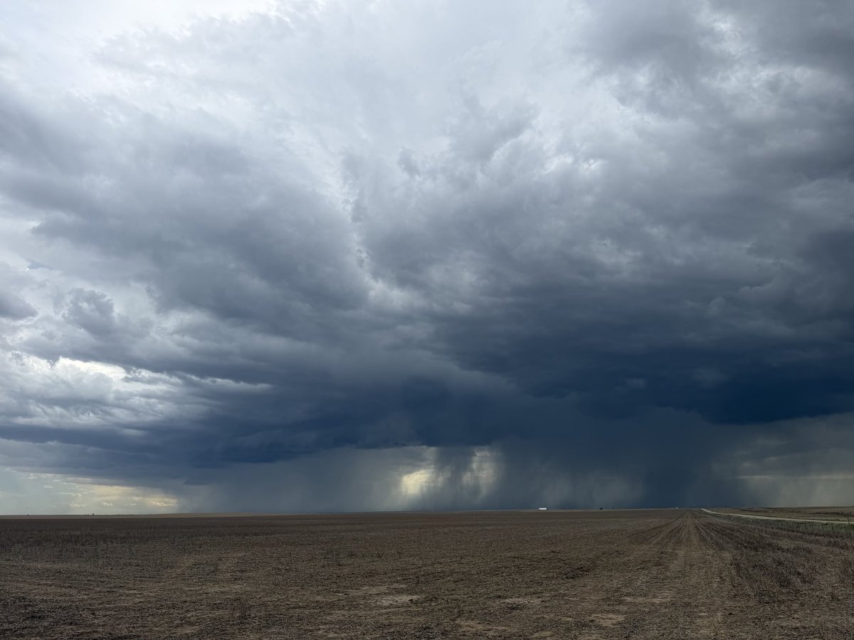
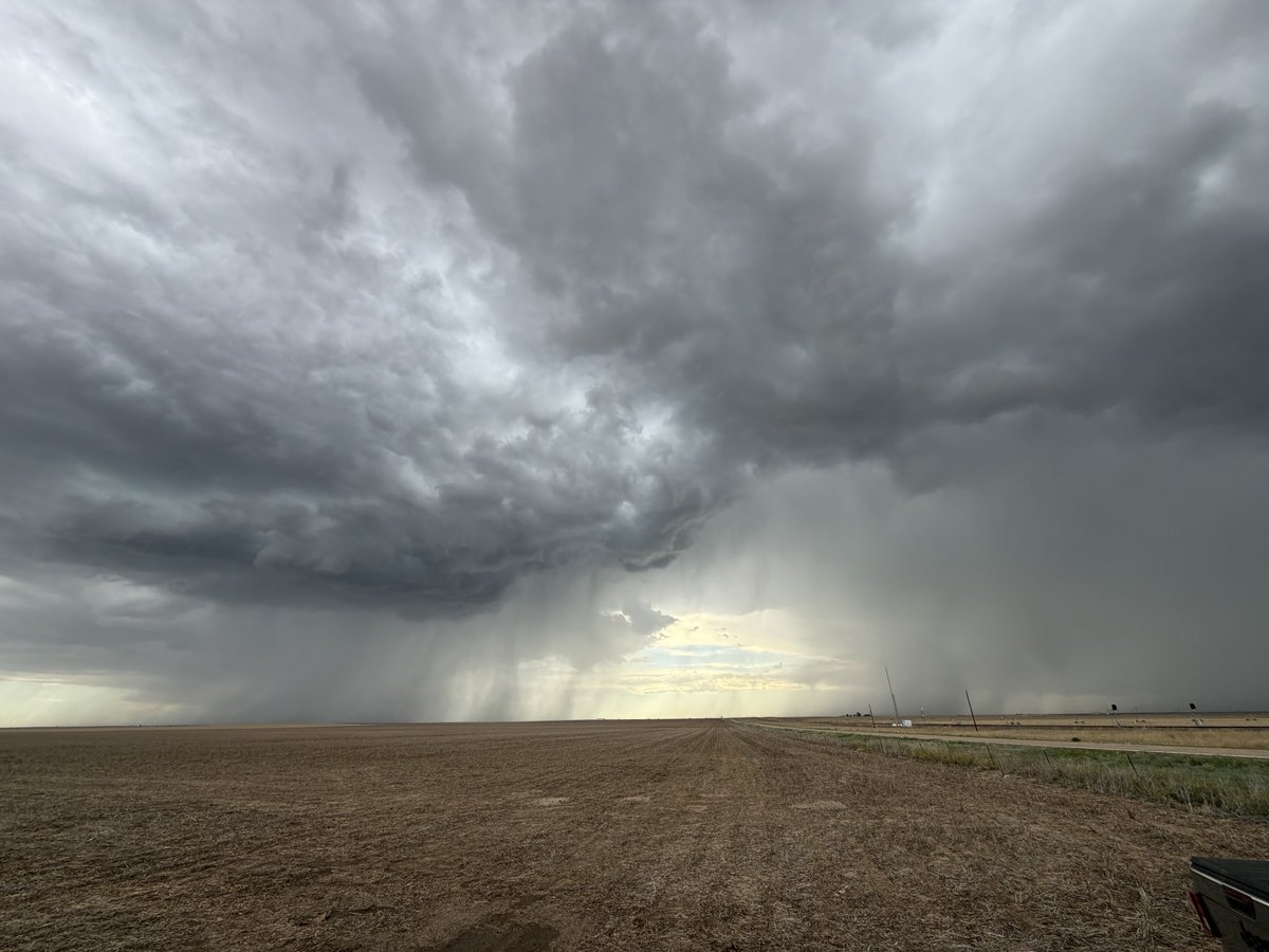
Today, newly-graduated meteorologist @willcanowx chased cells across the barren terrain of western Kansas and eastern Colorado.
The most impressive part? Perhaps the mighty rain shafts dancing across expansive dirt fields. Or maybe the creamsicle sunset fused with a purple lightning show to the east.
Success in storm chasing is not solely defined by catching a tornado. It’s measured through many different modes — occasionally, by straight simplicity.


1
7
34
2,108
Weatherman Will retweeted
Apr 21
When "cloudy weather" becomes the coolest. thing. ever. 🏔️☁️
@willcanowx saw some astonishing meteorology atop the highest peak in the Iberian Peninsula: Mulhacén. This mountain is found in the Sierra Nevada National Park in Andalucía, Spain.
Watch as he breaks down the dynamics that cause mountains to produce some of the most unique clouds in the world.
#fyp #mountainwx #weather #spain
3
9
1,803
Weatherman Will retweeted
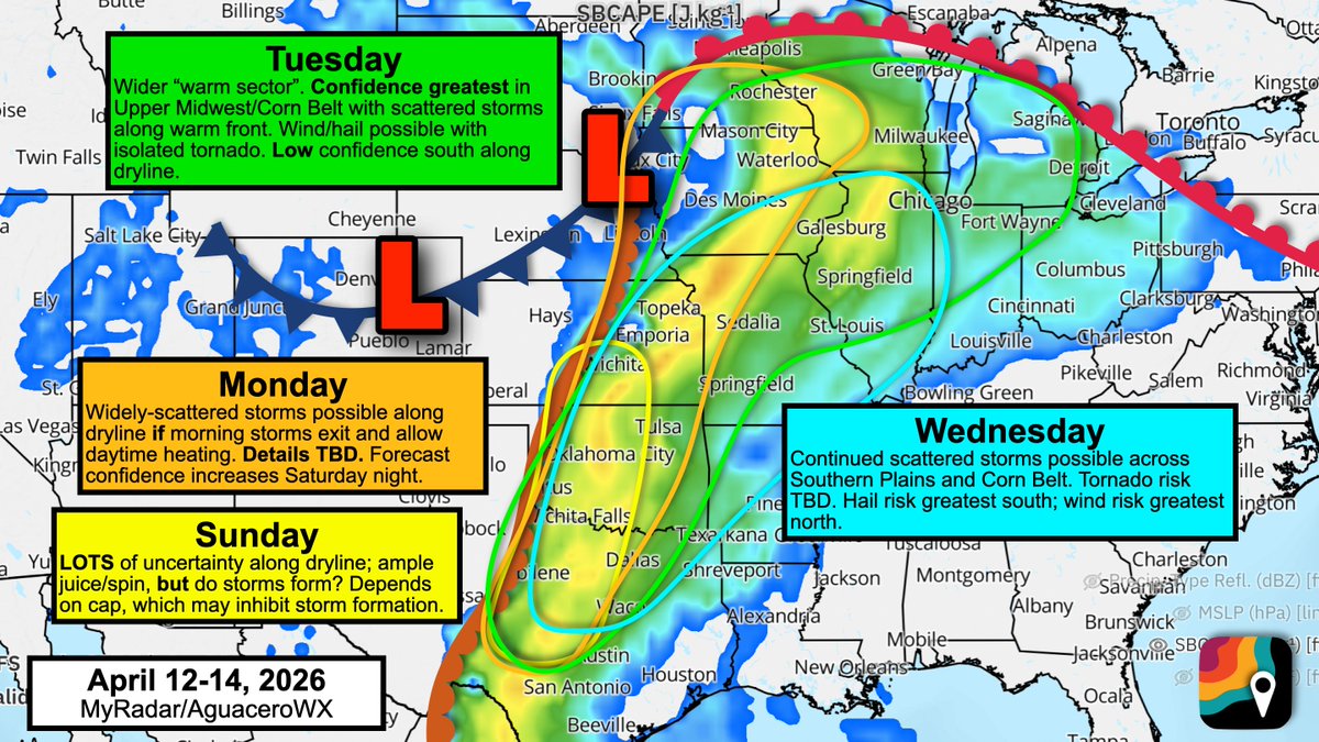
Apr 10
A busy stretch and a pain-in-the-you-know-what forecast. For multiple days, we'll be dealing with a juiced-up atmosphere BUT weak triggers. That's especially true in Texas, Oklahoma and Kansas.
Confidence is greatest in some storms Monday/Tuesday across the Corn Belt and Upper Midwest. These will accompany a lifting warm front. A couple tornadoes are possible, along with hail and maybe a few wind gusts.
But across the central/southern Plains, we have an impressive "parameter space" but not much "forcing." In other words, we have the storm fuel (instability) AND we have the spin (shear). But will storms form?
A cap, or lid of hot, dry air a mile above the ground, will work to suppress thunderstorm development by preventing surface air to rise. In MOST spots, this will win out. However, it's possible (especially Sunday/Monday) that smaller-scale features help to kick up isolated supercells. Any isolated supercells would be able to take advantage of a higher-end environment and produce significant severe weather, including baseball hail, tornadoes and damaging gusts.
90% of the area won't see much. 10% of the area could see significant impacts. These "conditional" all-or-nothing risks are difficult to communicate. Legitimately, it will be mostly sunny with a slight chance of tornadoes.
Weather models also struggle to handle these sorts of events. We won't be able to sniff out "mesoscale" details (tiny smaller-scale forcing mechanisms) until the night before.
Stay tuned!
3
24
160
10,992
Weatherman Will retweeted
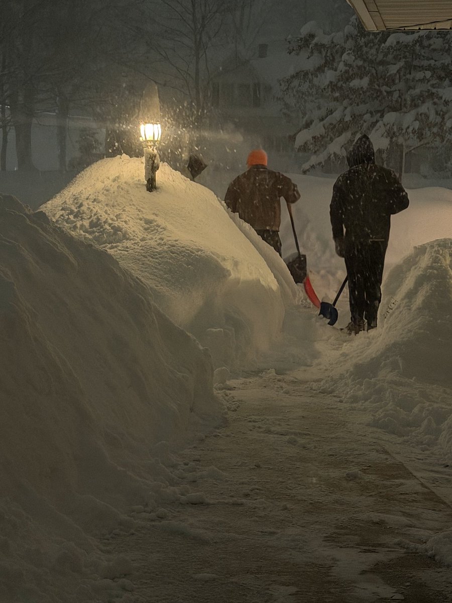
Mar 17
65°F to heavy snow...in HOURS.
That's what millions of people experienced as yesterday's potent cold front dashed across the Eastern U.S.
Specifically, the heavy snowfall seen across the Northeast was caused by an "Ana-front", which allows snow to develop on the back side of cold fronts for hours.
@willcanowx explains why yesterday's example was a rare — yet superb — case of the phenomenon.
1
8
33
3,597
Weatherman Will retweeted
Mar 16
🌡️ A powerful heat dome is expected to build across parts of the western U.S.
Some cities in the West & Southwest could approach 100° nearly two months ahead of schedule, potentially challenging early-season records.
MyRadar's @willcanowx breaks down the setup.
2
9
32
6,725
Weatherman Will retweeted

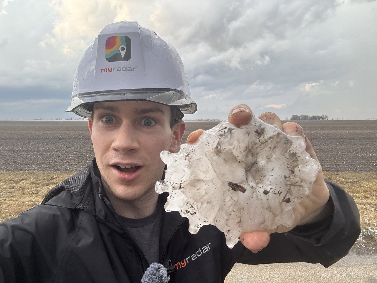
Mar 10
HOLY SH*T THE ILLINOIS STATE RECORD HAILSTONE OF FIVE INCHES IN DIAMETER HAS BEEN FOUND NW OF BUCKINGHAM
WE DID IT @MyRadarWX

135
934
8,118
492,672
Weatherman Will retweeted
Mar 10
NEW: A Level 4 out of 5 severe weather risk has been introduced in the red zone across portions of north central Illinois and adjacent western Indiana.
Several tornadoes, including a couple strong and/or long -track, are expected.

36
183
12,966
Weatherman Will retweeted
Mar 9
TUESDAY: A broad, multi-faceted severe weather event is likely Tuesday from the Midwest to the Rio Grande.
Damaging gusts, very large hail and a couple tornadoes, some significant, are expected.
Senior meteorologist @MatthewCappucci has a severe weather briefing.
1
10
43
11,209
Weatherman Will retweeted
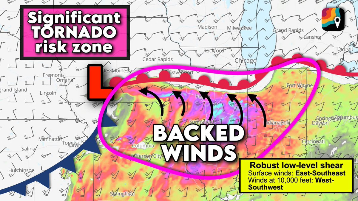
Mar 9
From meteorologist @MatthewCappucci:
TUESDAY, MARCH 10 – I'm growing increasingly concerned about southeast Iowa, central/northern Illinois and northwest Indiana. That's where we have a potentially worrisome setup.
The tornado parameter is concerning. If any supercells become established, we could be talking the chance of a strong (EF3 ) tornado near and just south of the warm front.
That's where we have backed winds – out of the southeast. But at 10,000 feet, we have winds out of the west-southwest. That means winds basically entirely switch directions within the lowest 2 miles of the atmosphere. That will favor AMPLE rotation in the low levels... any storms that grow tall enough to feel those changing winds will rotate something fierce. Tennis ball-sized hail and a few tornadoes possible, especially near the warm front.
MEANWHILE models are also spitting out up to 3,000 units of storm fuel. That would be a record... we haven't seen a value over 3,000 before MAY 7 in this area, so we're like 40-50 days early in terms of the amount of pent-up storm fuel we'll have. Explosive storm growth possible.
3
31
200
18,342
Weatherman Will retweeted
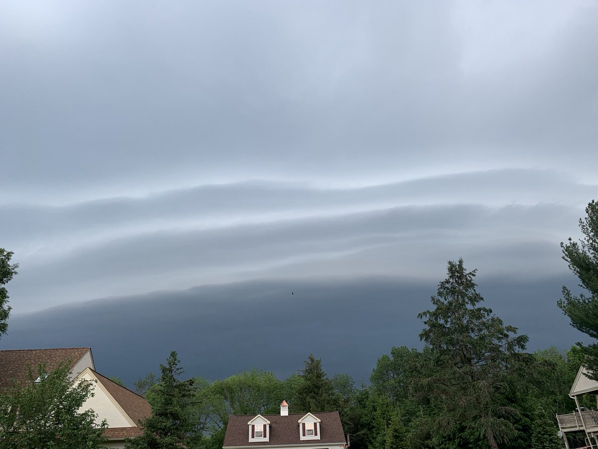
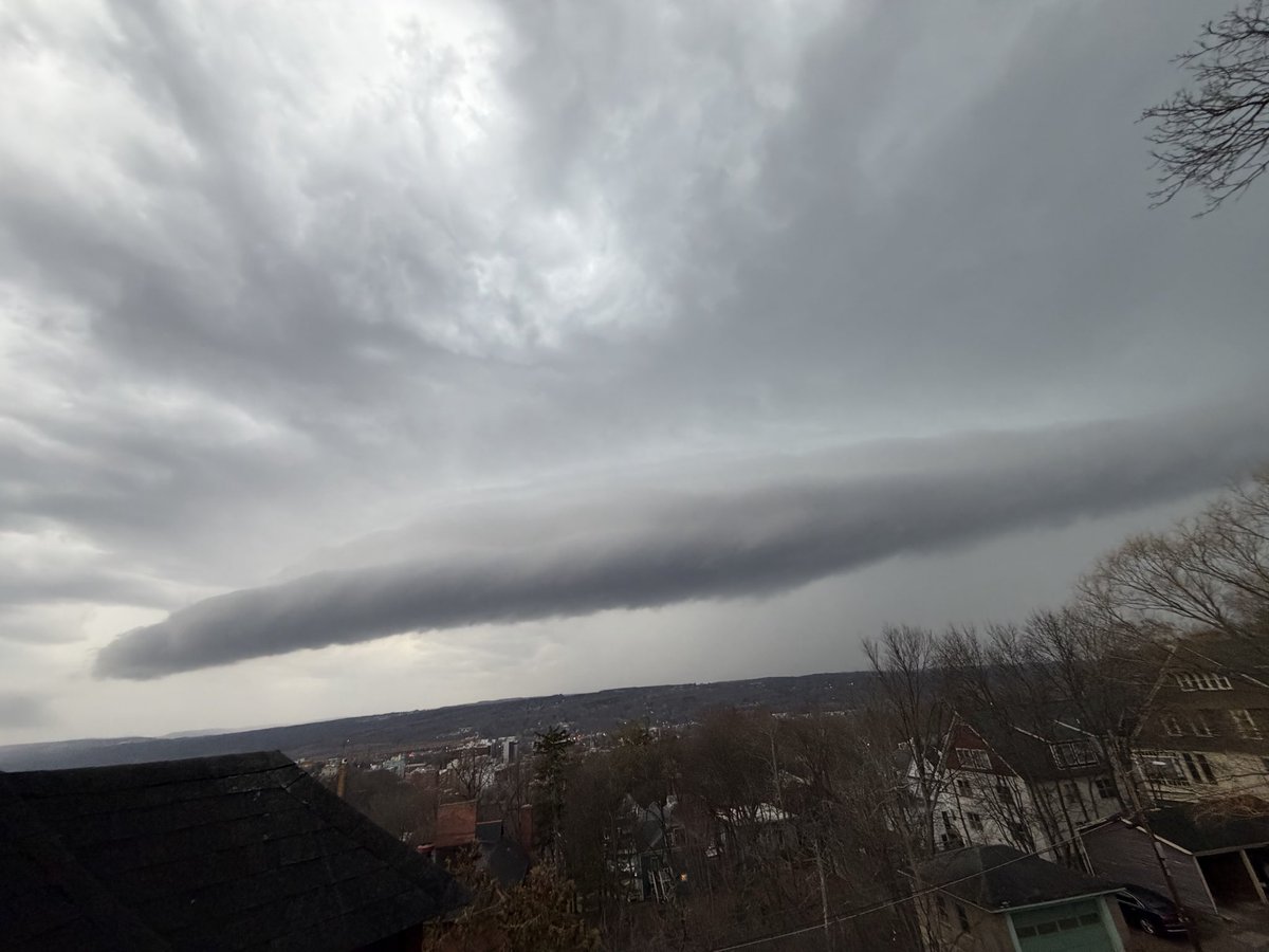
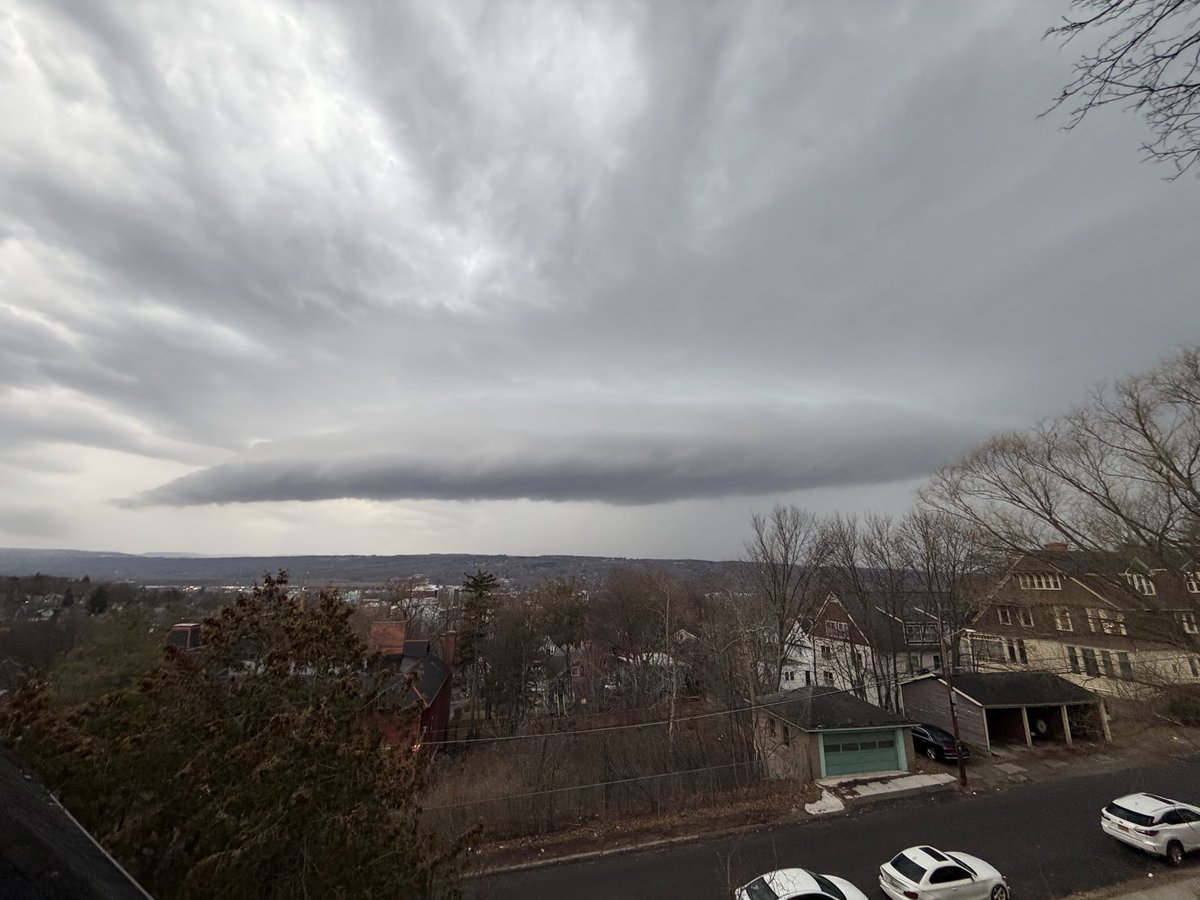
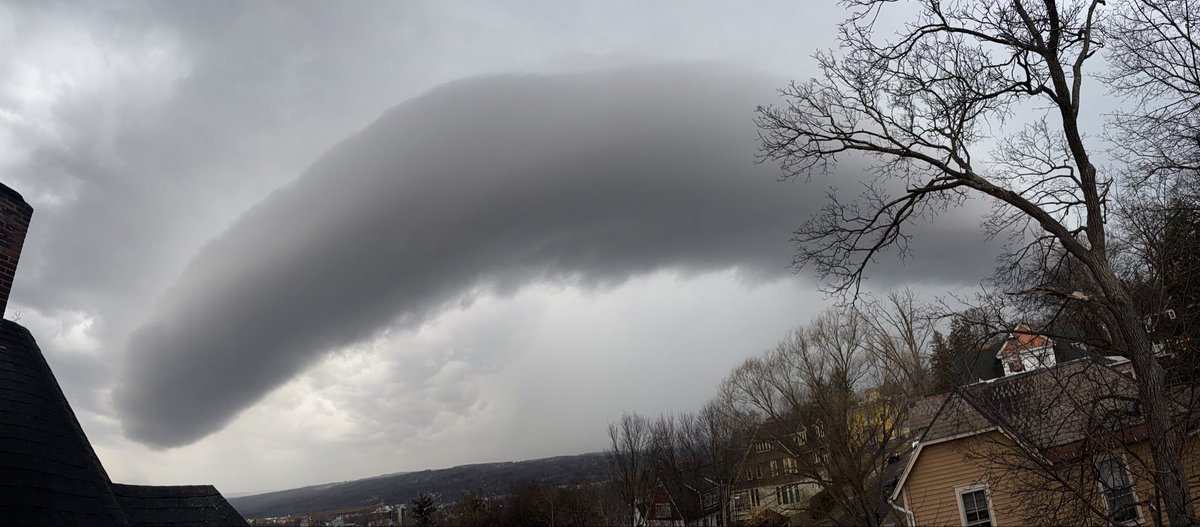
Mar 7
Check out the unique structure of this shelf cloud caught by @willcanowx this afternoon.
As a squall line approached, some “SCUD” (Scattered Cumulus Under Deck) clouds made it look vertically-oriented as it passed overhead.
📸 - Ithaca, New York
1
8
55
4,102