
Joined December 2010
- Tweets 1,463
- Following 799
- Followers 961
- Likes 1,666
143 Photos and videos


Pinned Tweet

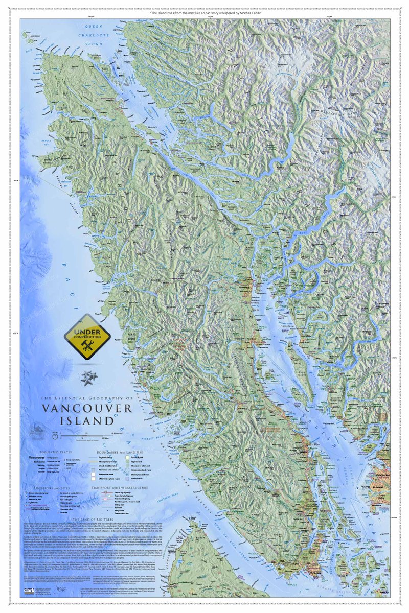
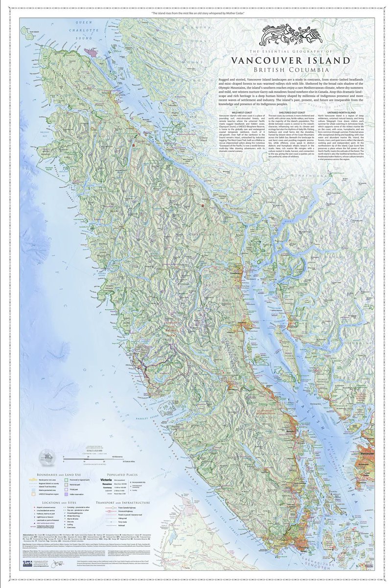
Vancouver Island is getting a new map! It's a work-in-progress but the key word is "progress!"
Please RT so the fine folks on the island can hear about the map. Thanks!
#cartography #geography #lovemaps #dataviz #britishcolumbia #vancouverisland
3
22
1,334
See this Instagram photo by @russellbooksvictoria instagram.com/p/DSWfl5ukZsK/…
188
Looking for an awesome map of Vancouver Island? Head over to Russell Books if you live in Victoria @russellbooksvictoria instagram.com/p/DSWfl5ukZsK/…
You can also order one online - clarkgeomatics.ca
1
264
Jeff Clark - Sea To Sky Map - Best of Show! retweeted

26 Nov 2025
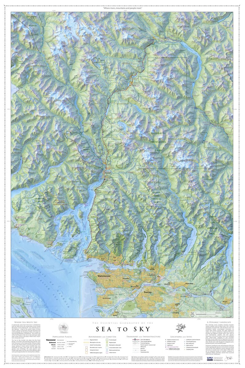
Canadian excellence: if you're after a wall/trail map of British Columbia, you need to see @ClarkGeomatics
He just released the 3x2 ft. "Essential Geography of Vancouver Island," all printed and inspected by the author.
1
7
34
1,497
Jeff Clark - Sea To Sky Map - Best of Show! retweeted

7 Nov 2025
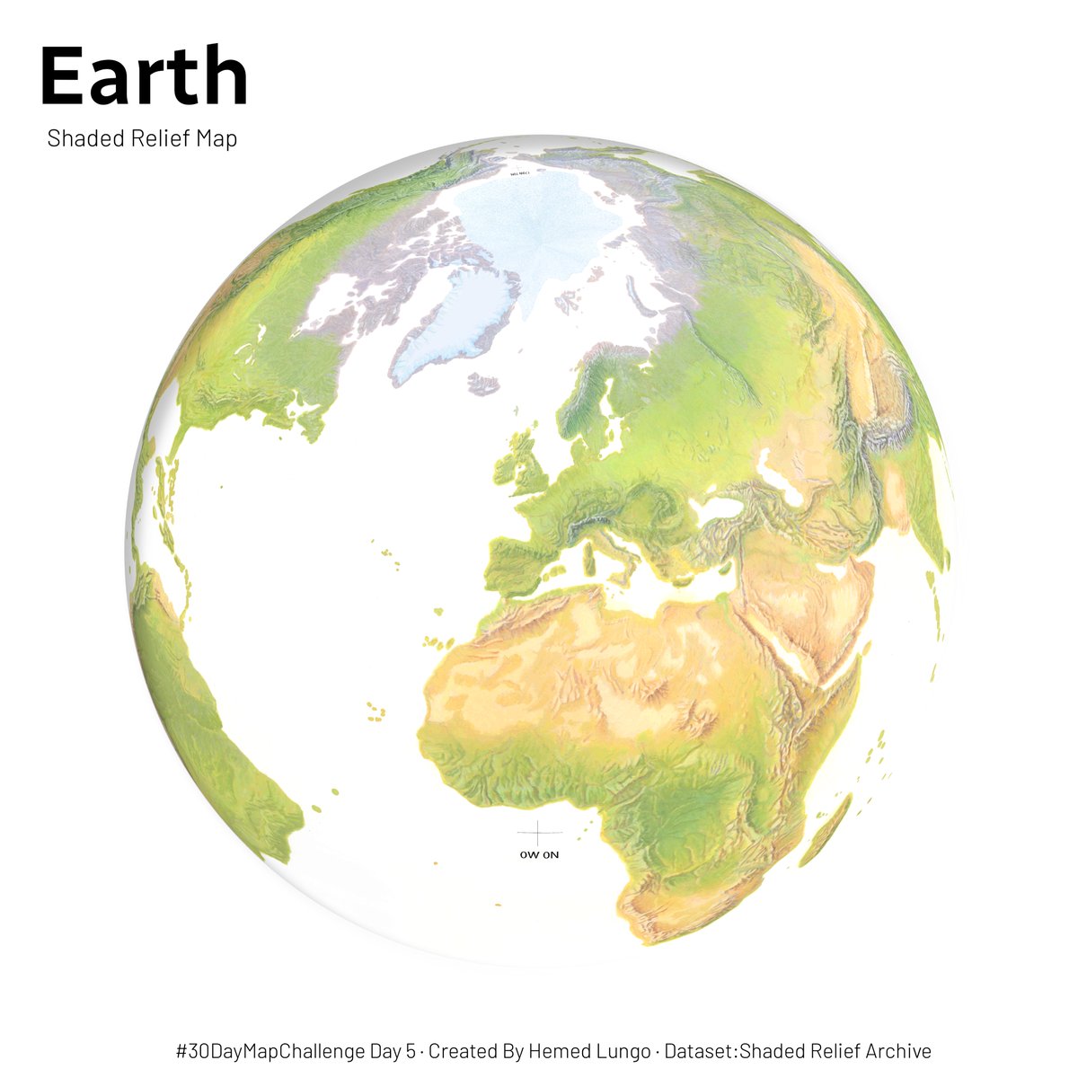
Find georeferenced hand-drawn reliefs here: shadedreliefarchive.com
7 Nov 2025

#30DayMapChallenge Day 5 - Earth🌍, Map showing Shaded Relief Map of Earth in Orthographic form through Globe Builder Plugin , Data from @MtnMapper's Shaded Relief Archive website Link below #qgis #earth #data #globe #gischat
2
13
114
7,710
Jeff Clark - Sea To Sky Map - Best of Show! retweeted
12 Sep 2025
Time to scroll around the most beautiful map ever made: the 1739 "Plan de Turgot," commissioned by the chief merchant of Paris.
Every mark was originally engraved into brass plates and the detail is insane, like examining an 8x10 ft. banknote.
38
337
4,006
147,591
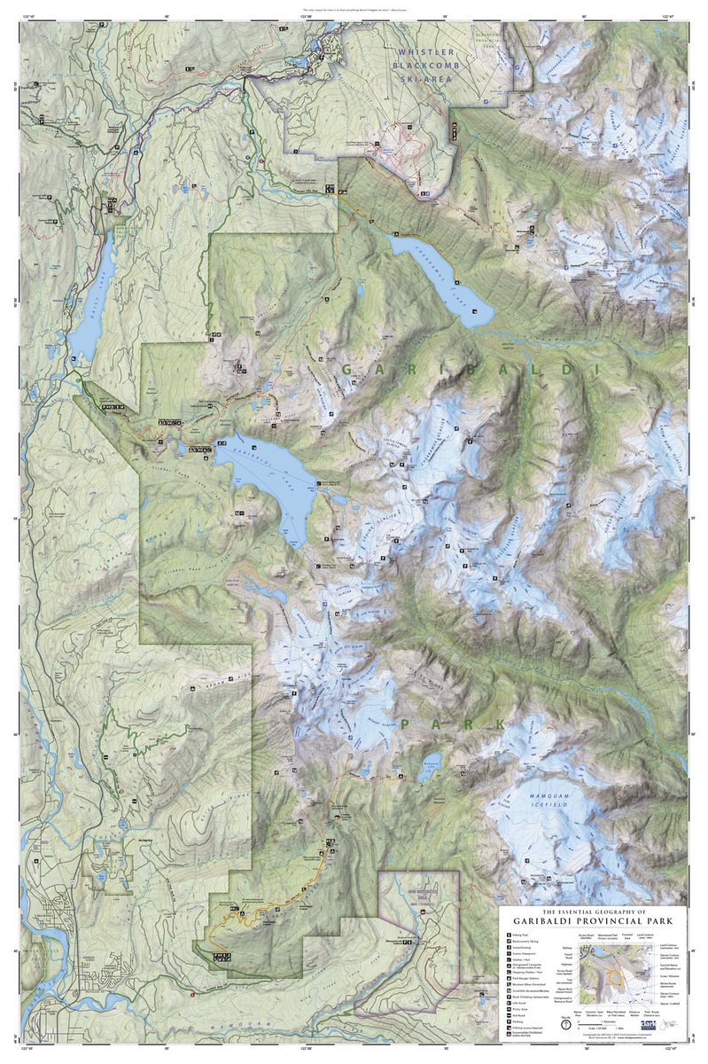
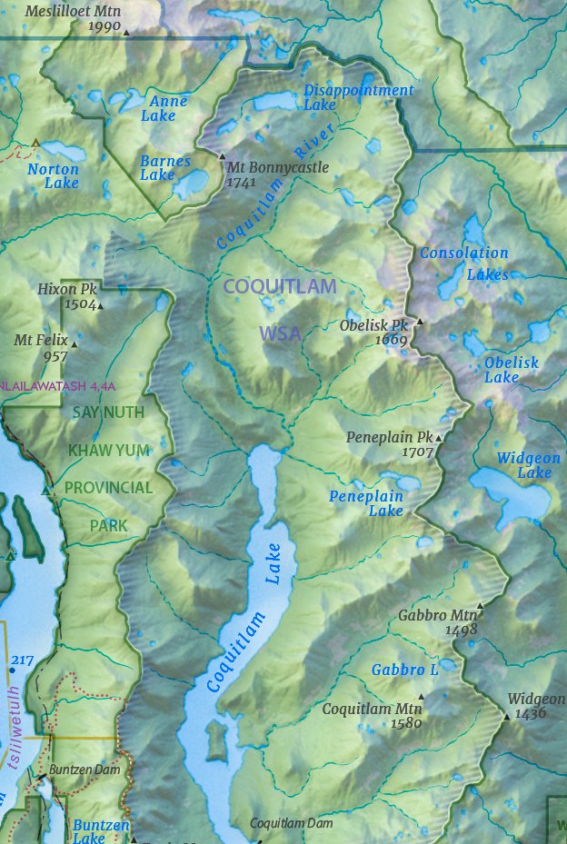
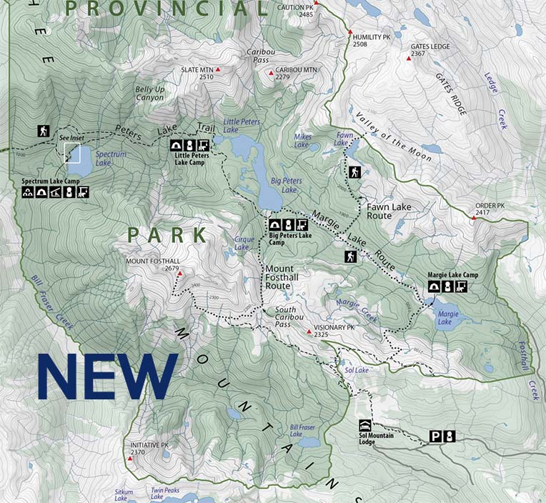
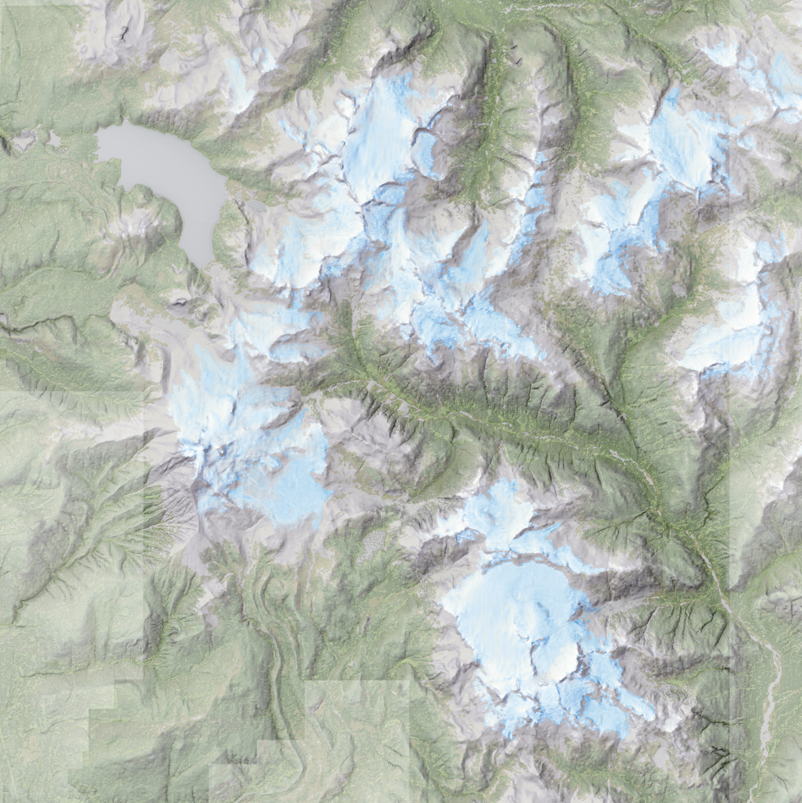
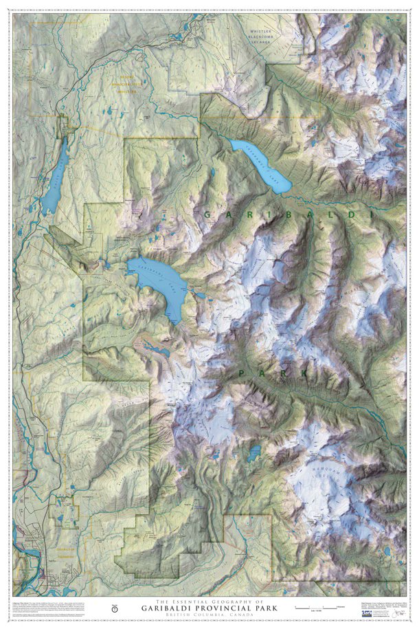
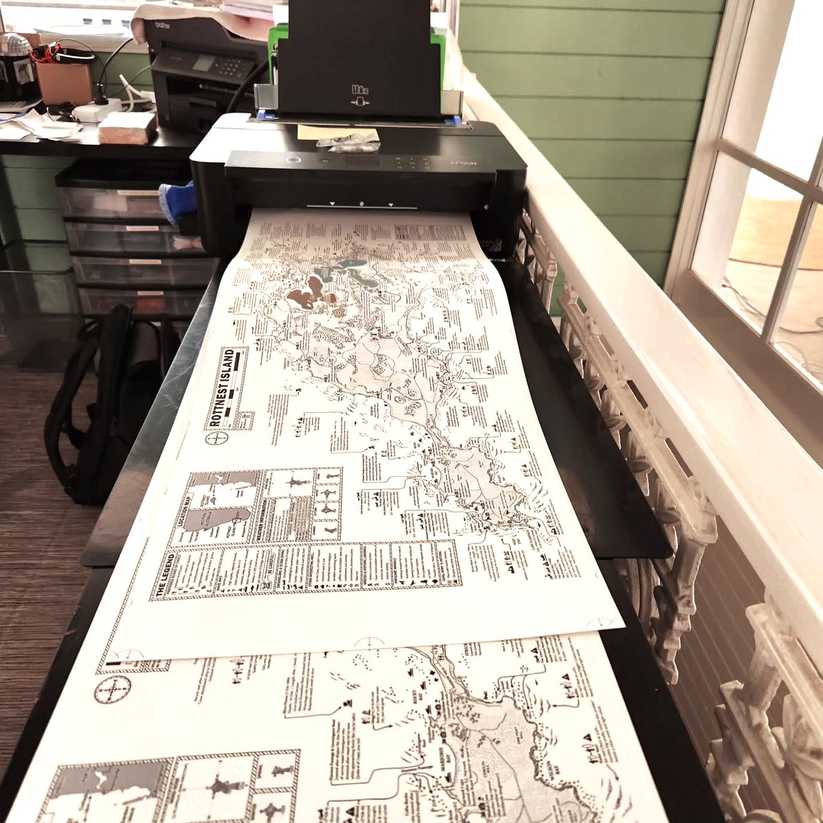
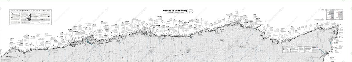
Getting ready to publish a new #map for Garibaldi Park, BC. If you've hiked this beautiful park, this is a great memento. 24" x 36" - for your wall!
#Vancouver #bcparks #cartography #maps #SQUAMISH #whistler #mapart #geography
1
6
544
Definitely my inspiration!
6 Sep 2025

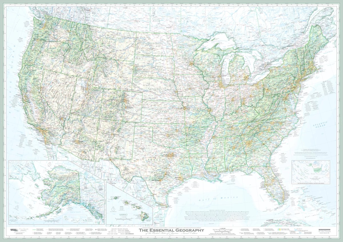
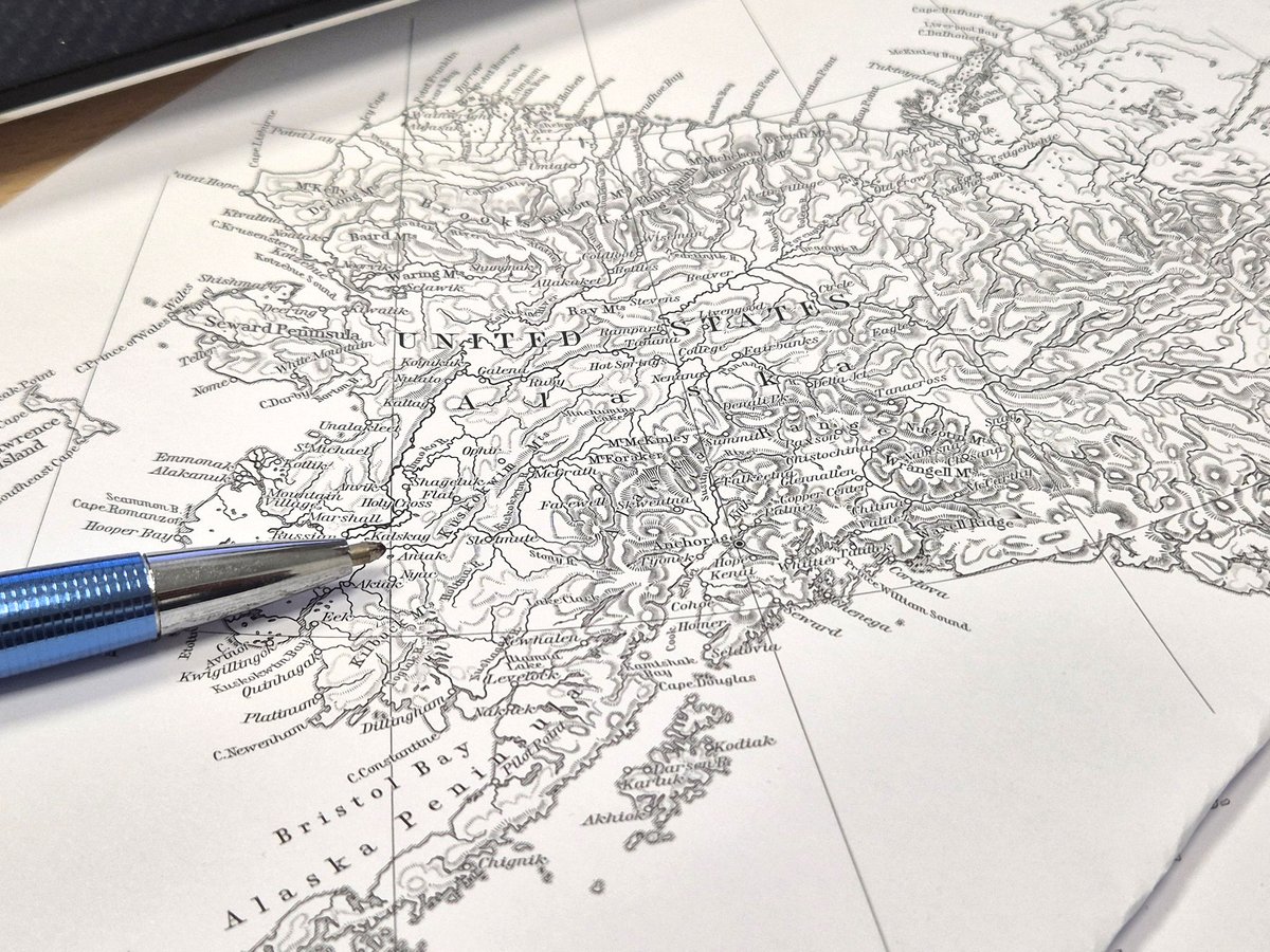
Maps by Dave Imus, one of the best living reference cartographers.
His 4x6 ft. “Essential Geography of the United States” took six years of daily work to finish and his relief maps are just 🤌

6
494
Jeff Clark - Sea To Sky Map - Best of Show! retweeted

5 Sep 2025
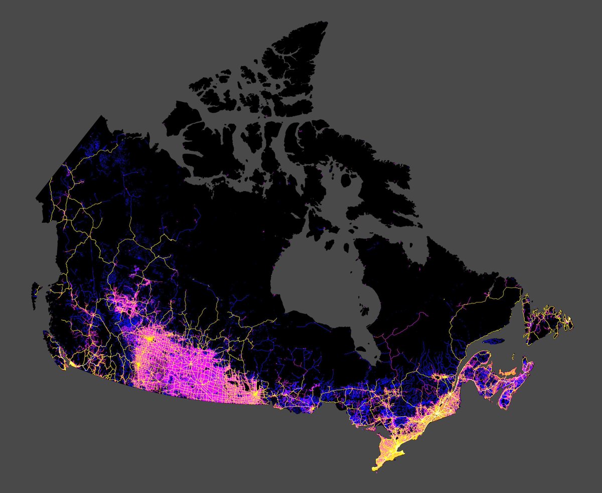
All the roads in Canada. Reveals much to think about.
(map by @EarthArtAus)
199
515
3,733
398,900
Jeff Clark - Sea To Sky Map - Best of Show! retweeted

6 Aug 2025
🌍 New Tutorial Alert: Visualizing Google's AlphaEarth Satellite Embeddings in 3D! 🛰️🏙️
Google DeepMind has released AlphaEarth, a groundbreaking satellite embedding dataset on Google Earth Engine. It includes annual global embeddings from 2017 to 2024, where each pixel covers a 10×10 meter area.
In this tutorial, you'll learn how to:
✅ Access and visualize AlphaEarth embeddings in 3D
✅ Leverage them for machine learning and change detection
🎥 Watch the tutorial: youtu.be/EGL7fXyA7-U
📘 Try the notebook: leafmap.org/maplibre/AlphaEa…
#GeoAI #geospatial #AI #Python #DeepLearning
4
133
654
25,936
Jeff Clark - Sea To Sky Map - Best of Show! retweeted
19 Apr 2025
“Handmade maps in the digital world” is my bailiwick, here are 23 modern map artisans:
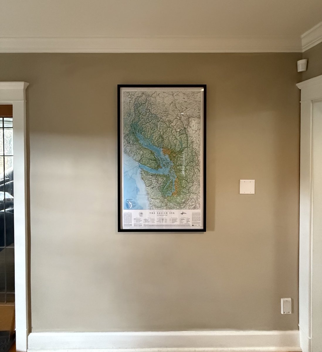
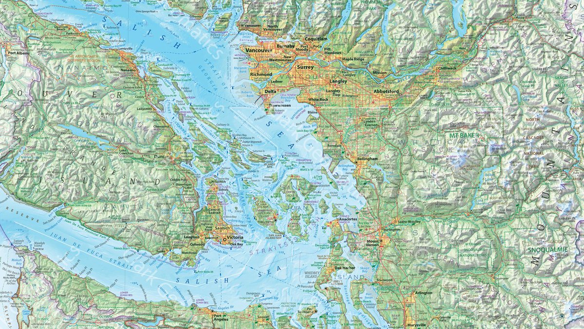
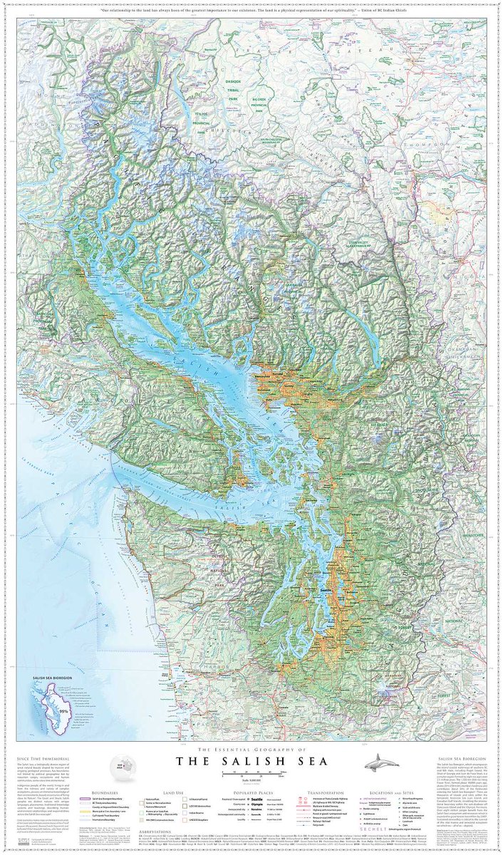
@ClarkGeomatics Jeff Clark completed a 100-layer 18-month project to map the Salish Sea.
@MtnMapper Tom Patterson spent decades mapping for the National Park Service, still releases a banger map every few months AND releases his design files to the public domain.
@DonatasBruzas Donatas Bružas is working on an engraving-style 3 ft. globe, makes custom typefaces and the most beautiful computer-mediated hachures you’ve ever seen.
@JapanMapping Markus Hauser, trained in Switzerland with decades of experience, makes the best trail maps of Japanese wilderness.
@FleischerHannes Hannes Fleischer wanted an old-school pen plotter map, so he lathed and milled his own parts to build the plotter, wrote custom scripts to turn DEMs into hachures, and designed the map with turfjs.
Henrik Jonasson made an acre-sized handmade topo map of Sweden
tiles.calazoffice.biz/#65567…
hkartor.se/
Mike Hall’s incredibly thick reference maps (he draws his own coastlines)
thisismikehall.com/europe
Dave Imus’s 5 ft. wide maps of the U.S.
imusgeographics.com/
Alex McPhee’s 6 ft. maps of Canadian provinces
pronghornmaps.com/saskatchew…
Andrew Lynch spent years tracking down every NYC rail siding
vanshnookenraggen.com/_index…
Nat Slaughter spent two years walking Central Park to make this central park map
davidrumsey.com/luna/servlet…
Aaron Taveras’s stunning trail maps of the Pacific Northwest
cartografix.co/
Daniel Huffman’s 3 ft. map of Michigan
somethingaboutmaps.com/Landf…
Carl Churchill’s pitch-perfect relief maps in Imhof style
flickr.com/photos/cchurchili…
Bill Marsh’s 30-year project to map Philadelphia
store.philamuseum.org/philad…
Eric Knight’s Nat Geo panoramas
ericknightmaps.com/panoramas
Marty Schnure’s wilderness maps
martyschnure.cargo.site/cart…
Margot Dale Carpenter’s landform maps for publishing
hartdalemaps.com/
Jamie Robertson’s trail maps of Big Sky country
cairncarto.com/product/publi…
Mike Hermann’s Pennsylvania trail maps
purplelizard.com/
Maddy Grubb’s Blender maps of mountains
maddygrubbmaps.github.io/Map…
John Tauranac learned Illustrator and walked every block in Manhattan to make his own guide maps
johntauranac.com/tauranac_s_…
Eleanor Lutz is a bio PhD and taught herself how to make all kinds of maps of earth, sky and everything in between
eleanorlutz.com/animated-sea…


18 Apr 2025

Someone needs to do handmade maps in the digital world. The same underlying data, chosen and arranged by human designers.
2
24
184
19,495
Jeff Clark - Sea To Sky Map - Best of Show! retweeted
9 Jul 2025
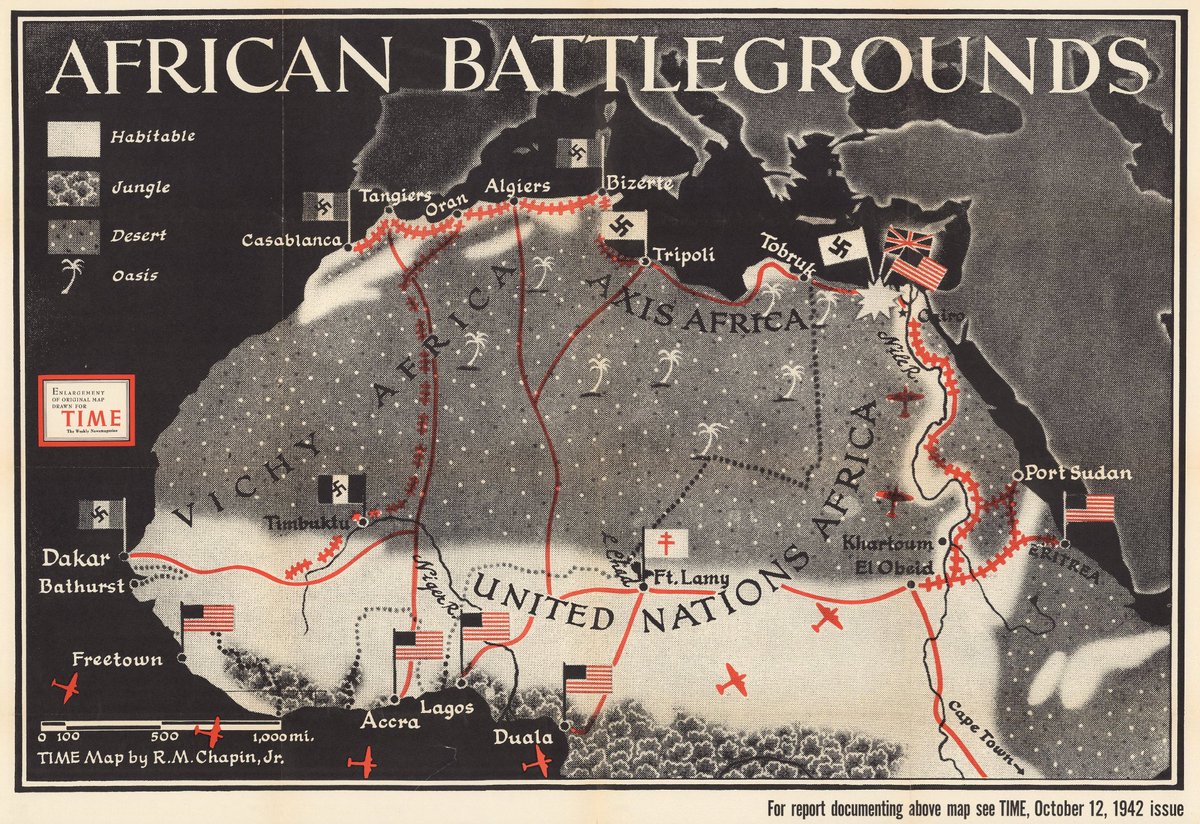
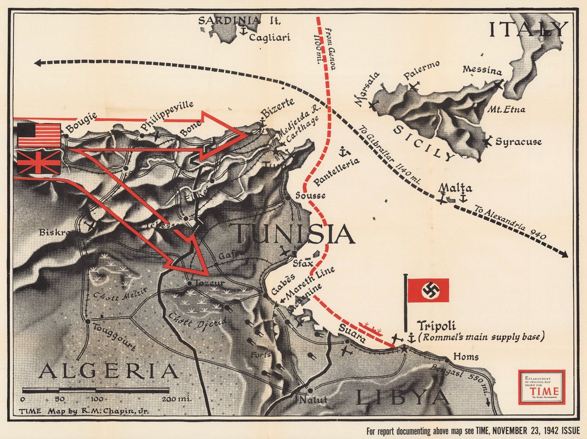
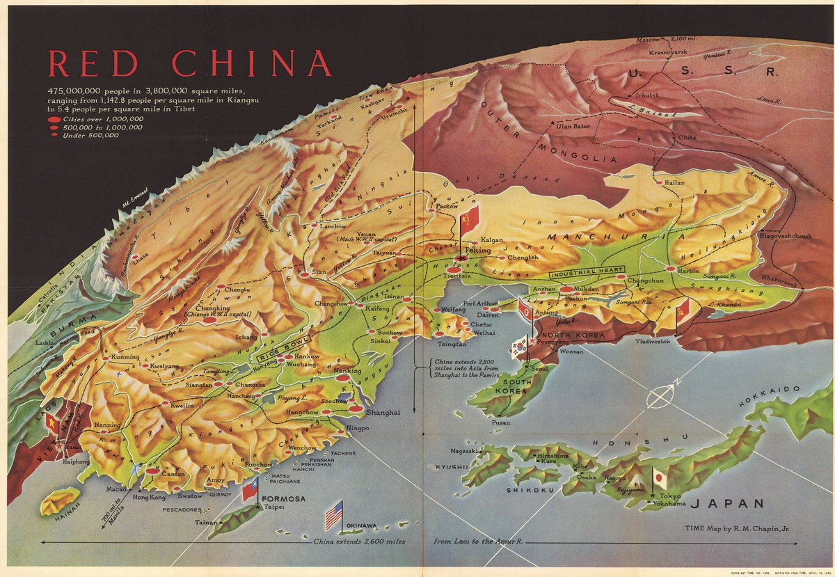
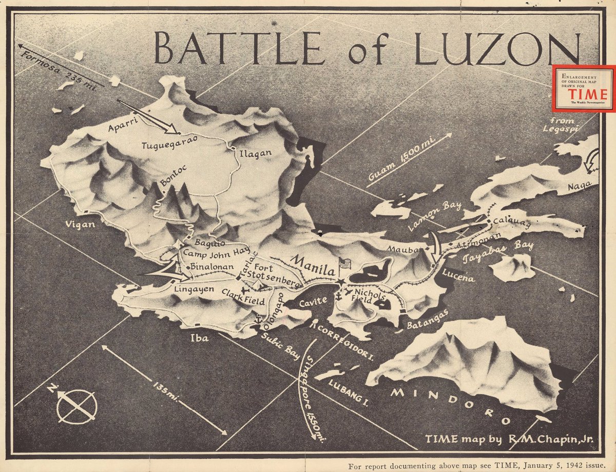
WWII editorial maps for Time Magazine by R.M. Chapin
11
227
2,069
148,641
Jeff Clark - Sea To Sky Map - Best of Show! retweeted
27 Jun 2025
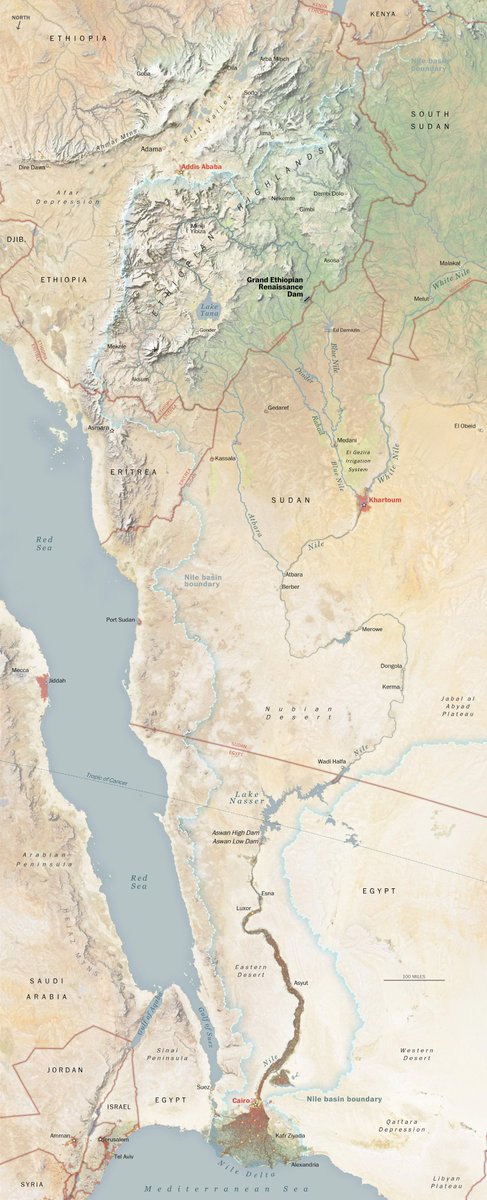
My favorite editorial map: north-down Nile by Laris Karklis for an Oct. 2020 Washington Post story about the Grand Ethiopian Renaissance Dam
1
7
58
3,448
Jeff Clark - Sea To Sky Map - Best of Show! retweeted
25 Jun 2025
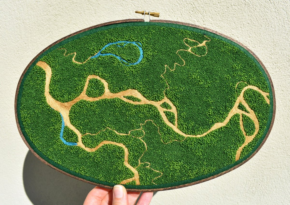
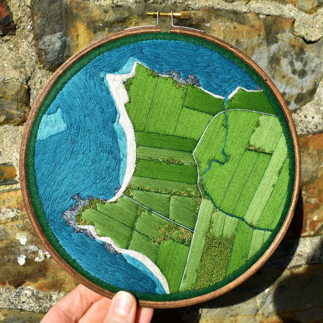
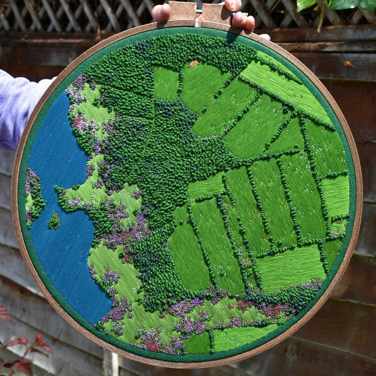
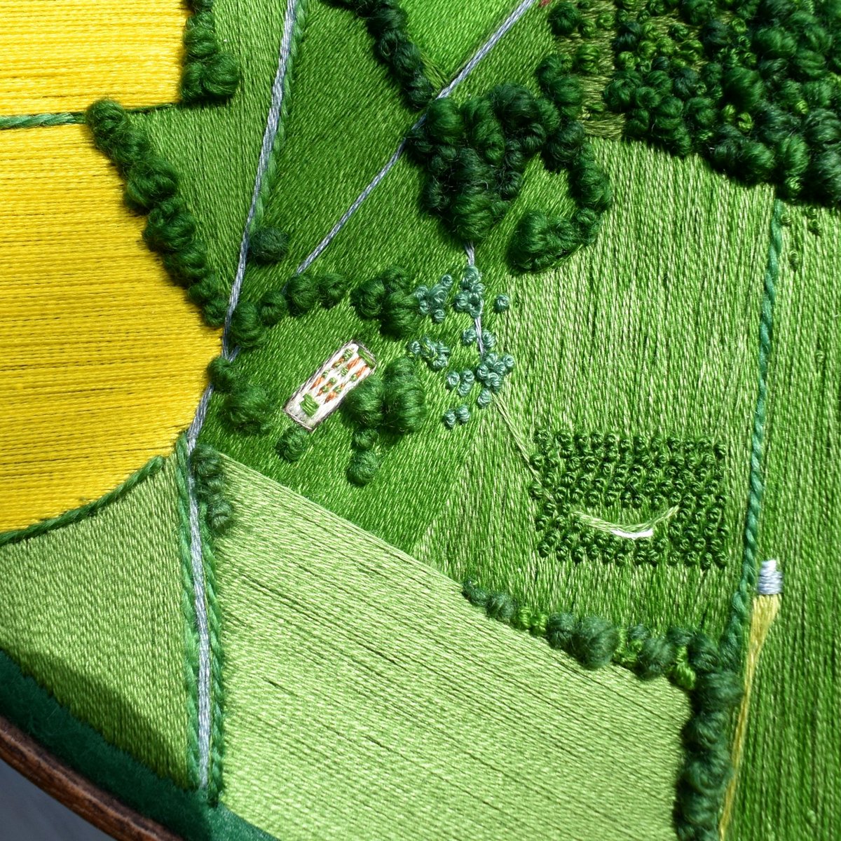
Devon, U.K. artist Victoria Rose Richards embroiders rich territories.
"I am surrounded by inspiration for my pieces in the endless fields and meadows, lush forests, winding rivers and reaching moorland."
2
12
149
5,787
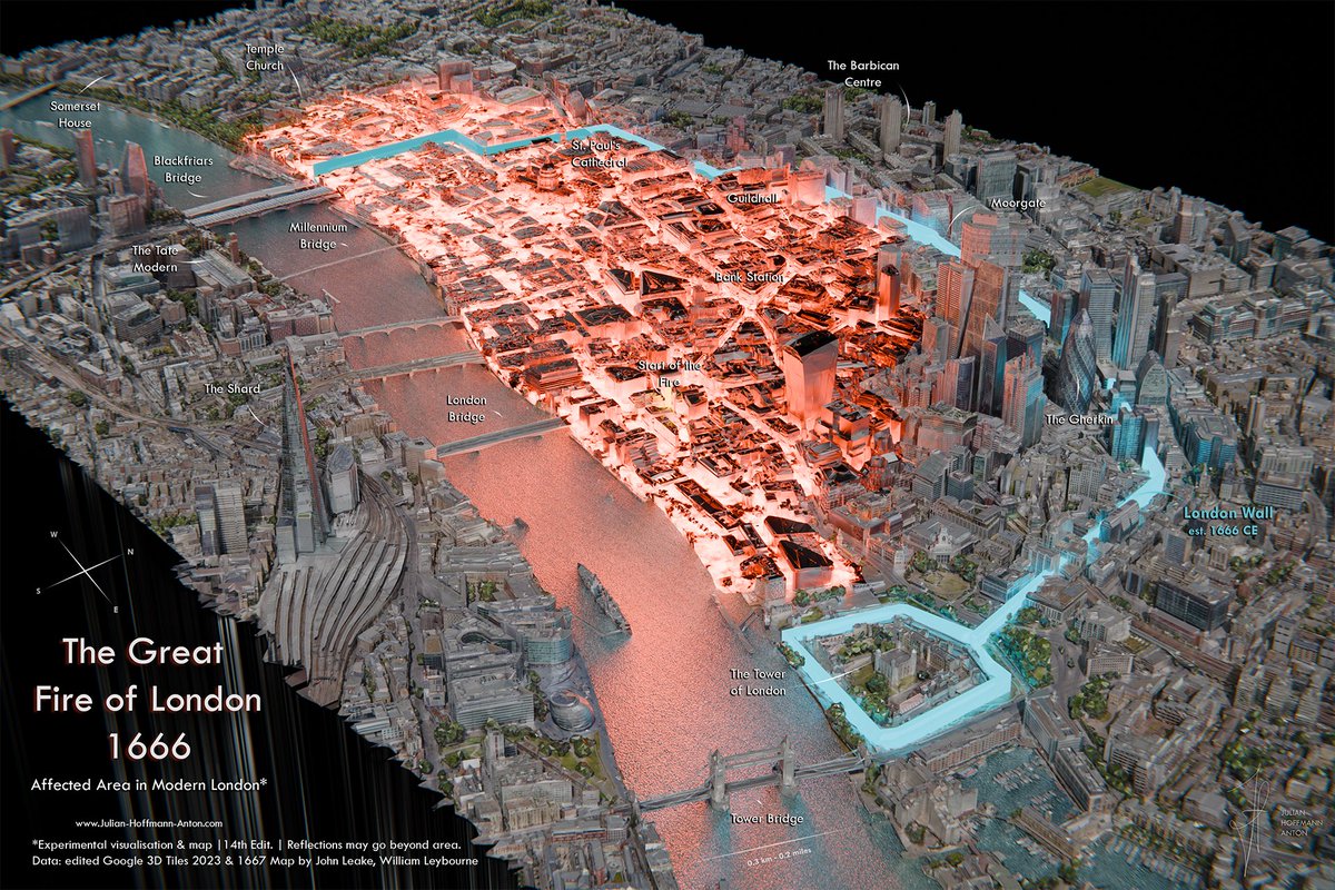
Jeff Clark - Sea To Sky Map - Best of Show! retweeted

25 Jun 2025
The Great Fire of London – 1666 CE | Affected area in modern-day London. Made in Blender based on the area in ruines mapped by Leake & Leybourne (1667) and Google's photoreal 3D Tiles. I loved making this. London TimeOut even wrote about it:
1
22
182
6,592
Jeff Clark - Sea To Sky Map - Best of Show! retweeted
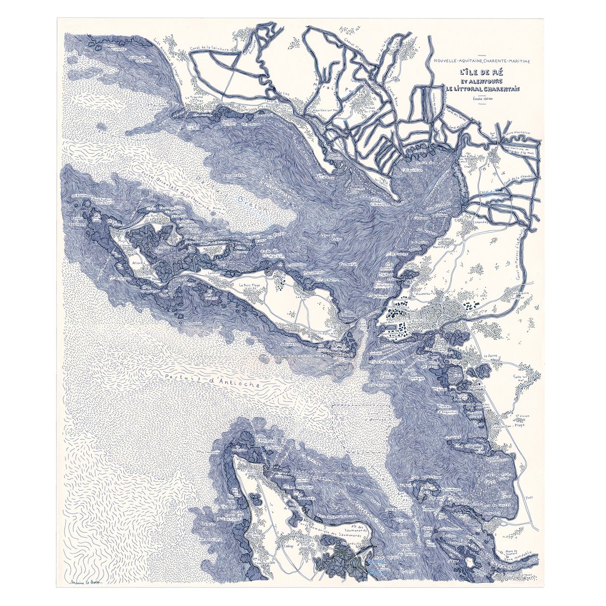
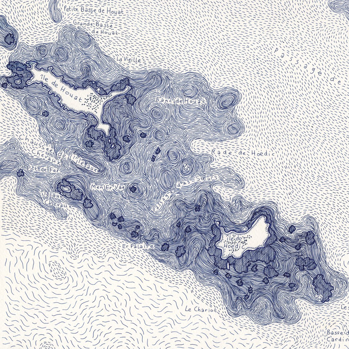
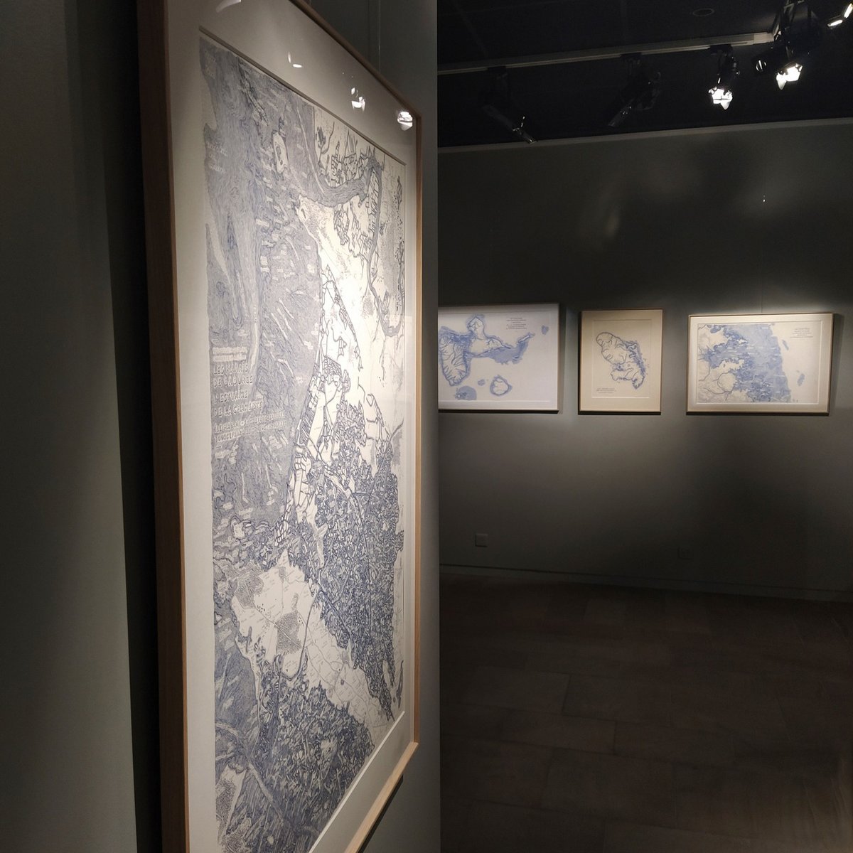
7 Jun 2025
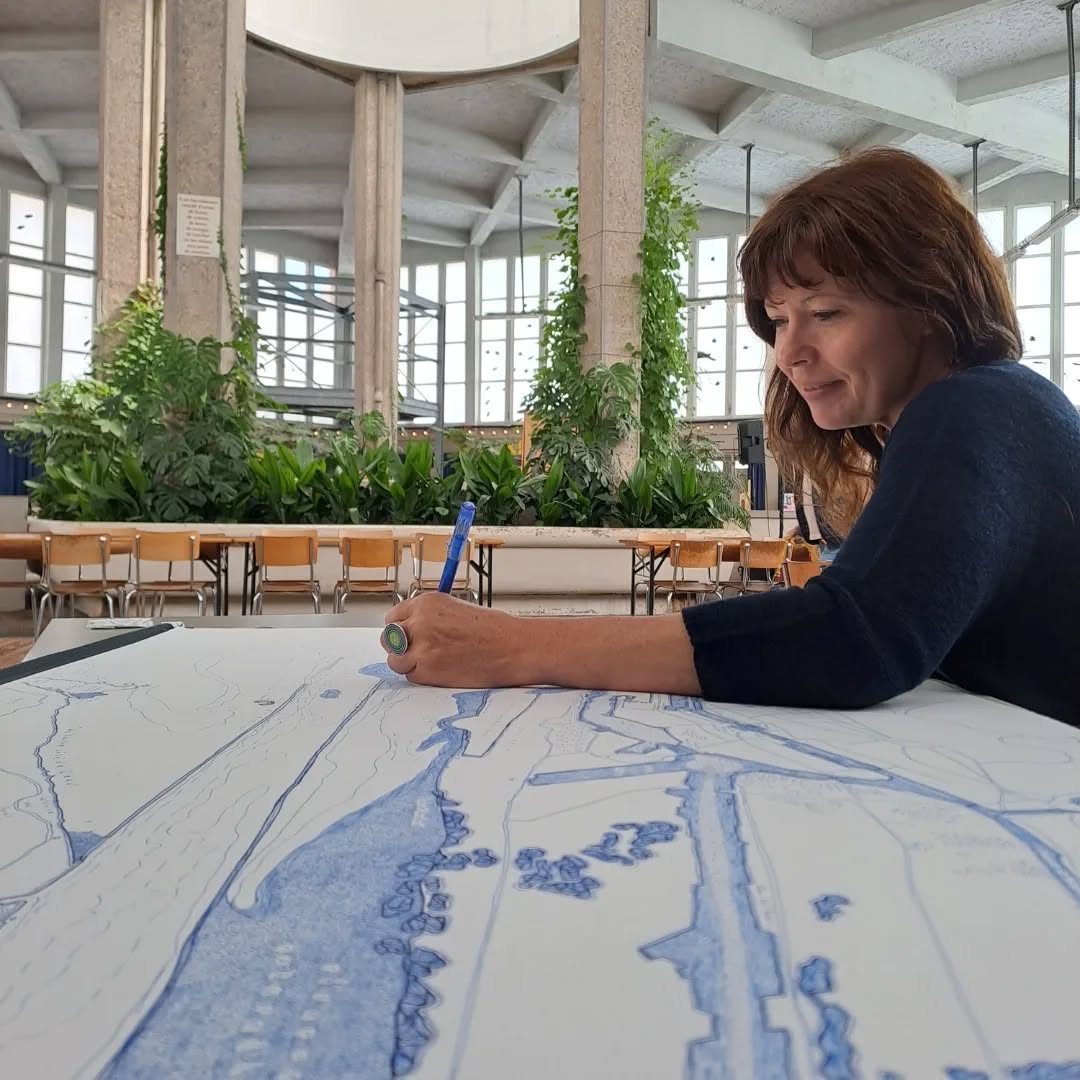
Marine Le Breton draws swirling pen maps of France’s coastal areas and islands; you rarely see a map where the water gets as much ink as the land.
Nautical love letters with towns, roads, marshes, tidal flats, creeks, bays, inlets, piers.
3
27
291
16,905
Jeff Clark - Sea To Sky Map - Best of Show! retweeted
4 Jun 2025
Margaret River, Australia cartographer Grant Preller walks the coast, surfs the breaks, then uses Google Earth, 1890s coastline maps, 1:50k topos, a pencil and CorelDraw to create 8-foot-wide maps that show where to catch a sick barrel 🤙
A true go-somewhere mapmaker

2
16
109
13,068
Jeff Clark - Sea To Sky Map - Best of Show! retweeted

31 May 2025
magellan expedition in 1 minute
156
715
6,294
633,266
Jeff Clark - Sea To Sky Map - Best of Show! retweeted

29 May 2025
The population density of our planet by people
65
537
2,436
333,994
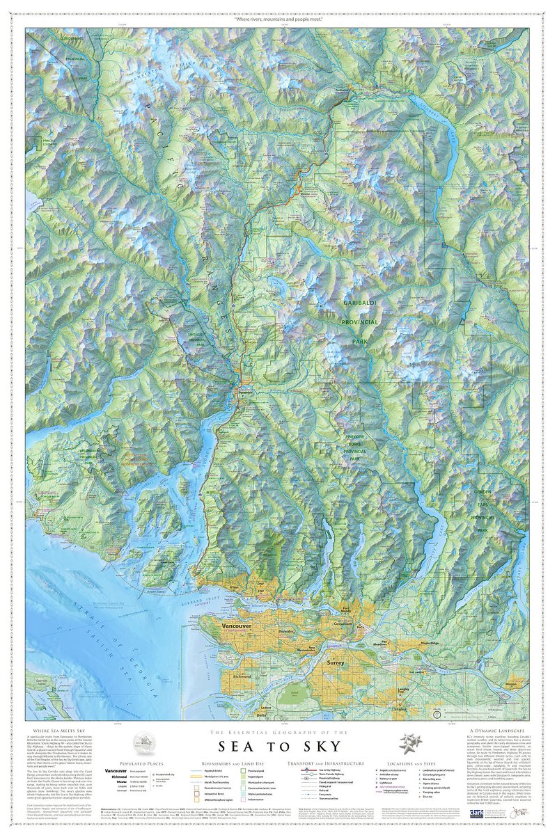
Check out interview with @Thuncher (@squamishchief) where we talk about essential geography - it's a gripping tale, trust me.😉
#Squamish #Vancouver #BritishColumbia
tinyurl.com/CGCInterview
Please RT to let the good folks in Squamish know about the Sea To Sky map. Thanks!!
1
3
382