
Remote Sensing for GeoHazards (RS4GeoHZ) group at GFZ Potsdam, Germany, focuses on understanding the geo-hazards in light of the current Climate Crisis.
Joined December 2022
- Tweets 148
- Following 18
- Followers 382
- Likes 157
105 Photos and videos


20 Jan 2025
We join those universities and research institutes in Germany to discontinue our activities in this platform. Thank you for following us over the last yrs. You can find updates about our reseach in the following address:
linkedin.com/company/remote-…
1
4
772
8 Jan 2025
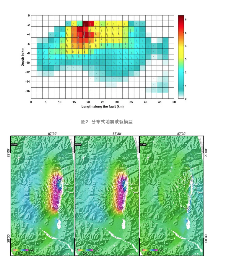
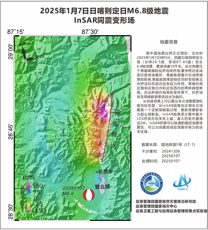
Ministry of Natural Resources in China releases the first LuTan-1 (L-band SAR satellite)-based earthquake displacement field and fault slip model associated with Jan. 7, 2025 Mw 6.8 earthquake that occurred in Dingri County, Shigatse City, Tibet.
18
36
5,662
14 Dec 2024
In a new study together with colleagues in the US, we used our newly developed open-source #SARvey software to analyze structural instability of coastal buildings in #Miami .
link to the article --> dx.doi.org/10.1029/2024EA003…
link to SARvey --> github.com/luhipi/sarvey
2
8
589
8 Nov 2024
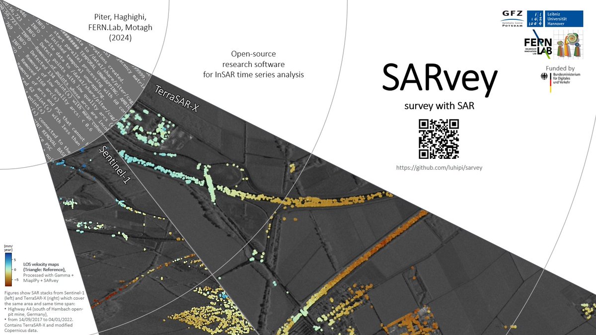
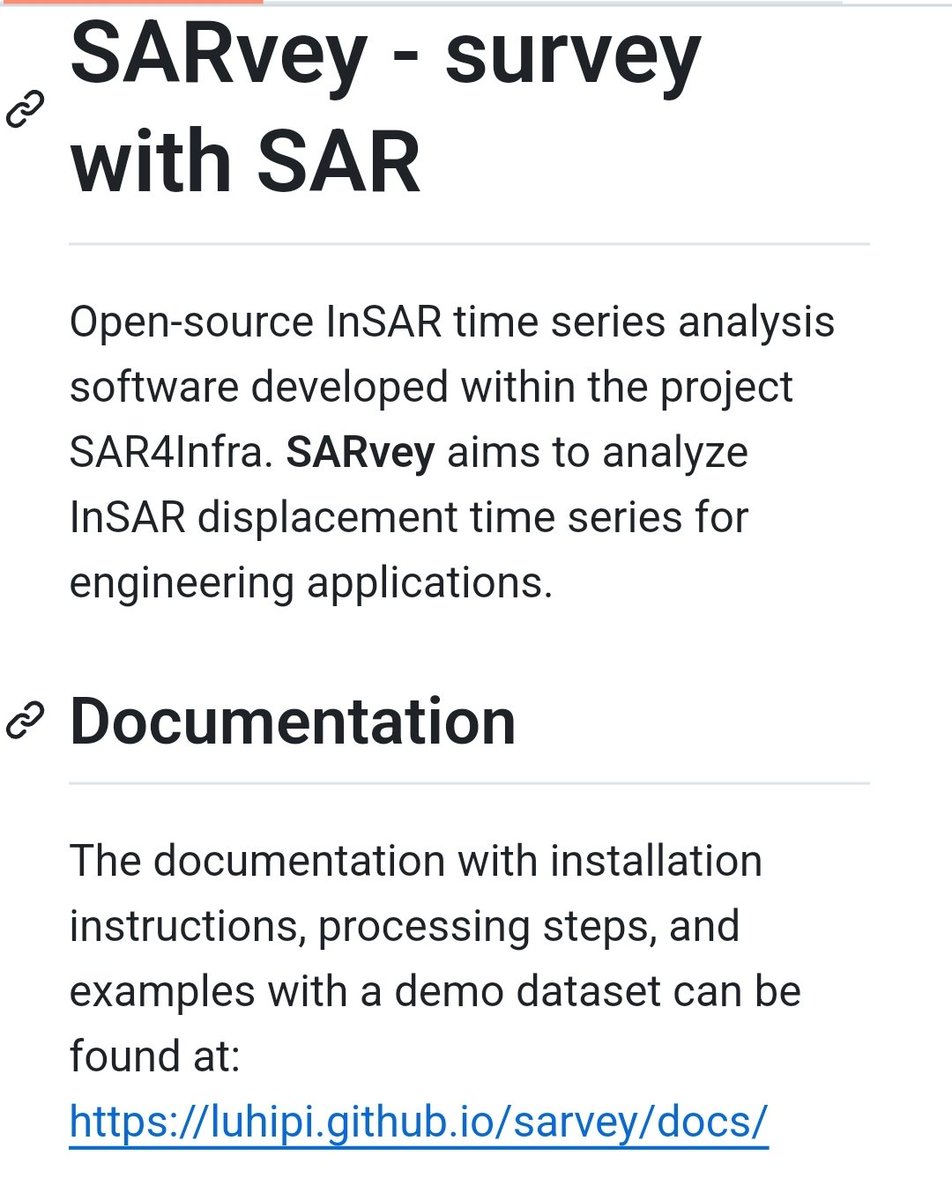
Thrilled to announce the release of #SARVey, an open-source #software for the #InSAR time-series analysis using both #Persistent & #Distributed scatterers in #Python.
link to software ->
github.com/luhipi/sarvey
The paper describing the methodology->
link.springer.com/article/10…
1
19
75
5,170
3 Nov 2024
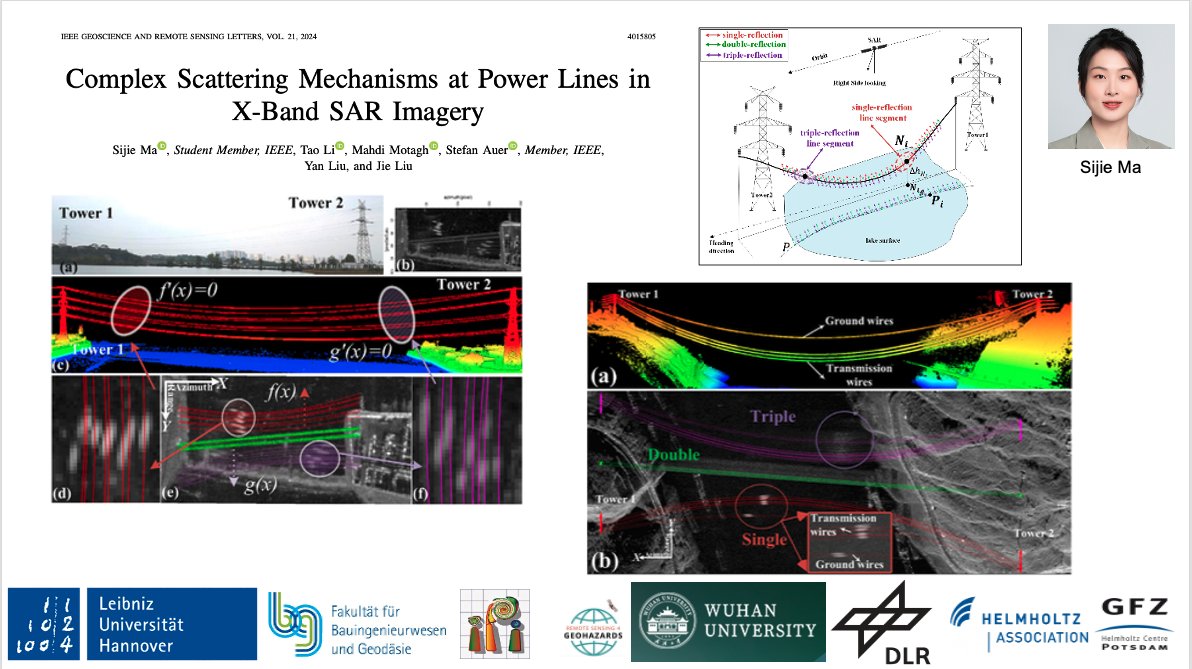
Analysing complex #SAR #echoes associated with #powerlines is important for inspection management applications. In this paper, we proposed a novel tracing method to analyze #multireflection effects of such objects in #TSX data. @WHU_1893
link to paper -> ieeexplore.ieee.org/document…
1
10
563
28 Oct 2024
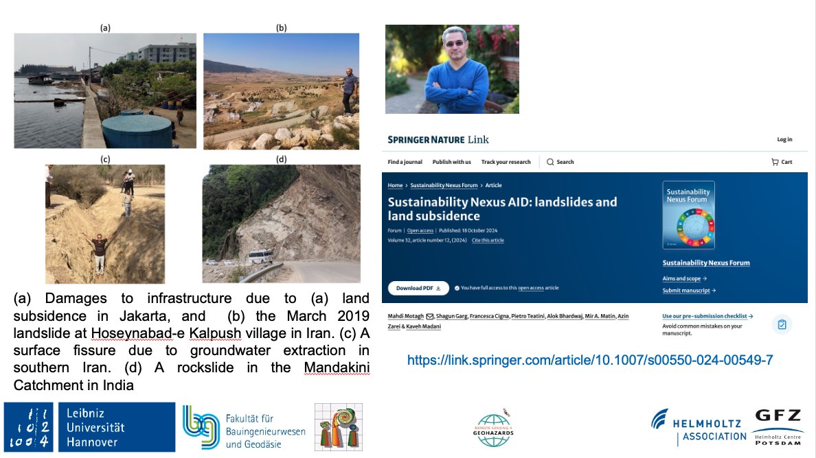
In this forum article led by @MahdiMotagh, a team of scientists discusses the critical role of a data-driven #nexus approach in understanding hazards related to #landslides & #land_subsidence
Link to paper->
link.springer.com/article/10…
@Land_Subsidence
@ShagunGarg1511
@FraCigna
4
10
715
22 Oct 2024
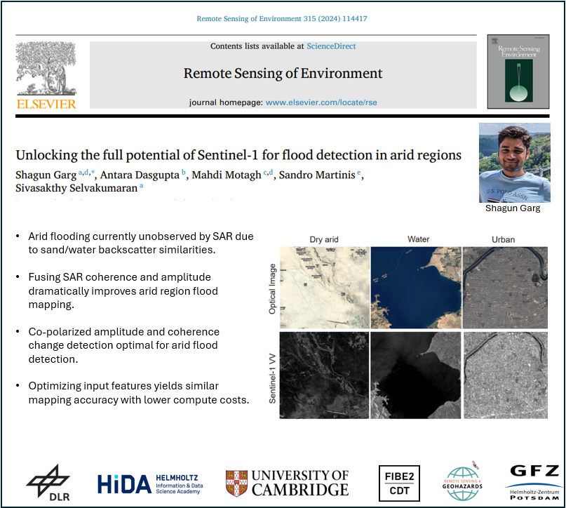
New paper alert! In this new study, led by @ShagunGarg1511-PhD student from @Cambridge_Uni & #HIDA scholar at @GFZ_Potsdam, we have shown how potentials of #SAR data can be exploited for accurate flood mapping in arid regions
link--> sciencedirect.com/science/ar…
3
15
654
20 Oct 2024
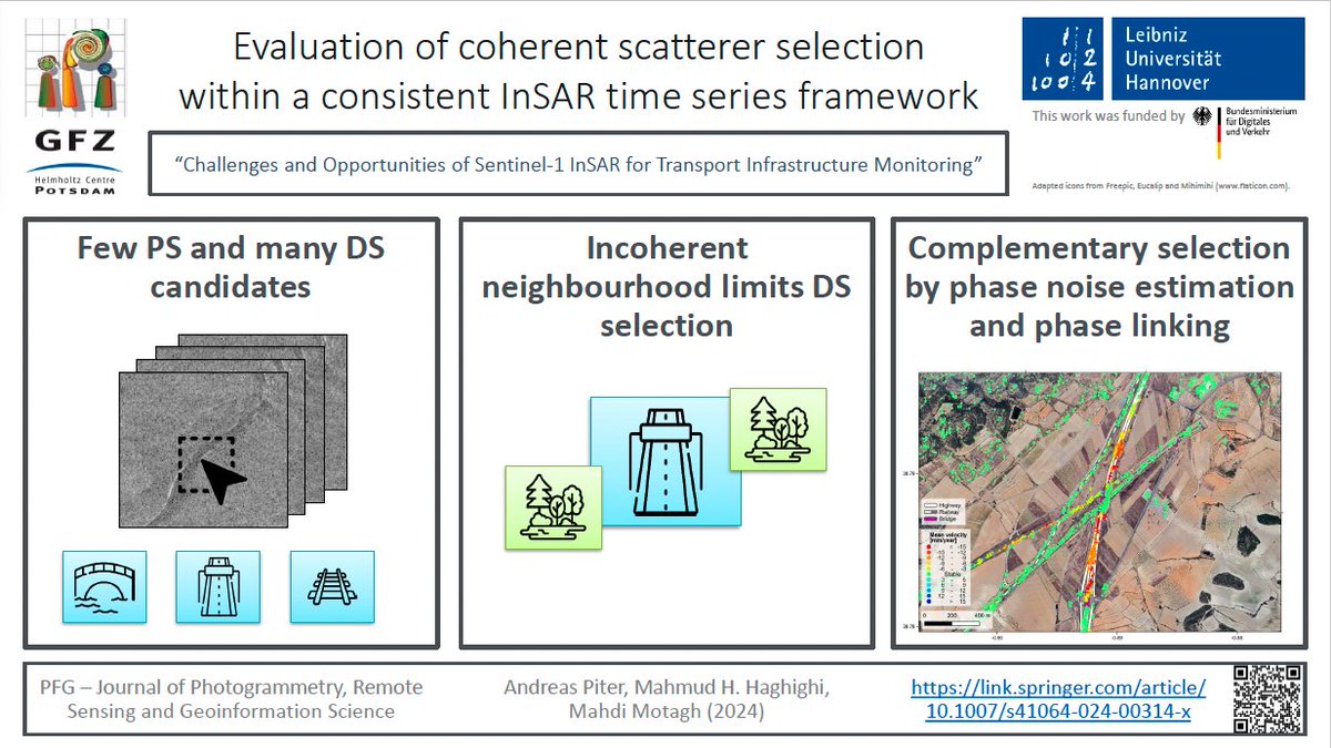
New Paper Alert!
Are you interested in applying #Sentinel1-based #InSAR measurements for #infrastructure stability analysis? Then please see the paper led by our PhD student Andreas Piter about challenges and opportunities in this regard.
link.springer.com/article/10…
5
16
1,179
12 Oct 2024
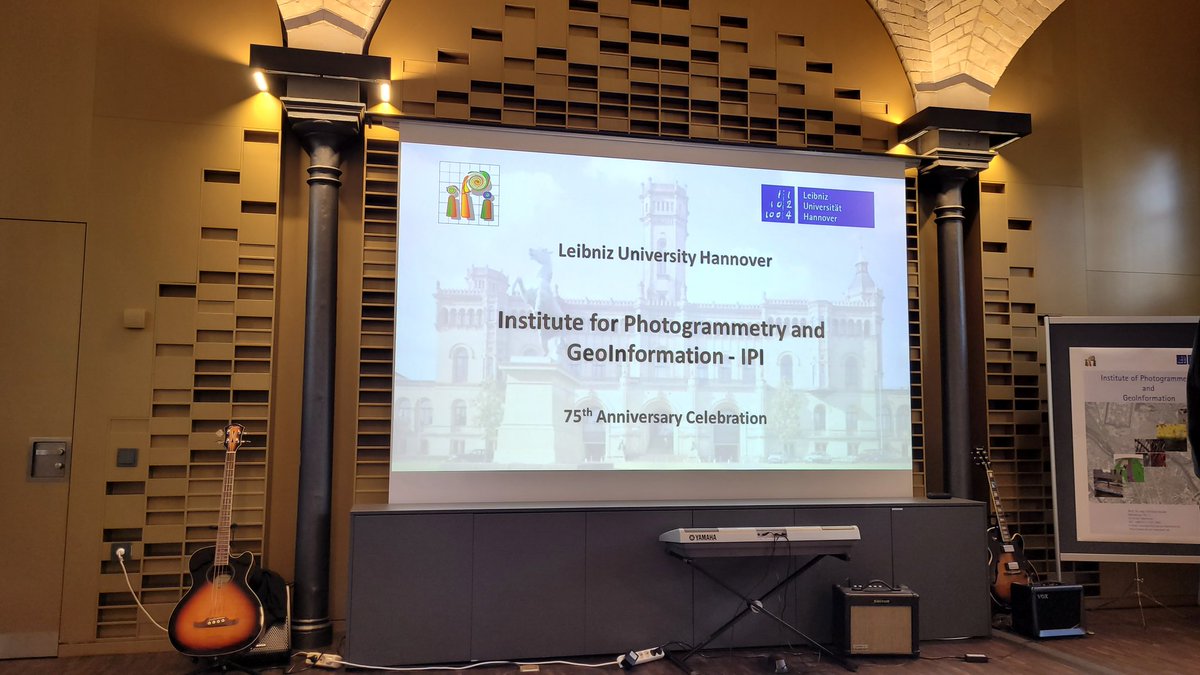
At @UniHannover we are proud for our internationalization and be inclusive for different cultures. A memorable night for 75th anniversary of the #IPI institute with amazing performance of traditional Indian dances from a member of our #RADAR group @Ritushr80919287 from 🇮🇳
2
10
748
RS4GeoHZ retweeted

10 Oct 2024
📍New paper out!
We explore how to detect floods in arid regions better using #Sentinel -1 SAR data. These areas are often ignored in global flood mapping, but our work highlights a new approach that improves detection by up to 50%!
A thread 🧵 (1/n)
sciencedirect.com/science/ar…

6
42
191
9,709
30 Sep 2024
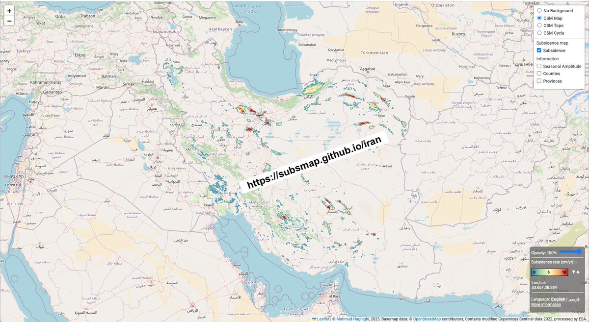
An Interactive map of #land #subsidence in #Iran, developed in a collaboration between @UniHannover & @GFZ_Potsdam
subsmap.github.io/iran/
Link to paper->
science.org/doi/10.1126/scia…
link to Zenodo ->
zenodo.org/records/10815578
@Land_Subsidence
@UNU_FLORES
@MahdiMotagh
@Mahmudhh

3
12
452
RS4GeoHZ retweeted
19 Sep 2024
🔔New paper alert!
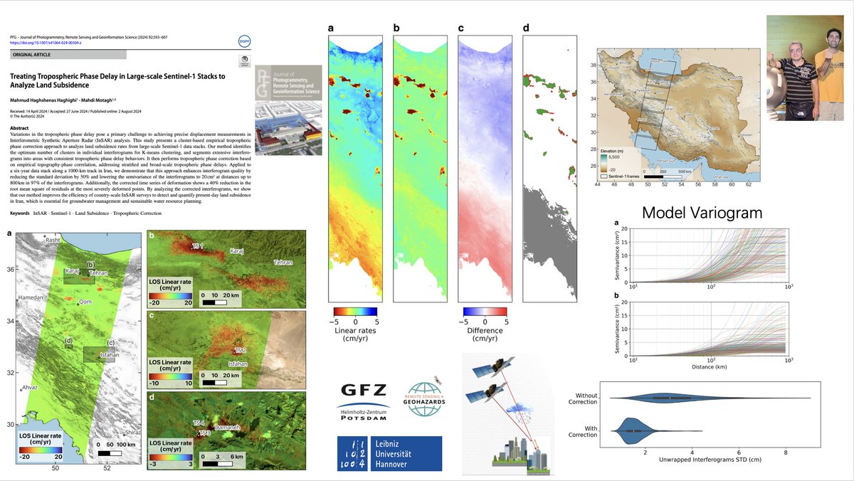
A cluster-based approach for mitigating #tropospheric phase delay in large-scale #Sentinel1 stacks for mapping land #subsidence
link.springer.com/article/10…
4
15
1,904
26 Sep 2024
Our recent work for #land #subsidence in #Iran that was published earlier this year by @Mahmudhh & @MahdiMotagh in @ScienceAdvances was featured in @guardian
@Land_Subsidence
@GFZ_Potsdam
Link to Guardian-->
theguardian.com/science/2024…
1
3
349
21 Sep 2024
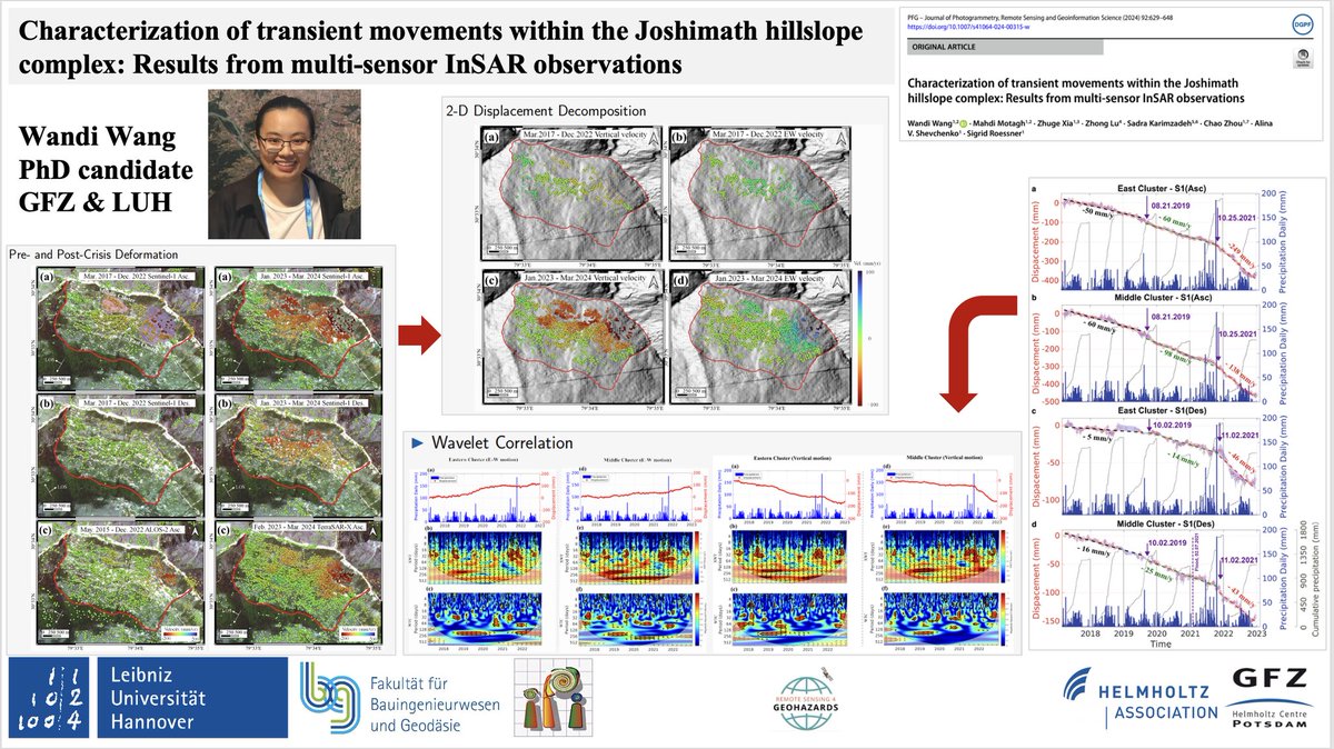
New paper alert!
In this paper, led by Wandi, we investigate #slope instability processes before & after the 2023 slope destabilization crisis within the #Joshimath hillslope complex in #India using #Sentinel1
, #ALOS2, and #TerraSAR-X #InSAR
link.springer.com/article/10…
4
20
900
RS4GeoHZ retweeted

18 Sep 2024
New study on #joshimath using #SAR #remotesensing by @GfzRemote research group
link.springer.com/article/10…
Congratulations to Wandi Wang, Prof. @MahdiMotagh and others
1
3
10
516
18 Sep 2024
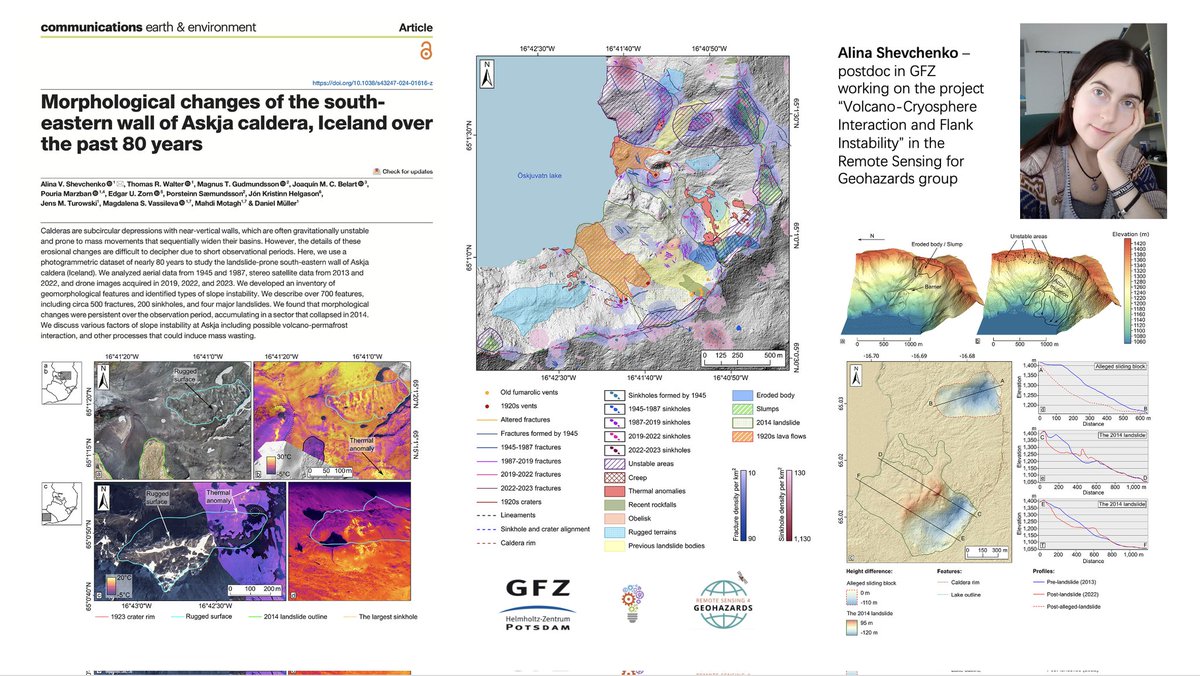
New paper alert!
#Photogrammetry meets #Volcanology
See the new paper by our posdoc, Alina, published at @CommsEarth.
@VOLCAPSE
Link to the paper-->
nature.com/articles/s43247-0…
1
2
11
406
13 Sep 2024
1
4
453
4 Sep 2024
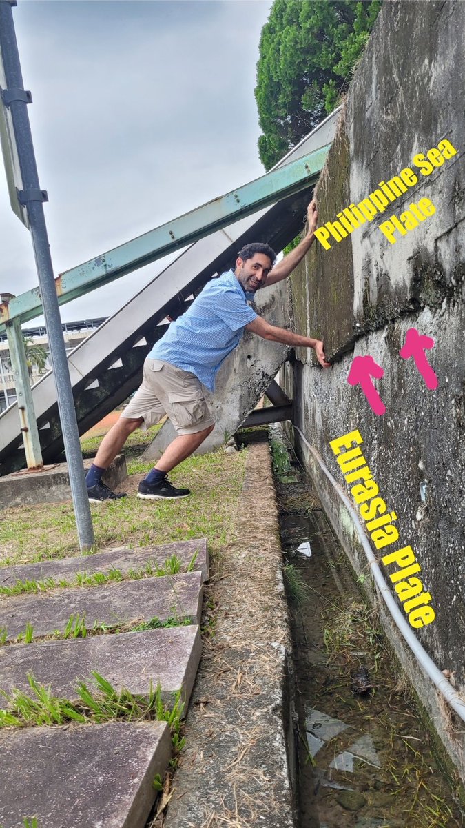
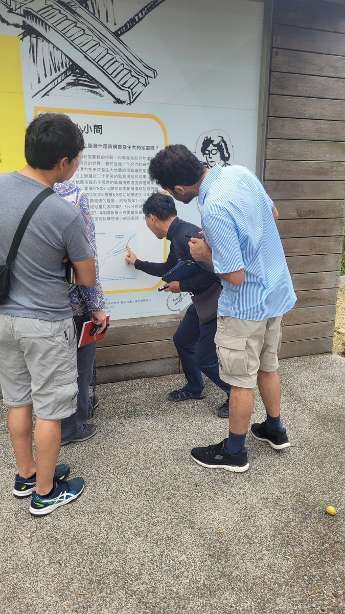
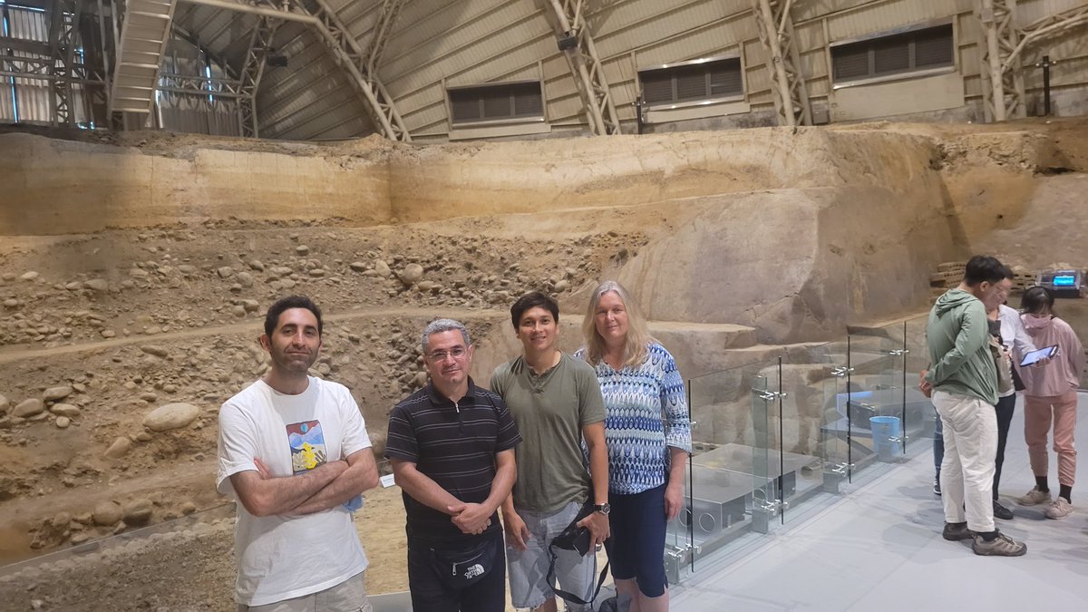
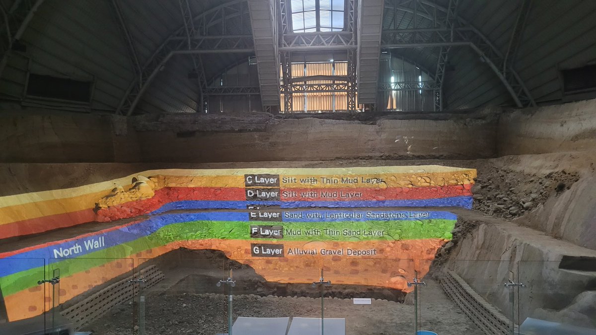
Visting the creeping section of the #Chihshang fault in 🇹🇼 . @Mahmudhh is doing his best to stop the fault slip between the Philippine Sea Plate & the Eurasian Plate😉


1
7
446
2 Sep 2024
1
13
684