
Joined October 2016
- Tweets 72
- Following 7
- Followers 450
- Likes 42
39 Photos and videos


OpenMapTiles 3.15 is out! The main changes include
* Big improvements to the road network
* More water features
* Integration of Aboriginal lands
* Extra functionality for adding the most requested data & improving cartography
Read more at bit.ly/44k6640
13
33
1,867
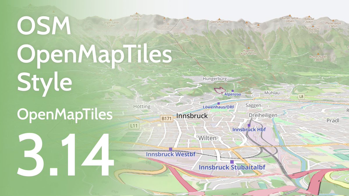
We've added some extra features to @OpenMapTiles. You can now use the following when making your maps:
- Parcel lockers
- Shrubberies
- Bus guideways
- Quarries
Read more: maptiler.link/omt_314
6
9
1,305

23 May 2023
We have a new style inspired by @OpenStreetMap Carto that shows all the features. Now you can have vector maps in a familiar design that will rotate and look good in 3D. We’ve even proposed that it is available on the OSM website!
Find out more: maptiler.com/news/2023/05/op…
3
28
2,665
OpenMapTiles retweeted

26 Aug 2022
9
34
OpenMapTiles retweeted

26 Aug 2022
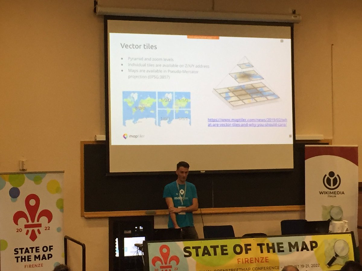
Hearing so many people talk about @OpenMapTiles at #FOSS4G2022. This is going to be a must see talk!

Don’t forget! @TomPohanka is speaking about the latest release of @OpenMapTiles @FOSS4G at 11:30: ow.ly/fm6F50Kp4o0
#FOSS4G2022 #OpenSource #OpenData

2
7
26 Aug 2022
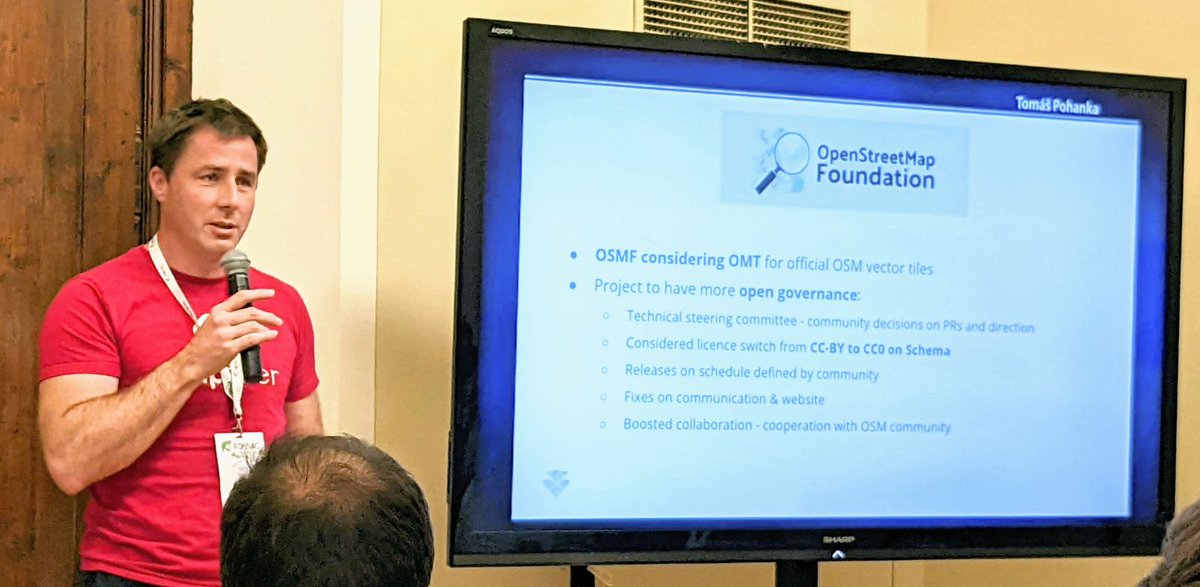
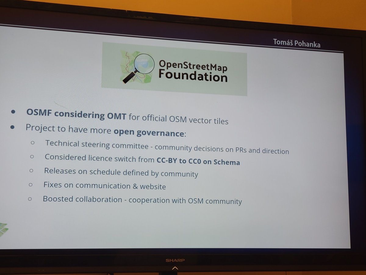
Just Announced📢 OpenMapTiles makes steps towards Open Governance and considers CC0 licence!
OpenMapTiles may also become the Official #OSM #VectorTiles!!
#FOSS4G2022 @openstreetmap @foss4g
3
39
122
OpenMapTiles retweeted

26 Aug 2022
3
8
OpenMapTiles retweeted

19 Aug 2022

2
5
27
The latest release of @OpenMapTiles greatly enhanced its cartography and map styling options! Find out what’s new in @TomPohanka’s talk @FOSS4G 2022, 26th Aug. - 11:30.
Find out more: maptiler.link/FOSS4G22-OpenM…
#FOSS4G2022 #OpenSource #OpenData
1
3
9
OpenMapTiles retweeted

Friday 22 July is Black Friday for #FOSS4G2022 online registration! From 00:00 to 23:59 CEST you can get your ticket discounted half price! Hurry up: the promotion will only be available for a limited time! ‼🗯
💻 2022.foss4g.org/registration…
#OSGeo @OSGeo

21
25
OpenMapTiles retweeted

26 May 2022
(Re)découvrez la carte #OpenStreetMap sur @MapTiler Cloud! maptiler.link/openstreetmap - une adaptation du style osm-carto pour les tuiles vectorielles @OpenMapTiles
2
6
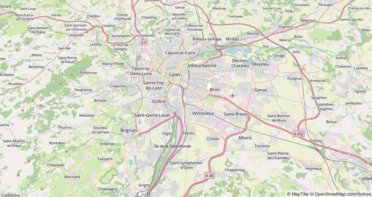
Don't forget to catch up with all improvements for showing routes on your map that came in with @OpenMapTiles 3.13. Highlight toll roads, use multiple labels for highways, mark out private roads with no access, and much more. See all the improvements here: maptiler.link/3wc6MJJ

3
7
#OpenMapTiles 3.13 gives you the option to label mountains in feet or meters, you can even use a combination of both for when your map shows both Canada and the USA like this one. Find out more here: maptiler.link/3sTxJjy @OpenMapTiles
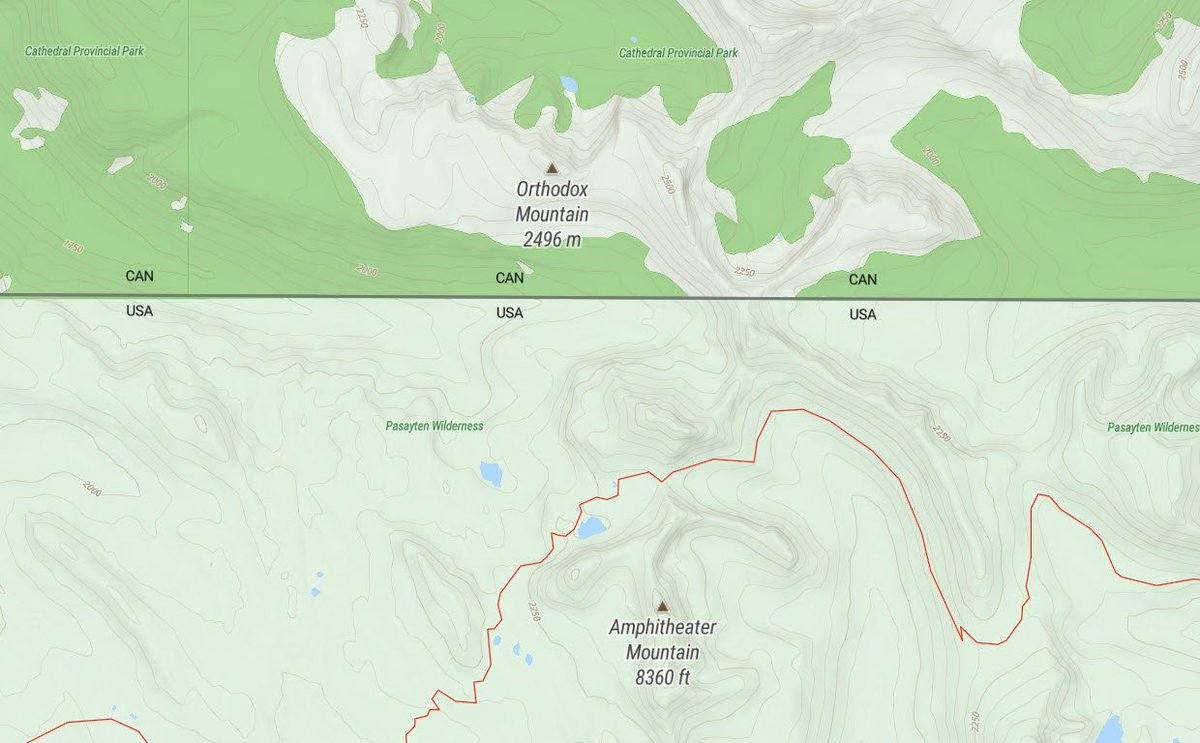
3
5
There are some new data layers in @OpenMapTiles 3.13 including cable car names and ferry route labels like the ones shown here. Learn all about the improvements in the latest release here: maptiler.link/3h2mj6k
#osm #maps #OpenMapTiles
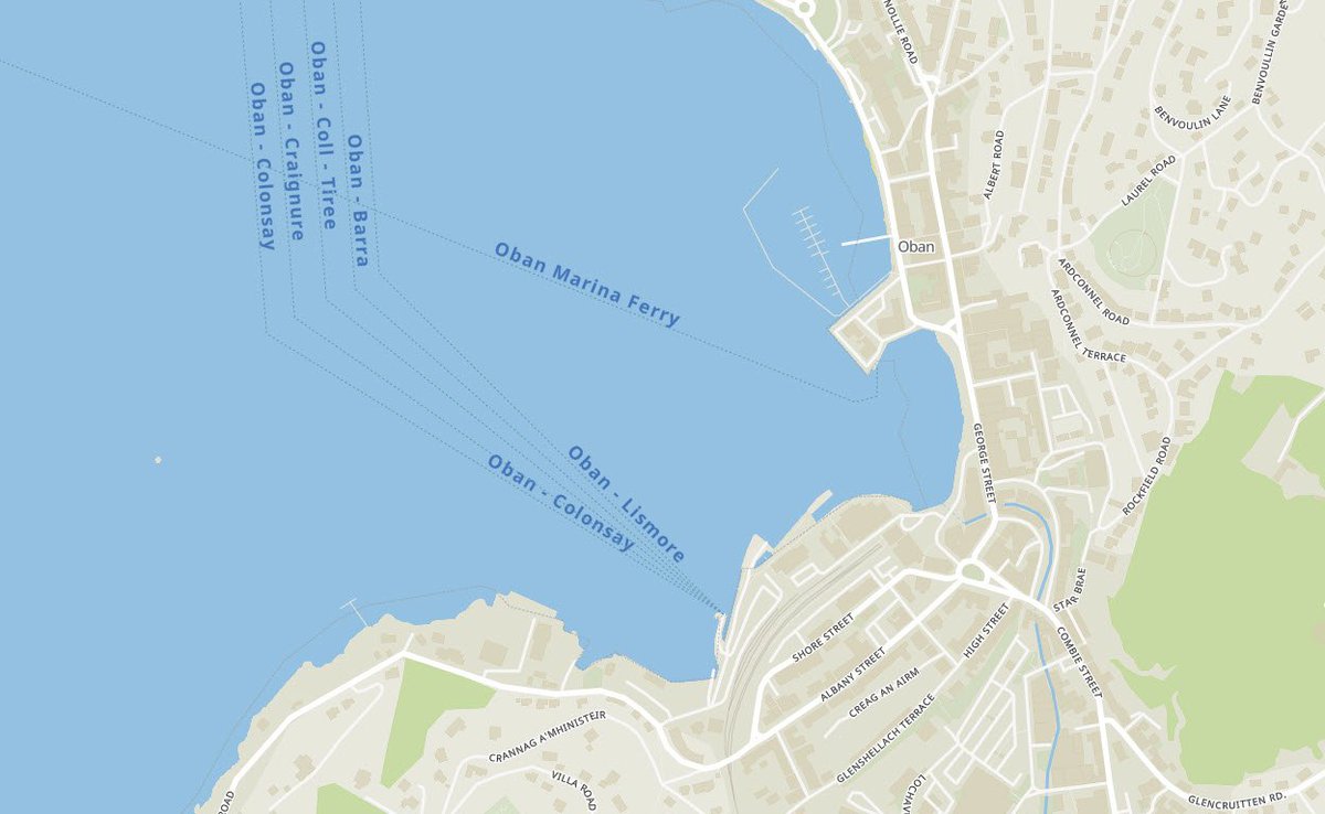
2
6
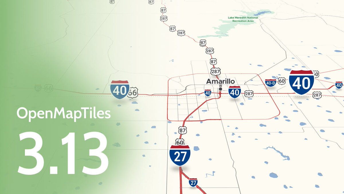
#OpenMapTiles version 3.13 has been released with improvements for showing routes on your maps. You can highlight toll roads, use multiple labels for highways, mark out private roads with no access, and much more. Check out what has been improved here: maptiler.link/3BkPDy2.
7
22
5 Jan 2022
OpenMapTiles 3.13 released: github.com/openmaptiles/open…
Big thanks to all who contributed! #OpenMapTiles
4
6

Our first pre-release version of BSD-licensed maplibre-gl is out, a drop-in replacement for mapbox-gl. Big thanks to Seth Nickell! github.com/maplibre/maplibre…
1
32
68
Mapbox GL JS 2.0 software is no longer open-source! We remain on 1.13 and are keen to ensure an BSD licensed open-source fork remains to be available and maintained by the community or a well known foundation. Star & follow github.com/openmaptiles/gl-j… for updates. Discussion going on
2
19
50
A new feature - vector tiles support - makes it so easy to print high-res maps in @qgis 3.14 Pi! 🖨️🗺️
Learn how to add a very detailed vector map from anywhere in the world into #qgis at bit.ly/2V3PcUM
Big thanks to @lutraconsulting @kanahiro_iguchi
1
21
56