
Christian, Husband, Father, SC Firefighter/Retired Chief, Faith-Family-Fire-Flip Flops, Roll Tide, Palmetto Executive Services, LLC Consulting, MCA Sales
Joined January 2012
- Tweets 10,023
- Following 2,625
- Followers 2,317
- Likes 7,208
1,565 Photos and videos


SO proud of Ansley and SO thankful for the Lord’s blessings. We are also incredibly grateful for every person who helped her get to this point spiritually and in education. Now, on to @AndersonUnivSC ! Dennis


1
226
Chief Dennis Ray 🐘 retweeted

May 18
Godspeed Soldier! Go forth and do great things in the @USArmy 🪖🫡✈️🥹

2
1
36
864
Chief Dennis Ray 🐘 retweeted

May 13
Here is a closer look at that Matthews gas line fire. This video was sent to us by a neighbor. This is right after it started. You can see both trucks from the contracting company on fire. Firefighters say this started when crews hit a natural gas line while drilling to place new power poles. It was extinguished when crews closed the pipe with a hydraulic press. More on @wsoctv at 5 and 6.
28
56
263
90,776
Great to see all the incredibly talented and anointed artists at #singinginthesun2026 in @MyMyrtleBeach this week! Fantastic job @abrahamprod for lining this up. Hate I could not stay all week! @ScottyInman @WhisnantSusan @chappytann @DanielGoldcity @thegoldcityqt


1
39
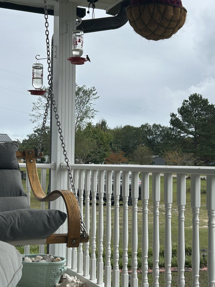
Three hummers so far in Lugoff SC this spring 4-10-26. Here is one if you look close! #hummingbird #hummingbirds
1
42
Agreed!! Tough guy! 👍

I have been to every state in the Union, all over Canada and 30 different countries! But, there is no place like home!!
67
Chief Dennis Ray 🐘 retweeted

Mar 15
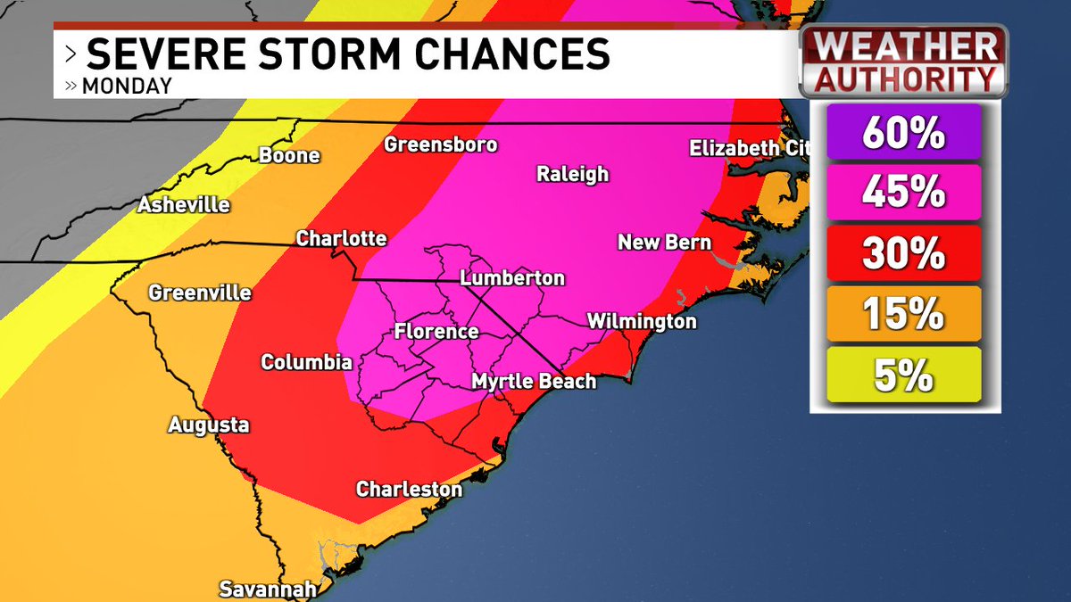
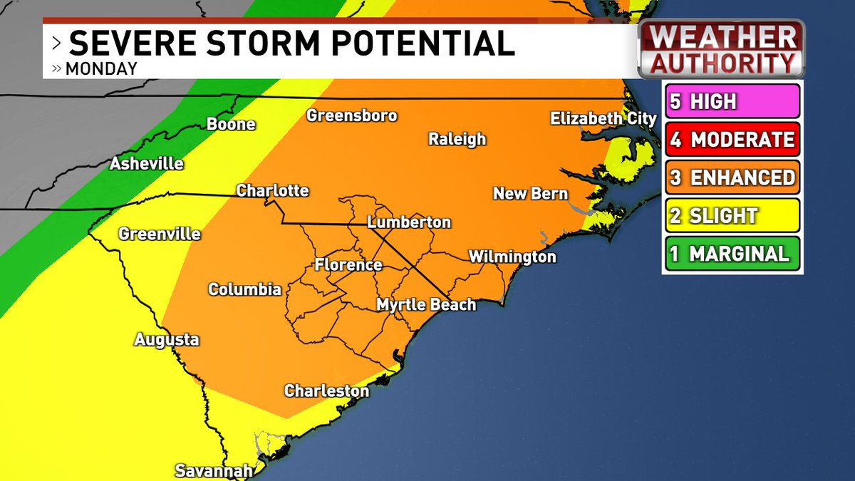
Monday brings the greatest threat for severe weather where portions of the area were upgraded to a Moderate risk (level 4 out of 5). The main threats will be damaging to destructive wind gusts and several tornadoes, a few of which could be strong. #caewx #scwx #gawx
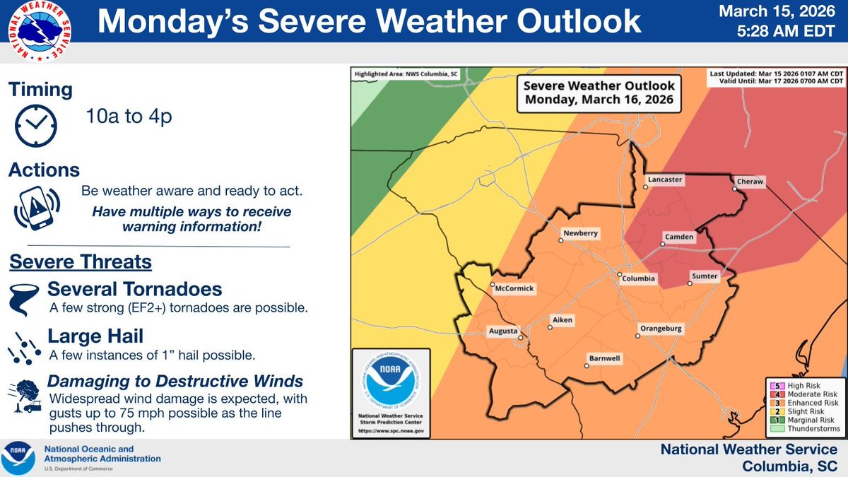
ALT Severe Weather Outlook on Monday.
1
19
60
9,484
Chief Dennis Ray 🐘 retweeted

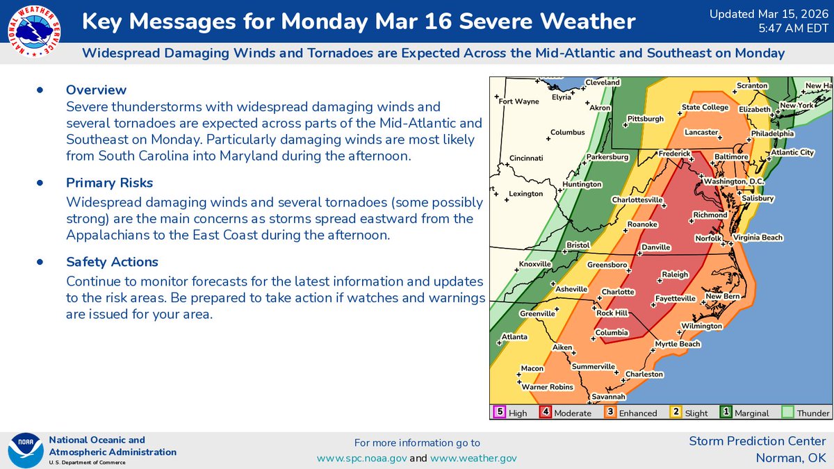
Here are our Key Messages for Monday (3/16).
7
177
524
73,266
Chief Dennis Ray 🐘 retweeted

Mar 14
SEVERE WEATHER THREAT MONDAY
(UPDATE SATURDAY 5 PM)
You know I’ll always shoot straight with you and never hype or sensationalize anything. So when I tell you to pay attention to the weather Monday, I really mean it.
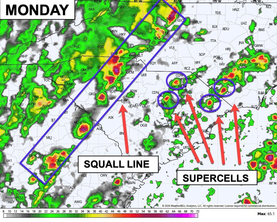
A powerful cold front, strong upper-level winds, and plenty of storm fuel are likely to combine and produce scattered to widespread severe storms on Monday. The entire area is currently under a Level 3 (Enhanced) risk out of 5, but the Storm Prediction Center believes part of the Pee Dee and Border Belt into central North Carolina could be upgraded to a Level 4 (Moderate) risk in their next update Sunday.
In a setup like this, we could initially see individual rotating storms (supercells) develop from late morning through mid-afternoon. These isolated storms can produce strong tornadoes. After those move through, an intense line of storms (Squall Line) along the cold front may sweep across the area late in the afternoon, bringing the potential for damaging straight-line winds and a few tornadoes.
1. Is this a slam dunk? Still no. Cloud cover could limit the available storm fuel, and the front could move through earlier than expected, reducing the threat. However, the chances of that happening are lower than they were this morning. Just know that if we see sunshine on Monday, that’s bad news because it increases the amount of storm fuel available, leading to more intense storms and greater tornado potential.
2. Even in higher-end severe weather setups, many people never see severe weather. That’s good news. However, Monday is one of those days where if you do see severe weather, it could be very bad. That’s why it’s important to stay weather-aware. Have multiple way to get warnings Monday by downloading our Weather Authority app now. Search “WPDEWX” in your app store.
I'll have another update on Sunday.
6
34
218
26,517
Chief Dennis Ray 🐘 retweeted

Feb 20
A clearer, terrifying view of the liquefied gas tanker crash in Renca, Chile, moments before the explosion.
No escape. One minute you are driving along, then boom.
201
1,122
10,313
2,563,470
Chief Dennis Ray 🐘 retweeted

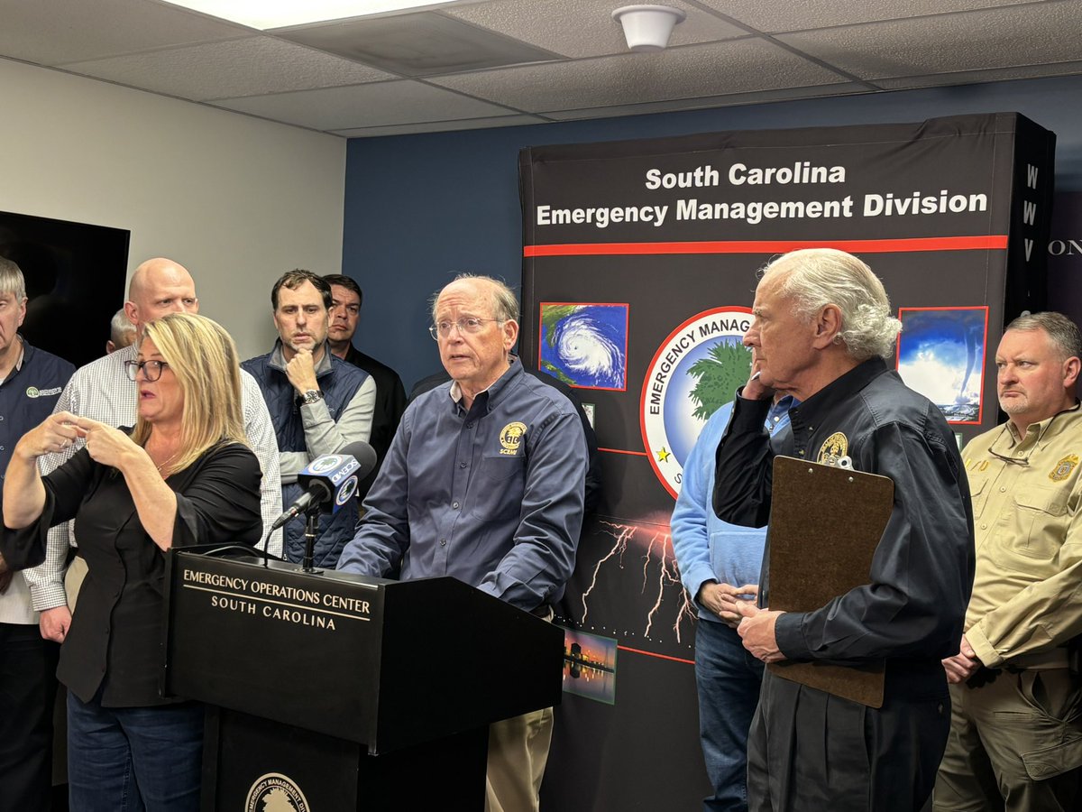
NEWS RELEASE: The South Carolina Emergency Management Division participated in the South Carolina Emergency Management Association (SCEMA) annual conference in Greenville.
Read more: scemd.org/news/scemd-attends…


3
17
1,755
Chief Dennis Ray 🐘 retweeted

West Monroe, LA, is one of the communities devastated by recent ice and snow storms. It’s also the home of our friends, the Robertson family of @DuckDynastyAE. Thank you Jase and @MissyDuckWife for all you’re doing to help your neighbors. Find out more about volunteering with @SamaritansPurse at spvolunteer.org.
64
934
5,902
114,353
Chief Dennis Ray 🐘 retweeted

One of the most underrated players returning to that defense next season

Run it back? That’s what zabien Brown did at the end of the half that’s for sure
6
84
1,430
73,927
Chief Dennis Ray 🐘 retweeted

I have to give props to someone who went through all of this to help explain what to do if you fall through ice.
I learned something. I didn’t quite know all of this. Is it just me? Does everyone know this? He must be sooooo cold!!
233
2,885
13,115
343,422
Chief Dennis Ray 🐘 retweeted

Additional video of Nags Head *WORKING FIRE* via @PappenheimWx
#NCfire
4
19
91
14,629


Pine Grove Baptist Lugoff SC service for 2-1-26 .
youtube.com/live/PypzvRYQEd4…
64
Chief Dennis Ray 🐘 retweeted
Jan 28
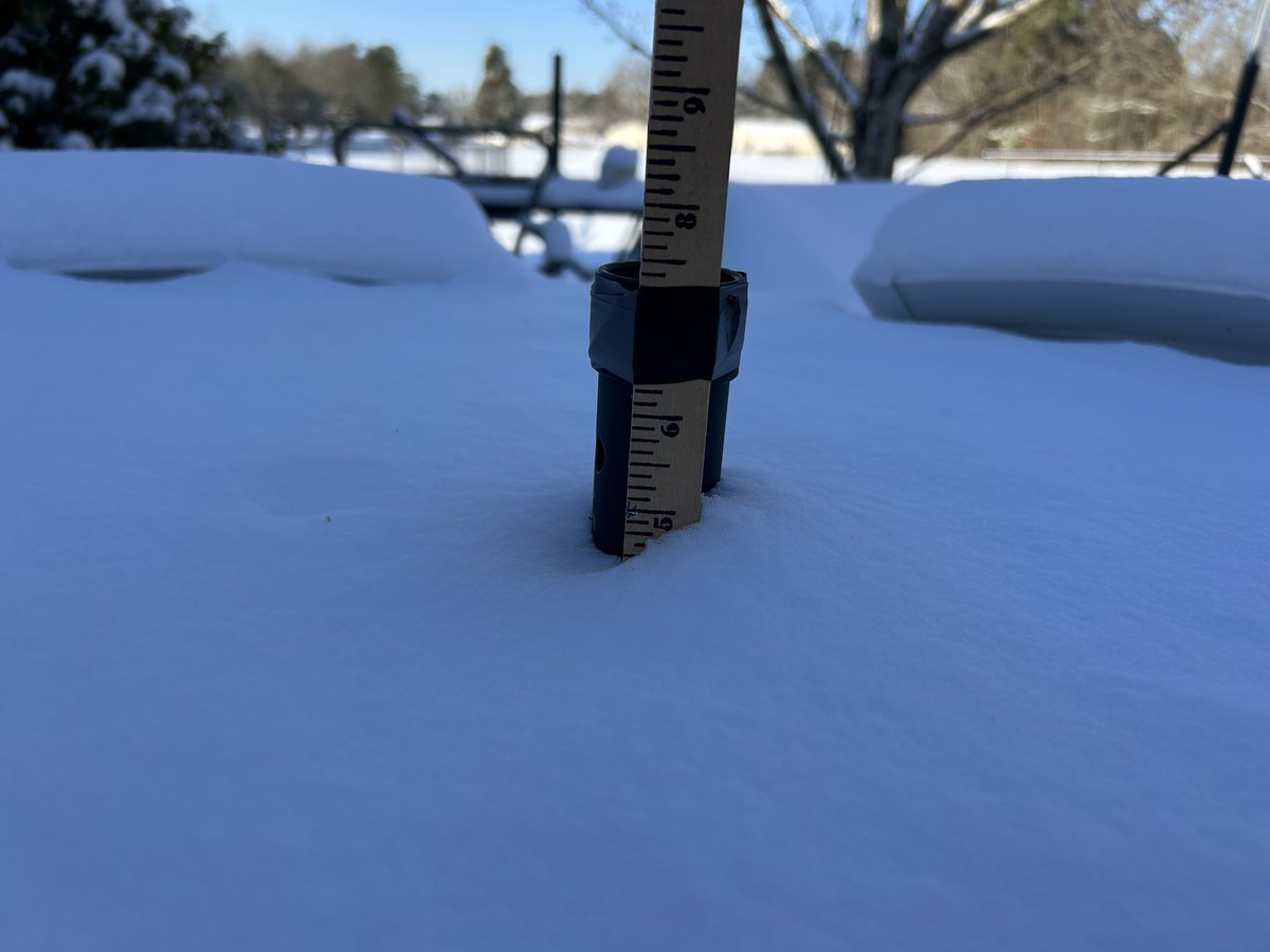
The potential for a rare and notable snow event continues for this weekend with increasing confidence in accumulation. Much of the area can expect to see some snow, but confidence remains highest along the SC-NC border.

4
23
95
23,414
Chief Dennis Ray 🐘 retweeted
NEWS RELEASE: South Carolina moves to OPCON 1 Ahead of Winter Weather. Read more here: scemd.org/news/south-carolin…
2
26
56
5,963
Chief Dennis Ray 🐘 retweeted
Jan 24
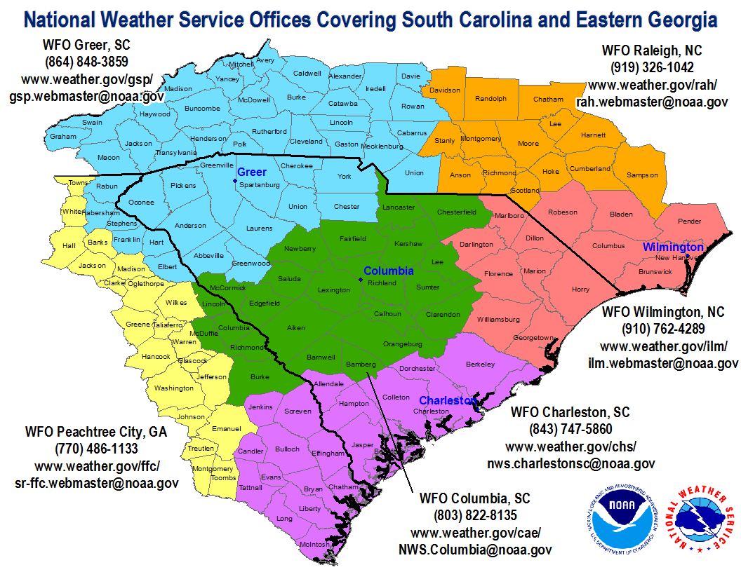
The latest video briefing for our forecast area (the counties shown in Green below) regarding the incoming winter storm is available at youtu.be/CW6fyoWNCV4. For all other locations, please refer to our neighboring offices across the Carolina and Georgia. #CAEWx #SCWx #GAWx
1
21
62
13,880