
Joined July 2009
- Tweets 1,093
- Following 99
- Followers 4,106
- Likes 317
192 Photos and videos


Pinned Tweet

28 Dec 2023
Need to align edges? With our new patent-pending zipper tool, making precise boundaries and edges is now a zip!" #Innovation #GIS #Mapping
11
46
702
139,188
Scribble Maps retweeted

25 Sep 2025
👁🗨 Meet @scribblemaps, built with Google Maps Platform to help users create custom scores for virtually anything.
ScribbleSight uses our APIs to allow users to factor in both pros and cons.
Learn how their creation lets you access granular data for any scenario ➡️ goo.gle/46UzDnN
2
4
13
1,678
Scribble Maps retweeted

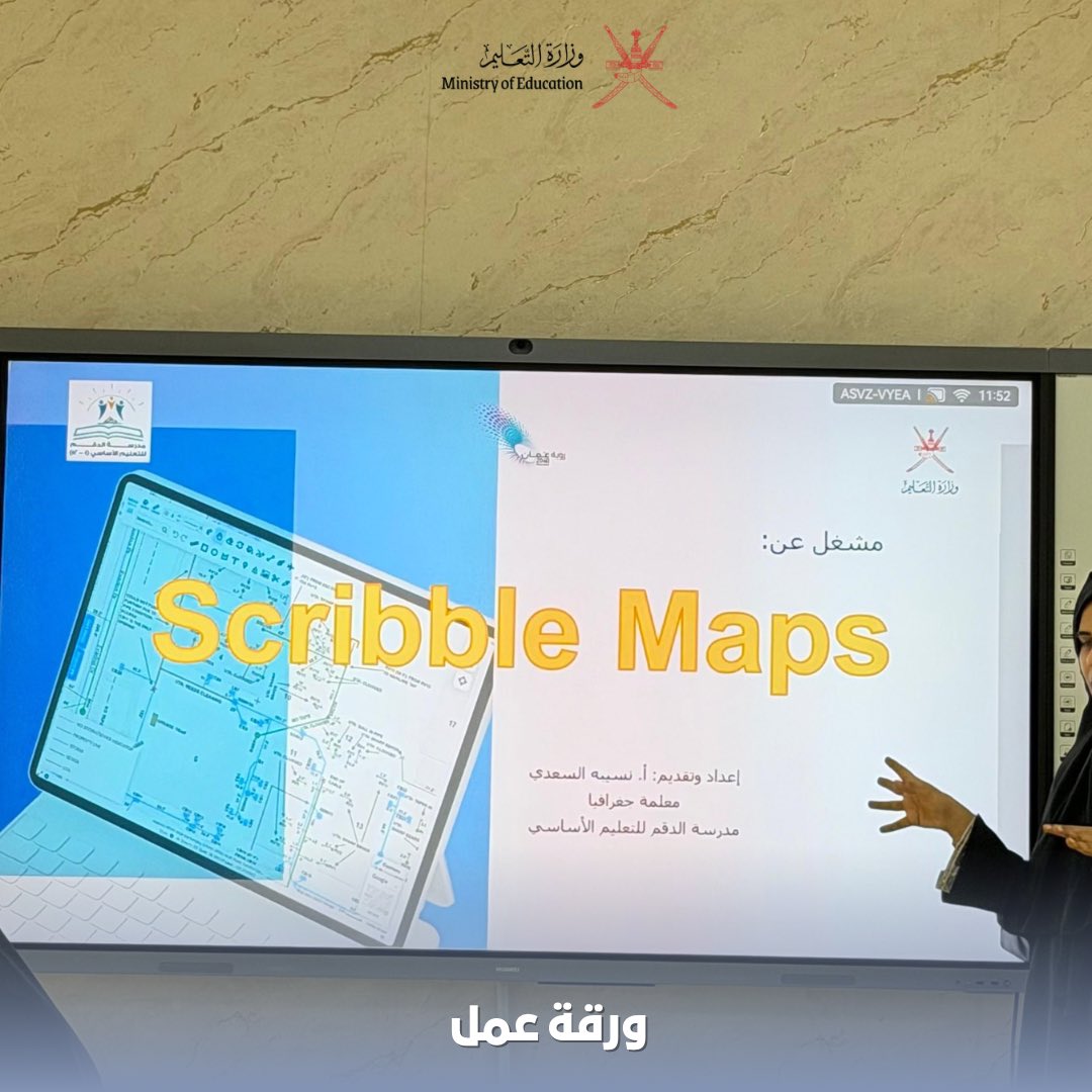
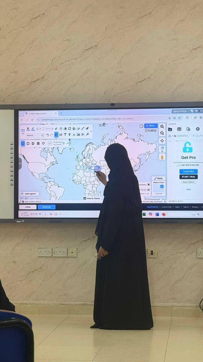
نفذت الأستاذة نَسيبه السعدية مشغل عن برنامج Scribble Maps لمعلمات المدرسة في مركز مصادر التعلم
أبرز محاور المشغل:
نبذه تعريفيه عن البرنامج
مميزات وكيفة الاستفادة منه
كيفية تطبيق البرنامج في الفصل الدراسي
تطبيق عملي له
1
2
634
29 Oct 2025
We rolled out a temporary fix while azure fixes there systems. Everything should be up again.
2
579
29 Oct 2025
Azure front door is currently having issues which is affect us - see: azure.status.microsoft/en-us…
1
554
19 Sep 2025
Hey all thanks for hanging in there with us, all systems are operational again status.scribblemaps.com/. Thanks @AzureSupport
2
1
601
19 Sep 2025
Hey all, we are not going to sleep until this is fixed. Unfortunately @AzureSupport has informed us it takes time for them to resolve the issue, so there is not much else we can do but wait on them.
1
1
8
3,383
19 Sep 2025
They informed us we would get updates every 2 hours, scribblemaps status can be seen at status.scribblemaps.com
1
479
18 Sep 2025
We are experience an issue right now, we are working on it. Sorry for the inconvenience.
1
4
7
15,666
Scribble Maps retweeted

16 Mar 2025
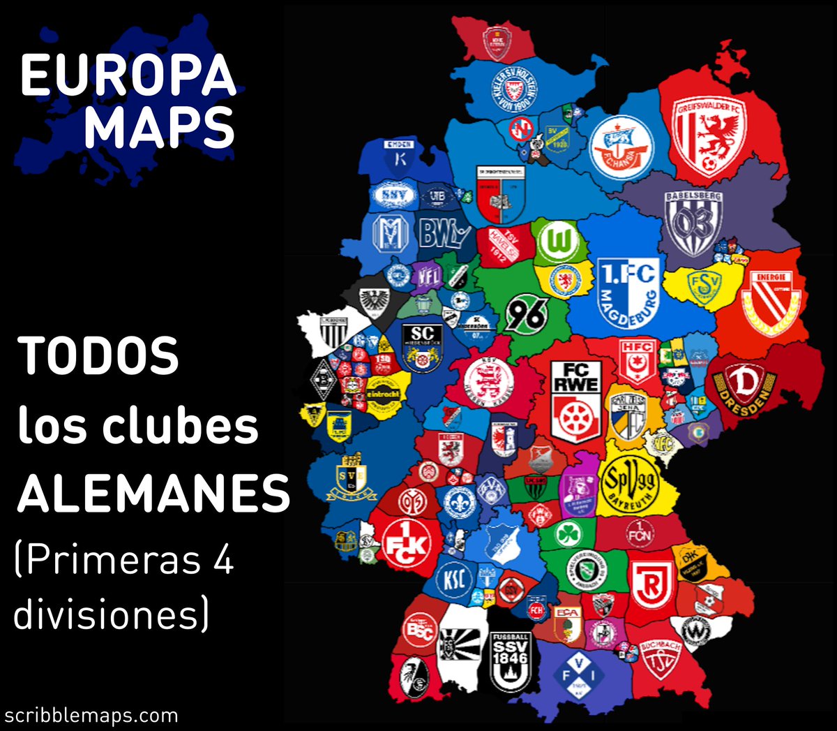
TODOS los clubes ALEMANES
(Mapa interactivo: scribblemaps.com/maps/view/C…)
1
3
13
851
11 Jan 2025
Discover how Scribble Maps is redefining mobile precision editing in 2025! With their patent-pending feature, create detailed drawings and edits effortlessly using just your finger – no stylus needed. Try it now at lite.scribblemaps.com.
#UX #Design #GIS #Innovation #mapping
1
3
51
6,104
24 Dec 2024
Santa's optimized route with charts for cookie consumption, cookie type, milk consumption, and entry method. #GIS #Christmas #Santa
scribblemaps.com/maps/view/S…
541
18 Dec 2024
1
457
Scribble Maps retweeted

20 Nov 2024
Happy #GISDay! We're proud to power native experiences in apps like @Esri & @ScribbleMaps, and seamless data hosting and publishing into multiple other apps across a variety of industries.
Show your favourite GIS professionals some ❤️ then head over to hubs.li/Q02YVdJm0
1
3
682
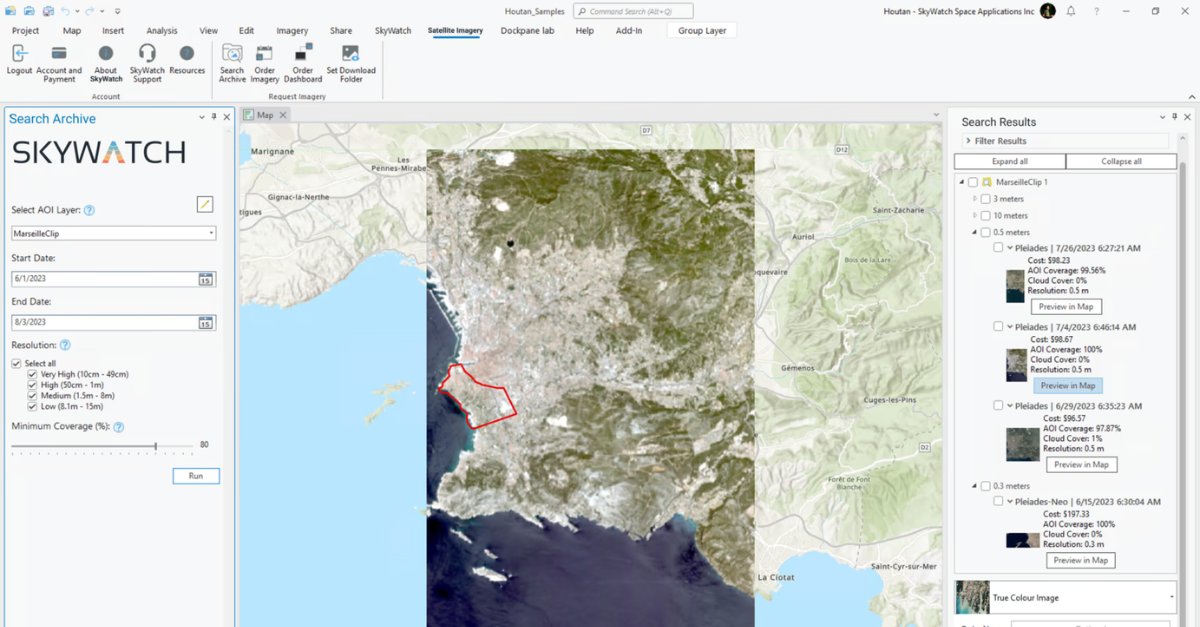
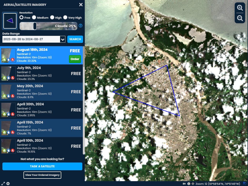
29 Aug 2024
Exciting Day! We have rolled out satellite imagery ordering/tasking in Scribble Maps. Order recent imagery and even conduct optical band analysis. Sentinel-2 is free with Pro Basic! #GIS #Mapping #EO #satellites #space
youtube.com/watch?v=b7pKS6vH…
1
1
639
Scribble Maps retweeted
28 Aug 2024
Congrats🎉 to our friends @scribblemaps on the successful integration of satellite imagery into Scribble Maps, powered by SkyWatch BUILD, which allows users to access satellite imagery & tasking, in-app.
Learn more: hubs.li/Q02MVfKb0 or visit hubs.li/Q02MVkXD0
4
4
793
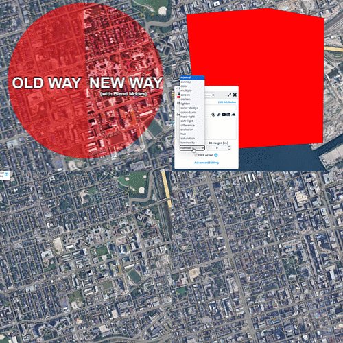
19 Jul 2024
Blend Modes in Scribble Maps! A common task in mapping is to highlight areas while maintaining details on the background, we just made it super easy with Blend Modes. Blend modes maintain the details of the background, including text, clearly. This allows you to make true highlighter effects on your map. #mapping
3
645
29 May 2024
New supported file formats!
We know support for importing: dgn, dxf, fgb, gml, gpkg, geojsonl, geojsons, rss, gxt, mbtiles, mvt, mapml, ods, gmt, gdb, pix, pmtiles, sqlite, db, slf, vdv, vic, map
And export: DGN, FlatGeobuf, GML, GPKG, GeoJSONSeq, Geoconcept, JML, JSONFG, MBTiles, MapInfo File, GeoRSS, MapML, PDS4, ODS, OGR_GMT, PCIDSK, PMTiles, SQLite, Selafin, VDV, VICAR, WAsP, XLSX
#GIS #Mapping
1
563