
Catholic, Husband to an awesome wife, Dad to two miracles, Professor of meteorology, SUNY Oswego, storm chaser, COOP observer. All opinions mine.
Joined March 2015
- Tweets 8,623
- Following 487
- Followers 1,022
- Likes 8,869
3,161 Photos and videos


Scott Steiger retweeted

Jun 12
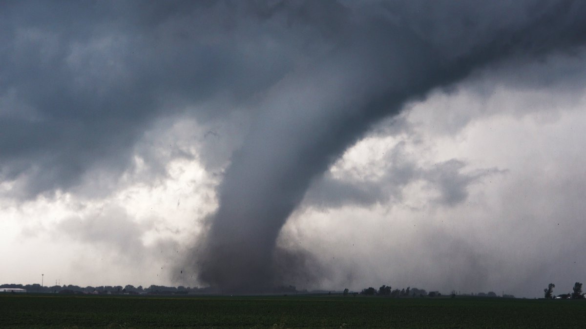
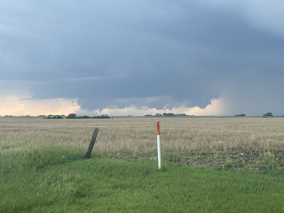
Today will go down as the craziest weather day I have ever covered in my home state. Gambled east in the open warm sector / modifying outflow regime ahead of the PFT/cold front and it paid off in the form of numerous large, damaging, but photogenic tornadoes in central Illinois.


36
261
1,916
54,294
Scott Steiger retweeted

Jun 5
This weekend, on the anniversary of D-Day, honor their courage, see their story.
See PRESSURE in theaters now: pressurethefilm.com
4
11
34
14,479
Scott Steiger retweeted

Jun 9
Still living off the high from Friday's supercell in southeast Nebraska. I've seen some epic structure on this trip! #newx
4
23
250
10,767

Jun 10
Just watched the Pressure movie with three of my storm chase meteorology students. A great movie in terms of acting and tension, but also a must-see for all meteorologists to understand why we train them hard!
8
474
Scott Steiger retweeted

Jun 7
My best bolt of the day
Plymouth, Nebraska on 6/5
#NEwx
6
29
136
5,442
Scott Steiger retweeted
Jun 6
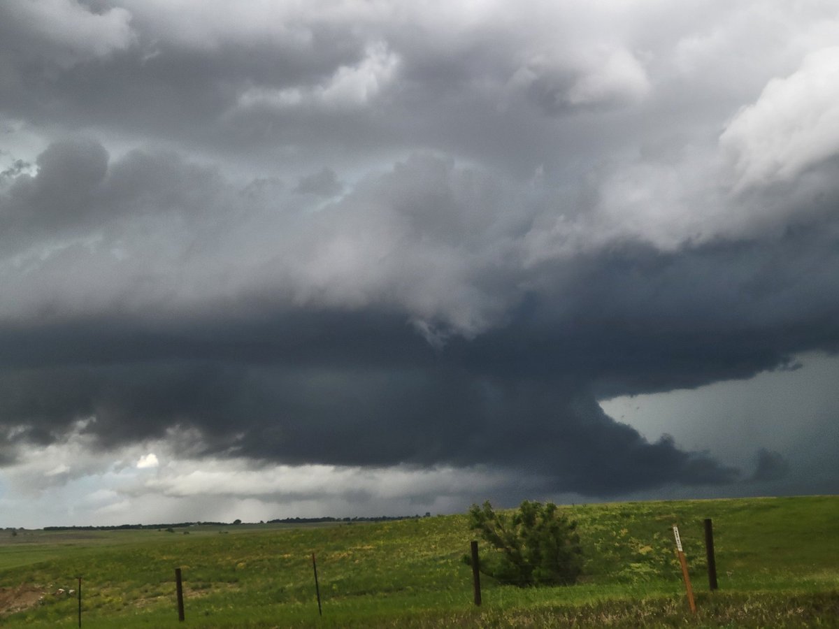
STRUCTURE OF THE YEAR IN SE NEBRASKA
2
18
114
7,082
Scott Steiger retweeted

Jun 6
This was one of the videos I got of this storm yesterday. 6 minutes before the tweet below.
Jun 6

FUNNEL CLOUD is coming down in Swanton, Nebraska, right now!
Storm Chaser Jakob McMillin is LIVE on this on YouTube and inside of the FREE WeatherFront app!
@WXPeterGriffin @WxFront
1
2
13
921
Scott Steiger retweeted

Jun 6
FUNNEL CLOUD is coming down in Swanton, Nebraska, right now!
Storm Chaser Jakob McMillin is LIVE on this on YouTube and inside of the FREE WeatherFront app!
@WXPeterGriffin @WxFront
5
22
418
22,138
Scott Steiger retweeted

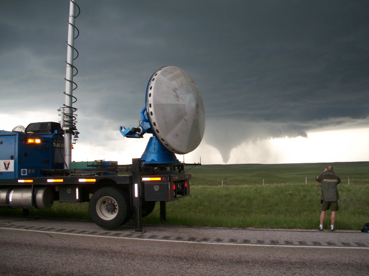
17 years ago today! As part of VORTEX2, we parked in front of an incipient tornado and collected coordinated data (also I still thought radomes were cool 😎). Lots of papers were written about the Goshen tornado using DOW data! Learn more by going to our retro cool website 💾👇
9
22
260
5,517
Scott Steiger retweeted

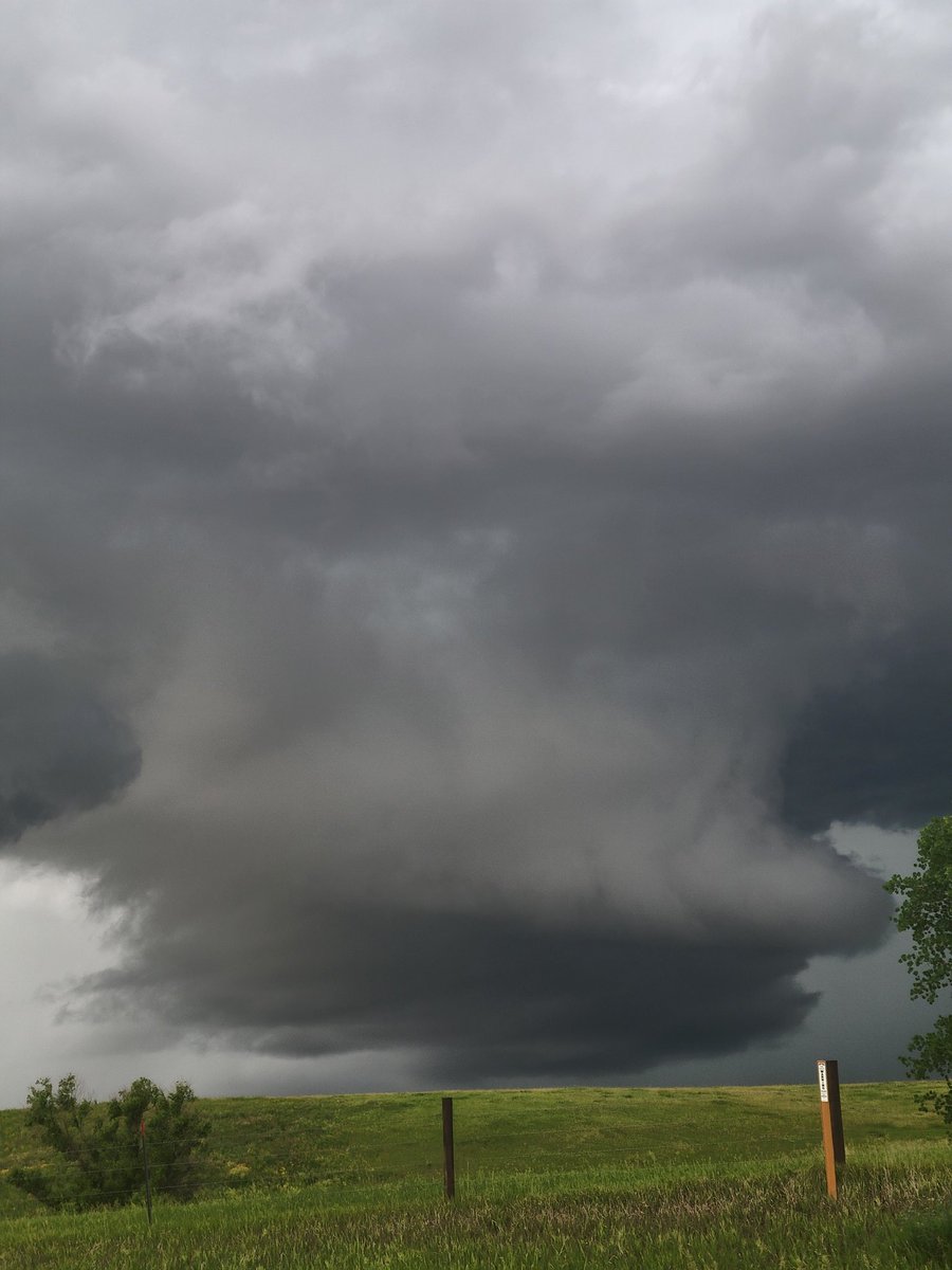
Rotating wall cloud a few miles east of Ellis NE, looking from route 136 @NWSOmaha @NWSHastings
3
20
448
Scott Steiger retweeted

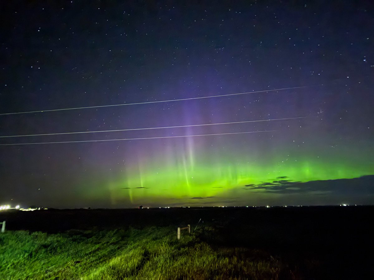
That’s more like it! Nice substorm happening now! Minot, ND 🙌🏼
2
16
187
2,290
Jun 6
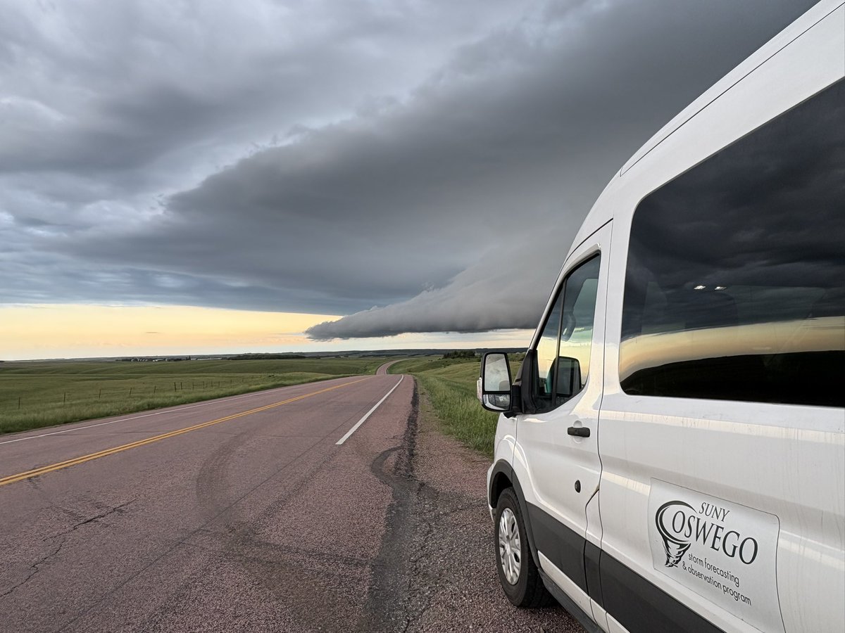
Our likely last chase day of 2026 gave us a special show: another mothership supercell thunderstorm! So many of these great structures this trip! #NEwx @OswegoChasers @sunyoswego


6
25
581
Scott Steiger retweeted
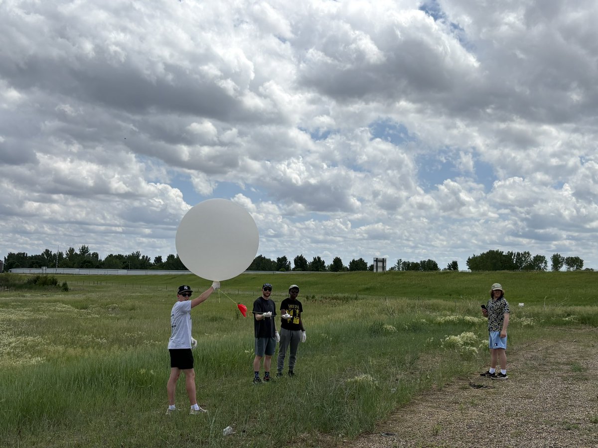
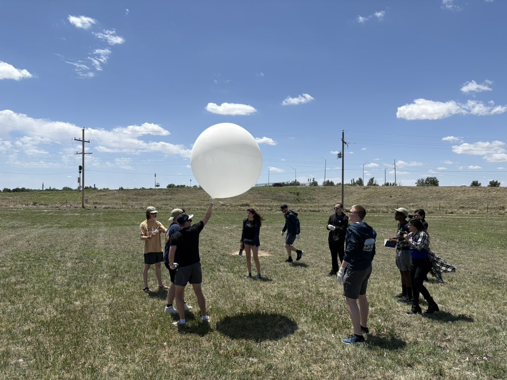
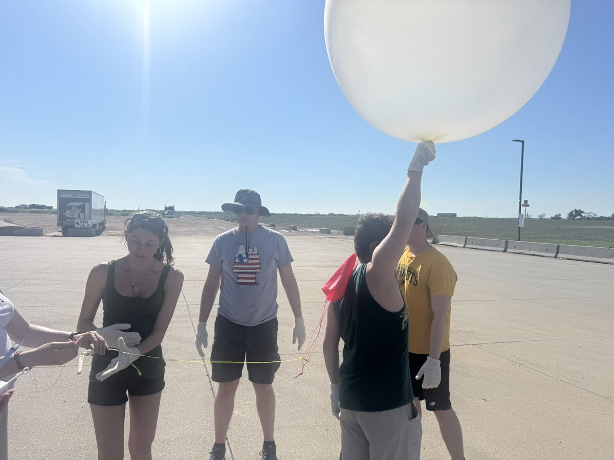
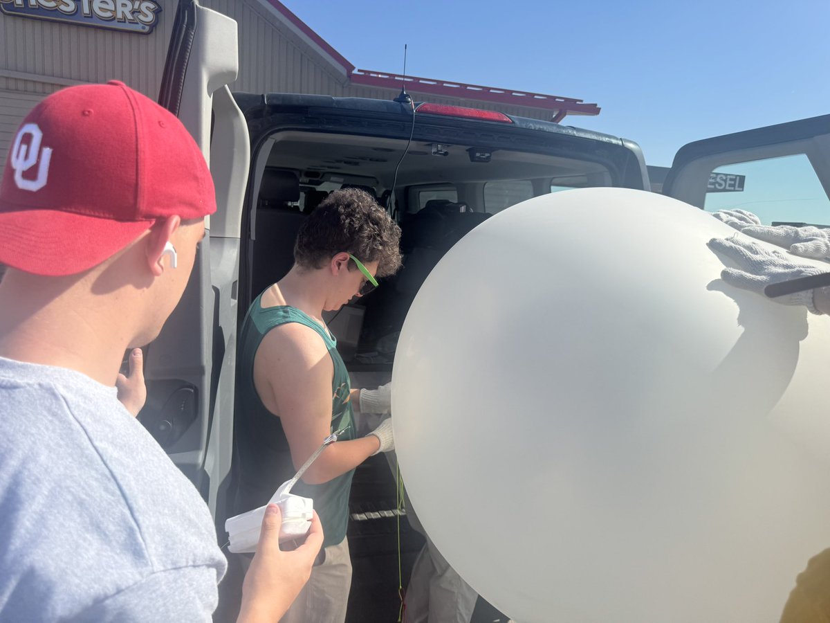
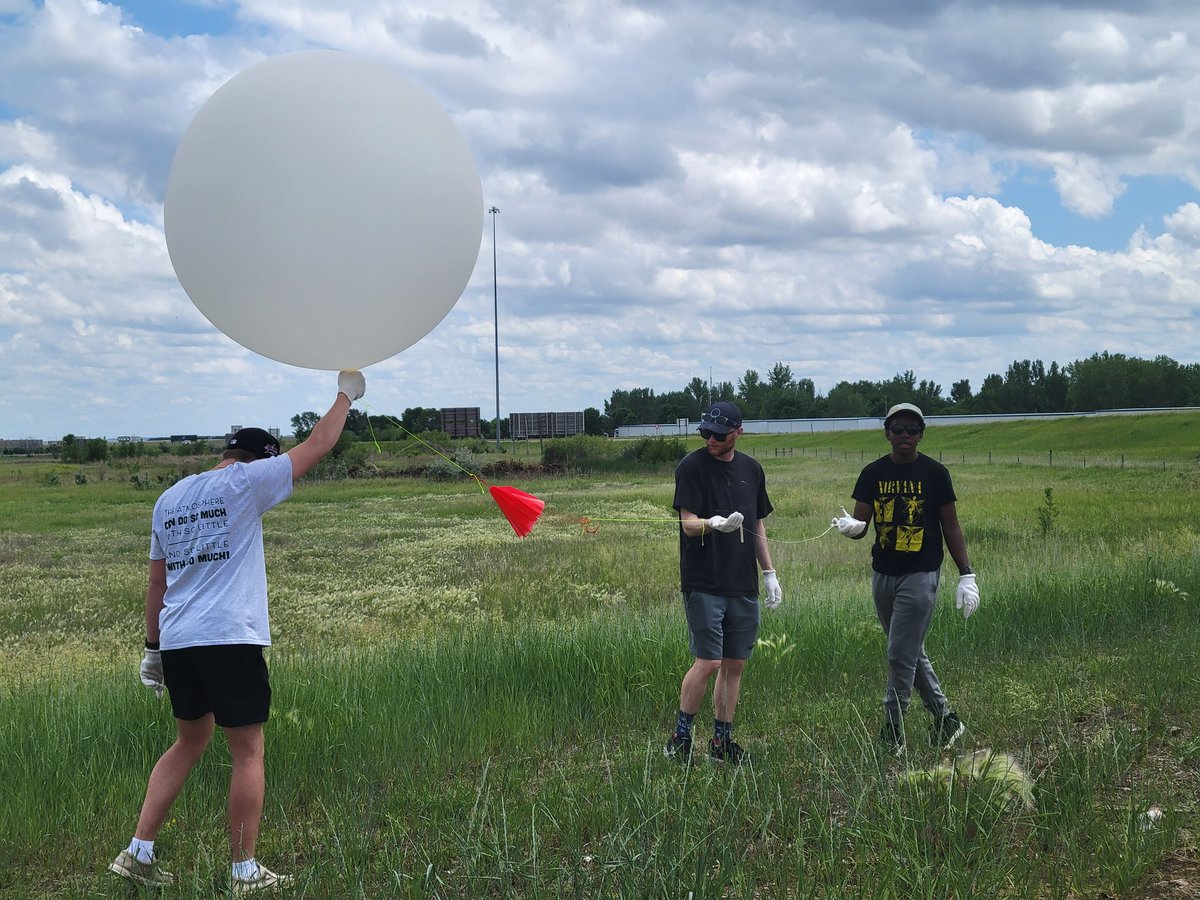
Our crew just completed our 7th successful radiosonde launch of the trip near Milford, Nebraska around 22:00z. @NWSHastings @NWSOmaha @NWSSPC

2
17
515
Jun 5
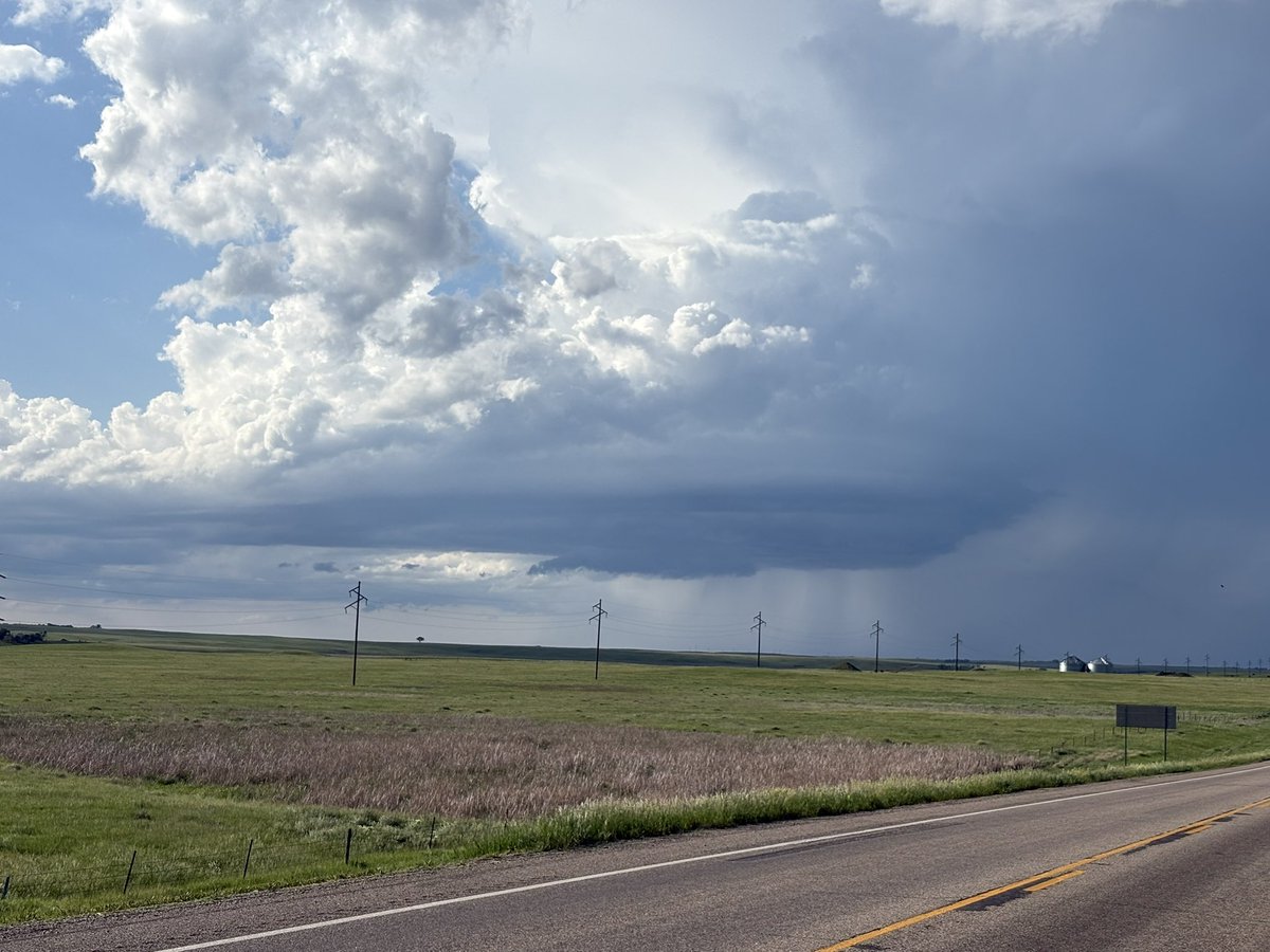
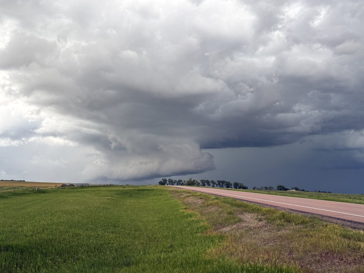
Another spectacular day for @OswegoChasers seeing space ship-looking supercells, wall clouds, and shelf clouds! #sdwx @sunyoswego
2
13
398
Scott Steiger retweeted
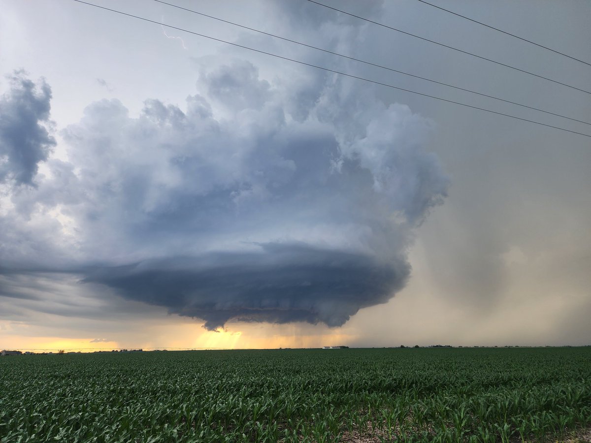
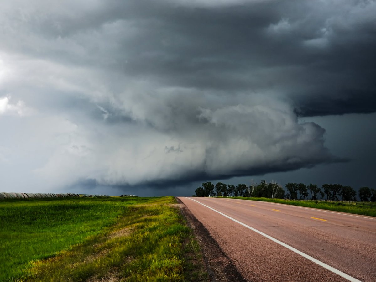
An incredible end to today with beautiful storm structure, unique scenery, and more rotations than we could count. Tomorrow is a new day- where will the winds take us next?
4
25
555
Scott Steiger retweeted

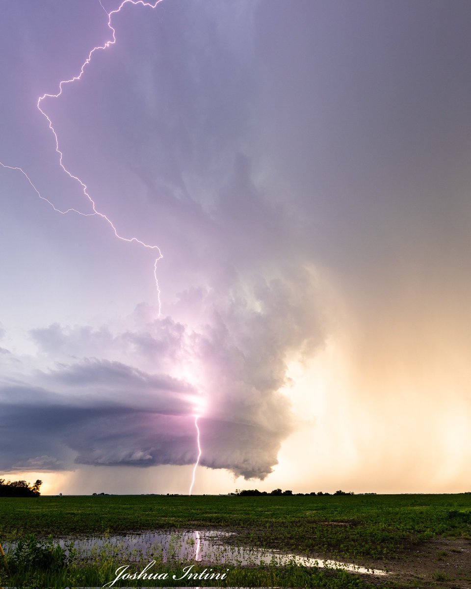
This was one of the sharpest, prettiest and most textbook RFDs I have seen. I genuinely enjoyed this vantage point as much as I did the tornado intercept.
Jun 4

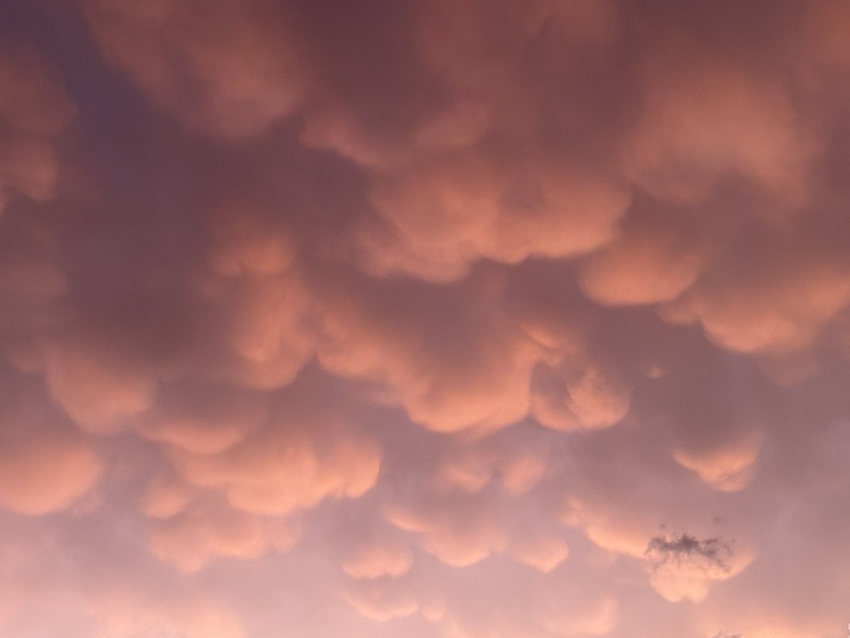
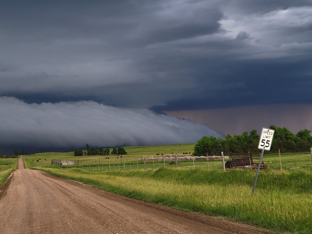
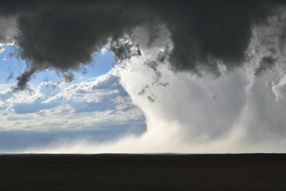
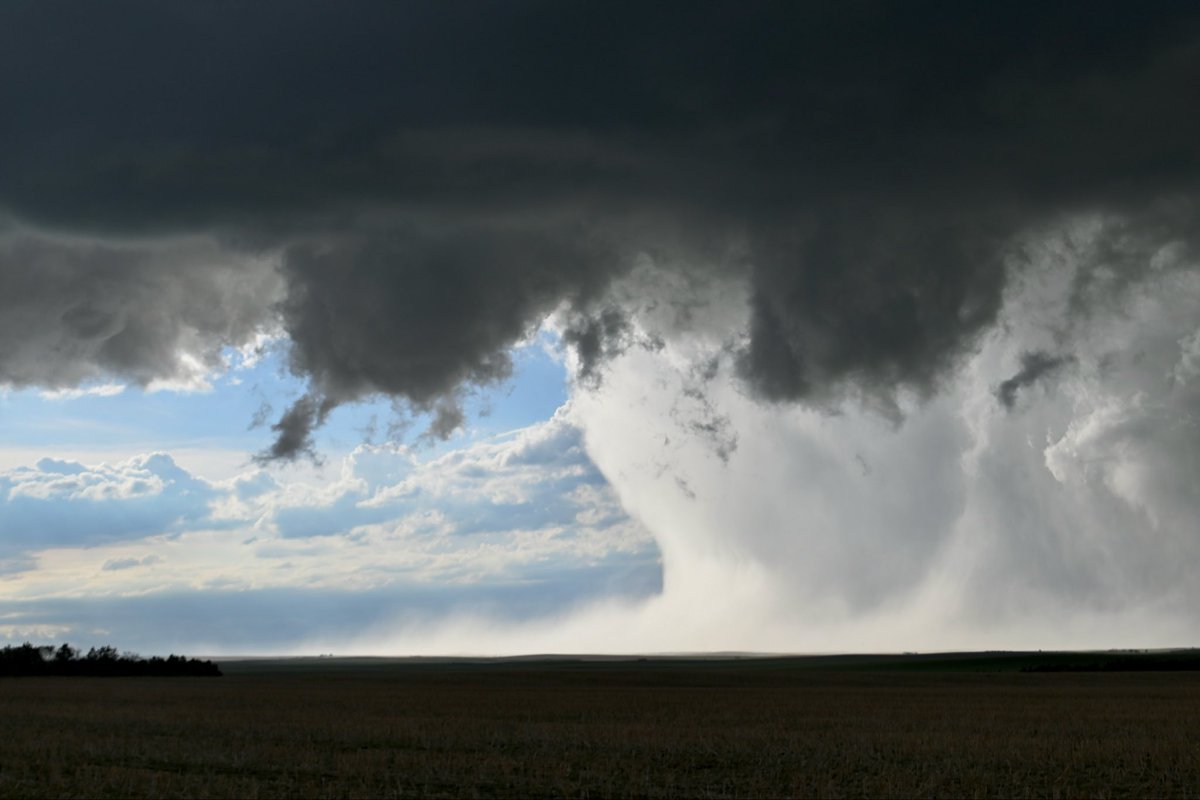
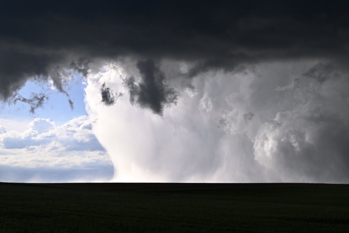
South Dakota storm put on an unreal show last night; look at this microburst/downburst in the RFD, or rear flank downdraft, of the tornadic supercell near the town of Ideal! This was the plume of heavy rain and hail that crashed to earth on the back side of the tornado, wrapping the circulation in rain.
The RFD is like a cold air wraparound on the back side of a thunderstorm. It can both tighten a burgeoning tornadic circulation or, if it’s too strong, choke it. The strength of the RFD is crucial in tornado formation; it must be perfectly balanced with the storm’s inflow, or supply of warm, humid air being ingested from the southeast.
We believe this was a microburst embedded within the RFD (relatively common, and also leading to an RFD surge, since it kicks the RFD forward). Note how the dense, rain-cooled air crashes to the ground and then flattens outward.
Tornado formation occurred shortly after this.

11
44
572
27,618
Scott Steiger retweeted
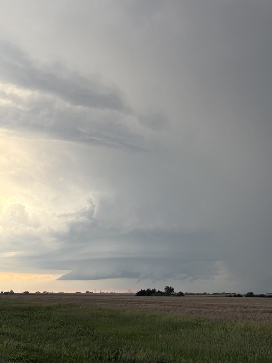
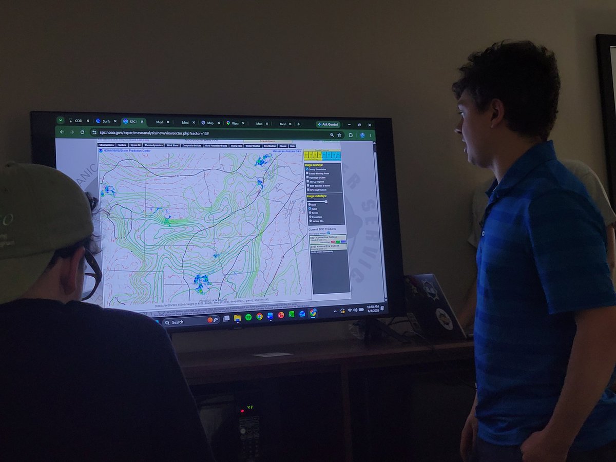
After our morning forecast discussion, the crew is setting up for a late show today in southern South Dakota and playing our favorite game: Will storms initiate to our east or west? Which environment is most favorable?
We'll stay put until we have a better idea!

2
13
469
Scott Steiger retweeted
Another successful radiosonde launch from the crew near Chamberlain, SD at 2:19 CDT! Data incoming soon... @NWSSiouxFalls @NWSSPC

2
17
549
Scott Steiger retweeted

Jun 4
Winner South Dakota Tornado today. Mixed in some real time and 8x time to help show it. Also added some of the amazing structure in at the end. Watch over on youtube for higher quality
1
6
63
2,464
Scott Steiger retweeted

BANG! Major #tornado intercept in the Dominator F150 blew out the window!
Dangerous tornado to intercept given the rain-wrapping. This was a classic vigorous South Dakota supercell
#stormchasing
8
79
1,066
49,754