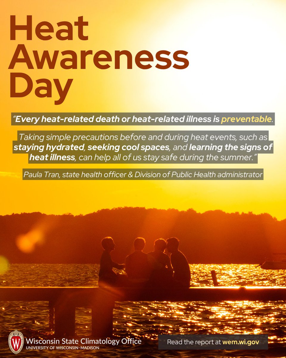
As part of the University of Wisconsin–Madison’s Rural Partnerships Institute, the SCO collects, analyzes, and shares climate information.
- Tweets 899
- Following 179
- Followers 590
- Likes 815


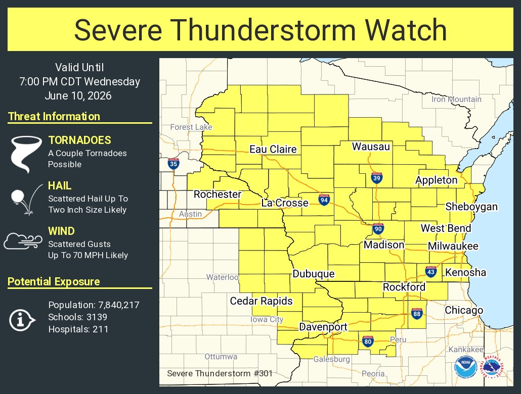
ALT This graphic displays Severe Thunderstorm watch number 301 plotted on a map. The watch is in effect until 7:00 PM CDT. The watch includes parts of Illinois, Iowa, Minnesota and Wisconsin. The threats associated with this watch are a couple tornadoes possible, scattered hail up to two inch size likely and scattered gusts up to 70 mph likely. There are 7,840,217 people in the watch along with 3139 schools and 211 hospitals.

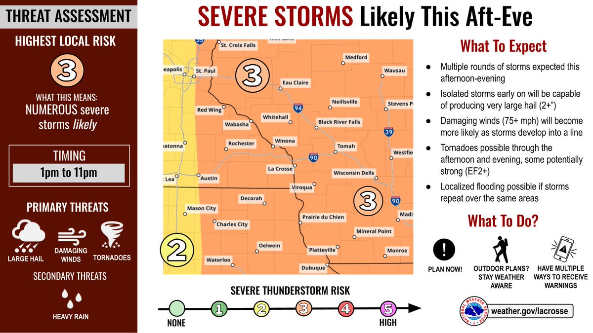
ALT A map of the severe weather outlook for this afternoon, June 10, showing a level 3 out of 5 risk across the Upper Mississippi River Valley.

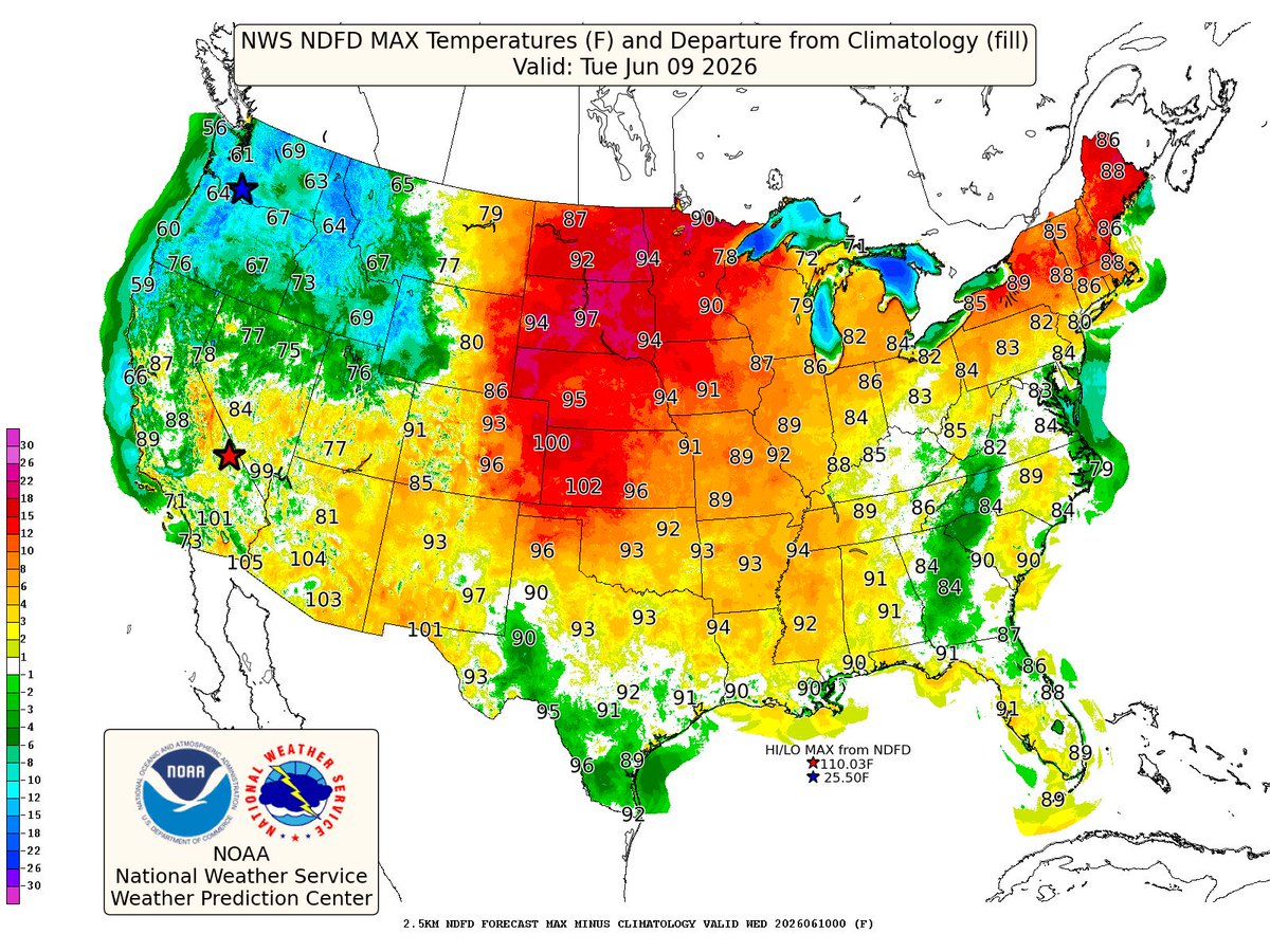
ALT Map showing forecast high temperature departures from normal for the contiguous U.S. The highest departures above normal lie in the central and northern Plains.
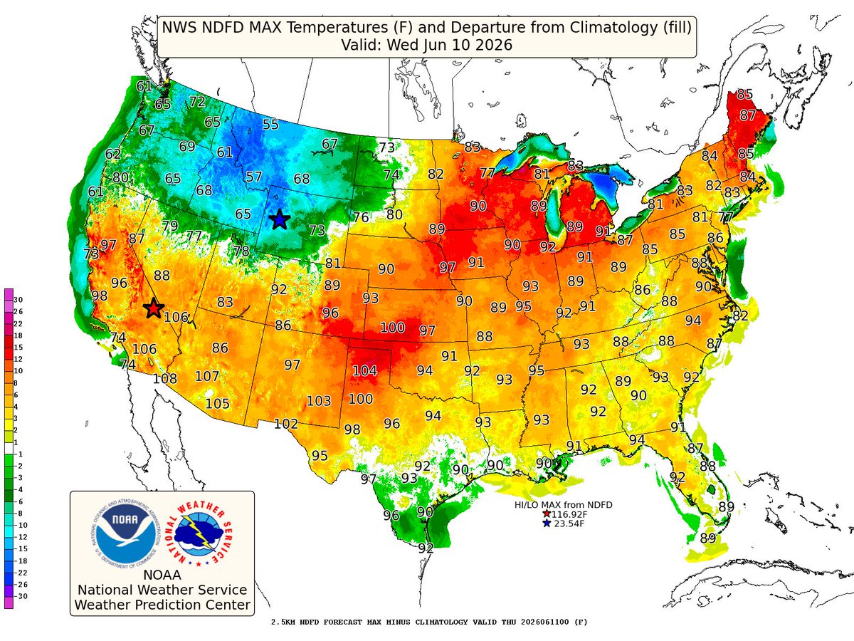
ALT Map showing forecast high temperature departures from normal for the contiguous U.S. The highest departures above normal lie from the Plains, to the Midwest to the NE.

ALT Map showing forecast high temperature departures from normal for the contiguous U.S. The highest departures above normal lie from the Midwest to the NE and Mid-Atlantic.
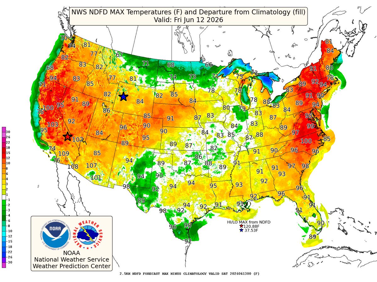
ALT Map showing forecast high temperature departures from normal for the contiguous U.S. The highest departures above normal lie in the NE and Mid-Atlantic.


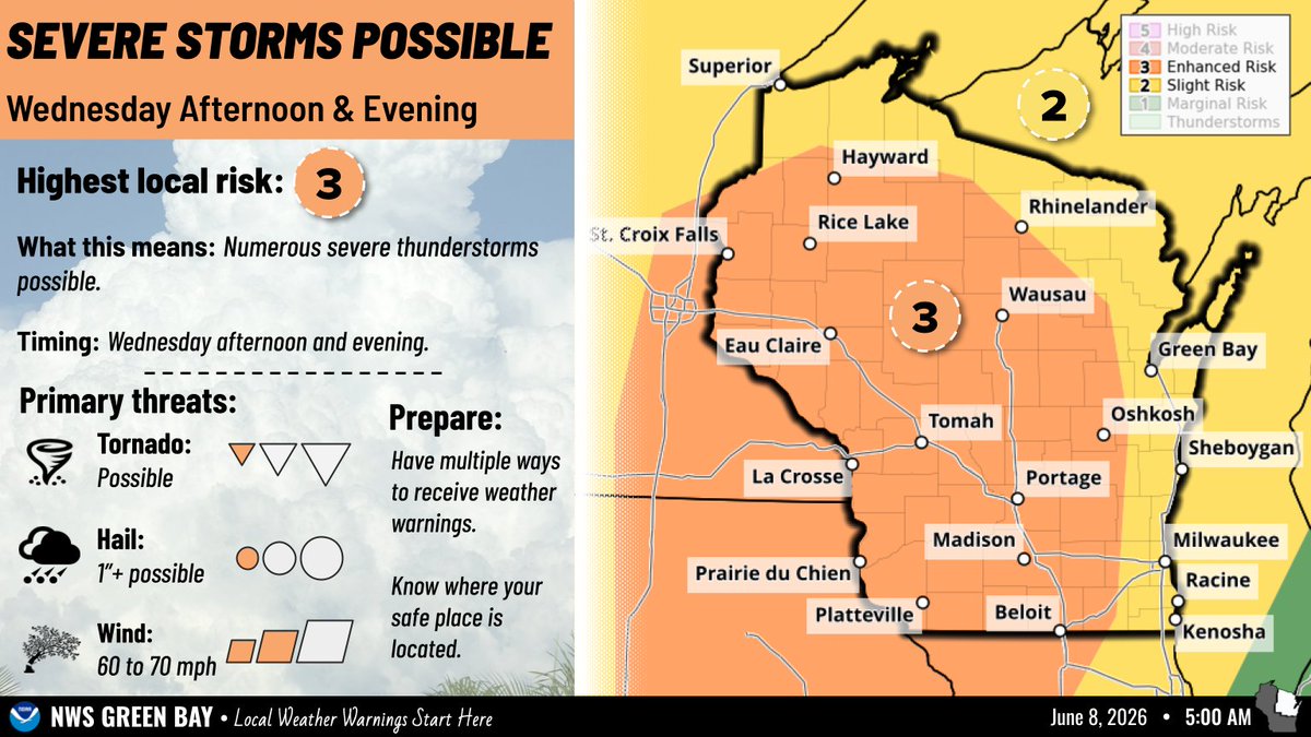
ALT Right image shows a map of Wisconsin with the Storm Prediction Center's Day 3 Severe Weather Outlook valid for June 10th. To the left against a cumulonimbus background are text descriptions of the severe thunderstorm risk on Wednesday, including timing, location, and potential hazards of severe storms.