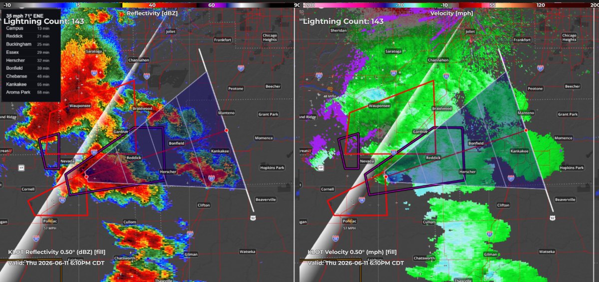
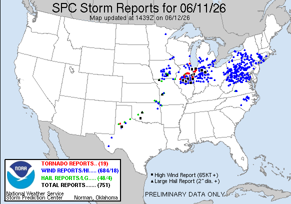
I post about weather, sometimes other stuff.
- Tweets 26,248
- Following 15
- Followers 1,336
- Likes 660
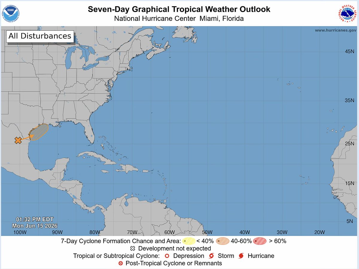


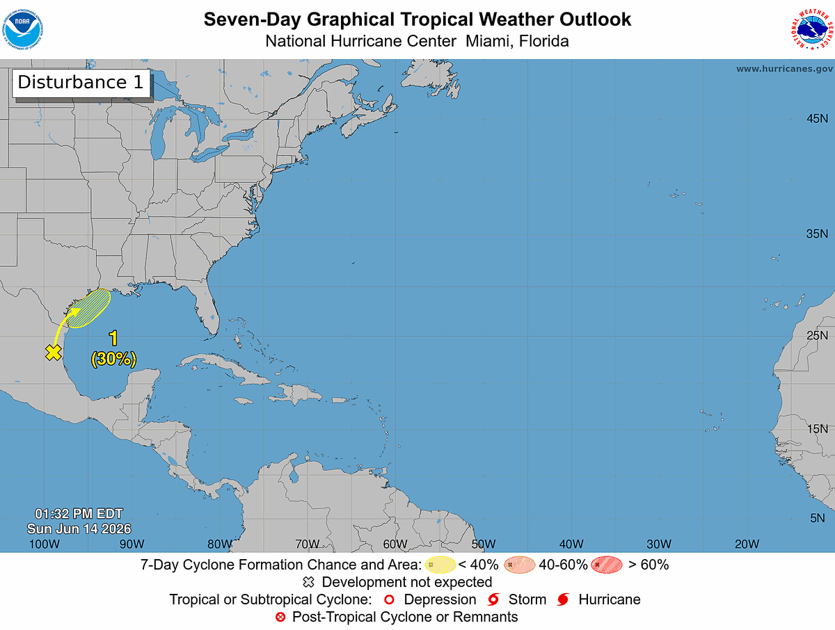
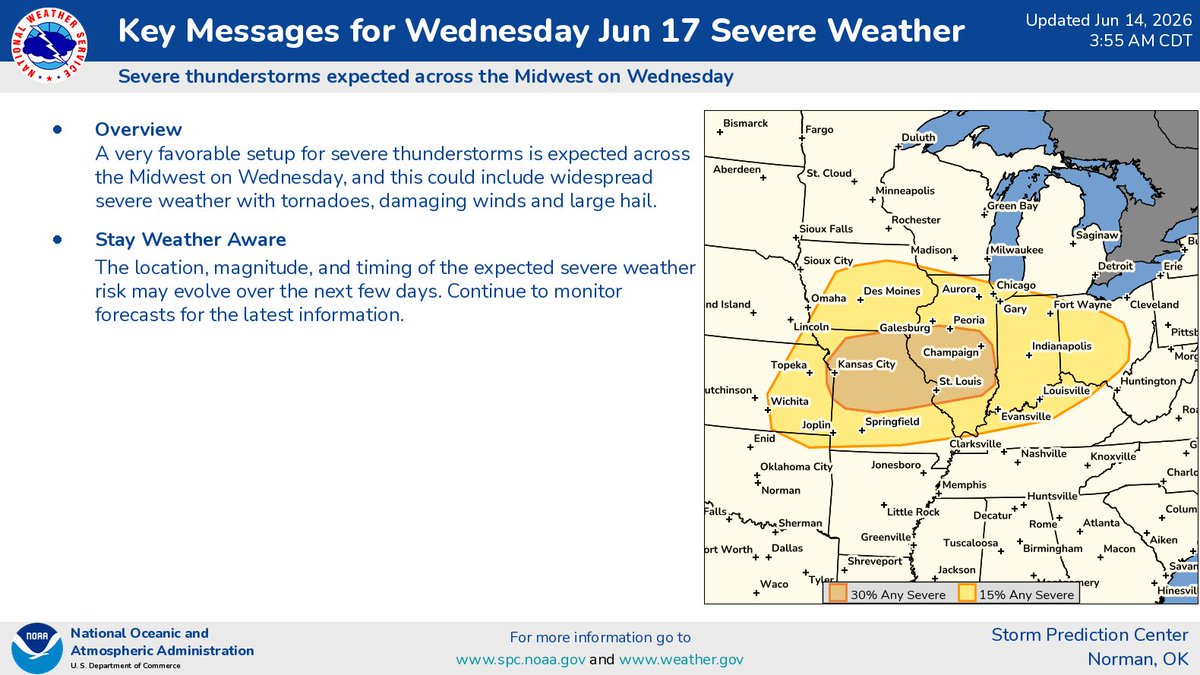
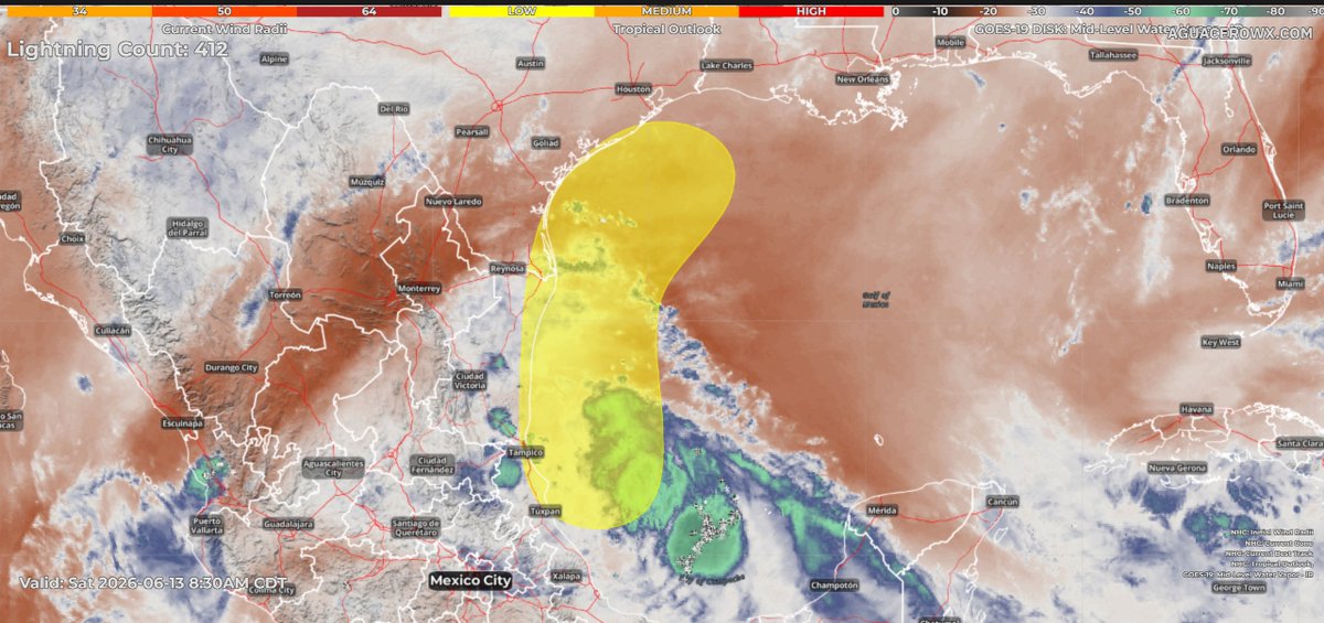
ALT Tropical Weather Outlook: 200 PM EDT Sun Jun 14 2026. For the North Atlantic...Caribbean Sea and the Gulf of America: 1. Northwestern Gulf of America: A trough of low pressure located over northeastern Mexico is producing disorganized shower and thunderstorm activity. Development is not expected during the next day or so while the trough remains inland and drifts northward over northeastern Mexico or southern Texas. The system is then forecast to move northeastward and could re-emerge over the northwestern Gulf of America late Tuesday or Wednesday, where environmental conditions may support some development around midweek. Regardless of formation chances, heavy rainfall and flash flooding are possible across portions of eastern and southern Texas and Louisiana this week. Formation chance through 48 hours...low...near 0 percent. Formation chance through 7 days...low...30 percent.