
Transform complex geospatial data into actionable intelligence with Zam Zam Satellite's GeoTIFF and mapping solutions.
From infrastructure planning and environmental analysis to engineering and research, we deliver high-precision geospatial datasets that help organizations make smarter, data-driven decisions.
zamzamsatellite.com/
#GeoTIFF #GIS #Geospatial #SatelliteData #RemoteSensing #AI #EarthObservation #DataAnalytics #SmartMapping #ZamZamSatellite

25

May 15
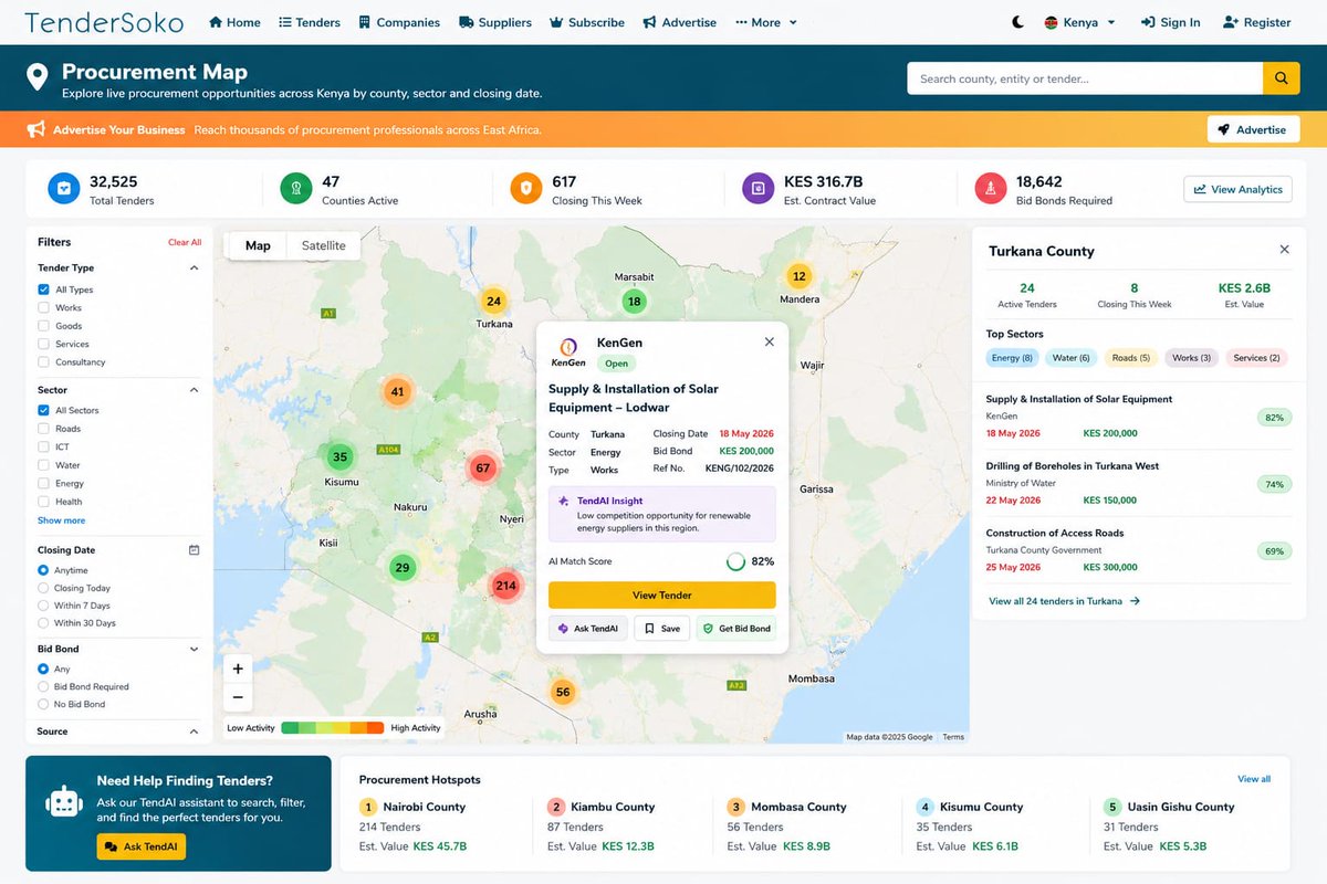
📍 Transforming Tender Discovery with Location Intelligence 🌍JapakGIS partnered with Tendersoko to deliver a smart geospatial solution that geocodes business locations and visualizes tender opportunities on an interactive map platform.By combining GIS technology with business intelligence, users can now quickly identify nearby tender opportunities based on their location — making the procurement process faster, smarter, and more accessible.✅ Business Location Geocoding
✅ Interactive Tender Opportunity Mapping
✅ Faster Opportunity Discovery
✅ Improved Spatial Decision-Making
✅ User-Friendly Web GIS ExperienceAt JapakGIS, we continue to help organizations unlock the power of maps and location data to improve efficiency, visibility, and digital transformation.#JapakGIS #GIS #WebGIS #Geospatial #DigitalTransformation #LocationIntelligence #TenderSoko #MappingSolutions #GoogleMapsAPI #BusinessIntelligence #DataVisualization #KenyaTech #SmartMapping
2
5
398

Celebrate the spirit of Eid with Panafrica Geo Information Services 🌙✨
Wishing you and your loved ones peace, prosperity, and success this festive season.
Explore more: panafricagis.com/
#EidMubarak #PanafricaGIS #Geospatial #GIS #AfricaInnovation #SmartMapping

2
14

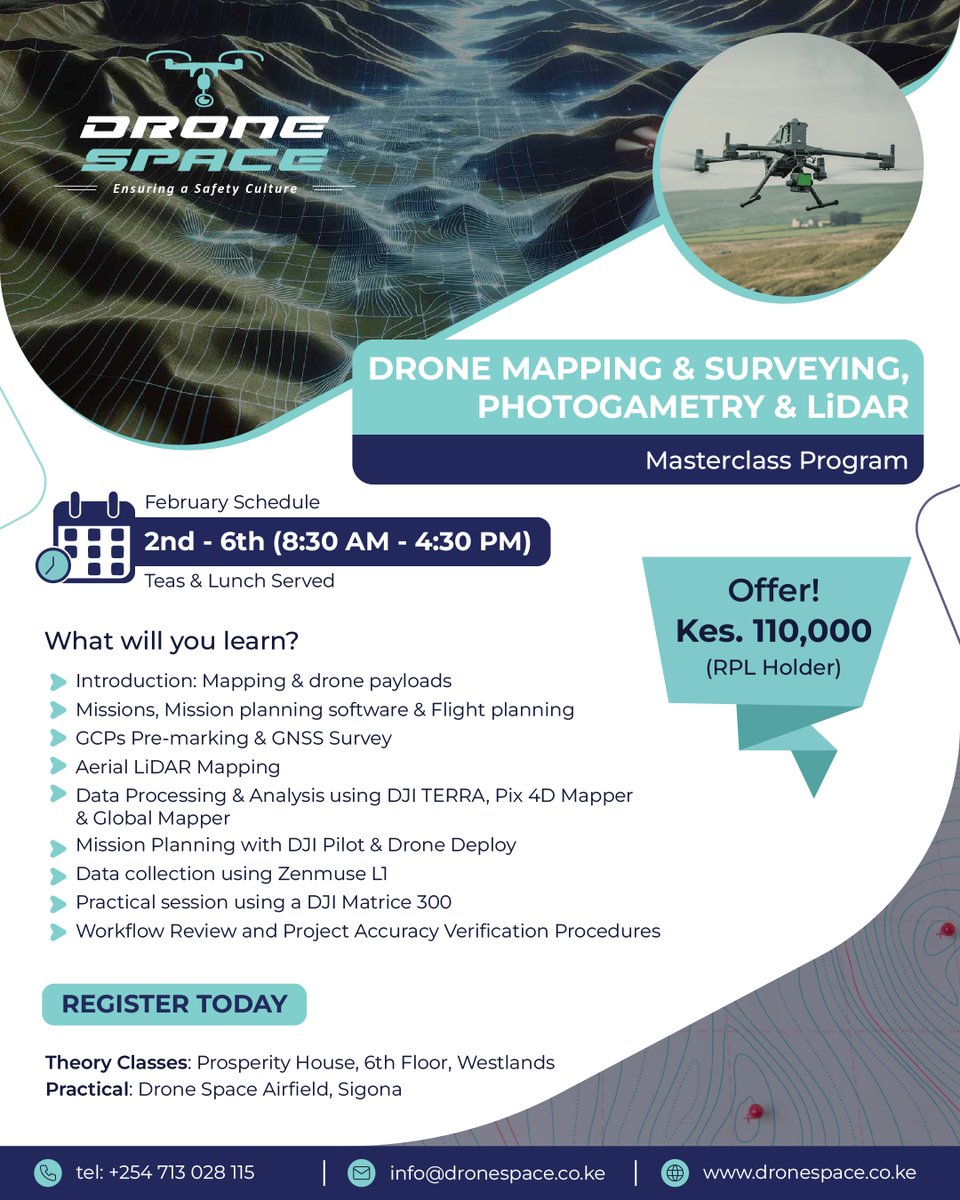
Turn aerial data into accurate insights with our Drone Mapping & Survey course — built for precision, efficiency, and real-world impact.
#DroneMapping #AerialSurvey #Geospatial #GIS #DroneTechnology #Surveying #SmartMapping #DroneTraining #DataFromAbove
3
102

24 Dec 2025
Autonomous GIS is here! 🤖 Penn State’s AI agents fetch, analyze, and map geospatial data on their own. LLM-Find, GIS Copilot & more are redefining what’s possible in GIS 🌍
Source: psu.edu/news/earth-and-miner…
#Geoawesome #GISAI #SmartMapping
2
13
94
5,036

29 Nov 2025
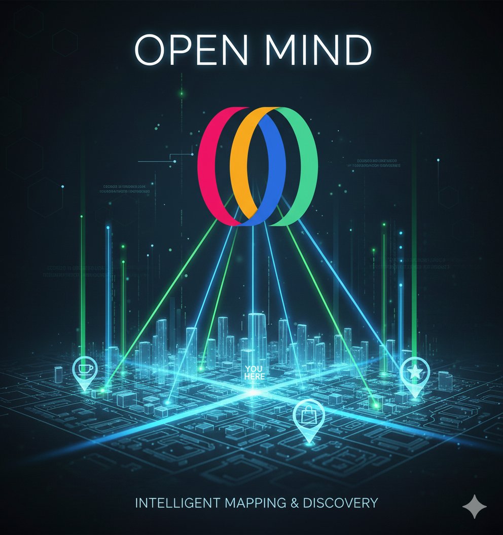
Meet Open Mind! 🧠 The AI that doesn't just map—it thinks.
Get context-aware, real-time insights on points near you. True spatial intelligence is here.
#OpenMindAI #SmartMapping #AI
@openmind_agi
1
2
57

nnovation is a duty." 🗣️ We aren't just talking about AI and Drones; we are deploying them to solve Nigerian business challenges. See the reveal live in Lagos. 🗺️
#Geoinfotech #SmartMapping | Life Imprisonment | Court of Appeal | BAD HABITS | Cubana Chief Priest | Gumi
2
2
23

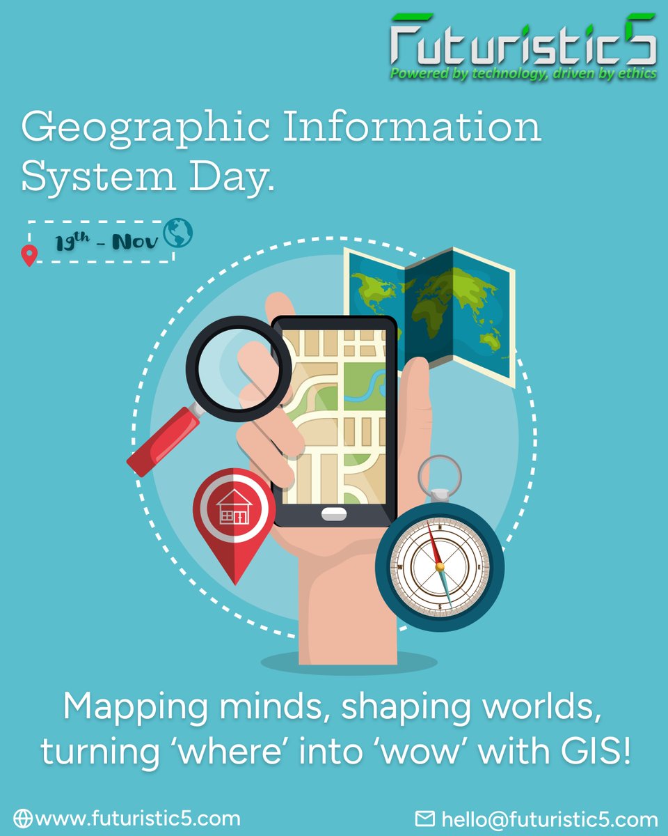
19 Nov 2025
Location intelligence is transforming how the world moves, builds and decides. 🌍📍
Here’s to #tech that makes the invisible, visible.
For IT solutions ⬇️
🌐 futuristic5.com
📩 hello@futuristic5.com
#GISDay #GeoTech #Futuristic5 #SmartMapping #FutureReady #India #Pune
2
3
39

24 Oct 2025
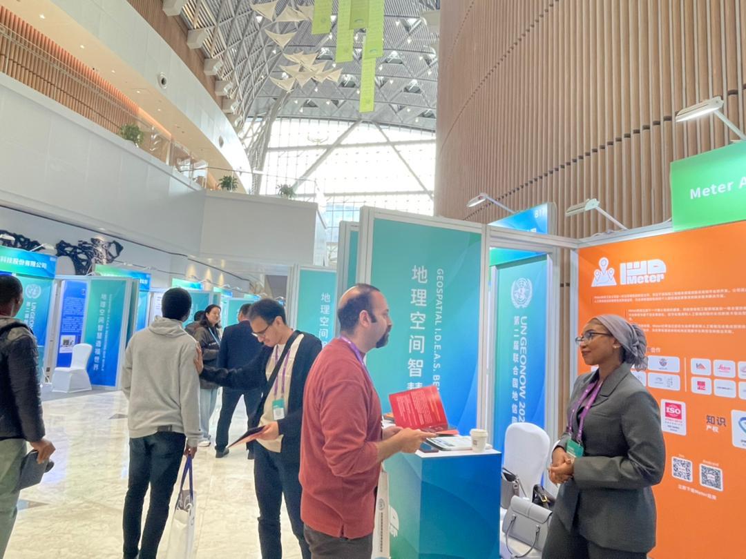
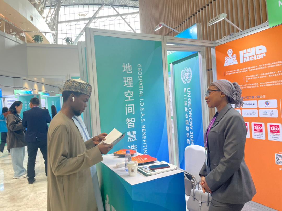
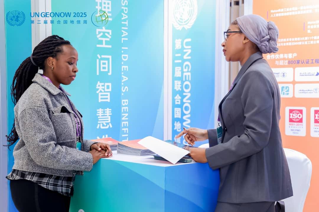
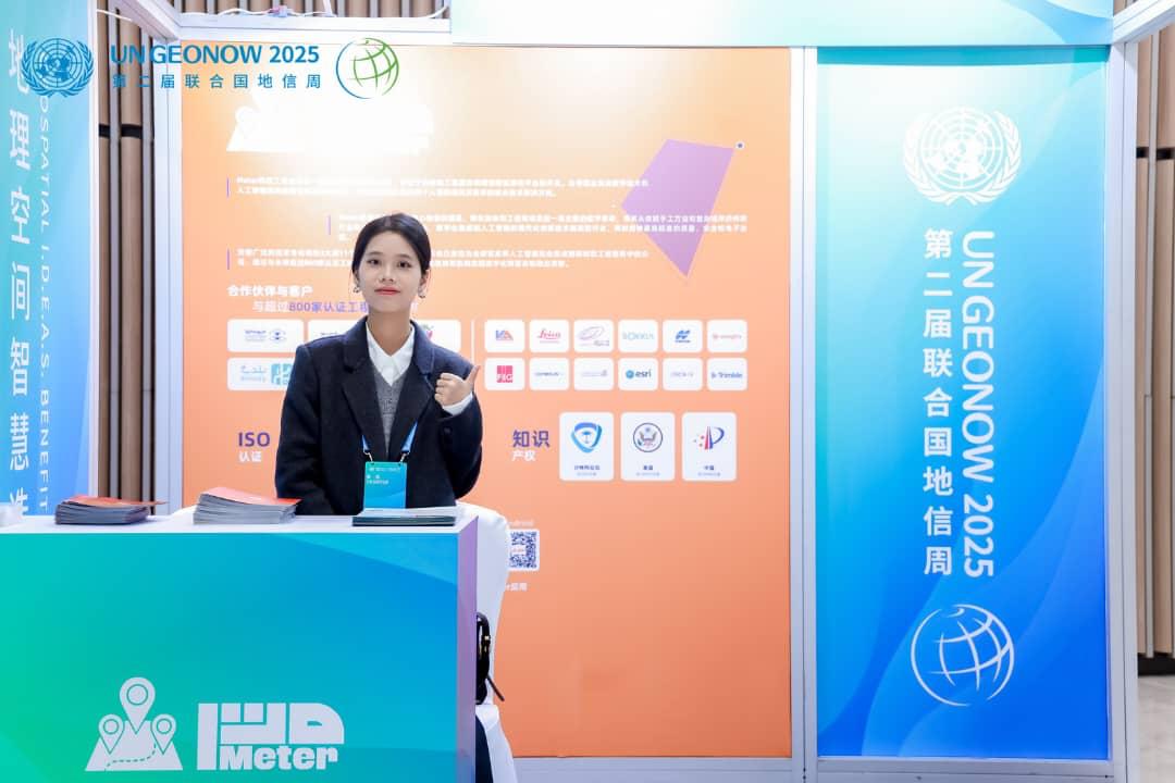
جانب من مشاركة شركة متر – فرع الصين في معرض UNGEONOW 2025، حيث استعرضت الشركة أحدث ابتكاراتها وحلولها المتقدمة المدعومة بتقنيات الذكاء الاصطناعي في مجالات الخدمات المساحية والهندسية، ضمن رؤيتها لتعزيز التحول الرقمي وتطوير قطاع المساحة والهندسة على مستوى عالمي.
#شركة_متر #Meter #UNGEONOW2025 #الذكاء_الاصطناعي #المساحة #الخدمات_الهندسية #التحول_الرقمي #الابتكار #الصين #تقنية #هندسة #SmartMapping #AI #Geospatial #Innovation #السعودية
1
2
4
533

22 Oct 2025
At AI Geo Navigators, we use GIS to innovate, ensure accuracy, and make spatial analysis smarter every day.
GIS (Geographic Information Systems) allows us to explore new technologies, maintain clean and structured databases, and go beyond traditional maps to create innovative solutions.
We believe that every GIS challenge is an opportunity to think differently and improve how data is visualized, analyzed, and shared.
#AIGeoNavigators #GIS #GeographicInformationSystems #MappingSolutions #DataDrivenDecisions #SmartMapping #GeospatialTechnology #GISInnovation #SpatialData #DigitalMapping #PythonForGIS #GeoAnalytics #GISExperts #TechForSustainability #SpatialIntelligence #GISCommunity #GISApplications #LocationIntelligence
7
41

9 Oct 2025
Quedan pocos días para participar en el concurso #MapasenAcción y mostrar tu mapa en la #CEsri25.
📅 Cierre: 15 de octubre
📌 Regístralo aquí: esri.es/es-es/acerca-de/even…
#GIS #ArcGISOnline #LivingAtlas #SmartMapping #EsriEspaña
3
4
184

8 Aug 2025
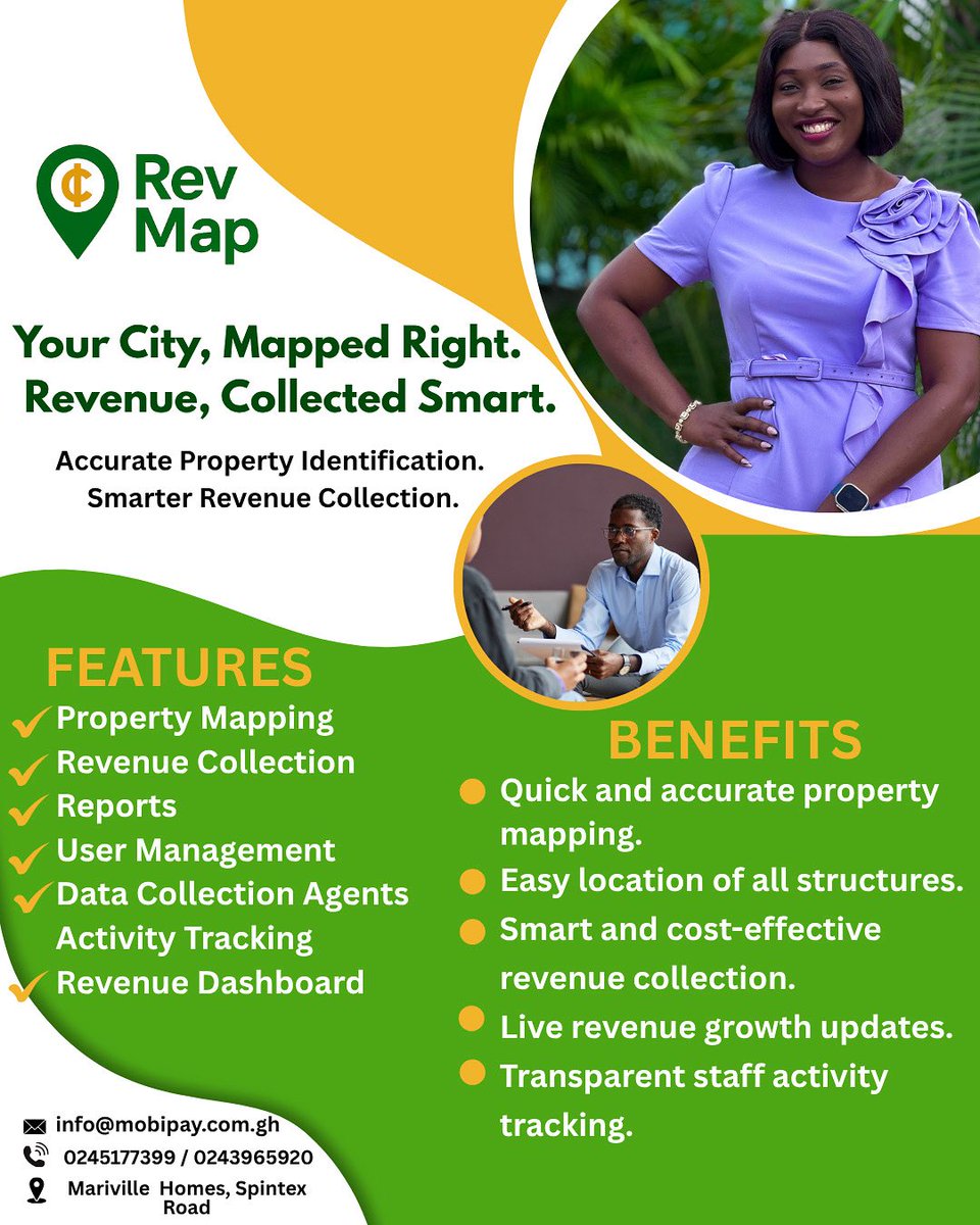
Map your city. Collect revenue smarter. 📍💰 RevMap delivers accurate property mapping, live revenue dashboards, and transparent staff tracking.
📞 Call 0245177399 | ✉️ info@mobipay.com.gh
#RevMap #RevenueGrowth #SmartMapping #PropertyMapping #MobiSolutions #G
2
8

7 Aug 2025
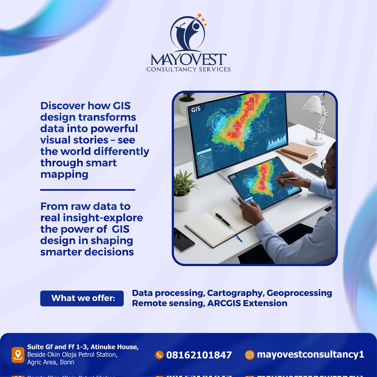
Turning data into maps that speaks | Learn GIS with us today!!!
#techskills #ilorin #Gis #smartmapping #ilorinupgrade #goviral❤️ #fyp
4
23

29 Jul 2025
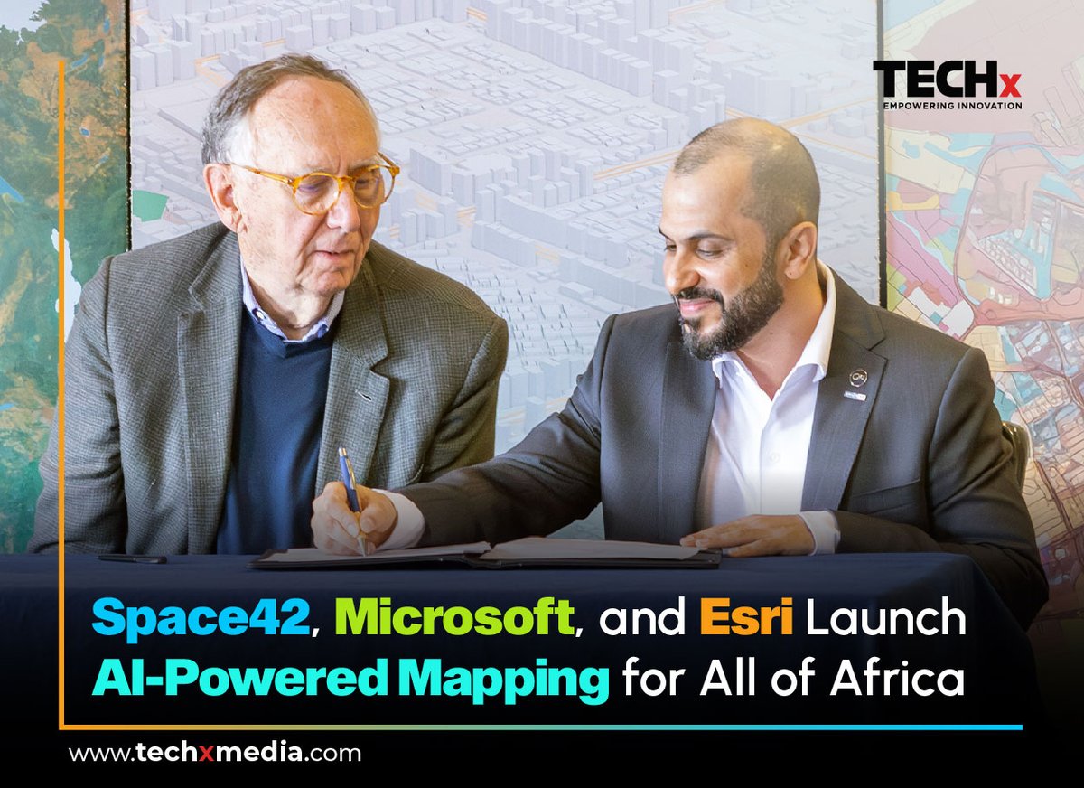
@space42ai x @Microsoft x @Esri : Mapping Africa’s Future
UAE's Space42 leads the Map Africa Initiative to build real-time, high-res base maps for all 54 African nations.
🔷 Powered by AI, GeoAI & Azure cloud
🔷 Supports smart cities, logistics, energy & more
🔷 Impacting 1.4B people across the continent
Read more : techxmedia.com/en/space42-pa…
#Space42 #MapAfrica #GeospatialAI #TECHxMEDIA #MicrosoftAzure #Esri #DigitalTwins #SmartCities #TechForGood #AfricaTech #UAEInnovation #SatelliteData #SmartMapping #PublicSectorAI #AIforDevelopment #techx
🔔 Follow @TECHxMediaUAE for more Tech innovations, Exclusive interviews & Industry Updates!
2
38

17 Jul 2025
Discover how Germany’s national-scale digital twin—built with 10 cm horizontal resolution—is revolutionizing climate response, airspace safety, and insurance risk assessment.
In this keynote by Paul Becker, President of the Federal Agency for Cartography and Geodesy (@BKG_Bund), Germany, at the Geospatial World Forum 2025, learn how the digital twin is being used to monitor forest carbon storage, assess storm and fire damage, and manage aerodrome obstacle risks.
Despite technical and licensing challenges, the digital twin is emerging as a powerful tool for decision-makers in government, industry, and environmental planning.
#GermanyDigitalTwin #ClimateRiskManagement #GeospatialInnovation #DigitalTwinTechnology #BKGGermany #PaulBecker #GeospatialWorldForum #GWF2025 #ClimateAction #SmartMapping #ForestMonitoring #DisasterResponseTech #DigitalGeography #GeospatialForGood #SustainableDevelopmentTools #NationalDigitalTwin #SpatialIntelligence #InsuranceRiskModeling #AerodromeSafety #FutureOfMapping
4
503
16 Jul 2025
متر... قصة سعودية تنطلق إلى العالمية🌍
هناك لحظات لا تُنسى في عمر الشركات...
ولحظة "متر" في الصين هي لحظة ولادة رؤية تتجاوز الجغرافيا.
لسنا مجرد منصة...
نحن نموذج سعودي يحول المعرفة إلى خريطة،
والطموح إلى طريق،
والابتكار إلى لغة يفهمها الجميع.
اليوم لا نصدّر خدمة... بل نُصدر ثقة،
نُطلق مشروعًا... ونُطلق معه قصة نجاح سعودية بعقول محلية ورسالة عالمية.
مع متر ... خدماتك الهندسية والمساحية بين يديك.
#منصة_متر #متر_في_الصين #قصة_سعودية_عالمية #الخرائط_الذكية #التقنية_السعودية #التحول_الرقمي #الريادة_السعودية #التوسع_الدولي #الابتكار_الجغرافي #SaudiToGlobal #Geospatial #GIS #SmartMapping #Deqing #China #Meter_Platform

1
3
4
1,157

27 Jun 2025
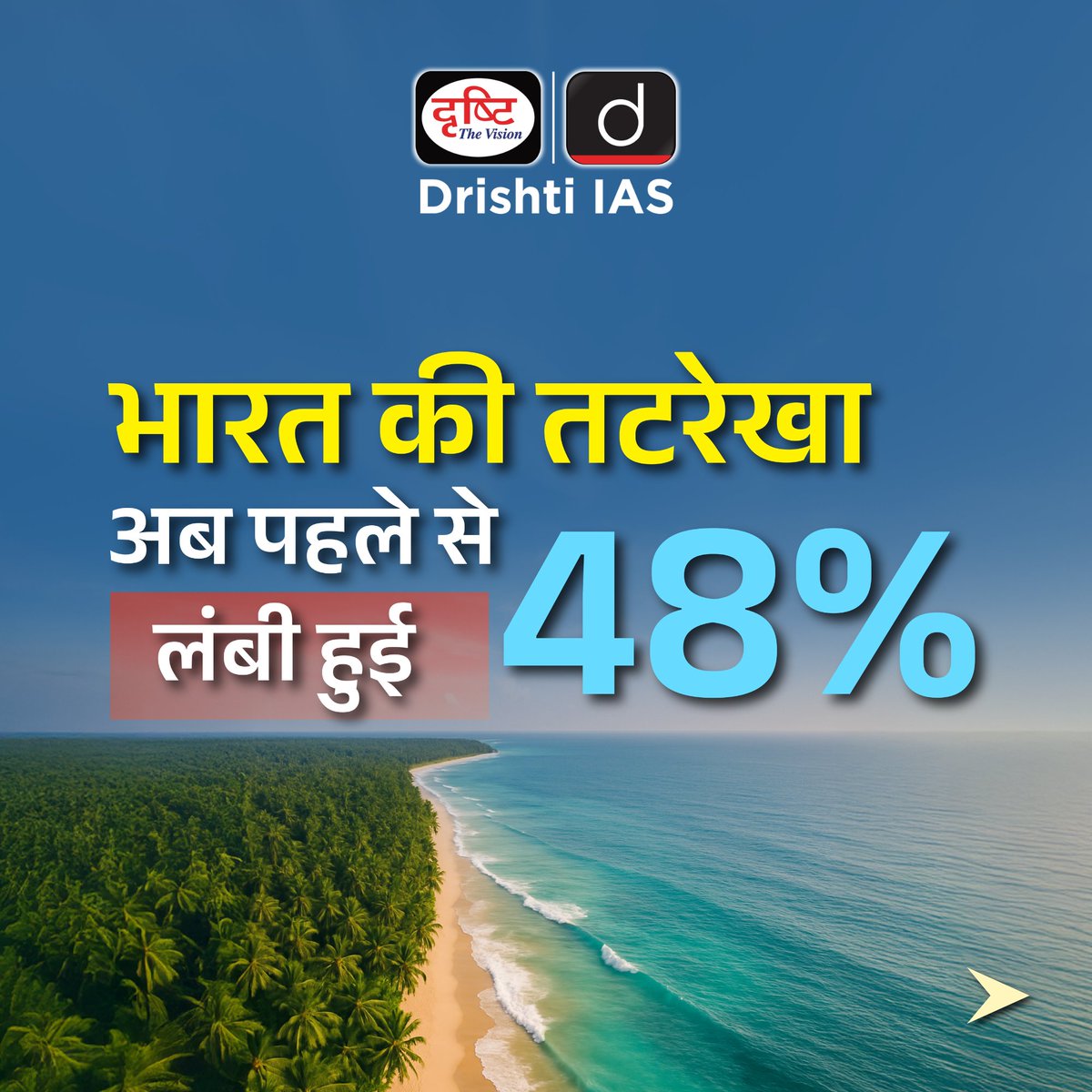
भारत की समुद्री पहचान को नया आकार
#IndianCoastline #TideOfChange #CRZPolicy #BlueEconomy #IndiaMaritime #CoastalIndia #SmartMapping #IndianIslands #CurrentNews


10
150

27 Jun 2025
सटीक माप, सशक्त तट: भारत की समुद्री पहचान को नया आकार
#IndianCoastline #TideOfChange #CRZPolicy #BlueEconomy #IndiaMaritime #CoastalIndia #SmartMapping #IndianIslands #CurrentNews #DrishtiIAS


30
181
4,597

22 Apr 2025
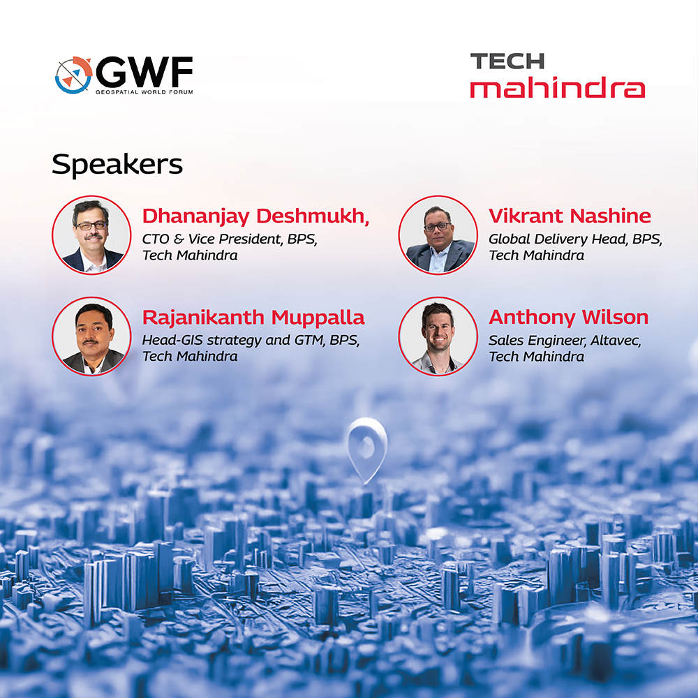
@tech_mahindra is proud to co-sponsor the @geospatialworld Forum (GWF) 2025! Join us at Booth #H25 from April 22–25, 2025, to explore our cutting-edge geospatial services—covering the entire data value chain from capture to actionable insights.
Don’t miss thought-provoking sessions by our leaders:
• Rajanikanth Muppalla – National Mapping Collaboration | Apr 22 | 10:45–11:30
• Dhananjay Deshmukh – Spatial Computing & Geospatial Platforms | Apr 23 | 13:00–13:45
• Vikrant Nashine – Railway Asset Management | Apr 24 | 16:00–17:30
• Anthony Wilson – Network Governance | Apr 25 | 10:15–11:30
Connect with our industry experts Tejas (TJ) Desai and Toshi Choudhary. Let’s shape the future of geospatial intelligence together!
Read more: geospatialworld.net/gwf/2025…
#GWF2025 #GeospatialSolutions #GIS #Innovation #DigitalTransformation #SmartMapping #BPS

2
303

24 Mar 2025
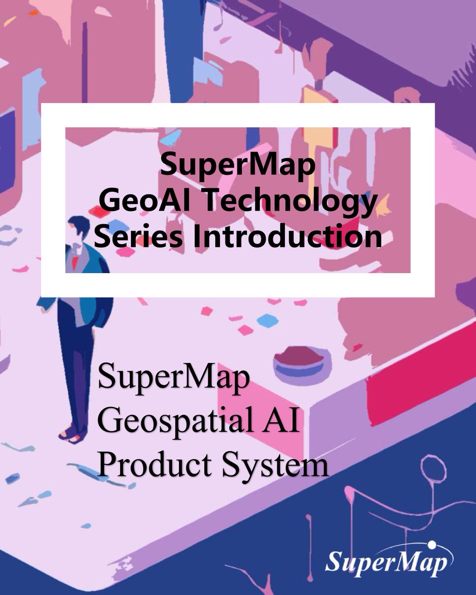
🔥 By seamlessly integrating #AI into GIS, SuperMap empowers users with powerful features like intelligent spatial analysis.
👉Check SuperMap's AI-driven software products: bit.ly/4kS6TBd
#SuperMap #GeospatialAI #SmartMapping #GISInnovation #SuperMapiDesktopX
2
132