
Joined October 2012
- Tweets 981
- Following 5
- Followers 1,690
- Likes 599
114 Photos and videos


Pinned Tweet

23 Apr 2024
We have released version 9.0 of GraphHopper, an open source routing engine for OpenStreetMap.
graphhopper.com/blog/2024/04…
#Java #gis #gischat #spatial #logistics
8
17
1,120
GraphHopper retweeted

5 Dec 2023
5️⃣. GraphHopper Routing Engine by @graphhopper - Open source routing engine for OpenStreetMap. Use it as Java library or standalone web server.
👉 github.com/graphhopper/graph…
1
1
8
1,505
GraphHopper retweeted

25 Oct 2023
Nice... I had no idea routing was so convenient to self-host.
Took me minutes to get @GraphHopper running on my desktop, both having a map visible below and the JSON of instructions for use in #WebXR.
API doc docs.graphhopper.com/#tag/Ro…
Docker image github.com/IsraelHikingMap/g…
2
1
6
1,621
18 Oct 2023
We have released version 8.0 of GraphHopper, an open source routing engine for OpenStreetMap.
graphhopper.com/blog/2023/10…
#opensource #Java #gis #gischat #spatial #logistics
11
22
2,109
GraphHopper retweeted

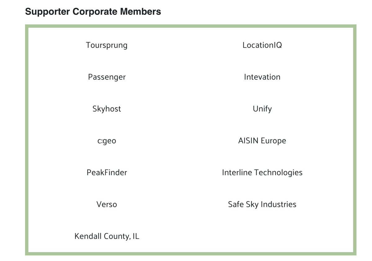
8 Sep 2023
Now is a good time to say THANK YOU to TomTom and current Gold members Mapbox, Esri, Gojek, Grab, Graphhopper, Meta, & Microsoft our other corporate members, and our 2 newest members: @StadiaMaps
Kendall County, IL, our first governmental member
wiki.osmfoundation.org/wiki/…


2
27
79
9,776
10 May 2023
Our new API editor is now available and we can't wait for you to try it out!
All 8 API parts are covered:
Routing, Route Optimization, Matrix, Map Matching, Isochrone, Cluster, Geocoding and even the newest Profiles API which is still in private beta:
graphhopper.com/blog/2023/05…
2
5
15
2,378
3 May 2023
Improving The Route Planning Experience in GraphHopper Maps
graphhopper.com/blog/2023/05…
#OpenStreetMap
3
6
752
24 Apr 2023
"If GraphHopper can do complex graph processing (...) in less than 12 hours, then generating map tiles should be possible in less than 100 days."
An interesting post where @msb5014 describes how planetiler was created in 2021.
medium.com/@onthegomap/helpi…
#OpenStreetMap #MapLibre
2
4
465
31 Mar 2023
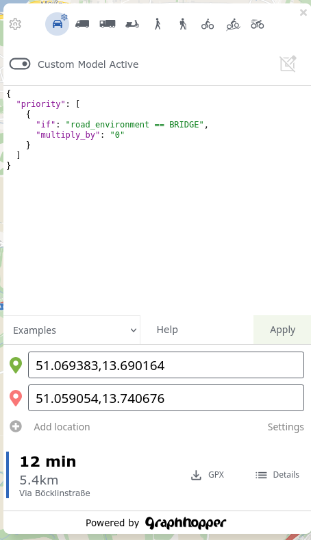
Here is a little preview of our latest development, our API editor. It’s not just an ordinary JSON editor. Our API editor comes with a unique feature that will make your development process a lot more fun: a map at the center of it all!
graphhopper.com/blog/2023/03…
3
15
1,938
GraphHopper retweeted

23 Mar 2023
"start at Leeds, drive a car all possible routes, all at once, and tell me where every minute, then I'll put that on a map" > makes a nice map. Very exciting performance improvements in recent @graphhopper releases.
3
1
33
4,785

14 Mar 2023
We are pleased to announce the latest release 7.0 of the GraphHopper routing engine 🎉
graphhopper.com/blog/2023/03…
#OpenStreetMap #opensource
1
11
41
4,859
6 Mar 2023
Our Latest Performance Improvement: Solving Traveling Salesman Problems Up To 50% Faster graphhopper.com/blog/2023/03…
1
5
364
GraphHopper retweeted

25 Jan 2023
Analyser l'accessibilité des écoles sur QGIS (atouts et limites de l'outil GraphHopper)
gispo.fi/en/blog/analyzing-s…
Avec lien vers un plugin spécifique pour QGIS développé conjointement par l'IIPE-UNESCO et GISPO LTD
github.com/iiepdev/school-ca…
1
2
2
447
9 Nov 2022
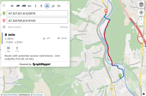
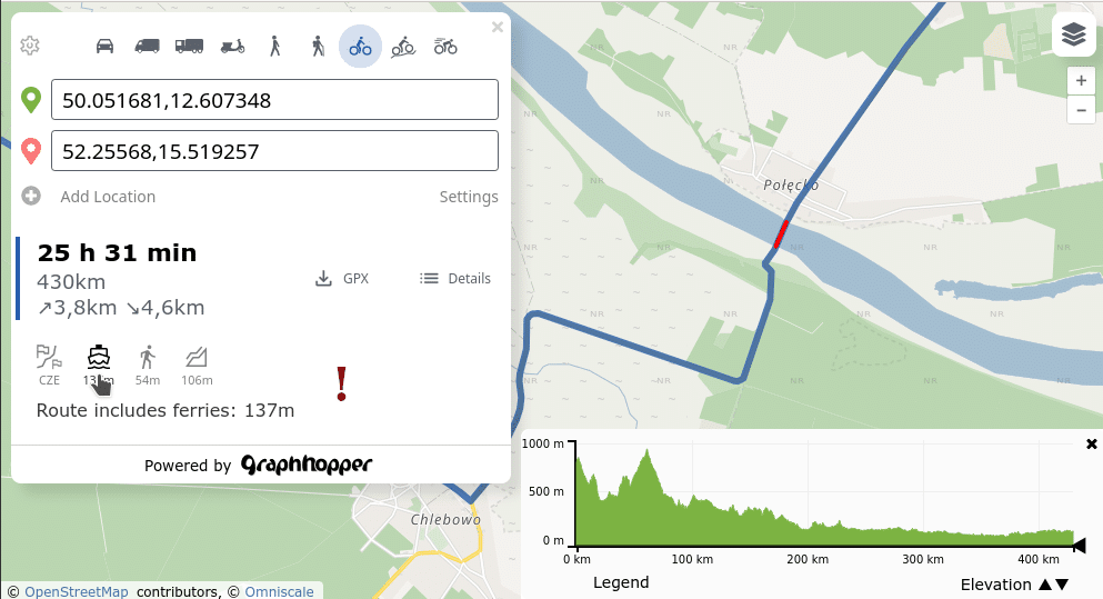
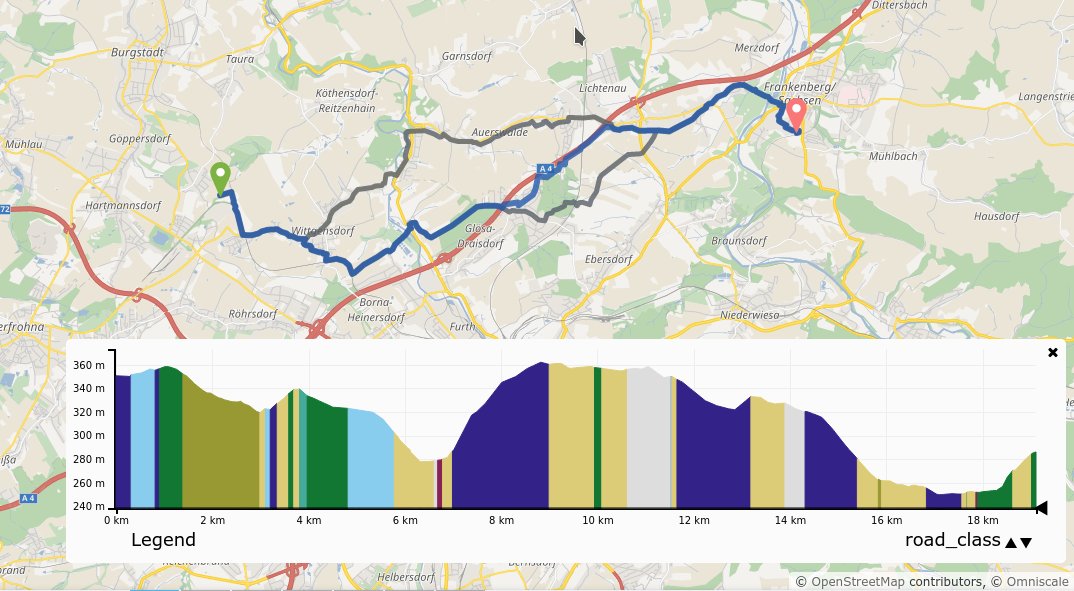
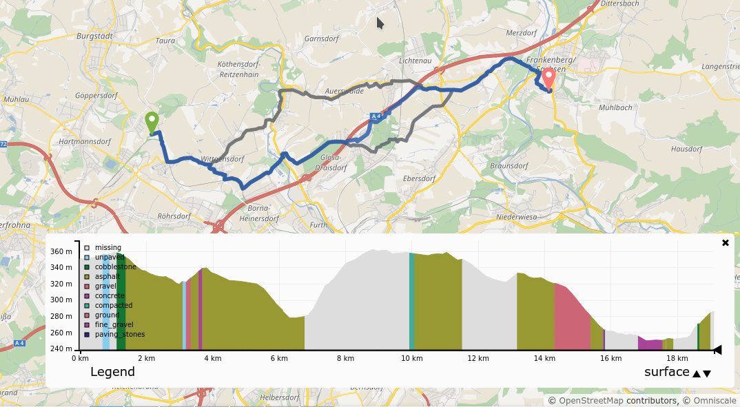
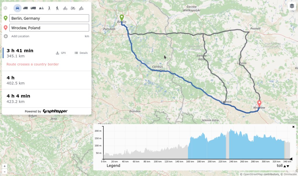
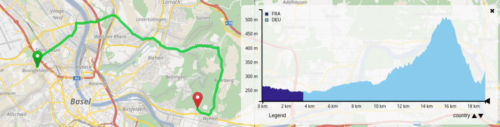
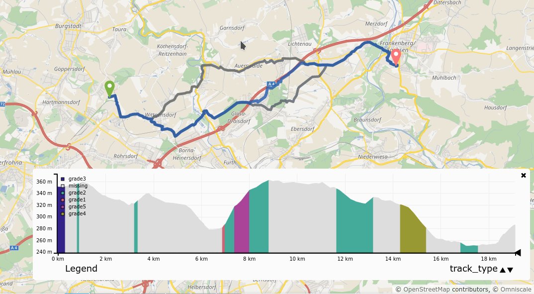
The new GraphHopper Maps shows the elevation data along the route in the lower right corner. If you click on the small triangles, you can view more OpenStreetMap data along the route: surface, highway (road class), max speed, tracktype, toll information, the country and more.
1
1
6
GraphHopper retweeted

8 Nov 2022
This got me reinterested in @graphhopper,
It took about 3 minutes to install and run a server for Israel, literally 2 commands before I had a running instance & a pretty nice UI.
1 downside, by default, the config file only defines "car" as a transport mode, bike and walk missed.

1
2
2
8 Nov 2022
The New GraphHopper Maps Route Planner
graphhopper.com/blog/2022/11…
#OpenStreetMap
1
3
11
19 Sep 2022
We have released version 6.0 of our open source routing engine GraphHopper
graphhopper.com/blog/2022/09…
#OpenStreetMap
2
14
65