
Meteorologist and outdoorsy guy. Founder of powder forecasts @findopensnow and hiking forecasts @findopensummit
Joined October 2008
- Tweets 3,501
- Following 82
- Followers 6,521
- Likes 24
252 Photos and videos


24 Oct 2020
(1/2) Wind on the east side of #easttroublesomefire near @RockyNPS will be strong through Saturday-day, then slowing Saturday-evening, and reversing with snow by Sunday morning. Best wishes to all involved as Saturday is going to be (and already is) a tough day.
1
1
21
24 Oct 2020
(2/2) For major fires like this #easttroublesomefire there are dedicated @NWS meteorologists that work with fire officials to give them the best weather information. My forecasts are just to provide perspective for those of us following on Twitter.
1
19
22 Oct 2020
Weather update for #EastTroublesomeFire near Estes Park: Winds blow from the east Thu aftrn through Thu night (this is good). Then winds switch back to blow from west, strongly, from Fri aftrn to Sat aftrn (this is bad). Fri night - Sat aftrn is concerning. Then snow Sat night!
1
31
22 Oct 2020
Weather forecast... Thu winds still gusty. Thu evening winds slow, change direction, temps cool, moisture increases through Fri. Then Sat winds will be strong with low moisture. Sat night & Sun = cold & snow likely. 🤞#EastTroublesomeFire
1
3
28
21 Oct 2020
Weather update for #CalWoodFire and #LefthandCanyonFire: Thu ~6am winds shift to blow from east, Thu ~4pm winds get stronger from the east. Maybe light snow on Thu night. Solid chance for snow Sat night into Sunday.
3
8
20 Oct 2020
Wind update: Tue AM: Gusty from W. Tue PM: Slow speeds, from E. Wed: Increasing speeds, from W. Thu: Slowing speeds, from E. Snow update: Thu night: light snow possible, colder. Sun: Possibly significant snow, very cold. This is mostly good news. #CalWoodFire #lefthandcanyonfire
2
3
28
18 Oct 2020
Weather update 3/2:-) High chance of measurable snow, just have to wait until end of the week or next weekend. #CalwoodFire opensnow.com/dailysnow/color…
2
3
27
18 Oct 2020
Weather update 2/2: Weather this week will be iffy with times of calm and times of stronger winds. Light snow and cold possible Fri 10/23 and Sun 10/25. #CalwoodFire
1
5
18 Oct 2020
Weather update 1/2: was not expecting to see drops of moisture on Sun morning - a gift! Light east winds and high humidity are also great news. Clouds should break around midday or a bit later. #CalwoodFire
2
14
18 Oct 2020
Good weather news for the #CameronPeakFire and #CalWoodFire: Sunday will bring light winds from the east, maybe pushing the fires back onto themselves, along with much higher humidity and colder temperatures. The atmosphere battled us on Saturday but will be with us on Sunday.
19
122
Joel Gratz retweeted

18 Oct 2020
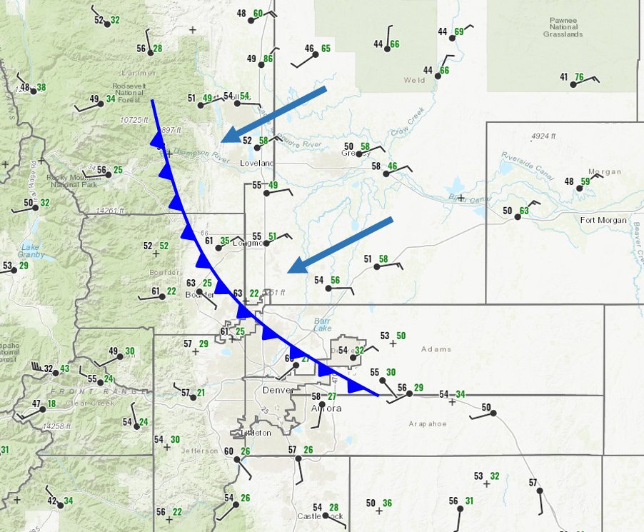
A cold front has arrived at lower elevations of the #CalWoodFire and #CameronPeakFire this evening. Cooler temperatures (black) and higher relative humidity (green) will advance towards the fires and will eventually reduce fire behavior. #COwx
5
82
407
17 Oct 2020
Good news for #CalwoodFire is that winds will slow and reverse, just gotta hang on. 2pm Sat = strong W winds. 4pm Sat = lighter W winds. 7pm Sat = winds reverse, blow from east. Sunday = cooler, winds from east. Hoping forecast is accurate and helps knock down the fire.


15
46
205
17 Oct 2020
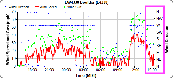
As of 315pm Sat, a weather station 6mi south of the #CalwoodFire and at similar elevation (~7,000ft) showed winds slowing and early flirting to east direction. Red line = wind speed, green pluses = wind gust. Wind gusts now 20-30mph down from 50-60mph. Still not good, but better.
1
6
18
14 Jul 2020
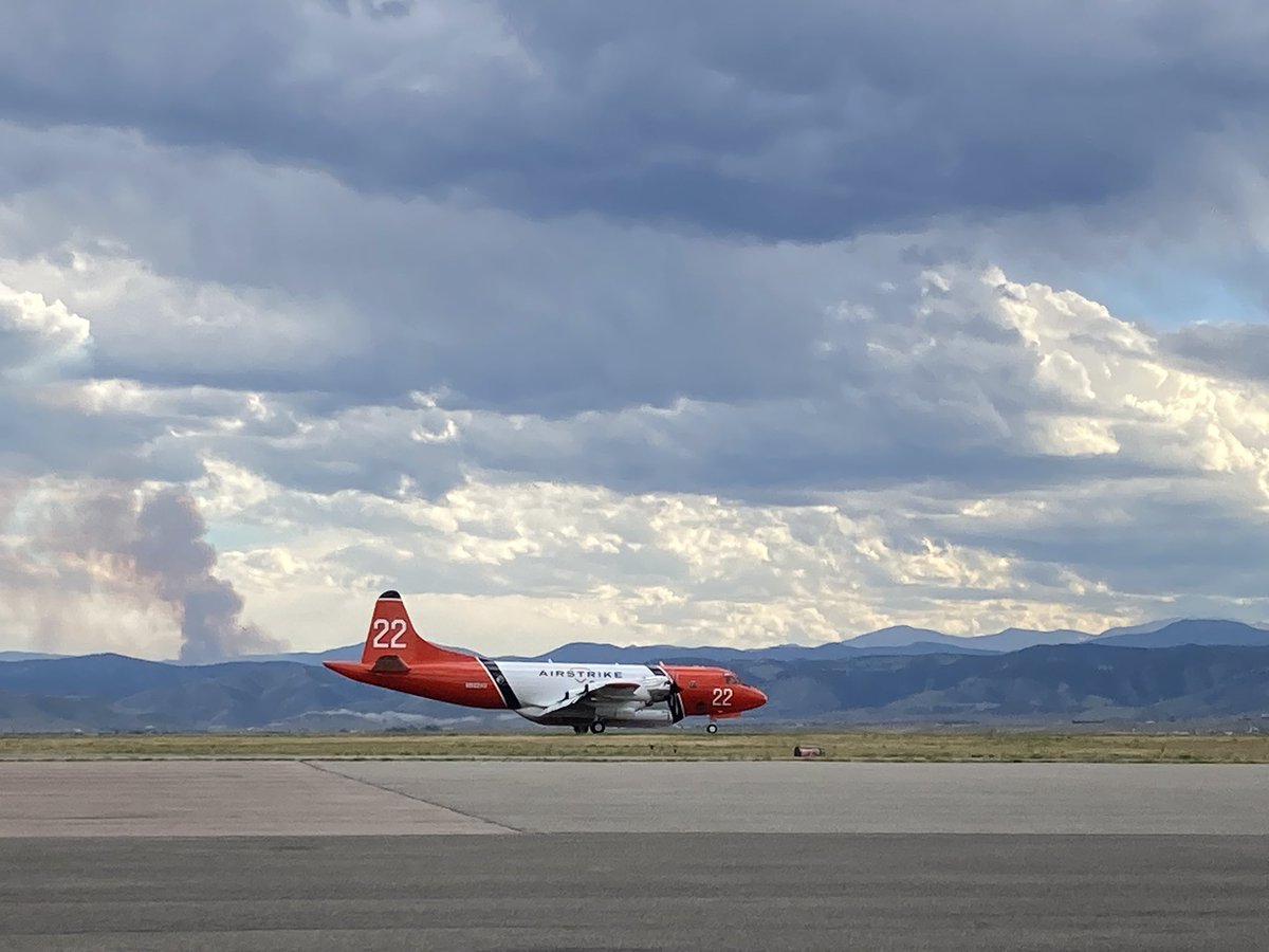
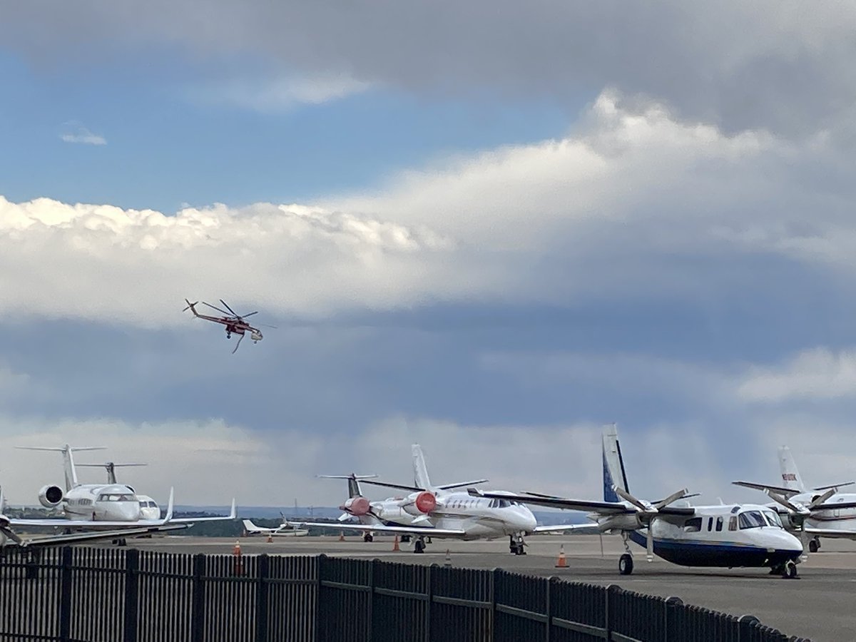
Support aircraft and helicopter at @flyRMMA at 600pm 7/13. Hoping air support now and cooler/moist weather tomorrow helps control the #ElephantButteFire
3
12
15 Nov 2017
Friday's storm is tracking further south, which should bring snow to all mountains in Colorado. Plus, more active weather in early Dec? Details: opensnow.com/dailysnow/color…
2
1
17
5 Nov 2017
The northern mountains of Colorado received the most snow on Saturday night, 3-10 inches. More on the way Mon/Tue: opensnow.com/dailysnow/color…
1
13
27 Oct 2017
Thanks to @ryanweather for creating free-to-use maps of the historically most accurate ECMWF and UKMET weather models! opensnow.com/dailysnow/color…
3
31