
At EXPANDEO 2026, the CopernicusData Space Ecosystem is printing satellite images of any location you choose — on the spot.
Pick your favourite place on Earth and take home a piece of EO.
Find them at the registration desk⤵️
expandeo.earsc.org/


2
2
62

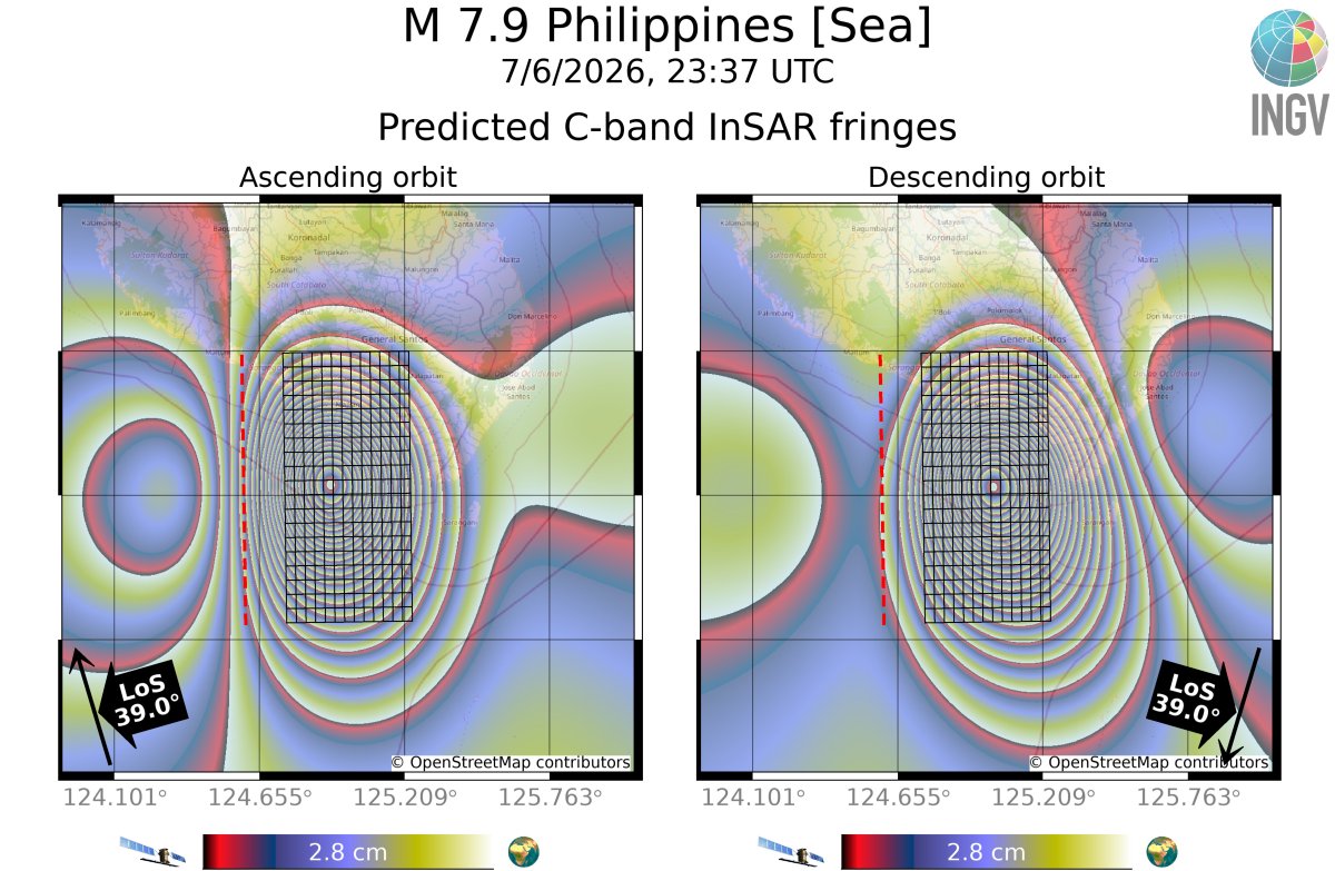
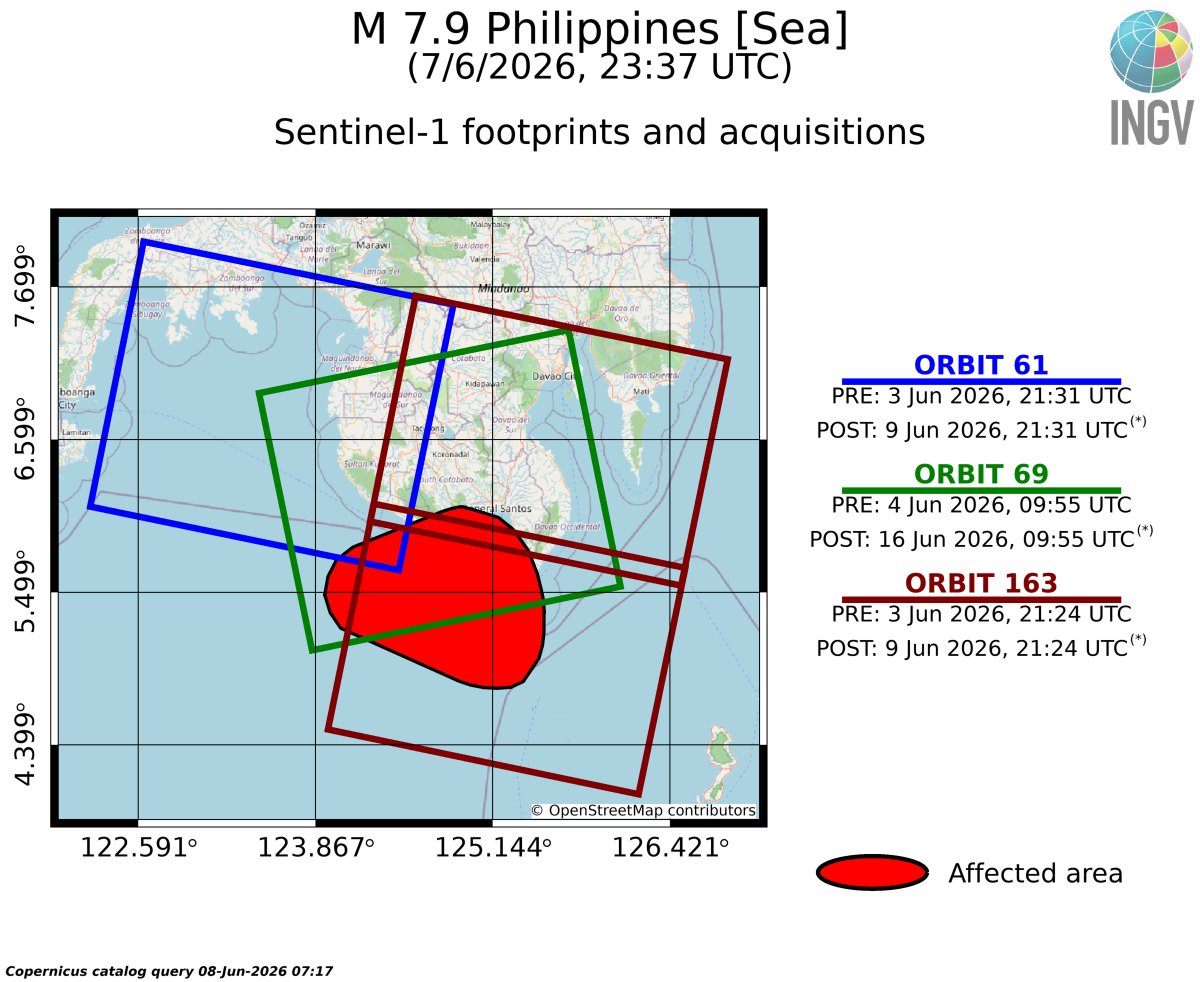
Scenario (**!SIMULATED DATA!**) of the #InSAR deformation associated with the June 7 M 7.8 #Philippines #earthquake (23:37 UTC), based on the USGS - Finite Sorce (earthquake.usgs.gov/earthqua…).
Expected Sentinel-1 (@CopernicusData) acquisitions.
with @antandre71 and @NikosSvigkas
3
11
348

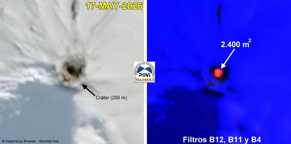
#volcanvillarrica Tras casi 2 meses de ausencia, regresa el calor en el fondo del cráter. El área de radiación detectado, de 2.400 m2, equivale al valor registrado el 13 de marzo pasado. Incandescencia ausente en nuestras cámaras IR. @GVPsmithsonian @CopernicusData
32
58
5,685

Mar 11
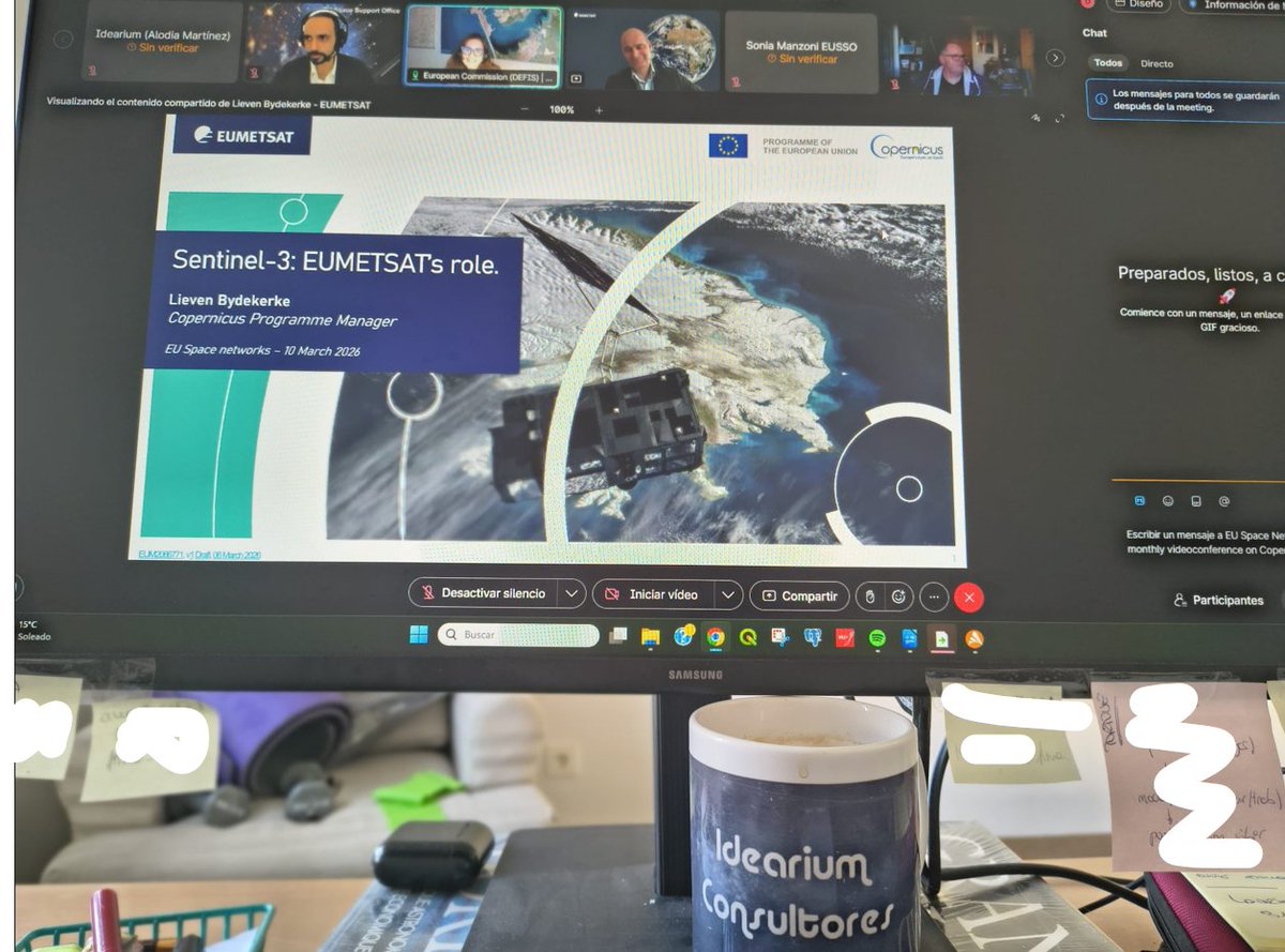
Ayer aistimos a un webinar de Symeon Mallis, DG DEFIS y Lieven Bydekerke, EUMETSAT donde nos ofrecieron una visión general de los lanzamientos de satélites de Copernicus previstos para 2026, las características de los instrumentos y los desarrollos futuros.
@CopernicusData
1
2
23

Jan 23
New to WEkEO or looking to deepen your skills?
WEkEO offers regular online trainings and workshops to help you:
📈 Discover Copernicus datasets
📈 Use cloud computing tools
📈 Build workflows for real world applications
Training is free and open to all users.
Check upcoming sessions and register here: wekeo.copernicus.eu/
#CopernicusData #OpenScience

ALT Promotional image for Copernicus data services, titled 'Copernicus data in one place'. Text inviting users to explore, download, visualize, and process Earth data related to atmosphere, climate, land, and ocean. Includes a 'Start exploring for free' button and logos for Copernicus and WEKEO at the bottom. Background shows a partial view of Earth from space.
2
7
240

29 Nov 2025
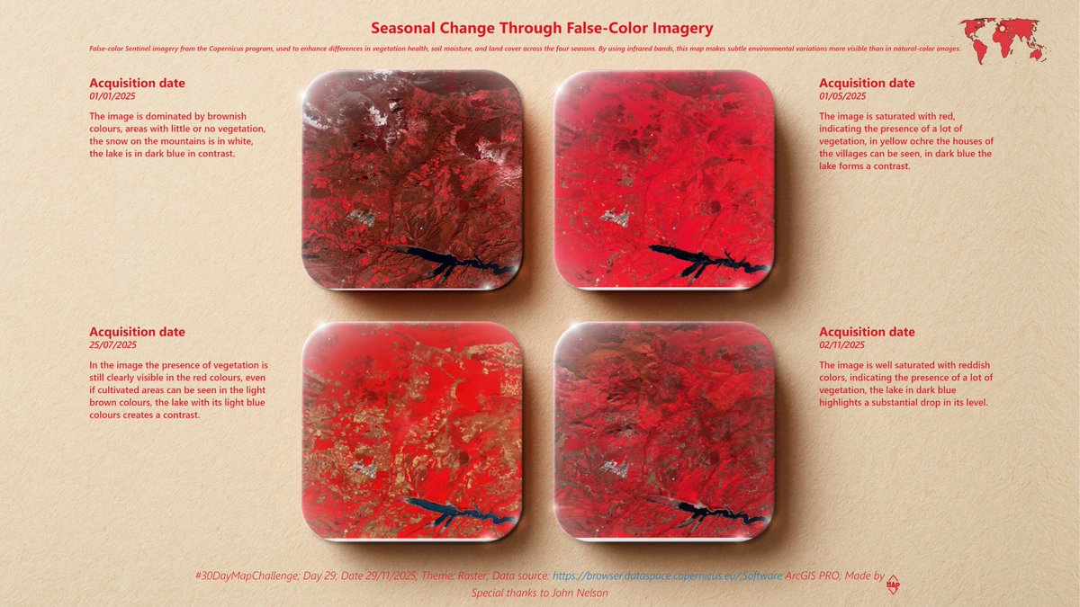
Day 29 - Raster
A series of false-color images from the Copernicus network reveals how the landscape transforms its spectral signature across the four seasons. Special thanks to @John_M_Nelson for Earth Block Poster.
#30DayMapChallenge #Day29 #Raster #CopernicusData #ArcGISPRO
2
7
721

14 Aug 2025
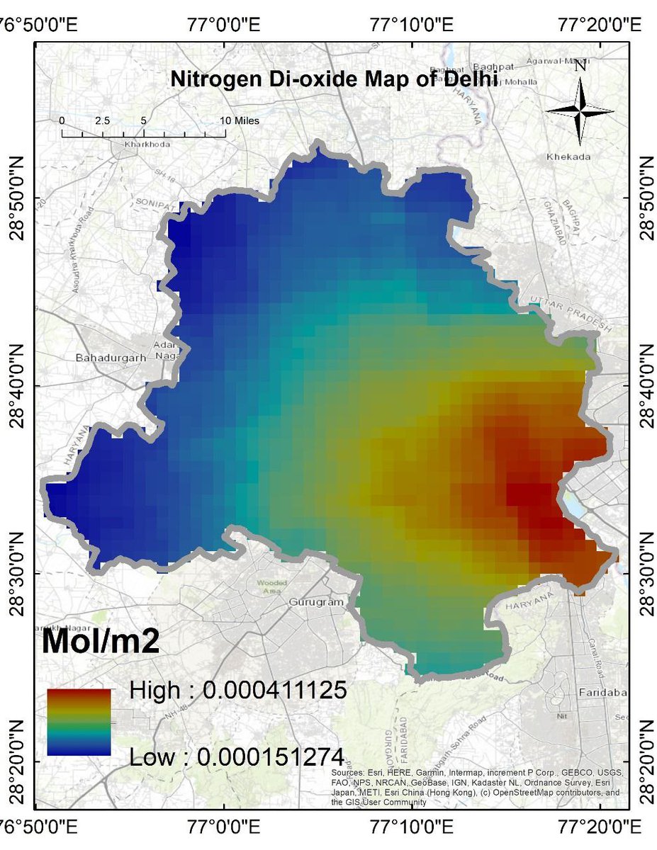
Nitrogen dioxide (NO₂) concentrations across Delhi. Vehicle and Industrial Emissions Are Key Contributors.
Tutorial Link: youtube.com/live/btXeyUVVlRc…
#NitrogenDioxide #NO2Pollution #AirQuality #DelhiAir #Sentinel5P #NASAData #CopernicusData #SatelliteImagery #RemoteSensing #Earth
2
156

10 Jan 2025
🌍 Global temperature anomalies have been on the rise since 1940, with 2024 marking the warmest year on record. According to Copernicus data, human activities are the primary drivers of this alarming trend.
Global Temperature Anomalies: The deviation of global annual temperatures from the pre-industrial period (1850-1900), shows a significant increase over the decades.
Copernicus Data: The data is sourced from the Copernicus Climate Change Service (C3S), which provides comprehensive climate data and analysis.
Impact of Human Activities: The rise in temperature anomalies is largely attributed to human activities, such as the burning of fossil fuels and deforestation.
Record-Breaking Years: Recent years have seen unprecedented temperature increases, with 2024 being the warmest year on record
✅What are your thoughts on the urgent need for climate action?
✅Do you believe or not in #ClimateChange?
#GlobalWarming #CopernicusData #lafires
Source: Copernicus Data

9 Jan 2025

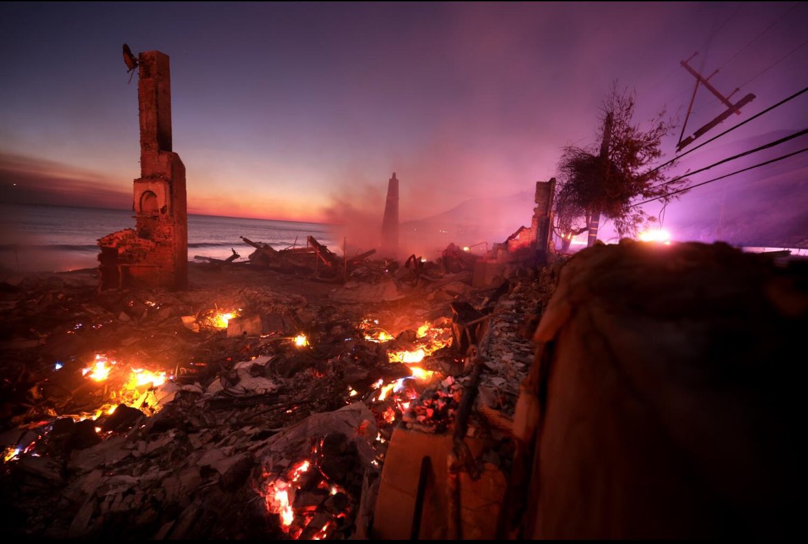
I have spent a lot of time in Los Angeles.
It is an extraordinary, beautiful place.
Watching L.A. burn is extremely painful.
The footage is nothing short of apocalyptic.
I am deeply sad for the people of this wonderful city.
We need climate action NOW.
1
1
4
786

14 Nov 2024
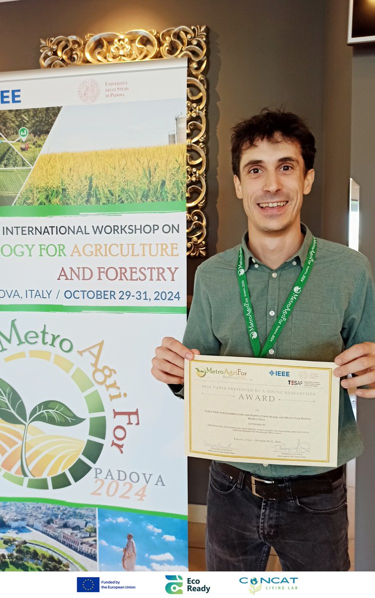
Teledetecció i IA per la estimació PRECOÇ de cultius i prediccions demandes aigua. Ha estat de gran ajuda x les comunitats de regants x planificar campanya de reg en situacions de sequera. Enhorabona xl premi! @ESA_EO @agriculturacat @CopernicusData @aigua_cat @acatcoregants
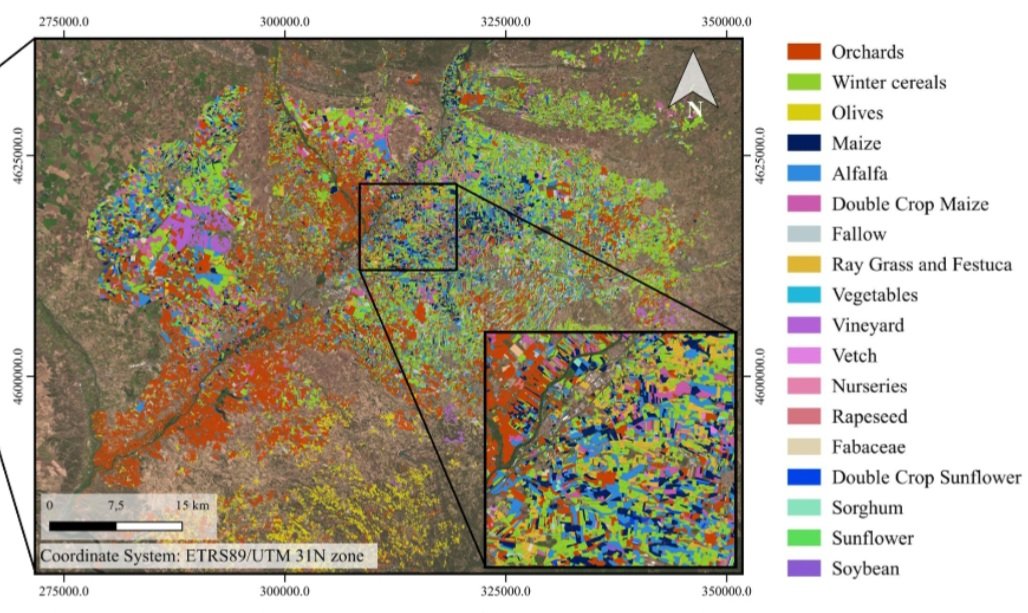

🌍 Del 29 al 31 d’octubre, l’investigador Jordi Gené-Mola va participar al congrés IEEE MetroAgriFor a Pàdova, presentant el treball “Early Crop Type Classification and Mapping”, reconegut amb el Premi al Millor Article per un investigador jove. 🏆
Enhorabona, Jordi! 👏
4
12
401

🌄 How can satellite data make mountain sports safer? Catch the recording of "Sentinel Satellite Data for Mountain Sports and Safety," with TUM LMF PhD student & certified guide Michael Engel!
🎥 Watch: youtube.com/watch?v=IAVKUU_S…
@CopernicusData Copernicus Data Space Ecosystem
1
2
84

22 Aug 2024
New paper | We did for the first time a comparative study over the 5 largest cities of #Switzerland using @USGSLandsat & @CopernicusData with #MachineLearning to produce LCZ maps: mdpi.com/2413-8851/8/3/120
@UNIGEnews @sciences_UNIGE @GRIDgva @GEOSEC2025 @EuroGEO_eu
3
6
548

24 May 2024
@RymdstyrelsenSE this is why EO and @CopernicusData is needed in Antarctic research! Without #remotesensing Antarctic #glaciology is constrained by geography and weather.
1
1
105

22 May 2024
Shopping center near Kenwood Towne Centre to be sold: bit.ly/4e52bNd
Photo: Google Earth / Landsat / CopernicusData SIO, NOAA, U.S. Navy, NGA, GEBCO

1
1
1,452

22 May 2024
cc: @MKelko @CopernicusEU @CopernicusLand @CopernicusData @volcanodiscover @johnseach @fathialz @widjokongko
2
616

24 Apr 2024
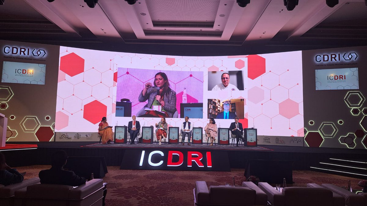
#ICDRI is timely.
DG @KoenDoens @EU_Partnerships joined the opening plenary.
🇪🇺is investing in key resilient infrastructure under its #GlobalGateway strategy; channelling finance, sharing knowledge & standards, mitigating risk, incl through @euspaceagency@CopernicusData

Join the conversation as Sharada Balasubramanian moderates the #ICDRI Opening Plenary ‘Investing Today for a more resilient tomorrow.’
Register here to join online: icdri.cdri.world/register
#ICDRI2024 #resilientinfrastructure
1
5
12
1,815

19 Apr 2024
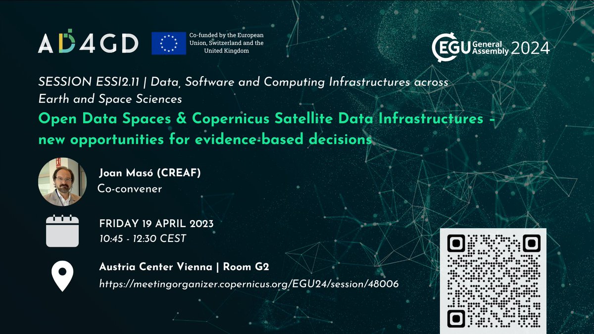
This session at #EGU24 is starting in less than an hour! Come to discuss how open Data Spaces & @CopernicusData Infrastructures can support science-informed decisions #DataScience #Software 💥👇 #EGUtoday
10 Apr 2024

📈#Data is crucial for innovation and informed decisions. This session connects developers & users of the #Copernicus Data Space Ecosystem and others to show how #dataspaces facilitate the sharing, integration, and processing of environmental and Earth data 🌍🛰️
1
6
208

8 Mar 2024
It feels a little bit like this is just general news now... and not a bit of urgency to be seen from governments worldwide @CopernicusData
irishmirror.ie/news/irish-ne…
3
165

29 Feb 2024
Woosh, both forward and backward releases dates estimates are really exciting!
1
25