
خبر کی مزید تفصیل جانئیے
urdupoint.com/n/4836723
#OneMapPunjab #DigitalMapping #PunjabGovernment #GIS

1
7
378

May 20
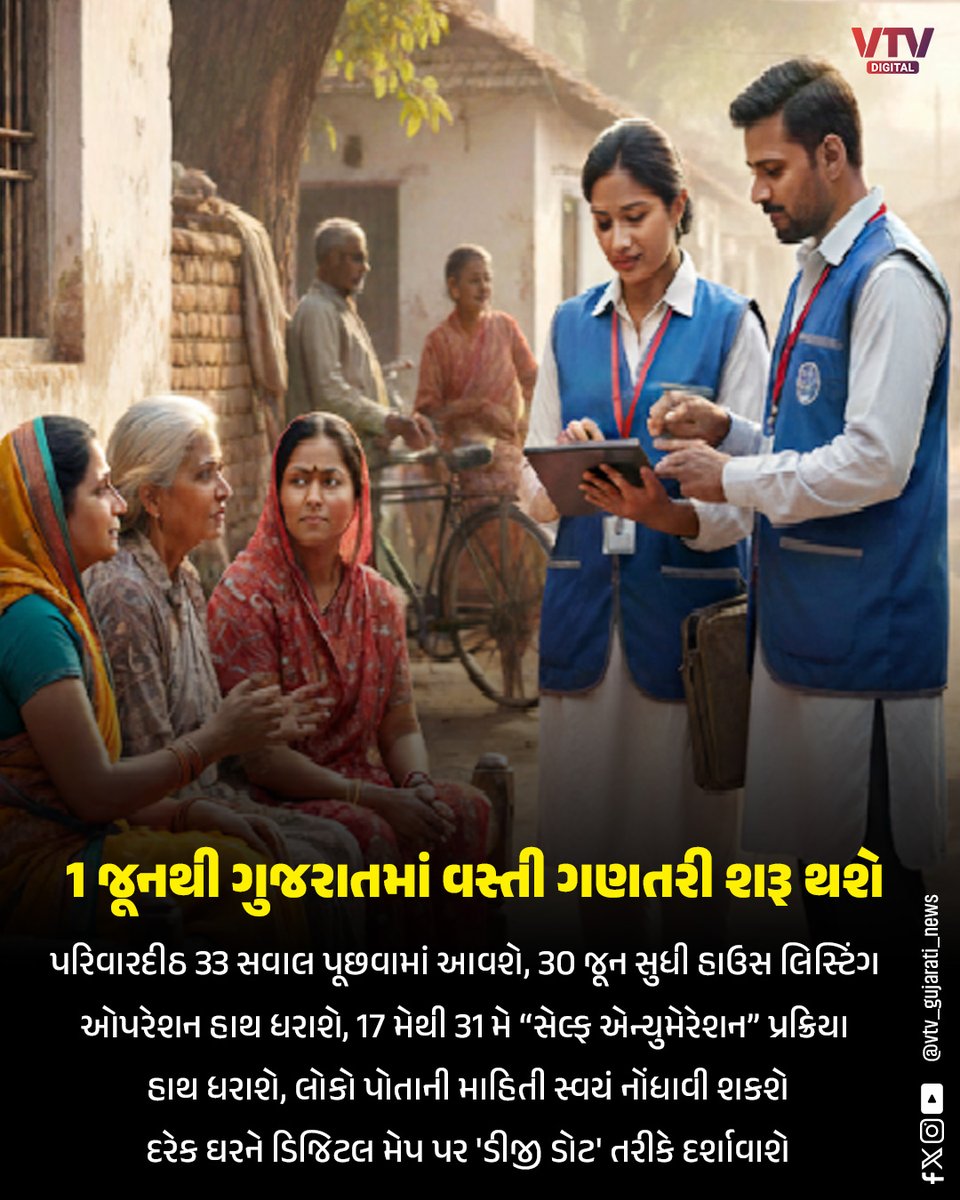
🔸માહિતી એકત્ર કરવાની પ્રક્રિયા અને ડિજિટલ મેપિંગ અંગે માર્ગદર્શન
🔸ડિજિટલ વસ્તી ગણતરી માટે નવસારી જિલ્લામાં તૈયારીઓ બની તેજ
🔸2200 સુપરવાઈઝર અને પ્રગણકોને તાલીમ
#DigitalMapping #DataCollection #GIS #TechGuidance
145

May 15
🚩 ऐतिहासिक, तेजस्वी आणि अविस्मरणीय सोहळा..! 🚩
धर्म, स्वराज्य आणि हिंदवी अस्मितेसाठी आपल्या प्राणांची आहुती देणारे धर्मवीर छत्रपती श्री संभाजी महाराज यांच्या जयंतीनिमित्त आयोजित भव्य ऐतिहासिक सोहळा अत्यंत दिमाखात आणि जनसागराच्या उपस्थितीत संपन्न झाला.
आकर्षक विद्युत रोषणाई, अत्याधुनिक डिजिटल मॅपिंगद्वारे सादर झालेला शिवशंभुंचा तेजस्वी इतिहास व धर्मवीर संभाजी महाराजांच्या पराक्रमाचे थरारक दर्शनाने उपस्थित प्रत्येकाच्या अंगावर अक्षरशः शहारे आणले. इतिहास केवळ ऐकायचा नाही, तर अनुभवायचा असतो, हे या सोहळ्याने पुन्हा एकदा सिद्ध केले.
'स्टॅच्यू ऑफ हिंदुभूषण' बोऱ्हाडेवाडी, मोशी येथे साकारलेला हा सोहळा म्हणजे हिंदवी स्वाभिमानाचा जिवंत जागर होता. सहकुटुंब उपस्थित राहिलेल्या असंख्य शिवप्रेमींनी कार्यक्रमाला अभूतपूर्व भव्यता दिली.
जय शिवराय.. जय शंभूराजे..!
#Dharmaveer #ChhatrapatiSambhajiMaharaj #ShivShambhu #जयशिवराय #जयशंभूराजे #HindaviSwarajya #HinduAsmita #ShivPremi #Maharashtra #HistoricEvent #DigitalMapping #StatueOfHindubhushan #Moshi #Swarajya #MarathaHistory #TrendingNow #ProudMoment #ShivSambhu #Hindutva #GrandCelebration
5
12
224

May 14
The Survey of India defines and maintains Mean Sea Level (MSL) as the national vertical reference for measuring elevations across the country.
Since sea level continuously varies due to tides, waves, and meteorological conditions, MSL is established as a long-term average derived from systematic tidal observations. Through a network of tide gauges along the coastline, precise data is collected and analyzed to determine a consistent reference level.
MSL plays a crucial role in navigation, flood forecasting, coastal planning, and climate studies, supporting informed decision-making and national development.
@DrJitendraSingh @karandi65 @IndiaDST @moesgoi @isro @ndmaindia
#SurveyOfIndia #MeanSeaLevel #MSL #GeospatialIndia #VerticalDatum #CoastalMonitoring
#DigitalMapping #InfrastructurePlanning #ClimateStudies #CoastalDevelopment #Surveying
1
5
145

May 14
ड्रोन सर्वे और डिजिटल मैपिंग तकनीक के माध्यम से उत्तर प्रदेश में संपत्तियों का सटीक डिजिटल रिकॉर्ड तैयार कर पारदर्शी और सुरक्षित संपत्ति व्यवस्था को नई मजबूती दी जा रही है।
#DigitalMapping #DroneSurvey #SmartGovernance #PropertyRecords #SmartTech #DigitalUP

2
1
3
219

1 જૂનથી ગુજરાતમાં વસ્તી ગણતરી શરૂ થશે
#Census #Gujarat #DigitalMapping #HouseListing #PopulationSurvey #IndiaNews #BreakingNews #VTVDigital
4
133
3,034

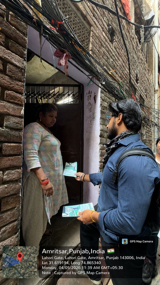
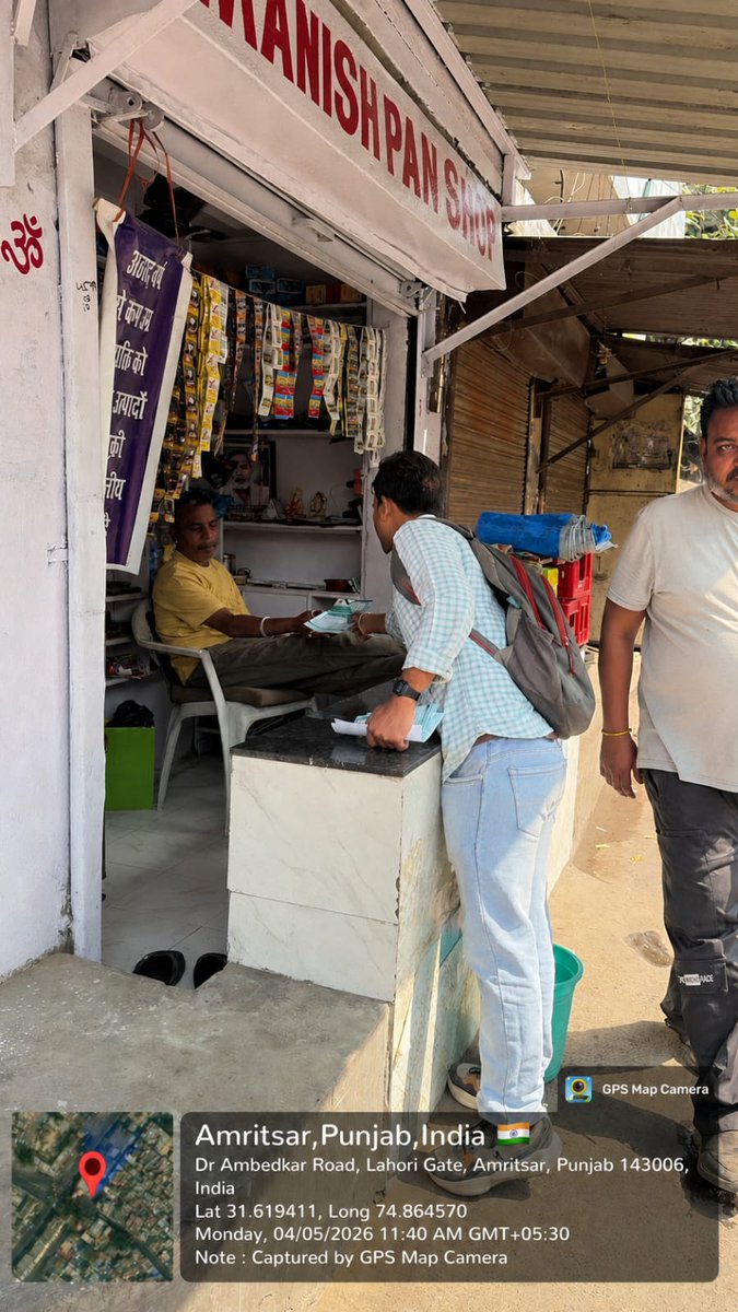
ਵਾਰਡ ਨੰਬਰ- 56 ਵਿੱਚ ਜੀ.ਆਈ.ਐੱਸ ਸਰਵੇ ਸਬੰਧੀ ਜਾਗਰੂਕਤਾ ਮੁਹਿੰਮ ਜਾਰੀ। ਨਗਰ ਨਿਗਮ ਦੀ ਟੀਮ ਡੋਰ -ਟੂ-ਡੋਰ ਲੀਫ਼ਲੈੱਟ ਵੰਡਦੀ ਹੋਈ।
#DigitalMapping #Gisservey #MCA #DoortoDoor #MunicipalCorporationAmritsar


1
2
28
Apr 13
Survey of India conducted a Workshop on CORS and its Applications at NIT Meghalaya Campus, Sohra, under the MoU between NIT Meghalaya and Survey of India, Shillong.
The session was led by Shri Rajiv Kumar Srivastava, Director, Meghalaya & Arunachal Pradesh GD, who delivered an insightful presentation highlighting the importance, benefits, and real-world applications of the CORS network in modern surveying and geospatial practices.
The workshop also featured hands-on practical sessions conducted by Survey of India officers, covering NRTK methodology of GNSS surveying, Total Station Survey, and a live demonstration of Drone Technology for geospatial data acquisition.
This initiative aimed at strengthening academic collaboration while enhancing both theoretical understanding and practical skills of Civil Engineering students in advanced geospatial technologies.
@DrJitendraSingh @karandi65 @IndiaDST @NIT_Meghalaya
#SurveyOfIndia #CORS #GeospatialIndia #GNSS #Surveying #DigitalIndia #DroneTechnology #NITMeghalaya #CapacityBuilding #GeospatialEducation
[GeospatialTechnology, CORSWorkshop, GNSSSurvey, NRTK, DroneSurvey, SurveyingIndia, SkillDevelopment, DigitalMapping]
1
3
151

Apr 2
Rajasthan में Digital Mapping से होगा गांवों और शहरों का विकास | CM Bhajanlal Sharma | BJP News
#GangaurTV #DigitalMapping #BhajanlalSharma #DigitalIndia #RajasthanNews #BJP @RajCMO @BhajanlalBjp @RajGovOfficial
1
2
27

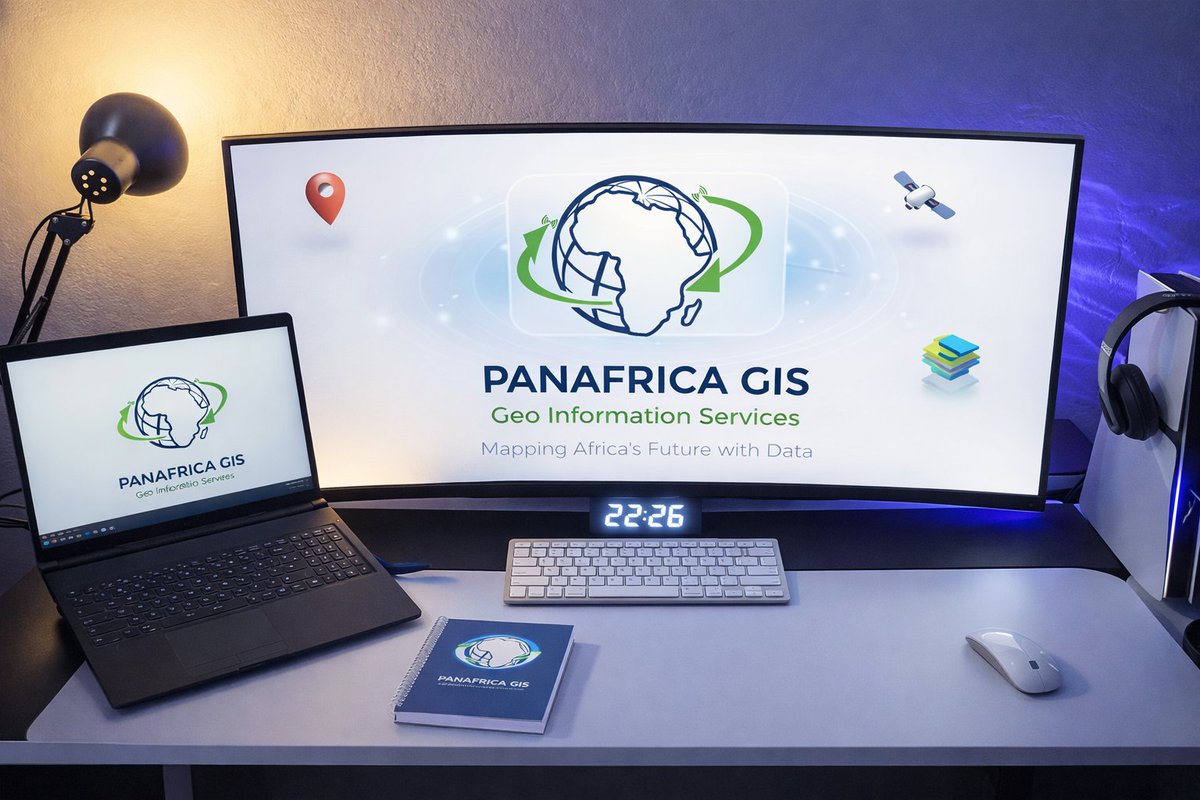
🚀 Transforming Data into Insight with Modern GIS Solutions
👉 Explore more: panafricagis.com/
#PanafricaGIS #GISAfrica #Geospatial #DigitalMapping #SmartAfrica #DataVisualization #GeoInnovation #TechInAfrica #MappingSolutions #GISExperts #SpatialData #ModernDesign
2
8
Mar 26
“Every line on the map has a purpose, and every boundary tells a story.”
The Political Map of India shows more than just the country’s borders. It presents the official boundaries of India and helps us understand how the country is organized administratively. The map shows all the States and Union Territories along with their capital cities, which represent the system through which the country is governed.
Inside these boundaries, the map also shows districts and important cities that play a key role in regional administration and development. The map further presents national lifelines such as railway networks, national highways, major roads, which link different cities and regions across the country. The political map also shows main rivers, and reservoirs of the country.
The Political Map prepared by the Survey of India. It is used for governance, census activities, infrastructure planning, and national development programs.
@DrJitendraSingh @karandi65 @IndiaDST @HMOIndia
#SurveyOfIndia #PoliticalMap #GeospatialIndia #NationalBoundaries #AdministrativeFramework
[DigitalMapping, InfrastructurePlanning, ViksitBharat, NationalBoundaries, AdministrativeFramework, DigitalMapping, InfrastructurePlanning, Governance]
3
9
194
Mar 25
Survey of India inaugurated a CORS Station in Kurnool District, Andhra Pradesh on 23 March 2026 under the NAKSHA Project.
The station was inaugurated by Shri Noorul Quamer, IAS, Joint Collector & Addl. District Magistrate, Kurnool, accompanied by Shri B.C. Parida, Director, AP & T GD, Hyderabad, marking a significant step towards strengthening high-precision geospatial infrastructure in the region.
This initiative will support accurate positioning, modern surveying applications, and improved planning and development activities. It reflects the continued efforts to enhance India’s geospatial capabilities through advanced technologies.
@DrJitendraSingh @karandi65 @IndiaDST @AndhraPradeshCM @governorap @OurKurnool
#SurveyOfIndia #CORS #NAKSHA #GeospatialIndia #MappingIndia #Surveying #DigitalIndia #AndhraPradesh #Kurnool #GeospatialInfrastructure
[GeospatialTechnology, CORSStation, PrecisionMapping, SurveyingIndia, InfrastructureDevelopment, DigitalMapping, NAKSHAProject]
2
4
237

Mar 23
Land demarcation and digital mapping key to national development – Licensed Surveyors Association 3news.com/news/land-demarcat… #LandDemarcation #DigitalMapping #NationalDevelopment
1
2
10
1,686

Delhivery & NVIDIA Boost Bharat Mapping
capitalmarket.com
#Delhivery #NVIDIA #Bharat #DigitalMapping #AI

2
128

Feb 12
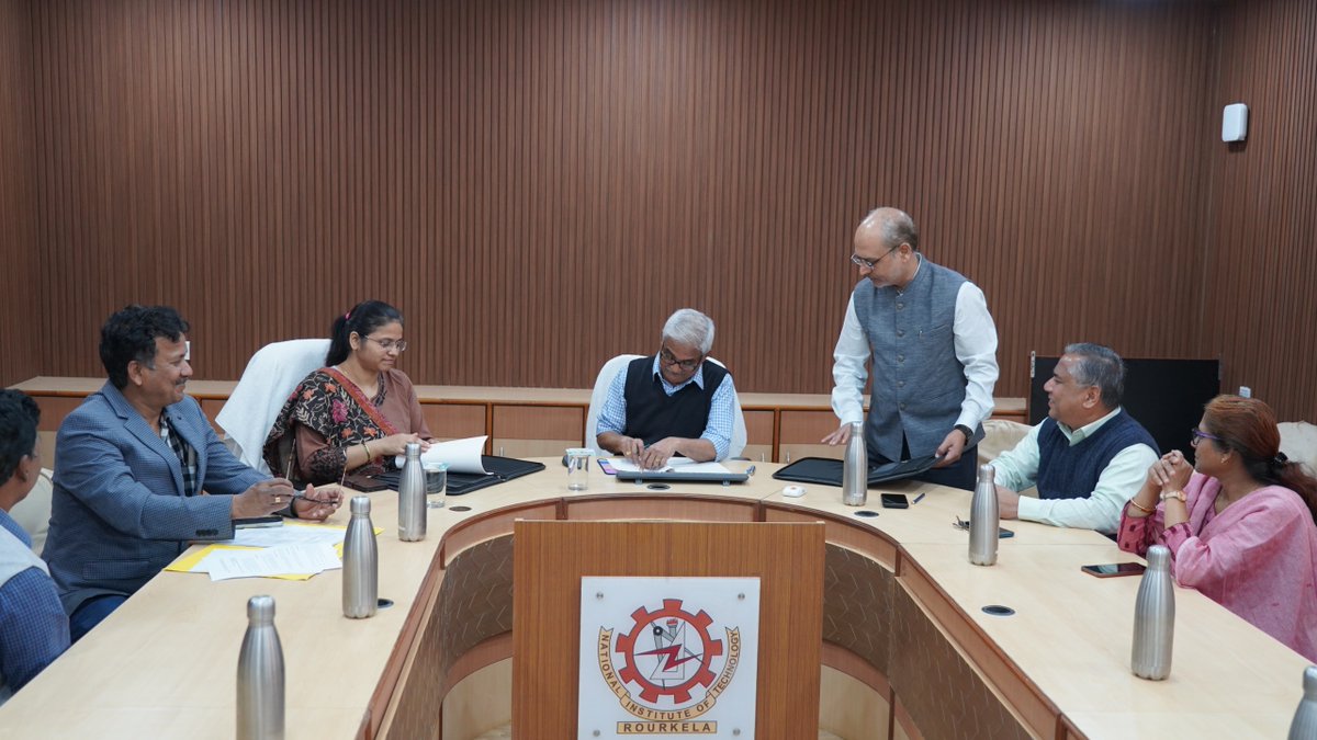
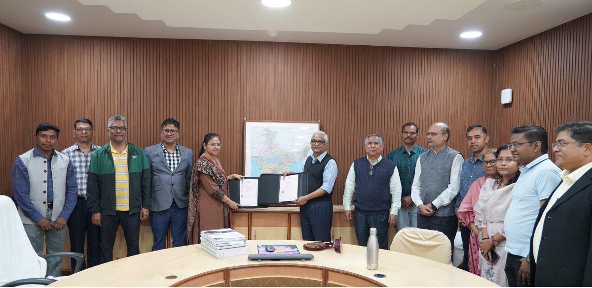
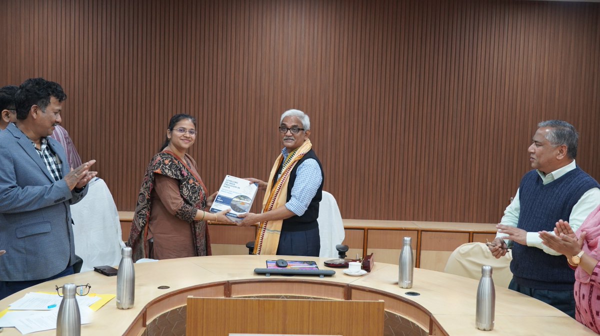
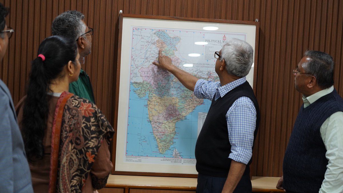
NIT Rourkela Signs MoU with Survey of India to Boost Geospatial Research and Innovation!
The National Institute of Technology Rourkela and the Survey of India (Odisha & Chhattisgarh Geo-Spatial Directorate) signed a Memorandum of Understanding (MoU) to promote collaboration in geospatial science, mapping technologies and advanced research in engineering and science. The partnership combines Survey of India’s expertise in national mapping and geodesy with NIT Rourkela’s strengths in geo-dynamics, earth sciences and climate studies. The agreement enables joint research projects, academic events and technical exchanges in alignment with the National Geospatial Policy–2022.
The MoU was signed by Prof. K. Umamaheshwar Rao, Director, NIT Rourkela, and Smt. Swarnima Bajpai, Director, Odisha & Chhattisgarh Geo-Spatial Directorate, Survey of India. The initiative was facilitated by Prof. Kishanjit Kumar Khatua (Department of Civil Engineering, NITR) along with Shri Bharat Kumbhar and Shri Ashish Kaushal from Survey of India. Senior administrative heads, faculty members and officers from both institutions attended the ceremony.
Under this agreement, NIT Rourkela will provide expert consultation on complex geodetic surveys and extend research-driven support for the professional advancement of Survey of India personnel. The Institute will facilitate specialised training, higher education opportunities and access to research facilities and academic resources. The collaboration will utilise advanced national infrastructure such as CORS (Continuously Operating Reference Stations) for scientific and applied studies. The MoU will also facilitate knowledge sharing, curriculum enrichment, technical skill development, workshops, conferences etc contributing to long-term institutional capacity building. The partnership is expected to enhance India’s geospatial research ecosystem and support national priorities in precision mapping and sustainable development.
@EduMinOfIndia @india_soi @IndiaDST
#NITRourkela #SurveyOfIndia #Odisha #Mapping #GeospatialResearch #Geodesy #DigitalMapping
#MappingInnovation #ClimateScience #CORS
#RemoteSensing #NationalGeospatialPolicy
#ResearchCollaboration #CapacityBuilding
#EngineeringResearch #NationBuilding
4
24
691

Jan 28
We’re at SIAT Expo 2026 and showcasing what MapmyIndia does best — powering intelligent mobility with maps, location, and AI.
Visit us to explore:
* Next-generation automotive navigation
* Lane-level ADAS maps designed for auto-pilot
* AI-powered mobility intelligence
* Mappls app and map APIs
* Automotive electronics
Meet us at:
📍 Sponsor's Pavilion 10, PIECC, Pune
📅 28th–30th January 2026
Discover how MapmyIndia’s solutions enable connected, assisted, and intelligent vehicle platforms—shaping the road ahead with location intelligence.
@rakeshverma1950 | @MapmyindiaVerma | @sapnaahuja | @rishinkalra | @MonikaJaipuriar
#MapmyIndia #SIATExpo2026 #IndigenousTechnology #DigitalMapping #LocationIntelligence #SmartMobility #MadeInIndia #Geospatial #InnovationForIndia
1
7
42
1,280
Jan 28
Honoured to welcome Shri H. D. Kumaraswamy, Hon’ble Union Minister for Heavy Industries and Steel, to the MapmyIndia booth at #SIATExpo2026.
The interaction included discussions on indigenous, high-precision digital mapping—spanning Indoor & Outdoor mapping, 2D/3D and HD lane-level navigation, Navigation on Autopilot, ADAS simulation, Automotive make-in-India electronics and how these technologies can enable smarter mobility and future-ready infrastructure across India.
Grateful for the opportunity to showcase Made in India innovations powering the nations mobility future.
@rakeshverma1950 | @MapmyindiaVerma | @sapnaahuja | @rishinkalra | @MonikaJaipuriar
#MapmyIndia #SIATExpo2026 #IndigenousTechnology #DigitalMapping #LocationIntelligence #SmartMobility #MadeInIndia #Geospatial #InnovationForIndia
1
10
58
2,148

Jan 23
MCSV Annual Vision: Defining the Global Industry Map
MCSV: Architecting a new media order with premium content and global partners.
🔗 mcsv.tv
#AnnualVision #MediaOrder #DigitalMapping #TechExcellence #IndustryLeadership #ContentFirst #FutureReady

7
1
29
3,452

दिल्ली सरकार राजधानी के सभी सरकारी स्कूलों की करेगी डिजिटल मैपिंग।शिक्षा मंत्री @ashishsood_bjp ने कहा, अब हर निर्माण, मरम्मत व सुविधा का डिजिटल रिकॉर्ड होगा।कागजी लीपापोती पर रोक लगेगी। नरेला में पायलट सफल, जल्द पूरे दिल्ली में लागू।
#digitalmapping #DelhiNews
1
3
228

Jan 5
देहरादून,उत्तराखंड-
उत्तराखंड में सड़कों का जाल अब डिजिटल दुनिया में
राज्य में सड़क किनारे अतिक्रमण पर लगाम लगाने के लिए PWD द्वारा स्टेट हाईवे से ग्रामीण सड़कों तक डिजिटल मैपिंग की जा रही है।
डिजिटल मैपिंग से सरकारी संपत्तियों की पहचान, रखरखाव और अतिक्रमण पर सख्त कार्रवाई संभव होगी।
#Uttarakhand #PWD #DigitalMapping #Dehradun #SmartUttarakhand #Infrastructure #DigitalIndia #EncroachmentFree #UttarakhandNews #primenews
@pushkardhami @uppwdofficial @CPWDGOV @ukcmo @PrimeNewsInd
3
53