
📢 A digital twin approach for the identification and update of ecological infrastructure by Audrey Lambiel, Gregory Giuliani @greggiuliani, Nathan Külling& Anthony Lehmann
👉doi.org/10.1080/20964471.202…
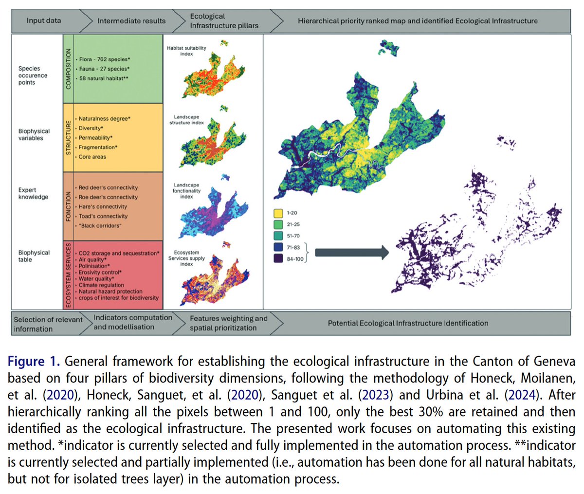
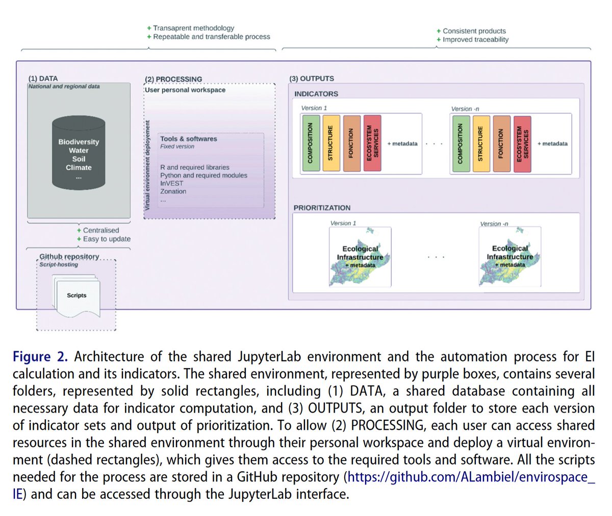
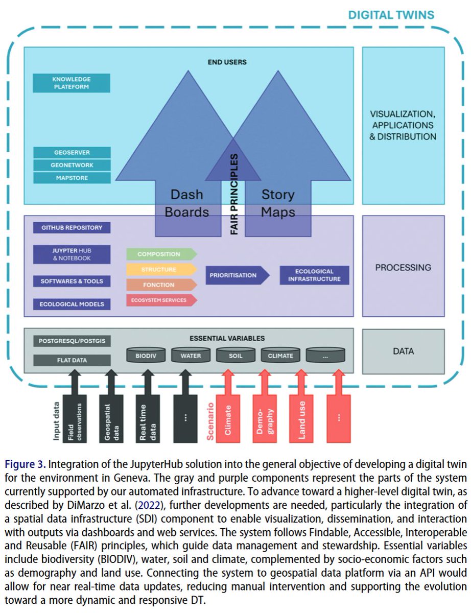
💌Addressing the global environmental crisis necessitates coordinated efforts, supported by open and #reproducibleresearch practices. Such practices aim to enhance the reliability, efficiency, and credibility of scientific outputs. Innovative tools are necessary for systematic conservation planning. This technical note presents a reproducible and automated approach for supporting #landmanagement and planning by identifying and updating ecological #infrastructure (EI). Grounded in #openscienceFindable, Accessible, Interoperable, and Reusable principles #datamanagement, and #digitaltwin (DT) concepts, the method focuses on the Canton of #Geneva, #Switzerland. It integrates species distribution modelling, #ecosystemservice assessments, and spatial prioritization within a shared #JupyterLabenvironment. The infrastructure centralizes data, automates indicator calculations, and ensures transparency, traceability, and reproducibility through version control and metadata generation. Ecological tools like #Zonationenable the identification of high-priority #conservation areas aligned with international targets. The system facilitates collaborative #workflowsand indicator updates. Its architecture allows scalability to broader regions and scenario modelling, laying the foundation for a DT of Geneva’s environment. Despite challenges in harmonizing workflows across institutional partners, this solution enhances efficiency and replicability in EI planning. The methodology is transferable to other regions and adaptable to various environmental modelling domains, offering a robust base for sustainable territorial management. All scripts needed for the process are stored and described in a #GitHubrepository: github.com/ALambiel/envirosp….
#Ecologicalinfrastructure #ecosystemservices #spatialanalysis #biodiversity #bigearthdata #digitalearth #geoscience #remotesensing #earthobservation #GIS #dataanalysis #BigData #FAIR #SpatialDataInfrastructure #SDI
3
456

Feb 27
📄Legume cover crops don’t just protect soil. They can boost yields by 4–8%, cut fertiliser needs and strengthen biodiversity.
Read more in the @Unipisa White Paper: tinyurl.com/5b5w89xv
#VALERECO #HorizonEU #Agroecology #EcosystemService

1
3
15

25 Jul 2025
🌊The Mekong River Basin, a global biodiversity hotspot, delivers ecosystem services worth billions yearly, including $12.9B from fisheries (2M tons/year) and flood regulation. Home to 20,000 plant species, 850 fish, and 1,200 birds, it supports 60M people’s livelihoods in Thailand, Vietnam, Laos, and Cambodia. It generates 16% of global inland fish catch and stores vast carbon. Hydropower dams, sand mining, and climate change threaten its riches. Save the Mekong! 🌏
#Biodiversity #Conservation #MekongRiver #EcoTourism #Wildlife #Himalayas #Ecosystem #Wetlands #Floodplains #Philanthropy #Nature #NatureVibes #Fishing #Mekong #Community #EcosystemService #ClimateChange #Challange #Fisheries #Thailand #Vietnam #Laos #Cambodia #Asia #FoodSecurity #ClimateAction #ActNow #ThailandCambodia

3
215

31 May 2025
Study Identifies US Regions that Benefit #Birds, People & #Climate the Most | By @RamanSpoorthy
Forests are #ecosystemservice machines. The number of benefits they provide is really diverse & the magnitude very high, says lead author @RachelNeugarten.
news.mongabay.com/short-arti…
3
4
246

23 Apr 2025
The striking red flowers of Erythrina abyssinica are a sufficient reason for one to plant such a tree.
Besides this, it's a native tree species with all the associated benefits.
#Dendrophilelifestyle #LoveTrees #NativeTrees #MedicinalTrees #ecosystemservice #ClimateAction
6
67

3 Mar 2025
Conserving natural resources is crucial for enhancing socio-economic services. #Sustainable management of these resources can lead to resilient communities and improved livelihoods. #WetlandConservation #EcosystemService #SustainableDevelopment #ResourceManagement #EcoEconomics

1
8
18
233

21 Feb 2025
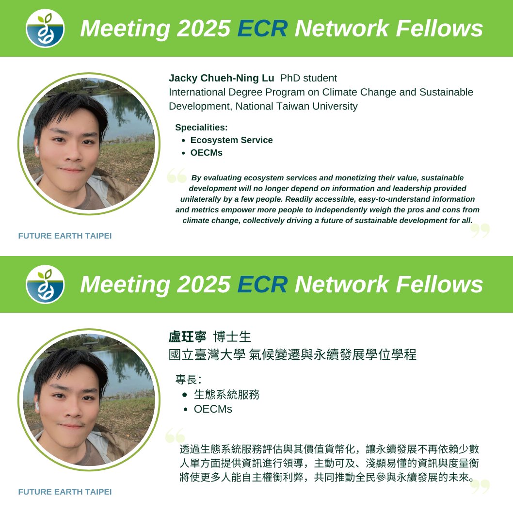
Meeting 2025 fellows! We selected 14 members from sustainability science for our #ECR network. We will introduce them to you in the following weeks.😉
2️⃣Jacky Chueh-Ning Lu is interested in #EcosystemService and #OECMs.
@EarthTP_ECR
ECR website: FutureEarthTaipeiECR.com
1
3
41

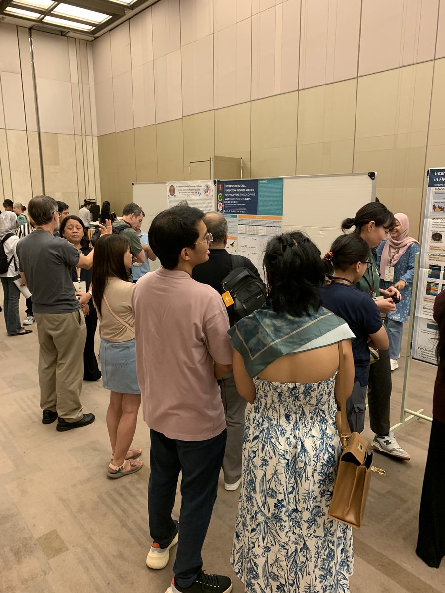
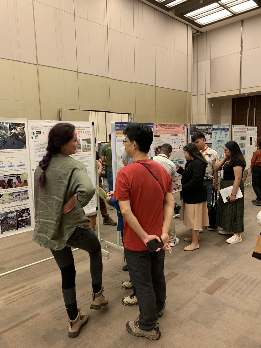
The poster session is happening now!
#SoutheastAsianBatConference #SEABCO #SEABCO2024VN #HoChiMinh #Vietnam #GlobalSouth #Bats #Biology #Conservation #Disease #Ecology #Microbial #Taxonomy #Systematics #Environmental #Education #Bioacoustics #EcosystemService #poster
2
10
233

11 Oct 2024
We are still processing the call for experts and fellows for @IPBES 's Spatial Planning Assessment.
Please get in touch with us if you want to be nominated!
More info ➡️ ipbes.net/spatial-planning-a…
#ecosystemservice #ipbes #spatialplanning #biodiversity
11 Sep 2024

@IPBES invites nominations for experts and fellows in its upcoming Spatial Planning Assessment. Please contact us to express your interest. If you have not worked with us, kindly attach your CV and brief motivation letter for the position.
🗓️ Deadline for YESS: 1 December 2024

7
6
1,690
4 Oct 2024
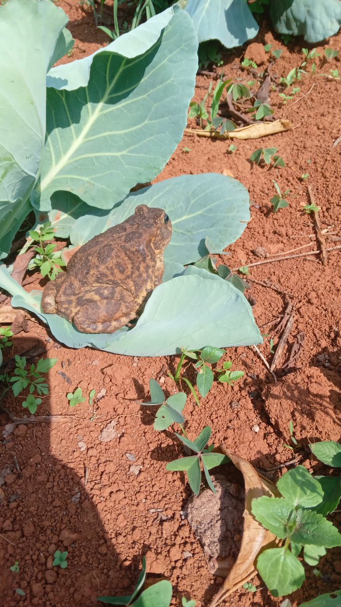
While we were in feild for Plant Indetification,
Look what I found. It came in as a substitute and eventually made our feild super interesting.
#ecosystembalance #ecosystemservice #savetheplanet #lovenaturesbeauty #LoveTrees #Dendrophileslifestyle
3
53

30 Aug 2024
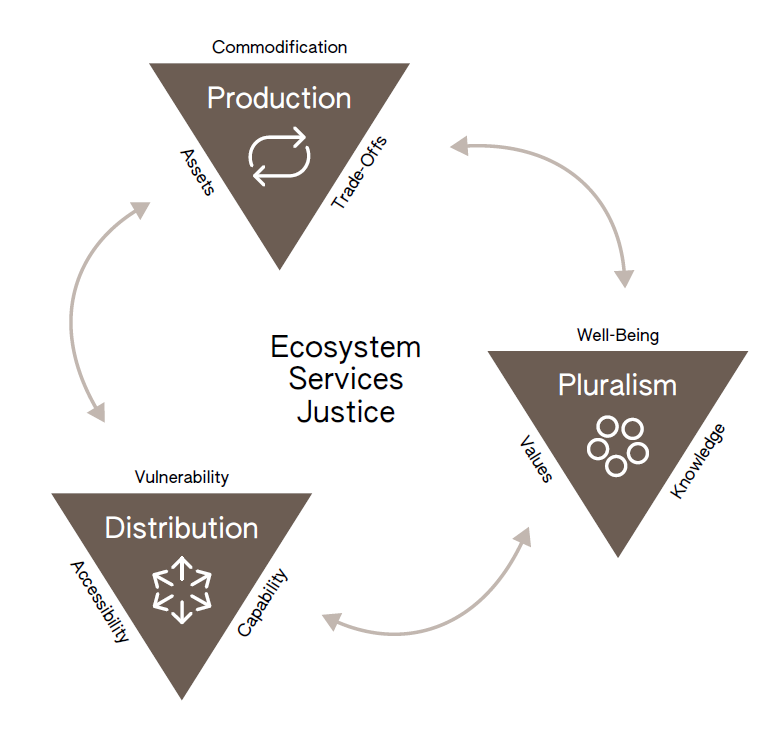
Our new article on "Ecosystem Services Justice" is out, providing an overview of past developments and future research needs on #equity and #justice in #ecosystemservice research. w @JLangemeyer @FelipeBenra & Nahuelhual L. @ESPartnership @ILEN_BOKU @BOKUvienna
30 Aug 2024

Have a look at our latest article on "Ecosystem Services Justice: The Emergence of a Critical Research Field" sciencedirect.com/science/ar… @ESPartnership @ICTA_UAB @Laseg_ICTA
1
9
14
778

7 Aug 2024
Apart from providing beneficial #weedregulation, many seed-consuming #carabids can also harm crops – we unearthed evidence for 72 species acting as crop pests and highlight the need to understand role switching for reliable #ecosystemservice provision. doi.org/10.1016/j.agee.2024.…
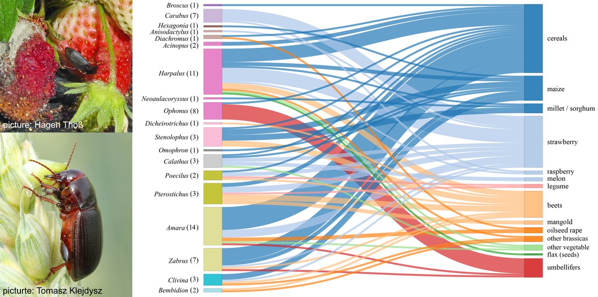
ALT Top left: The strawberry seed beetle, Harpalus rufipes, feeding on a strawberry; bottom left: The corn ground beetle, Zabrus tenebrioides, feeding on ripening wheat seeds; Right: Interactions between carabid genera (left; with number of species indicated in parentheses) acting as pests on crops (right) found in the literature review.
1
3
9
366

27 Jul 2024
When we destroy a hectare of #Mangroves, we basically lose out on an #ecosystemservice worth up to $57K per year. Protecting mangroves is also about reducing the cost of protecting ourselves from #storms. Building a #seawall costs 1000 times more than conserving these #wetlands
6
14
203
20 Jun 2024
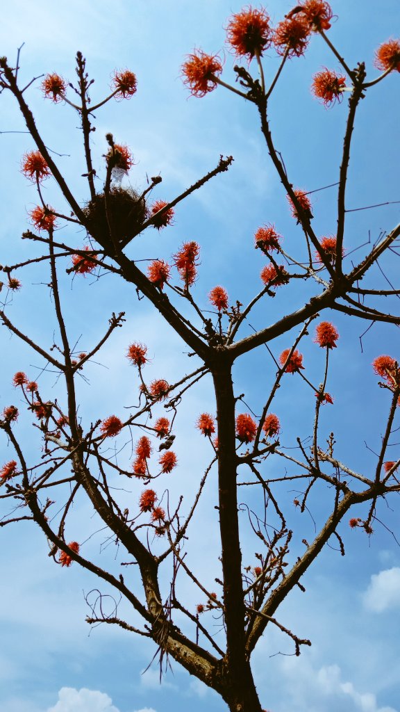
There's actually a bird's nest in this leafless Erythrina Abyssinica.
Perhaps because it's a native tree species
#SaveNativeTrees #PlantNativeSpecies #Dendrophiles #ClimateAction #Ecosystemservice🍀🌏🌳
2
80

31 May 2024
🌍 What is an #EcosystemService? How Do We Measure Its Value, Especially for Seagrass #Restoration? 🌿
After our #Artemis4MED's meeting in Marseille a few weeks ago, our discussion on ecosystem services has truly taken off! Here during the @ecoacsa workshop in Marseille!
3
92

27 May 2024
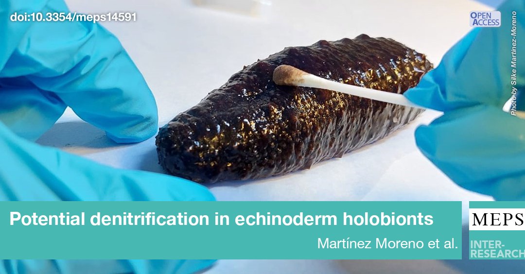
This study describes the subcuticular and biofilm #microbiomes in #Holothuria tubulosa & confirms the presence of #denitrification genes in the biofilm. This suggests this species might provide another #ecosystemservice, reducing nitrogen in coastal areas
bit.ly/meps_736_81
14
24
3,167
10 May 2024
Registration for the IPBES Plenary this year as a YESS delegation is open!
Applying here: bit.ly/YESS-IPBES11
Our deadline is set at 30 June. We are looking forward to having you with us in Africa this December! #ecosystemservice #biodiversity #ipbes
3
9
1,125

7 May 2024
The importance and perception of value of ecosystem service to people vary, depending on their own values, beliefs and needs. River maybe source of water supply to a community and to another a spiritual healing place. That is provisioning and cultural.
#Ecosystemservice ❤️🌍🙏

1
40

17 Apr 2024
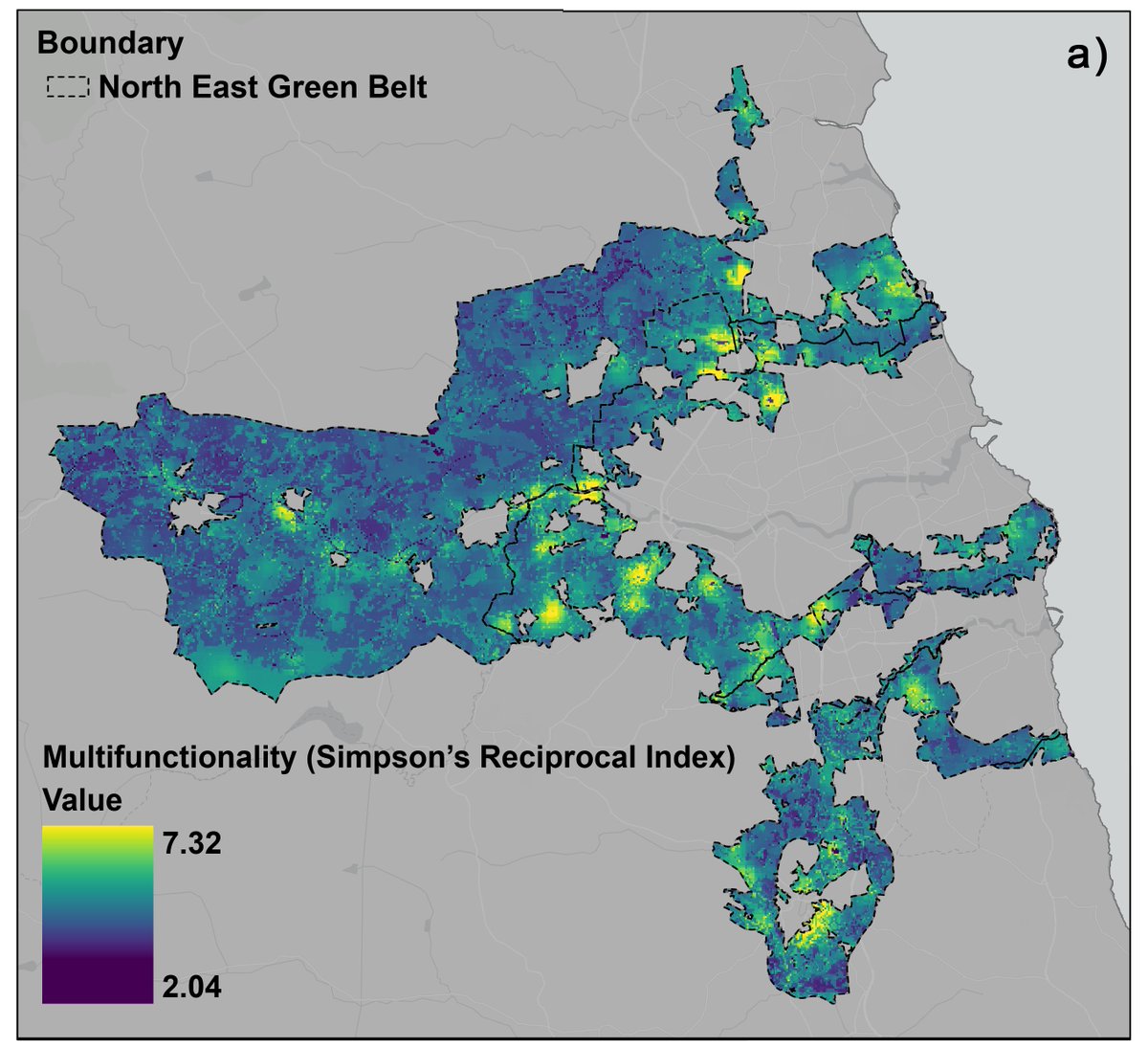
Contrary to popular claims that #GreenBelts provide neither social nor environmental benefits we found Green Belts do and can provide important #EcosystemService multifunctionality close to people 🧵(2/8)
1
1
3
342

17 Apr 2024
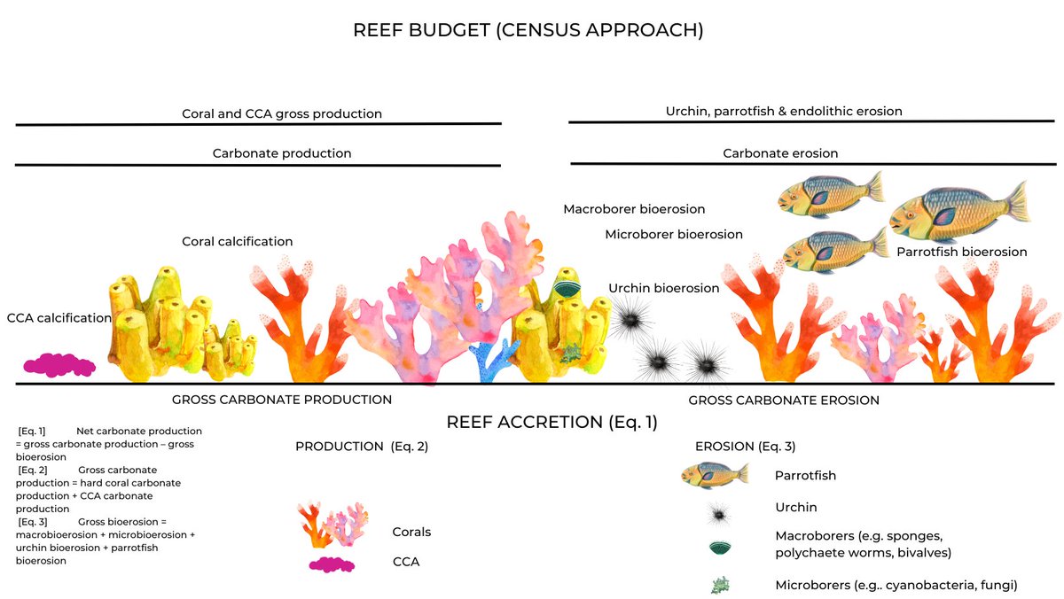
Presenting today at #ReefResilienceSymposium2024 in Cairns! Do you know that #coral #reef carbonate budgets can be enhanced through local #coralrestoration? Thus restoring the valuable #ecosystemservice of wave attenuation 🌊✨ Wednesday April 17, Reef Room at 12h00 #GBR

22
634