
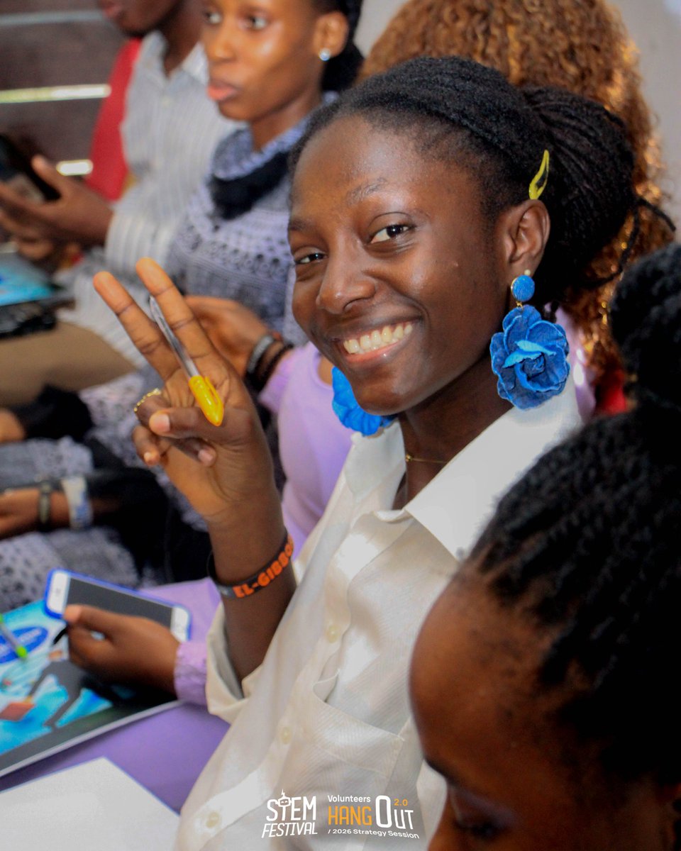
Jun 10
They said the future belongs to those who build it.
So we're bringing together the innovators, creators, problem-solvers, and dreamers.
Something bigger than a competition.
Something greater than an event.
stemfestival.org
#STEMFestival2026
#EngineeringTomorrow
1
1
1
9
liten drage retweeted

Jun 9
Meet the @NASAArtemis 3 crew: Astrodynamics Event with Andre Douglas 12/4/25 @EngineeringTomorrow-vl4ty 🚀🇺🇸
1
6
1,088

Cheers to 15 Years of @ViitorCloud
From a simple idea to a global technology company, and every step of it was built by this team.
Our 15-year journey! Think big, start small. The journey continues.
#ViitorCloud #15YearsOfInnovation #EngineeringTomorrow
3
94
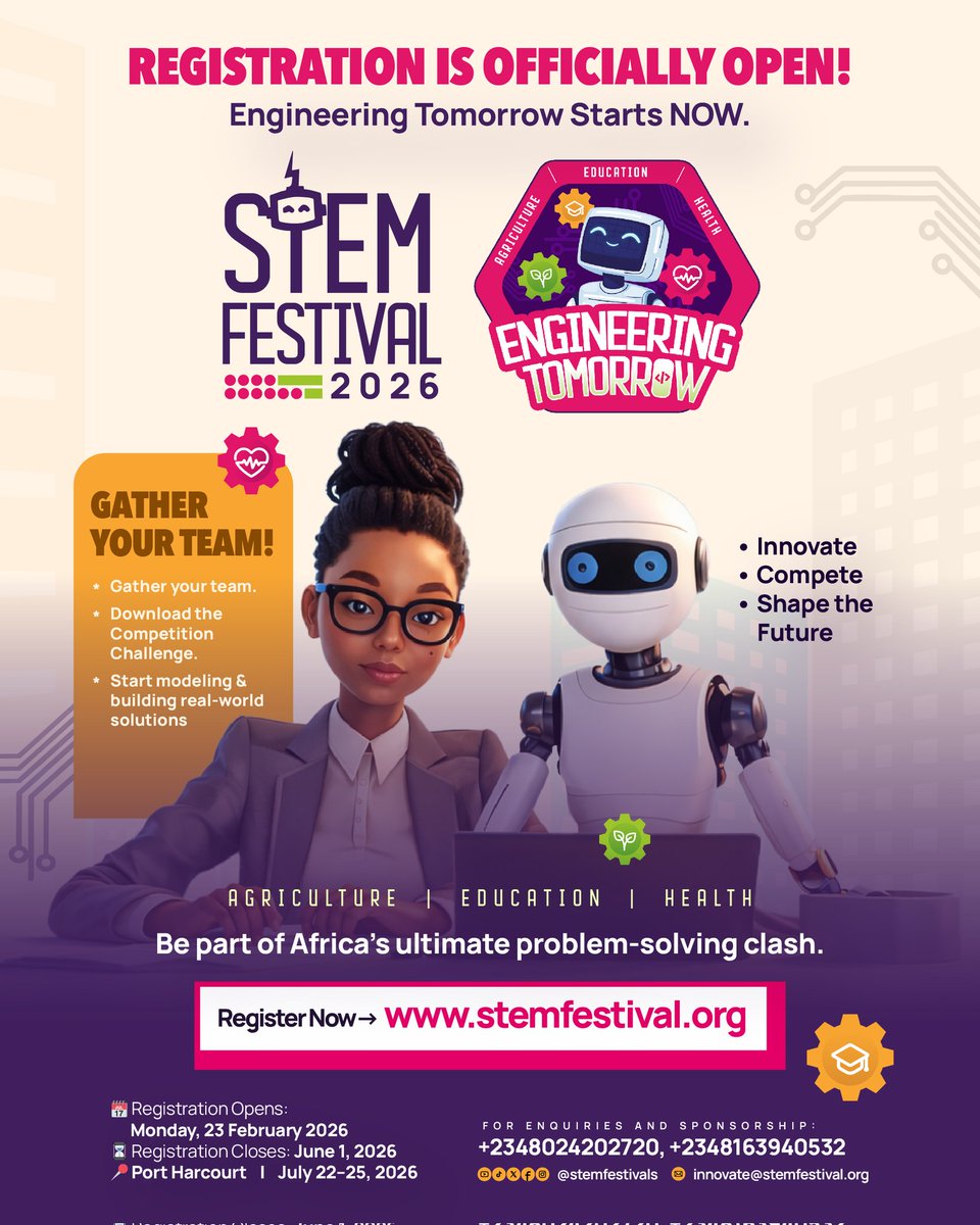
May 12
The team behind STEM Festival 2026 is preparing to deliver an experience that challenges young people to think bigger, build smarter, and create solutions that matter.
Registration is now open: stemfestival.org
#STEMFestival2026 #EngineeringTomorrow #Agriculture #Health


1
4
21
Feb 23
🔥 REGISTRATION IS OFFICIALLY OPEN! 🔥
The race to engineer tomorrow has begun.
Registration closes June 1, 2026.
STEM Festival 2026 | July 22–25
stemfestival.org
Don’t just imagine tomorrow.
Engineer it.
#EngineeringTomorrow #STEMFestival2026 #AfricaInnovates
2
3
48

✨ Welcome to 2026!
At Coltek Technologies, we’re ready to turn potential into excellence and build smarter digital solutions for the future. 🚀
Happy New Year!
#HappyNewYear2026 #ColtekTechnologies #EngineeringTomorrow #TechInGhana #Innovation

3
4
48

18 Dec 2025
Steel isn’t just for today — it’s shaping tomorrow.
A glimpse into 2050, where innovation meets strength and vision becomes reality.
.
.
.
.
.
#steelofthefuture #FutureReady
#industrialinnovation #modernmanufacturing #sustainablesteel
#engineeringtomorrow #Infrastructure

2
52

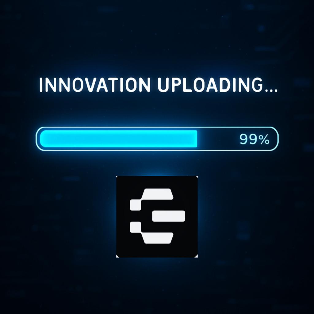
3 Sep 2025
99% isn’t hesitation. It’s precision.
Endless Protocol is engineering tomorrow—where every line of code is a commitment to the future.
Innovation isn’t coming. It’s uploading.
@EndlessProtocol
#EngineeringTomorrow #Web3 #AI #DigitalSovereignty
1
1
22
62

28 Aug 2025
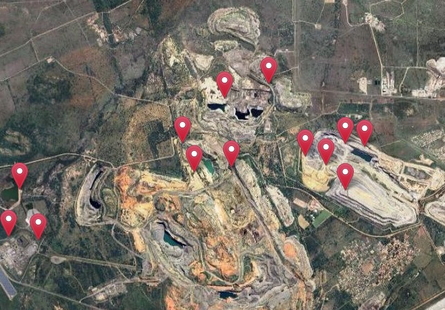
At Xuremi, we believe that the future will be shaped by those who understand our planet deeply — from the sky down to the soil.
That’s why we are building geospatial intelligence systems that combine AI, satellite data, and scientific models to help governments, conservationists, and enterprises detect environmental degradation, stop illegal mining, measure carbon integrity, and plan sustainable restoration.
From MinerAI — our flagship tool detecting illegal mining and ecosystem damage — to Carbon Sentinel and Soil & Carbon Sentinel, we are redefining how Africa and the world monitors and protects the Earth’s most vulnerable regions.
Our tools are designed for:
Governments seeking to enforce environmental regulations
NGOs and conservation partners restoring degraded lands
Climate-tech researchers building scalable models
ESG teams verifying carbon and land integrity
Companies seeking real-time environmental insights for risk, planning, and sustainability
We are not just engineering systems. We are engineering tomorrow — responsibly, intelligently, and collaboratively.
We welcome partnerships and conversations that push the limits of climate intelligence and restoration tech.
Let’s build the future — together.
#GeospatialAI #ClimateTech #EnvironmentalIntelligence #SatelliteData #Conservation #Sustainability #xuremi #EngineeringTomorrow


3
4
59

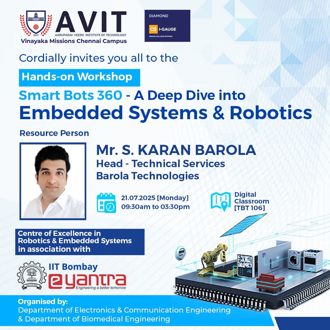
21 Jul 2025
What if you get a chance to take a sneak-peek into the applications of the theory you learn in classes? This workshop will give you more than that. Don’t miss it!
#VMRFChennai #AVIT #SmartBots360 #EmbeddedSystems #eYantra #IITBombay #EngineeringTomorrow #TechEducation
2
44

9 Jul 2025
🚗 Electric Without Illusion: Rethinking the Foundations of Clean Mobility ⚡
Electric mobility isn’t clean if the power behind it isn’t. Grid-reliant EVs still draw from fossil-heavy systems, and charging logistics remain a bottleneck.
Neutrinovoltaic integration changes that, generating continuous onboard power from ambient radiation, redefining the vehicle as its own power source. Mobility, unshackled from the socket.
🔗 Read more: energy-news.net/electric-wit…
#ElectricMobility #EVInnovation #GridFreePower #Neutrinovoltaic #EngineeringTomorrow

6
136

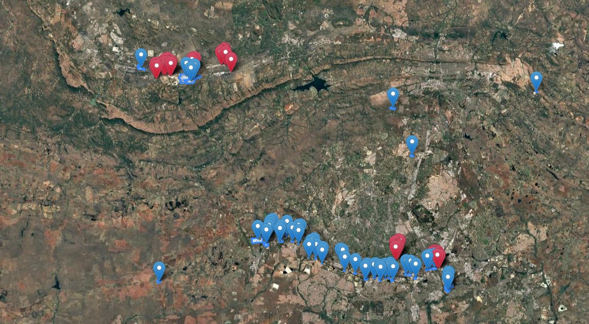
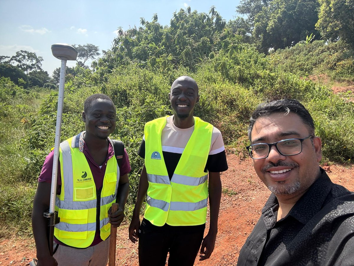
On the ground. In the field. Changing the game.
Precision isn’t just a job it’s how we shape Africa’s future.
#BrimsLLP #SurveyingAfrica #EngineeringTomorrow #GeoSpatial #InfraTech #AfricaRising #FieldWork #SmartSolutions

5
9
202

3 Jun 2025
I’m currently designing a flotation motor —
a breakthrough solution for the future of air transportation and space travel.
The easiest way to curve space-time for galactic journeys
is not by forcing external distortion,
but by curving it from within the ship itself.
My design does exactly that.
It’s like using a lever from the shortest end
instead of pushing from the longest —
efficiency from the core.
#FuturisticTech #SpaceTravel #FlotationEngine #GravityDesign #GalacticVision #NGEToE #EngineeringTomorrow
157

21 May 2025
Where Every Detail Drives Aerospace Excellence.
At Aequs, every component we make, carries the weight of our purpose to engineer excellence for a better future.
From the strength of our 10,000T forging press to the precision of over 1.5 million machining hours annually, we deliver aerospace manufacturing that’s both globally trusted and locally built.
Our NADCAP-accredited surface treatments and flight-critical aerostructure assemblies, like Over-Wing Exit and Plug Doors, are engineered to meet the most rigorous aerospace standards.
Driven by precision. Powered by purpose. Built for the future.
#AerospaceManufacturing #PrecisionEngineering #SustainableManufacturing #AdvancedManufacturing #ForgingExcellence #MachiningInnovation #SurfaceTreatment #Aerostructures #MakeInIndia #EngineeringTomorrow #GlobalManufacturing #AerospaceIndustry #AerospaceInnovation
@amelligeri @rajekaul
1
9
613

17 May 2025
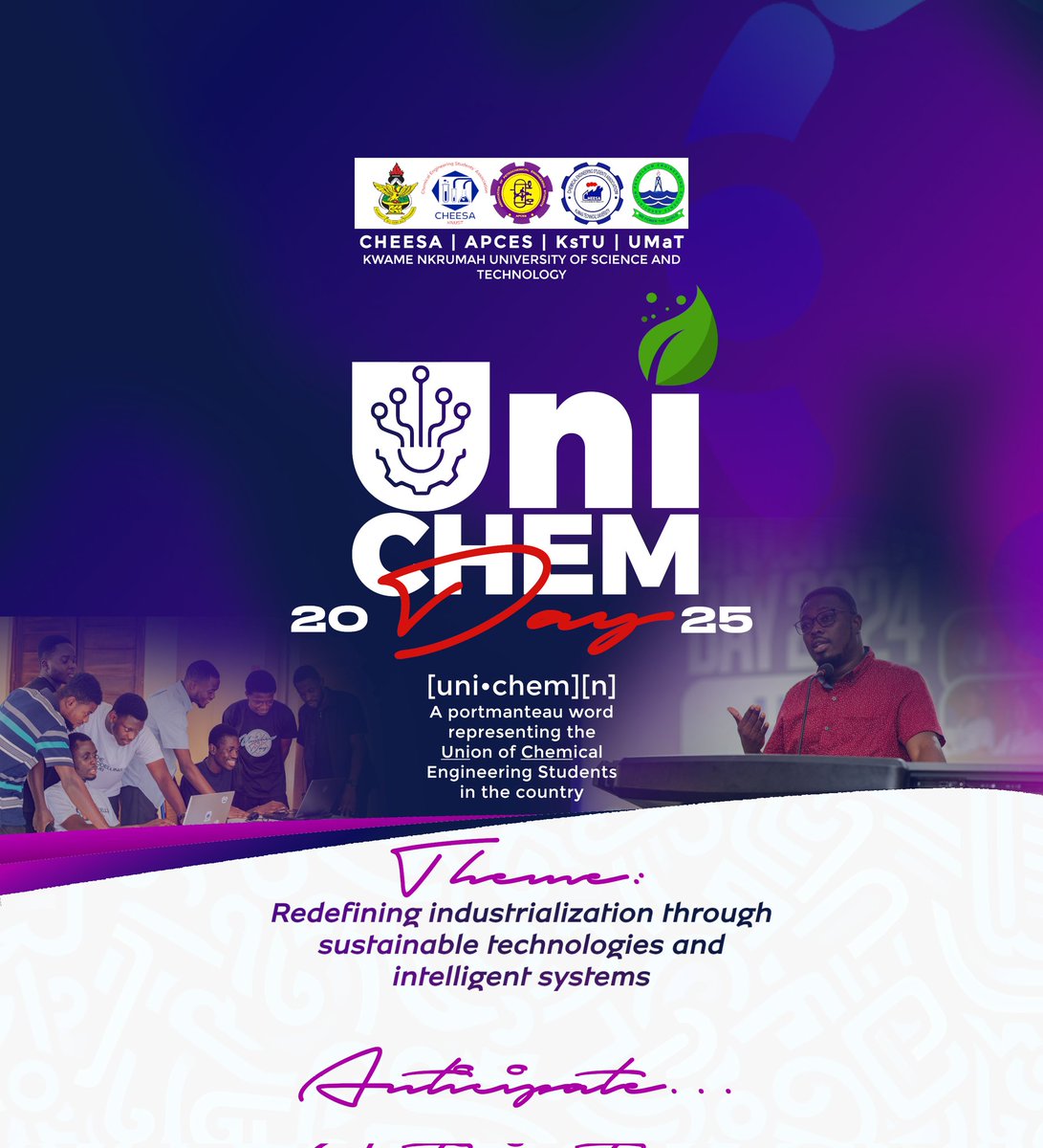
Anticipate the most impactful gathering of young chemical engineers in Ghana — UNICHEM Day 2025!
A celebration of innovation, purpose, and progress.
Redefining industrialization through sustainable technologies and intelligent systems.
#UNICHEM25 #EngineeringTomorrow #Anticipate
5
7
500

17 May 2025

1
13
175

6 May 2025
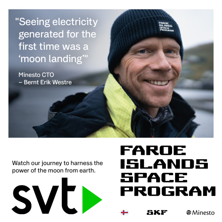
Watch our journey to harness the power of the moon from earth on SVT now. SBS in Australia.
svtplay.se/video/eb3m7zz/fra…
sbs.com.au/ondemand/tv-serie…
Coming to more countries around the world soon.
#EngineeringTomorrow #TidalEnergy #FaroeIslandsSpaceProgram @SKFgroup
1
15
387
30 Apr 2025
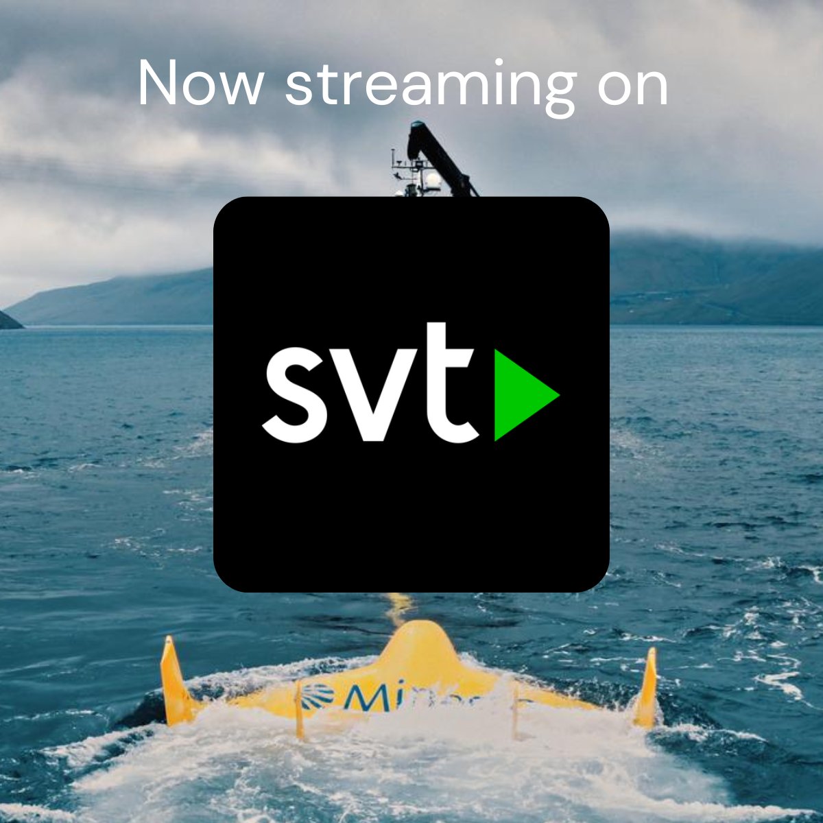
Minesto’s pioneering technology features in internationally broadcast documentary #EngineeringTomorrow
@svt in Sweden svtplay.se/video/eb3m7zz/fra…
@SBSOnDemand in Australia sbs.com.au/ondemand/tv-serie…
Coming to more countries around the world soon
#Innovation #Technology #TidalEnergy
1
14
307

23 Apr 2025
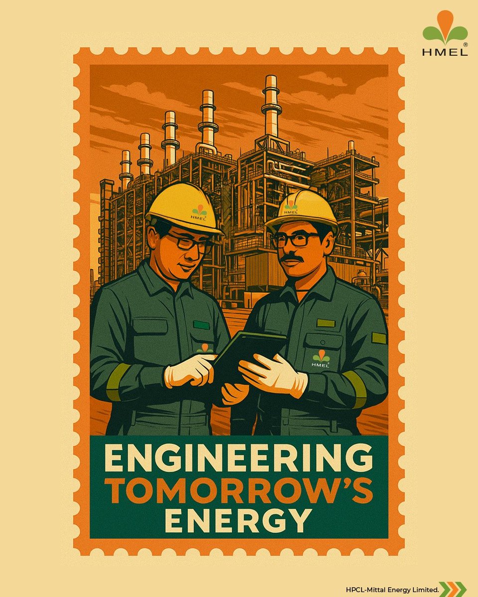
Postmarked from the Future.
Where pipes, precision & purpose power every drop of progress.
#StampVerse #EngineeringTomorrow #EnergisingABrighterTomorrow #HMEL
1
6
196
32,200