Wait, there is no single #mapprojection that shows true world? 🌎🌍🌏🤔
@icawebsite's first fact sheet is on #mapprojections!
👉🔗icaci.org/files/documents/fa…
#mapprojectionsarehard #projectionsarehard #mapprojections #mapping #map #cartography #geospatial #GIS #gischat
1
1
3
155

Feb 20
Day 12. Same time zone data, 8 projections 🌐
Van der Grinten, Mollweide, Sinusoidal, Cassini and more.
A projection is always a decision. Most maps hide it. This one makes it visible.
#100DayMapChallenge #QGIS #MapProjections #Cartography
2
14
825

🌍 Surprised that Africa is 14× larger than Greenland? This StoryMap provides helpful resources on Coordinate Systems and Transformations to explain why maps often distort the true size of countries:
👉 ow.ly/9vPM50XZBRL
#WorldGeography #MapProjections #CoordinateSystems
1
3
139

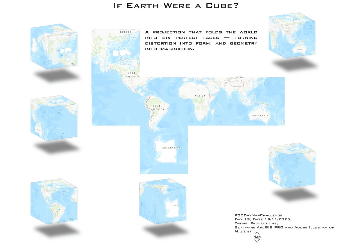
19 Nov 2025
Day 19 - Projections
For GIS Day I mapped the world using a cubic projection, an unusual way to reveal how dramatically our planet’s shapes and areas change depending on the projection we choose.
#30DayMapChallenge #Day19 #Projections #Cartography #ArcGISPRO #MapProjections
4
13
550

19 Nov 2025
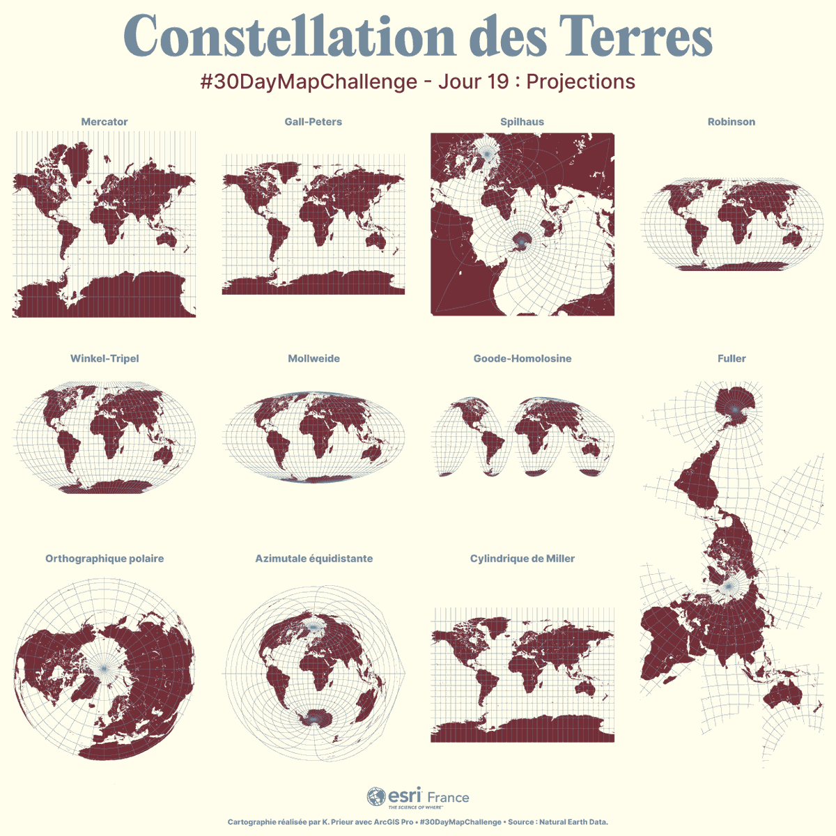
🗺️ Constellation des Terres : un tour du monde en projections
🌍 #30DayMapChallenge – Jour 19 : Projections
Chaque projection transforme la Terre — une sphère — en un plan, avec ses choix, ses compromis, ses angles et ses déformations.
Cette carte rassemble quelques projections :
➡️ Mercator
➡️ Gall-Peters
➡️ Spilhaus
➡️ Robinson
➡️ Winkel-Tripel
➡️ Mollweide
➡️ Goode-Homolosine
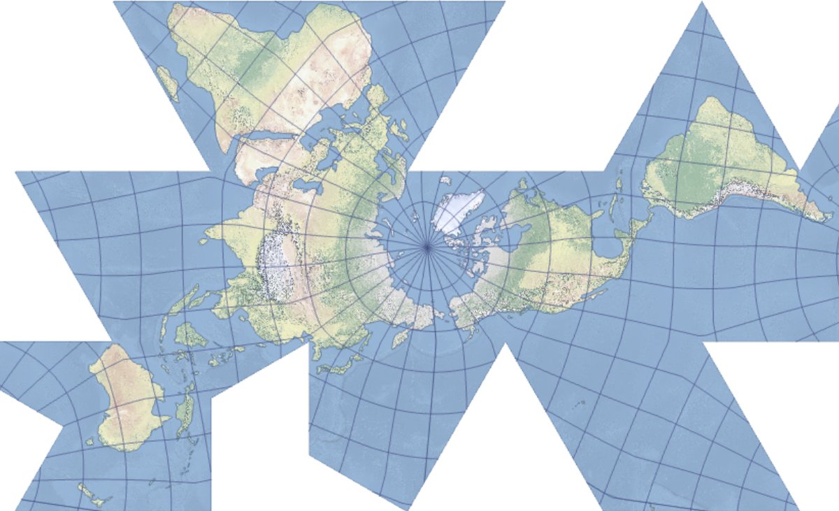
➡️ Fuller
➡️ Orthographique polaire
➡️ Azimutale équidistante
➡️ Cylindrique de Miller
ArcGIS Pro propose plus d’une centaine de projections et autant de manières différentes de représenter notre planète à différentes échelles.
🗺️ Réalisé avec ArcGIS Pro
📊 Données : Natural Earth Data
✍️ Kevin Prieur
#Cartographie #SIG #DataViz #EsriFrance #ArcGIS #Esri #Projection #MapProjections
1
5
216

20 Sep 2025
5. Liquid Neural Networks (LNNs)
A type of recurrent neural network inspired by the nervous system of a microscopic worm (C. elegans).
· How it works: Uses differential equations to define the dynamics of neurons and synapses. The network's parameters are "time-aware" and change based on the input, making them dynamic and adaptive.
· Why it's different: Highly robust to noisy data and distribution shifts. They are much more interpretable than standard deep networks because they learn very compact, sparse representations (often with far fewer neurons). They excel in continuous-time tasks.
· Example: Autonomous driving systems where conditions change rapidly and decisions must be based on a continuous stream of sensor data.
6. Deep Reinforcement Learning (DRL) Architectures
These architectures are specifically designed for an agent to learn optimal actions through trial and error in an environment.
· Key Architectures:
· Deep Q-Networks (DQN): Uses a deep neural network to approximate the Q-function, which estimates the expected reward of an action in a given state.
· Actor-Critic Methods: Combine two networks: an Actor that decides which action to take, and a Critic that evaluates the action taken by the Actor. (e.g., Proximal Policy Optimization - PPO, Soft Actor-Critic - SAC).
· Example: Mastering complex games like Go, StarCraft II, and DOTA 2, as well as controlling robotic locomotion.
7. Generative Architectures (Beyond LLMs)
Focused on creating new data that resembles the training data.
· Generative Adversarial Networks (GANs): A two-network system: a Generator creates fake data, and a Discriminator tries to distinguish real from fake. They are trained in an adversarial game, leading to highly realistic outputs.
· Example: Creating photorealistic images, "deepfakes," and artistic style transfer.
· Diffusion Models: The current state-of-the-art in image generation. They work by progressively adding noise to data (forward process) and then learning to reverse this process to generate new data from noise (reverse process).
· Example: Models like DALL-E 2, DALL-E 3, Midjourney, and Stable Diffusion.
· Variational Autoencoders (VAEs): An autoencoder that learns a probabilistic latent representation of the input data. This allows for the generation of new data points by sampling from the latent space.
· Example: Generating new faces, molecular structures, or interpolating between data points.
8. Memory-Augmented Neural Networks
Architectures that add an explicit, external memory component that the network can read from and write to.
· How it works: The network (typically a controller, like an LSTM) interacts with a memory matrix using read and write heads, similar to a Turing Machine.
· Why it's different: Overcomes the limited context window of standard RNNs/Transformers. Designed for tasks that require long-term memory and complex reasoning.
· Example:
· Neural Turing Machine (NTM): The foundational architecture.
· Differentiable Neural Computer (DNC): A more advanced version that solves complex graph traversal and question-answering tasks requiring long-term memory.
This list showcases the incredible diversity of AI research, where architectures are designed not just for raw power but for specific capabilities like efficiency, explainability, robustness, and reasoning. In cartography, these enable AI to be superhuman-e.g., using DRL to "learn" optimal projections or GANs to visualize them. If you're in GIS, experiment with tools like Grok or Stable Diffusion for map gen! #MapProjections #AICartography #GIS #AIArchitectures
(Thread end hope this sparks some geo-AI projects!)
2
50

20 Dec 2024
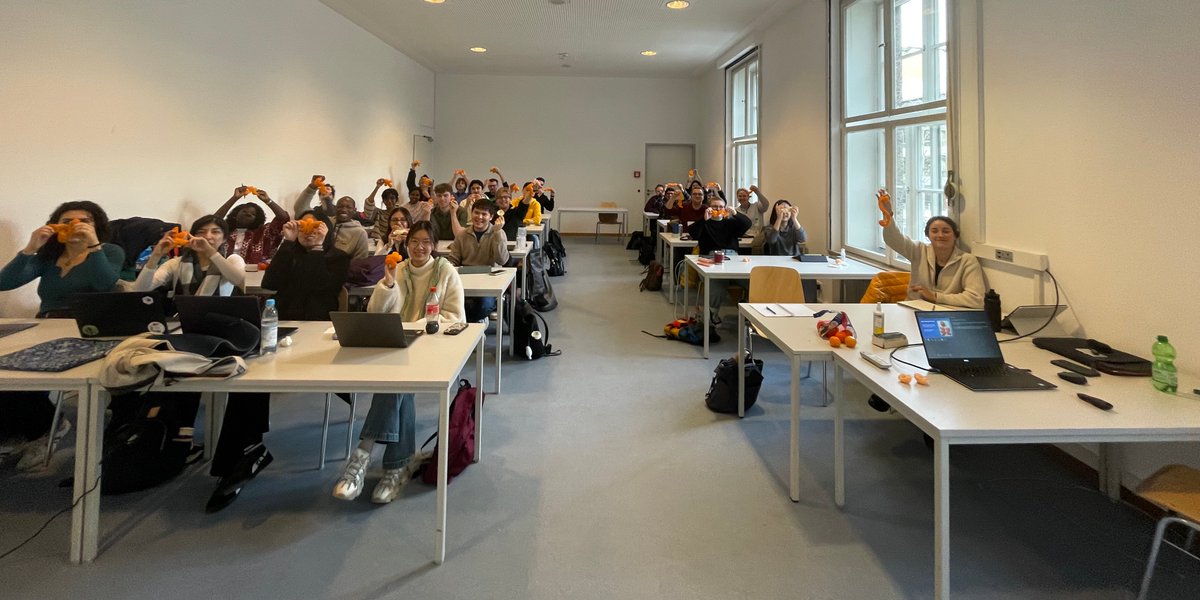
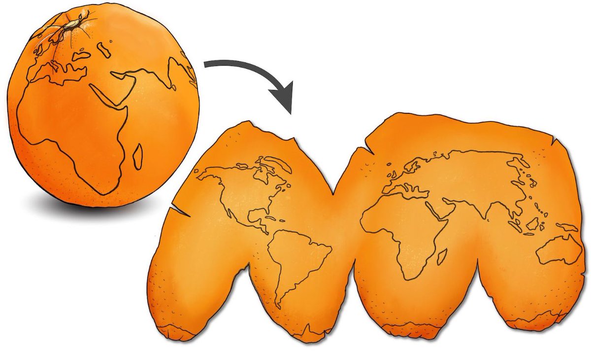
I had the pleasure of giving a guest lecture to students in the @cartography_MSc program at TUM. Another group of future cartographers is now fully familiar with the concepts of #mapprojections, and they even gained experience in creating their own using the clementine technique.
8
228

28 Nov 2024
Day 26: Map Projections | #30DayMapChallenge
For this challenge, I built a Map Projection Generator App that uses DALL·E to create images of different map projections like Orthographic, Mollweide, and Mercator. 🌍 The app allows you to select a projection and image size, then generates a custom map. 🎨
I used OpenAI’s DALL·E API to generate the map images, giving users a fun, interactive way to explore how the world looks in various projections.
Explore the code: codepen.io/cyatteau/pen/raBa…
#MapProjections #DALL·E #AI #GIS
13
534

#30DayMapChallenge Day 26 — Map Projections 🗺️
Today’s highlight, inspired by the ever-changing landscape of our planet, explores the retreat of Arctic sea ice, visualized through the Lambert Conformal Conic projection by Mapbox designer Nikita Slavin. This map shows the stark impact of climate change, rendering the shrinking ice coverage in a way that emphasizes both the scale and urgency of the situation.
Explore the map here: labs.mapbox.com/map-design-d…
#BuiltWithMapbox #MapProjections
2
2
9
1,376

26 Nov 2024
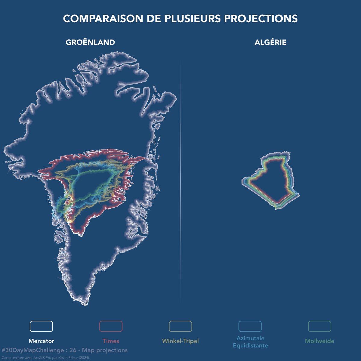
Saviez-vous que le Groënland est en réalité plus petit que l'Algérie ?
#30DayMapChallenge - Jour 26 : #MapProjections
Superficie de l'Algérie : 2 382 000 km²
Superficie du Groënland : 2 166 000 km²
Si vous êtes curieux, découvrez ce site : eu1.hubs.ly/H0dZpD-0
#ArcGIS #Maps
9
35
3,696

25 Nov 2024
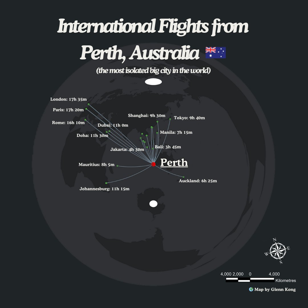
#30DayMapChallenge 🗺️ (Day 26: #MapProjections)
Perth, Western Australia, is often referred to as the world's most isolated major city. This map visualises the international flights departing from Perth. This map uses an #AzimuthalEquidistantProjection with Perth as the origin.
2
7
262
22 Nov 2024
It has been 10 years since #ProjectionWizard 🗺️🌐🪄 was first introduced at @NACIS Practical Cartography Day @nacis_PCD #nacis2014.
To all of you, who are using the tool to select #mapprojections for your 🗺️map projects, a huge THANK YOU! 🙏🙏🙏
Happy #mapping!🌎🌍🌏
6
186
22 Nov 2024
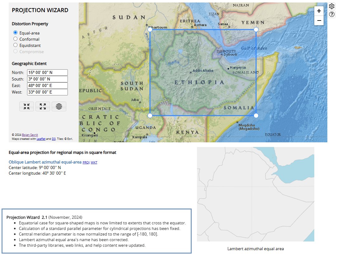
📣A new version of #ProjectionWizard v2.1 🗺️🌐🪄 is now live as of this morning.
Visit projectionwizard.org
#mapprojection #mapprojections #webMercator #endMercator #mapprojectionsarehard #projectionsarehard #gischat #geospatial
1
13
61
13,725
18 Jul 2024
Do you have any questions about #MapProjections, coordinate systems, and transformations still unanswered? Stop by for a chat at @ArcGISPro Coordinate Systems Expo kiosk. We are here until 4pm. 🌐
#EsriUC #EsriUC2024 @EsriUC
storymaps.arcgis.com/stories…

3
187
17 Jul 2024
Day 3 of the @EsriUC #EsriUC #EsriUC2024. Do you have questions about #MapProjections, coordinate systems, and transformations? Stop by for a chat at @ArcGISPro Coordinate Systems Expo kiosk. We also know a thing or two about NSRS 2022 modernization. 🌐🗺️
storymaps.arcgis.com/stories…
1
167
15 Jul 2024
Welcome to #EsriUC2024! If you are interested in coordinate systems, transformations, #MapProjections, and you would like to learn more about these or you have specific questions, here is a #ArcGISStoryMap will all information you need to know. @EsriUC
storymaps.arcgis.com/stories…
1
6
333

15 May 2024
ما الفرق بين #إسقاط_الخرائط #MapProjections وأنظمة #الإحداثيات #CoordinateSystems؟
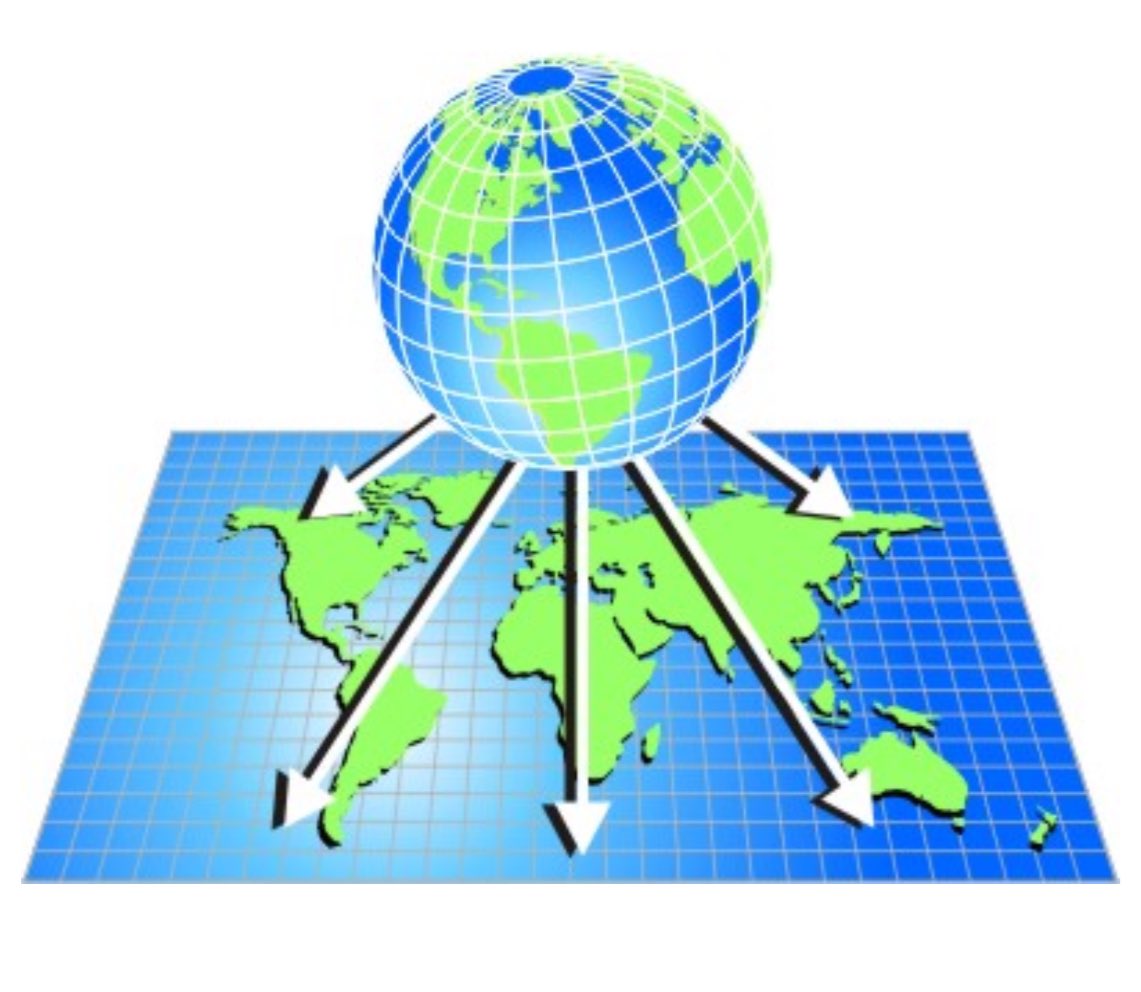
#إسقاط_الخرائط عبارة عن طرق تستخدم لتحويل السطح الكروي للأرض إلى مستوى ثنائي الأبعاد
من المعلوم أن شكل سطح الأرض منحني وعندما يتم تمثيله على خريطة مسطحه ستحدث بعض التشوهات لذلك فإن الغرض الأساسي من إسقاط الخريطة هو تقليل هذه التشوهات وتقديم المعلومات بطريقة واضحة ودقيقة بشكل أكبر
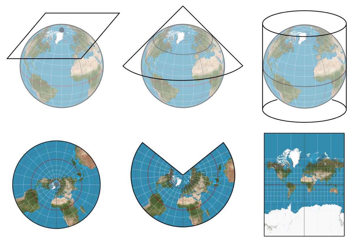
هناك عدة أنواع من إسقاطات الخرائط أشهرها الإسقاطات الأسطوانية والمخروطية والسمتية ولكل منها نقاط قوة ونقاط ضعف خاصة بها
يعتمد اختيار نوع الإسقاط على الاحتياجات المحددة للمشروع ومساحة الأرض المطلوب تمثيلها على #الخريطة حيث يُعد علم #إسقاط_الخرائط ضروري لإنشاء خرائط دقيقة في مجال المسح والمجالات الأخرى
أما #نظام_الإحداثيات فهو مجموعة من القواعد الرياضية المستخدمة لتحديد المواقع على سطح الأرض ثلاثي البعد
هنالك العديد من أنظمة الإحداثيات لكن قد يكون نظام الإحداثيات الجغرافية أو ما يسمى في #المساحة بالإحداثيات #الجيوديسية هو النظام الأكثر شيوعا والذي يستخدم خطوط الطول ودوائر العرض لتحديد المواقع على الأرض
يعتمد هذا النظام على شكل كروي وغالبًا ما يستخدم لتحديد المواقع على سطح الأرض بالنسبة إلى دائرة عرض #الإستواء وخط الطول الرئيسي #جرينيتش
ختاما لايمكن الجزم بدقة #الخرائط بشكل كامل لكن لاشك أن استخدام علم إسقاط الخرائط بالشكل الصحيح سيقلل من نسبة التشوهات بشكل كبير عند تمثيل الأرض على خريطة
إن علم إسقاط الخرائط عبارة عن طرق تستخدم لتحويل سطح الأرض الكروي إلى مستوى ثنائي الأبعاد 2D
في حين أن أنظمة الإحداثيات هي مجموعات من القواعد الرياضية المستخدمة لتحديد المواقع على سطح الأرض
الميزة الأساسية لإسقاط الخرائط هو التقليل من التشوهات بشكل كبير عند تمثيل سطح الأرض الثلاثي الأبعاد على #خريطة ثنائية البعد بينما يوفر نظام الإحداثيات طريقة متناسقه وموحدة لتحديد المواقع على الإرض
كتبه:
م. خالد العريني
مواضيع ذات صلة:
x.com/geomaticsk/status/1552…
x.com/geomaticsk/status/1552…
x.com/geomaticsk/status/1684…
x.com/geomaticsk/status/1570…
16 Sep 2022

1️⃣
يتبادر إلى الذهن أحيانا هذا التساؤل:
هل خريطة العالم المنتشرة تمثل الشكل الحقيقي للعالم؟
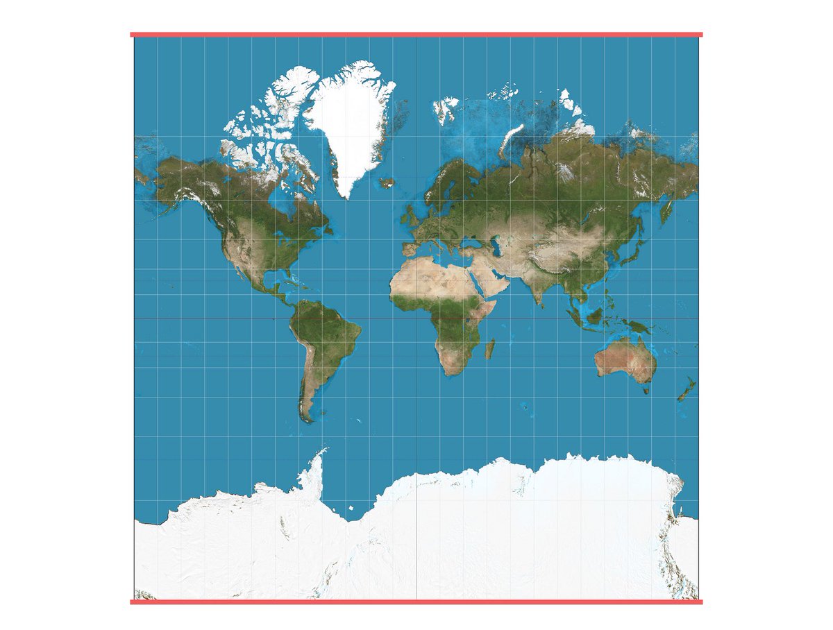
الخرائط عبارة عن تصوير مرئي مسطح للعالم في بعدين استنادًا إلى إسقاط Mercator المعروف
هذه الخريطة تبرمجت على نطاق واسع في الوعي الجمعي البشري كحقيقة مقبولة
#الجيومكانية
9
36
3,138

16 Oct 2023
1
42
25 Aug 2023
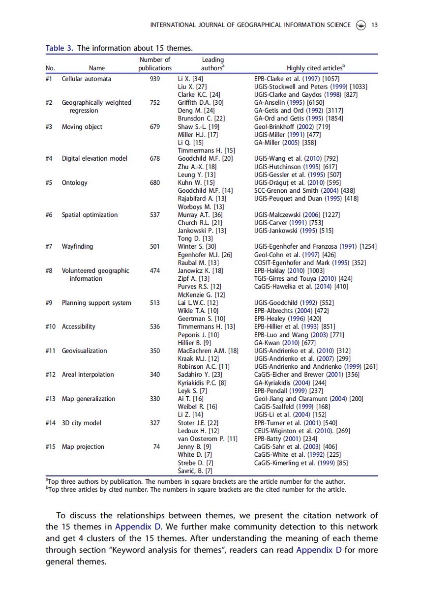
Besides being in top three by publication on #gis #mapprojection topic during last 30 years, I like the company even more. cc @mappingbernie 🏆👏
Research themes of geographical information science
during 1991–2020: tandfonline.com/doi/full/10.…
#mapprojectionsarehard #mapprojections
1
11
1,147